Embed Size (px)
Citation preview
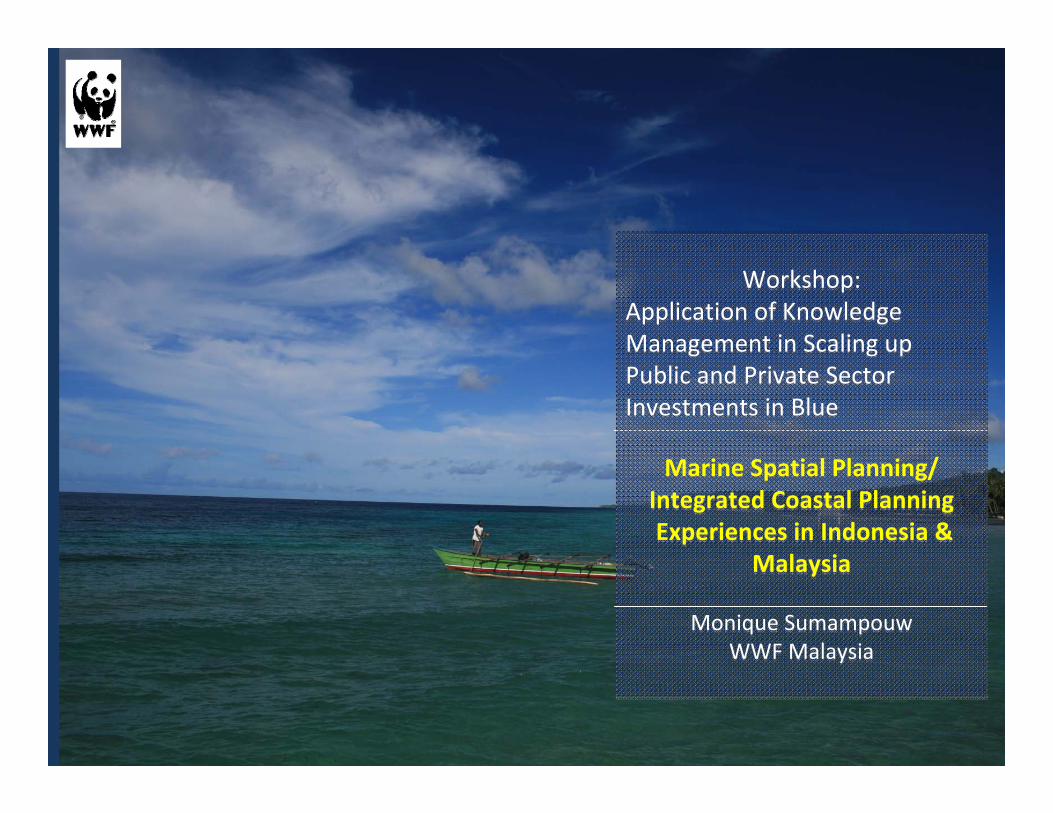
Workshop:Application of Knowledge Management in Scaling up Public and Private Sector Investments in Blue
Marine Spatial Planning/ Integrated Coastal PlanningExperiences in Indonesia &
Malaysia
Monique SumampouwWWF Malaysia
Workshop:Application of Knowledge Management in Scaling up Public and Private Sector Investments in Blue
Marine Spatial Planning/ Integrated Coastal PlanningExperiences in Indonesia &
Malaysia
Monique SumampouwWWF Malaysia
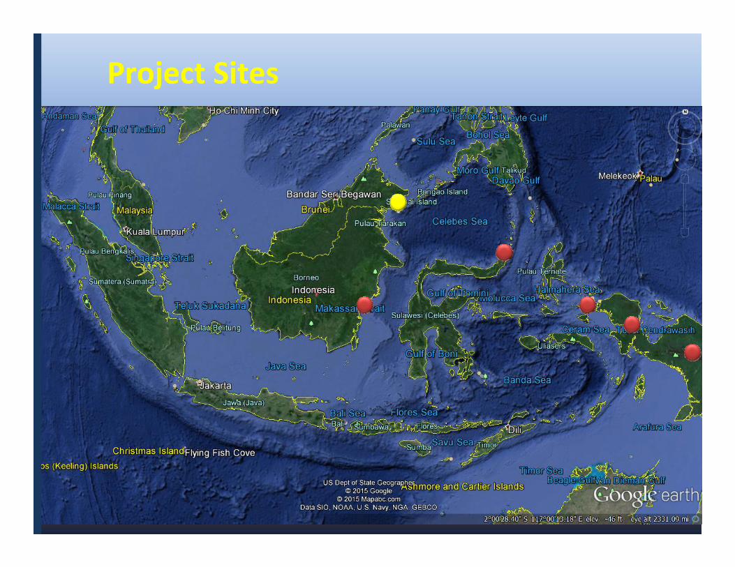
Project Sites
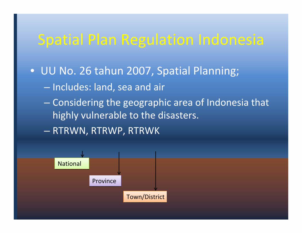
Spatial Plan Regulation Indonesia
• UU No. 26 tahun 2007, Spatial Planning; – Includes: land, sea and air
– Considering the geographic area of Indonesia that highly vulnerable to the disasters.
– RTRWN, RTRWP, RTRWK
National National
ProvinceProvince
Town/DistrictTown/District
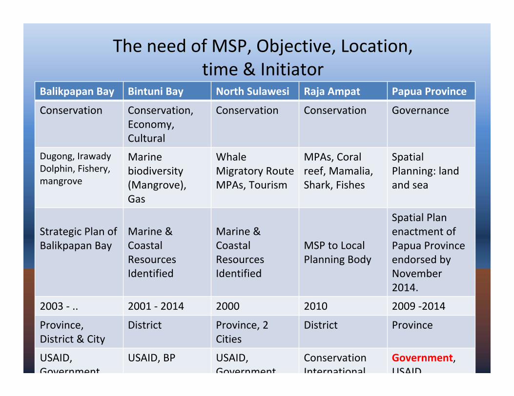
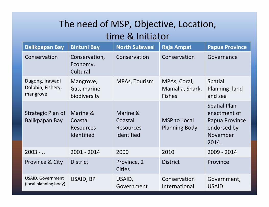
The need of MSP, Objective, Location, time & Initiator
Balikpapan Bay Bintuni Bay North Sulawesi Raja Ampat Papua Province
Conservation Conservation, Economy, Cultural
Conservation Conservation Governance
Dugong, Irawady Dolphin, Fishery, mangrove
Marine biodiversity (Mangrove), Gas
Whale Migratory RouteMPAs, Tourism
MPAs, Coral reef, Mamalia, Shark, Fishes
Spatial Planning: land and sea
Strategic Plan of Balikpapan Bay
Marine & Coastal Resources Identified
Marine & Coastal Resources Identified
MSP to Local Planning Body
Spatial Plan enactment of Papua Province endorsed by November 2014.
2003 - .. 2001 - 2014 2000 2010 2009 -2014
Province, District & City
District Province, 2 Cities
District Province
USAID, Government
USAID, BP USAID, Government
Conservation International
Government, USAID
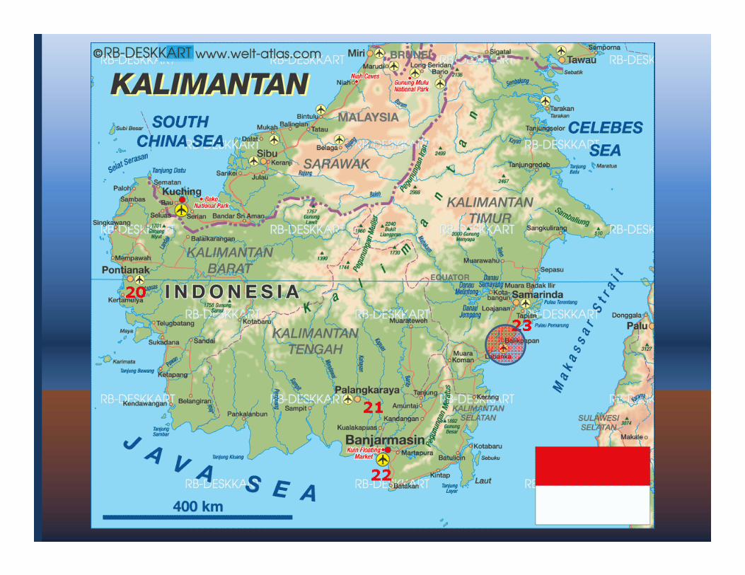
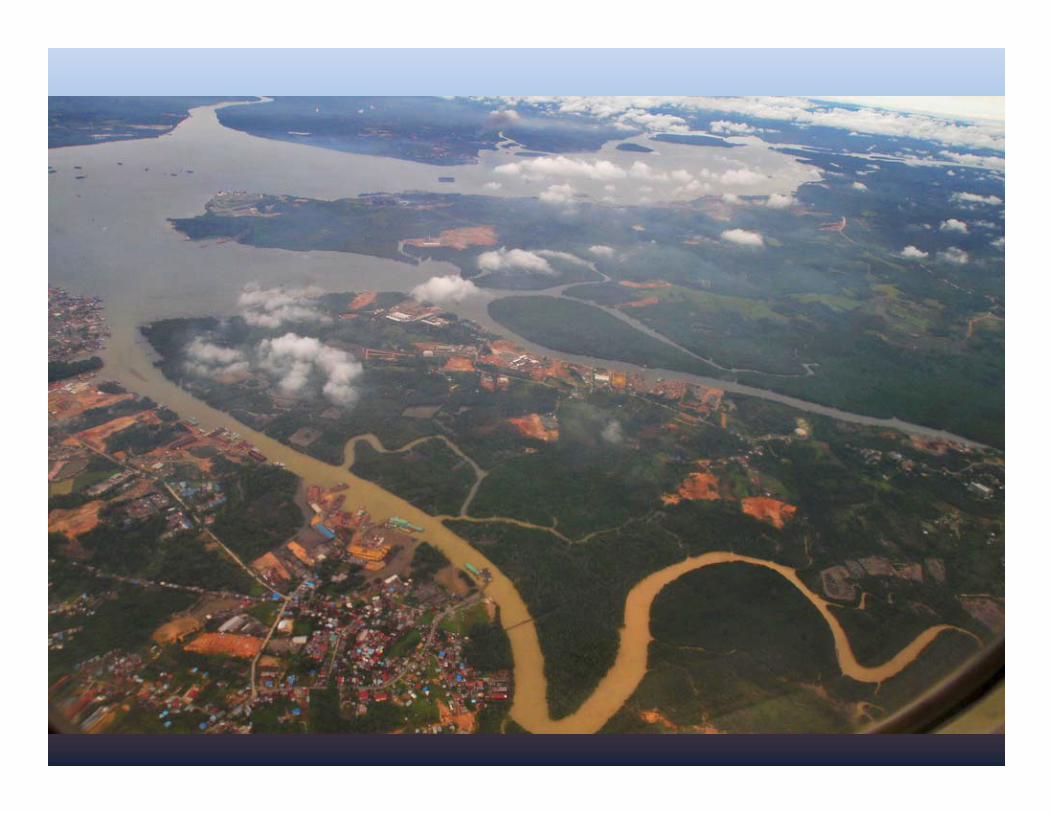
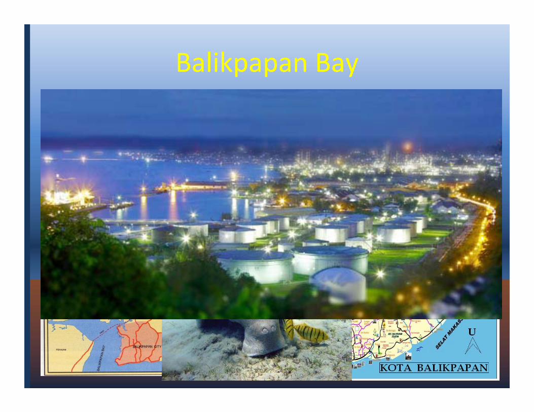
Balikpapan Bay
• Management Area: Balikpapan Bay (200,000 Hectare)
• Study area: watershed & City town
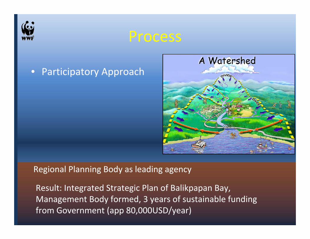
Process
• Participatory Approach
Regional Planning Body as leading agency
Result: Integrated Strategic Plan of Balikpapan Bay, Management Body formed, 3 years of sustainable funding from Government (app 80,000USD/year)
Lesson Learned From Balikpapan• Recognize that building capacity in partner
organizations must occur simultaneously with building capacity within the project team
• Work at multiple levels and with multiple sectors simultaneously so that coordination is maximized and the potential for miscommunication is minimized.
• Be prepared to both lead and take a backseat role in the planning process

Bintuni Bay - Papua
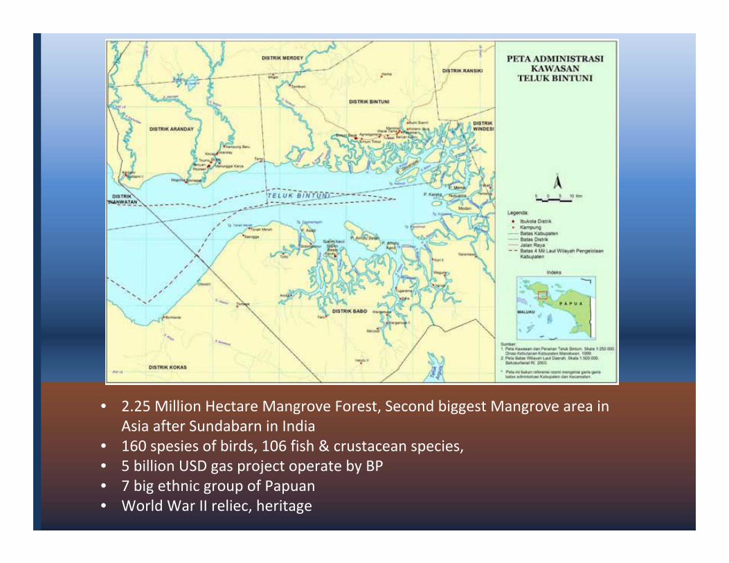
• 2.25 Million Hectare Mangrove Forest, Second biggest Mangrove area in Asia after Sundabarn in India
• 160 spesies of birds, 106 fish & crustacean species, • 5 billion USD gas project operate by BP• 7 big ethnic group of Papuan • World War II reliec, heritage
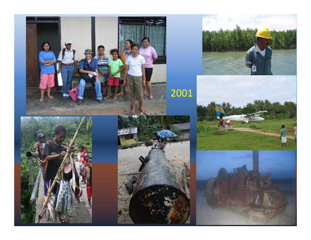
2001
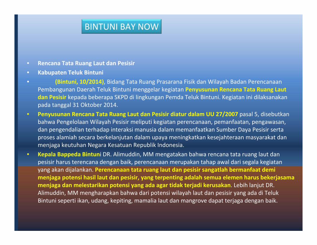
• Rencana Tata Ruang Laut dan Pesisir
• Kabupaten Teluk Bintuni
• (Bintuni, 10/2014), Bidang Tata Ruang Prasarana Fisik dan Wilayah Badan Perencanaan Pembangunan Daerah Teluk Bintuni menggelar kegiatan Penyusunan Rencana Tata Ruang Laut dan Pesisir kepada beberapa SKPD di lingkungan Pemda Teluk Bintuni. Kegiatan ini dilaksanakan pada tanggal 31 Oktober 2014.
• Penyusunan Rencana Tata Ruang Laut dan Pesisir diatur dalam UU 27/2007 pasal 5, disebutkan bahwa Pengelolaan Wilayah Pesisir meliputi kegiatan perencanaan, pemanfaatan, pengawasan, dan pengendalian terhadap interaksi manusia dalam memanfaatkan Sumber Daya Pesisir serta proses alamiah secara berkelanjutan dalam upaya meningkatkan kesejahteraan masyarakat dan menjaga keutuhan Negara Kesatuan Republik Indonesia.
• Kepala Bappeda Bintuni DR. Alimuddin, MM mengatakan bahwa rencana tata ruang laut danpesisir harus terencana dengan baik, perencanaan merupakan tahap awal dari segala kegiatan yang akan dijalankan. Perencanaan tata ruang laut dan pesisir sangatlah bermanfaat demi menjaga potensi hasil laut dan pesisir, yang terpenting adalah semua elemen harus bekerjasama menjaga dan melestarikan potensi yang ada agar tidak terjadi kerusakan. Lebih lanjut DR. Alimuddin, MM mengharapkan bahwa dari potensi wilayah laut dan pesisir yang ada di Teluk Bintuni seperti ikan, udang, kepiting, mamalia laut dan mangrove dapat terjaga dengan baik.
BINTUNI BAY NOW
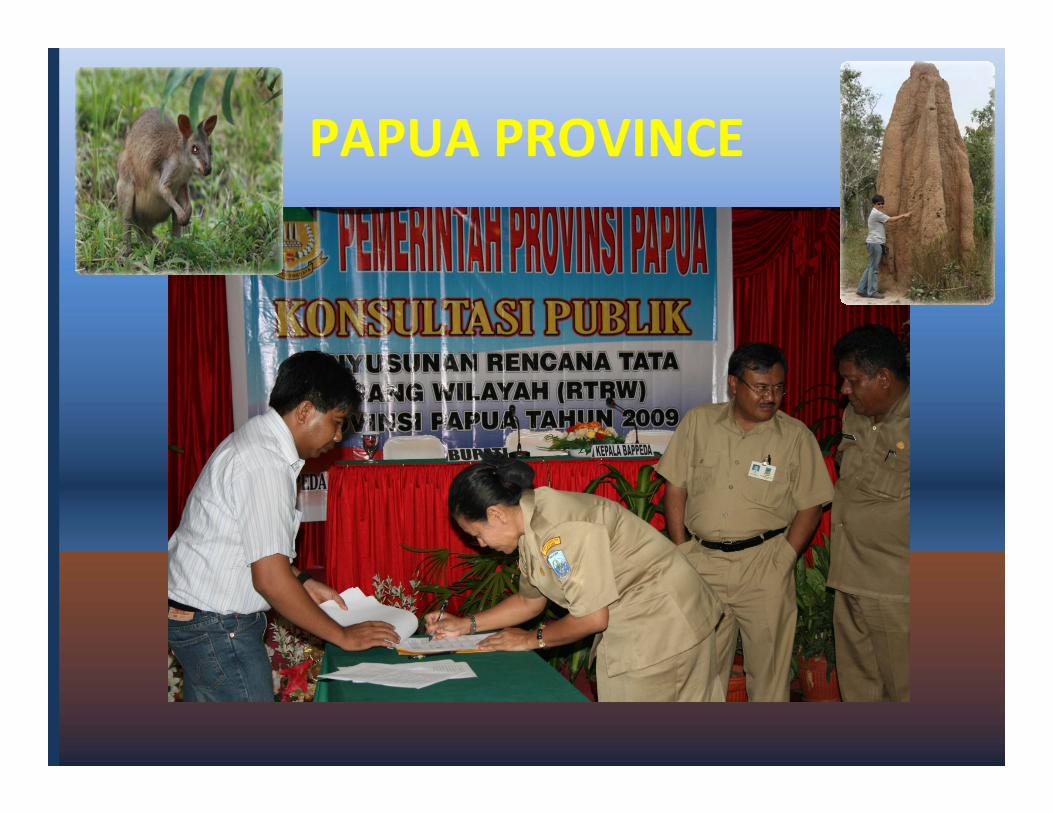
PAPUA PROVINCE
The need of MSP, Objective, Location, time & Initiator
Balikpapan Bay Bintuni Bay North Sulawesi Raja Ampat Papua Province
Conservation Conservation, Economy, Cultural
Conservation Conservation Governance
Dugong, irawadi Dolphin, Fishery, mangrove
Mangrove, Gas, marine biodiversity
MPAs, Tourism MPAs, Coral, Mamalia, Shark, Fishes
Spatial Planning: land and sea
Strategic Plan of Balikpapan Bay
Marine & Coastal Resources Identified
Marine & Coastal Resources Identified
MSP to Local Planning Body
Spatial Plan enactment of Papua Province endorsed by November 2014.
2003 - .. 2001 - 2014 2000 2010 2009 - 2014
Province & City District Province, 2 Cities
District Province
USAID, Government (local planning body)
USAID, BP USAID, Government
Conservation International
Government, USAID
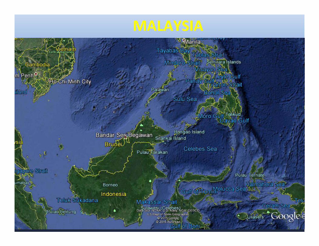
MALAYSIA
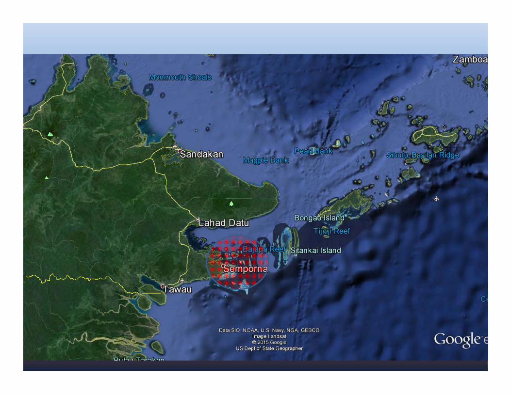
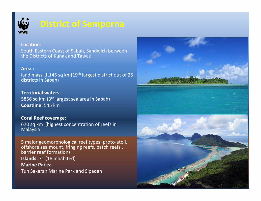
Location: South Eastern Coast of Sabah, Sandwich between the Districts of Kunak and Tawau
Area : land mass: 1,145 sq km(19th largest district out of 25 districts in Sabah)
Territorial waters: 5856 sq km (3rd largest sea area in Sabah)Coastline: 545 km
Coral Reef coverage: 670 sq km (highest concentration of reefs in Malaysia
5 major geomorphological reef types: proto-atoll, offshore sea mount, fringing reefs, patch reefs , barrier reef formation)Islands: 71 (18 inhabited)Marine Parks: Tun Sakaran Marine Park and Sipadan
District of Semporna
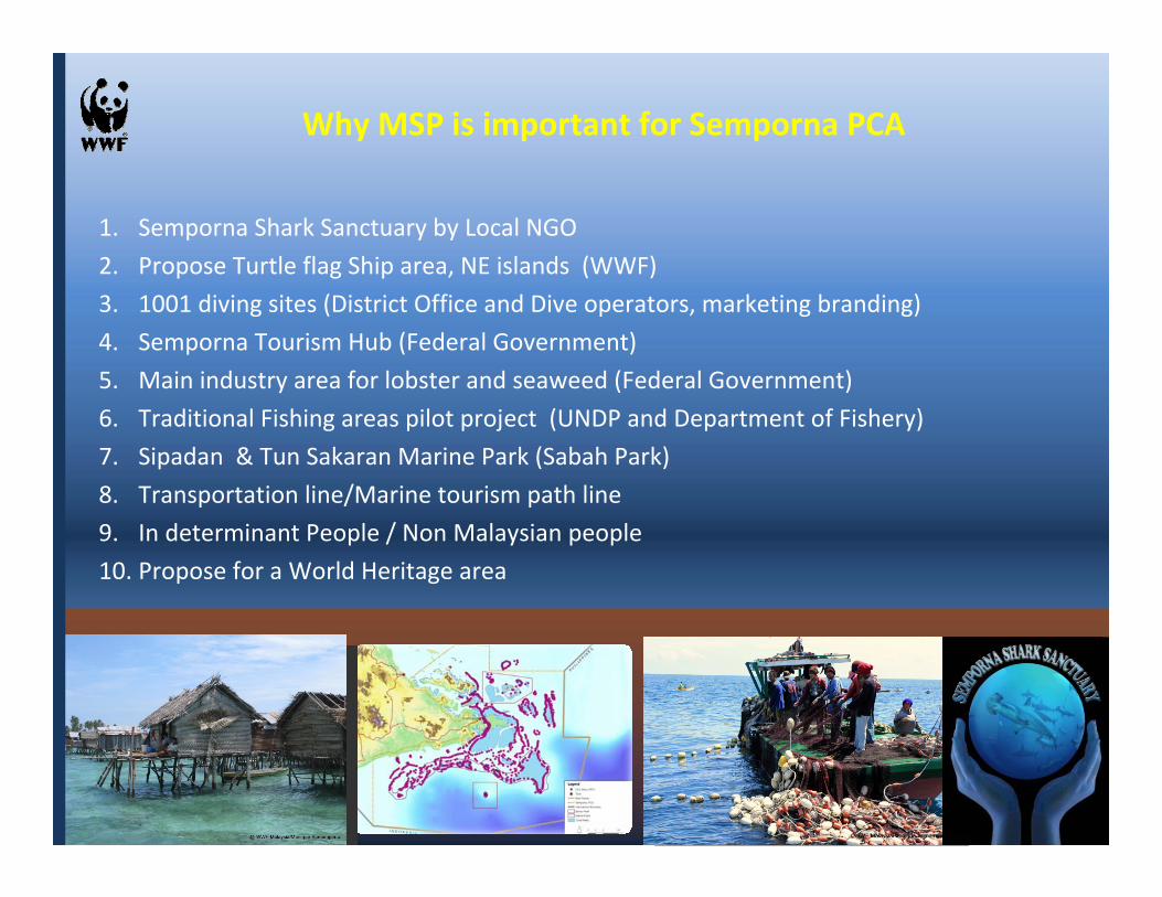
1. Semporna Shark Sanctuary by Local NGO
2. Propose Turtle flag Ship area, NE islands (WWF)
3. 1001 diving sites (District Office and Dive operators, marketing branding)
4. Semporna Tourism Hub (Federal Government)
5. Main industry area for lobster and seaweed (Federal Government)
6. Traditional Fishing areas pilot project (UNDP and Department of Fishery)
7. Sipadan & Tun Sakaran Marine Park (Sabah Park)
8. Transportation line/Marine tourism path line
9. In determinant People / Non Malaysian people
10. Propose for a World Heritage area
Why MSP is important for Semporna PCA
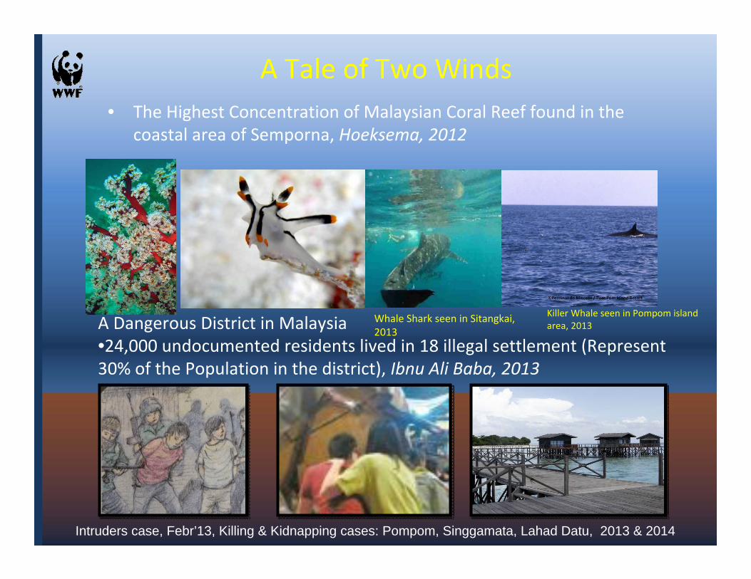
A Tale of Two Winds• The Highest Concentration of Malaysian Coral Reef found in the
coastal area of Semporna, Hoeksema, 2012
A Dangerous District in Malaysia•24,000 undocumented residents lived in 18 illegal settlement (Represent 30% of the Population in the district), Ibnu Ali Baba, 2013
Killer Whale seen in Pompom island area, 2013
Intruders case, Febr’13, Killing & Kidnapping cases: Pompom, Singgamata, Lahad Datu, 2013 & 2014
Whale Shark seen in Sitangkai, 2013
MALAYSIA
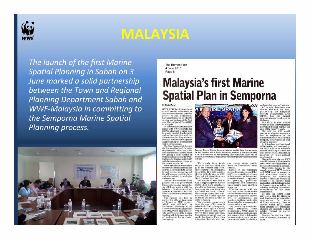
The launch of the first Marine Spatial Planning in Sabah on 3 June marked a solid partnership between the Town and Regional Planning Department Sabah and WWF-Malaysia in committing to the Semporna Marine Spatial Planning process.
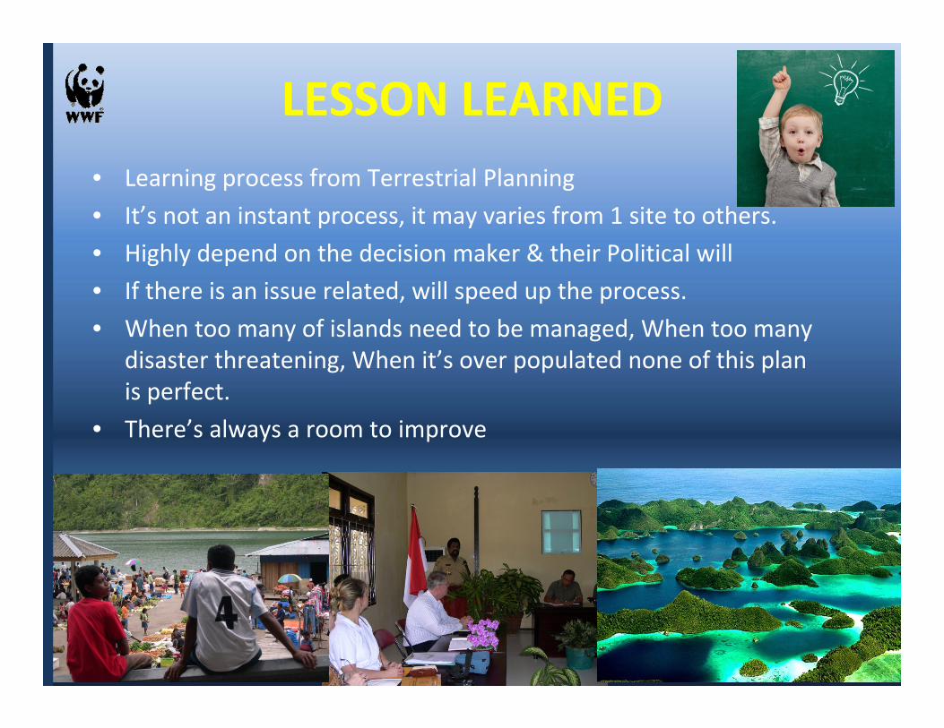
LESSON LEARNED• Learning process from Terrestrial Planning
• It’s not an instant process, it may varies from 1 site to others.
• Highly depend on the decision maker & their Political will
• If there is an issue related, will speed up the process.
• When too many of islands need to be managed, When too many disaster threatening, When it’s over populated none of this plan is perfect.
• There’s always a room to improve