Embed Size (px)
Citation preview

9-20-15
5
4.0 Horizontal and Vertical Control of Dredging Equipment
Horizontal positioning will be accomplished by using GPS positioning with differential
GPS and Windows-driven HYPACK software, and assisted by line of sight positioning
from the numerous visual reference points in the harbor. This is feasible because all
planned dredging will occur within the harbor where reference landmarks (i.e. boat slips,
floating and permanent docks) are readily available. Vertical positioning is also
accomplished by HYPACK, assisted via a ladder gauge on the dredge. This gauge is to
be regularly checked and adjusted with the tide gauge at the Port.
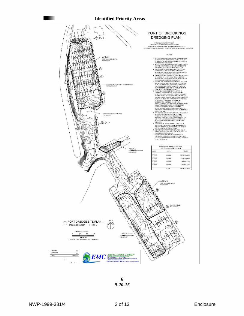
5.0 Dredge Area - Priorities
Description Table – The following table presents the specific sub-areas within the basins
and dock more generally named “Sport Basin” , “Commercial Basin” and the “Ice
House Inlet”.
Table A
Port To Disposal Site Disposal Site
Area Depth (ft. MLLW) Maximum Volume
Removed (yds.3)
Area 1 Not to Exceed 14’ MLLW 18462
Area 2 Not to Exceed 14’ MLLW 1146
Area 3 Not to Exceed 14’ MLLW 3862
Area 4 Not to Exceed 14’ MLLW 6046
NWP-1999-381/4 1 of 13 Enclosure
9-20-15
6
Identified Priority Areas
NWP-1999-381/4 2 of 13 Enclosure
9-20-15
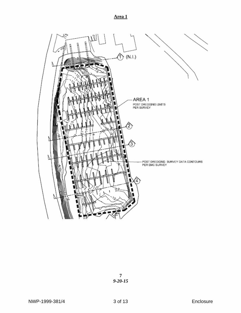
7
Area 1
NWP-1999-381/4 3 of 13 Enclosure

9-20-15
8
Area 2
Areas 3 & 4
NWP-1999-381/4 4 of 13 Enclosure

9-20-15
9
Prisms 2 - 9
NWP-1999-381/4 5 of 13 Enclosure
9-20-15
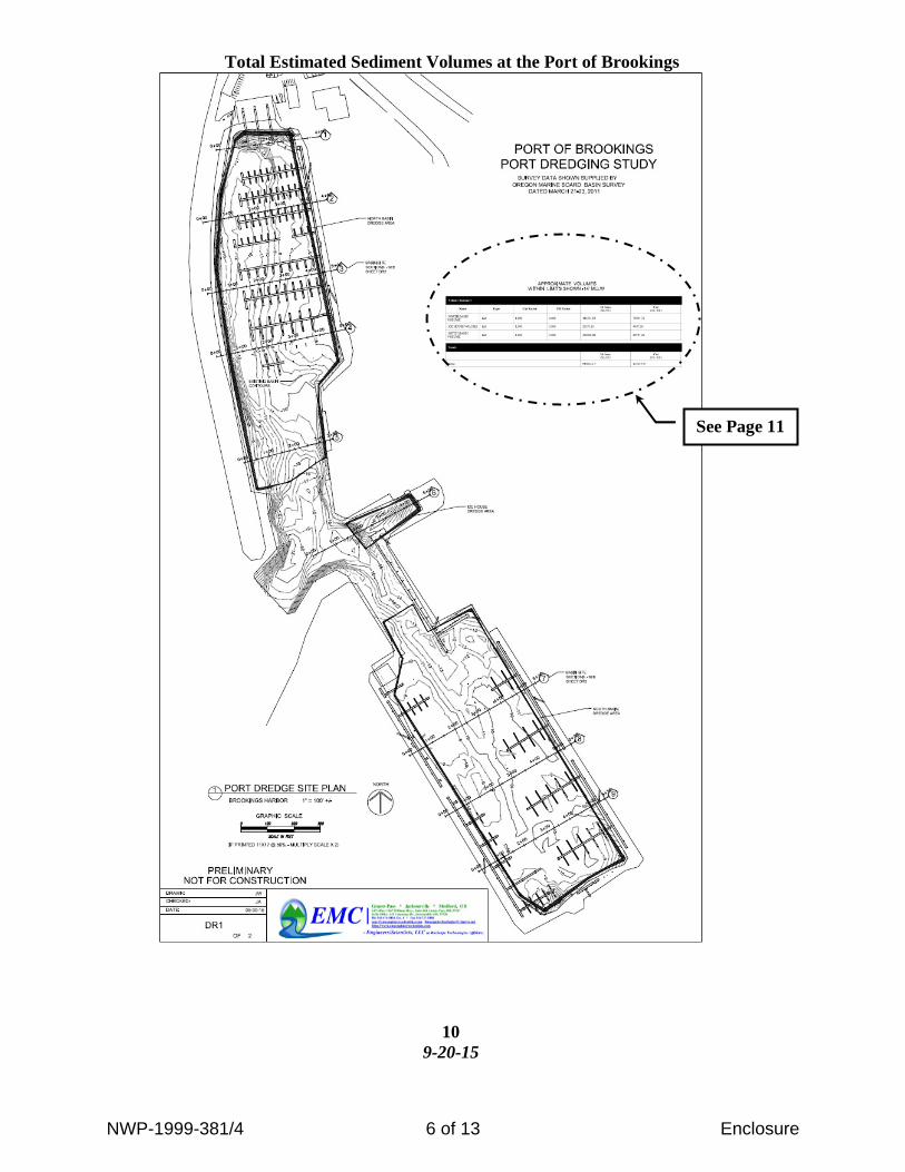
10
Total Estimated Sediment Volumes at the Port of Brookings
See Page 11
NWP-1999-381/4 6 of 13 Enclosure

NWP-1999-381/4 7 of 13 Enclosure
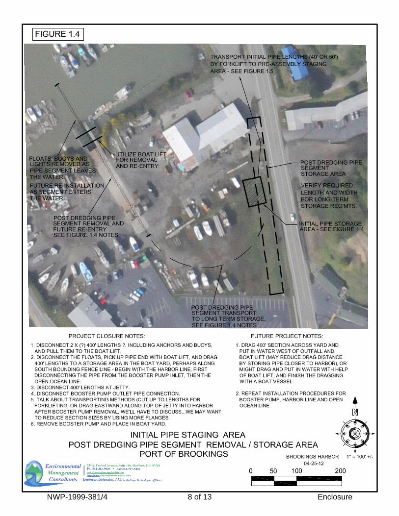
NWP-1999-381/4 8 of 13 Enclosure

NWP-1999-381/4 9 of 13 Enclosure

NWP-1999-381/4 10 of 13 Enclosure

NWP-1999-381/4 11 of 13 Enclosure
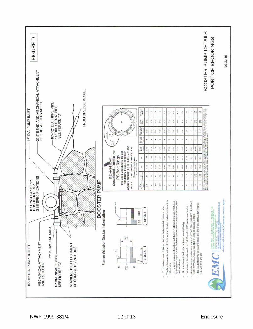
NWP-1999-381/4 12 of 13 Enclosure
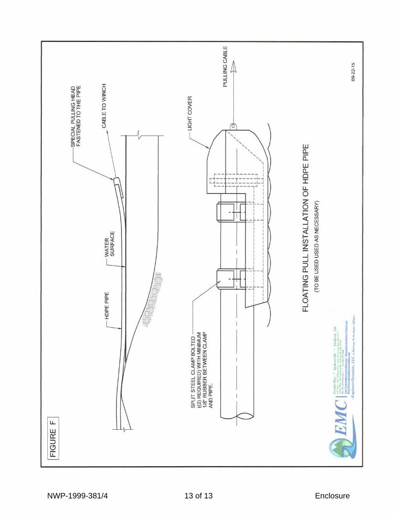
NWP-1999-381/4 13 of 13 Enclosure