Embed Size (px)
Citation preview

In Reply Refer To: HS 5231 October 2, 1992
Seagull Energy E&P Inc. Attention: Ns. Rita Heintz 1001 Fannin, Suite 1700 Houston, Texas 77002-6794
Gentlemen:
Reference Is made to the folloving plan received Septenber 18, 1992:
Type Plan - I n i t i a l Plan of Exploration Lease - OCS-G 9564 Block - 255 Area • South Marsh Island Activities Proposea - Veils A through D
In accordance with 30 CFR 250.33, this plan i s hereby deeaed subaitted and is nov being considered for approval.
Your control number Is N-4356 and should be referenced In your communication and correspondence concerning this plan.
Sincerely,
(Orig. Sgd.) A. Dowld Giroir
3m D. J . Bourgeois Regional Supervisor Field Operations
bcc: .Lease OCS-G 9564 POD File (NS 5032)
DTrocquet: clc: 09/22/92: POECOM

SEP 18 1992
SEAGULL ENERGY E&P INC.
September 17,1992
Mr. Daniel J. Bourgeois Recionai Supervisor Office of Field Operations Minerals Management Service 1201 Elinwoc^ParkBoulewd New Orleans, Louisiana 70123-2394
Offshore Louisiana
Gentlemen:
^ ^ ^ ^ ^ ^ ^ ^ ^ ^ Louisiana. SeaguU anticipates commencing activities under this Plan of Exploration on « about October 24,1992.
Should you require additional information, please advise.
Very truly yours, ,
Rita Heintz C / Regulatory Coordinator
rh
PUBLIC INFORMATrvl

SEAGULL ENERGY E&P INC INITIAL PLAN OF EXPLORATION
SOUTH MARSH ISLAND BLOCK 255 OCSG 9564
Seagull Energy E&P c. is the designated operator of the South Marsh Island Block 255 and is sub ng this Initial Plan of Exploration in accordance with 30 CFR 250.33 and ubsequent guidelines, excluded from the "Public Information" copies of this plan are certain geologic discussions, well depths, and structure map.
PROPOSED OPERATION
Seagull proposes to drill four (4) wells, Locations A through D under this Plan of Exploration. Anticipated commencement date of operations is October 24, 1992 subject to plan approval and issuance of n. mits to drill. The proposed wells should take approximately 40 days each to drill
Other activilies which may be conducted under this plan would be the setting of a well protector structure or template, running a velocity survey, and collections of soil borings.
DRILLING EQUIPMENT DESCRIPTION
The proposed wells will be drilled with a typical jackup drilling rig. Drilling and other operations will be conducted under the applicable provisions of OCS orders, notices and regulations and in the interest of safety and pollution control. A schematic of a typical diverter system and blowout preventer are enclosed on Attachment A.
WELL LOCATIONS
WELL LOCATION PTD WATER DEPTH
A SL: 5525* FSL & 5900' FWL 22' BHL:
B SL: 5525* FSL & 5900* FWL 22* BHL
C SL 0750* FSL A 3100* FEL 22' BHL:
D SL: 0750* FSL & 3100* FEL 22' BHL
Location plat, structure map, and bathymetry map are enclosed on Attachments B,C,andD.
SHALLOW HAZARDS
Information on geological and physical hazards pertinent to the surface locations of the proposed wells is enclosed as Attachment E
1

OIL SPILL CONTINGENCY PLAN
Seagull is a member of tlie Clean Gulf Associates wi'h an approved Gil Spill Contingency Plan on tale with the MMS. Seagull intends to exercise aue diligence towards protection of the environment curing C flling and production operations. An oil spill trajectory and response analysis is mcluded on Attachment F.
NEW OR UNUSUAL TECHNOLOGY
Seagull will not use any new or unusual technology in the drilling of these wells.
LEASE STIPULATIONS
Stipulation No. 1 - A Cultural Resource Report was submitted with the Shallow Hazards Survey.
DISCHARGES
arge Rates associated with the drilling of the proposed wells will be in
accordance with the EPA NPDES General Permit for the Gulf of Mexico. A discussion of the approximate anticipated discharge rates per well are listed on Attachment G.
Circulating Media , , Seagull does not plan to utilize oil based muds during the drilling of these wells. Monthly and end of well LCSO toxicity tests will be performed in accordance with EPA regulations. Any drilling fluid contaminated with oil will be transported to shore for proper disposal at an authorized disposal site. A list of mud additives is enclosed on Attachment H.
Domi Sewa
mestieWfltte ige will be treated on location. Solid domestic wastes will be transported
to shore for proper d iosal.
Deck drainage will be estimated by amount of rainfall and wash water used. All discharges will be free of oil.
HYDROGEN SULFIDE
A Reological review of the South Marsh Island Block 255 indicates no evidence of hydrogen sulfide. Data reviewed included information from Sohio's #1 well in SMI 255 (OCS-G 4111) which penetrated a depth of 13,483' and #3 well which penetrated a depth of 18,352'. These wells are located approximately 1800* north and 710Cr east, respectively, of our nroposed location "A". Also reviewed was data from Tenneco's A-l well ir. SMI Block 252 (OCS-G 2598) which
Senetrated a depth of 11,010' (TVD) and Brooklyn Union's B-l and B-2 wells in MI Block 253 (OCS-G 8690) which nenetrated a depth of 10,003' (TVD). These
wells are located approximately 35,000 feet northeast of our proposed location "A". Based on this data, Seagull requests that in accordance with 30 CFR 250.67 a determination be made that this area is classified as an area where the absence of H2S has been confirmed.
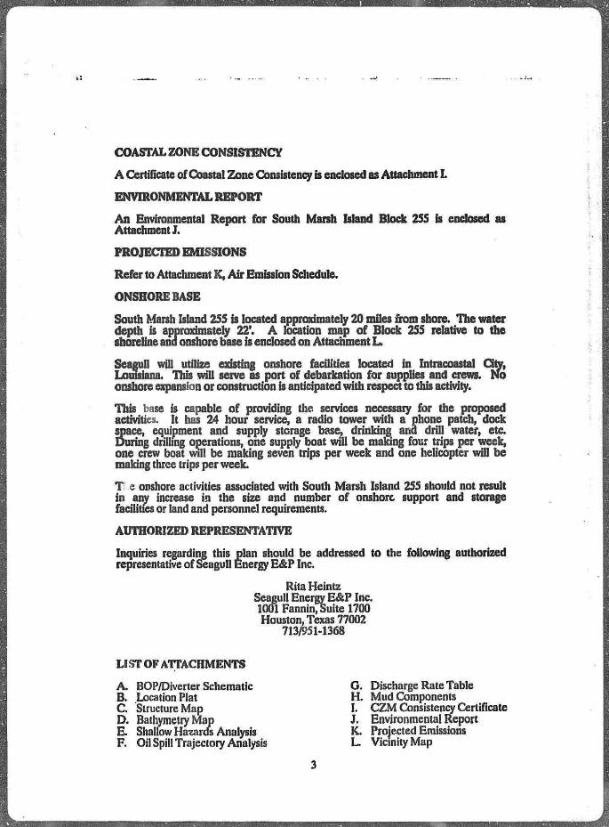
COASTAL ZONE CONSISTENCY
A Certificate of Coastal Zone Consistency is enclosed as Attachment I.
ENVIRONMENTAL REPORT
An Environmental Report for South Marsh Island Block 255 is enclosed as Attachment J.
PROJECTED EMISSIONS
Refer to Attachment K, Air Emission Schedule.
ONSHORE BASE
South Marsh Island 255 is located approximately 20 miles from shore. The water depth is approximately 22*. A location map of Block 255 relative to the shoreline and onshore base is enclosed on Attachment L.
Seagull will utilize existmg onshore facilities located in Intracoastal City, Louisiana. This will serve as port of debarkation for supplies and crews. No onshore expansion or construction is anticipated with respect to this activity.
This base is capable of providing the services necessary for the proposed activities. It has 24 hour service, a radio tower with a phone patch, dock space, equipment and supply storage base, drinking and drill water, etc During drilling operations, one supply boat will be making four trips per week, one crew boat will be making seven trips per week and one helicopter will be making three trips per week.
Ti e onshore activities associated with South Marsh Island 255 should not result in anv increase in the size and number of onshore support and storage facilities or land and personnel requirements.
AUTHORIZED REPRESENTATIVE
Inquiries regarding this plan should be addressed to the following authorized representative of Seagull Energy E&P Inc.
Rita Heintz Seagull Energy E&P Inc. 1001 Fannin, Suite 1700 Houston, Texas 77002
713/951-1368
LIST OF ATTACHMENTS
A. BOP/Diverter Schematic B. Location Plat C Structure Map D. Bathymetry Map E. Shallow Hazards Analysis F. Oil Spill Trajectory Analysis
G. Discharge Rate Table H. Mud Components I. CZM Consistency Certificate J. Environmental Report K. Projected Emissions L. Vicinity Map

Attachment A
DIVERTER AND BOP SCHEMATIC
DIVERTER ASSEMBLY
SO tn.2M M l Annular 80*-
0 In, RtmetaCtntrat Gala Valva
SfeOwtrbtartfOUehargtUn*
9 In. Ramata Contra! Gate Valva
APiSM-SO-M • m.OvtrbetrdDl i t t i«ratUf l«
BOP ASSEMBLY 18 • / • n, tM psj Annular BOP
a k k t O R U w t k C k i k t U M
2 l / « l n . tOMChtcHVaiv.
API 10M-1J S/S-RSRdA H28 Trim

SEAGULL LNERGY 255 OCS-G-9564
Soh.o OCS-4///
• •4 13.4B3'
•A" Loc. & S.L. for"B"
Sohio OCS-4M %• 18,352'
"C "Uc . f t S.L f o r " 0 " |-
3100'
J 0
PUBLIC INFORMATION
ATTACHMENT B
SEAGULL ENERGY E & P INC.
SO. MARSH ISLAND BLK. 255 OFFSHORE LOUISIANA
SCALE * r 12000' OATEt 0/02


Attachment B
SHALLOW HAZARDS REVIEW SOUTH MARSH ISLAND BLOCK 255
OCS.G9S64
Gulf Ocean Services, Inc. completed a shallow hazard survey in South Marsh Island Block 255 for Seagull Energy E&P Inc. during August, 1992. The data obtained included side scan sonar, magnetometer, subbottom profiler, fathometer and sparker.
Seagull geophysicists have reviewed the geophysical data pertment ta tbe surfece location of the wells and determined the area clear of any natural or man made hazards.

Attachment F
OIL SPILL TRAJECTORY ANALYSIS
Seagull is a member of Clean Gulf Associates (CGA). The CGA has two permanent equipment bases in Texas, at Port Aransas ana Galveston, and five bases in Louisiana, at Venice, Grand Isle, Houma, Intracoastal City and Cameron. Each base is equipped with fast response skimmers and there is a barge mounted high volume open sea skimmer based at Grand Isle. Louisiana. In addition to providing equipment, the CGA also supplies advisors for clean-up operations. Equipment available from CGA, and the case it is located is listed in the OGA Manual, Volume I , Section HI. Equipment located in Intracoastal City, Louisiana would be utilized first with additional equipment transported from the nearest equipment base on-site as required.
Estimated response time for a spill in South Marsh Island Bio..; **5 ••'jf* 4 normal weather conditions could vary from 11 to 13 hours based on the following:
PROCEDURE HOURS
1. Procurement of equipment and transportation vessel 4.0
2. Load out of FUt Response Unit 2.0
3. Travel to deployment site frora COA base (50 miles @ 10 mph) 5.0
4. Deplovment of containment and clan op equipment on site LQ
TOTAL ESTIMATED TiME 110
Should a spill occur during operations on South Mann Island Block 255, Seagull has projected trajectory of a spill utilizing infom ation in the Environmental Impact Statement (EIS) for OCS Lease Sales 239 and 141.
We have calculated the probable pr zd land fall of an oil spill from our area of operations by referring to - summary of the trajectory analysis presented in the EIS. The follow mlations outline the probability of a spill making landfall within 10 days. /*iss listed is the CGA Map Number corresponding to the land segment which will be utilized to determine environmentally sensitive areas tbat may be affected by a spill.
LAND PCNT AREA SGMNT PARISH PROB CGA MAP #
C-31 12 Cameron 2% LA Map 5 C-31 13 Vermilion 25% LAMap5&6 C-3V . 14 Iberia 6% LA Map 6 C-31 15 St. Mary 1% LA Map 6
The tables provided with the maps hsted above also identify the protection response modes required to protect the biologically sensitive areas. Referring to Section VI in the CGA Manual, each of the appropriate pieces of equipment to be deployed would be identified in this site specific instance to protect the biologically sensitive areas.

Attachment H
DRILLING MUD COMPONENTS FOR POB
COMMON NAME DESCRIPTION OF MATERIAL
Weighting Agents Barite Calcium Carbonate Heavywate
Ylfeostfta-s Gel Benex SaltWi,tcr Gel Asbestos Fibers Polymer
Dispersant-" Phos SAPP Lignosulfonate Lignite Tannin
Filtration Control Additives Starch CMC Drispac CVpan,WM00
Chemicals Lime Bicarb Soda Ash Caustic Sodium Chromate
Gypsum
Salt Chrome Alum
L .bamers, Flocculants /Juminum Stearate Defoam Foamban
Barium Sulfate (BaSOi) Aiagonite (CaCOj) Iron Oxide (FeaOs)
Bentorite, Montmorillonite Polymer, Clay Extender Attapulgite. Clay Chrysot »Je Asbestos Synthetic Polymer
Sodium TetrapW;>;*R'* Sodium Acid Jyr.phijsphate Sodium Uguosutt rotate NaCH Treated i^mite S>:iso Methyl n?edannin + Sodium Dichromate
"brn bunch f idium Carboxymetl/I Cellulose Polyanionic Cellulose Sodium Polyacrylate
Calcium Hydroxide Sodium Bicarbonate O aHCXb) Sodium Carbonate (Na2C03) Sodium Hydroxide (NaOH) Sodium Chromate
SaCrOUOHiG) Icium Sulfate
(C3SO4.2H2O) SaIt(NaCJ) Chromic Ch'oride
AJuminnm Stearic Sodium AJkyi teyi Sulfonate Surfactant

DRILLING MUD COMPONENTS PAGE 2
C O M M O N N A M E
Detergents, Bactcriocides, Lubricants Preservative DME
Soltex11
Hokcoat* Lubriral Shafetrol Noxygen Freepjpe* SnottingRuids
Black Magic ST."*
IxistCSnvtlaiJuo Materials Nut Plug Mica Celioflake Kwik-Sea!R
Diaseal.MR
Paraformaldehyde Non-ionic Emulsifier Drilling FluW De*srseu. Proassed Hyikociroons Waisr Cispercabte Asphalts Biodr radable Vegetable Oil Awminum Organic Add Comply Otalyzed, Sodium Sslfte On notable Surfactant Fatty Acids, Sulfonates and Asphaltic Materials Sacked Concentrated Aspbafrraes
Ground Nut Shells Ground Mica Plastic, Shredded Ce, to pl aue Combination of Gra i: Jc*, Flakes and Fibers of Various Sk& High Water Loss Vi? .omits Blend

Attachment I
COASTAI £ONE MANAGEMENT
CONSISTENCY CER riFICATI ON
INIT < U PLAN OF EXPLORATION SOUTi! MARSH ISLAND BLOCK 255
QCS-G9S64
The proposed activities described in detail in this Plan comply with Louisiana's approved Coastal Ms agement Program and will be conducted in a manner consistent with such Prograr\
Arrangements have been made wJib the Advocate in Baton Rouge, Louisiana, to publish a public notice of the proposed acs&riss no later than Oct'toer 6, 1992, Additionally, arrangements ixxs been made with the Daily IbeK-r. :«i ilew Iberia Parish to publish a public notice of the proposed activities r-o later thanaiober6,19§2.
SEAGULL ENERGY E&P INC
Certifying Official
September 17,199Z Date

Public Notice of Federal Consistency Review ofa Proposed Exploration Plan (POE) by ;ve Coastal Management Divisicn/I, ,uisia»ta
Department of Natural Rest -rets forthe Plan's Consistency r' a the Louisiana Ct» tfal Resourcei Program.
Applicant; Seagull Energy E&.\> imc. 1001 Fannin, S-jite IV00 Houston, Texas 77<Xfi'
Location: South Marsh Islairr Area, Lease OCS-G 956* Block 255 Offshere, Louisiana
Description: Pioposed Plan of Exploration for the above area provides for the exploration ior oil anr1 gas. Exploration activities snail itcludc drilling from a .aclc-up rig and transport of drilling crews and equipment by helicopter and/or cargo vesse) from an onshore base located at Intracoastal Qty, Louis n.i No ecologically sensitive sr' ;e» or habitats **re expected to be located near or i ' ted by these activities.
A copy of the plan descrfc&S aU;?ve is available for mspection ai the Coastal Management Division Office located on the 10th floor of the State Land and Natural Resources Bldg., 625 Nort * 4th Street, Baton Rouge, Louisiana. Office hvms: 8:00 am. to 5:00 p.m., Mot day through Friday. The public is requested to i iibmit comments to the Coastal Management Division, Attention: OCS Plans, PO Box 44487, Baton Rouge, Louisiana 70S04-4487. Comments must be received within 15 dey* cf the date of this notice or 15 days after the Coastal Management Division obtains a copy of the plan and i i» available for public inspection. This public notice is provided to meet tr * requirements of the NOAA Regulations on Federal Consistency with approver 'Coastal Management Programs.

Attachment J
ENVIRONMENTAL REPORT
ENERGY E&P INC
INITIAL iri'JM OF EXPLORATION
&OUTH MARSH WAND BLOCK 255 OFFSHORE, LOUISIANA
Prepared by:
Rita Heintz Seagull Energy E&P Inc. 1001 Fannin Suite 1700 Houston, Texas 770ft?
713/95M368
September 17, i v£2

DESCRIPTION OF PROPOSED ACTION
Seagull Energy E&P Inc plans to conduct exploration activities on South Marsh Island Block 255, OCS-G 9564. In the Initial Plan of Exploration for South Marsh Island Block 255, Seagull Energy E&P Inc. proposes to drill four (4) wells. The anticipated commencement date of operations is October 24,1992.
DESCRIPTION OF PROPOSED TRAVEL MODES
Grew boats, supply boats and helicopters will be dispatched from the support base in Intracoastal City, Louisiana and will travel to the block by the most direct route from Intracoastal Qty or from nearby facilities if operating in the area. During drilling operations, one crew boat wfll be making seven trips per week, one supply boat will be making four trips per week and one helicopter will be m:' ing three trips per week.
ONSRCV VPPORTBASE
Seagull Enerev E&P Inc. wfll utilize existing onshore facilities located in Intracoastal City, Louisiana. This base is capable of providing the services necessary for the proposed activities. It has 24 hour service, a radio tower with a phone patch, dock space, equipment and supply storage base, drinking and drill water, etc Activities associated with South Marsh Island 255 should not result in any increase in the size and number of onshore support and storage facilities or land and personnel requirements.
The Socioeconomic data base report will be submitted once the requirements are finalized by the MMS and the States of Alabama, Louisiana, and Mississippi.
NEW OR UNUSUAL TECHNOLOGY
1 to new or unusual technology will be required for this operation.
VICINITY MAP
South Marsh Island Bfcy 1 255 is located approximately 20 miles from shore. Tbe water depth is approximately 22*. A location map of Block 255 is attached.
COMMERCIAL FISHING
The Gulf of Mexico provides 40% of tbe commercial fish landings and one-third of the recreational fishing activities in the continental US. Commercial landings of all fisheries in the Gulf during 1989 totaled nearly 1.8 billion pound, valued at $649 million.
Louisiana ranked first among Central and Western Gulf states in total commercial fishery landings for 1989 with nearly 1.2 billion pounds landed, valued at $264.2 million. Menhaden represents the highest quantity with 1.1 billion pounds landed and shrimp represents the highest value with 100.8 million pounds landed, valued at $134 million. In addition, each of the following 10 species accounted for landing valued at over $1 million: black
1

drum, black mullet, spatted seatrout, shark, red snapper, swordfish, bluefin tuna, yellowfin tuna, blue crab and tbe American oyster.
Louisiana is the most productive state in the Gulf of Mexico in terms of commercial fisheries because of its extensive estuaries, coastal marshes, and nutrient input from the Mississippi and Atchafalaya Rivers. Coastal Louisiana contains approximately 60% of the estuaries and marshes ia tbe Gulf of Mexico. Over 90% of tbe blue crab harvest, which amounts to about 50 million pounds, comes from estuary nursery areas.
SHIPPING
The establishment of a series of safety fairways or traffic separations schemes (TSS's), and anchorage areas provide unobstructed approach for vessels using US ports. Shipping safety fairways are lanes or corridors in which no fixed structure, whether temporary or permanent, is pennitted. TSS's increase navigation safety by separating opposing lanes of vessel traffic. Fairway anchorage are areas contiguous to and associated with a fairway, in which fixed structures may be permitted within certain spacing limitations.
Fairways play an important role in the avoidance of collisions on the OCS, particularly in the case of the larger ocean-going vessels, but not ah* vessels stay within the fairways. Many others, such as fishing boats and OCS support vessels, travel through areas with high concentrations of fixed structures. In such cases the most important mitigation factor is the requirement fbr adequate marking and lighting of structures. After a structure has been in place for a while, it often becomes a landmark and an aid to navigation fbr vessels that operate in the area on a regular basis. Most ocean going vessels are equipped with radar capable of aiding navigation on the OCS.
South Marsh island Block 255 is clear of all shipping fairways and anchorage areas. The driUing rig and all marine vessels servicing this operation will be equipped with US Coast Guard required navigational safety aids.
SMALL CRAFT PLEASURE BOATING, SPORT FISHING AND RECREATION
The northern Gulf of Mexico coastal zone is one of the major recreational regions of the United States, particularly in connection with marine fishing and beach-related activitiea. The coastal beaches, barrier islands, estuarine bays and sounds, river deltas, and tidal marshes are extensively and intensively utilized for recreational activity by residents of the Gulf Coast and tourists from throughout the nation. Publicly-owned and administered areas such as national seashores, parks, beaches and wildlife lands, as well as specially designated preservation areas such as historic and natural sites and landmarks, wilderness areas, wildlife sanctuaries, and scenic rivers attract residents and visitors throughout the year. Commercial and private recreational facilities and establishments, such as resorts, marinas, amusement parks, and ornamental gardens, also serve as primary interest areas and support services (or people who seek enjoyment from the recreational resources associated with the Gulf.
2

The two major recreational areas most directly associated with tbe offshore leasing and potentially affected by it are tbe onshore marine environment and the coastal shorefront of the adjoining states. The only major recreational activity occurring on the OCS is offshore marine recreational fishing and diving. Major spon species sought and caught offshore include snappers, groupers, seatrout, croakers, mackerels, amberjack, cobia, dolphin, tarpon, and billfishes. Studies, reports, and conference proceedings published by MMS and others have documented a substantial recreational fishery including scuba diving, directly associated with oil and gas production platforms. The recreational fishing .seriated with oil and gas structures stems from their function as high profile artificial fishmg reefs. A report on the 1984 Marine Recreational Fishery Statistics Surveys presented by NMFS at the Sixth Annual Gulf of Mexico imormation Transfer Meeting indicates a majority of the offshore recreational fishmg in the Central and Western Gulf of Mexico is directly associated with the oil and gas structures. Many other studies have demonstrated that when oil and gas structures are accessible to marine recreational fishermen and scuba divers they are a major attraction for marine recreational activities and a positive influence on tourism and coastal economics Throughout the Gulf of Mexico Region, there is high mterest in acquiring, relocating, and retaining selected ofl and gas structures in the marine environmental as dedicated artificial reefs to enhance marine fisheries when tbe structures are no longer useful for ofl and gas production.
With tbe exception of Grand Isle and vicinity and a stretch of beach area in Cameron Parish. (Peveto/Constance/Ocean View Beaches, Holly Beach, Hackbcny Beach) Louisiana has very limited beach area suitable for recreation. Most of it it very narrow, of poor recreational quality and generally inaccessible by a rfomobue. Some of the highest quality beach areas in coastal Louisiana are found along the barrier islands chain off Terrebonne Parish. Several additional significant recreational resources are fou», 1 along the Gulf Coast Louisiana has ornamental gardens, scenic roads, rivers, and trails.
CULTURAL RESOURCES
Archaeological resources are any objects or features which are man-made or modified by human activity. Significant archaeological resources are either historic or prehistoric and, as defined by 36 CFR 60.6, generally include properties greater than 50 years old which are associated with events that have made a significant contribution to the broad patterns of our history; are associated with the lives of persons significant in the past; embody the distinctive characteristics of a type, pe riod, or method of construction; represent the work of a master, possess high artistic values; represent a significant and distinguishable entity whose components may lack individual distinction or have yielded, or may be likely to yield, information in prehistory or history.
Geographic features that have a high probabihty for associated prehistoric sites in the Central Gulf include barrier island and backbarrier embayments, river channels and associated floodplains and terraces, and salt-dome features.

A Cultural Resources Report was prepared using tbe data from the Shallow Hazards Survey run by Gulf Ocean Services, Inc in August, 1992. No known recorded historic shipwreck dam has been found tor this block. The magnetometer recorded forty-eight anomalies; twenty are unidentified. The probability of locating tbe presence of significant prehistoric cultural reaourcea in the survey of Block 255 South Marsh Island Area is assessed as probable. Areas associated with the confluences of streams should have more potential fbr sites than other areas. The narue of lhe magnetic anomalies is unknown. They could represent modem cultural material associated with the ofl and gas field conttruction activity, geological or lost historic material. They snouid therefore be avoided.
ECOLOGICALLY SENSITIVE FEATURES
Barrier beaches are a common landform along the Gulf Coast and stretch in an irregular chain from Florida to Texas. These elongated, narrow landforms are composed of sand and other loose sediments transported by waves, currents, norm surges, and wind. Barrier landforms are a young coastal feature. Tbe term "barrier" identifies tbe structure as one that protects other features, such as bays, estuaries, and marshes, from direct impacts of the open ocean. By separating coastal waters from the ocean, barriers contribute to ttie amount of estuarine habitat along the coast As much as two-thirds of tbe top value Atlantic and Gulf Coast species of fish are considered to be directly dependent during some stage of their ufe on conditions in these estuaries.
Another benefit of both the islands and their adjacent marshes and bays is tbat of providing habitats for a large number of birds and other animate, induding several threatened or endangered species, for example, tbe loggerhead turtle, the southern bald eagle, alligators, ana brown pelicans.
Louisiana has tbe most rapidly retreating beaches in the nation. The average retreat for the Fourchon beach over the last 100 years has been in excess of 60 ft/yr. The statewide average according to Dolan et al. (1982) is in excess of 11 ft/yr. Beaches along the deltaic plain in Louisiana fit into one of three categories, depending on the stage of the deltaic cycle of the nearby landmass. When a major distributary of the Mississippi River is abandoned, subsidence results in a local sea level transgression that transforms the active delta into an erosional headland with flanking barriers. With increased age and subsidence, the barrier shoreline evolves into a transgressive barrier island arc that is separated from the mainland by a lagoon. Eventually with continued subsidence and sediment deprivation, the island ceases to exist
The importance of coastal wetlands to the coastal environment has been well documented. Coastal wetlands are characterized by high organic productivity, high detritus production, and efficient nutrient recycling. They provide habitat for a-great number and wide diversity of invertebrates, fish, reptiles, birds, and mammals. Wetlands are particularly important as nursery grounds for juvenile forms of many important fish species. The Louisiana coastal wetlands support over two-thirds of the Mississippi Flyway wintering waterfowl population and the largest fur harvest in North America.
4
Louisiana contains most of the Gulf coastal wetlands. The deterioration of coastal wetlands, particularly in Louisiana, is an issue of concern In Louisiana, the annual rate of wetlands loss has been measured at 130 km2 for the period 1955-1978. Several factors contribute to wetlands loss in coastal Louisiana, including sediment deprivation (a result of a 50% decrease m the suspended sediment load of the nver since the 1950's and the channelisation of the river, which as prevented overbank sediment deposition), subsidence and sea-level rise, and the construction of pipeline and navigation canals through the wetlands.
In Mississippi and Alabama, the marshes occur primarily as discontinuous wetlands associated with estuarine environments. The wetlands in this area of the Gulf are more stable than those in Louisiana, reflecting the more stable substrate and more active sedimentation per unit of wetland area. Most of the wetlands in Alabama occur on the Mobile River delta or along northern Mississippi Sound. On a percentage basis, wetlands loss has occurred more rapidly in Alabama during 1955 and 1979 than it did in Louisiana.
A recent study funded by MMS entitled "Causes of Wetland Loss in the Coastal Central Gulf of Mexico, examined coastal ecosystems of the Northern Gulf of Mexico region and how wetland habitats have changed as a result of natural processes and man's activities thereor The study's primary focus was on assessing and quantifying the direct and indirect impacts of OCS-related activities on wetland areas. Canal construction for pipelines and navigation has been the major OCS-related impacting factor.
The shelf and shelf edge of the Central and Western Gulf are characterized by topographic features which are inhabited by benthic communities. The habitat created by the topographic features is important because they support hardbottom communities of high biomass, high diversity, and high numbers of plant and animal species; they support, either as shelter, food, or both, large numbers of commercially and recreationaiiy important fishes; they are unique to the extent that they are small isolated areas of commumties in the vast Gulf of Mexico; they provide a relatively pristine area suitable for scientific research; and they have an aesthetically attractive intrinsic value.
Live bottoms are regions of high productivity characterized by a firm substrate with high diversity or density of epibota. These communities are scattered across the west Florida shelf in the shaUow waters with depth zonation apparent in dominant communities, and within restricted regions of the Central Gulf of Mexico. Live bottoms also include biological assemblages consisting of sea fans, ear whips, hydroids, ascidians, or corals living upon and attached to naturally occurring hard or rocky formations with rough, broken or smooth topography; or areas whose lithotome favors the accumulation of turtles, fishes, seagrass, algae, and other fauna. Chemoynthetic clams, mussels, and tube worms, similar to the hydrothermal vent communities of the eastern Pacific have been discovered in the deep waters of the Gulf and have been the subject of numerous MMS site-specific reviews. These cold-water communities are associated with seismic wipe-out zones and hydrocarbon-seep areas between water depths of 400 and 1000 meters. Seven distinct biotic zones on the banks of the Gulf have been identified. None of the banks contain all of the seven zones.

The Central Gulf of Mexico Ust 16 topographi: features. None of those hsted are in or near the vicinity cf the proposed operations in South Marsh Island Biock 255.
EXISTING PIPELINES AND CABLES
There an no pipelines or cables in the vicinity of the proposed operations.
OTHER MINERAL USES
The proposed activities for South Marsh Island Block 255 will have no direct or indirect unpact on other mineral uses.
OCEAN DUMPING ACTIVITIES
Ocean dumping is prohibited.
ENDANGERED OR THREATENED SPECIES
Although a large number of endangered and threatened species inhabit the Gulf Coast States and their adjoining waters, only a small percentage occupy coastal and marine habitats. An even smaller number are likely to be affected by OCS ofl and gas exploration and production.
Six Federally listed endangered whale species have been reported in the Gulf of Mexico - the blue, fin, humpback, right, sie, and sperm whales. Generally, these large cestaceans inhabit the continental slope and deep oceanic waters; occasionally, they are sighted near shore. Right whales are the most endangered cystectasia in the Gulf of Mexico.
The Kemp's ridley sea turtle is the most imperiled of the world's marine turtles. Female Kemp's ridley sea turtles appear to tnh %»•*': nearshore areas and congregations of Kemp's have been recorded off tte. mouth of the Mississippi River.
The loggerhead sea turtle occurs throughout the world and is the most common marine turtle in the US. The majority of nesting in the Gulf of Mexico occurs in Florida from the Keys to Tampa Bay. Nesting has also been reported on Gulf Shores and Dauphin Island, Alabama and Ship Island, Mississippi. Chandeleur Islands off the Louisiana coast may be the most important nestmg areas for the northern Gulf of Mexico.
The piping plover is endangered in the Great Lakes watershed and threatened elsewhere. The largest numbers and highest densities of birds were found in the Western and Central Gulf of Mexico. The preferred feeding habits appear to be sandflats adjacent to passes and inlets, mudflats near sandy beaches, overwash san r mudflats, ana barrier islands with overwash areas.
The Arctic peregrine falcon is a subspecies of the peregrine falcon, which breeds in the North American tundra. A portion of the population migrates along the Central, Mississippi, and Eastern flyways to winter on the U.S. and Mexican Gulf coasts. The birds concentrate along beaches and barrier islands.
Brown pelicans remain listed as endangered in Mississippi, Louisiana and Texas. Nesting occurs in colonies on coastal islands, six brown pelican rookeries occur in Louisiana and cne small active rookery in Texas. Brown pelicans inhabit the coast, rarely venturing into freshwater or flying more than 32 km offshore.
Bald eagles are found throughout the Gulf States. They actively nest in all but Alabama. Bald eagles inhabit areas near water although they rarely nest on the coast They prey on birds, fish, and small mammals.
The Eskimo curlew is one of the rarest native North American birds in the wild. Only 18 birds were reported between 1983-1987. Most of these sightings occur in coastal Texas. The birds migrate through and concentrate in the Gulf Coast marshes during the spring on their way from South American to Canada. The drastic population decline, which was first reported in the late 1800's, appears due to overharvest, habitat loss, and short-term climatic changes.
The whooping crane breeding population winters along the Texas coast rrom November to April. The birds occupy the coastal marshes along Texas gulf coast counties; portions of which are located in the Aransas National Wildhfe Refuge.
A marine mammal, the West Indian manatee, is a aquatic herbivore and one of the five living species of the order Sirenia. It inhabits low-energy coastal areas throughout the northern Gulf of Mexico; however, it is known to winter only in south and central Florida.
The Gulf sturgeon is a subspecies of the Atlantic sturgeon. It historically spawned in the major rivers of Alabama, Mississippi, and the Florida panhandle. Its present spawning is limited to rivers from the Pearl to the Suwannee Rivers. Food-habit studies suggest that the Gulf sturgeon feeds on benthic invertebrates over sandj hard-bottom, and seagrass substrates. It was recommended for protection as a threatened species in early 1990.
^CIOECONOMIC
oil exploration industry including oil companies, drilling , and oilfield suppliers provide a major input to Louisiana's
< burtomy. A number of ports in the Central and Western Gulf have developed into important centers tor offshore support The most active of these in Louisiana are (from east to west) Venice, Morgan City, Intracoastal City, and Cameron, Louisiana. The onshore support base for operations in South Marsh Island 255 is Intracoastal City, Louisiana.
UNAVOIDABLE ADVERSE ENVIRONMENTAL EFFECTS
Water Qualitv Operational discharges (drilling muds and cuttings, deck drainage and sanitary and domestic wastes) or accidental oil spill may temporarily degrade some measures of water quality adjacent to the proposed surface location. The impact level from these factors is considered to be low.
7
Effects on Marine Organisms Some organisms wm be killed end some **orar1y ti;"ciionally impaired as a result of exploration operations, affected gM .»ys wfll be plankton and benthos immediately arounJ & Damag*.*. will be both mechanical and toxicological. These i '-•"•Mifder**! to be localized, short term and reversible at tlie \n puiatj
An oil spill could affect a broad spectrum of mans. However, most effects would be localized and short term. AnyJammals and turtles would be significant
Wetfaytds and Beach. , f
In the unlikely event of a spill occurring antnore, organisms in wetland and beach habitats could be killed on impaired. Human community disruption could also occur. Aithn effects would be locali d, any effects on endangered species al habitats would be signif
Air Quality .. . . The major impact-producing factors on air quab-related a due to combustion, evaporation, or venting of I The air m
the lease site wfll be degraded temporarily duos, as a result support vessels (boats and helicopters) as m the driUing Anticipated emissions are expected to be beloieline limits and , quality should retum to normal once operatusurably completed. Offshore activities should not affect onshory because of the distance between the drilling rig and shore.
Commercial Fishing The major impact-producing factors on fishirfrom the proposed operations is production platform placement td water discharges, sale-related ou spill and underwater OCS obsh as pipelines and debris.
Oil spills that contact the coastal marshes, es, and open Gulf areas with high concentrations of floating egp have the greatest potential for damage to commercial fisheriexm'ty of the Gulfs fishes are estuarine dependent. An oil spill cy affect commercial fisheries such as menhaden, shrimp, ana blu use these areas as nursery or spawning grounds.
One production platform may remove approxi&s of trawling space, and underwater OCS obstructions cause geahich result in such losses as trawls, shrimp catch, business downtimeunage.
Commercial fishery resources may also be affidischarge of drilling muds and produced waters. Drilling muds material toxic to marine fishes; however, this is only at concentnor five orders of magnitude higher than those found more than; from the discharge point. Further dilution is extremely rapid in offsl
8
Ths installation of pipelines may contribute to salinity regimes, water current patterns, turbidity and/or wetland/seagrass lost, and, therefore, negatively impact fishery resources.
In conclusion, although these factors impact the commercial fisheries industries, the level of impact is expected to be very negligible.
Ship Navigation Very little interference can b %2 w<d between the drilling rig and marine vessels utilized during expte:;jn operations and ships that use established (airways. However, at night and during rough weather, fog, and heavy seas, ships not using established: fairways could collide with the ng. Approved aids to navigations wot be installed on the drilling rig and all manne vessels servicing these operations in accordance with US Coast Guard regulations.
Cultural Resources The probability of locating the presence of resources in the survey of Block 255 South * probable.
Recp?ation Ena* Aesthetic Values The drilling rig and marine vessels may represent an obstacle to son i port fishermen, but such an effect is expected to be negligible and not pet rati lent The effects that normal operations a minor oil :;pill would have oa any Ish stacks important to sport fisher • -re also considered to be negligibEe. A minor oil spill and^r non-petrof m boating debris could foul beaches insi de of the lease area. The fouio$ i the beaches would be an aesthetic denimex* tnatcould adversely affect rtcr vi.«on.
I prehistoric cultural Island Area is assessed as
STATEMENT
The proposed activity will be carried out and completed with the guarantee of the following items:
a. The best available and safest technologies will be utilized throughout the project. This includes meeting all applicable requirements for equipment types, general project layout, safety systems, and equipment and monitoring systems.
b. AM operations will be covered b> an MMS-approved oil spill contingency plan,
c. All .applicable Federal, State, and local requirements regarding air emission aad water quality and discharge for the proposea activities, as well as any other permit conditions, will oe complied with.
9

RF.1.2RENCES
Final Environmental Impact Statement Froposed Oil and Gas lease Sales 110 and 112, Gulf of Mexico OCS Region, OCS EIS, MMS 86-0087.
Final Environmental Impact Statement Proposed Oil and Gas Lease Sales 110 and 112, Gulf of Mexico OCS Region, OCS EIS, MMS 86-0087, visuals.
Final Environmental Impact Statement Proposed Cm and Gas Lease Sain OCfTEB, MMS 87-0077
Final fnvironmental Impact Statement Proposed Oil and Gas Lease Sales 118 and 122, Gulf of Mexico OCS Region, OCS EIS, MMS 884044.
Final Environmental Impact Statement Pioposed Ofl and Gas Lease Sale* 123 ai>a VZ5t Ou.: Mexico OCS Region, OCS EIS, MMS 894053.
Fina. Environmental Impact Statement Prop* ted Oil and Gas Lease Sales 131,135, and 137, Gulf of Mexico OCS Region, OCS i % MMS 89-0042.
Final En ironmentai Impact Statement Proposed Oil and Gas Lease Sales 139 aad 141, Gulf of Mexico OCS Region, OCS EIS, MMS 91-0054
10

Attachment K
AlK EMISSION SCHEDULE FOR FOB SOUTH MARSH ISLAND BLOCK 255
OCS-G 9564
GENERAL INFORMATION
Location of Projecl:
Location of Shore Base: 50.0 Miles NW
MODU Type: Operator:
Company Representative: Footage Planned 1992/93: Planned Commencement Date: Exemption Level Calculations:
Distance to shoreline (CO) E=3400(D2/3) (NOx,VOC,TSP,SO*) E=33.3(D)
MAJOR OFFSHORE SOURCT1
Power used hy driUing unit: 160 Days Duration
Projected Emissions
CO S0» NOx VOC TSP
Lbs/Dav **
105 46
394 11 39
South Marsh Island Block 255 OCS-G 9564 Intracoastal City, Louisiana Existing Facilities Bottom Supported Jack Up Seagull Energy E&P Inc. 1001 Fannin, Suite 1700 Houston, Texas 77002 Ms. Rita Heintz
October 24,1992 Air Emissions Miles 20.0 Tons/Yr 25051 Tons/Yr 666
Approvmate footage to be drilled *
Tons/Year
8.41 3.68
31.52 0.92 3.15
* Based cm 60 HpHr/Ft from "Atmospheric Emissions from Offshore Oil sod Gas Development end Production", Table 4-3. EPA No. 450/3-77-026, June 1977.
• • From "Compilation of Air Pollution Emission Factors", Tsble 3.4-1, EPA Report AP-42, Fourth Edition, September 1985.

AIR EMISSION SCHEDULE SEAGULL ENERGY E&P INC. PAGE 2
MINOR OFFSHORE SOURCE • HpHrs/
Transport Type HP Trips Weeks Cycles Supply Boat 2000 4 22 1173333 Crew Boat 1300 7 22 1108800 Helicopter N/A 3 22 66
Minor Emissions Lbs/Day Lbs/Yea r Tons/Year CO 94 15067 7.53 SO2 40 6431 3.22 NOx 343 54886 27.44 VOC 11 1739 0.87 TSP 35 5652 2.83
• From -Compilaiion of Air Pollution Emission Factors", Volume I , Tables 3.4-1, 2.1-1, Volume II , rabies H-l-2,0-1-3, II-1-8. EPA Report AP-42, Fourth Edition, September 1915.
SOURCE TOTALS frons/Year)
1992/93 CO SO2 NOx VOC TSP Major 8.41 3.68 31.52 0.92 3.15 Minor 7.53 3.22 27.44 0.87 2.83 Total 15.94 6.89 58.96 1.79 5.98
ONSHORE SOURCES
No additional onshore facilities are required for this operation. The onshore source emission total should be less than the Minor Source Total.
EMISSION EXEMPTION STATEMENT
Due to the low level of emissions associated with this operation, it has been determined per DOI/MMS regulations that this project is exempt from further air quality review and will not have an adverse affect on air quality.