Embed Size (px)
Citation preview
GeoGraphix® is a registered trademark of Landmark Graphics Corporation. The LMKR Logo is a trademark of LMKR Holdings. LMKR Holdings is the exclusive world-wide licensor and distributor of GeoGraphix® software.
www.lmkr.com
smartSTRAT®
smartSTRAT® 2019.2
2D/3D Horizontal Well Correlation & Geosteering GeoSteering within a dynamic, 3D geomodel
Plan more wells, drill more wells, and do so faster, and with greater
accuracy. Geoscientists today are tasked with this challenge as
horizontal well drilling and “factory production” development
methodologies increase in popularity. As they seek to tackle this
seemingly daunting challenge, these same geoscientists are also
responsible for developing new plays and drilling locations.
Needless to say, it is imperative that the geosteering process
remains efficient; as new drilling data arrives, the geoscientist can
interpret and integrate it into the geomodel quickly, all in an effort
to keep the drilling on target.
Such efficiency is achieved with smartSTRAT®, an add-on
module to LMKR GeoGraphix® smartSECTION®. It enables fast,
easy, and accurate horizontal well geosteering with
instantaneous geomodel updates. The module offers easy-to-
use, geosteering tools with the capacity to view depth-converted
seismic backdrops, formations, and faults. It also offers direct
integration with mapped, geologic surfaces within the 3D
geomodel. This unique ability enables the geoscientists to
perform with greater efficiency and make accurate geologic
correlations and predictions. This additional level of quality
assurance allows the geoscientists to stay ahead of the drill bit,
avoid faults, and other geohazards, and keep the borehole in-
zone.
During the geosteering process, geoscientists interactively
update their geologic models in smartSECTION® with new picks,
inter-well points, and revised drilling targets. The resulting
interpretations are displayed seamlessly in GeoGraphix®
advanced 3D visualization, allowing for effortless problem
identification and avoidance.
smartSTRAT integrates directly with GVERSE WebSteering,
LMKR’s light-weight web based geosteering tool, to update the
geomodel from remotely steered wells. Together, smartSTRAT
and WebSteering provide the best light-weight, fast, and powerful
remote geosteering solution.
Key Benefits Increased Productivity
Because smartSTRAT®
is an integral extension of
smartSECTION®, the geosteering process facilitates quick
updates to the project database and 3D geomodel, saving
time and ensuring accurate, structural modeling.
GeoGraphix® is a registered trademark of Landmark Graphics Corporation. The LMKR Logo is a trademark of LMKR Holdings. LMKR Holdings is the exclusive world-wide licensor and distributor of GeoGraphix® software.
www.lmkr.com
smartSTRAT®
smartSTRAT® 2019.2
Multiple Type Logs
Because accurate type logs are required for the horizontal
correlation process, smartSTRAT® incorporates multiple,
type-log curves to correlate LWD data, resulting in precisely-
steered, long-reach, horizontal wells and accurate,
geomodel interpretations..
Real-Time Geological and Geophysical Interpretations
Seismic data provides valuable information about a reservoir's
structure and stratigraphy away from the borehole. View dynamically
depth-converted seismic data and interpreted seismic horizons and
faults as a backdrop, or as surfaces within the Framebuilder™
geomodel (scaled to the extents of the smartSTRAT®
vertical section).
To refine the geomodel further, superimpose log curves, surface
correlations, and borehole data on the vertical section to provide key
information about the geology and structure of the reservoir.
Geomodeling While Drilling
To tie a smartSTRAT®
interpretation to a Framebuilder™,
geomodeled surface, hang the type logs used for each dip segment
along the wellbore in Vertical Section view to facilitate inter-well,
correlation point picking.
To maintain an optimal borehole path, once the geomodel updates,
draw drilling target lines on the smartSTRAT®
vertical section to
generate the required trajectory parameters. As the horizontal well
correlates in cross section view, the project's geomodel updates
dynamically for immediate viewing in Map View (with the purchase
of Framebuilder™) and in the, advanced 3D visualization view.
Pack-and-Go Portability
From the well site, geoscientists geosteer using smartSTRAT®, then
email the vertical section and smartSTRAT®
model files to the home
office, where the new data can synchronize with the parent project
instantly to update the geomodel with the new interpretation.
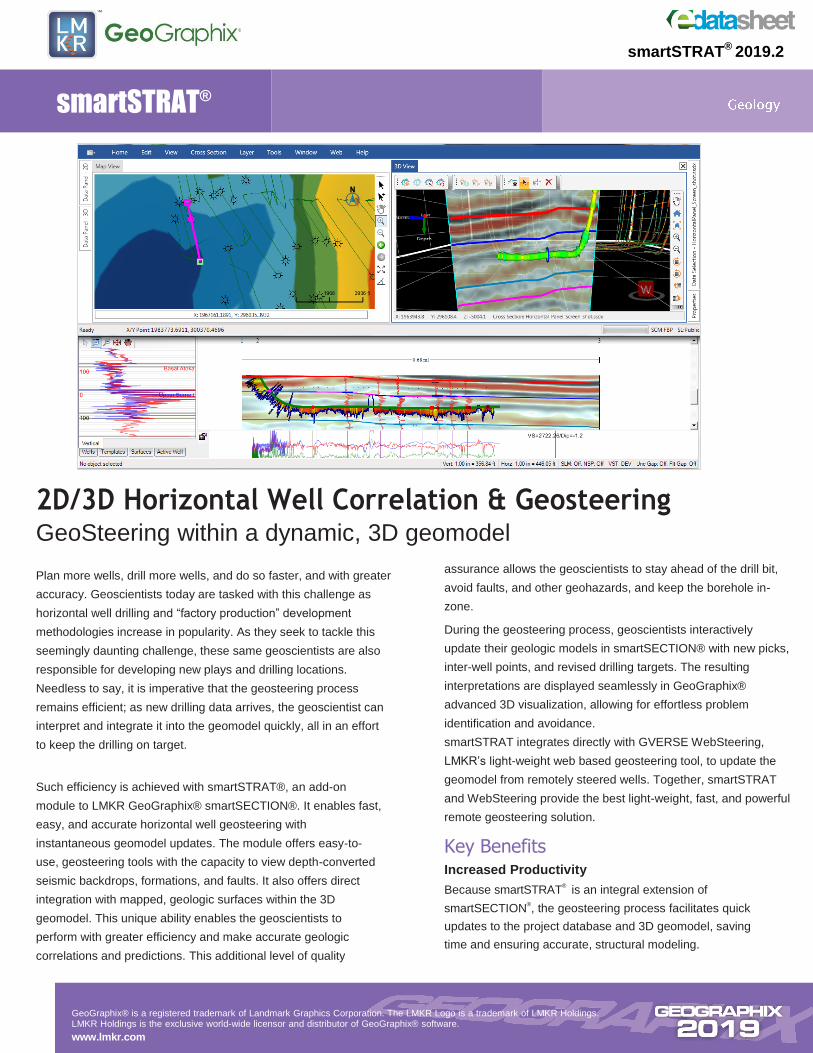
Features Horizontal Panel View
View predicted log curves vs. Logging-While-Drilling (LWD) log
curves beneath the smartSTRAT®
vertical section in a horizontal
panel. The predicted response is modeled by varying the dip
angle and/or fault offset of the 2D active surface. Determine the
geometry of the model by matching the predicted curve response
to the LWD curve. Ancillary curves like ROP, and resistivity can
be displayed along with the LWD curve in the horizontal panel
view.
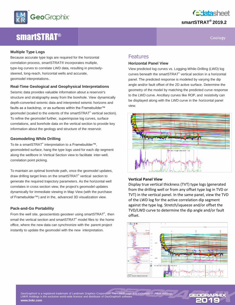
Vertical Panel View Display true vertical thickness (TVT) type logs (generated from the drilling well or from any offset type log in TVD or TVT) in the vertical panel. In the same panel, view the TVD of the LWD log for the active correlation dip segment against the type log. Stretch/squeeze and/or offset the TVD/LWD curve to determine the dip angle and/or fault offset.
GeoGraphix® is a registered trademark of Landmark Graphics Corporation. The LMKR Logo is a trademark of LMKR Holdings. LMKR Holdings is the exclusive world-wide licensor and distributor of GeoGraphix® software.
www.lmkr.com
smartSTRAT®
smartSTRAT® 2019.2
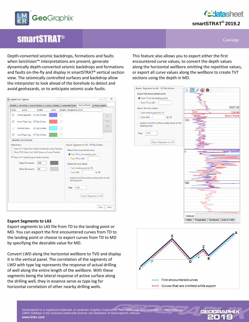
Depth-converted seismic backdrops, formations and faults when SeisVision™ interpretations are present, generate dynamically depth-converted seismic backdrops and formations and faults on-the-fly and display in smartSTRAT® vertical section view. The seismically controlled surfaces and backdrop allow the interpreter to look ahead of the borehole to detect and avoid geohazards, or to anticipate seismic scale faults.
Export Segments to LAS Export segments to LAS file from TD to the landing point or MD. You can export the first encountered curves from TD to the landing point or choose to export curves from TD to MD by specifying the desirable value for MD. Convert LWD along the horizontal wellbore to TVD and display it in the vertical panel. The correlation of the segments of LWD with type log represents the response of actual drilling of well along the entire length of the wellbore. With these segments being the lateral response of active surface along the drilling well, they in essence serve as type log for horizontal correlation of other nearby drilling wells.
This feature also allows you to export either the first encountered curve values, to convert the depth values along the horizontal wellbore omitting the repetitive values, or export all curve values along the wellbore to create TVT sections using the depth in MD.
GeoGraphix® is a registered trademark of Landmark Graphics Corporation. The LMKR Logo is a trademark of LMKR Holdings. LMKR Holdings is the exclusive world-wide licensor and distributor of GeoGraphix® software.
www.lmkr.com
smartSTRAT®
smartSTRAT® 2019.2
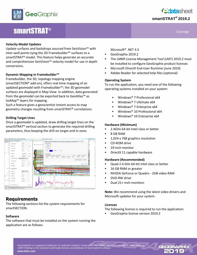
Velocity Model Updates Update surfaces and backdrops sourced from SeisVision™ with inter-well points tying the 3D Framebuilder™ surfaces to a smartSTRAT® model. This feature helps generate an accurate and comprehensive SeisVision™ velocity model for use in depth conversions. Dynamic Mapping in Framebuilder™ Framebuilder, the 3D, topology mapping engine (smartSECTION® add-on), offers real-time mapping of an updated geomodel with Framebuilder™; the 3D geomodel surfaces are displayed in Map View. In addition, data generated from the geomodel can be exported back to GeoAtlas™ as IsoMap™ layers for mapping. Such a feature gives a geoscientist instant access to map geometry changes resulting from smartSTRAT® correlations. Drilling Target Lines Once a geomodel is updated, draw drilling target lines on the smartSTRAT® vertical section to generate the required drilling parameters, thus keeping the drill on target and in-zone.
Requirements The following sections list the system requirements for smartSECTION.
Software The software that must be installed on the system running the application are as follows:
Microsoft® .NET 4.5
GeoGraphix 2019.2
The LMKR License Management Tool (LMT) 2019.2 must
be installed to configure GeoGraphix product licenses
Microsoft DirectX End-User Runtime (June 2010)
Adobe Reader for selected help files (optional)
Operating System To run the application, you need one of the following operating systems installed on your system:
Windows® 7 Professional x64
Windows® 7 Ultimate x64
Windows® 7 Enterprise x64
Windows® 10 Professional x64
Windows® 10 Enterprise x64
Hardware (Minimum) 2.4GHz 64-bit Intel class or better
8 GB RAM
1,024 x 768 graphics resolution
CD-ROM drive
19-inch monitor
DirectX 11 capable hardware
Hardware (Recommended) Quad 2.4 GHz 64-bit Intel class or better
16 GB RAM or greater
NVIDIA GeForce or Quadro - 2GB video RAM
DVD-RW drive
Dual 21+-inch monitors
Note: We recommend using the latest video drivers and Microsoft updates for your system. Licenses The following license is required to run the application: GeoGraphix license version 2019.2