Embed Size (px)
Citation preview

1
Remote Sensing for Fire Management
FOR 435: Remote Sensing for Fire Management
2. Remote Sensing Primer
• Primer
• A very Brief History
• Modern Applications
“As a young man, my fondest dream was to become a geographer. However, while working in the Patents Office, I thought deeply about the matter and concluded that it was far too difficult a subject. With some reluctance, I then turned to physics as an alternative.” - Albert Einstein

2
A GIS is a system for capturing, storing, checking, integrating, manipulating, analyzing, and displaying data which are spatially referenced to the Earth. : http://maps.google.com/
FOR 435: Remote Sensing Primer
FOR 435: Remote Sensing Primer
Wildlife Management
Hazard Assessment
FOR 435: Remote Sensing Primer
We aim to: Physically relate surface process to remotely derived measures
3
‘Remote sensing is the science of obtaining information about an objectfrom measurements made at a distance from the object (i.e. withouttouching the object).’
FOR 435: Remote Sensing Primer
UV - .3-.38 μmVisible - .38-.72 μm IRNear - .72-1.3 μm Mid - 1.3-3 μm (SWIR) Far - 7.0-1,000 μm (Thermal)
Microwave 1mm 30cm
Electromagnetic Spectrum:
FOR 435: Remote Sensing Primer
Microwave 1mm-30cmRadio >30cm
Reflective spectrum - .38-3 μm -wavelengths
A wavelength or frequency interval in the EMR is commonly referred to as a band.
Radiance and Reflectance
FOR 435: Remote Sensing Primer

4
100%
FOR 435: Remote Sensing Primer - Reflectance
5%
5%
8%
40% 10%
FOR 435: Remote Sensing Primer - Reflectance
Energy emitted (q λ) at a given wavelength and temperature is given by the Stefan-Boltzmann law:
q λ = εσ T4 [σ = 5.67 x 10⁻⁸ watts/m2/K4]
ε = emissivity, 0 <= ε <= 1, and is the efficiency that surface emits energywhen compared to a black body
FOR 435: Remote Sensing Primer - Emittance

5
FOR 435: Remote Sensing Primer - Emittance
Wooster et al 2005
Spatial Resolution
High Low
FOR 435: Remote Sensing Primer - Scale
Extent
Low High
FOR 435: Remote Sensing Primer - Scale

6
Spectral Resolution
FOR 435: Remote Sensing Primer - Scale
Seeing the Light with Physics:
1643-1727 Isaac Newton uses a prism to split day-light into the spectrum of the ‘rainbow’
1800: William Herschel discovers the infrared
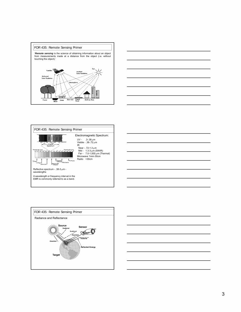
FOR 435: Remote Sensing Primer – A very Brief History
1820s: The Photographic Age:
1826: Niepce Takes First Digital Photograph
1839: Photography begins to
FOR 435: Remote Sensing Primer – A very Brief History
1839: Photography begins to be widely used
1850s: First photographs taken from balloons
Nadar "elevating photography to thecondition of art", 1862, Honoré Daunier.

7
1860: Oldest Surviving Aerial Photograph
As Nadar's pioneering work has been lost the oldest surviving aerial
FOR 435: Remote Sensing Primer – A very Brief History
lost, the oldest surviving aerial photograph was acquired by James Wallace Black of Boston on October 13, 1860:
Seeing the Light with Physics:
1860s: James Clerk Maxwell develops the ‘Theory of Electromagnetic Radiation’
FOR 435: Remote Sensing Primer – A very Brief History
1873: Hermen Vogel Develops Infrared Film
1900s: The Aviation Age:
FOR 435: Remote Sensing Primer – A very Brief History
1903: Wright Brothers Invent the Airplane
1910: Wilbur Wright takes the first Aerial photographs of Italy.

8
1906: Einstein and Max Planck Develop the ‘photon’ model of light
FOR 435: Remote Sensing Primer – A very Brief History
1914-18: First spy-remote sensing during WWI
1940s: The Development of Radar During WWII
FOR 435: Remote Sensing Primer – A very Brief History
1950s The Space Age:
1950s: US Military invents Thermal Remote Sensing
1957: USSR Launches Sputnik 1: First Man-made Satellite in Space
1958: Invention of the Laser at Bell Labs
FOR 435: Remote Sensing Primer – A very Brief History
1958: Invention of the Laser at Bell Labs

9
1960: First ever satellite image of the Earth was taken by TIROS:
TIROS = Television Infrared Observation Satellite
FOR 435: Remote Sensing Primer – A very Brief History
1972: Landsat Program Begins
1999: TERRA (MODIS) Launched
FOR 435: Remote Sensing Primer – A very Brief History
NIR – REDNIR + RED
NDVI =
2005: Maps of area burned, vegetation mortality, and recovery developed
FOR 435: Remote Sensing Primer – A very Brief History
NIR – SWIRNIR + SWIR
NBR =
dNBR = NBRprefire - NBRpostfire

10
FOR 435: Remote Sensing Primer – A very Brief History
MODIS BIRD3.9 μm channel imagesMODIS andBIRD FRP data in
Boreal Forest
FRP dataMODIS BIRD‘false alarms’
Zhukov, B., et al. (2005) Spaceborne detection and characterization of fires during the Bi-spectral Infrared Detection (BIRD) experimental small satellite mission (2001-2004) Remote Sensing of Environment, 100, 29-51
MIR channel TIR channelMSG SEVIRI
FOR 435: Remote Sensing Primer – A very Brief History
MIR-TIR Fire Map
15 mins imaging frequency
11
FOR 435: Remote Sensing Primer – A very Brief History
0 3 6 9 11Day of Burn
FOR 435: Remote Sensing Primer – A very Brief History
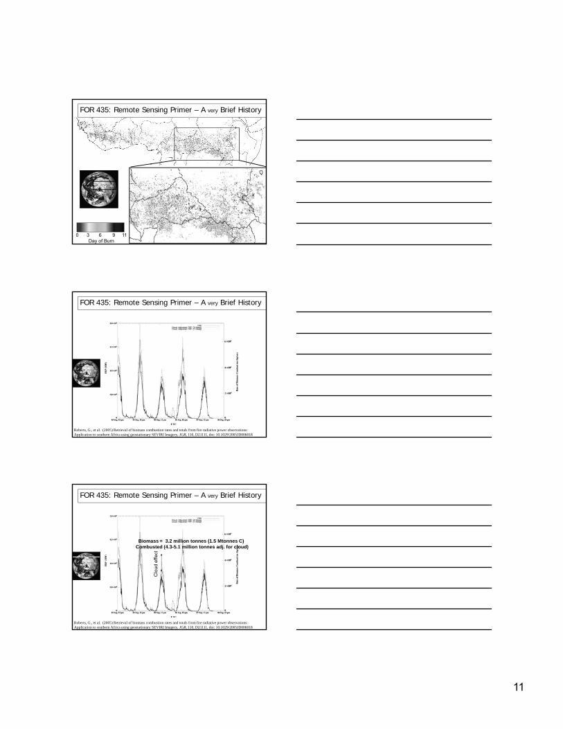
Roberts, G., et al. (2005) Retrieval of biomass combustion rates and totals from fire radiative power observations: Application to southern Africa using geostationary SEVIRI Imagery, JGR, 110, D21111, doi: 10.1029/2005JD006018
BiomassCombusted
= 3.2 million tonnes (1.5 Mtonnes C)(4.3-5.1 million tonnes adj. for cloud)
ect
FOR 435: Remote Sensing Primer – A very Brief History
Roberts, G., et al. (2005) Retrieval of biomass combustion rates and totals from fire radiative power observations: Application to southern Africa using geostationary SEVIRI Imagery, JGR, 110, D21111, doi: 10.1029/2005JD006018
Clo
ud e
ffe

12
FOR 435: Remote Sensing Primer – A very Brief History