Embed Size (px)
Citation preview
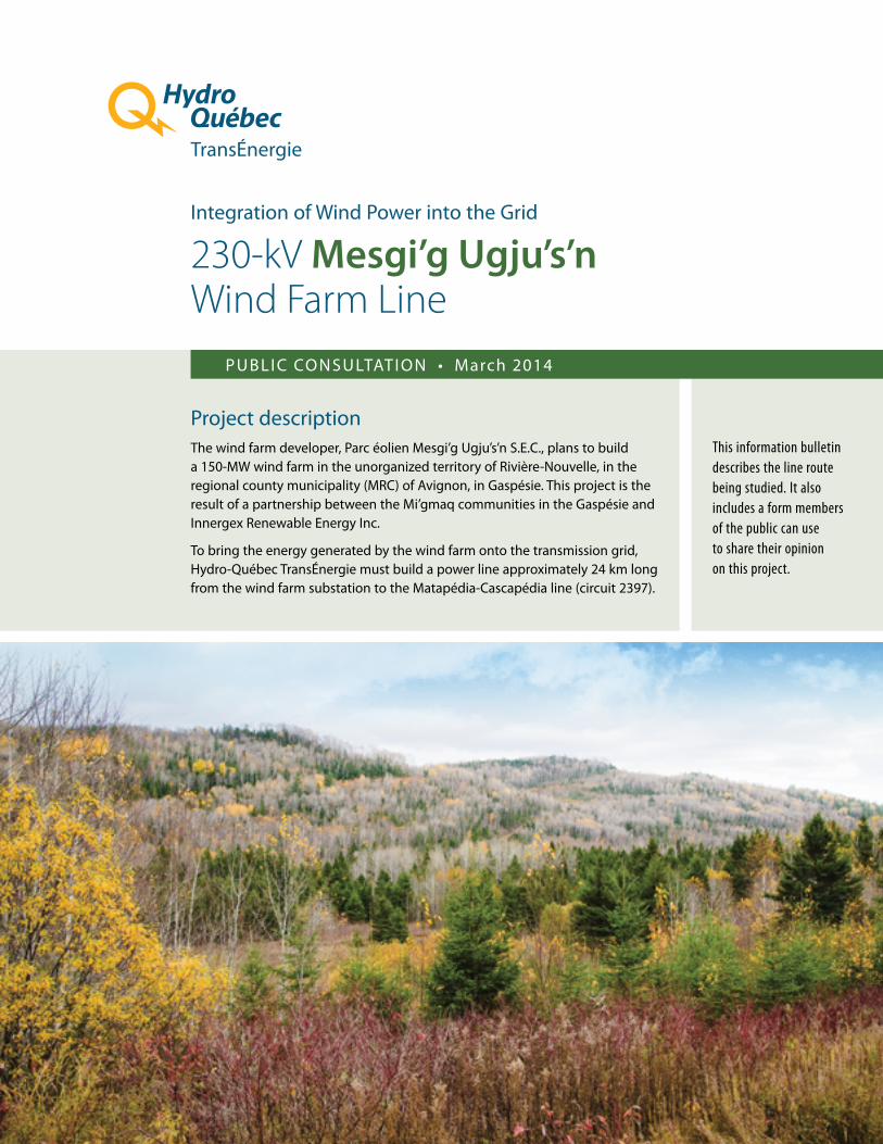
Integration of Wind Power into the Grid
230-kV Mesgi’g Ugju’s’nWind Farm Line
PUBLIC CONSULTATION • March 2014
Project description The wind farm developer, Parc éolien Mesgi’g Ugju’s’n S.E.C., plans to build a 150-MW wind farm in the unorganized territory of Rivière-Nouvelle, in the regional county municipality (MRC) of Avignon, in Gaspésie. This project is the result of a partnership between the Mi’gmaq communities in the Gaspésie and Innergex Renewable Energy Inc.
To bring the energy generated by the wind farm onto the transmission grid, Hydro-Québec TransÉnergie must build a power line approximately 24 km long from the wind farm substation to the Matapédia-Cascapédia line (circuit 2397).
This information bulletin describes the line route being studied. It also includes a form members of the public can use to share their opinion on this project.

2
Fichier : 738401_cm_001_140217.ai
Fichier : 738401_cm_001_140217.ai
The line will cross a number of deep valleys. At these locations, only the upper portion of the slopes will be cleared. No work will be required on the valley floors.
Valley crossing
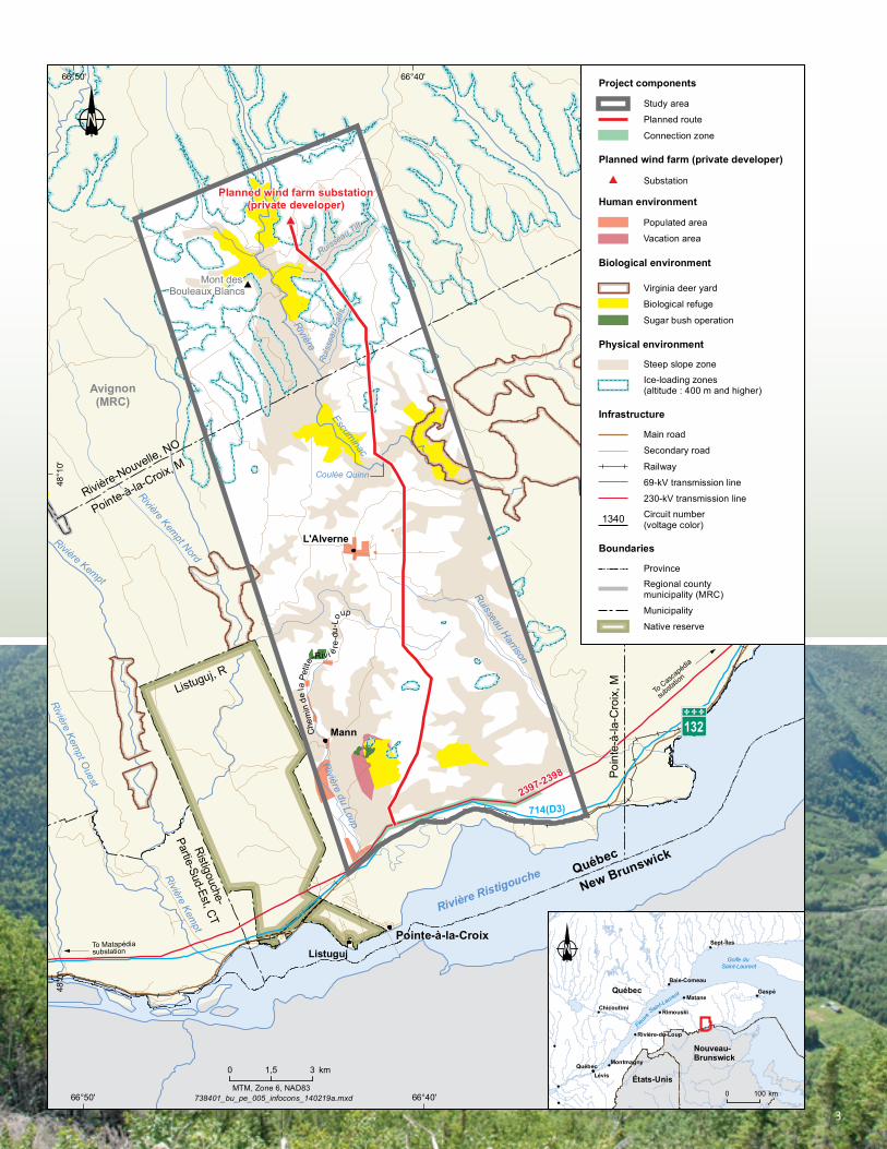
Study area
The study area is located in the municipality of Pointe-à-la-Croix and the unorganized territory of Rivière-Nouvelle. It is bordered to the south by Route 132, runs along the eastern limit of Listuguj reserve and continues north to the planned site for the Mesgi’g Ugju’s’n wind farm substation.
The northern section of the study area is crossed by many logging roads, while inhabited areas are concentrated in its southern section. Its population is primarily established along the main roads (Route 132 and Chemin de la Petite-Rivière-du-Loup) and in the hamlets of L’Alverne and Mann.
In addition to forestry, the study area is used for recreational activities, including moose and deer hunting, fishing, trapping, berry picking, ATV riding and snowmobiling, and hiking.
The study area is characterized by steep slopes and valleys where rivers run, notably the Escuminac. It includes nine biological refuges, two White-tailed deer yards and several operating sugarbushes.
Proposed route
The numerous constraints imposed by the local environment determined the proposed line route.
Located mostly on public land, the proposed route avoids the following sensitive elements: • Populated areas• Sugar bush operations• Very rugged or inaccessible areas• Steep slopes• Ice-loading zones and wind corridors• Soils of low bearing capacity• Wetlands• Biological refuges• White-tailed deer yards
From its starting point, near Route 132, the planned line will run up a steep slope to the high plateau. Once on the plateau, the line will cross a harvested forest and ATV and snowmobile trails at several locations. No home or camp is located within the planned right-of-way. Heading towards the substation, the line will cross deep valleys, in particular the Rivière Escuminac.
The visible part of the line is on slope leading to the plateau near Route 132. Every effort will be made to reduce the visual impact of the line in this area recognized for its landscape.
3
#
#
#
2397-2398
714(D3)
Che
min
dela
Petit
e-Riv i è
re-d
u-Lo
up
Mont des Bouleaux Blancs
Mont Escuminac
L'Alverne
Mann
Pointe-à-la-CroixListuguj
Rivière Kempt
Rivière Kempt O
uest
Rivière Kempt Nord
Ruisseau Harrison
Ruisse
au K
eys
Ruisseau Ronald
Ruisseau Ell
Rivière du Loup
Coulée Pratt
Ruisseau McDavid Est
Ruisseau McKenzie
Rivière Escuminac
Ruiss
eau
Ell
Ruisseau McClenderRuisseau Ash
Ruisseau Edward
Ruiss
eau
Jos-
Le B
lanc
Cou
lée
à B
irgor
neau
x
Rivière Escum
inac
Rivière Kempt
Rui
ssea
u M
offe
t
Rivière
Rivière Ristigouche
Rivière Nouvelle
Ruisseau Tilt
Ruis
seau
Fal
ls
Coulée Quinn
Escuminac
Rivière-Nouvelle, NO
Escuminac, MNouvelle, M
Escu
min
ac, M
Nouvelle, M
Pointe-à-la-Croix, M
Saint-André-de-Restigouche, M
Ristigouche-
Partie-Sud-Est, CT
Pointe-à-la-Croix, M
Avignon(MRC)
Listuguj, R
Poin
te-à
-la-C
roix
, MPo
inte
-à-la
-Cro
ix, M To
Cascapédia
substa
tion
?
To Matapédiasubstation?
132
Planned wind farm substation(private developer)
Québec
New Brunswick
66°30'
66°30'
66°40'
66°40'
66°50'
66°50'
48°1
0'
48°1
0'
48°0
'
48°0
'
Document for information purposes only. For any other use, please contact Géomatique at Hydro-Québec Équipement et services partagés.
MTM, Zone 6, NAD83738401_bu_pe_005_infocons_140219a.mxd
0 31,5 km
Québec
Nouveau-Brunswick
Saint-Laurent Gaspé
Lévis
Matane
Québec
Rimouski
Sept-Îles
Chicoutimi
Baie-Comeau
Rivière-du-Loup
Montmagny
États-Unis
Golfe du Saint-Laurent
Fleuve
0 100 km
Planned wind farm (private developer)
Substation#
Municipality
Native reserve
Study area
Planned route
Connection zone
Boundaries
Main road
Secondary road
Railway
69-kV transmission line
230-kV transmission line
Infrastructure
Ice-loading zones(altitude : 400 m and higher)
Virginia deer yard
Biological refuge
Sugar bush operation
Steep slope zone
Populated area
Vacation area
Human environment
Biological environment
Physical environment
Project components
Circuit number(voltage color)1340
Regional countymunicipality (MRC)
Province

Ce document est également publié en français.This is a translation of the original French text.
2014E0083-A
Maxim
um he
ight: 5
2mMi
nimum
heigh
t: 36m
7384
01_b
u_pe
_007
_pyl_
type_
230k
V_14
0207
a.ai
Guyed suspensiontower
Self-supporting suspension tower
Document for information purposes only. For any other use, please contact Géomatique at Hydro-Québec Équipement et services partagés.
Maxim
um he
ight: 5
2mMi
nimum
heigh
t: 36m
7384
01_b
u_pe
_007
_pyl_
type_
230k
V_14
0207
a.ai
Guyed suspensiontower
Self-supporting suspension tower
Document for information purposes only. For any other use, please contact Géomatique at Hydro-Québec Équipement et services partagés.
Printed on paper made in Québec from 100% postconsumer recycled fibre.
Types of towers and width of right-of-way The planned power line will be supported mostly by guyed steel lattice towers. Other types of towers could be used in locations where the line changes direction or when required by the topography.
To ensure safe clearances and service reliability, a right-of-way of approximately 65 to 70 m must be cleared under the line. However, the cleared width will be reduced where the line will be more visible, near Route 132.
Public participationHydro-Québec’s goal is to integrate the future line as harmoniously as possible into the environment. The company invites all organizations, landowners and individuals affected to share their concerns in regards to the project before March 24 using the enclosed form or online at www.hydroquebec.com/projects/ mesgig-ugjusn/.
Hydro-Québec will take these concerns into consideration when defining the final project characteristics and determining mitigation measures.
Tangible support for community developmentHydro-Québec sees its projects as an opportunity to participate in the development of host communities through its Integrated Enhancement Program (IEP). Once the work has begun, Hydro-Québec will grant eligible organizations funding equivalent to 1% of the initially authorized value of the new facilities.
Project schedule
Information and consultation Winter 2013-2014
Information on route selected Spring 2014
Environmental assessment Fall 2013 – fall 2014
Permitting Winter 2014-2015
Clearing Fall 2015
Construction Fall 2015 – summer 2016
Commissioning Fall 2016
For more information
Info-project line1 866 724-1369
Catherine Bujold Advisor – Community Relations – Matapédia Direction – Affaires régionales et collectivités 389, rue Vanier, 1er étage Rimouski (Québec) G5L 8L4
Fax: 418 724-1371 Email: [email protected]/projects/mesgig-ugjusn/