Embed Size (px)
Citation preview
SMWLP, Responses to Preferred Options Consultation, March 2018
Assessment Suffolk County Council Page 1030
I hope you will duly consider my views in reaching a decision.
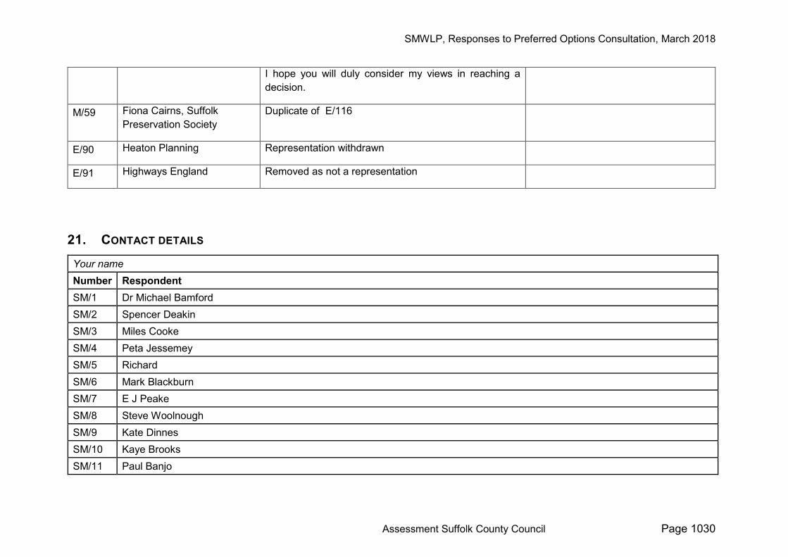
M/59 Fiona Cairns, Suffolk Preservation Society
Duplicate of E/116
E/90 Heaton Planning Representation withdrawn
E/91 Highways England Removed as not a representation
21. CONTACT DETAILS Your name Number Respondent SM/1 Dr Michael Bamford SM/2 Spencer Deakin SM/3 Miles Cooke SM/4 Peta Jessemey SM/5 Richard SM/6 Mark Blackburn SM/7 E J Peake SM/8 Steve Woolnough SM/9 Kate Dinnes SM/10 Kaye Brooks SM/11 Paul Banjo
SMWLP, Responses to Preferred Options Consultation, March 2018
Assessment Suffolk County Council Page 1031
SM/12 Mrs Colette Skelly SM/13 Robert Farquharson SM/14 Alex Winterbotham SM/15 Heloise Winterbotham SM/16 Kirsty MacPherson SM/17 Stacey Elliott SM/18 Leah SM/19 Jonathan Minter SM/20 Terry Corner SM/21 Terry Corner SM/22 Mr S McNamara SM/23 Richard Griffiths SM/24 Stephen Edgell SM/25 Clive Pearsons SM/26 Clive Pearsons SM/27 Robin Wraight SM/28 Ann Ross. SM/29 James Ross SM/30 James Ross SM/31 Tony Casement SM/32 Verity SM/33 Sara Farrands SM/34 Anne Eaton SM/35 Anne Eaton SM/36 Emma Williamson
SMWLP, Responses to Preferred Options Consultation, March 2018
Assessment Suffolk County Council Page 1032
SM/37 Allan Cawthorn SM/38 Annabel Kingsman SM/39 Charlotte de Rothschild SM/40 Nicholas Chapman SM/41 Ben Hayward SM/42 Graham Fry SM/43 Lionel de Rothschild SM/44 Isobel Fraser SM/45 Laura Pirkis SM/46 Stella Morland-Pearce SM/47 M J G Fletcher SM/48 Lawrence Mallinson SM/49 Rupert Wise SM/50 Caroline Wilson SM/51 Andrew Deller SM/52 Lord and Lady Derwent SM/53 Lord and Lady Derwent SM/54 Amy Wren SM/55 Frederick Winterbotham SM/56 Barking Parish Council SM/57 James Boggis, Blythburgh with Bulcamp and Hinton Parish Council SM/58 Hugh Carson SM/59 Gillian Harrison SM/60 S Laing SM/61 Thomas Van Oss

SMWLP, Responses to Preferred Options Consultation, March 2018
Assessment Suffolk County Council Page 1033
SM/62 Thomas Van Oss SM/63 Jack Boyer SM/64 Luke Rajah SM/65 Nicholas Ford SM/66 Rachel Wight SM/67 Richard and Margaret Sax SM/68 Richard Stevens SM/69 John Scott SM/70 Fred Cooke SM/71 P.T.E. Massey SM/72 Penelope Roskell-Griffiths SM/73 Mr J Nottage SM/74 Peter Dow, Elmswell Parish Council SM/75 E.J.V. Carey SM/76 Mary Colwell SM/77 Hugh Williamson SM/78 Annie Wootton SM/79 P. G. Parke SM/80 Alison McKay SM/81 Nat le Roux SM/82 Andrew Fuller SM/82 Andy Smedley SM/84 Wayne Jones SM/85 Paul Hegarty SM/86 Sarah Jandu
SMWLP, Responses to Preferred Options Consultation, March 2018
Assessment Suffolk County Council Page 1034
SM/87 Tim & Marylyn Bacon SM/88 Sarah Partridge, Clerk to Kersey PC SM/89 PJ Mansfield SM/90 PJ Mansfield SM/91 PJ Mansfield SM/92 Ann SM/93 Mrs Jane Wooster SM/94 Richard Wells SM/95 Francis Johnstone SM/96 Simon Ford SM/97 Paul Bastick and Sally Kington SM/98 Daniel Jones SM/99 William Glynn SM/100 Dorothy Newton SM/101 Natasha Longman SM/102 Simon Hutley SM/103 Sam Chadd SM/104 Clive Tickner SM/105 Christopher Charles Spink SM/106 Sue Taylor SM/107 Wendy Thorpe SM/108 Elly Brindle SM/109 Deborah Bookman SM/110 Richard and Jacqueline Fortey SM/111 John Holmes
SMWLP, Responses to Preferred Options Consultation, March 2018
Assessment Suffolk County Council Page 1035
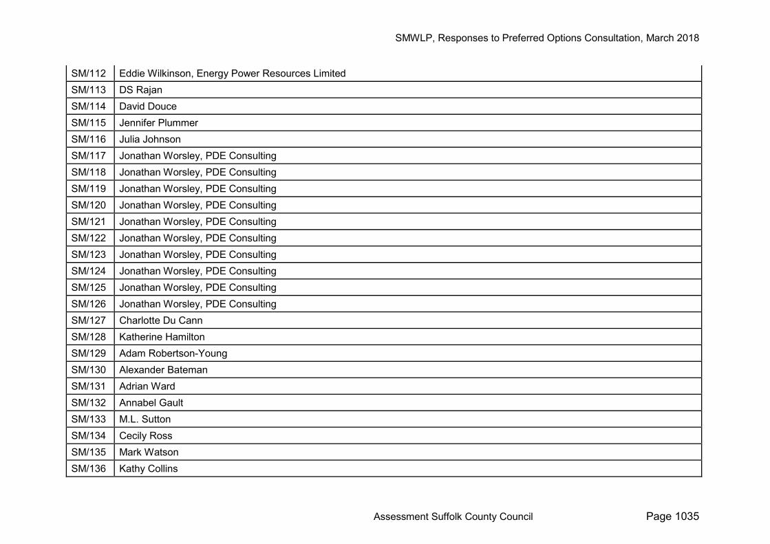
SM/112 Eddie Wilkinson, Energy Power Resources Limited SM/113 DS Rajan SM/114 David Douce SM/115 Jennifer Plummer SM/116 Julia Johnson SM/117 Jonathan Worsley, PDE Consulting SM/118 Jonathan Worsley, PDE Consulting SM/119 Jonathan Worsley, PDE Consulting SM/120 Jonathan Worsley, PDE Consulting SM/121 Jonathan Worsley, PDE Consulting SM/122 Jonathan Worsley, PDE Consulting SM/123 Jonathan Worsley, PDE Consulting SM/124 Jonathan Worsley, PDE Consulting SM/125 Jonathan Worsley, PDE Consulting SM/126 Jonathan Worsley, PDE Consulting SM/127 Charlotte Du Cann SM/128 Katherine Hamilton SM/129 Adam Robertson-Young SM/130 Alexander Bateman SM/131 Adrian Ward SM/132 Annabel Gault SM/133 M.L. Sutton SM/134 Cecily Ross SM/135 Mark Watson SM/136 Kathy Collins
SMWLP, Responses to Preferred Options Consultation, March 2018
Assessment Suffolk County Council Page 1036
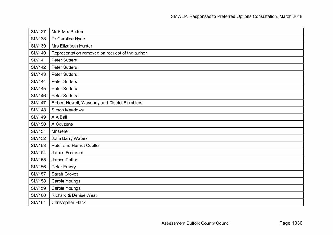
SM/137 Mr & Mrs Sutton SM/138 Dr Caroline Hyde SM/139 Mrs Elizabeth Hunter SM/140 Representation removed on request of the author SM/141 Peter Sutters SM/142 Peter Sutters SM/143 Peter Sutters SM/144 Peter Sutters SM/145 Peter Sutters SM/146 Peter Sutters SM/147 Robert Newell, Waveney and District Ramblers SM/148 Simon Meadows SM/149 A A Ball SM/150 A Couzens SM/151 Mr Gerell SM/152 John Barry Waters SM/153 Peter and Harriet Coulter SM/154 James Forrester SM/155 James Potter SM/156 Peter Emery SM/157 Sarah Groves SM/158 Carole Youngs SM/159 Carole Youngs SM/160 Richard & Denise West SM/161 Christopher Flack
SMWLP, Responses to Preferred Options Consultation, March 2018
Assessment Suffolk County Council Page 1037
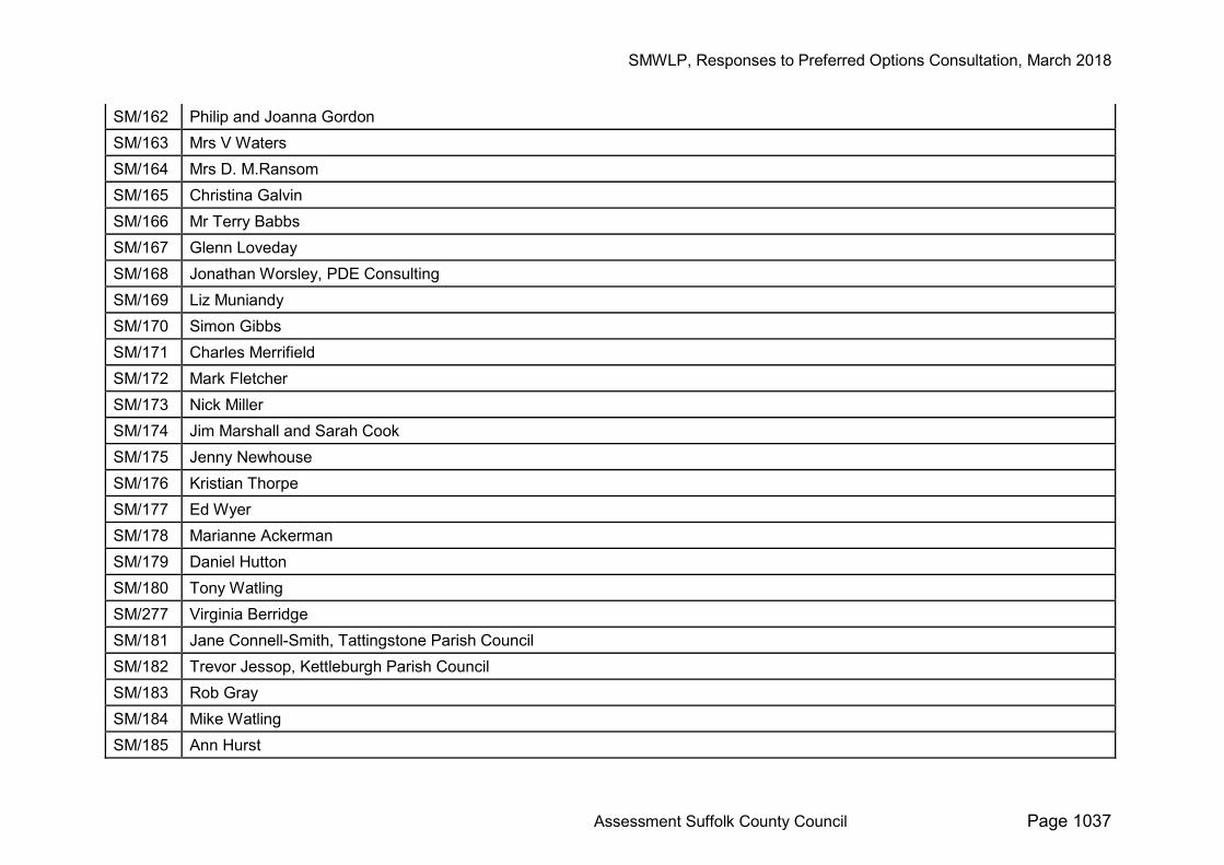
SM/162 Philip and Joanna Gordon SM/163 Mrs V Waters SM/164 Mrs D. M.Ransom SM/165 Christina Galvin SM/166 Mr Terry Babbs SM/167 Glenn Loveday SM/168 Jonathan Worsley, PDE Consulting SM/169 Liz Muniandy SM/170 Simon Gibbs SM/171 Charles Merrifield SM/172 Mark Fletcher SM/173 Nick Miller SM/174 Jim Marshall and Sarah Cook SM/175 Jenny Newhouse SM/176 Kristian Thorpe SM/177 Ed Wyer SM/178 Marianne Ackerman SM/179 Daniel Hutton SM/180 Tony Watling SM/277 Virginia Berridge SM/181 Jane Connell-Smith, Tattingstone Parish Council SM/182 Trevor Jessop, Kettleburgh Parish Council SM/183 Rob Gray SM/184 Mike Watling SM/185 Ann Hurst
SMWLP, Responses to Preferred Options Consultation, March 2018
Assessment Suffolk County Council Page 1038
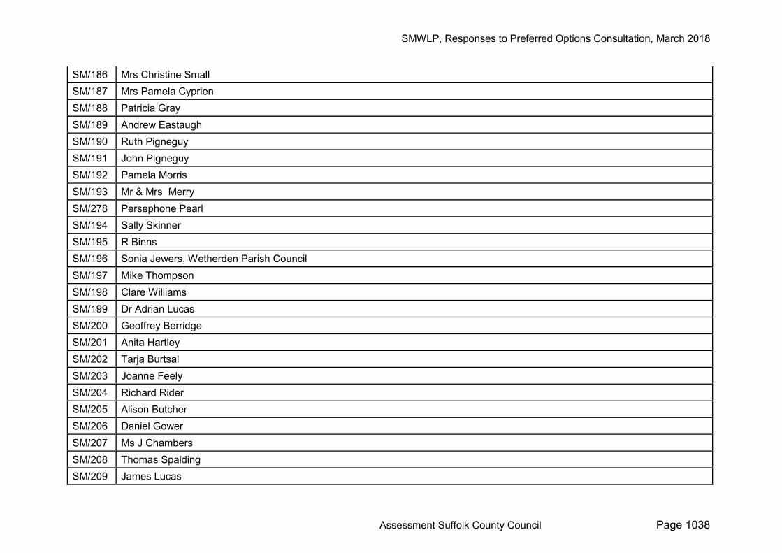
SM/186 Mrs Christine Small SM/187 Mrs Pamela Cyprien SM/188 Patricia Gray SM/189 Andrew Eastaugh SM/190 Ruth Pigneguy SM/191 John Pigneguy SM/192 Pamela Morris SM/193 Mr & Mrs Merry SM/278 Persephone Pearl SM/194 Sally Skinner SM/195 R Binns SM/196 Sonia Jewers, Wetherden Parish Council SM/197 Mike Thompson SM/198 Clare Williams SM/199 Dr Adrian Lucas SM/200 Geoffrey Berridge SM/201 Anita Hartley SM/202 Tarja Burtsal SM/203 Joanne Feely SM/204 Richard Rider SM/205 Alison Butcher SM/206 Daniel Gower SM/207 Ms J Chambers SM/208 Thomas Spalding SM/209 James Lucas

SMWLP, Responses to Preferred Options Consultation, March 2018
Assessment Suffolk County Council Page 1039
SM/210 Liz and David Goodman SM/211 John Hellard SM/212 Martin Soons SM/213 Simon Baker SM/214 Sarah Brownie SM/215 Sonia Plume SM/217 Adrian Bertie & Jayne Neal SM/216 Kurt von Bussmann SM/218 Helen Kerridge SM/219 Trevor Kerridge SM/220 Robert Ayers SM/221 Gavin Hughes SM/222 J Baker SM/224 David Cheshire SM/223 Terence & Josephine Nicholls SM/225 Jocelyn Blakey SM/226 Judith Mitchell SM/227 Vickie Lack SM/228 Chris Heath SM/229 Glenn Mitchell SM/230 Alex Bedford SM/231 Laurence Bickell SM/232 Vanessa Selwyn SM/233 V Weston SM/234 Stephen Clarke
SMWLP, Responses to Preferred Options Consultation, March 2018
Assessment Suffolk County Council Page 1040
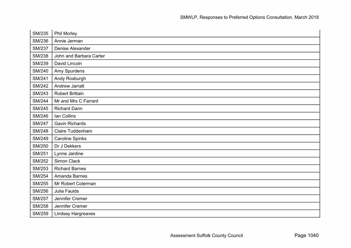
SM/235 Phil Morley SM/236 Annie Jerman SM/237 Denise Alexander SM/238 John and Barbara Carter SM/239 David Lincoln SM/240 Amy Spurdens SM/241 Andy Roxburgh SM/242 Andrew Jarratt SM/243 Robert Brittain SM/244 Mr and Mrs C Farrant SM/245 Richard Dann SM/246 Ian Collins SM/247 Gavin Richards SM/248 Claire Tuddenham SM/249 Caroline Spinks SM/250 Dr J Dekkers SM/251 Lynne Jardine SM/252 Simon Clack SM/253 Richard Barnes SM/254 Amanda Barnes SM/255 Mr Robert Colerman SM/256 Julia Faulds SM/257 Jennifer Cremer SM/258 Jennifer Cremer SM/259 Lindsay Hargreaves
SMWLP, Responses to Preferred Options Consultation, March 2018
Assessment Suffolk County Council Page 1041
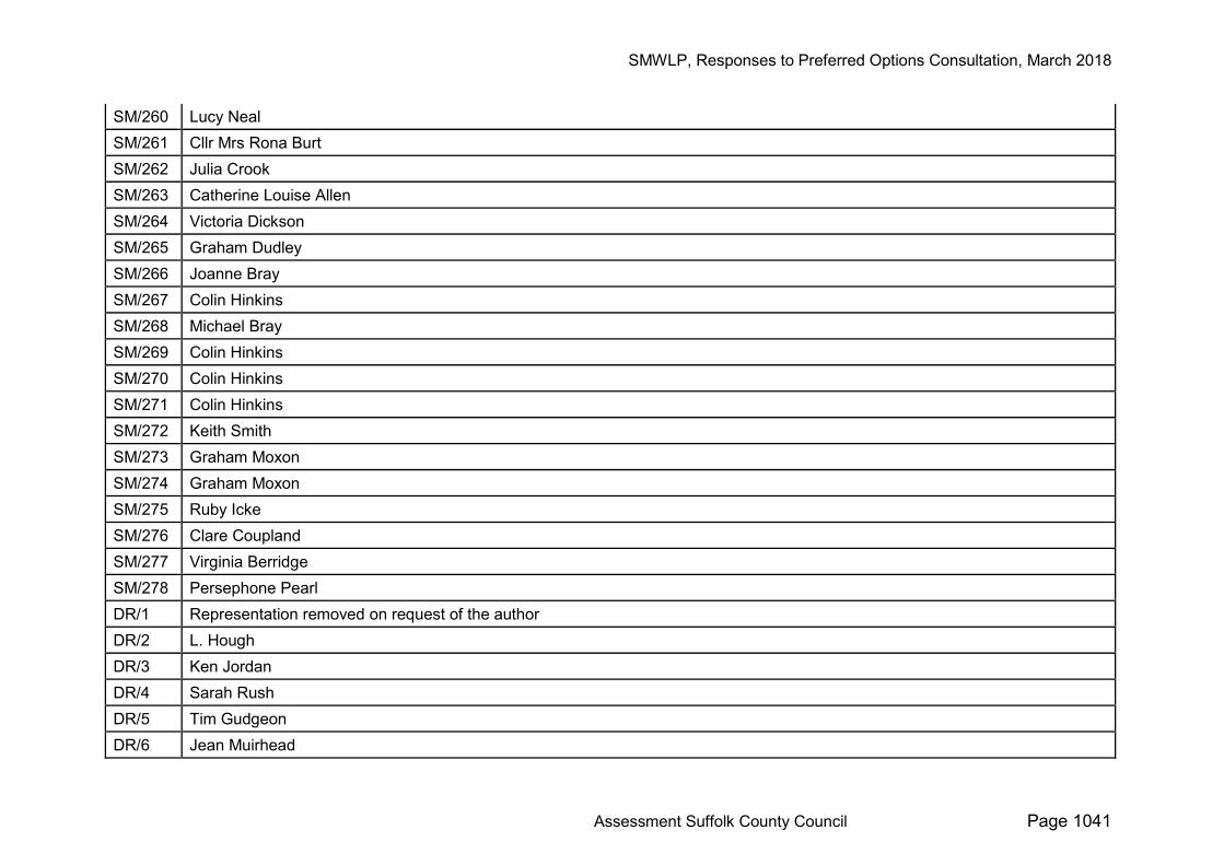
SM/260 Lucy Neal SM/261 Cllr Mrs Rona Burt SM/262 Julia Crook SM/263 Catherine Louise Allen SM/264 Victoria Dickson SM/265 Graham Dudley SM/266 Joanne Bray SM/267 Colin Hinkins SM/268 Michael Bray SM/269 Colin Hinkins SM/270 Colin Hinkins SM/271 Colin Hinkins SM/272 Keith Smith SM/273 Graham Moxon SM/274 Graham Moxon SM/275 Ruby Icke SM/276 Clare Coupland SM/277 Virginia Berridge SM/278 Persephone Pearl DR/1 Representation removed on request of the author DR/2 L. Hough DR/3 Ken Jordan DR/4 Sarah Rush DR/5 Tim Gudgeon DR/6 Jean Muirhead

SMWLP, Responses to Preferred Options Consultation, March 2018
Assessment Suffolk County Council Page 1042
DR/7 Katherine Hodge DR/8 V.Stearn DR/9 Toby Rush DR/10 Jonathan Ford DR/11 Alex Watson DR/12 Peter Holland DR/13 Andrea Eden DR/14 Anne-Marie Cracknell DR/15 Mrs D Catchpole DR/16 J.M.Wilson DR/17 James Easter DR/18 Dr Michael Bamford DR/19 J.S Barnes DR/20 Steve McNamara DR/21 John Levantis DR/22 R. Corsfield DR/23 Carol & Peter Tricky DR/24 Miss Gloria Betts DR/25 Lynda Collins DR/26 Esme Murfitt DR/27 Jennifer Easter DR/28 Mrs Pamela Tait DR/29 Catherine Dell DR/30 Tim Hunter DR/31 Tim Hunter
SMWLP, Responses to Preferred Options Consultation, March 2018
Assessment Suffolk County Council Page 1043
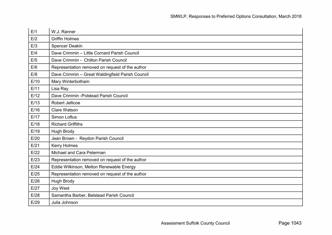
E/1 W.J. Ranner E/2 Griffin Holmes E/3 Spencer Deakin E/4 Dave Crimmin – Little Cornard Parish Council E/5 Dave Crimmin - Chilton Parish Council E/6 Representation removed on request of the author E/8 Dave Crimmin – Great Waldingfield Parish Council E/10 Mary Winterbotham E/11 Lisa Ray E/12 Dave Crimmin -Polstead Parish Council E/13 Robert Jellicoe E/16 Clare Watson E/17 Simon Loftus E/18 Richard Griffiths E/19 Hugh Brody E/20 Jean Brown - Reydon Parish Council E/21 Kerry Holmes E/22 Michael and Cara Peterman E/23 Representation removed on request of the author E/24 Eddie Wilkinson, Melton Renewable Energy E/25 Representation removed on request of the author E/26 Hugh Brody E/27 Joy West E/28 Samantha Barber, Belstead Parish Council E/29 Julia Johnson
SMWLP, Responses to Preferred Options Consultation, March 2018
Assessment Suffolk County Council Page 1044
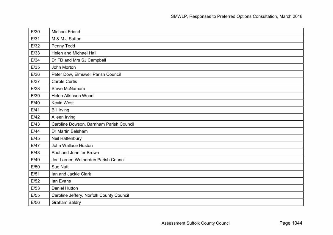
E/30 Michael Friend E/31 M & M.J Sutton E/32 Penny Todd E/33 Helen and Michael Hall E/34 Dr FD and Mrs SJ Campbell E/35 John Morton E/36 Peter Dow, Elmswell Parish Council E/37 Carole Curtis E/38 Steve McNamara E/39 Helen Atkinson Wood E/40 Kevin West E/41 Bill Irving E/42 Aileen Irving E/43 Caroline Dowson, Barnham Parish Council E/44 Dr Martin Belsham E/45 Neil Rattenbury E/47 John Wallace Huston E/48 Paul and Jennifer Brown E/49 Jen Larner, Wetherden Parish Council E/50 Sue Nutt E/51 Ian and Jackie Clark E/52 Ian Evans E/53 Daniel Hutton E/55 Caroline Jeffery, Norfolk County Council E/56 Graham Baldry
SMWLP, Responses to Preferred Options Consultation, March 2018
Assessment Suffolk County Council Page 1045
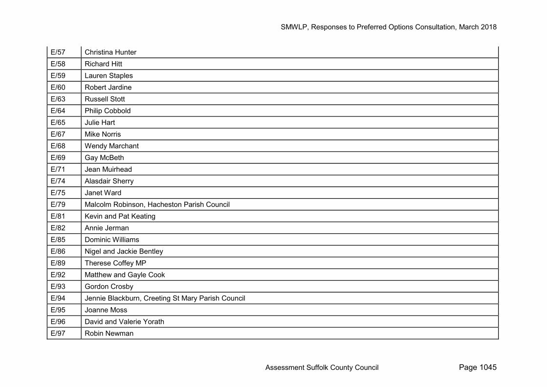
E/57 Christina Hunter E/58 Richard Hitt E/59 Lauren Staples E/60 Robert Jardine E/63 Russell Stott E/64 Philip Cobbold E/65 Julie Hart E/67 Mike Norris E/68 Wendy Marchant E/69 Gay McBeth E/71 Jean Muirhead E/74 Alasdair Sherry E/75 Janet Ward E/79 Malcolm Robinson, Hacheston Parish Council E/81 Kevin and Pat Keating E/82 Annie Jerman E/85 Dominic Williams E/86 Nigel and Jackie Bentley E/89 Therese Coffey MP E/92 Matthew and Gayle Cook E/93 Gordon Crosby E/94 Jennie Blackburn, Creeting St Mary Parish Council E/95 Joanne Moss E/96 David and Valerie Yorath E/97 Robin Newman
SMWLP, Responses to Preferred Options Consultation, March 2018
Assessment Suffolk County Council Page 1046
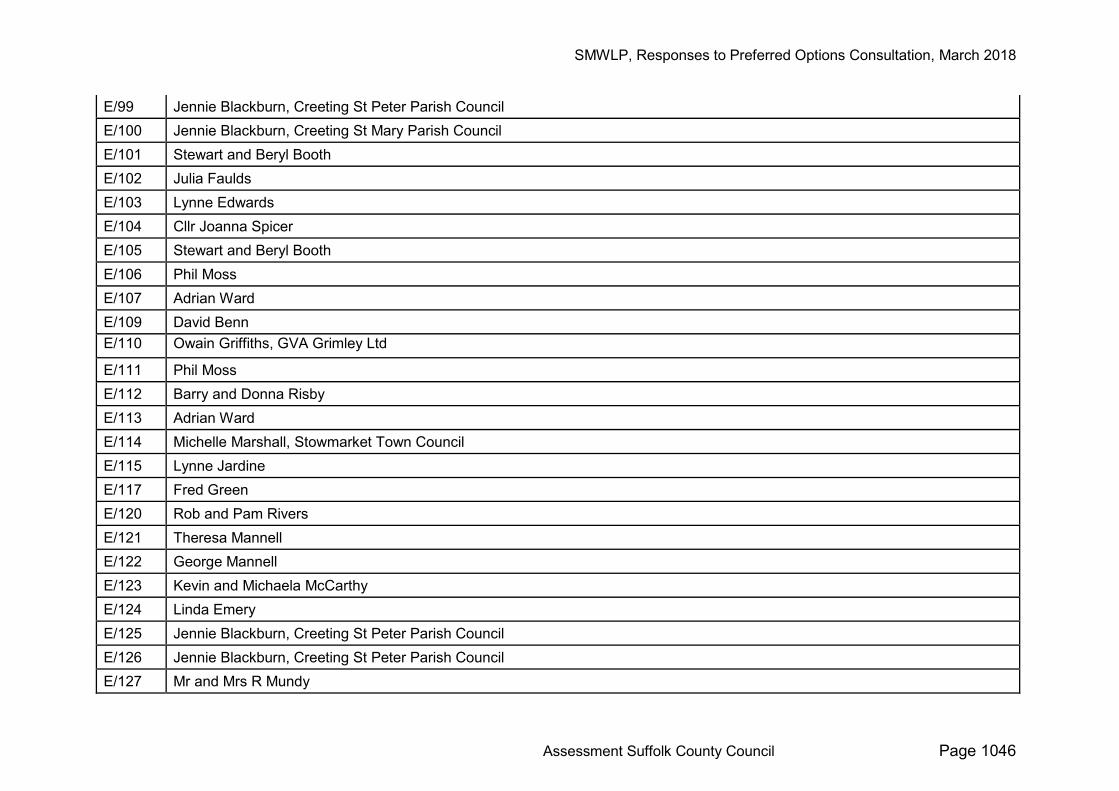
E/99 Jennie Blackburn, Creeting St Peter Parish Council E/100 Jennie Blackburn, Creeting St Mary Parish Council E/101 Stewart and Beryl Booth E/102 Julia Faulds E/103 Lynne Edwards E/104 Cllr Joanna Spicer E/105 Stewart and Beryl Booth E/106 Phil Moss E/107 Adrian Ward E/109 David Benn E/110 Owain Griffiths, GVA Grimley Ltd
E/111 Phil Moss E/112 Barry and Donna Risby E/113 Adrian Ward E/114 Michelle Marshall, Stowmarket Town Council E/115 Lynne Jardine E/117 Fred Green E/120 Rob and Pam Rivers E/121 Theresa Mannell E/122 George Mannell E/123 Kevin and Michaela McCarthy E/124 Linda Emery E/125 Jennie Blackburn, Creeting St Peter Parish Council E/126 Jennie Blackburn, Creeting St Peter Parish Council E/127 Mr and Mrs R Mundy
SMWLP, Responses to Preferred Options Consultation, March 2018
Assessment Suffolk County Council Page 1047
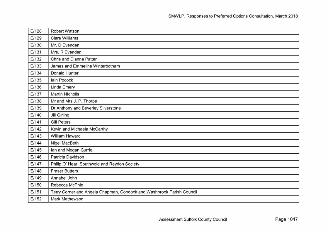
E/128 Robert Watson E/129 Clare Williams E/130 Mr. D Evenden E/131 Mrs. R Evenden E/132 Chris and Dianna Patten E/133 James and Emmeline Winterbotham E/134 Donald Hunter E/135 Iain Pocock E/136 Linda Emery E/137 Martin NIcholls E/138 Mr and Mrs J. P. Thorpe E/139 Dr Anthony and Beverley Silverstone E/140 Jill Girling E/141 Gill Peters E/142 Kevin and Michaela McCarthy E/143 William Haward E/144 Nigel MacBeth E/145 Ian and Megan Currie E/146 Patricia Davidson E/147 Philip O’ Hear, Southwold and Reydon Society E/148 Fraser Butters E/149 Annabel John E/150 Rebecca McPhie E/151 Terry Corner and Angela Chapman, Copdock and Washbrook Parish Council E/152 Mark Mathewson
SMWLP, Responses to Preferred Options Consultation, March 2018
Assessment Suffolk County Council Page 1048
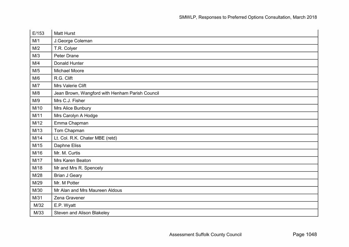
E/153 Matt Hurst M/1 J.George Coleman M/2 T.R. Colyer M/3 Peter Drane M/4 Donald Hunter M/5 Michael Moore M/6 R.G. Clift M/7 Mrs Valerie Clift M/8 Jean Brown, Wangford with Henham Parish Council M/9 Mrs C.J. Fisher M/10 Mrs Alice Bunbury M/11 Mrs Carolyn A Hodge M/12 Emma Chapman M/13 Tom Chapman M/14 Lt. Col. R.K. Chater MBE (retd) M/15 Daphne Eliss M/16 Mr. M. Curtis M/17 Mrs Karen Beaton M/18 Mr and Mrs R. Spencely M/28 Brian J Geary M/29 Mr. M Potter M/30 Mr Alan and Mrs Maureen Aldous M/31 Zena Gravener M/32 E.P. Wyatt M/33 Steven and Alison Blakeley
SMWLP, Responses to Preferred Options Consultation, March 2018
Assessment Suffolk County Council Page 1049
M/35 Mrs. M.A.G Osborne M/36 Steven Potter M/37 Caroline N Fox M/38 Amanda Humphrey M/39 Diane Evans M/40 J.R.Castle M/41 Ian and Jackie Clark M/42 Mark Peel M/43 Mr and Mrs, R Forsdike M/44 Peter Dow, Elmswell Parish Council M/45 R Crosfield M/47 Milly Butters M/48 Virginia Taylor M/49 Terence Taylor M/50 Mr and Mrs Bahar M/51 Robert W Warnes M/52 Lesley Warnes M/53 Trevor Butters M/54 Duncan Clarke M/55 Michelle Marshall, Stowmarket Town Council M/57 Deborah Worboys
SMWLP, Responses to Preferred Options Consultation, March 2018
Assessment Suffolk County Council Page 1050
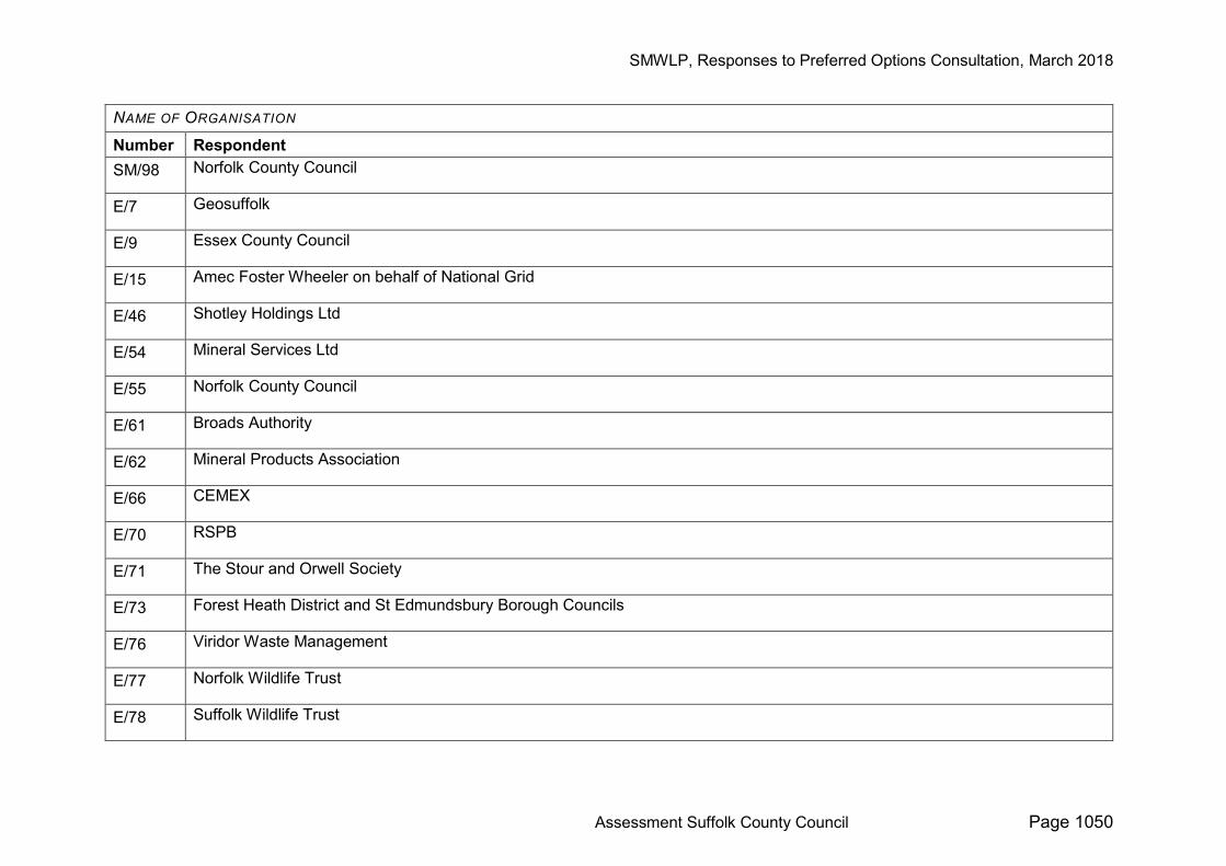
NAME OF ORGANISATION
Number Respondent SM/98 Norfolk County Council
E/7 Geosuffolk
E/9 Essex County Council
E/15 Amec Foster Wheeler on behalf of National Grid
E/46 Shotley Holdings Ltd
E/54 Mineral Services Ltd
E/55 Norfolk County Council
E/61 Broads Authority
E/62 Mineral Products Association
E/66 CEMEX
E/70 RSPB
E/71 The Stour and Orwell Society
E/73 Forest Heath District and St Edmundsbury Borough Councils
E/76 Viridor Waste Management
E/77 Norfolk Wildlife Trust
E/78 Suffolk Wildlife Trust
SMWLP, Responses to Preferred Options Consultation, March 2018
Assessment Suffolk County Council Page 1051
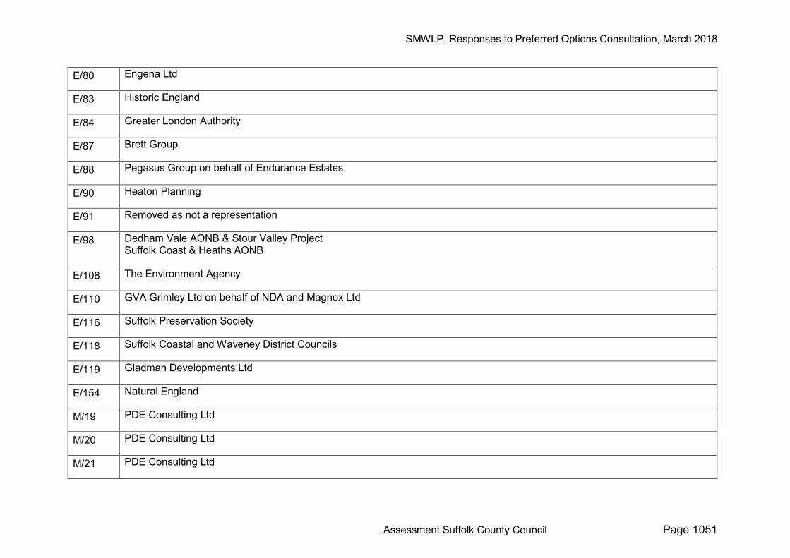
E/80 Engena Ltd
E/83 Historic England
E/84 Greater London Authority
E/87 Brett Group
E/88 Pegasus Group on behalf of Endurance Estates
E/90 Heaton Planning
E/91 Removed as not a representation
E/98 Dedham Vale AONB & Stour Valley Project Suffolk Coast & Heaths AONB
E/108 The Environment Agency
E/110 GVA Grimley Ltd on behalf of NDA and Magnox Ltd
E/116 Suffolk Preservation Society
E/118 Suffolk Coastal and Waveney District Councils
E/119 Gladman Developments Ltd
E/154 Natural England
M/19 PDE Consulting Ltd
M/20 PDE Consulting Ltd
M/21 PDE Consulting Ltd
SMWLP, Responses to Preferred Options Consultation, March 2018
Assessment Suffolk County Council Page 1052
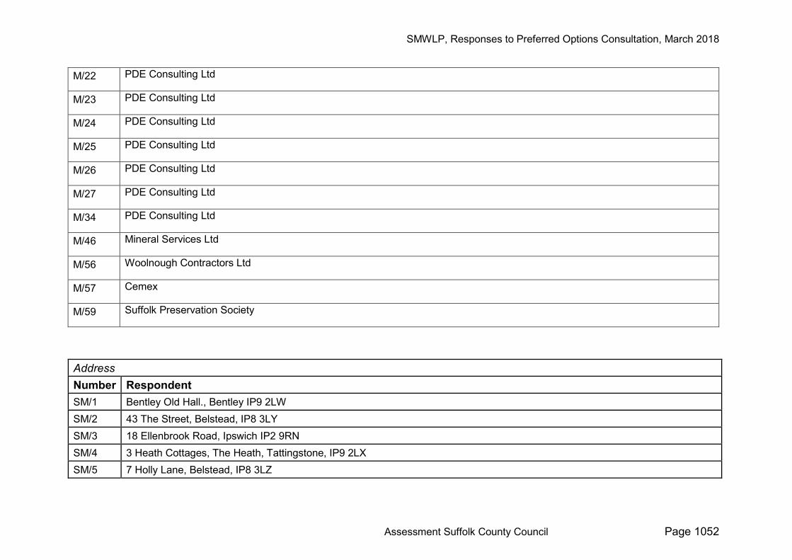
M/22 PDE Consulting Ltd
M/23 PDE Consulting Ltd
M/24 PDE Consulting Ltd
M/25 PDE Consulting Ltd
M/26 PDE Consulting Ltd
M/27 PDE Consulting Ltd
M/34 PDE Consulting Ltd
M/46 Mineral Services Ltd
M/56 Woolnough Contractors Ltd
M/57 Cemex
M/59 Suffolk Preservation Society
Address Number Respondent SM/1 Bentley Old Hall., Bentley IP9 2LW SM/2 43 The Street, Belstead, IP8 3LY SM/3 18 Ellenbrook Road, Ipswich IP2 9RN SM/4 3 Heath Cottages, The Heath, Tattingstone, IP9 2LX SM/5 7 Holly Lane, Belstead, IP8 3LZ
SMWLP, Responses to Preferred Options Consultation, March 2018
Assessment Suffolk County Council Page 1053
SM/6 The Stables, 1 Barnaby Green, Wangford, Beccles, Suffolk NR34 8AY SM/7 The Bogan, Grove Hill, Belstead, IP8 3LU SM/8 4 Forester Close, Thorrington Park, Ipswich, IP8 3TF SM/9 8 Belmont Road, Ipswich, Suffolk IP2 9RH SM/10 22 Oxford Close, MIldenhall IP28 7RP SM/11 45 Pearsons Way, Copdock, IP8 3LG SM/12 Millfield Barn, Mill Lane, Barnham IP24 2NG SM/13 9 Lee Road, Aldeburgh IP15 5HG SM/14 46 basement flat Oakley Road SM/15 Reydon Hall, Wangford, Suffolk, IP18 6SJ SM/16 24 Charlotte Road SM/17 Flat 2 Stoneworth Court, London SE25 5DE SM/18 4 Thornbury Close, N16 8UX SM/19 Rivers Hall, Boxted, Colchester, Essex CO4 5SN SM/20 Upway, The Street, Washbrook, Ipswich, IP8 3HR SM/21 Upway, The Street, Washbrook, Ipswich, Suffolk, IP8 3HR SM/22 1, Warren Close, Elmswell IP30 9DS SM/23 66 Queen Elizabeth's Walk, London N16 5UQ SM/24 The Boundary SM/25 The Gables, Washbrook, Ipswich IP8 3HR SM/26 The Gables, Washbrook, Ipswich IP8 3HR SM/27 Belstead View, Chapel Lane, Belstead, Ipswich, IP8 3LR SM/28 Gwynair,Grove Hill, Belstead IP8 3LS SM/29 Gwynair,Grove Hill, Belstead IP8 3LS SM/30 Gwynair,Grove Hill, Belstead IP8 3LS
SMWLP, Responses to Preferred Options Consultation, March 2018
Assessment Suffolk County Council Page 1054
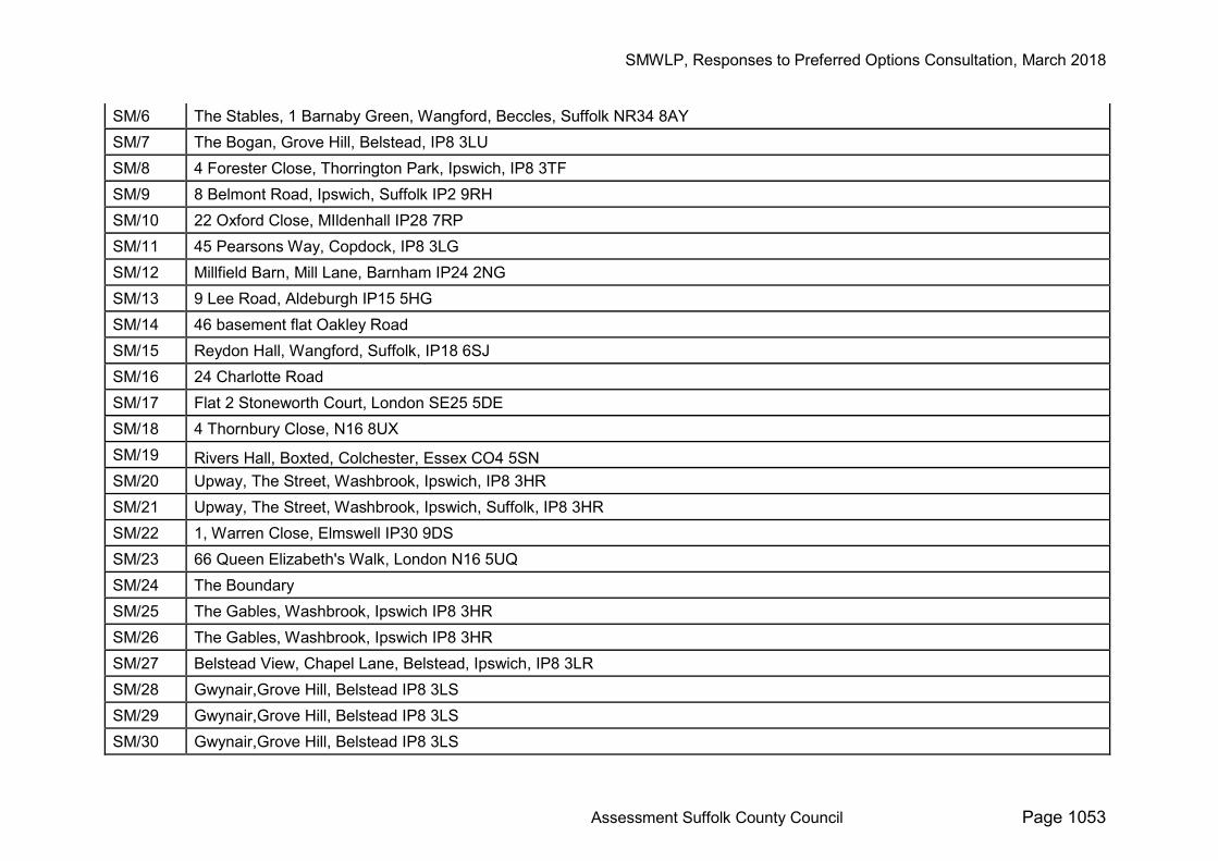
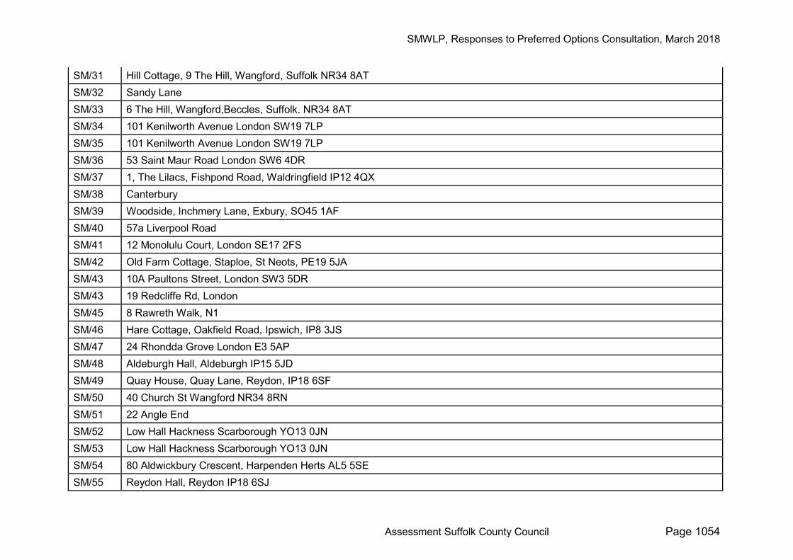
SM/31 Hill Cottage, 9 The Hill, Wangford, Suffolk NR34 8AT SM/32 Sandy Lane SM/33 6 The Hill, Wangford,Beccles, Suffolk. NR34 8AT SM/34 101 Kenilworth Avenue London SW19 7LP SM/35 101 Kenilworth Avenue London SW19 7LP SM/36 53 Saint Maur Road London SW6 4DR SM/37 1, The Lilacs, Fishpond Road, Waldringfield IP12 4QX SM/38 Canterbury SM/39 Woodside, Inchmery Lane, Exbury, SO45 1AF SM/40 57a Liverpool Road SM/41 12 Monolulu Court, London SE17 2FS SM/42 Old Farm Cottage, Staploe, St Neots, PE19 5JA SM/43 10A Paultons Street, London SW3 5DR SM/43 19 Redcliffe Rd, London SM/45 8 Rawreth Walk, N1 SM/46 Hare Cottage, Oakfield Road, Ipswich, IP8 3JS SM/47 24 Rhondda Grove London E3 5AP SM/48 Aldeburgh Hall, Aldeburgh IP15 5JD SM/49 Quay House, Quay Lane, Reydon, IP18 6SF SM/50 40 Church St Wangford NR34 8RN SM/51 22 Angle End SM/52 Low Hall Hackness Scarborough YO13 0JN SM/53 Low Hall Hackness Scarborough YO13 0JN SM/54 80 Aldwickbury Crescent, Harpenden Herts AL5 5SE SM/55 Reydon Hall, Reydon IP18 6SJ
SMWLP, Responses to Preferred Options Consultation, March 2018
Assessment Suffolk County Council Page 1055
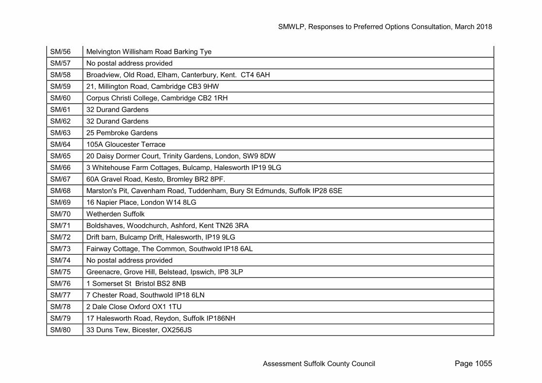
SM/56 Melvington Willisham Road Barking Tye SM/57 No postal address provided SM/58 Broadview, Old Road, Elham, Canterbury, Kent. CT4 6AH SM/59 21, Millington Road, Cambridge CB3 9HW SM/60 Corpus Christi College, Cambridge CB2 1RH SM/61 32 Durand Gardens SM/62 32 Durand Gardens SM/63 25 Pembroke Gardens SM/64 105A Gloucester Terrace SM/65 20 Daisy Dormer Court, Trinity Gardens, London, SW9 8DW SM/66 3 Whitehouse Farm Cottages, Bulcamp, Halesworth IP19 9LG SM/67 60A Gravel Road, Kesto, Bromley BR2 8PF. SM/68 Marston's Pit, Cavenham Road, Tuddenham, Bury St Edmunds, Suffolk IP28 6SE SM/69 16 Napier Place, London W14 8LG SM/70 Wetherden Suffolk SM/71 Boldshaves, Woodchurch, Ashford, Kent TN26 3RA SM/72 Drift barn, Bulcamp Drift, Halesworth, IP19 9LG SM/73 Fairway Cottage, The Common, Southwold IP18 6AL SM/74 No postal address provided SM/75 Greenacre, Grove Hill, Belstead, Ipswich, IP8 3LP SM/76 1 Somerset St Bristol BS2 8NB SM/77 7 Chester Road, Southwold IP18 6LN SM/78 2 Dale Close Oxford OX1 1TU SM/79 17 Halesworth Road, Reydon, Suffolk IP186NH SM/80 33 Duns Tew, Bicester, OX256JS
SMWLP, Responses to Preferred Options Consultation, March 2018
Assessment Suffolk County Council Page 1056
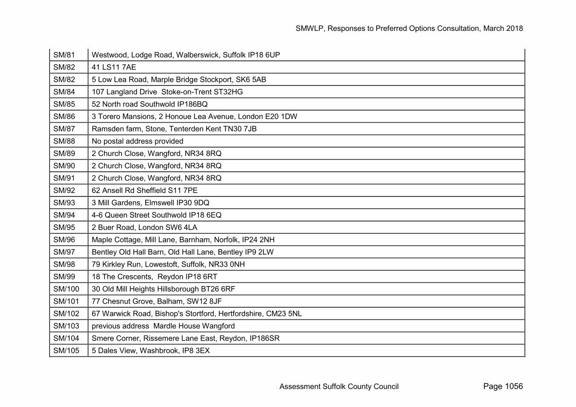
SM/81 Westwood, Lodge Road, Walberswick, Suffolk IP18 6UP SM/82 41 LS11 7AE SM/82 5 Low Lea Road, Marple Bridge Stockport, SK6 5AB SM/84 107 Langland Drive Stoke-on-Trent ST32HG SM/85 52 North road Southwold IP186BQ SM/86 3 Torero Mansions, 2 Honoue Lea Avenue, London E20 1DW SM/87 Ramsden farm, Stone, Tenterden Kent TN30 7JB SM/88 No postal address provided SM/89 2 Church Close, Wangford, NR34 8RQ SM/90 2 Church Close, Wangford, NR34 8RQ SM/91 2 Church Close, Wangford, NR34 8RQ SM/92 62 Ansell Rd Sheffield S11 7PE SM/93 3 Mill Gardens, Elmswell IP30 9DQ SM/94 4-6 Queen Street Southwold IP18 6EQ SM/95 2 Buer Road, London SW6 4LA SM/96 Maple Cottage, Mill Lane, Barnham, Norfolk, IP24 2NH SM/97 Bentley Old Hall Barn, Old Hall Lane, Bentley IP9 2LW SM/98 79 Kirkley Run, Lowestoft, Suffolk, NR33 0NH SM/99 18 The Crescents, Reydon IP18 6RT SM/100 30 Old Mill Heights Hillsborough BT26 6RF SM/101 77 Chesnut Grove, Balham, SW12 8JF SM/102 67 Warwick Road, Bishop's Stortford, Hertfordshire, CM23 5NL SM/103 previous address Mardle House Wangford SM/104 Smere Corner, Rissemere Lane East, Reydon, IP186SR SM/105 5 Dales View, Washbrook, IP8 3EX
SMWLP, Responses to Preferred Options Consultation, March 2018
Assessment Suffolk County Council Page 1057
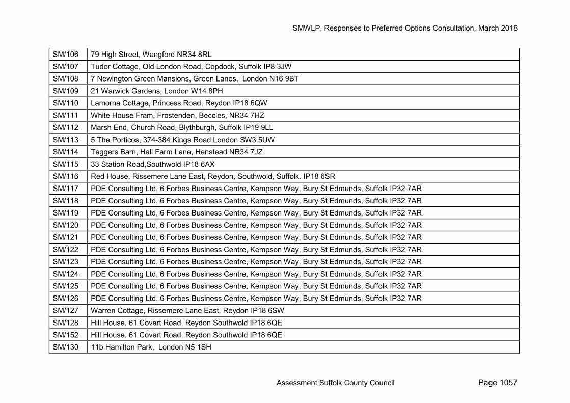
SM/106 79 High Street, Wangford NR34 8RL SM/107 Tudor Cottage, Old London Road, Copdock, Suffolk IP8 3JW SM/108 7 Newington Green Mansions, Green Lanes, London N16 9BT SM/109 21 Warwick Gardens, London W14 8PH SM/110 Lamorna Cottage, Princess Road, Reydon IP18 6QW SM/111 White House Fram, Frostenden, Beccles, NR34 7HZ SM/112 Marsh End, Church Road, Blythburgh, Suffolk IP19 9LL SM/113 5 The Porticos, 374-384 Kings Road London SW3 5UW SM/114 Teggers Barn, Hall Farm Lane, Henstead NR34 7JZ SM/115 33 Station Road,Southwold IP18 6AX SM/116 Red House, Rissemere Lane East, Reydon, Southwold, Suffolk. IP18 6SR SM/117 PDE Consulting Ltd, 6 Forbes Business Centre, Kempson Way, Bury St Edmunds, Suffolk IP32 7AR SM/118 PDE Consulting Ltd, 6 Forbes Business Centre, Kempson Way, Bury St Edmunds, Suffolk IP32 7AR SM/119 PDE Consulting Ltd, 6 Forbes Business Centre, Kempson Way, Bury St Edmunds, Suffolk IP32 7AR SM/120 PDE Consulting Ltd, 6 Forbes Business Centre, Kempson Way, Bury St Edmunds, Suffolk IP32 7AR SM/121 PDE Consulting Ltd, 6 Forbes Business Centre, Kempson Way, Bury St Edmunds, Suffolk IP32 7AR SM/122 PDE Consulting Ltd, 6 Forbes Business Centre, Kempson Way, Bury St Edmunds, Suffolk IP32 7AR SM/123 PDE Consulting Ltd, 6 Forbes Business Centre, Kempson Way, Bury St Edmunds, Suffolk IP32 7AR SM/124 PDE Consulting Ltd, 6 Forbes Business Centre, Kempson Way, Bury St Edmunds, Suffolk IP32 7AR SM/125 PDE Consulting Ltd, 6 Forbes Business Centre, Kempson Way, Bury St Edmunds, Suffolk IP32 7AR SM/126 PDE Consulting Ltd, 6 Forbes Business Centre, Kempson Way, Bury St Edmunds, Suffolk IP32 7AR SM/127 Warren Cottage, Rissemere Lane East, Reydon IP18 6SW SM/128 Hill House, 61 Covert Road, Reydon Southwold IP18 6QE SM/152 Hill House, 61 Covert Road, Reydon Southwold IP18 6QE SM/130 11b Hamilton Park, London N5 1SH
SMWLP, Responses to Preferred Options Consultation, March 2018
Assessment Suffolk County Council Page 1058
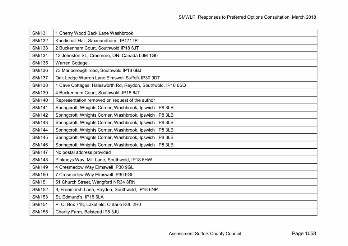
SM/131 1 Cherry Wood Back Lane Washbrook SM/132 Knodishall Hall, Saxmundham , IP171TP SM/133 2 Buckenham Court, Southwold IP18 6JT SM/134 13 Johnston St., Creemore, ON. Canada L0M 1G0 SM/135 Warren Cottage SM/136 73 Marlborough road, Southwold IP18 6BJ SM/137 Oak Lodge Warren Lane Elmswell Suffolk IP30 9DT SM/138 1 Cave Cottages, Halesworth Rd, Reydon, Southwold, IP18 6SQ SM/139 4 Buckenham Court, Southwold, IP18 6JT SM/140 Representation removed on request of the author SM/141 Springcroft, Whights Corner, Washbrook, Ipswich IP8 3LB SM/142 Springcroft, Whights Corner, Washbrook, Ipswich IP8 3LB SM/143 Springcroft, Whights Corner, Washbrook, Ipswich IP8 3LB SM/144 Springcroft, Whights Corner, Washbrook, Ipswich IP8 3LB SM/145 Springcroft, Whights Corner, Washbrook, Ipswich IP8 3LB SM/146 Springcroft, Whights Corner, Washbrook, Ipswich IP8 3LB SM/147 No postal address provided SM/148 Pinkneys Way, Mill Lane, Southwold, IP18 6HW SM/149 4 Cresmedow Way Elmswell IP30 9GL SM/150 7 Cresmedow Way Elmswell IP30 9GL SM/151 51 Church Street, Wangford NR34 8RN SM/152 9, Freemarsh Lane, Raydon, Southwold, IP18 6NP SM/153 St. Edmund's, IP18 6LA SM/154 P. O. Box 718, Lakefield, Ontario K0L 2H0 SM/155 Charity Farm, Belstead IP8 3JU
SMWLP, Responses to Preferred Options Consultation, March 2018
Assessment Suffolk County Council Page 1059
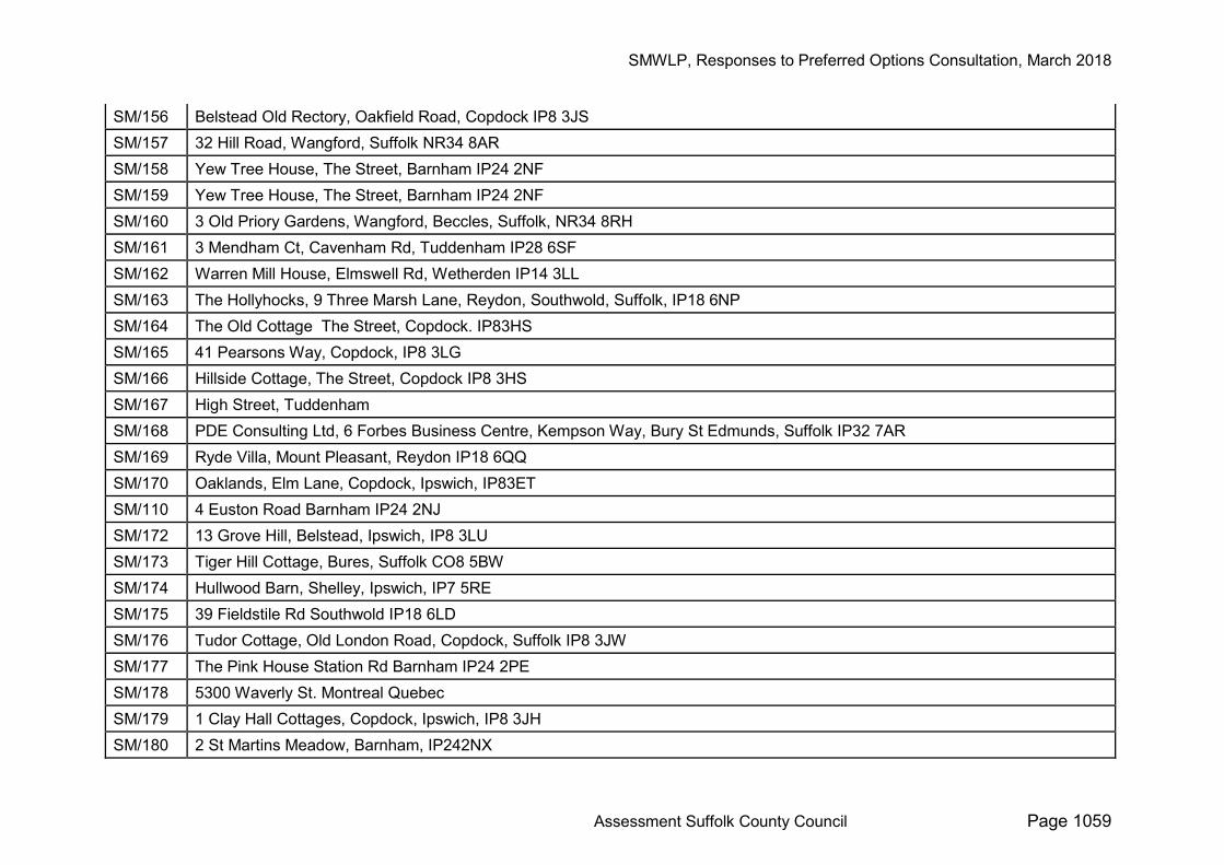
SM/156 Belstead Old Rectory, Oakfield Road, Copdock IP8 3JS SM/157 32 Hill Road, Wangford, Suffolk NR34 8AR SM/158 Yew Tree House, The Street, Barnham IP24 2NF SM/159 Yew Tree House, The Street, Barnham IP24 2NF SM/160 3 Old Priory Gardens, Wangford, Beccles, Suffolk, NR34 8RH SM/161 3 Mendham Ct, Cavenham Rd, Tuddenham IP28 6SF SM/162 Warren Mill House, Elmswell Rd, Wetherden IP14 3LL SM/163 The Hollyhocks, 9 Three Marsh Lane, Reydon, Southwold, Suffolk, IP18 6NP SM/164 The Old Cottage The Street, Copdock. IP83HS SM/165 41 Pearsons Way, Copdock, IP8 3LG SM/166 Hillside Cottage, The Street, Copdock IP8 3HS SM/167 High Street, Tuddenham SM/168 PDE Consulting Ltd, 6 Forbes Business Centre, Kempson Way, Bury St Edmunds, Suffolk IP32 7AR SM/169 Ryde Villa, Mount Pleasant, Reydon IP18 6QQ SM/170 Oaklands, Elm Lane, Copdock, Ipswich, IP83ET SM/110 4 Euston Road Barnham IP24 2NJ SM/172 13 Grove Hill, Belstead, Ipswich, IP8 3LU SM/173 Tiger Hill Cottage, Bures, Suffolk CO8 5BW SM/174 Hullwood Barn, Shelley, Ipswich, IP7 5RE SM/175 39 Fieldstile Rd Southwold IP18 6LD SM/176 Tudor Cottage, Old London Road, Copdock, Suffolk IP8 3JW SM/177 The Pink House Station Rd Barnham IP24 2PE SM/178 5300 Waverly St. Montreal Quebec SM/179 1 Clay Hall Cottages, Copdock, Ipswich, IP8 3JH SM/180 2 St Martins Meadow, Barnham, IP242NX
SMWLP, Responses to Preferred Options Consultation, March 2018
Assessment Suffolk County Council Page 1060
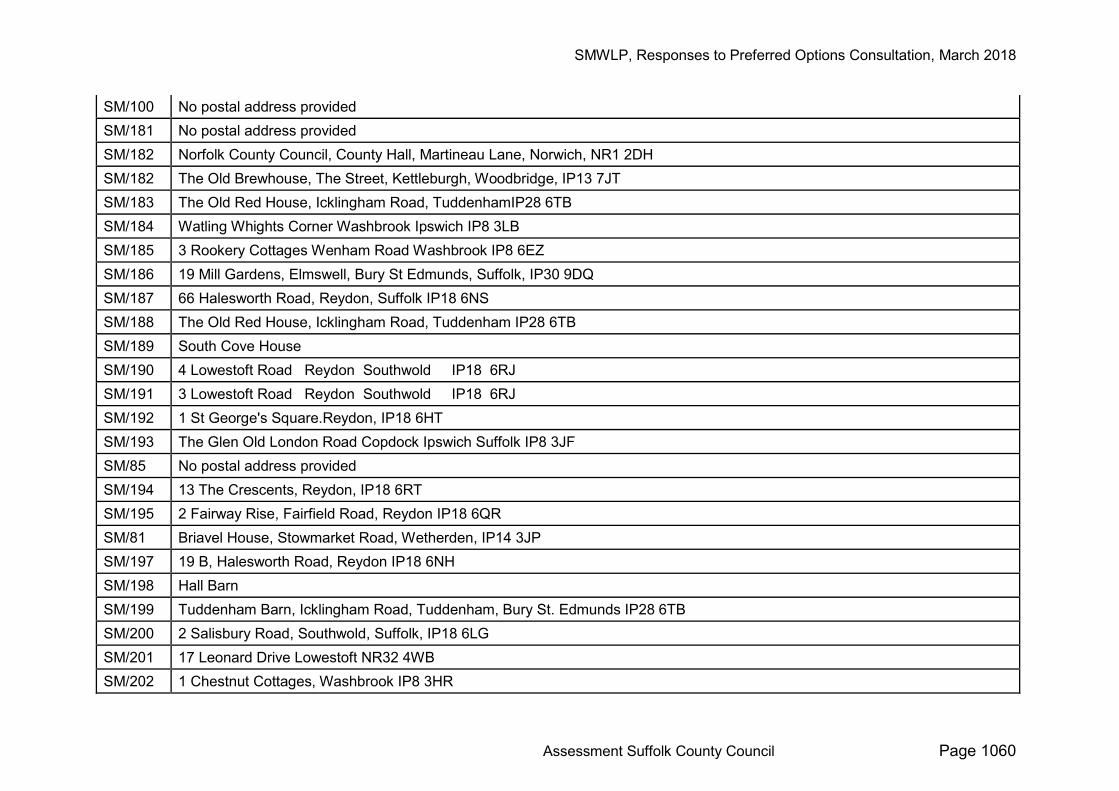
SM/100 No postal address provided SM/181 No postal address provided SM/182 Norfolk County Council, County Hall, Martineau Lane, Norwich, NR1 2DH SM/182 The Old Brewhouse, The Street, Kettleburgh, Woodbridge, IP13 7JT SM/183 The Old Red House, Icklingham Road, TuddenhamIP28 6TB SM/184 Watling Whights Corner Washbrook Ipswich IP8 3LB SM/185 3 Rookery Cottages Wenham Road Washbrook IP8 6EZ SM/186 19 Mill Gardens, Elmswell, Bury St Edmunds, Suffolk, IP30 9DQ SM/187 66 Halesworth Road, Reydon, Suffolk IP18 6NS SM/188 The Old Red House, Icklingham Road, Tuddenham IP28 6TB SM/189 South Cove House SM/190 4 Lowestoft Road Reydon Southwold IP18 6RJ SM/191 3 Lowestoft Road Reydon Southwold IP18 6RJ SM/192 1 St George's Square.Reydon, IP18 6HT SM/193 The Glen Old London Road Copdock Ipswich Suffolk IP8 3JF SM/85 No postal address provided SM/194 13 The Crescents, Reydon, IP18 6RT SM/195 2 Fairway Rise, Fairfield Road, Reydon IP18 6QR SM/81 Briavel House, Stowmarket Road, Wetherden, IP14 3JP SM/197 19 B, Halesworth Road, Reydon IP18 6NH SM/198 Hall Barn SM/199 Tuddenham Barn, Icklingham Road, Tuddenham, Bury St. Edmunds IP28 6TB SM/200 2 Salisbury Road, Southwold, Suffolk, IP18 6LG SM/201 17 Leonard Drive Lowestoft NR32 4WB SM/202 1 Chestnut Cottages, Washbrook IP8 3HR
SMWLP, Responses to Preferred Options Consultation, March 2018
Assessment Suffolk County Council Page 1061
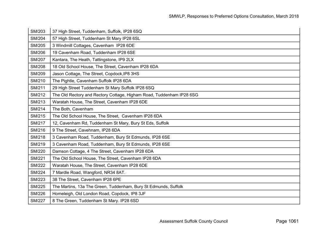
SM/203 37 High Street, Tuddenham, Suffolk, IP28 6SQ SM/204 57 High Street, Tuddenham St Mary IP28 6SL SM/205 3 Windmill Cottages, Cavenham IP28 6DE SM/206 19 Cavenham Road, Tuddenham IP28 6SE SM/207 Kantara, The Heath, Tattingstone, IP9 2LX SM/208 18 Old School House, The Street, Cavenham IP28 6DA SM/209 Jason Cottage, The Street, Copdock,IP8 3HS SM/210 The Pightle, Cavenham Suffolk IP28 6DA SM/211 29 High Street Tuddenham St Mary Suffolk IP28 6SQ SM/212 The Old Rectory and Rectory Cottage, Higham Road, Tuddenham IP28 6SG SM/213 Waratah House, The Street, Cavenham IP28 6DE SM/214 The Both, Cavenham SM/215 The Old School House, The Street, Cavenham IP28 6DA SM/217 12, Cavenham Rd, Tuddenham St Mary, Bury St Eds, Suffolk SM/216 9 The Street, Cavehnam, IP28 6DA SM/218 3 Cavenham Road, Tuddenham, Bury St Edmunds, IP28 6SE SM/219 3 Cavenham Road, Tuddenham, Bury St Edmunds, IP28 6SE SM/220 Damson Cottage, 4 The Street, Cavenham IP28 6DA SM/221 The Old School House, The Street, Cavenham IP28 6DA SM/222 Waratah House, The Street, Cavenham IP28 6DE SM/224 7 Mardle Road, Wangford, NR34 8AT. SM/223 38 The Street, Cavenham IP28 6PE SM/225 The Martins, 13a The Green, Tuddenham, Bury St Edmunds, Suffolk SM/226 Homeleigh, Old London Road, Copdock, IP8 3JF SM/227 8 The Green, Tuddenham St Mary. IP28 6SD
SMWLP, Responses to Preferred Options Consultation, March 2018
Assessment Suffolk County Council Page 1062
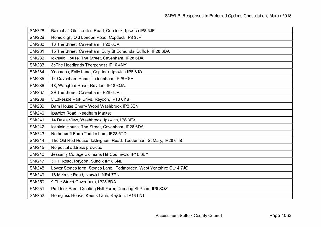
SM/228 Balmaha', Old London Road, Copdock, Ipswich IP8 3JF SM/229 Homeleigh, Old London Road, Copdock IP8 3JF SM/230 13 The Street, Cavenham, IP28 6DA SM/231 15 The Street, Cavenham, Bury St Edmunds, Suffolk, IP28 6DA SM/232 Icknield House, The Street, Cavenham, IP28 6DA SM/233 3cThe Headlands Thorpeness IP16 4NY SM/234 Yeomans, Folly Lane, Copdock, Ipswich IP8 3JQ SM/235 14 Cavenham Road, Tuddenham, IP28 6SE SM/236 48, Wangford Road, Reydon. IP18 6QA. SM/237 29 The Street, Cavenham. IP28 6DA SM/238 5 Lakeside Park Drive, Reydon, IP18 6YB SM/239 Barn House Cherry Wood Washbrook IP8 3SN SM/240 Ipswich Road, Needham Market SM/241 14 Dales View, Washbrook, Ipswich, IP8 3EX SM/242 Icknield House, The Street, Cavenham, IP28 6DA SM/243 Nethercroft Farm Tuddenham, IP28 6TD SM/244 The Old Red House, Icklingham Road, Tuddenham St Mary, IP28 6TB SM/245 No postal address provided SM/246 Jessamy Cottage Skilmans Hill Southwold IP18 6EY SM/247 3 Hill Road, Reydon, Suffolk IP18 6NL SM/248 Lower Stones farm, Stones Lane, Todmorden, West Yorkshire OL14 7JG SM/249 18 Melrose Road, Norwich NR4 7PN SM/250 9 The Street Cavenham, IP28 6DA SM/251 Paddock Barn, Creeting Hall Farm, Creeting St Peter, IP6 8QZ SM/252 Hourglass House, Keens Lane, Reydon, IP18 6NT

SMWLP, Responses to Preferred Options Consultation, March 2018
Assessment Suffolk County Council Page 1063
SM/253 Suffolk Heritage Antiques Centre, Old London Road, IP83JF SM/254 Suffolk Heritage, Old London Road, Copdock, IP8 3JF SM/255 3 Prescott Drive, Elmswell, Bury St Edmunds IP30 9DE SM/256 Coles Green Farm Washbrook IP8 3HB SM/257 Wandelaar, Foly Lane, Copdock IP8 3JQ SM/258 Wandelaar, Foly Lane, Copdock IP8 3JQ SM/259 Cavenham House, Cavenham, Bury St Edmunds, IP28 6DF SM/260 16 Woodnook Road London SW16 6TZ SM/261 52 High Street Tuddenham Bury St Edmunds IP28 6SA SM/262 No postal address provided SM/263 Valley Farm Lower Layham Ipswich IP7 5RW SM/264 3 The Street, Cavenham, Suffolk, IP28 6DA SM/265 62a High St , Tuddenham, IP28 6SA SM/266 Hillcrest, Old London Road Copdock IP8 3JF SM/267 Spring Barn, Old London Road, Copdock, Ipswich IP8 3JW SM/268 Hillcrest Old London Road Copdock IP8 3JF SM/269 Spring Barn, Old London Road, Copdock, Ipswich IP8 3JW SM/270 Spring Barn, Old London Road, Copdock, Ipswich IP8 3JW SM/271 Spring Barn, Old London Road, Copdock, Ipswich IP8 3JW SM/272 West Hill Bungalow, Wenham Road, Copdock, Ipswich, IP8 3EY SM/273 St. Patricks, Elm Lane, Copdock, Ipswich, IP8 3ET SM/274 St. Patricks, Elm Lane, Copdock, Ipswich, IP8 3ET SM/275 43 Trinity Walk, Stowupland, IP14 4AS SM/276 26 Pheasant Rise. Copdock, IP8 3LF DR/1 Representation removed on request of the author
SMWLP, Responses to Preferred Options Consultation, March 2018
Assessment Suffolk County Council Page 1064
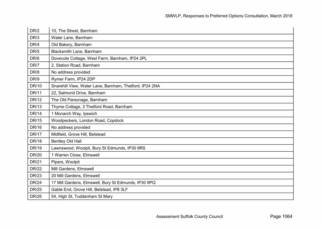
DR/2 10, The Street, Barnham DR/3 Water Lane, Barnham DR/4 Old Bakery, Barnham DR/5 Blacksmith Lane, Barnham DR/6 Dovecote Cottage, West Farm, Barnham, IP24 2PL DR/7 2, Station Road, Barnham DR/8 No address provided DR/9 Rymer Farm, IP24 2DP DR/10 Snarehill View, Water Lane, Barnham, Thetford, IP24 2NA DR/11 22, Salmond Drive, Barnham DR/12 The Old Parsonage, Barnham DR/13 Thyme Cottage, 3 Thetford Road, Barnham DR/14 1 Monarch Way, Ipswich DR/15 Woodpeckers, London Road, Copdock DR/16 No address provided DR/17 Midfield, Grove Hill, Belstead DR/18 Bentley Old Hall DR/19 Lawnswood, Woolpit, Bury St Edmunds, IP30 9RS DR/20 1 Warren Close, Elmswell DR/21 Pipers, Woolpit DR/22 Mill Gardens, Elmswell DR/23 20 Mill Gardens, Elmswell DR/24 17 Mill Gardens, Elmswell, Bury St Edmunds, IP30 9PQ DR/25 Gable End, Grove Hill, Belstead, IP8 3LF DR/26 54, High St, Tuddenham St Mary
SMWLP, Responses to Preferred Options Consultation, March 2018
Assessment Suffolk County Council Page 1065
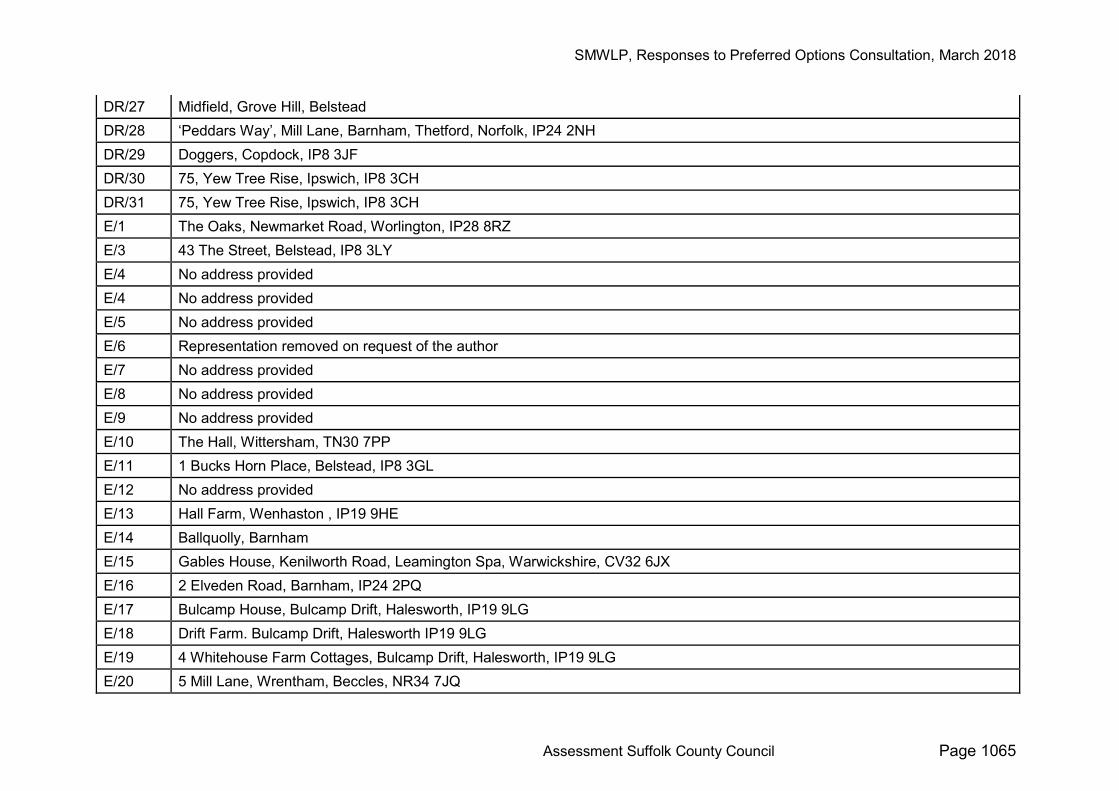
DR/27 Midfield, Grove Hill, Belstead DR/28 ‘Peddars Way’, Mill Lane, Barnham, Thetford, Norfolk, IP24 2NH DR/29 Doggers, Copdock, IP8 3JF DR/30 75, Yew Tree Rise, Ipswich, IP8 3CH DR/31 75, Yew Tree Rise, Ipswich, IP8 3CH E/1 The Oaks, Newmarket Road, Worlington, IP28 8RZ E/3 43 The Street, Belstead, IP8 3LY E/4 No address provided E/4 No address provided E/5 No address provided E/6 Representation removed on request of the author E/7 No address provided E/8 No address provided E/9 No address provided E/10 The Hall, Wittersham, TN30 7PP E/11 1 Bucks Horn Place, Belstead, IP8 3GL E/12 No address provided E/13 Hall Farm, Wenhaston , IP19 9HE E/14 Ballquolly, Barnham E/15 Gables House, Kenilworth Road, Leamington Spa, Warwickshire, CV32 6JX E/16 2 Elveden Road, Barnham, IP24 2PQ E/17 Bulcamp House, Bulcamp Drift, Halesworth, IP19 9LG E/18 Drift Farm. Bulcamp Drift, Halesworth IP19 9LG E/19 4 Whitehouse Farm Cottages, Bulcamp Drift, Halesworth, IP19 9LG E/20 5 Mill Lane, Wrentham, Beccles, NR34 7JQ
SMWLP, Responses to Preferred Options Consultation, March 2018
Assessment Suffolk County Council Page 1066
E/21 2 Lowestoft, Reydon, IP18 6PT E/22 Trent University, Peterborough, Ontario, Canada E/23 Representation removed on request of the author E/24 Marsh End, Church Road, Blythburgh, Suffolk IP19 9LL E/25 Representation removed on request of the author E/26 4 Whitehouse Farm Cottages, Bulcamp Drift, Halesworth, IP19 9LG E/27 25 North Road, Southwold, IP18 6BG E/28 No address provided E/29 Red House, Rissemere Lane East, Reydon, Southwold, IP18 6SR E/30 22 Mill Gardens, Elmswell, IP30 9DQ E/31 Warren Gate, Elmswell E/32 16 Mill Gardens, Elmswell, Bury St Edmunds IP30 9DQ E/33 No address provided E/34 Wangford Farm, Mardle Road, Wangford NR34 8AU E/35 Bulcamp Cottage, Bulcamp Drift, Blythborough, IP19 9LG E/36 Parish Council Office, Station Road, Elmswell, IP30 9HR E/37 New Road, Elmswell E/38 1 Warren Close, Elmswell E/39 Bulcamp Cottage, Bulcamp Drift, Bylthborough IP19 9LG E/40 1 Ewen Close, Reydon, Suffolk IP18 6RZ E/41 Reydon Grange, Mardle Road, Wangford, NR34 8AU E/42 Reydon Grange, Mardle Road, Wangford, NR34 8AU E/43 Old West Stables, Bury Road, Barnham, IP24 2PL E/44 Jubilee Cottage, Euston Road, Barnham, IP24 2NJ E/45 The Village Store, The High Street, Wangford, Beccles NR34 8RA

SMWLP, Responses to Preferred Options Consultation, March 2018
Assessment Suffolk County Council Page 1067
E/46 Folly Farm, Tattingstone, Ipswich, IP9 2NY E/47 Oakwood Cottage, The Street, Barnham, IP24 2NF E/48 18 Salmond Drive, Barnham, IP24 2NL E/49 No address provided E/50 Portelet, Blacksmith Lane, Barnham, Thetford, NR24 2NE E/51 Hambleden, Blacksmith Lane, Barnham, Thetford, NR24 2NE E/52 Hall Farm, Copdock E/53 No address provided E/54 PO Box 10523, Stoke by Nayland, Colchester CO6 4WJ E/55 Norfolk County Council, County Hall, Martineau Lane, Norwich, NR1 2DH E/56 28 Pheasant Rise, Copdock, Ipswich IP8 3LF E/57 Ballquolly, Barnham E/58 North Wing, Creeting Hall, Creeting St Peter, Ipswich IP6 8QZ E/59 4, Peterhouse, Creeting St Peter, IP6 8QP E/60 Paddock Barn , Creeting Hall Farm, Creeting St Peter, Ipswich, IP6 8QZ E/61 Broads Authority, Yare House, 62-64 Thorpe Road, Norwich, NR1 1RY E/62 Gillingham House, 38 -44 Gillingham Street, London SW1V 1HU E/63 Willow House, Pound Road, Creeting St Peter IP6 8QR E/64 42, Beatrice Avenue, Felixstowe, IP11 9HB E/65 No address provided E/66 CEMEX UK Operations Ltd, Wolverhampton Road, Oldbury, Warley West Midlands, B69 4RJ E/67 Brackendale, 20 Stowmarket Road, Needham Market, Ipswich IP6 8DS E/68 Hallgarth House, 137 High Street, Needham Market, Ipswich, IP6 8DH E/69 30 St Mary’s Road, Creeting St Peter, IP6 8LZ E/70 Eastern England Regional Office, 65 Thorpe Road, Norwich, NR1 1UD
SMWLP, Responses to Preferred Options Consultation, March 2018
Assessment Suffolk County Council Page 1068
E/71 Dovecote Cottage, West Farm, Barnham, IP24 2PL E/72 No address provided E/73 West Suffolk House, Bury St Edmunds E/74 Strutt and Parker, Coval Hall, Rainsford, Chelmsford CM1 2QF E/75 Applecroft, The Heath, Tattingstone IP9 2LX E/76 Century Wharf, Crayford Creek, Dartford DA1 4QG E/77 Bewick House, 22 Thorpe Road, Norwich, NR1 1RY E/78 Brooke House, Ashbocking, Ipswich, IP6 9JY E/79 No address provided E/80 The Old Stables, Bosmere Hall, Creeting St Mary, IP6 8LL E/81 Howe Farm, Mill Lane, Stowmarket, IP14 5BP E/82 No address provided E/83 Brooklands, 24 Brooklands Avenue, Cambridge CB2 8BU E/84 No address provided E/85 Hall Barn, Creeting Hall, Creeting St Peter, IP6 8QZ E/86 Salix House, The Lane, Creeting St Peter, IP6 8QR E/87 Robert Brett House, Ashford Road, Canterbury, CT4 7PP E/88 Suite 4, Pioneer House, Vision Park, Histon, Cambridge, CB24 9NL E/89 House of Commons, London SW1A 0AA E/90 9 The Square, Keyworth, Nottingham NG12 5JT E/91 Removed as not a representation E/92 Gransden House, The Street, Creeting St Peter, IP6 8QT E/93 Needham Market E/94 The Wren, 1 All Saints Road, Creeting St Mary, IP6 8NF E/95 Petronilla House, The Lane, Creeting St Peter, IP6 8QR
SMWLP, Responses to Preferred Options Consultation, March 2018
Assessment Suffolk County Council Page 1069
E/96 Laburnum Cottage, Pound Road, Creeting St Peter, IP6 8QR E/97 No address provided E/98 Dock Lane, Melton, Suffolk IP12 1PE E/99 The Wren, 1 All Saints Road, Creeting St Mary, IP6 8NF E/100 The Wren, 1 All Saints Road, Creeting St Mary, IP6 8NF E/101 Granary Barn, Clamp Farm, Stowmarket, IP14 5BP E/102 No address provided E/103 Cherry Tree Farm, Badley, Suffolk, IP6 8RN E/104 No address provided E/105 Granary Barn, Clamp Farm, Stowmarket, IP14 5BP E/106 Petronilla House, The Lane, Creeting St Peter, IP6 8QR E/107 No address provided E/108 Iceni House, Cobham Road, Ipswich, Suffolk, IP3 9JD E/109 No address provided E/110 One, Kingsway, Cardiff, CF10 3AN E/111 Petronilla House, The Lane, Creeting St Peter, IP6 8QR E/112 Barnfield, the Green, Creeting St Peter, Ipswich IP6 8QT E/113 No address provided E/114 Milton House, Milton Road South, Stowmarket, Suffolk IP14 1EZ E/115 Paddock Barn, Creeting Hall Farm, Creeting St Peter, IP6 8QZ E/116 Little Hall, Market Place, Lavenham, CO10 9QZ E/117 6 Elm Lane, Copdock, IP8 3ET
E/118 East Suffolk House, Riduna Park, Station Road, Melton, Woodbridge, IP12 1RT Riverside, 4 Canning Road, Lowestoft, NR33 0EQ
E/119 Gladman House, Alexandria Way, Congleton Business Park, Congleton, Cheshire, CW12 1LB
SMWLP, Responses to Preferred Options Consultation, March 2018
Assessment Suffolk County Council Page 1070
E/120 No address provided E/121 Highview Cottage, Mill Lane, Creeting St Peter, Ipswich, IP6 8QQ. E/122 Highview Cottage, Mill Lane, Creeting St Peter, Ipswich, IP6 8QQ. E/123 Clamp Farmhouse, Mill Lane, Creeting St Peter, Stowmarket, IP14 5BP E/124 Belstead Old Rectory, Copdock, Ipswich, IP8 3JS E/125 The Wren, 1 All Saints Road, Creeting St Mary, IP6 8NF E/126 The Wren, 1 All Saints Road, Creeting St Mary, IP6 8NF E/127 Scotsfield Cottage, The Avenue, Copdock IP8 3JR E/128 4 Kettleborrow Close, Ixworth, Bury St Edmunds, IP31 2UN E/129 Hall Barn, Creeting Hall, IP6 8QZ E/130 Moss House, Oakfield Road, IP8 3JS E/131 Moss House, Oakfield Road, IP8 3JS E/132 Jubilee House, Pound Road, Creeting St Peter, IP6 8QS E/133 Reydon Hall, Wangford Road, Reydon, IP18 6SJ E/134 Balquholly, Blacksmiths Lane, Barnham IP24 2NE E/135 West Hill, Elm Lane, Copdock, IP8 3ET E/136 Belstead Old Rectory, Copdock, Ipswich, IP8 3JS E/137 No address provided E/138 Old Elm Cottage, Fen Lane, Creeting St Mary, Ipswich, IP6 8QE E/139 5 Whitehouse Cottages, Bulcamp Drift, IP19 9LG E/140 Morfield, Wenham Road, Washbrook, Ipswich IP8 3EZ E/141 No address provided E/142 Clamp Farmhouse, Mill Lane, Creeting St Peter, Stowmarket, IP14 5BP E/143 14 Evans Close, Reydon, Suffolk, IP18 6PU E/144 30 St Marys Road, Creeting St Mary, Ipswich, IP6 8LZ
SMWLP, Responses to Preferred Options Consultation, March 2018
Assessment Suffolk County Council Page 1071
E/145 High Banks, Jacks Green Road, Creeting St Mary, IP6 8NA E/146 14, Evans Close, Reydon, Southwold, IP18 6PU E/147 Rowan Croft, Rissemere Lane East, Reydon, Southwold, IP18 6SW E/148 Fen Farm , Fen Lane, Creeting St Mary, IP6 8QD E/149 No address provided E/150 6 Peterhouse, Creeting St Peter, IP6 8QP
E/151 Terry Corner - Upway, The Street, Washbrook, Ipswich, Suffolk, IP8 3HR, Angela Chapman, 65 Thorney Road, Capel St Mary, Ipswich, IP9 2LL
E/152 No address provided E/153 Millmead, The Lane, Creeting St Peter, IP6 8QR E/154 Customer Services, Hornbeam House, Crewe Business Park, Electra Way, Crewe, Cheshire, CW1 6GJ IE/1 Planning and Development, Suffolk County Council, 8 Russell Road, Ipswich IP1 2BX IE/2 Transport Policy and Development, Suffolk County Council, 8 Russell Road, Ipswich IP1 2BX IE/3 Flood and Water Management, Suffolk County Council, 8 Russell Road, Ipswich IP1 2BX M/1 1 Mill Lane, Barnham, Thetford, IP24 2NH M/2
M/3 Bowmans Grove, The Heath, Tattingstone, IP9 2LX M/4 Balquholly, Blacksmiths Lane, Barnham IP24 2NE M/5 8 Mill Gardens, Elmswell, IP30 9DQ M/6 Belstead Hall, Belstead , IP8 3JT M/7 Belstead Hall, Belstead , IP8 3JT M/8 5 Mill Lane, Wrentham, Beccles NR34 7JQ M/9 41 Charlottes, Washbrook, IP8 3HZ M/10 South Green Cottage, Southwold, IP18 6ET M/11 The Palms, 13 The Charlottes, Washbrook, IP8 3HZ
SMWLP, Responses to Preferred Options Consultation, March 2018
Assessment Suffolk County Council Page 1072
M/12 Ivy Cottage, Flixton Road, Flixton, Lowestoft, NR32 5PF M/13 9 Ash Drive, Carlton Manor Park, Chapel Road, Carlton Colville, NR33 8BL M/14 Toad Hall, Mardle Road, Wangford, Beccles, NR34 8AU M/15 1 Elm Cottages, Old London Road, Copdock, IP8 3JD M/16 Inglenook, Back Lane, Washbrook, IP8 3HS M/17 The Ramblers, Swan Hill, Washbrook, IP8 3HR M/18 39 The Charlottes, Washbrook, IP8 3HZ M/19 6 Forbes Business Centre, Kempson Way, Bury St Edmunds, Suffolk IP32 7AR M/20 6 Forbes Business Centre, Kempson Way, Bury St Edmunds, Suffolk IP32 7AR M/21 6 Forbes Business Centre, Kempson Way, Bury St Edmunds, Suffolk IP32 7AR M/22 6 Forbes Business Centre, Kempson Way, Bury St Edmunds, Suffolk IP32 7AR M/23 6 Forbes Business Centre, Kempson Way, Bury St Edmunds, Suffolk IP32 7AR M/24 6 Forbes Business Centre, Kempson Way, Bury St Edmunds, Suffolk IP32 7AR M/25 6 Forbes Business Centre, Kempson Way, Bury St Edmunds, Suffolk IP32 7AR M/26 6 Forbes Business Centre, Kempson Way, Bury St Edmunds, Suffolk IP32 7AR M/27 6 Forbes Business Centre, Kempson Way, Bury St Edmunds, Suffolk IP32 7AR M/28 2 Fen View, Washbrook, IP8 3EU M/29 Charity Farm, Belstead Village, IP8 3JU M/30 31 Fen View, Washbrook, IP8 3EU M/31 Oak Barn, Copdock, Ipswich, IP8 3JN M/32 Strathmere, London Road, Copdock, IP8 3JF M/33 The Croft, Lower Layham, Ipswich, IP7 5RD M/34 6 Forbes Business Centre, Kempson Way, Bury St Edmunds, Suffolk IP32 7AR M/35 Woodside, Old London Road, Copdock, IP8 3JH M/36 Tralee, Chapel Lane, Belstead, IP8 3LR

SMWLP, Responses to Preferred Options Consultation, March 2018
Assessment Suffolk County Council Page 1073
M/37 36 Pheasant Rose, Copdock, IP8 3LF M/38 Corner Cottage, Queens Road, Reydon, Southwold, IP18 6QH M/39 Hall Farm, Church Lane, Copdock IP8 3JZ M/40 1 Elm Lane, Copdock, IP8 3ET M/41 Hambleden, Blacksmith Lane, Barnham, Thetford, NR24 2NE M/42 26 Old School Drive, Reydon, Southwold, IP18 6JZ M/43 Largona, Folly Lane, Copdock, IP8 3JQ M/44 Parish Council Office, Station Road, Elmswell, IP30 9HR M/45 18 Mill Gardens, Elmswell, IP30 9DQ M/46 PO Box 10523, Stoke by Nayland, Colchester CO6 4WJ M/47 Fen Farm, Fen Lane, Creeting St Mary, IP6 8QD M/48 Lacedean, The Lane, Creeting St Peter, IP6 8QR M/49 Lacedean, The Lane, Creeting St Peter, IP6 8QR M/50 Flint Hall, Creeting St Peter, IP6 8QL M/51 Fen Bungalow, Fen Lane, Creeting St Mary, IP6 8QD M/52 Fen Bungalow, Fen Lane, Creeting St Mary, IP6 8QD M/53 Fen Farm, Fen Lane, Creeting St Mary, IP6 8QD M/54 Belstead Rise, Church Lane, Copdock , IP8 3JY M/55 Milton House, Milton Road South, Stowmarket, Suffolk IP14 1EZ M/56 Low Farm, Wenhaston, Halesworth, IP19 9EL M/57 Squirrels, Rands Lane, Lower Layham, IP7 5FB M/58 Wangford Quarry, Hill Road, Wangford, NR34 8AR M/59 Little Hall, Market Place, Lavenham, CO10 9QZ
SMWLP, Responses to Preferred Options Consultation, March 2018
Assessment Suffolk County Council Page 1074
22. REPRESENTATIONS RECEIVED AFTER THE DEADLINE REPRESENTATIONS RECEIVED AFTER THE DEADLINE
Number Respondent Representation SCC Response L/1 Ian Johns, Suffolk Coastal
and Waveney District Council
Duplicate of E/118
L/2
Mrs S. Corcoran Brackley Wood – Christopher Hudson
Air Pollution - Noise Heavy – Traffic Old London road at peak times, traffic builds up, if the A12 is at a stand still its back up along our road up to Caple. I strongly disagree with the Belstead quarry proposals. It will be and eye sore, + the air pollution, noise, heavy traffic. Why are planners tring to ruin our village and our lovely countryside. I know we need housing etc. but it should be done in a more suitable area. Copdock + Belstead, even Caple are villages and should stay that way.
L/3
Mary Woods This iste is not needed – there are others in the area. Increased traffic on old London Road, already bumper to bumper when congestion at Copdock interchange backs traffic up on A12 to proposed site area. Copdock village could not support this heavy traffic. In conjuction with proposed new houses the quality of lide would be much worsened, and the air pollution serious for health.
L/4 Robert Hignett 1) A propoer study of the traffic build up on the A12
towards the Copdock interchange needs to be carried out. Traffic is backed up to and beyond the
SMWLP, Responses to Preferred Options Consultation, March 2018
Assessment Suffolk County Council Page 1075
Copdock/Washbrook sliproads on the A12 northbound at peak times morning and evenings + when accidents or bridge closed 2) During peak times traffic also builds up from beagle roundabout. Sometimes down Swann Hill. 3) this quarry will devalue existing properties and future 4) The proposed lorries carrying extracted material will it ba garunteed (no alternative route). The back lanes will not sustain large vehicles without the roads being widened and the old A12 will not take the constant abuse. 5)Will the lorries be washed down before proceeding onto the carriage way i.e. look at the road at Gt Blakenham.
L/5
Clare Williams I am writing to express my support for the draft Suffolk Minerals and Waste Local Plan, in particular the fact that Grove Farm Quarry is not included. I live at Hall Barn, Creeting Hall and if Grove Farm were to be given permission to extract sand and gravel it would destroy the quiet enjoyment of my home for me and all the residents of Creeting Hall. The noise, dust and vibration from extraction machinery and traffic to transport the sand and gravel away would be very intrusive and destructive. I strongly feel that industrial activity is not suited to this part of the Gipping Valley because as you travel along the river on the train you can see that there is so little left that hasn't already been developed. River valleys should be amenities for all locals, and
SMWLP, Responses to Preferred Options Consultation, March 2018
Assessment Suffolk County Council Page 1076
there is a well known and loved walk along between Stowmarket and Needham Market. Walking is an excellent way to protect and heal physical and mental health. People need to be able to escape from the built environment to quiet places in nature so that they can contemplate, calm down and consider whatever is happening in their lives. Although I appreciate that there is actually very little of our countryside that is developed, there are still not too many places where you can walk and we need to protect them. The therapeutic benefits of walking are well proven and very importantly, this activity needs very little in the way of equipment so can be taken up by pretty much anyone, regardless of income. I sincerely hope that Grove Farm will not be included in the Minerals and Waste Local Plan, either now or in the future so that the green corridor between the two towns can remain in place to preserve the distinct characters of both and provide recreational amenity for the local population.
Please do contact me if there is a need.
L/6
Richard Pope I am writing to stress the fragility of such species as bitterns and curlews and to ask you to please reject any plan that compromises their feeding grounds. Suffolk is an important area for these birds whose numbers are declining disturbingly. I am sure you know that curlews are actually threatened with extinction (the Eskimo Curlew is already extinct; we must not lose another one). While I understand that gravel extraction is a

SMWLP, Responses to Preferred Options Consultation, March 2018
Assessment Suffolk County Council Page 1077
necessity, surely better places could be found than farmland in an AONB near the Hen Reedbeds Nature Reserve. In the 21st century, England needs to do all it can to preserve its endangered wildlife. Bitterns and curlews are iconic birds for the area and once gone, they cannot be brought back. This is a battle I have seen fought many times elsewhere, sometimes lost, sometimes won. Please do not let this be another loss for nature and birds. We humans have a duty to act as good stewards of the planet and gravel extraction at the expense of threatened species is not good stewardship.
L/7
Reydon Action Group for the Environment
Minerals and Waste Local Plan Consultation – Preferred Options – Wangford These comments are made on behalf of Reydon Action Group for the Environment (RAGE). RAGE is a local residents’ group with some 120 members which was set up in July 2017 inter alia to protect the natural environment of Reydon and surrounding areas. We OBJECT to the inclusion of the proposed site at Lime Kiln Farm, Wangford on the grounds that it would constitute inappropriate major development in the Suffolk Coasts and Heaths Area of Outstanding Natural Beauty (AONB) which would breach relevant provisions of the National Planning Policy framework (NPPF) and the equivalent environmental policy of Waveney District Council (DM29).
SMWLP, Responses to Preferred Options Consultation, March 2018
Assessment Suffolk County Council Page 1078
We are also concerned at the likely adverse effects of Lime Kiln Farm on the nearby European protected and other protected habitat sites. AONB Out of the 10 proposed sites, we note that Wangford is the only site which is in an AONB. The total requirement for sand and gravel as per proposed policy MP1 is 10.422 Mt. The total estimated capacity of the 10 proposed sites is 16.539 Mt reducing to 13.639 Mt during the plan period. The estimated capacity of Lime Kiln Farm is 2.4Mt. It is thus apparent that policy requirements could be met without including Lime Kiln Farm. Lime Kiln Farm would be an extension of the existing Wangford quarry site and is the SCC preferred option out of three alternative sites for an extension at Wangford. We note that extremely limited information appears to have been provided by the existing operator, Cemex in appendices 1-3 of the SCC Site Selection Report. In particular, we note that although a Landscape and Visual Impact Assessment has been provided for the other two sites, one has not been provided (or at least included in the consultation documents) for Lime Kiln Farm. It is stated at paragraph 5.35 of the Site Selection Report that Lime Kiln Farm is inside AONB but will be capable of mitigation if overriding need case exists. This statement in turn is derived from the Place Services Sustainability Appraisal (Table 47) but is simply an assertion: no justification is provided. The Site Selection Report correctly refers to the relevant paragraphs of the NPPF but fails properly to apply the tests set out.
SMWLP, Responses to Preferred Options Consultation, March 2018
Assessment Suffolk County Council Page 1079
NPPF paragraph 144 states: local planning authorities should: • As far as practical, provide for the maintenance of landbanks of non-energy materials from outside ... Areas of Outstanding Natural Beauty ... As we have already pointed out, Lime Kiln Farm is the only proposed site in the AONB and sufficient landbanks exist outside the AONB. Lime Kiln Farm does not meet the paragraph 144 test. NPPF paragraph 116 provides that planning permission for major developments (which SCC acknowledges would include Lime Kiln Farm) should be refused except in exceptional circumstances AND where it can be demonstrated that they are in the public interest. It then sets out criteria which should be taken into account in three bullet points. It is suggested at paragraph 7.5 of the Site Selection Report that there are exceptional reasons to justify inclusion of Like Kiln Farm in accordance with NPPF. With respect, we do not agree. Taking each of the reasons in turn: a) The existing quarry at Wangford has been in operation for several decades and is an important part of the local economy; The effect on the local economy would be negligible. Cemex indicate in its representation that it would employ only 3 people. b) There is a shortage of gravel in the market area served by this quarry and the proposed extension contains an unusually high percentage of gravel compared to most other quarries;

SMWLP, Responses to Preferred Options Consultation, March 2018
Assessment Suffolk County Council Page 1080
No justification is provided for this assertion and the information provided by Cemex in its representation suggests otherwise. Cemex states that (only) 50% of the expected output is expected to be sold within Suffolk. The market area served by this quarry is not defined (but see (c) and (e) below) but on the face of it, any shortage of gravel in the market area is not consistent with a statement by the operator that 50% of material will be exported. c) The market area includes both Ipswich and Norwich and the gravel from Wangford is used to supplement the sand rich deposits from other quarries within the market area; Again, no justification is provided for this assertion but even if correct, it suggests that there is no requirement for a new quarry within the AONB and is inconsistent with (e) below (no other acceptable proposed sites within NE Suffolk); d) Processing is able to produce a regular spherical gravel grade product which can be used for specialist uses such as filter beds; Once again, no justification is provided for this assertion. This does not appear to accord with Cemex’s comments on its intended market: Intended markets for products would remain as per the extant local quarry, ie CEMEX readymixed concrete plants and local collect customers, with some material being sold for decorative purposes regionally/nationally. There is no suggestion that gravel is expected to be sold for use in filter beds. e) There are no other acceptable proposed sites within the north-east area of Suffolk;
SMWLP, Responses to Preferred Options Consultation, March 2018
Assessment Suffolk County Council Page 1081
Only one of the Cemex batching plants (Flixton) listed in table 3 of the Appendices to the draft plan can be considered to be in NE Suffolk. As most of the product from this proposed site is apparently destined for markets outside NE Suffolk, this assertion is irrelevant. f) Alternative sources such as crushed rock, recycled aggregates and marine dredged sand and gravel are unable to provide a suitable alternative due to availability or economic viability; See our comments in relation to (b) to (d) above. In the absence of evidence of local shortage, the absence of these alternative sources is irrelevant. (g) It is considered that in the impact upon the wider AONB, recreation within the area, and the nearby residential properties and ecological designations could be moderated to an acceptable extent. This is a bald assertion without any justification and as such should be rejected. None of the claimed reasons set out above can be considered to be ‘exceptional circumstances’ within the meaning of NPPF paragraph 116. Nor, in our view, has the need for this site been made out. Ecology We note from the Site Selection Report that the potential effects of Lime Kiln Farm on nearby protected sites has not been assessed and it appears that there is no intention to make any assessment unless or until a planning application is made. In our view this is inappropriate. A site should not be included in the Local Plan unless it is likely to be prima facie environmentally

SMWLP, Responses to Preferred Options Consultation, March 2018
Assessment Suffolk County Council Page 1082
acceptable. That is the purpose of the site selection process: see Aim 1, Objective 3. In view of the close proximity of Lime Kiln farm to the designated sites listed in the Site Selection Report, there is every reason to expect that it will not be environmentally acceptable. We also note that of the three nominated Wangford sites, Lime Kiln Farm was preferred on ecological grounds. Neither the Site Selection Report nor the evidence base disclose any justification for this preference. In the absence of any objective justification, the selection of Lime Kiln Farm is not sustainable. For all the reasons set out above, we urge SCC to reject the Lime Kiln Farm site.
L/8
Caroline Walker I am writing as an individual, wishing to express my objection to the proposed site for the Belstead quarry, as the local area is unable to handle the increased traffic in a safe and sustainable manner. The site plans acknowledge an increase in traffic locally if the plans are to be implemented. Swan Hill will be unable to cope with this safely. Already, it receives a large amount of traffic at peak times, with queues regularly reaching down from the roundabout to 'the street' junction and further as the road is used as a cut through for traffic from the A12. The addition of more vehicles will only make traffic into Ipswich for local residents even more challenging. This road, a 12% gradient, already sees frequent traffic accidents at the bottom of the hill with cars swerving off the road and close to (even on occasion into) houses, the risks associated with this to pedestrians walking along the road or to those
SMWLP, Responses to Preferred Options Consultation, March 2018
Assessment Suffolk County Council Page 1083
using the bus and waiting at the bus stop opposite are significant and will only increase with more, larger vehicles using it. A further concern is the risk of traffic collisions with increased numbers and sizes of vehicles. It is difficult at present for a car to safely pass a van, let alone a bus or larger vehicle. This risk will be increased with more traffic using the road. Further concerns lie in the safety of such a site. Over the course of the past 6 months local residents (in particular of swan farm mews) have seen a dramatic increase in the frequency of petty crimes in the area, having to install CCTV cameras and lights in our communal car park adjacent to Swan Hill (contact Suffolk Police for crime reference numbers). This is due to a prolonged period of vehicle damage and fuel thefts (fuel pipes have been cut and petrol stolen, leading to expensive costs to fix cars and get them back on the road). If this is happening to personal use vehicles, the proximity of a quarry site with machinery etc, will only further encourage these crimes.
L/9
Charles Morris I am a permanent resident of Blythburgh. I appreciate that I am an hour beyond your deadline – due to being held up by the poor weather – but remain hopeful that you will accept this late email. I wish to object very strongly to the proposed land being allocated for quarrying. If we cannot protect our AONB’s, then why do we bother at all? It is bad enough to learn that a
SMWLP, Responses to Preferred Options Consultation, March 2018
Assessment Suffolk County Council Page 1084
precious tract of visually prominent landscape is at risk, but almost worse to think that there are people so misguided and uncaring as to even consider including this site. You must think again, and restore our trust.
L/10
Richard Keating Fedders I wish to object to the proposal quarry sand and gravel in Creeting St Peter. This development is not necessary as the demand for sand and gravel is already met by existing quarry arrangements. The environmental concerns are many and various , not least pollution, noise and the general erosion and destruction of the Gipping Valley
L/11
Anna Keating Fedders wish to object to the proposal quarry sand and gravel in Creeting St Peter. This development is not necessary as the demand for sand and gravel is already met by existing quarry arrangements. The environmental concerns are many and various , not least pollution, noise and the general erosion and destruction of the Gipping Valley
L/12
Stewart Patience, Anglian Water
Thank you for the opportunity to comment on the Suffolk Minerals and Waste Local Plan Preferred Options consultation. The following comments are submitted on behalf of Anglian Water. I would be grateful if you could confirm receipt of this response. Policy WP3: Existing or designated land-uses potentially suitable for waste development Reference is made to waste management uses on wastewater management
SMWLP, Responses to Preferred Options Consultation, March 2018
Assessment Suffolk County Council Page 1085
sites being limited to composting and anaerobic digestion. Anglian Water as sewerage undertaker is concerned that this is not justified in that there may be other waste management uses which would be suitable at water recycling centrese dependanpt upon both scale and location. It is therefore suggested that the above wording is removed or amended to allow for other waste management uses. Policy WP14: Waste water treatment facilities The policy refers to both new waste water treatment facilities and the extension of existing waste water treatment facilities. However there may be circumstances in which improvements e.g existing processes without the need to extend existing site. It is therefore suggested that the policy should also refer to improvements to existing sites to accommodate further growth or where required for operational reasons as well as supporting infrastructure e.g. renewables. Similarly it is assumed that all proposals will be related to discharge into water bodies and water quality. This will not be the case for all proposals and Policy WLP14 should be amended to make this clear. Finally the policy should set out the circumstances in which proposals are likely to be supported (where they meet the specified criteria). As drafted
SMWLP, Responses to Preferred Options Consultation, March 2018
Assessment Suffolk County Council Page 1086
Policy WLP14 is not a positive policy which would allow proposals to come forward to accommodate growth and for operational reasons where it meets the specified criteria. Policy WP18: Safeguarding of waste management sites Anglian Water is generally supportive of the requirement to safeguard existing waste management uses from other uses which could prejudice the operation of existing sites. However there is a need to clarify which uses are covered by the policy. We assess the risk of odour from developments located within 400m of an existing water recycling centres (formerly sewage treatment works). Nuisance may be caused by noise, lighting and traffic movements but its most prevalent source will be odours, unavoidably generated by the treatment of sewerage. Our concern is to prevent encroachment of sensitive development (occupied land and buildings) which could give rise to future amenity loss and impose additional constraints on the operation of our assets. It is considered that planning permission must only be granted where it has been demonstrated that the proposed development would not be adversely affected by the normal operation of our operational assets.
SMWLP, Responses to Preferred Options Consultation, March 2018
Assessment Suffolk County Council Page 1087
Therefore we would suggest Policy WP18 should refer to odour as a specific consideration, occupied land and buildings and the need to ensure to continued operation of Anglian Water’s existing infrastructure. Table 19: Wastewater treatment plants and Safeguard and Proposals Map It would be helpful to clarify whether all water recycling centres in Anglian Water’s ownership are intended to be safeguarded as part of the Minerals and Waste Local Plan. (It is assumed that this is the intention). Anglian Water would wish to have all WRCs included and that development would only be allowed where a compatible waste management use is proposed or there is no longer an operational need for a specific site. Similarly it is not made clear what distance has been used to identify the wastewater facilities safeguarding areas as this is not specified in Policy WLP18 or the related supporting text. Should you have any queries please let me know.
L/13
G Stibbe Wangford Lime Kiln Farm is close to both an AONB and Reydon Parish. This is a huge 27.7 hectare (70 acre) site by the Hen Reedbeds Nature Reserve (Suffolk Wildlife Trust), inside the Suffolk Coast and Heaths Area of Outstanding Natural Beauty (AONB). Very little analysis is available about why this site has been included relative to other rejected
SMWLP, Responses to Preferred Options Consultation, March 2018
Assessment Suffolk County Council Page 1088
sites and there has been a marked absence of local consultation. Even Reydon Parish Council was not notified. The law states that development in AONBs can only be approved in exceptional circumstances, and I do not believe it appropriate for the Council to argue exceptional circumstances in a Plan that looks forward 10 years, and already has a significant (32%) surplus built into forecast of need. If these circumstances do emerge in future, then the site can always be put forward for planning permission at that point, and argued on its merits, as opposed to second-guessing the future at the immediate and permanent cost to wildlife, landscape, and public enjoyment of this precious and scarce amenity.
L/14 Copdock and Washbrook Sustainable Community Planning
See representation – contains maps, photos, tables
L/15 Michelle Marshall, Stowmarket Town Council
Duplicate of E114, which was received on time
L/16
Mr and Mrs M.V. Woolnough
We are writing in support of the Cemex UK materials Ltd’s application to extend the Wangford Quarry. We are a local aggregate supplier and have been collecting aggregates from the Wangford site for 30 years, we employ three drivers and now have our 18-year-old son join our company, who in the future would like to continue in running the business. The Wangford quarry is a vital part of our business to which we have a large customer list. We would find it difficult to find quality aggregates nearby and feel by running our vehicles further afield to source what our customers require will not only be detrimental to
SMWLP, Responses to Preferred Options Consultation, March 2018
Assessment Suffolk County Council Page 1089
the environment but also very expensive for everyone.
We believe that the planning application is an extension to what already exists so feel that it would make perfect sense for them to continue there. We feel strongly that the future of our business relies on this site to continue.
L/17
Deborah Worboys If Brett in Layham Pit reopens, we don’t want lorries waiting in the road with engines running early in the morning waiting for it to open. We don’t want lorry drivers to throw litter out of their windows. We don’t want lorries to drive too fast on Rands Road as it is very much a country road. We are annoyed that our property isn’t mentioned in the extensions proposed as we are very close to the entrance and the processing plant area! Literally a few hundred yards away. If they extract the proposed amount the lorries would be unbearable and create too much pollution. There would also be too much noise and dust. What will happen to the buzzards and hares that are now living there?
L/18 David Harmer, Cemex
I am the Assistant Quarry Manager at Cemex Wangford, and I would like to write to you to tell you why we need the Lime Kiln Farm extension at Wangford Quarry. Firstly, our biggest quarry in East Anglia – Flixton Park Quarry will be coming to the end of its life in the next 5 or 6 years, so we need some substantial reserves in the area to reach out to all the demand inland, and the surrounding areas.
SMWLP, Responses to Preferred Options Consultation, March 2018
Assessment Suffolk County Council Page 1090
Wangford has been supplying high quality aggregates for decades to the surrounding east coast areas, and within the 14 years I’ve worked here we have sold hundreds of thousands of tonnes to local projects in Reydon, Southwold, Wrentham, Halesworth, Kessingland, Lowestoft etc…If we can no longer meet local demand for development in the future, then aggregates will simply have to be hauled in to the area from further afield. This will mean a significantly higher amount of energy and time will be wasted to do so. There will be more emissions, more road traffic, more congestion and less efficiency in meeting local demand.
The recent articles in local newspapers were unfair, in my opinion. I don’t feel like we will be any closer to the Hen reed beds (in Lime Kin Farm) than we are now. For years we have responsibly restored and landscaped out quarry as we go and this will not change. The areas of reinstatement in our old dig are full of wildlife, and in the summer there are wonderful sights for all to see. Deer, foxes, owls, weasels, rabbits, wood peckers, marsh harriers, buzzards, even kingfishers at our fresh water lagoon can be seen regularly. I can clearly visualize how the reinstated quarry will one day become part of the hen reed beds and care deeply about the beautiful environment in which I work.
Not only does Wangford Quarry employ a number of local people (amount varies depending on work
SMWLP, Responses to Preferred Options Consultation, March 2018
Assessment Suffolk County Council Page 1091
load) we used locally sources responsible contractors for our maintenance and projects. We are an outlet for them to work in, and without us all the local building companies will have to travel further for aggregates. This in turn will trigger a larger carbon footprint, and pollution from the additional transportation. Lindon Pallet over at Henham is no competition for our clean, compliant and tested aggregates. We are ISO 14001 & ISO 9001 accredited.
People may have to go as far as Lowestoft & Gt Yarmouth to collect out of depots which have artic loads delivered to sell on. This will not be cheap and will mean more pollution and energy is wasted doing so. Costs will increase for local builders as it will for locals wanting building work done on their properties. If you ask any local builder within a 10 -12 mile radius of our site they will tell you how important we are to them.
On a personal level, I have worked here for 14 years and it’s been the main focus of my working life. I have a 3 year old daughter and a wife to provide for. The potential threat to my livelihood is a real worry. It would mean a lot to all the men and women who work directly and indirectly out of this quarry if we get the extension. We can continue supply all manner of local building and infrastructure projects in the surrounding areas.
L/19 Fiona Cairns, Suffolk Preservation Society
Duplicate of E116, which was received on time

SMWLP, Responses to Preferred Options Consultation, March 2018
Assessment Suffolk County Council Page 1092
L/20 Michelle Marshall, Stowmarket Town Council
Duplicate of E114, which was received on time
L/21 Steve Merry I’ve looked at the sites and there are no significant changes to what was discussed previously. I have attached a summary of the notes for each of the sites which may be of use.
(See attachment)
L/22 Simon Curl Flood and Water teams responded in March this years to your sites consultation. Those comments remain valid. As far as the draft plan is concerned, the issues are generic. Development of sites will require a detailed Flood Risk Assessment which will need to cover all phases of a site; preparation, minerals excavation / working, reinstatement and aftercare / after use. The flood risk to off site receptors shall not be any greater, and preferably less, during all phases of a sites working. This is also the case with regard to water quality; re chemical and water borne solids/suspended solids. Operations of sites will need to be managed in the appropriate ways to ensure that flood risk and water quality are effectively managed and do not make any existing situation worse. Particular care need to be taken with regards to site restoration, the phasing and the final land surface profiles to ensure that water run off (quantity, velocity and quality) does not adversely affect flood risk to receptors and does not compromise water quality or quantum of water entering watercourses or aquifer. In summary, the development of sites within the draft
Flood risk assessment will be expected if planning applications are submitted for any of the sites.
SMWLP, Responses to Preferred Options Consultation, March 2018
Assessment Suffolk County Council Page 1093
plan will need to be accompanied by robust Flood Risk Assessments and assessments in line with the Water Framework Directive in order to identify water management and quality impacts, and consequently detail measure to mitigate these impacts.
Suffolk Minerals & Waste Local Plan, Responses to I & O Consultation, September 2017
Suffolk County Council Page 1094
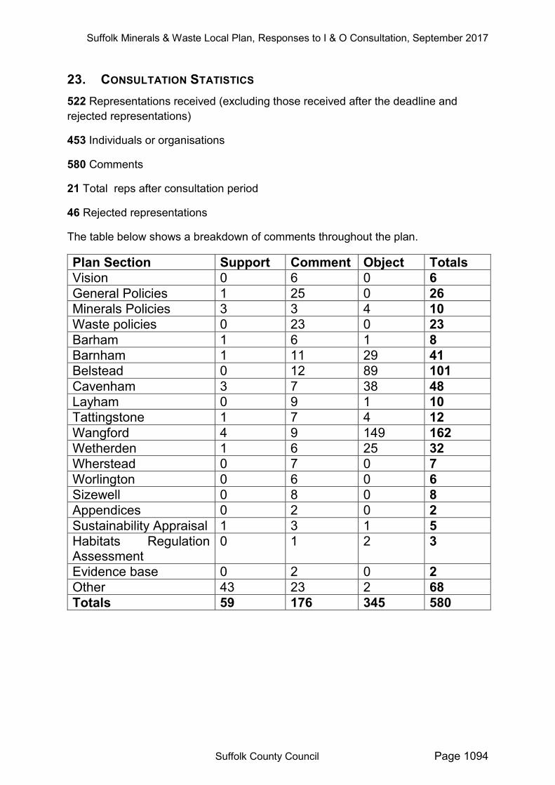
23. CONSULTATION STATISTICS 522 Representations received (excluding those received after the deadline and rejected representations)
453 Individuals or organisations
580 Comments
21 Total reps after consultation period
46 Rejected representations
The table below shows a breakdown of comments throughout the plan.
Plan Section Support Comment Object Totals Vision 0 6 0 6 General Policies 1 25 0 26 Minerals Policies 3 3 4 10 Waste policies 0 23 0 23 Barham 1 6 1 8 Barnham 1 11 29 41 Belstead 0 12 89 101 Cavenham 3 7 38 48 Layham 0 9 1 10 Tattingstone 1 7 4 12 Wangford 4 9 149 162 Wetherden 1 6 25 32 Wherstead 0 7 0 7 Worlington 0 6 0 6 Sizewell 0 8 0 8 Appendices 0 2 0 2 Sustainability Appraisal 1 3 1 5 Habitats Regulation Assessment
0 1 2 3
Evidence base 0 2 0 2 Other 43 23 2 68 Totals 59 176 345 580
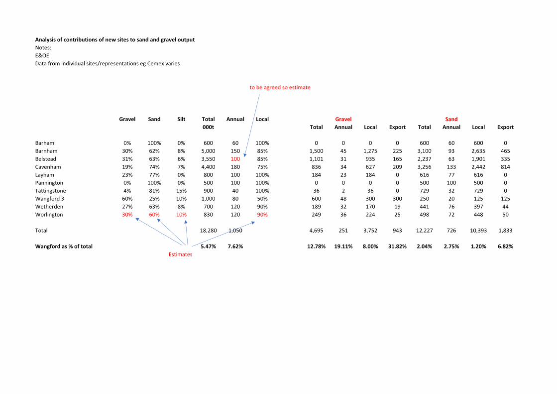
Analysis of contributions of new sites to sand and gravel output
Notes:
E&OE
Data from individual sites/representations eg Cemex varies
to be agreed so estimate
Gravel Sand Silt Total Annual Local Gravel Sand
000t Total Annual Local Export Total Annual Local Export
Barham 0% 100% 0% 600 60 100% 0 0 0 0 600 60 600 0
Barnham 30% 62% 8% 5,000 150 85% 1,500 45 1,275 225 3,100 93 2,635 465
Belstead 31% 63% 6% 3,550 100 85% 1,101 31 935 165 2,237 63 1,901 335
Cavenham 19% 74% 7% 4,400 180 75% 836 34 627 209 3,256 133 2,442 814
Layham 23% 77% 0% 800 100 100% 184 23 184 0 616 77 616 0
Pannington 0% 100% 0% 500 100 100% 0 0 0 0 500 100 500 0
Tattingstone 4% 81% 15% 900 40 100% 36 2 36 0 729 32 729 0
Wangford 3 60% 25% 10% 1,000 80 50% 600 48 300 300 250 20 125 125
Wetherden 27% 63% 8% 700 120 90% 189 32 170 19 441 76 397 44
Worlington 30% 60% 10% 830 120 90% 249 36 224 25 498 72 448 50
Total 18,280 1,050 4,695 251 3,752 943 12,227 726 10,393 1,833
Wangford as % of total 5.47% 7.62% 12.78% 19.11% 8.00% 31.82% 2.04% 2.75% 1.20% 6.82%
Estimates
37
Agenda Item 8
Cabinet
Report Title: Suffolk Minerals & Waste Local Plan
Meeting Date: 17 April 2018
Lead Councillor(s): Councillor Matthew Hicks, Cabinet Member for Environment, Public Protection and Broadband
Local Councillor(s):
All, but specifically John Field, Joanna Spicer, Victor Lukaniuk, Christopher Hudson, Gordon Jones, Colin Noble, David Wood, Tony Goldson, Michael Ladd, Jane Storey, Andrew Stringer, Louis Busuttil, Robin Millar, Russ Ranger
Director: Sue Cook, Interim Chief Executive
Assistant Director or Head of Service:
Sue Roper, Assistant Director Strategic Development, Growth & Highways Infrastructure
Author: Graham Gunby, Development Manager, Telephone
Brief summary of report 1. Following the previous approvals by Cabinet in 2015, 2016 and 2017, officers
have continued to progress the preparation of a Minerals & Waste Local Plan (the “Plan”) which will provide an updated framework for determining planning applications for minerals and waste development.
2. In 2017 a Preferred Options Draft Plan was prepared and consulted upon for a 6 week period ending in December. Representations made during that consultation have since been analysed to inform the preparation of the Submission Draft Plan. This draft Plan sets out policies related to minerals and waste planning applications and identifies 11 sites for minerals and/or waste development.
3. The approval of Cabinet and County Council is required before the next stage of the Plan making process can be undertaken. This will involve a further 6 week public consultation period. Representations made at this stage will be sent to the Planning Inspectorate along with the draft Plan and supporting documents. An Examination in Public (EiP) is expected to be held early in 2019.
4. Following the EiP the Planning Inspector will produce a Report which includes recommendations, including any changes required to be made to the Plan. The County Council will then adopt the Plan as planning policy.
38
What is Cabinet being asked to decide? 5. Cabinet is being asked to propose to County Council that it agrees:
i) to the publication of the Suffolk Minerals & Waste Local Plan, Submission Draft for a 6 week period of public consultation, following considerations of the information contained in this report including items a) to p) listed under sources of further information;
ii) to delegate to the Head of Planning the ability to make textural changes to the wording of the Plan and supporting documents prior to the start of the consultation after discussion with the Cabinet Member for Environment, Public Protection and Broadband;
iii) to delegate to the Head of Planning the ability to propose pre-submission modifications to the Plan following consultation after discussion with the Cabinet Member for Environment, Public Protection and Broadband;
iv) to the preparation of a Statement of Common Ground (if required by new Government policy) by the Head of Planning, after discussion with the Cabinet Member for Environment, Public Protection and Broadband, and;
v) to the submission of the Plan to the Planning Inspectorate together with supporting documents and representations made at the next round of public consultation.
Reason for recommendation 6. The County Council is required to keep its Local Plan for minerals and waste up
to date. Failure to produce an up-to-date Plan could result in the County Council’s minerals and waste plan-making function being put into special measures, resulting in the responsibility for the Plan being taken away and being produced by the Planning Inspectorate in consultation with the local community.
What are the key issues to consider? 7. Failure to plan for minerals extraction sites so that the landbank of permitted
reserves falls below the equivalent of seven years production for sand and gravel, at a level previously agreed with the East of England Aggregates Working Party, would seriously weaken the County Council’s position in the case of an appeal against the refusal of planning permission for a site by the Development and Regulation Committee.
8. Similarly, the County Council must make provision for the management of waste at a level previously agreed with other members of the East of England Waste Technical Advisory Body, otherwise a similar situation might arise. The aim is to achieve net self-sufficiency whereby the County Council permits sufficient waste management infrastructure to be able to manage a level of waste equivalent to that arising within Suffolk, whilst at the same time acknowledging that waste is imported and exported across the County border.
What are the resource and risk implications? 9. Previously the estimated total cost of preparing the Plan was estimated to be up
to £400,000 although it is now expected that the preparation of the Plan will cost less than this figure.
10. In terms of risk, as with any planning process it can be subject to legal challenge.
39
11. A further risk to the timescale is if the Planning Inspector requires modifications to the Plan before adoption including if they recommend inclusion, for example, of a previously excluded site.
12. The Plan was screened out by the Equalities Impact Assessment Panel at the Issues & Options stage as this is a high level document with no impacts identified under any category and because any issues would be dealt with at the planning application stage.
What are the timescales associated with this decision? 13. The adoption date of the Plan is timetabled for July 2019 although following the
submission of the Plan events are controlled by the Planning Inspectorate and are our best estimates. A Gantt chart setting out the remaining stages can be found at Appendix A.
14. A further stage of public consultation will take place before submission of the Plan to the Planning Inspectorate. The Submission Draft consultation will take place, subject to Cabinet’s and County Council Committee’s approval of the draft Plan, between 11 June 2018 and 23 July 2018.
Alternative options 15. Cabinet could choose to change the content of the document or the nature of the
proposed consultation exercise. 16. Not to prepare a Plan would be likely to result in the County Council’s minerals
and waste plan-making function being put into special measures, with the Plan being drawn up by the Planning Inspectorate in consultation with the local community. Until the Plan is in place, it would also cause difficulties in defending the refusal of planning permission for minerals and waste development at appeal.
Who will be affected by this decision? 17. Preparation of any Development Plan involves consultation with local
communities who are interested, in particular, in respect of the proposed sites in their locality.
18. Local communities have an opportunity to comment upon the proposed sites at this Submission Draft Plan Stage and those objections would be considered at the ‘Examination in Public’ stage. The Planning Inspector would make their recommendations within their Report upon the final content of the Plan.
19. Similarly, other interested groups and in particular minerals and waste businesses and landowners will be affected by this Plan and are likely to take the opportunity to comment on the contents.
Input from the Cabinet Committee 20. As described in para 22 below, previous Cabinet meetings had set up a Working
Party of councillors from the three largest parties to work on this on an on-going basis, taking account of changes to the document over a period of time. This had been set up and was working well before Cabinet Committees had been established. After discussion with the Monitoring Officer, it was considered that further consideration by the Cabinet Committee would have largely duplicated this work.
40
Main body of report 21. The following paragraphs set out the previous and future stages of Plan
production. Initial Cabinet Decisions (November 2015 and July 2016) 22. Cabinet agreed to initiate a review of the Suffolk Minerals Local Plan in
November 2015 and then agreed to combine the Minerals and Waste Local Plans into a single document in July 2016. It also agreed to set up a Working party consisting of a representative from each of the three largest parties. Before the most recent council elections the representatives were Councillors Hicks, Gage and Flood. Since the election, Councillor Wood has replaced Councillor Flood. The role of the Working Party is to comment on draft proposals and issues relevant to minerals and waste development.
Issues and Options Consultation (November 2016 to February 2017) 23. Following Cabinet’s decision, the Suffolk Minerals & Waste Local Plan Issues &
Options Consultation document was prepared. Then, following consideration by the Members of the Minerals & Waste Working Party, public consultation was undertaken between 28 November 2016 and 6 February 2017.
24. The Issues and Options document combined, updated and added to the existing minerals and waste policies. It also included a call for new minerals and waste sites. In response 89 representations were made that included 851 separate comments. These representations included proposals for 32 sand and gravel sites and 9 waste sites.
25. This information together with consultation with the Minerals & Waste Working Party then formed the basis for the Preferred Options Draft Plan.
Suffolk Minerals & Waste Local Plan Preferred Options Draft
26. The draft Plan set out a Vision, Aims and Objectives for minerals and waste development within Suffolk until 2036 and developed these into policies for use in the determination of minerals and waste planning applications. The draft Plan also identified where future minerals and waste development may be acceptably located and safeguarded existing minerals and waste facilities.
27. The draft Plan proposed the following sites for sand and gravel extraction and sets out planning constraints that would need to be considered as part of the planning application process:
a) Barham; b) Barnham c) Belstead; d) Cavenham; e) Layham; f) Tattingstone; g) Wangford h) Wetherden; i) Wherstead, and; j) Worlington.
41
28. Besides the potential of some inert waste recycling and disposal at the aforementioned sand and gravel sites to aid restoration, the Plan only identified one waste site at Sizewell A Nuclear Power Station which is currently being decommissioned. As part of this process radioactive wastes will need to be treated and temporarily stored.
Preferred Options Consultation (October 2017 to December 2017) 29. Following Cabinet’s decision in October 2017, the Suffolk Minerals & Waste
Local Plan Preferred Options Draft, was published for public consultation between 30 October 2017 and 11 December 2017. In response 520 representations were made. Full details are included in the Responses to Preferred Options Document (listed in the supporting information).
30. During the course of the consultation public drop-in sessions were held between the hours of 15:00 and 19:00 in the following locations:
a) Barham Village Hall; b) Barnham Village Hall; c) Belstead Village Hall; d) Tuddenham St Mary Village Hall; e) Layham Village Hall; f) Tattingstone Village Hall; g) Wangford Community Centre; h) Elmswell Blackbourne Centre; i) Wherstead Community Centre, and; j) Worlington Village Hall.
Responses to Representations 31. The representations have been all been considered and responded to in the
Responses to Preferred Options Consultation document and in the appropriate Site Selection Reports. These will be published as supporting documents to the consultation.
32. In essence, the comments upon the draft policies resulted in some redrafting and reordering. Further information is included in Appendix B and in the Responses to Preferred Options Consultation document.
33. In response to the analysis of the comments in respect of the proposed sites, the conclusion is that three of the sites would be reduced in area (see Appendix C). Site specific policies have also been introduced for all of the proposed sites to make clear the requirements that must be satisfied at the planning application stage. Further information is included in Appendix D (which summarises the representations on each site) and in the full Responses to Preferred Options Consultation document.
34. Whilst considering the site specific representations it became apparent that the robust site selection procedure had already covered many of the concerns that are mentioned including issues such as traffic, air quality, noise, amenity, ecology, landscape, heritage assets, groundwater, flooding, infilling, agricultural land etc.
42
35. Accompanying the draft Plan is a Sustainability Appraisal (SA) which assesses the potential economic, social and environmental impact of the draft Plan. This has been prepared by external consultants. The SA concludes that overall the Plan satisfies the sustainable development criteria. Comments were made about some inconsistencies in the SA and these have been fed back to the external consultants and changes made (see Section 19 of the responses document).
36. A Habitats Regulation Assessment (HRA) has also been prepared which assesses the impact of the draft Plan upon Special Protection Areas, Special Areas of Conservation and Ramsar sites. The HRA identifies that detailed consideration of the impact of sites close to or within these designated areas will need to be given at the planning application stage. Comments were made about the level of detail included in the HRA and as a result some limited changes were made (see Section 20 of the responses document).
37. A number of sites put forward as a result of the call for sites at the Issues & Options stage were not included in the Preferred Options Plan. One of these at Grove Farm, in the Gipping Valley between Creeting St Mary and Stowmarkert was the subject of a number of representations in support of the site not being included in the Preferred Options Plan (see Section 22 of the responses document).
38. At the Preferred Options stage a further site was put forward at Holton St Mary. However, no supporting geological information was submitted and therefore it has not been considered any further (see site selection report for Holton St Mary).
Suffolk Minerals & Waste Working Party
39. Councillors together with officers have visited all of the proposed sites and have concluded they are suitable for inclusion in the next round of public consultation
Proposed Pre-Submission Consultation Process (June 2018 to July 2018)
40. It is intended to publish the draft Plan for a six week period of public consultation beginning at 17:00 on the 11 June and ending at 17:00 on the 23 July 2018. To facilitate the consultation the following actions will be undertaken:
a) a press release will announce the start of the consultation; b) in excess of 900 emails will be sent out to statutory and non-statutory
consultees and those who previously made comments at the Issues & Options stage and Preferred Options stage;
c) in excess of 200 letters will be sent to residents and businesses within 250 metres of a proposed site;
d) adverts will appear on Facebook, Twitter and in the local press; e) a drop-in session will be held between 15:00 and 19:00 at venues close
to each of the proposed sand and gravel sites; f) all relevant documents will be available on the County Council website; g) representations can be made via the website, email or by letter.
41. The Representations made at this stage will be sent to the Planning Inspectorate along with the draft Plan and supporting documents prior to an Examination in Public (EiP) that is expected to be held early in 2019. At this point, the Council
43
could suggest amendments to the Plan responding to these consultations and these would be put to the Inspector alongside the original Review document.
42. Following the EiP the Planning Inspector will produce a Report which includes recommendations, including any changes required to be made to the Plan. The County Council will then decide whether it wishes to adopt the Plan as planning policy.
Impact of National Planning Policy Framework 43. The Government has recently published proposed changes to the National
Planning Policy Framework (see separate report on this Agenda). The full revised document is likely to be in place by the summer before the submission of the Local Plan Review. Accordingly, the Local Plan will be judged against the new Policy Framework. It appears that the only significant change that will need to be taken into account by the Local Plan Review is that there will be a requirement to prepare a Statement of Common Ground. This should evidence the work that has been undertaken with neighbouring authorities to address the wider need for minerals and waste facilities and with district councils to examine the effects on their development strategies.
44. As a new requirement, although the work has been done liaising with other councils, the preparation of a Statement of Common Ground has not begun. Therefore, the recommendations for this report include provision for the preparation of such a document by the Head of Planning, after consultation with the Cabinet Member for Environment, Public Protection and Broadband.
Conclusions
45. The Suffolk Minerals & Waste Local Plan Submission Draft now requires a 6 week period of public consultation before it can be submitted to the Planning Inspectorate for Examination in Public.
46. Following the EiP the Planning Inspector will produce a Report which includes recommendations, including any changes required to be made to the Plan. The County Council will then decide whether it wishes to adopt the Plan as planning policy.
47. The Plan will, once adopted, provide an updated framework for the determination of planning applications for minerals and waste development.
44
Sources of further information a) Appendix A: Timescale for the production of the Suffolk Minerals &
Waste Local Plan b) Appendix B: Areas removed following consultation c) Appendix C: Summary of objections to proposed policies d) Appendix D: Summary of objections to proposed sites e) Suffolk Minerals & Waste Local Plan – Submission Draft f) Suffolk Minerals & Waste Local Plan – Preferred Options Draft g) Suffolk Minerals & Waste Local Plan – Responses to Preferred
Options Consultation h) Suffolk Minerals & Waste Local Plan – Issues and Options
Consultation i) Suffolk Minerals & Waste Local Plan – Responses to Issues and
Options Consultation j) Suffolk Minerals & Waste Local Plan – Site Selection Reports k) Suffolk Minerals & Waste Local Plan – Strategic Flood Risk
Assessment l) Suffolk Local Aggregates Assessment (2017 data) m) Suffolk Waste Study n) Final Sustainability Appraisal o) Suffolk Minerals & Waste Local Plan Habitats Regulations
Assessment p) Suffolk Minerals & Waste Development Scheme Items e) to p) can be reached by following the link provided below. https://www.suffolk.gov.uk/council-and-democracy/consultations-petitions-and-elections/consultations/minerals-and-waste-local-plan-issues-and-options-consultation/
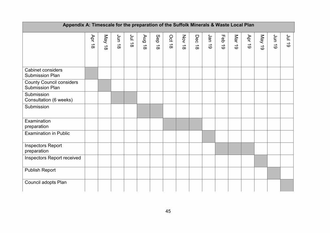
45
Appendix A: Timescale for the preparation of the Suffolk Minerals & Waste Local Plan
Apr 18
May 18
Jun 18
Jul 18
Aug 18
Sep 18
Oct 18
Nov 18
Dec 18
Jan 19
Feb 19
Mar 19
Apr 19
May 19
Jun 19
Jul 19
Cabinet considers Submission Plan
County Council considers Submission Plan
Submission Consultation (6 weeks)
Submission
Examination preparation
Examination in Public
Inspectors Report preparation
Inspectors Report received
Publish Report
Council adopts Plan
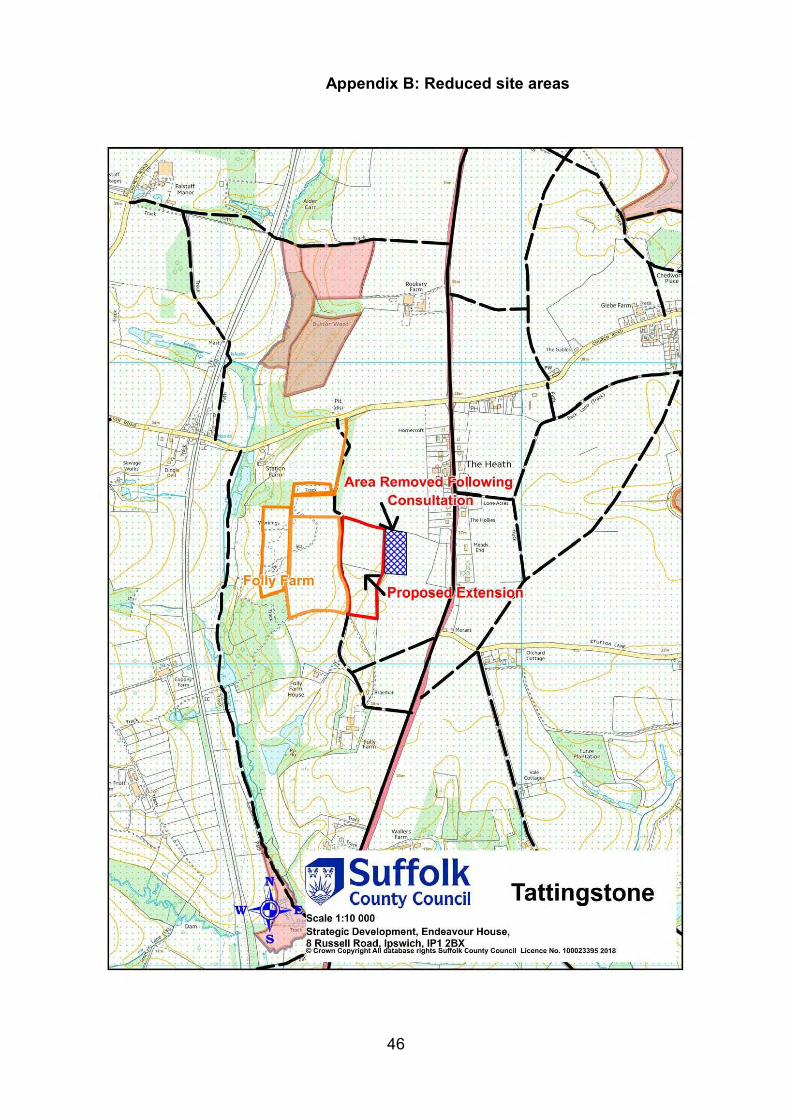
46
Appendix B: Reduced site areas
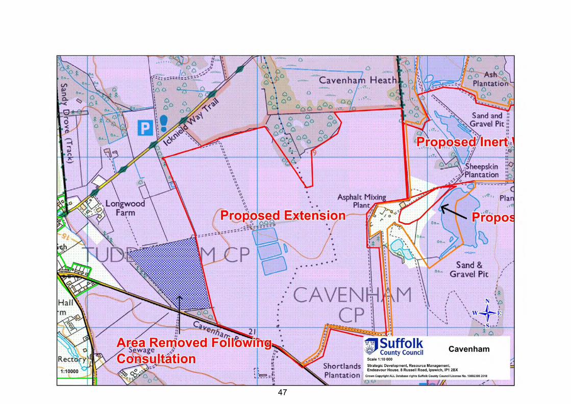
47
47
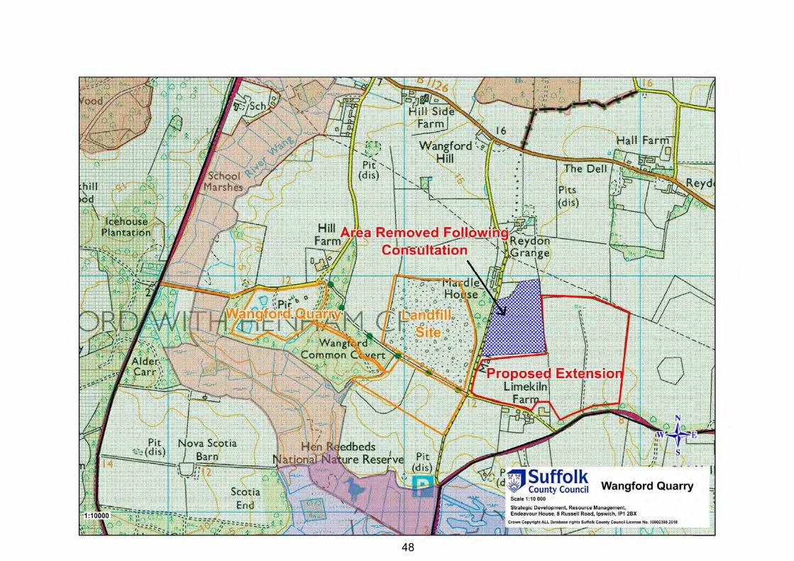
48
48
49
Appendix C: Summary of the objections to proposed policies
Vision, aims and objectives (see Section 2 of the responses document)
48. Energy Power Resources Ltd (EPRL) who operate the Eye Airfield Energy fromWaste plant were concerned the references in the Plan to net self-sufficiency inwaste management might prevent the importation of feedstock. This wasconfirmed as not being the case.
49. Essex County Council (ECC) asked for the limitations of net self-sufficiency inwaste management to be defined such as economies of scale. Further text wasadded to the paragraph 3.4 in response.
50. Historic England (HE) wanted reference to the “historic environment” added tothe Vision and “cumulative impacts” to Objective 7. Further text was added to thePlan in response. They were concerned that heritage assets were sufficientlyprotected and were referred to Policy GP4.
51. The Royal Society for the Protection of Birds (RSPB) wanted additional detail inrespect of the working, restoration and after-use of sites that would be linkedtogether in an overall biodiversity lead strategy. In response however, it isconsidered that the purpose of the Plan is to establish in principle where mineralsand waste development may take place. The detail of how the site would operateand the type of restoration and after-use is a matter for the planning applicationsstage.
52. The Suffolk Wildlife Trust (SWT) considers that the restoration of sites shouldprioritise ecology other potential restorations such as agricultural. The Plan doesnot however prioritise one particular type of restoration over another.
53. The Area of Outstanding Natural Beauty Team (AONB Team) criticised the KeyDiagram for not showing the full extent of the statutory designations such asSpecial Protection Areas. This is a drafting error and has been corrected. Theyalso criticised the lack of site assessment. This information is however containedwithin the Site Assessment Reports. They also wanted reference to “landscapecharacter, natural beauty and special qualities” included in the Plans policies.These aspects are adequately covered under Policy GP4 clause c).
Policy GP1: Presumption in favour of sustainable development (see Section 3 of the responses document)
54. The Minerals Products Association (MPA) and Cemex requested amendedwording to the supporting text to emphasize that the economic, social andenvironmental pillars of sustainable development are equal. Additional wordingwas added to paragraph 4.2.
55. Historic England (HE) wanted an example of how the Plan is relevant to thehistoric environment in the supporting text. Additional paragraph 4.6 was addedto the Plan.
56. The Suffolk Preservation Society (SPS) and the RSPB the wanted recognition inPolicy GP1 that the presumption in favour of sustainable development does notapply all cases for example in Areas of Outstanding Natural Beauty. It isconsidered however that clause b) already covers this point.
50
Policy GP2: Climate change mitigation and adaption (see Section 3 of the responses document)
57. The MPA wanted reference to the fact that travel plans should only be required where practical. It was considered however that the existing wording already covered this.
58. The EA suggested that sources of further guidance in respect of flooding etc should be provided. It is considered that pre-application discussions would adequately cover this if required.
59. The EA also suggest that reference to pluvial and fluvial flooding be included. Additional wording was added to the Policy under clause d).
Policy GP3: Spatial strategy (see Section 3 of the responses document)
60. ECC questioned whether the Spatial Strategy should be a policy or just an arm of the Aims and Objectives. It is considered that it is a useful Policy as it directs development towards the most appropriate areas albeit at a high level.
61. ECC questioned why the Spatial Strategy does not mention safeguarding sites and the bringing forward of new sites. The safeguarding and identification of sites is however covered under other policies.
62. ECC stated that the term “centres of population” should be replaced with the term “key centres of growth” because the existing term may include small centres of population. Reference to “major centres of population” has been added to the Policy.
63. ECC questioned the phrase “adverse impacts” and preferred “unacceptable” or “non-mitigatable.” Reference to “potentially significant adverse impacts” has been added to the Policy in response.
64. HE wanted local and small scale constraints shown on the Key Diagram. This is not considered practicable and the point is made in the Plan that it is a broad-brush approach.
65. EA wanted reference to recycling being located near to future infrastructure and and housing. This is however adequately covered by the existing wording.
66. SPS wanted heritage assets etc more strongly safeguarded within this policy. This and other policies in the Plan adequately address this aspect.
Policy GP4: General environmental criteria (see Section 3 of the responses document)
67. ECC want an amendment to the wording to clarify who applicants should engage with in pre-application discussions. Additional wording was added to paragraph 4.12.
68. HE requested that references to “Scheduled Ancient Monument” are changed to “Scheduled Monument.” This request has been complied with in paragraph 4.14. HE were also unhappy with the wording of Policy GP4 particularly in the absence of site specific polices. Additional wording including site specific policies has been added to the Plan.
69. NE requested the removal of the phrase “where appropriate” and the inclusion of text setting out the specific procedure for Habitats Regulation Assessment
51
(HRA). The phrase “where appropriate” has been removed from the Policy. Additional explanatory in respect of HRA procedure has not be added because it is not the Plans purpose to restate other legislation.
70. The EA wished to be included as a relevant consultee in the supporting text. They also wanted tidal and groundwater added to the list of criteria in Policy GP4. These changes have been made to paragraph 4.12 and the Policy under clause a). They requested that reference be made to the need for Flood Risk Assessment. They also wanted reference made to the Water Framework Directive and the need for Environmental Permits. These changes have not been made because it is not the Plans purpose to restate other legislation.
71. The SPS wanted reference included under Policy GP4 to the setting of heritage assets. This has been included in the Policy under clause f).
72. West Suffolk District Council suggest that the invitation for pre-application discussions be moved to the supporting text. The text has been moved accordingly to paragraph 4.12.
73. The SWT wanted the first line of the Policy amended to read “adequately assess and address”. This was added. They also wanted the mitigation hierarchy of “avoid, mitigate, compensate added to the Policy. It was considered however that this is not applicable to the Plan.
74. The AONB Team wanted reference to landscape character and quality included. It is considered however that landscape is however covered adequately under Policy GP4.
Policy MP1: Provision of land won sand and gravel (see Section 4 of the responses document)
75. ECC pointed out that there is no assessment of other relevant information. An assessment of other relevant information has been added to the supporting text.
76. The MPA, Cemex and Brett Aggregates (BA) claimed that the draft plan was deficient because it did not take into account other relevant information, did not plan for a seven-year landbank at the end of the Plan period, did not take account of the last three years sales and did not refer to a review of the Plan after five years. An assessment of other relevant information, the three-year average, the and the need to review has been added to the supporting text. Taking into account a review after five years there is no need to provide a seven-year landbank at the end of the Plan period in order to maintain a landbank of at least seven years at the end of the Plan period.
77. The Stour and Orwell Society objected to what they considered the gross over provision in the Plan and said that there was no justification. This apparent overprovision provides flexibility to the Plan to be able to take into account uncertainties of sites coming forward and the uncertain demand for sand and gravel considering the Governments aspirations for housing building as well as other large developments.
78. Waveney & Suffolk Coastal District Council suggested that allowance should be made for the requirements of house building. This has been taken into account hence more that an average of the last ten years sales has been provided for.
Policy MP2: Proposed sites for sand and gravel extraction (see Section 4 of the responses document)
52
79. SWT wished to be involved with the restoration and after-use strategies for sites which would be considered in detail at the planning application stage.
Policy MP3: Borrow Pits (see Section 4 of the responses document)
80. ECC and MPA question the 10km limit for distance between a borrow pit and construction site. ECC, MPA and BA suggest that borrow pit proposals need to justify why material should be taken from them rather than existing quarries. It is considered however that the applicant does not need to justify an overriding justification for the borrow pit over existing sites as the purpose of borrow pits is that they are closer to the construction project and in many cases, do not need to use the public highway; making them more sustainable to use, due to reduced carbon emissions from transport and reduced impact on local highways. This is also the reason for the distance limit is included.
81. The RSPB highlighted the potential benefits of and ecologically based restoration, which is acknowledged.
Policy MP4: Agricultural and public supply reservoirs (see Section 4 of the responses document)
82. The EA welcome this policy although they point out that stockpiles would not be welcomed in the flood plain. Any such issues would need to be resolved at the planning application stage.
Policy MP5: Recycled Aggregates (see Section 4 of the responses document)
83. ECC suggests that the temporary permission for recycling should be linked to the end date of the quarry. In response to these comments and ECC comments upon Policy WP8, Policy WP5 has been deleted and the policy content included under policy WP8.
Policy MP6: Cumulative environmental impacts and phasing of workings (see Section 4 of the responses document)
84. ECC suggests that cumulative impacts are expanded to include other forms of development. This policy is intended to address the over concentration of minerals workings issue.
85. Mineral Planning Services suggested alternative wording. However, the existing wording is preferred.
86. BA suggested that cumulative impacts should be addressed as part of the Environmental assessment process. Planning Practice guidance however recommends than Plans include policies on cumulative impacts.
Policy MP7: Progressive working and restoration (see Section 4 of the responses document)
87. ECC suggested that the wording of the Policy should be amended to refer to restoration proposals linking within existing “green infrastructure.” Appropriate wording has been included in the Policy.
88. Mineral Planning Services and BA wanted more emphasis on non-ecology based restorations. It is considered that the existing wording allows non-ecology based
53
restorations whilst recognising that non-ecology based restorations can still include an ecological component at the margins of the site for example.
89. HE wanted reference included to the historic environment but it is considered that this is included adequately in Policy GP4.
90. EA wanted more emphasis on ecology based restoration but it is considered that the current wording provides the right balance between different forms of restoration.
91. SWT supported the Policy. Policy MP8: Aftercare (see Section 4 of the responses document)
92. HE wanted reference included to the historic environment but it is considered that this is included adequately in Policy GP4.
93. EA want the involvement of NE and SWT in the long-term management of ecologically based restorations. Where appropriate these bodies would be consulted and involved.
94. SWT and the ANOB Team wanted a longer period than the standard five-year aftercare period. Where appropriate longer periods would be sought.
Policy MP9: Concrete batching plant and asphalt plants (see Section 4 of the responses document)
95. No representations received. Policy MP10: Safeguarding of port and rail facilities, and facilities for the manufacture of concrete, asphalt and recycled materials (see Section 4 of the responses document)
96. MPA, ECC and Cemex suggest that the 250m safeguarding zone and the consultation process should be mentioned in the Policy. Appropriate wording has been included in the Policy now renumbered MP9.
97. MPA, Brett and Cemex suggested including information on who is responsible for mitigation when development takes place within the vicinity of a safeguarded site. Appropriate wording has been included in the Policy now renumbered MP9.
Policy MP11: Minerals consultation and safeguarding areas (see Section 4 of the responses document)
98. ECC suggest stating which proposed developments are affected within a Mineral Consultation Area by type, area and whether it not designated within an adopted Local Plan would be helpful. The existing wording is however preferred with the exception of increasing the safeguarding consultation threshold to those developments of five hectares or more.
99. Gladman Developments wish to see the Policy amended to avoid creating the presumption that the resources defined will be worked. The terms “practicable” and “environmentally feasible” have been added to the Policy.
100. Suffolk Coastal & Waveney District Councils wanted information on inactive sites to inform the preparation of Local Plans. However, all known sites with planning permission or proposed sites in the existing and draft Plans are already included.
54
Policy WP1: Management of waste (Mt) (see Section 5 of the responses document)
101. EPRL were concerned that the concept of net self-sufficiency might prevent them bringing waste from outside of Suffolk to fuel the Eye Airfield Energy from Waste plant. This is not the case.
102. ECC wanted further clarification added to the text and Policy with regard to the need for waste management facilities and if there is or isn’t a need during the plan period. Text will be added to the effect that there is no immediate need although should such a need arise suitable policies have been included.
103. EA requested more emphasis in the Plan on waste reduction or re-use. However, this is a land-use Plan concerned with the delivery of minerals and waste development. Waste reduction and re-use is upstream of where land-use waste planning becomes involved.
Policy WP2: Proposed site for waste management (see Section 5 of the responses document)
104. ECC questioned the need for this policy as only a single site at Sizewell A is involved and WP16 is also included in the Plan. This Policy is important however because it proposes the site and refers to the Proposals Map which identifies the location of the site. Policy WP16 on the other hand is a generic policy for the treatment and storage of radioactive waste at Sizewell nuclear power stations which also includes Sizewell B and potentially Sizewell C if it is ever built.
Policy WP3: Existing or designated landuses potentially suitable for waste development (see Section 5 of the responses document)
105. ECC suggested that the supporting text should refer specifically to Policy WP3. The text has been amended accordingly.
106. Hacheston Parish Council made the comment that open air composting plants should not be encourage in the vicinity of housing and villages. It is considered that Policy GP4 which is cross referenced by Policy WP3 would safeguard residential amenity.
Policy WP4: Household waste recycling centres(see Section 5 of the responses document)
107. No comments received. Policy WP5: Open air composting (see Section 5 of the responses document)
108. ECC wanted the term “landfill activities” defined. Appropriate text has been added.
109. Hacheston Parish Council made the comment that open air composting plants should not be encourage in the vicinity of housing and villages. It is considered that Policy GP4 which is cross referenced by Policy WP3 would safeguard residential amenity.
Policy WP6: In-vessel composting facilities (see Section 5 of the responses document)
55
110. ECC wanted the term “landfill activities” defined. Appropriate text has been added.
111. Hacheston Parish Council made the comment that appropriate licences or permits should be in pace to help prevent odour and noise problems arising. However, Policy WP6 requires schemes for the management of odours and dust. Policy GP4 also requires proposals to address potential noise impacts. A permit would also be required from the EA.
Policy WP7: Anaerobic digestion (see Section 5 of the responses document)
112. ECC wanted the term “landfill activities” defined. Appropriate text has been added.
113. EA suggested that anaerobic digestion facilities would not be built on a temporary basis at landfill sites due to the capital investment required. This clause will remain however just in case such a proposal comes forward.
Policy WP8: Proposals for recycling or transfer of inert and construction, demolition and excavation waste (see Section 5 of the responses document)
114. ECC commented that Policy WP8 and Policy MP5 overlap and that Policy WP8 seems to allow recycling to extend the life of the landfill. In response Policy MP5 has been deleted and Policy WP8 amended to tie the life of the recycling to the landfill.
Policy WP9: Waste transfer stations, materials recycling facilities, end of life vehicle facilities and waste electrical and electronic equipment recovery facilities (see Section 5 of the responses document)
115. ECC wanted the term “landfill activities” defined. Appropriate text has been added.
Policy WP10: Residual waste treatment facilities (see Section 5 of the responses document)
116. ECC wanted the term “landfill activities” defined. Appropriate text has been added.
Policy WP11: Approval of sites for the disposal of inert waste by landfilling or landraise (see Section 5 of the responses document)
117. ECC suggested that other waste projects should be included under acceptable types of development. The current list comprising of the “restoration of a former mineral extraction void” or “agricultural improvement” is considered appropriate.
118. Brett wanted clarification as to want is meant by the term “no acceptable alternative form of waste management” and suggested that criteria a, b and c should be alternatives rather than criteria that all applications should meet.
119. Clarification has been added to the effect that “no acceptable alternative form of waste management” refers to management further up the waste hierarchy. The Policy has also been amended so that “restoration of a former mineral extraction void” or “agricultural improvement” are alternative forms of acceptable development.
56
120. Policy WP12: Disposal of non-hazardous waste by landfilling or landraise (see Section 5 of the responses document)
121. EA indicated that non-hazardous and inert landfill would need to be assessed against the EA groundwater protection documents. This is a matter for the EA.
122. Reference to hazardous waste has been added to this policy in response to Viridor’s comment that Plan had no policy for hazardous waste.
123. Policy WP13: Mining or excavation of landfill waste (see Section 5 of the responses document)
124. No comments received. 125. Policy WP14: Waste water treatment facilities (see Section 5 of the responses
document) 126. No comments received. 127. Policy WP15: Transfer, storage, processing & treatment of hazardous
waste (see Section 5 of the responses document) 128. ECC wanted clarification as to what a “small proportion” of the overall waste
meant. The text has been amended to refer to 5%. 129. Policy WP16: Treatment and storage of radioactive waste at Sizewell
nuclear power stations (see Section 5 of the responses document) 130. The Nuclear Decommissioning Agency suggesting amending the policy by
removing the words “treatment and storage” and inserting “management.” They also wanted references to the AONB and Policy GP4 removed. Finally, they also wanted references to “financially viable” removed and “preference” inserted when considering the use of rail under clause e). The existing wording is however preferred.
131. Policy WP17: Design of waste management facilities (see Section 5 of the responses document)
132. HE wanted reference to the setting included. The text has been amended accordingly.
133. West Suffolk District Council wanted the apparent tautology between clauses d) and e) examined. No change is proposed other than the deletion of “are” at the end of clause d).
134. Policy WP18: Safeguarding of waste management sites (see Section 5 of the responses document)
135. ECC wanted the safeguarding distances set out in the policy and the consultation mechanism set out as well. These changes have been included in the Policy.

57
Appendix D: Summary of the objections to proposed sites
Proposed extensions to Barham Quarry (see Section 6 of the responses document)
136. 8 representations were received in respect of the proposed extensions to the existing permitted workings. The main issues are discussed below.
137. BA supported the inclusion of the site. 138. An objection from a local resident was received which raised concerns in respect
of the potential impact upon the residential amenity at The Lodge, Church Lane, and the adequacy of the local highway network. However, the distance between the proposed eastern extension and the residential property is considered sufficient to avoid any significant impacts from noise and dust. The local highways network is already supporting the existing operations at Barham Quarry without problems arising.
139. HE wanted reference to the fact that the site is within the setting of a Shrublands Park which is a Registered Park and Garden and on the Heritage at Risk Register. Appropriate wording has been inserted within the Plan.
140. NE are concerned about the potential impact upon the Geological Site of Special Scientific Interest. A site specific Policy MS1: Barham, has been included in the Plan which requires applicant to address potential impacts upon the SSSI.
141. RSPB point out that Turtle Dove and Nightingale are present in the vicinity of the site and the working and restoration should be designed to take this into account. Appropriate text has been added to the Plan.
142. EA were concerned about the loss of trees along the northern boundary of the site. The retention or otherwise of these trees would be determined at the detailed planning application stage.
143. SPS where concerned about the impact upon the setting of the Grade 1 listed Church of St Mary. It has already been determined by Heritage England that there would no impact.
144. SWT were concerned about the implications of extraction and restoration on existing and future ecological interest. A site specific Policy MS1: Barham has been included in the Plan which requires applicant to address potential impacts upon natural history interests. Policy MP7: Progressive working and restoration, gives preference to restoration schemes that incorporate a net gain for biodiversity.
Proposed extension to Barnham Quarry (see Section 7 of the responses document)
145. 41 representations were received in respect of the proposed extension to the existing permitted workings. The main issues are discussed below.
146. The site is currently agricultural land farmed by tenants who believe that they would be required to vacate the farm and tied houses if the development went ahead. This is however an issue between the landowner and the tenant and not a material planning consideration.
147. Objections have been raised to the site on the basis of the potential impact on features of ecological interest. In particular the site is within the Breckland
58
Special Protection Area which has been designated as it is used regularly by 1% or more of the Great Britain population of Stone Curlew, European Nightjar and Woodlark. The Stone Curlew is a ground nesting bird whose nests have been recorded in the general vicinity of the proposed extension site. However, the proposals are to work the mineral outside of the Stone Curlew nesting season, the details of which would be confirmed during the planning application process. Nightjar and Woodlark are less likely to nest in the open farmland of the site.
148. Concern was also expressed that quarry traffic would access the site via Barnham. A Traffic Management Plan would be required at the planning application stage which would prohibit quarry traffic routeing via Barnham except in the case of local deliveries.
149. Objections were also received as to the safety of children at Elveden School. The existing route that the quarry traffic would take in the vicinity if the school is the former A11 and the level of traffic would be much lower than when the carriageway formed part of the A11. The existing planning permission has conditions (which would apply to the proposed extension) attached that also address road safety and amenity concerns in respect of the school. These conditions restrict the times when road going vehicles can access the quarry to outside of school drop-off and pick-up times. They restrict the speed of vehicles to 20mph. They also ensure that the highway would be kept clean and that all loads would be sheeted.
150. One comment was received to the effect that only inert wastes should be used to restore the site and this is included in the site specific policy.
151. Representations were received highlight the number of services which cross the site including a high pressure gas main, overhead power lines and irrigation pipes. The Plan has been amended to require applications to state how these would be safeguarded or that they would be removed from the site.
152. National Grid (NG) indicate that there is a high pressure gas main which crosses the site, and that the 12.5 metre easements either side of the pipeline should be left undisturbed. Appropriate has been incorporated into the site specific Policy MS2: Barnham.
153. Barnham Parish Council objects to the inclusion of the site in the Plan for the following reasons: the site is not really a quarry extension as the existing quarry has never produced any sand and gravel; the loss of an agricultural tenant’s land; the impact upon residential amenity; the impact of heavy goods vehicles; it is contrary to Policy GP3; the impact on ecology; the visual impact; the potential to cause flooding; it is contrary to the Aims, Objectives and Policies of the Plan; only a small number of jobs would be created, and; the removal of the would not create a shortfall of sand and gravel. In response it is concluded that the site is suitable for inclusion in the Plan and could be worked without unacceptable environmental impacts arising in accordance with the Aims, Objectives and Policies of the Plan.
154. Norfolk Wildlife Trust (NWT) has concerns over the air quality impacts upon rare plants and Special Protection Area birds. The details of working and mitigation would be determined at the detailed planning application stage. The site specific Policy MS2 Barnham requires proposals to address potential impacts upon ecological features.
59
155. County Councillor Joanna Spicer objects to the inclusion of the site in the Plan for the following reasons: misleading consultation; inaccurate site size; haul route not shown; stock piling area not shown; rejected areas unclear; proposed nearby industrial area not shown; former mustard gas factory not shown; British Trust for Ornithology not consulted; owner of Gorse Industrial Estate not consulted; Ministry of Defence not consulted; borrow pit not in previous minerals plan; site is not an extension; impact on residential amenity; impact upon Gorse Industrial Estate; impact of processing plant; noise and dust; impact of haul route on Site of Special Scientific Interest; impact on Eleveden School; Impact on Stone Curlew and Woodlarks. In response it is concluded that the site is suitable for inclusion in the Plan and could be worked without unacceptable environmental impacts arising in accordance with the Aims, Objectives and Policies of the Plan.
156. HE wanted policy content added to safeguard and enhance the setting of
Barnham Bomb Store Scheduled Monument and to highlight the potential that archaeological remains within the site may require preservation in situ. Appropriate wording has been added to the site-specific Policy.
157. NE wanted policies to require adequate mitigation for the extensive ecological designations within and around the site and a net benefit to biodiversity. Appropriate wording has been included in the site-specific Policy.
158. EA wanted polices to take account of inert only waste for restoration, groundwater protection, controlled waters and flood risk. Appropriate wording has been included in the site-specific Policy. The EA also wanted confirmation that a Strategic Flood Risk Assessment had been carried out which it has and is included as part of the evidence base for the Plan.
159. RSPB wanted detailed proposals for the mitigation in respect of the ecological designations within the site and surrounding the site. However, it is considered that such detailed information is something that is considered at the planning application stage rather than in a Plan or accompanying Habitats Regulation Assessment.
160. West Suffolk District Council (WSDC) queried if part of the site is within Forest Heath which it is. They also indicated that the site is important for nature conservation and that a gas main runs across it. These points are agreed. WSDC recommended that NE, the Forestry Commission and the Health and Safety Executive are consulted, which they have been.
161. SWT wanted to draw attention to the sites nature conservation and indicated that a Habitats Regulation Assessment should be provided, which it has.
Proposed new sand and gravel quarry at Belstead (see Section 8 of the responses document)
162. 101 representations were received in respect of the proposed new site. The main issues are discussed below.
163. Objections were made in respect of the A12 Copdock interchange which suffers from traffic congestion at certain times causing vehicles to divert via Copdock village. A Traffic Management Plan would be required which would prohibit quarry traffic from travelling via this route.
60
164. Brockley Wood is a County Wildlife Site and concern was expressed as to the preservation of this site. Proposals to develop the site would be required to protect Brockley Wood.
165. There are a number of ancient trackways which cross the site and concern was expressed as to the preservation of these. Proposals to develop the site would be required to protect these ancient trackways.
166. There are a number of residential properties in the vicinity of the site including Bentley Old Hall which is a Grade II* Listed Building. Proposals to develop the site would be required to protect these properties and the amenity of their residents.
167. Belstead Parish Council objected on the grounds of noise, dust, detrimental impact upon the amenity of local residents, quarry traffic through villages, impact upon wildlife, public footpaths, infilling with waste. In response it is concluded that the site is suitable for inclusion in the Plan and could be worked without unacceptable environmental impacts arising in accordance with the Aims, Objectives and Policies of the Plan.
168. Copdock and Washbrook Parish Council objects on the grounds of highways impacts, need, impact upon listed buildings, noise impacts, dust and air quality impacts, light pollution, public amenity, ecological impacts, impacts upon rights of way including the ancient trackways, unavailability of site selection report. In response it is concluded that the site is suitable for inclusion in the Plan and could be worked without unacceptable environmental impacts arising in accordance with the Aims, Objectives and Policies of the Plan.
169. EA request that the watercourse in the northern part of the site be preserved and enhanced with native planting. Compensatory hedgerow planting should be undertaken for that hedgerow lost. Compensatory ditches and ponds maybe required where damp ditches are lost. Appropriate text has been added to the site specific Policy MS3 Belstead.
170. SPS state that references to archaeology need to be strengthened to endure that evaluation is carried out. No reference is made to Grade II listed Charity Farmhouse and Crope Hall. Appropriate text has been added to the text and site specific Policy MS3 Belstead..
171. Store & Orwell Society (SOS) comment that the site forms part of a highly attractive and visible mosaic of farmland and ancient woodlands on the southern approach to Ipswich and its working would set a highly undesirable precedent. It is considered the site could be adequately screened by a combination of existing woodland, hedgerows, bunding and advanced planting.
172. SWT are concerned about the potential impact upon dormice. Appropriate text has been added to the site specific Policy MS3 Belstead.
Proposed extensions to Cavenham Quarry (see Section 9 of the responses document)
173. 48 representations were received in respect of the proposed extensions to the existing permitted workings. The main issues are discussed below.
174. The subsequent backfilling of part of the existing quarry to return to pre-extraction levels would result in a doubling of existing lorry movements which is of great concern to the residents of Cavenham and Tuddenham St Mary. It is considered
61
that evidence would need to be provided at the planning application stage to demonstrate that there would not be an unacceptable impact on amenity from the additional traffic.
175. Objections have been raised to the site on the basis of the potential impact on features of ecological interest. In particular the site is within the Breckland Special Protection Area which has been designated as it is used regularly by 1% or more of the Great Britain population of Stone Curlew, Nighjar and Woodlark. The Stone Curlew is a ground nesting bird whose nests have been recorded in the general vicinity of the proposed extension site. However the phased working of the existing site together with Stone Curlew friendly restoration had been considered acceptable by Natural England at the time of previous planning applications.
176. The proposed site was considered to be very large and to encroach upon Tuddenham St Mary. It is also estimated that not all of the site would be worked by the end of the plan period in 2036 based on projected rates of extraction. The operator has also confirmed that the seam of sand and gravel is thin on the western extremity of the site. The area of the site has therefore been reduced by removing the western extremity of the site from the Plan.
177. Two representations were made in support of the proposed extension on behalf of Allen Newport.
178. HE were of the opinion that the Black Ditches Scheduled Monument should have text safeguarding it within the Plan. Appropriate text has been added to the Plan.
179. NE inidcate that no quarrying should take place during the Stone Curlew nesting season. The existing quarry however does not follow this pattern and therefore considering the large area involved it is considered that a phased approach to working would be appropriate.
180. EA indicate that there should be no dewatering of the proposed quarry extension due to the potential impact on the Cavenham and Icklingham Heath Site of Special Scientific Interest. They also indicate that only inert waste materials should be used in the proposed inert waste tipping area. They are concerned that adequate precautions are taken in respect of the area of the site that is within Flood Zone 2. Appropriate text has been added to the Plan.
181. RSPB want greater detail included in the accompanying Habitats Regulations Assessment. It is considered however that the HRA is at the in-principle level and that an Appropriate Assessment including the requisite detail should be provided at the planning application stage.
182. West Suffolk District Council indicate that the site has a number of constraints including statutory nature conservation ones and those for flood protection. They say that Natural England should be consulted which they have been.
183. SWT note the Special Protection Area and Site of Special Scientific Interest designations and comments that working and restoration should maximise the areas value for the species for which these designations exist. This would follow the existing practice.
Proposed extension to Layham Quarry (see Section 10 of the responses document)
184. 10 representations were received in respect of the proposed extension to the existing permitted workings. The main issues are discussed below.
62
185. Doubt was expressed as to the economic viability of the deposit and the remoteness of the quarry to serve the general market. Consideration of the submitted grading analysis indicates a grading of 23% stone, 61.1% plus sand and no more than 15.9% silt. This is not unusual in Suffolk. In terms of location the quarry has already been successfully operating for several decades although it is dormant at the present time.
186. Other responses concentrated upon the practical issues such as noise and dust attenuation and the crossing of Popes Green Lane. It is concluded that the extension could be operated acceptably in planning terms and that the detail would be considered at the planning application stage.
187. NE, SPS and the AONB Team made reference to the fact that the proposed site is within the setting of an AONB and that proposal to work the site will ned to address this. Appropriate text has been added to the site-specific Policy MS5 Layham.
188. SPS say that archaeological evaluation should be carried out before determination. The advice of the County Archaeologist is that a planning condition should be attached to any planning permission that is granted. The advice of the County Archaeologist is preferred.
189. SWT are concerned that there may be Dormice maybe affected by the proposal. Appropriate wording has been added to the site-specific Policy MS5 Layham.
Proposed extension to Tattingstone Quarry (see Section 11 of the responses document).
190. 12 representations were received in respect of the proposed extension to the existing permitted workings. The main issues are discussed below.
191. The proximity of the proposed extension to “The Heath” area of Tattingstone was the underlying issue with this site. It is noted that there is an established belt of coniferous trees that screen the southern part of the proposed extension and which also screen views very effectively from the east. Much of the site would remain unworked by the end of the Plan period based on the projected rates of working. It is concluded that the area of the site should be reduced so that the boundary of the northern part of the site could be screened by an extension of the existing tree belt to the south.
192. The whole premise of the proposal was questioned by one objector. However, the County Council is satisfied that the site selection procedure is robust.
193. The previous performance of the operator in observing the conditions attached to the existing permission was also a source of one objection. However, the past performance of an operator is not something which can be taken account when identifying areas considered suitable in principle for future extraction. This will be a matter for monitoring/enforcement of any future planning permissions.
194. One representation commented that the proposal was reasonable, so long as adequate tree planting was carried out.
195. One representation was made in support of the proposed extension on behalf of Shotley Holdings.
196. Tattingstone Parish Council objects to the proposed extension because of the potential noise, dust, traffic, and visual impacts upon the amenity of local
63
residents. To lessen the potential for such impacts the northern section eastern boundary of the site has been redrawn to bring the workings further away from the village.
197. NE and SPS advise that the site is within the setting of the proposed extension to the AONB and wants this to be included in the Plan. Appropriate text has been added to the site specific Policy MS6 Tattingstone..
198. EA would like the existing trees and ditches surrounding the site retained or compensated for. Appropriate text has been added to the Plan.
199. The Stour and Orwell society object to the extension as it will have a detrimental impact of upon the landscape. The sand is not needed and the site has been promoted as a way of extending the life of the waste recycling operation. It is considered however that the site could be screened by the use of planting and bunding satisfactorily. The sand also contributes towards the identified shortfall in provision during the Plan period to 2036.
200. SWT draw attention to the potentially important impacts upon ecologically which must be where required mitigated.
201. AONB Team queries why there is no reference to the AONB when discussing landscape and ecology in the supporting information. Appropriate text has been added to the site specific Policy MS6 Tattingstone.
Proposed extension to Wangford Quarry (see Section 12 of the responses document)
202. 162 representations were received in respect of the proposed extension to the existing permitted workings. The main issues are discussed below.
203. Objections were made on the basis that sites should not be proposed within the Suffolk Coasts & Heaths Area of Outstanding Natural Beauty. The National Planning Policy Framework (NPPF) provides the following guidance in respect of development within the AONB.
204. NPPF paragraph 115 states that great weight should be given to conserving landscape and scenic beauty in AONBs which have the highest status of protection in relation to landscape and scenic beauty.
205. NPPF paragraph 116 indicates that planning permission for major development (which would include sand and gravel extraction) should be refused except in exceptional circumstances and where it can be demonstrated that it is in the Public Interest. It states that such proposals should be considered in the light of an assessment of:
i) the need for the development, including in terms of any national considerations, and the impact of permitting it, or refusing it, upon the local economy;
ii) the cost of, and scope for, developing elsewhere outside the designated area, or meeting the need for it in some other way; and;
iii) any detrimental effect on the environment, the landscape and recreational opportunities, and the extent to which that could be moderated.
64
206. NPPF paragraph 144 states that when determining planning applications local authorities should as far as practicable provide for minerals from outside of AONBs.
207. Having appraised the proposed site within the context of the NPPF and other material considerations it was considered justified to include the Lime Kiln Farm within the Plan because of the following exceptional reasons:
i) the existing quarry at Wangford has been in operation for several decades and is an important part of the local economy;
ii) there is a shortage of gravel in the market area served by this quarry and the proposed extension contains an unusually high percentage of gravel (60%) compared to most other quarries in Suffolk and Norfolk;
iii) the market area includes both Ipswich and Norwich and the gravel from Wangford is used to supplement the sand rich deposits from other quarries within the market area including those of rival companies;
iv) processing is able to produce a regular spherical gravel grade product which can be used for specialist uses such as filter beds;
v) there are no other acceptable proposed sites within the north-east area of Suffolk;
vi) alternative sources such as crushed rock, recycled aggregates and marine dredged sand and gravel are unable to provide a suitable alternative due to availability or economic viability;
vii) it is considered that in respect of the impact upon the wider AONB, the recreation within the area, the nearby residential properties and ecological designations, the proposals could be mitigated to an acceptable extent. to
208. Objections were also made on the basis that the potential impact the proposed workings would have upon the Hen Reedbeds and wider area which have overlapping Ramsar, Special Protection Area, National Nature Reserve, Site of Special Scientific Interest, County Wildlife Status.
209. Having assessed the site within the context of these designations it considered that it could be worked without significant detrimental impacts upon these designated sites. This consideration takes into account not only the separation distance but also the topography, intervening vegetation, current arable land management, potential ecological enhancement following restoration and the proposal to only work the minerals above the watertable.
210. Further objections were received from residents of residential and holiday properties in the vicinity of the site. Cemex (who operate the existing quarry and who are behind the proposed extension) have suggested amending the boundary of the site by removing the field closest to Wangford Farm which includes both types of property. Considering the distance between the amended boundary of the proposed extension site and the closest property at Wangford Farm, it is considered that there would not be significant impacts in terms of visual impact, noise or dust.
65
211. Cemex support the inclusion of the site in the Plan (further supporting information was submitted and this is included in the addendum to the site selection report, including the proposed reduction in the site area).
212. Blythburgh with Bulcamp and Hinton Parish Council also support the inclusion of the site within the Plan.
213. Waveney District Ramblers object on the basis of the damage to the AONB and byway 1627 resulting in the loss of the only walking route to the Hen Reedbeds. As explained above there are reasons why minerals extraction in the AONB is justified. The byway would also remain open, albeit with plant crossing it at intervals.
214. Reydon Parish Council and Southwold & Reydon Society object to the proposed site on the basis of late consultation, misleading site name, misleading information, impact upon AONB, impact upon Hen Reedbeds, size of site, impact upon Mardle Lane, visual impact of bunding, no justification for working within the AONB, and only three employees would be affected. It is considered however that there is justification for working this site within the AONB due to the reasons set out above and in the site assessment report. It is also considered that the consultation process was not misleading.
215. AONB Team and Suffolk Coastal & Waveney District Councils object to the site because there is a lack of consideration of National policy, no overriding argument for inclusion has been made, there is little detail on the likely impacts upon the AONB and sites protected for their ecological interest. Text clarifying how the proposed site meets the National policy has been added to the Plan. Further detail on the likely impacts would be considered at the planning application stage.
216. Wangford with Henham Parish Council object to the proposed site because of the unacceptable impact on the landscape within an AONB, on the local ecology, on the residential amenities of nearby properties by reason of noise, fumes and general disturbance, and on wildlife. They also do not consider that there are any exceptional circumstances to justify working within the AONB and that for the same reasons as the two excluded Cemex extension sites this site should be excluded too. The Parish Council considered that even with the most stringent of planning conditions the site would still be unacceptable. It is considered however that there is justification for working this site within the AONB due to the reasons set out in the site assessment report.
217. NE in principle have no outright objection subject to further information being provided which demonstrates that impacts to protected landscape and designated features have been avoided where possible and mitigation measures put in place for those impacts which cannot be avoided, and a programme of monitoring agreed to ensure the measures are effective. The planning process including the Plan would ensure these goals would be met.
218. EA state that the site is located within Source Protection Zone 1 which would normally preclude infilling including with inert wastes. The ecological importance of the surrounding area is also noted. Infilling does is not proposed and mitigation of potential impacts on the wider area would be required.
219. SPS say that the site which is within the AONB is environmentally damaging and should not be included. The site assessment process carried out indicates that
66
there is justification for working within the AONB that any impacts could be moderated to an acceptable extent.
220. RSPB criticise the lack of detailed mitigation provided. The details of mitigation would be considered in depth at the planning application stage.
221. SWT want the site worked and restored in a way that maximises the areas ecological potential. The consideration of ecological aspects would be carried out in depth at the planning application stage.
Proposed extension to Wetherden Quarry (see Section 13 of the responses document)
222. 32 representations were received in respect of the proposed extension to the existing permitted workings. The main issues are discussed below.
223. The proximity to existing and proposed new properties in Elmswell is the main issue with this site. However, the separation is considered sufficient to avoid any significant impacts from noise and dust.
224. The previous performance of the operator in observing the conditions attached to the existing permission was also a source of objections. However, the past performance of an operator is not something which can be taken account when identifying areas considered suitable in principle for future extraction.
225. Two representations were made in support of the proposed extension, one on behalf of Aggmax and one on behalf of a local resident.
226. Elmswell and Wetherden Parish Councils both argue that the proposed extension is unacceptable considering the existing and proposed housing developments and the lack of enforcement against breaches of planning control. The proposed housing would be far enough away to enable a suitable buffer zone to be provided. The previous performance of the operator cannot be taken into account when considering the inclusion of the site in the Plan.
227. Endurance Estates are the developers behind the proposed new housing to the north of the proposed quarry extension. They expect to have planning permission in place prior to that of the quarry extensions and therefore expect that the extension proposals should at the planning application provide mitigation for the housing development as permitted. Endurance want this and a more accurate description of the housing development set out in the Plan. Appropriate text has been added to the Plan.
228. EA would like compensatory hedgerows and ditches proposed in lieu of those lost as a result of this development. Appropriate text has been added to the site-specific Policy MS8 Wetherden.
229. SPS want archaeological evaluation before determination of the planning application. Advice from the County Archaeologist, which is based upon knowledge of the adjoining site is however that this should be secured by a planning condition.
230. RSPB and SWT suggest ecological enhancements could be incorporated into the restoration of the site in accordance with Policy MP7. This is agreed.
67
Proposed extension to Wherstead Quarry (see Section 14 of the responses document)
231. 7 representations were received in respect of the proposed extension to the existing permitted workings. The main issues are discussed below.
232. Concerned was raised particularly by the residents of Belstead (as part of their representations about the Belstead site) to the potential for quarry traffic to route via the village particularly when the A137 becomes congested at the junction with the A12. A Traffic Management Plan will be required as part of the planning permission to remove this possibility.
233. A single comment was also made about the need to preserve public rights of way. A bridleway runs along the boundary of the site and will be safeguarded.
234. NE draw attention to the fact that the proposed extension is 800m form Feston and Cutler’s Woods with Holbrook Park SSSI and within the buffer zone for the proposed extension to the AONB. The SSSI is already mentioned in the Plan and reference will be added to the proposed AONB extension in the site-specific Policy MS9 Wherstead.
235. EA would like compensatory hedgerows and ditches proposed in lieu of those lost as a result of this development. Appropriate text has been added to the site-specific Policy MS9 Wherstead.
236. SPS want archaeological evaluation before determination of the planning application. Advice from the County Archaeologist, which is based upon knowledge of the adjoining site is however that this should be secured by a planning condition.
237. The Stour & Orwell Society object to the site because of the poor quality minerals, impact upon the Special Landscape Area, impact on the Ancient Woodland, Impact on Public Rights of Way, restoration using inert fill materials. The site however does comply with the site selection criteria and therefore is included in the Plan.
238. SWT draw attention to the nearby Ancient Woodland that is a designated as a County Wildlife Site that provides habitat along with hedgerows and scrub for dormice. SWT would also like to see the ecological potential of the site maximised through sympathetic restoration. A site specific Policy MS9 Wherstead has been added to the Plan which includes reference to dormice and existing Policy MP7 encourages ecology component to restoration.
239. Belstead Parish Council expressed concern about lorry movements through Belstead. A site specific Policy MS9 Wherstead has been added to the Plan which includes reference to a traffic management plan the aim of which would be to avoid any quarry traffic taking a short cut through Belstead.
Proposed extension to Worlington Quarry (see Section 15 of the responses document)
240. 6 representations were received in respect of the proposed extension to the existing permitted workings. The main issues are discussed below.
68
241. A single objection was received from a resident who lives at The Oaks, Worlington. Concerns were expressed about the potential increase in lorry movements through Worlington, increased noise arising from lorries and the proposed extensions which are closer to the village than the existing site, and depreciation in property values.
242. The proposed extension is a continuation of the existing workings and therefore the overall level of traffic would not increase. The distance between the proposed northern extension and residential properties is considered sufficient to avoid any significant impacts from noise. Depreciation of property values is not a material planning consideration.
243. NE say that the site is not within the buffer zone for the Breckland Farmland SPA, 244. EA say that the site is located over a principal aquifer and proposals should take
into account the impacts upon the local water environment. Reference has been added to the site-specific Policy MS10 Worlington.
245. SPS want archaeological evaluation before determination of the planning application. Advice from the County Archaeologist, which is based upon knowledge of the adjoining site is however that this should be secured by a planning condition.
246. West Suffolk District Council say that there is no bypass planned for the site and that that text should be removed. The text has been amended accordingly.
247. SWT say that the description of Badlingham Lane CWS is incorrect as it is not Ancient Woodland but is designated for its Breckland Flora. The text and site specific policy have been amended accordingly. In addition, SWT would also like to see the ecological potential of the site maximised through sympathetic restoration. Policy MP7 encourages ecology component to restoration.
Proposed disposal of decommissioning waste at the former Sizewell Nuclear Power Station (see Section 16 of the responses document)
248. 8 representations were received in respect of this site. The main issues are discussed below.
249. One comment was received from National Grid stating that the existing pylons should be left unaffected by any proposals that come forward for development within the site. Site-specific Policy WS1 Sizewell A Nuclear Power Station has been amended accordingly.
250. One representation of support was received from Therese Coffey MP expressing support for the proposal on the basis that it was a necessary precautionary approach to potential development within the existing nuclear campus.
251. SWT consider that fuller ecological listings should be provided, Appropriate text has been added to the site-specific Policy.
252. HE state that the archaeological potential of the site should be safeguarded by a policy. Site specific Policy WS1 Sizewell A Nuclear Power Station has been added which includes reference to archaeology.
253. NE say that this is a highly sensitive location environmentally and any proposal would have to take full account of any likely significant impacts to landscape, biodiversity and coastal access. Policy WS1 takes account of these aspects.
69
254. EA indicate that the disposal of radioactive waste is regulated by the EA through permits issued under the Environmental Permitting Regulations 2016. This is noted.
255. The Nuclear Decommissioning Agency and Magnox support the allocations but query reference to AONB under the Landscape heading. This is however correct. They also state that the reference to flooding is overstated because of the raising of levels during construction in response to the 1953 flood event and because of onsite drainage. The text has been amended accordingly.
256. RSPB state that the protection of Sizewell Marsh SSSI should be added to a site specific policy. Appropriate text has been added,
257. Suffolk Coastal & Waveney District Council state that no over-riding case has been presented for the management of radioactive waste in the AONB or any landscape mitigation proposed. These aspects are covered by Policy WP16: Treatment and storage of radioactive waste at Sizewell nuclear power station. Details would be required at the planning application stage.

70
This page is intentionally blank.
Reydon Hall
Wangford Road
Reydon, Suffolk, IP18 6SJ
Tel (01502) 57874137
To all elected Councillors Suffolk County Council Endeavour House 8 Russell Road Ipswich Suffolk IP1 2BX Dear Councillors,
16th May, 2018
Suffolk Minerals Plan and the AONB
On 24th May Councillors will be asked to approve the latest version of the Suffolk Minerals Plan following the consultation last October. One of the ten sites is in the Suffolk Coast and Heaths AONB and drew significant opposition locally. Objections to the Wangford Lime Kiln site were completely ignored at the 17th April Cabinet meeting discussion led by Councillor Hicks in April despite inclusion of the site being, in the words of Councillor Wood, “really on the edge of national policy”, and we are writing to draw your attention to material deficiencies in SCC’s treatment of this site. Firstly, on the last occasion that an AONB site was included in a Plan, in 1997, the Inspector was categoric that this was procedurally an error. “to comply with Government and Suffolk County Structure Plan policy it could only be justified on grounds of exceptional circumstances. By definition, schemes which can only be justified under exceptional circumstances cannot be a development plan policy or proposal.” Secondly, SCC appears repeatedly to accept the arguments of the operator, Cemex, without scrutiny. Statements are unsubstantiated and assertions accepted. This site has not been subject to the rigour of other proposed sites in the AONB that were as a consequence rejected from the Plan. We are at a loss to understand why the team running this process at SCC appears consistently to favour Cemex at the expense of residents. Thirdly, SCC has failed to exercise its obligations under NPPF 145 to address alternative sources of mineral outside the AONB such as marine dredged gravel (Cemex Marine exports substantial amounts of coarse aggregate to the Continent but hides behind commercial confidentiality and does not disclose volume, type or price).

Reydon Hall
Wangford Road
Reydon, Suffolk, IP18 6SJ
Tel (01502) 57874137
Fourthly, the Cabinet meeting that approved inclusion of the site in the next stage failed in a number of procedural ways. At no point was it mentioned by Councillor Hicks to Cabinet members that the Wangford Lime Kiln site was in the AONB nor that over 150 objections were received, more than to any other site. He also failed to make any response to Councillor Wood’s above statement. For all the above reasons we believe that the case against Wangford Lime Kiln is overwhelming and that Councillors would be failing in their duty to their constituents, and wasting public money, were Wangford Lime Kiln to be included the current Plan going forward to consultation in June. As a final point, Cemex are a consultee in the consultation process. This allowed them to submit a substantial amount of information on the final day of the last consultation in December which meant that no-one was able to review this before the deadline. Cemex inform me that the intend to do the same in the next stage of consultation. This does make a mockery of the process and we would urge Councillors to review the fairness of the consultation procedure before it is approved. Yours sincerely,
James and Emmeline Winterbotham
Suffolk Minerals and Waste Local Plan - Preferred Options Consultation
Response by
James and Emmeline Winterbotham
Reydon Hall
Wangford Road
Reydon IP18 6SJ
9th December, 2017
We object in the strongest terms to the inclusion of the Wangford Lime Kiln Site (“Lime Kiln”) in
the Suffolk Minerals and Waste Local Plan (the “Plan”).
We disagree with the statement in the corrected draft Wangford Site Selection Report Wangford Quarry Extensions Paragraph 7.3 that “Kiln farm could subject to a proven case for working within the AONB be included in the draft Plan”. Development of Lime Kiln would cause material and long term harm to landscape, wildlife and tourism, damaging endangered bird species and the local economy. Lime Kiln should NOT be included in the next draft of the Plan and assurances given that quarrying will cease at Wangford in 2022.
Our objections fall into five main areas. These are summarised below and addressed individually
in the following sections: consultation; supporting documentation; history of the Wangford Quarry
(adjacent to Lime Kiln); AONB statutory protections; and Site specific issues.
1. Consultation process
1.1 We consider that GP1 and MP2 should be redrafted to provide appropriate
protections for those affected by proposed developments
1.2 Reydon residents have not been properly consulted. This invalidates inclusion
of Lime Kiln
1.3 The SCC is not protecting the interests of the communities of Wangford and
Reydon
1.4 It is NOT accepted that there is an overriding need to work the mineral
2. Supporting documentation
2.1 There is minimal supporting data on Lime Kiln
2.2 The evidence is inadequate for a proper assessment of a site of this
significance within the AONB and for purposes of public consultation
3. History of the Wangford Quarry (adjacent to Lime Kiln)
3.1 Quarrying has been taking place at Wangford and could continue until 2060.
This is not reasonable
3.2 SCC should give assurances to the local community that a trade with operators
regarding other sites to create exceptional circumstances to override AONB
protections at Lime Kiln will not be considered or permitted
3.3 Undertakings to residents have been broken

3.4 Wangford quarry should not be allowed to extend its life indefinitely.
Quarrying must end in 2022 as promised when the 2013 extension was
granted
3.5 Full historic information must be made available to the public before any
future consultation
4. AONB protections
4.1 No AONB site should be included in a Plan – this is illegal. Lime Kiln should be
excluded from the next draft Plan
4.2 Creation of a new quarrying site at Lime Kiln overriding AONB protections
would be neither justified by exceptional circumstances nor in the public
interest
4.3 The “detrimental effect” of the quarry on the environment would be
permanent and cannot be moderated “to an acceptable extent”
4.4 Lime Kiln should be protected from creeping development and quarrying ruled
out permanently
4.5 Inclusion of Lime Kiln in the Plan would create a wholly unjustified precedent
for other AONB development and is therefore contrary to the public interest
5. Site specific issues
5.1 There is overwhelming local opposition that SCC must recognise
5.2 There would be permanent loss of local landscape
5.3 Quarrying at Lime Kiln would damage the local economy
5.4 Impact on tranquillity has not been properly assessed
5.5 Quarrying at Lime Kiln would threaten the future of red listed curlews and
other species important for the biodiversity of the area
5.6 Heavy traffic movements would damage Mardle Road, an important
recreational route, beyond repair
5.7 Historic buildings and their settings would be damaged, in particular Reydon
Hall

1. Consultation
The process of consultation has been flawed, slipshod and undemocratic. The current process came
out of the blue, only notified to a small number of individuals, and Lime Kiln was ascribed to the
wrong parish.
1.1 The earlier consultation
We have serious concerns at the lack of wider notification at the earlier consultation in late
2016. This was critical in setting the policy and does appear to have favoured operators rather than
the public. It is difficult to quantify responses but aggregates companies were, as might be
expected given their interest in maximising the supply of aggregates for profit, prolific
commentators, shaping eg the base data on which projections have been made to ensure high
demand targets and an unrestricted roads strategy.
The resultant GP1 and MP2 imply that SCC will put its weight behind operators’ applications rather
than be objective. Given the number of occasions in which the Suffolk County Council (“SCC”) or
Waveney District Council (“WDC”) have overridden local and Suffolk County Council’s own
executives’ advice at Wangford and more recently at the Reydon solar farm, this causes us great
concern. We consider this conduct to be against the public interest.
We consider that GP1 and MP2 should be redrafted to provide appropriate protections for those
affected by proposed developments.
1.2 The wrong parish
The misallocation of Lime Kiln – into the wrong parish and wrong ward – has caused considerable
confusion and has meant that people living in Reydon had until very late in the process (well after
the 6 week statutory commencement of the public stage of ‘consultation’) been totally unaware of
the prospect of a new quarry. We live less than 500m away from Lime Kiln Fields but unless we had
been notified by our neighbour and personally active in informing people and the Parish Council
itself, the consultation might have gone unnoticed locally. This should really have required 1) reissue
of documentation that clearly states that this is a possible development in Reydon; 2) public
correction of statements from 10 October onwards identifying the site as in Wangford.
https://www.suffolk.gov.uk/council-and-democracy/the-council-and-its-committees/cabinet/#tab4;
and 3) a well-publicised public drop-in opportunity in Reydon as with all the other sites.
Reydon residents have not been properly consulted. This invalidates inclusion of Lime Kiln.
1.3 The Council meeting on 10th October
Apparent absence of consideration for those potentially affected (the suggestion by Council officer
Mr Graham Gunby, during the Cabinet discussion on 10th October, that 100m was a distance that
people could live happily adjacent to a quarry) gave no comfort that the views of the local people
will properly be taken into account.
We were also interested to note that during that same discussion several Councillors spoke up with
concerns about certain other sites showing an awareness of the local issues. The misallocation of the
Reydon site may have been a factor, but in all this Wangford and Reydon have been too often taken
for granted. Given the huge scale of the site (36 football pitches!) and the fact that it is the only site
proposed within an AONB, something SCC are statutorily obliged to protect, we consider that this
should have been drawn to Councillors’ attention in the Cahirman’s opening introduction.

The SCC is not protecting the interests of the communities of Wangford and Reydon.
1.4 The Wangford drop-in At the meeting at Wangford on 10th November (wrong parish, poorly publicised) a resident was assured that Suffolk County Council will take any objections about encroachment into AONB seriously. However the Preferred Options Draft, October 2017 Para 14.5 makes a statement with regard to
Lime Kiln that is not supported by documentation and does not suggest that other views are being
properly taken into account.
“The site is inside the AONB however it is accepted that there is an overriding need to work the
mineral”
This statement should be withdrawn and residents’ concerns taken into account. It is NOT
accepted that there is an overriding need to work the mineral
2. Supporting documentation
Consultation documentation contains a number of errors, inconsistencies and omossions of such
magnitude as to make the consultation invalid.
In the Wangford Site Selection documentation 2.1 Lack of proper documentation The sites at Wangford Hill Farm and Wangford Southern Extension are accompanied by Outline Landscape and Visual Appraisals prepared by consultants for Cemex. Appendix 3 for Lime Kiln has only borehole log sheets from 1982.
There is minimal supporting data on Lime Kiln – merely a footnote that further information is being sought.
2.2 Conflicting and materially misleading information 2.2.1 Life of the proposed site at Lime Kiln The covering data sheets (p82 and 83) contain summary information. These state Estimated operational life to be 5-7 years. This conflicts with the Q&A sheet handed out at Wangford which states that the site will be operational for 30 years. Only those (17) people who attended the Wangford drop in were made aware of the very significant scale of the proposed site relative to the current site. This is a material discrepancy that invalidates the consultation on Lime Kiln. We were told categorically by Mr Gunby in a telephone conversation on 20th November that the site would NOT be used for landfill (other than clays and waste soils). This statement should have been made clearly in the documentation. 2.2.2 Traffic Movements Although no information was provided on this topic in the documentation further enquiry from the Waste and Minerals Office reveals a proposal for dump trucks to move material from Lime Kiln across Mardle Road to the existing quarry site in Wangford for loading and despatch. No figures are given for this but we estimate a minimum of 20 movements per day. The Site Selection document para 5.44 states that
“Traffic generation is anticipated to be the same as for the existing Wangford Quarry.” This statement is false and misleading and should be qualified.
2.2.3 Careless and misleading drafting in documentation under Lime Kiln Farm. Site Selection Report under Lime Kiln section, Landscape, states:

“6.37 The Southern Extension is potentially acceptable within the Area of Outstanding Natural Beauty provided that appropriate mitigation is provided and the case for working within the AONB is justified.”
This error has subsequently been corrected at our request.
‘Public Amenity’ in the same document, Paragraph 6.42 contains the statement that
“the levels of noise generated will be within ‘excepted’ guidelines.“
This statement is meaningless.
The quality and depth of the documentation is inadequate for a consultation of this importance.
Given that this site is in an AONB this is doubly unacceptable.
The evidence is inadequate for a proper assessment of a site of this significance within the AONB
and for purposes of public consultation.
3. The Wangford quarry – a history of broken promises by SCC
The history of the Wangford site is one of effectively permanent quarrying and broken promises to
the community.
The quarry pre-dates the AONB but has twice been extended since AONB was designated, and both
times AONB protections and objections from local residents have been overruled.
3.1 Past permissions
• In 1998 the site was included in the Suffolk Minerals Plan on the grounds that the operator offered to surrender a site at Westleton, outside the AONB. This was against the 1997 Inspector’s judgement that a Plan by definition could not be exceptional.
o Planning permission was granted in 2002.
• In 2006, against Council Officers’ advice, Councillors again overruled AONB protections and granted permission for the Wangford Extension when the operator offered to surrender a dormant site at Holton, also outside the AONB.
o That second extension was to last for seven years, yet with no apparent consultation with local residents was twice extended to finish only in 2022.
In both cases other parts of Suffolk benefitted at the cost to Wangford and the AONB.
Undertakings to limit quarrying have been broken.
Council officers’ advice has been overruled.
It has not been possible to trace full documentation justifying SCC past decisions.
3.2 Permanent quarrying
Quarrying has continued on the Wangford site for almost 70 years to date, and the current proposal
is for the new much, much larger 27 hectare site (possibly as large as all three sites quarried to date
combined) to operate for a further 30 year minimum. This will mean a century of quarrying - around
80 years from the date that the area was designated as an AONB in 1970. This record is completely
contrary to the spirit of the contract between the quarrying industry and the countryside that
quarrying should be temporary, measured in years, even short decades but certainly not whole
lifetimes.
Quarrying has been taking place at Wangford and could continue until 2060. This is not reasonable
3.3 Expansion through “deals” benefitting other communities
Given this background of broken promises we understand that many residents of Wangford are
becoming very impatient with the presence of the quarry. On 14th November 2017 Wangford Parish
Council voted unanimously to object to its extension into next door Reydon. SCC should expect
justified outrage if, as we fear, Cemex, or another operator, pulls another rabbit out of the hat and
offers some sort of deal (whether another site or eg as a trade for concessions at Sizewell) to provide
grounds for overruling AONB protections for a third time.
SCC should give assurances to the local community that a trade with operators regarding other
sites to create exceptional circumstances to override AONB protections at Lime Kiln will not be
considered or permitted.
3.4 Decisions against the advice of Council Officers
In addition to decisions against the advice of the Inspector in 1998 (see 4.1 below), in 2006 Suffolk
County Council’s Countryside Manager’s rejection of the proposed planning application for the
Wangford Extension was overruled by Councillors. This incidentally also happened when Waveney
District Councillors overruled Officers’ recommendations at the Reydon 10 hectare solar farm in
2013.
The 2006 Planners’ report (quoted in Development Control Committee, DC06/02, 26 January 2006
para 61) states:
‘The application fails to recognise the cumulative effect extending the quarry would have. The Visual and Landscape Assessment concedes there would be temporary adverse impact of high/very high significance for Green Lane, and medium significance for Mardle Road. The development would result in a permanent change in the landscape character of the site. The landform that would be created would not echo the gentle slopes that currently exist and represents a permanent adverse change to the landscape character of this part of the AONB.’ No-one at the Council has yet been able to produce minutes of the discussion that led to the
overturn in 2007 of Planning Officers’ recommendation to reject the application to extend the
Wangford quarry.
Undertakings at the time of that decision that the current site would be restored and public access
granted by 2013 have been broken as extensions have twice been approved, and have proved
worthless.
It is the distinctive character of our corner of the AONB that we are seeking to safeguard, albeit one
shaped by farming over hundreds of years but therefore a haven for our curlews and smaller birds in
winter – open fields and hedgerows. There is plenty of biodiversity metres away in the adjacent
Reed Beds and estuary.
Council officials in 2006 also recognised that there is no way deep quarrying can hope to return
the landscape to anything like its current distinctive character.
Wangford quarry should not be allowed to extend its life indefinitely. Quarrying must end in 2022
as promised when the 2013 extension was granted
3.5 Lack of historic documentation
We have been frustrated at the lack of available historic information on the quarry on either District
or County websites, which has given us little opportunity or time to fully understand the background
of the site and in particular the 1997 Inspector’s Report that appeared categorically to rule out the
possibility of exceptional circumstances arising in any Plan (as opposed to a specific planning
application).
Neither Waveney nor Suffolk County Council has uploaded comprehensive documentation to their
planning websites and so it has been impossible to gain a complete picture of the history of this site
in the time available.
Full historic information including all prior consultation responses and legal advice taken by SCC
and WDC in reaching decisions must be made available to the public before any consultation.
4. AONB statutory protections
SCC is statutorily required to protect the AONB in which this site is located.
4.1 The 1997 Inspector’s Report
In 1997 an Inspector’s Report was published into the Suffolk Minerals Plan then being debated.
His conclusion categorically ruled out the possibility of exceptional circumstances that might
overturn AONB protections arising in any Plan (as opposed to a specific planning application).
“to comply with Government and Suffolk County Structure Plan policy it could only be justified on
grounds of exceptional circumstances. By definition, schemes which can only be justified under
exceptional circumstances cannot be a development plan policy or proposal.”
This judgement was overturned by SCC in 1998 on a basis that as far as we can judge failed to
recognise the point of the ruling.
We did on 29th November get a copy of the Inspector’s report from Mr Gunby to enable us to
understand the context of this judgement and are satisfied that the above quoted statement is
unequivocal, and not qualified by any conditions. However, no-one at SCC seems able to lay their
hands on the subsequent discussion that resulted in it being ignored, or legal advice that it was
proper to do so.
Initial feedback from a planning QC suggests that the statement remains correct and therefore that
potentially the 1998 SCC decision was in error and even illegal.
On this basis no AONB site should be included in a Plan – this is illegal. Lime Kiln should be
excluded from the next draft Plan.
4.2 Conditions for overriding AONB protections
SCC appear to have already taken the view quoted above that
“The site is inside the AONB however it is accepted that there is an overriding need to work the
mineral”
The arguments cited in support of this statement are either irrelevant, inadequate or unsupported
by sufficient data for a reasonable judgement to be made.
Our comments on these are set out in Appendix 1. These include
a) Mineral surplus of over 30% in the Plan
b) Availability of sand and gravel elsewhere
c) Confusion over market being addressed
d) Lack of supporting evidence generally
e) Unsubstantiated conclusions
Creation of a new quarrying site at Lime Kiln overriding AONB protections would be neither
justified by exceptional circumstances nor in the public interest.
4.3 Permanent loss of landscape.
As noted above SCC officers have in the past conceded that the landscape will not return to its
original state and so this area of the AONB will be permanently lost.

The “detrimental effect” of the quarry on the environment would be permanent and cannot be
moderated “to an acceptable extent”.
4.4 Scale
Nowhere is the size and life of the quarry properly disclosed or discussed.
The scale of the site is vast – we believe the second largest proposed development in an AONB in the
last decade apart from Sizewell. It now emerges that quarrying would last for 30 years. It would also
mean an almost continuous stretch of industrial development of AONB land between Reydon and
the A12.
The history of the quarry however suggests that incremental extension is a habit. A smaller
application should not be entertained as the behaviour of operator and SCC would mean
development of the full site would be guaranteed irrespective of undertakings from operator or
SCC.
Lime Kiln should be protected from creeping development and quarrying ruled out permanently
after 2022
4.5 Precedent
Each time AONB protections are overturned the next application becomes easier. This happened
with the Reydon Solar Farm when the applicant submitted an aggressive threat to go to appeal
based on precedents in other AONBs elsewhere. Including (and effectively approving) Lime Kiln
given the weakness of the case for overriding AONB protections would add one more precedent
with consequences nationally.
The arguments put forward to justify this massive incursion into the AONB are hopelessly
inadequate and SCC should be embarrassed by this section of the documentation and the risk they
are opening up to AONB nationwide.
Inclusion of Lime Kiln in the Plan would create a wholly unjustified precedent for other AONB
development and is therefore contrary to the public interest.
5. Site specific issues
5.1 Local opposition
There is overwhelming local opposition that SCC must recognise from residents and both parish
councils by unanimous vote.
This area could be blighted for years by the threat of a new quarry.
Residents in the immediate vicinity should be given assurances that it will not be put forward again.
5.2 Permanent loss of local landscape
As noted above the proposed site risks obliterating this area of the AONB permanently. This will
have consequences that have not been taken into account, below.
5.3 Damage to local economy
No evidence is offered for the statement in Wangford Site Selection para 7.5 a) that the existing quarry is an important part of the local economy. It is likely that if quarrying is extended there will be long term losses of jobs in tourism, accommodation and the local shops as visitors are deterred. These would outweigh the three jobs “safeguarded” that are in any event dependent on the level of quarrying activity across the county. 5.4 Impact on tranquility
As noted in 1.3 and 2.2.2 and Appendix 1 para 7 no evidence has been submitted regarding potential
damage to tranquillity of the area and impact of noise on the surrounding flat landscape.
5.5 Protected birds
Curlews are a declining, a red listed species whose population is entitled to protection and whose
habitats should be preserved. Lime Kiln Fields are a winter feeding ground for these birds.
Therese Coffey, MP for the local area and Under Secretary of State for the Local Environment stated
in a House of Commons debate on 17th October 2017
“My right hon. Friend will understand that we need to undertake an appropriate mix of actions, including protecting important sites, working with farmers and other land managers to manage these habitats carefully, and targeting legal predator control to halt, and then reverse, the decline of this iconic species. The curlew is too important to be lost from our world’s biodiversity.”
Other threatened species such as bitterns live in the adjacent Hen Reed Beds nature reserve which
may also be affected by the prolonged presence of large scale mineral extraction workings.
This is in addition to other species that live in the hedgerows and oak trees of Lime Kiln Fields.
Together they form important parts of the biodiversity of the area.
Quarrying at Lime Kiln would threaten the future of red listed curlews and other species important
for the biodiversity of the area
5.6 Recreation
Mardle Road is an important link between Reydon Woods and the Hen Reed Beds: the only access
north to south from Wangford Road to the Blythe estuary between the A12 and Quay Lane. Judging
by the state of Green Lane (between the current quarry Extension and Landfill) this would be
damaged beyond repair by heavy traffic movements – which as noted above have not been
acknowledged in the Site Report or Q&A sheets.
Heavy traffic movements would damage Mardle Road, an important recreational route, beyond
repair.
5.7 Historic Landscape
Reydon Hall, 500m to the north, was the home of the Strickland family celebrated for their
contribution to literature in Great Britain and Canada. The landscape of Reydon surrounding the
house – woods and fields – features frequently in their writings. Two sisters became famous
historians of women (Agnes Strickland is specifically mentioned in Reydon Hall’s Grade II listing
entry), and two emigrated to Canada to become the founding mothers of Canadian literature, in
which focus on nature owes much to the influence of these writers (modern writers such as
Margaret Atwood acknowledge this debt). Tourists from Canada are regular visitors to Reydon Hall
as a consequence and there are plans in preparation to develop these cultural and literary links. A
quarry 500m to the south that destroys this landscape is not compatible with SCC’s other objectives
to protect the cultural as well as natural landscape and promote tourism.
Dame Una Pope-Hennessy in her 1940 biography of Agnes Strickland wrote [about Agnes’s
upbringing at Reydon Hall] “History hung like a vapour over the Suffolk scene and from the mists
activated by the Strickland imagination rose wraiths from the past.”
Para 5.36 of the Wangford Site Selection document states that there is no objection regarding
historic buildings. As residents of Reydon Hall for the above reasons we object to this statement.
Historic buildings and their settings would be damaged, in particular Reydon Hall
5.8 Visualising the impact
We attach as Appendix 2 photomontages (as would have been required to be submitted by the
applicant in any planning application) showing the potential impact of the quarry on the site.
Development of Lime Kiln would cause material harm to wildlife and tourism, damaging
endangered bird species and the local economy.
Suffolk Minerals and Waste Local Plan - Preferred Options Consultation Response by
James and Emmeline Winterbotham Reydon Hall
Wangford Road Reydon IP18 6SJ
Appendix 1
1. NPPF Paragraph 115
“Great weight should be given to conserving landscape and scenic beauty in AONBs…” Evidence from past quarrying and the comments of Council executives (see para 3.4) is that mitigation measures would NOT conserve the landscape of Lime Kiln.
SCC has failed in its duty to focus on conserving the landscape of this area of the AONB. On this basis quarrying should not be permitted at Lime Kiln.
2. NPPF Paragraph 115
“Planning permission should be refused for major developments in these designated areas except in exceptional circumstances AND where it can be demonstrated they are in the public interest.”
Para Paragraph 116 conditions SCC case Our refutation
1 the need for the development, including in terms of any national considerations, and the impact of permitting it, or refusing it, upon the local economy
7.5 a)
the existing quarry at Wangford has been in operation for several decades and is an important part of the local economy
No evidence is offered for the second part of this statement. More likely to damage local economy (tourist visiting and spending in hotels, B&Bs and shops) No evidence for impact beyond three jobs only maintained. The quarry may be argued to have been a drain on the local economy. We suspect that given the nature of the deposits it is also very profitable for Cemex to quarry and none of this exceptional profit would find its way back to the community. Failure even to notice that the new site is in Reydon suggests no concern for any benefit to the economy of Reydon.
Being in operation for several decades argues against continued quarrying in AONB.
2 7.5 b)
there is a shortage of gravel in the market area served by this quarry and the proposed extension contains an unusually high percentage of gravel compared to most other quarries
Plan includes 32% surplus. Case not made for need for gravel rather than sand Market served stretches from Ipswich to Norwich. Norfolk Plan (reviewed 2016) has adequate supply. There is other similar gravel in this broad region. There are no significant infrastructure projects on the horizon except Sizewell, that may be supplied from sea dredging. Lack of data in consultation documents – Appendix 3 page 83 note 2 reads "information currently being retrieved from archives". How is it possible to reach a conclusion of exceptional need/public interest on this data?
3 7.5 c)
processing is able to produce a regular spherical gravel grade product which can be used for specialist uses such as filter beds
No evidence provided of demand from this specialist market or that there are no other sources locally or nationally. We believe that filter bed gravel is in limited demand in East Anglia Housing requires fine sand/gravel not this particular type – angular gravel provides greater strength.
4 7.5 d)
the market area includes both Ipswich and Norwich and the gravel from Wangford is used to supplement the sand rich deposits from other quarries within the market area
No data given. Nowhere else in consultation documentation is this distinction between sand and gravel made
5 the cost of, and scope for, developing elsewhere outside the designated area, or meeting the need for it in some other way;
7.5 e)
there are no other acceptable proposed sites within the north-east area of Suffolk
This quarry is not just meeting demand in North East Suffolk. 50% to be exported. And the nearest border outside East Anglia (which has a gravel surplus) is almost 100 miles away. Remoteness argues AGAINST this location or alternatively restriction on use of current Wangford Extension reserves to supply ONLY this market for Plan period.
6 7.5 f)
alternative sources such as crushed rock, recycled aggregates and marine dredged sand and gravel are unable to provide a suitable alternative due to availability or economic viability
Plan is looking ahead 2021 to 2036. Recycling may be different in 10 years (look at solar panels or electric cars…). These sources may well provide suitable alternatives within 5-10 years which is why decisions on AONB destruction should not be made on basis of speculative Plan (as 1997 Inspector concluded) No supporting evidence re economic viability of offshore dredging/other sources which is becoming more competitive. Not acceptable to hide behind commercial confidentiality (5.20) for such an important decision.
7 any detrimental effect on the environment, the landscape and recreational opportunities, and the extent to which that could be moderated
7.5 g)
it is considered that in the impact upon the wider AONB, recreation within the area, and the nearby residential properties and ecological designations could be moderated to an acceptable extent
No outline Landscape and Visual Appraisal or other data despite reference in Wangford Appendix 3 page 8 so there is no basis for this judgement.
“Proposed method of working – Unknown Proposed mitigation measures – See Outline Landscape and Visual Appraisal. Site specific measures regards noise are thought likely to be required but as yet have not been developed. Industry best practice measure as currently implemented at the extant quarry would continue to be implemented for the life of the proposed extension.“
Information unknown, absent or not yet developed. Even life of extension not clear. Level of data offered in support of this assessment disgraceful. Quarrying at Wangford has already lasted 70 years – a century of quarrying within the AONB is not acceptable and there has to be a limit. Impact to date has been effectively permanent. Potential impact of Reydon Lime Kiln site on AONB is not acceptable to residents and others who enjoy the AONB. SCC accepted in 2006 that remedial landscaping “would result in a landform of artificial appearance alien to the landscape character of the area”.
In 1998 and 2006 SCC arguments were not deemed adequate alone. The only exceptional reason for overriding AONB protections in those cases was surrender of other sites (even that questionable).
Creation of a new quarrying site at Lime Kiln overriding AONB protections is neither justified by exceptional circumstances nor in the public interest.
3. NPPF Paragraph 144
“When determining planning applications local authorities should as far as practicable provide for minerals from outside of AONBs” The Plan provides for a 32% surplus over anticipated demand. This is in excess of the supply that would come from Lime Kiln so demand can be met without Lime Kiln.
SCC has not demonstrated that it cannot meet the obligation in 144 without inclusion of Lime Kiln
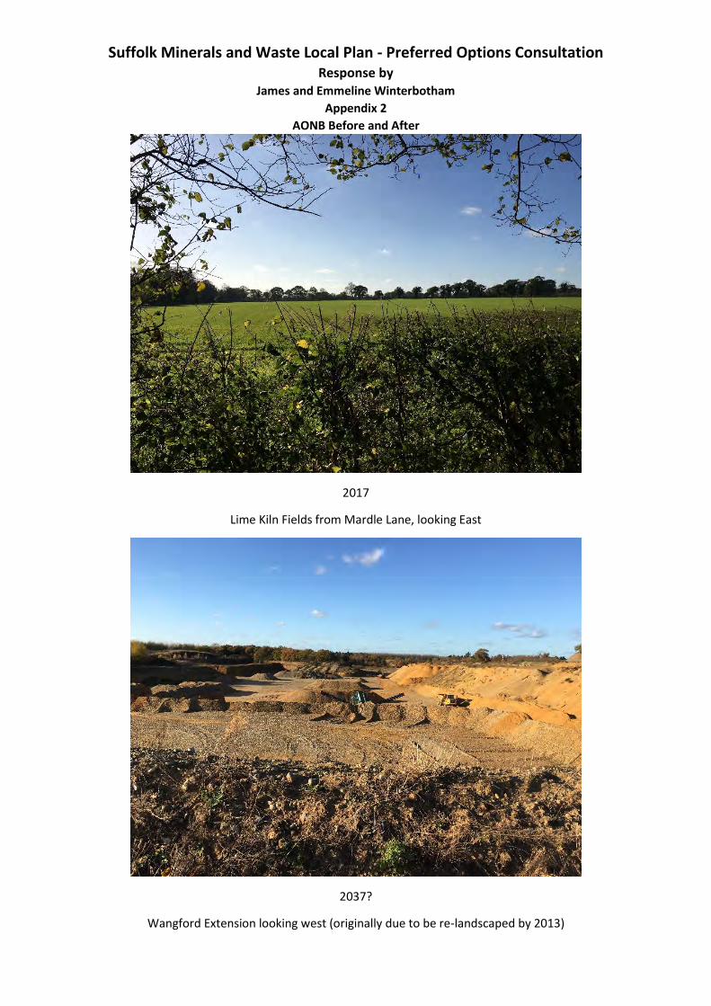
Suffolk Minerals and Waste Local Plan - Preferred Options Consultation Response by
James and Emmeline Winterbotham
Appendix 2
AONB Before and After
2017
Lime Kiln Fields from Mardle Lane, looking East
2037?
Wangford Extension looking west (originally due to be re-landscaped by 2013)
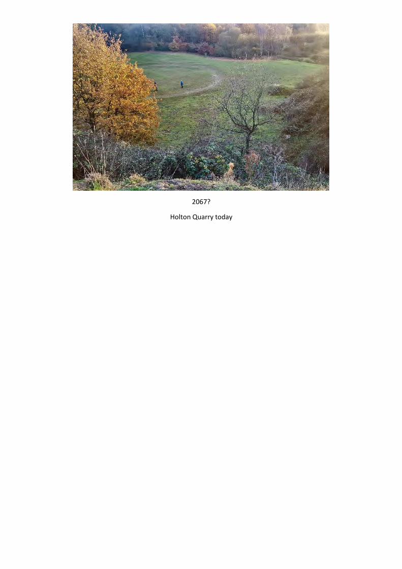
2067?
Holton Quarry today
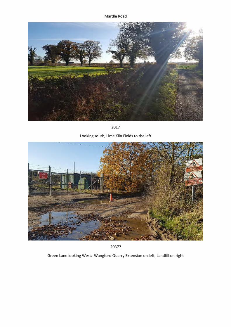
Mardle Road
2017
Looking south, Lime Kiln Fields to the left
2037?
Green Lane looking West. Wangford Quarry Extension on left, Landfill on right
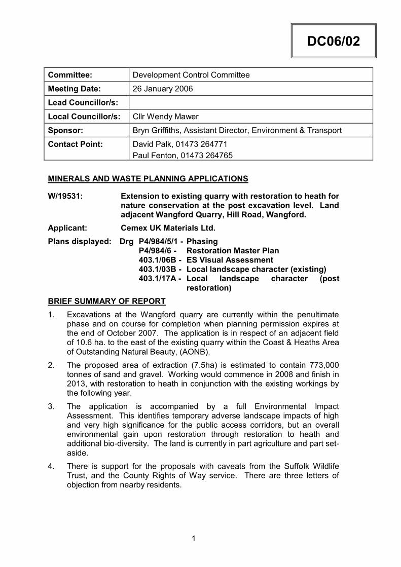
1
DC06/02 Committee: Development Control Committee
Meeting Date: 26 January 2006
Lead Councillor/s:
Local Councillor/s: Cllr Wendy Mawer
Sponsor: Bryn Griffiths, Assistant Director, Environment & Transport
Contact Point: David Palk, 01473 264771 Paul Fenton, 01473 264765
MINERALS AND WASTE PLANNING APPLICATIONS
W/19531: Extension to existing quarry with restoration to heath for nature conservation at the post excavation level. Land adjacent Wangford Quarry, Hill Road, Wangford.
Applicant: Cemex UK Materials Ltd. Plans displayed: Drg P4/984/5/1 - Phasing P4/984/6 - Restoration Master Plan 403.1/06B - ES Visual Assessment 403.1/03B - Local landscape character (existing) 403.1/17A - Local landscape character (post
restoration) BRIEF SUMMARY OF REPORT 1. Excavations at the Wangford quarry are currently within the penultimate
phase and on course for completion when planning permission expires at the end of October 2007. The application is in respect of an adjacent field of 10.6 ha. to the east of the existing quarry within the Coast & Heaths Area of Outstanding Natural Beauty, (AONB).
2. The proposed area of extraction (7.5ha) is estimated to contain 773,000 tonnes of sand and gravel. Working would commence in 2008 and finish in 2013, with restoration to heath in conjunction with the existing workings by the following year.
3. The application is accompanied by a full Environmental Impact Assessment. This identifies temporary adverse landscape impacts of high and very high significance for the public access corridors, but an overall environmental gain upon restoration through restoration to heath and additional bio-diversity. The land is currently in part agriculture and part set-aside.
4. There is support for the proposals with caveats from the Suffolk Wildlife Trust, and the County Rights of Way service. There are three letters of objection from nearby residents.
2
5. There are strong national, regional, county and Local Plan policies against mineral workings in AONBs. Only in exceptional circumstances should planning permission be granted for mineral workings in such areas.
6. The current land bank of primary aggregates for the county stands at 9.3 years based on a county apportionment of regional demand of 1.73 million tonnes per annum.
7. The applicants have offered the unopposed revocation of a mineral working planning permission on land they own at Holton St Peter, currently a dormant site. The applicants have estimated the reserve at Holton at 900,000 tonnes.
8. Policy requires that the prime consideration be given to the impact upon the integrity of the AONB. There are short to medium term adverse effects on the visual amenity of the immediate area arising from screen bunding and excavations. The landform created through mineral working, in combination with the adjacent working and the approved doming of the landfill site adjacent to the north, would result in a landform of artificial appearance alien to the landscape character of the area. The application is therefore recommended for refusal.
ACTION RECOMMENDED 9. That planning permission be refused for the following reasons:
1. The site lies within the Suffolk Coast and Heaths AONB at the boundary of two landscape character areas. The proposals would result in a permanent and significant adverse change in the landscape character of the area. The proposals would also perpetuate the presence of mineral processing plant and related development within the AONB longer than necessary to conclude the current permitted development.
2. There are southerly views across the site into the Wang Valley and Blyth Estuary from public roads along two boundaries of the site within the Suffolk Coast & Heaths AONB and Heritage Coast. The proposals would result in a loss of view and introduction of visual disturbance over the medium term from positions within the AONB enjoyed by the public. The long term changes to the bio-diversity potential of the site that may arise through the restoration proposals do not provide over-riding mitigation for such adverse medium and long term effects on the landscape of the AONB.
3. The development is not required to sustain a land bank of primary aggregates in accordance with policy SMLP 6 of the Adopted Suffolk Minerals Local Plan, and are not otherwise necessary in terms of national considerations of supply. The proposals are therefore contrary to policy MP5 of the County Structure Plan and policy SMLP1 of the Adopted Suffolk Minerals Local Plan.
4. There is no justification for considering the proposals as an exception to the presumption against major developments within AONBs, as advised in paragraphs 21 and 22 of PPS 7 - “Sustainable Development in Rural Areas”.

3
5. The proposed depth of extraction would prejudice the protection of
groundwater resources. The site lies within a designated Zone 1 Protection Area.
REASON FOR RECOMMENDATION 10. To exercise planning control having regard to policy and material planning
considerations. Policy requires that prime consideration be given to the impact upon the integrity of the AONB. The Environmental Statement identifies short to medium term adverse effects on landscape quality and public enjoyment of it, and a longer term change in the landscape character of the area post restoration. There is insufficient justification for considering the proposals as an exception to the presumption against major developments within AONBs, as advised in paragraphs 21 and 22 of PPS 7 - “Sustainable Development in Rural Areas” to over-ride these adverse effects.
ALTERNATIVE OPTIONS 11. None appropriate.
MAIN BODY OF REPORT
QUARRY HISTORY 12. Sand and gravel extraction from land off Hill Road, Wangford, has taken
place since the 1950s. 13. In the 1980s extraction extended onto land north of Green Lane. The first
area of working here was landfilled with municipal waste in the early 80s and has been restored to a generally flat profile after settlement, and grassed. From 1985 landfilling has taken place on the land north of the current application site, and is currently in the penultimate cell. Planning permission was granted in 2004 to raise the domed profile to a level 11 metres higher than the level of Green Lane to enable more waste to be added to redress the greater than expected percentage settlement, (20%).
14. The last quarry extension (Wangford Covert) onto land to the west of the proposed area was approved in 2002. Excavations in that area are now well advanced in the penultimate phase. Restoration has progressed into the second of the four working phases, by replacing overburden and soils over the base of the site to encourage heath restoration.
15. The Wangford Covert extension was included in the Minerals Local Plan and considered by the Minerals Local Plan Inquiry Inspector in 1997. The Inquiry Inspector concluded that the site should not be included in the Plan because: “…to comply with Government and Suffolk County Structure Plan policy it could only be justified on grounds of exceptional circumstances. By definition, schemes which can only be justified under exceptional circumstances cannot be a development plan policy or proposal.”
16. In the addendum/corrigendum report the inspector added: “…it is open for a developer to make a planning application for this site and argue that there are circumstances here which would justify an exception to
4
the structure plan policy. This would then become a matter for the (MPA) to take into account in the light of the development plan and all other material planning considerations.”
17. In reporting the Inspector’s recommendation to Committee in October 1998, I concluded that there were exceptional circumstances that justify the inclusion of the Wangford Covert area in the Plan; namely that the applicant company was willing to give up an old planning permission for mineral working at Westleton. The Westleton site adjoined the AONB and an SSSI which is also designated a Special Protection Area, Special Area of Conservation and a Ramsar site; access to the permitted area was over narrow lanes fronted by residential properties. The Wangford Covert area was accordingly included in the Modified and Adopted Plan as site P170.
18. Planning permission was granted for sand and gravel extraction following completion of a Planning Agreement revoking the Westleton planning permission, in April 2002. Restoration of the plant site is required by conditions of the 2002 permission. These require excavations to cease by 31 July 2007 and the site to be restored by 31 October 2007.
19. All planning permissions for mineral extraction and waste at Wangford are subject to Planning Agreements to restrict all traffic to and from the site(s) to travel via Hill Road west of the site only to directly connect to the A12. This agreement has operated satisfactorily over the past 20 years.
PROPOSAL
Excavations 20. The proposal is for an eastward extension of the Wangford Covert workings
into 10.6 ha of the adjacent field between the current workings and Mardle Road. 773,000 tonnes of sand and gravel would be extracted over 5 years at 150,000 tonnes per annum from a net area of 7.5 ha. The average mineral thickness is estimated at 8.3 metres overlaid by with just under 1 metre of overburden and soils. Stone content is assessed as an average of 58%, including a rare deposit of large rounded cobbles. The design base of excavations would be 0.5 metres above the highest recorded groundwater level. [Director’s Note: This is disputed by the Environment Agency].
21. Margins 10 metres wide around the perimeter of the site would be retained for the storage of stripped soils and overburden which would be placed along the north, south, and eastern boundaries. Excavations would be arranged in six phases working generally north-west to south-east. From phase three onwards restoration would be progressive, i.e. phase one would be restored with overburden and soils removed from phase three.
22. Production, operating hours, and traffic would be as existing but perpetuated for a further five years beyond the life of the existing permission.
23. Aggregate would be extracted by a front loading shovel and fed through a mobile dry screen plant nearby at the base of the quarry before subsequent transport via internal haul road at the quarry floor to the processing plant for washing and fine grading.
5
Restoration 24. Restoration is proposed as an extension to the approved low level
restoration at Wangford Covert which is to acid grass and heather heath. A combined area of 25 ha of new heath would then be formed. Margins to the adjacent land would have variable slopes with steep sections suitable for bats, sand martins, and invertebrates. The base would be formed to an undulating general southward slope.
25. Tree/shrub planting comprising a mix of Field Maple, Silver Birch, Oak, Scots Pine, Gorse and Broom are proposed mainly over the lowest slopes contiguous with the advance tree planting strip identified on the attached plan which would be retained. Gorse and heather from local sources would be planted/spread over the middle slopes with acid grasses sown within a wide strip through the middle of the site.
26. Upon restoration, a permissive right of way is proposed around the south and western boundaries of the application site, along the northern margin of the existing Covert working area and connecting to Hill Road near Hill Farm. A potential link to the Suffolk Wildlife Trust’s Hen Reedbed Reserve to the south is identified (See drawing P4/984/6 displayed at the meeting). This would enable a connection to be made between the site and the Suffolk Wildlife Trust’s Hen Reedbed public car park at the junction of Mardle Road and the A1095.
27. Advance planting has been provided within a strip generally 30 metres wide along the southern site boundary and as ‘gapping up’ supplementary planting to hedgerows adjacent to Green Lane and Mardle Road.
Surrender of Planning Permission – Holton St Peter 28. The applicants have indicated that, should the Committee be minded to
approve this application, they are prepared to an agreed revocation of the extant planning permission for sand and gravel extraction relating to land they own at Holton St Peter, and implement a restoration scheme for that part of that site already worked. The un-worked part would remain in agricultural use.
29. The area at Holton covers 8.9 ha. and is identified in the Minerals Local Plan as site C29. It is a Dormant Site where conditions of the 1966 planning permission were updated in April 2000. The former worked area has naturalised with a grass base and regenerated scrub around a lake used for angling. The applicant has estimated the reserve as 900,000 tonnes mainly of sand.
CONCLUSIONS OF ENVIRONMENTAL IMPACT ASSESSMENT
Landscape & Visual Amenity 30. The application site is situated at a break in slope between a plateau area
identified by the Countryside Commission classification of landscape types within the Suffolk Coast and Heaths AONB as ‘Sandlings Plateau with Farmland’, and the River Wang Valley within the landscape type ‘River and Stream Valleys’.
31. The Landscape Assessment concludes that there is a small zone of visual influence due to a combination of landform and vegetation. Committee
6
visited the site on 10 January and were able to appraise the views within the site surroundings.
Ecology 32. The application site is not ecologically an important habitat, being an area
that has been subject to intensive farming. The local area was found to support a rich variety of habitats, particularly to the south where habitats are wetland related.
33. Longer term greater bio-diversity would accrue following restoration as proposed. The additional heath would contribute to national bio-diversity targets and enhance the local diversity of the adjacent wildlife site.
34. Stand-off margins of 250 metres to the south, and adjacent to the surrounding hedgerows, are recommended, together with a restriction on working below the water table. Soil stripping should be undertaken outside the bird ground-nesting season.
Amenity – (Noise and Dust) 35. The application is supported by a noise assessment of excavation and soil
stripping operations. Plant operations, to which there would be no change, have been assessed previously.
36. The area is affected by traffic noise from the A12 and the A1095. Lowest recorded background noise levels at neighbouring properties nearest to the site range from 36dB(A) to 41 dB(A) L90. Predicted noise levels are within the nominal noise limits set out in Annex 2 of MPS 2.
37. Subject to adoption of good practice measures, seeding of soil bunds, and use of a water bowser to dampen tracks in dry periods, dust should not give rise to complaints.
Agriculture 38. The agricultural land quality of the site is Grade 4, i.e. below the quality
considered as ‘best and most versatile’.
Groundwater 39. The highest water table level over a 15 year period lies about 0.5 metre
below the proposed depth of excavation. Groundwater levels fluctuate seasonally by between 0.2 to 0.4 metres, and the flow is southward.
40. There are no watercourses or ponds within the site. Those adjacent to the site are within the Wang Valley SSSI. The effect of rainfall infiltration is not expected to have an adverse effect on the SSSI because the surface area of the site, (which is outside the SSSI), exposed through excavation is insignificant compared with the SSSI catchment area. In addition, the retention of a saturation zone above groundwater level of 0.5 will help absorb rainfall to avoid ponding, and minimise the risk of pollution from surface activity or spillage.
Traffic & Rights of Way 41. At present the quarry gives rise to 110 lorry movements per day on Hill
Road from the A12. No change to production levels or sales is proposed in the current application so the intensity and direction of traffic is expected to
7
remain the same. Right turn movements from the quarry onto Hill Road are prohibited through the Planning Agreement. Off site road improvements are not considered necessary.
42. There are no Public Rights of Way directly affected by the development. A new permissive right of way would be created around the perimeter of the restored site, with potential to connect to the Suffolk Wildlife Trust’s Hen Reedbeds Reserve public car park to the south.
Archaeology 43. A desk top archaeological appraisal of the site has been completed. There
is a suggestion of earlier pre-historic activity in the vicinity and it is recognised that the site could contain archaeology of interest, although field work to date suggests that the likelihood of a substantial archaeological find within the site is low.
Employment 44. Although not strictly an environmental impact, the socio-economic
consequences of a proposed development is a material planning consideration. The proposals would secure five jobs at the quarry and ten others indirectly until 2013.
CONSULTATIONS
Countryside Agency 45. Not received.
DEFRA – National Land Management Team 46. Does not wish to comment on the principle of the proposals but draws
attention to the following agricultural considerations: a) the site is Grade 4 land, b) consideration should be given to using the surplus topsoil to restore
other land where topsoil is deficient, c) the loss of the land to agriculture could have significance for the
viability of the farm holding if it results in under use of fixed equipment. Mitigation may be required if a network of irrigation infrastructure is affected.
Environment Agency 47. The development is within a Groundwater Protection Zone 1 area. The
Agency objects to the proposal as submitted unless the minimum level of working is set at 2.4 metres AOD. The historic maximum groundwater level (recorded in 1986) is 0.6 metres higher than stated in the Environmental Assessment. As such the minimum floor level proposed at 1.9 metres AOD has insufficient effective buffer zone above groundwater. This objection would be removed if the applicant agreed to raise the minimum floor height of the quarry to 2.4 metres AOD.
48. Planning permission should be subject to the following conditions: a) nothing other than uncontaminated soils should be tipped on the site;
8
b) there shall be no discharge of foul or contaminated drainage into ground or surface waters;
c) any land drainage problems that occur shall immediately be rectified by the applicant;
d) oils or chemicals shall be stored in bunded areas; and e) implementation of an agreed bio-diversity management plan which has
been formally agreed by the partners of the Suffolk Bio-Diversity Group, prior to any planning permission being granted.
49. The Agency considers that the proposals offer an “excellent opportunity, over the medium to long term, to enhance bio-diversity within the Suffolk Coast and Heaths AONB and provide a contribution to the local Bio-diversity Action Plan.” The Management Plan for restoration should be overseen by the Suffolk Coast and Heaths Project.
English Nature 50. Concerned regarding water table safeguarding i.e:-
a) the restoration to a flat area just 0.5 metre above groundwater is inadvisable. The water table only has to rise very slightly for water-logging to occur during and after restoration, and landfill related contaminants from the adjacent landfill site could be drawn near to the surface;
b) a base limit of excavation defined by height above groundwater would be difficult to monitor and police – a single bite with an earth moving machine could remove such a thickness of protection. The long term integrity of the restoration and the adjacent designated nature conservation sites could be affected.
51. In order to ensure that the above designated sites are not adversely affected by the proposal, English Nature advises that a minimum of 1.5 metres of undisturbed in situ mineral should be left in place above the recorded water level.
52. With regard to the restoration scheme, the essentially flat profile proposed will lead to water-logging. A more gentle southward slope should be provided by leaving mineral in situ. An undulating surface should have an overall southward slope.
53. English Nature broadly supports the management plan outlined for restoration but observes that no indication is given regarding the longer-term management of the site post restoration. English Nature requires assurance that the long-term management of the site has been considered and provided for financially.
Suffolk Coast & Heaths Countryside Management Project 54. The proposals are inconsistent with the objectives of the AONB designation
by impacting upon the peace and tranquillity and the special landscape quality of the area.
55. The application suggests the deposits found here are special and important but has given relatively little information to indicate that there are no other locations for such material. The justification of need relates primarily to local need.
9
56. The visual impact in the area is recognised as being significant. The views into the site from the main public highways are limited by the landform and existing vegetation. The noise from the working quarry does intrude over the area and the extension of working onto the valley sides of both the main and tributary river is likely to increase noise.
57. The restoration plans to create heath would increase a limited resource although it is doubtful whether the site is of sufficient size or close enough to existing heath to improve the current fragmentation of such habitats. Leaving the site as a hollow does significantly affect the landform and rather than bringing diversity it would detract from the local character of sweeping/rolling valley sides. The resulting landform brings little of value.
58. The continued cumulative impact on the AONB from local development does detract from its national importance.
Countryside Manager 59. Part IV of the Countryside and Rights of Way Act 2000 places a duty on
public bodies to have regard to the purpose of conserving and enhancing the natural beauty of the AONB.
60. PPS 7 says that major developments should not take place in nationally designated areas, such as AONBs, except in exceptional circumstances. The Minerals Local Plan Inquiry Inspector also said in 1997 that the working of minerals within the AONB could only be justified as an exception. The applicant has not demonstrated sufficient justification for the application to be accepted as an exception to policy.
61. The application fails to recognise the cumulative effect extending the quarry would have. The Visual and Landscape Assessment concedes there would be temporary adverse impact of high/very high significance for Green Lane, and medium significance for Mardle Road. The development would result in a permanent change in the landscape character of the site. The landform that would be created would not echo the gentle slopes that currently exist and represents a permanent adverse change to the landscape character of this part of the AONB.
Highways Development Control 62. Providing the existing traffic management conditions are applied to this
application, there are no highway objections.
Rights of Way 63. No recorded Public Rights of way or claimed Rights of Way are affected.
The proposed additional footpath around the restored site is welcomed.
County Archaeology Officer 64. The proposed archaeological mitigation strategy is acceptable. Standard
condition requiring prior detailing of advance investigation and recording of archaeology within the site is recommended.
Noise & Air Pollution Manager 65. The recordings of background noise levels submitted in the EIA are
considered representative and accurate.
10
66. Current noise control limits (Leq (1 hour) at Mardle House, Hill Farm, and Nova Scotia are 46 dB, 51dB, and 51dB respectively. The applicant has demonstrated that workings could be carried out within these limits, but assumes both the proposed and current working areas are not worked concurrently. During concurrent operations with the landfill site noise levels at any one receiver could be higher than the desirable limits. No account has been taken of concurrent mineral and waste disposal operations at the adjacent landfill site operated by Viridor. The total noise arising from both sites as a whole is of concern to local residents.
Suffolk Wildlife Trust 67. The Trust supports the proposed restoration to heath or acid grassland.
The creation of a 20ha. area of heath in close proximity to the Minsmere-Walberswick SPA will provide significant bio-diversity benefits and contribute to the Suffolk Bio-Diversity Action Plan targets.
68. The exact location of proposed new footpath(s) should be considered at the pre-restoration stage to ensure there would be no adverse impacts on the wildlife value of the SPA and newly created habitats.
Holton Parish Council 69. The Parish Council welcomes the future surrender of the extant extraction
permission in Holton and would be very interested in the public use of the land for conservation and recreation if and when firm proposals of this kind are made.
Wangford with Henham Parish Council 70. No objection.
Waveney District Council 71. Deferred. To be reconsidered on 1 February, following the site inspection
on the 10 January.
REPRESENTATIONS
F D Campbell, Mardle Road, Wangford 72. Objects on grounds of:
a) southerly views from Green Lane and Mardle Road would be closed off by screen bunding. This is the only walk locally with open views. 10 ha within an AONB would be removed from view and enjoyment of countryside for six years;
b) restoration would coincide with restoration of the adjacent landfill site, the combined effect of which would be to create a new landform not in keeping with the local topography involving an artificial change in levels of some 22 metres between the top of the landfill and the base restoration level;
c) the restored lower land levels may be liable to flooding in the future from the wetland to the east, and also from run off from the elevated levels of the landfill site;
11
d) noise sources would be brought close to public rights of way and, combined with noise sources from the landfill site, result in a significant increase in noise levels at public receptors, including areas of wildlife importance (Hen Reedbeds);
e) fumes from plant would be captured within the base of workings and screening and linger within the area;
f) dust would spread southwards towards the Hen Reedbed Reserve to the possible detriment of wildlife; and
g) wildlife is likely to be driven off from the area by the level of disturbance.
R K Chater, Mardle Road, Wangford 73. Objects on grounds of:
a) loss of view from Green Lane and Mardle Road. At present there are southern views towards the Hen Reedbeds Reserve from both lanes which would be closed off for the duration of the development; and
b) previous planting suggests that the heath restoration may not live up to expectations.
Dr S Roberts, Halesworth Road, Reydon 74. Objects on grounds of perceived noise, visual intrusion and change of
landscape character, from Limekiln Cottages.
POLICY 75. PPS 7 – “Sustainable development in Rural Areas (2004)” sets out
government policy towards development in the countryside. With regard to development in areas of National Designation, including AONBs, Paragraphs 21 and 22 states: “The conservation of the natural beauty of the landscape and countryside should be given great weight in planning policies and development control decisions in these areas… Major developments should not take place in these designated areas, except in exceptional circumstances…applications for all such developments should be subject to the most rigorous examination. Major development proposals should be demonstrated to be in the public interest before being allowed to proceed.”
76. MPG 6 and emerging (Draft) MPS 1 ‘Planning and Minerals’ Aggregate supply obligations for Suffolk based on the National Guidance and Regional apportionment of the supply of primary aggregates set out in MPG 6 (1994) are embodied within the Adopted Suffolk Minerals Local Plan. Under MPG 6 the Council is obliged to sustain a landbank of land won primary aggregates sufficient for at least 7 years supply throughout and at the end of the Plan period, based on the appropriate sub-regional apportionment. The current sub-regional (County) apportionment is 1.73 million tonnes per annum. ODPM published in November 2004 a Draft Minerals Policy Statement (MPS 1 – ‘Planning & Minerals’) to replace the MPG 6 Guidance. At
12
present this has emerging policy status:- the existing MPG 6 remains the adopted policy of the ODPM. Regard should nevertheless be had to the emerging policy set out in Draft MPS 1, and the relevant annex 1, as a material consideration of significant weight. The Government’s objectives for minerals planning in PPS 7 remains consistent with the policy set out in MPG 6 with regard to minerals development within AONBs;
77. MPG 6 (1994) paragraph 11 states that the objectives of sustainable development for minerals planning are: “to protect areas of designated landscape or nature conservation value from development, other than in exceptional circumstances where it has been demonstrated that the proposed development is in the public interest”. With specific regard to minerals development within AONBs, paragraphs 70 and 71 states; (70) “The Government considers that major developments should not
take place in these areas …save in exceptional circumstances. Because of the serious impact that mineral developments may have on the natural beauty of these areas the Government considers that all minerals applications must be subject to the most rigorous examination, and all mineral developments should be demonstrated to be in the public interest before being allowed to proceed.”
(71) “Consideration of mineral applications in such areas should therefore normally include an assessment of: a) the need for the development, in terms of national
considerations of mineral supply; and the impact of permitting the development, or refusing it, on the local economy;
b) whether alternative supplies can be made available at reasonable cost; and the scope for meeting the need in some other way;
c) any detrimental effect of the proposals on the environment and landscape and the extent to which that should be moderated; and
d) in the case of extensions to existing quarries, the extent to which the proposal would achieve an enhancement to the local landscape.“
78. MPS 1 Expands upon the policy of MPG 6 to convert the guidance into policy and applying it specifically to nationally and internationally designated areas. Paragraph 4 states the Governments objectives for mineral planning as inter alia:- “to protect nationally and internationally designated areas of landscape and sites of nature conservation value from minerals development, other than in exceptional circumstances where it has been demonstrated that the proposed development is in the public interest”.
79. MPS 1 - Paragraph 8 refers to protection of heritage and countryside and states:- MPAs should “Only permit mineral proposals within or adjacent to European Sites” (Spas, Sacs, Ramsar Convention sites),”if they would not have a
13
significant effect, (alone or in combination with other plans or projects), on the integrity of the sites...unless there are no alternative solutions and there are imperative reasons for over-riding public interest"
80. The proposed site is not identified for future mineral working in the Adopted Minerals Local Plan. MPS 1 (paragraph 38) address such situations:
“Planning applications for mineral developments at locations outside of areas identified in the plan for future mineral working can still be considered on their merits. It is possible that new information about mineral resources or developments in technology might lead to a proposal which could be significantly more acceptable overall than one for an area identified in the plan…. The key point is that MPAs must be satisfied there are good reasons for permitting such applications, after having considered all the relevant circumstances.”
81. MPS 1 paragraph 46 sets out relevant considerations relating to the need for development within, inter alia, AONBs: - “whether the proposal is important to the viability of the particular
extractive industry concerned; - whether the particular qualities and properties of the materials being
extracted are critical to the viability of other industrial sectors in the UK…;
- whether permitting the proposal would enhance, or refusing it harm, the local national economies;
- whether the proposal would create new jobs or safeguard existing ones; - whether permitting the proposal would support, or refusing it would
jeopardise, local firms and their future.”
82. Draft Annex 1 to the MPS makes a shift in policy regarding MPAs’ approach towards land bank provision at the end of the plan period, although the 7-year land bank is still retained as the key indicator to be used to assess the appropriate balance and for deciding when new permissions should be considered. Paragraphs 1.3.11-15 states: “The minimum length of the land bank should be taken as 7 years. A land bank of less than 7 years is an indication that additional resources may need to be permitted…. The length of the land bank should be used as a guide to the phasing of provision and not as a determinant of provision. MPAs should consider and report on the need to review minerals development documents and policies as part of their annual monitoring report to the Secretary of State, and before the remaining provision approaches the minimum land bank. Since this is a rolling process, the issue of maintaining a land bank beyond the end of the plan period should not arise.
The role for the land bank indicator in…Areas of Outstanding Natural Beauty, will be the exception rather than the norm, for environmental reasons Steps should be taken to avoid or reduce excessive landbanks. These include the following actions:
• where landbanks are more than twice the minimum – 14 years – new permissions should only be given where it can be shown that
14
demand could not be met from the existing permitted reserves, for example, for reasons of quality and/or distance to market.
• the industry is encouraged to agree voluntarily to the revocation of planning permissions at sites that are unlikely to be worked again.
• in consultation with the RAWPs, MPAs should carry out, and publish the results of regular reviews of those sites which have not been worked for 10 years to assess whether production is likely to begin again”.
Draft East of England Plan(RSS14) – 2004 83. This plan provides the draft strategic planning policies for the region and will
replace the County Structure Plans on formal adoption under the provisions of the new Development Planning system. Emerging strategic policies ENV 2 and ENV 3 are relevant to consideration of this application:
84. ENV 2: (Landscape character) "Planning authorities…in their plans, policies, and programmes will provide the strongest level of landscape character protection for East of England’s …areas of national importance… The diversity and local distinctiveness of landscape character…should be protected and enhanced. Planning authorities…in their plans, policies and programmes will conserve and enhance landscape character by: a) developing criteria - based policies… to ensure all development,
wherever possible respects and enhances local landscape character, b) providing appropriate mitigation measures where avoidance of
damage to local landscape character is unavoidable. " 85. ENV 3: (Bio-diversity and earth heritage)
"Planning authorities in their plans, policies, and proposals, will ensure that the internationally and nationally designated sites in the region…are given the strongest level of protection. The region’s bio-diversity, and…natural resources will be protected and enriched through conservation, restoration and re-establishment of key resources by:
a) promoting the restoration, re-establishment of habitats and species populations in accordance with…targets set out in the UK, England and local bio-diversity action plans…ensuring the appropriate management and further expansion of wildlife corridors that are important for the migration and dispersal of wildlife,
b) ensuring that all new development minimises any damage to the bio-diversity and earth heritage resource and, where possible, enhances it."
County Structure Plan 86. The following relevant policies remain part of the Development Plan:
"ENV 7 Development which would have a material adverse impact on the …Areas of Outstanding Natural Beauty, or the Heritage Coast will only be acceptable where an over-riding national need for development in the particular location can be demonstrated and there is a lack of acceptable alternative sites. Where development

15
proceeds because of an over-riding national requirement, removal and restoration of the site will be required in the event of redundancy at a later date.
MP1 The County Council will seek to maintain a stock of planning permissions for the winning and working of sand and gravel in Suffolk sufficient for at least seven years extraction. In maintaining this stock, favourable consideration will be given to mineral working within sites proposed in the Minerals Local Plan.
MP5 Mineral working and associated development will not be acceptable within the Broads and Areas of Outstanding Natural Beauty, including the Heritage Coast, where: (a) the development is unnecessary in terms of national
considerations of supply; and/or (b) there would be a material adverse impact upon the
landscape or ecology. MP7 Favourable consideration will be given to proposed extensions to
mineral workings and associated development where there is no material conflict with other relevant policies of this Plan."
Suffolk Minerals Local Plan 87. The Minerals Local Plan, adopted in May 1999, is based on the regional
annual apportionment of aggregate demand from the MPG 6 Guidance in 1994 which was 2.43 million tonnes.
88. Policy SMLP 6 "The County Council will aim to maintain a reserve of land (a land bank) in Suffolk with planning permission for mineral working, sufficient to supply at least enough sand and gravel to meet the agreed sub regional apportionment throughout the plan period, subject to other relevant policies of the development plan. Furthermore the council will aim to provide such a land bank appropriate for at least seven years extraction at the end of the plan period."
89. Policy SMLP 1 "When considering planning applications for mineral working and associated development, the County Council will grant permission where: a) the proposals are not considered detrimental to designated landscape
areas;…
j) the cumulative environmental effects of the proposed mineral workings and the existing mineral workings in the vicinity would be acceptable."
90. Policy SMLP 7 "Planning permission for sand and gravel workings outside the specific sites listed… [the proposed site lies outside the area identified for site P170, Wangford with Henham] … will be granted where at least two of the following criteria, including d) are satisfied: a) the development covers an area of generally less than 5 hectares and
forms an extension to, or replacement for, an existing quarry;
16
b) it can be demonstrated that working is necessary prior to other permanent forms of development taking place in order to prevent sterilisation of sand and gravel resources;
c) the proposal is for a borrow pit …;
d) the proposal does not conflict with other relevant policies of the Development Plan.
Planning permission for sand and gravel working for proposals which do not meet the above criteria may be granted where it can be demonstrated that the site offers significant advantages over those specified above and identified on the proposals map in terms of landscape considerations, environmental and ecological impact, disturbance to residential amenity, access and highway safety, and where the proposal does not conflict with other relevant policies of the Development Plan."
COMMENTS OF HEAD OF DEVELOPMENT CONTROL 91. The principal issue in this application is the interpretation of policy with
regard to ‘exceptional circumstances’ for development affecting AONBs. Planning policy at all levels requires that development having a material adverse impact upon the AONB should not be approved other than in exceptional circumstances.
92. The provision for permissions to be granted for sand and gravel workings outside of existing mineral working sites identified in the Suffolk Minerals Local Plan policy SMLP 7 are not satisfied in this case; the proposal is substantially larger than the nominal 5 hectares applicable to extensions to existing sites. There is no justification on basis of national need under policy ENV 7 and MP5. In my view the site does not offer significant advantages over the sites identified in the Minerals Local Plan.
Consideration of ‘exceptional circumstances’ 93. The applicants have suggested that the exceptional circumstances which
should be taken into account in this case are: a) There is a need for the development to maintain the County’s
apportionment in accordance with national and regional advice. b) The proposed restoration and aftercare management would provide
significant long term landscape and ecological benefits, improve the bio-diversity contribution of the site, and make a positive contribution towards meeting the Counties BAP targets – (the creation of 2,385 ha of lowland grass and heath by 2010.) The development in conjunction with the restoration of the adjacent parts of the quarry will help to improve the intrinsic quality and diversity of the local landscape.
c) Permission is appropriate now to enable the high quality deposits in the site to be worked and processed through the existing plant. The alternative would be to source materials from a greater distance and sterilise the remaining deposits or lead to their lower grade use if extracted at a later date after the plant had been removed.
d) The site is the only quarry in Suffolk, and one of only three sites in the country, producing high quality cobble type stone.
17
e) There are only three other quarries in the vicinity supplying the local aggregates market – at Wenhaston, Henham, and Flixton;
f) The Environmental Impact Assessment has not identified that a further extension will have an adverse impact upon the surrounding area.
g) The unilateral undertaking offered relating to the planning permission at Holton would effectively replace the land bank contribution of a predominantly sand deposit, with a reserve of a higher and more versatile quality.
Response 94. Emerging policy set out in MPS 1 indicates that land bank justification for
development should be the exception rather than the norm. At the beginning of 2005 the land bank, based on the revised apportionment of 1.73 million tonnes set out in revised MPG 6 (2003), is 9.3 years. For the last three years annual sales have been consistently below the revised county apportionment at an average 1.46mt per annum. On the basis of average sales the land bank would be 11 years. A reserve of 770,000 tonnes would not be strategically significant in land bank terms, amounting to approximately 6 months supply in County terms. There is therefore no demonstrable need to extend the land bank at the present time.
95. The Landscape and Visual Appraisal within the Environmental Impact Assessment identifies that the screen bunding around the site would have a temporary adverse impact of high/very high significance for Green Lane, and Medium significance for Mardle Road. These views across the site to the south are valued by the objectors. This loss of aspect would occur at a threshold of a significant change in the landscape character of the area, and would endure for 5 years plus restoration. The proposals would also lead to a deferment of restoration of the plant site and continuation of aggregate processing, stockpiling, and related traffic for at least that time.
96. The identification of the post restoration landscape type for the site as a new feature - ‘Wangford Valley Side Heath’- does not have the widespread recognition as a landscape type definition developed by the Countryside Commission for the Coast & Heaths AONB. It is therefore of unconfirmed merit. It is essentially little more than a description of the proposed restored landscape objective in this particular case; there are no other examples within the area. The accumulative effect of the creation of a southward slope within the site, with the domed landform of the restored landfill site to the north would result in a significant increase in slope at the northern end of the Wang valley. Consequences for land drainage and pollution control at the edge of the SSSI/SPA, and Ramsar designated wetlands have also been identified by English Nature and the Environment Agency and gives some cause for concern.
97. It is probable that restoration as proposed would result in an increase in bio-diversity over the current use of the application site through increasing habitat type. However such habitat creation is complex, takes a long time to establish, and requires a high degree of post restoration management. In the meantime the site would have an unnatural and disturbed appearance for some years beyond the active working life of five years.
98. The proposed restoration scheme, including creation of new permissive public access to the restored site in six years time and the surrender of a
18
permitted reserve of uncertain commercial quality at another site outside of the AONB, is not of such substantive ‘public benefit’ within the context of PPS 7 that an exception should be made to the strict presumption against major development in the AONB.
99. The quality of the deposit at Henham, just 2 km from this site and part of the same geological bed, is of a similar quality to the proposed site. The applicants' other quarry at Flixton is also able to provide a wide range of aggregate grades from indigenous resources. The absence of the extension area from the land bank would not therefore lead to a shortage of concreting quality aggregate for local construction. In the long term, longer haulage distances of aggregate to the north east of the County, possibly from Norfolk sites, may result but this is a reasonable ‘cost’ of conserving the landscape quality of this part of the AONB and is already a feature of local supply. I do not therefore consider that the winning of the high quality reserve whilst the applicants are present on the adjacent land is an over-riding factor justifying an exception to the policy presumption against the development.
100. The offer of a unilateral undertaking is a material planning consideration which should be taken into account in the determination of this application. The weight to be given to such a material consideration is for committee to decide, but should relate to very exceptional circumstances to over-ride a national policy presumption against development. In my view, taking all of the above factors into consideration, no such circumstances have been identified. Planning permission should be refused in accordance with established policy to continue to protect the integrity of the landscape of the AONB.
SOURCES OF FURTHER INFORMATION a) Consultation replies between 3 November 2005 and 25 January 2006
held on file W19531 b) Letters of representation from the public received between 22
November 2005 and 25 January 2006 held on file W19531.
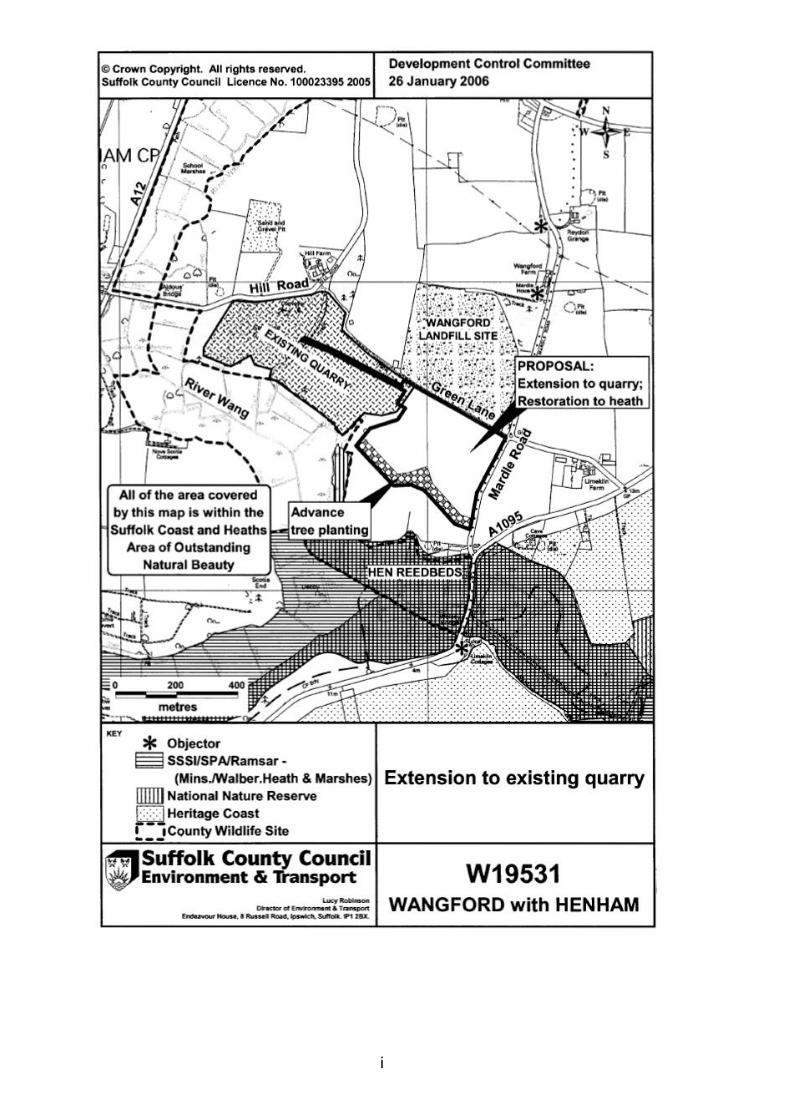
i