Embed Size (px)
Citation preview
2019 Spring AICP Exam ReviewAREAS OF PRACTICETRANSPORTATION AND INFRASTRUCTURE
Claudia M. Bilotto, AICP
WSP USA
I. Introduction and Format of Review
A. Who Are the Players?
B. Planning and Engineering Principles
C. Planning Approach, Practices, and Tools
II. Transportation Planning
A. Principles, Planning Approach, Practices, and Tools
B. Modal Areas
C. Integrated Planning
D. Equity of Access
III. Infrastructure Planning
I. Principles, Planning Approach, Practices, and Tools
II. Range of Community Systems
III. Integrated Planning
IV. Summary
Areas of Practice
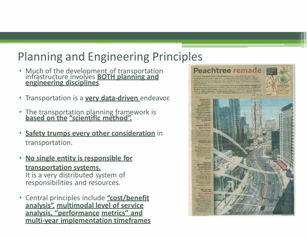
• Much of the development of transportation infrastructure involves BOTH planning andengineering disciplines.
• Transportation is a very data‐driven endeavor.
• The transportation planning framework isbased on the “scientific method”.
• Safety trumps every other consideration in transportation.
• No single entity is responsible fortransportation systems.It is a very distributed system ofresponsibilities and resources.
• Central principles include “cost/benefitanalysis”, multimodal level of serviceanalysis, “performance metrics” andmulti‐year implementation timeframes
Planning and Engineering Principles
I. Roads and Bridges
II. System Safety, Operations, and IntelligentTransportation Systems (ITS)
III. Transit (Bus, Rail, Paratransit, and On‐Demand Services)
IV. Freight and Logistics
(Truck, Rail, Pipeline, Aviation, Waterways)
V. Active Transportation (Pedestrian,
Bicycle, and Trail Systems)
VI. Parking
VII. Transportation Demand Management
Transportation ‐ Modal Areas
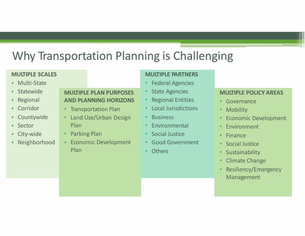
Why Transportation Planning is Challenging
AND PLANNING HORIZONS
• Transportation Plan
• Land Use/Urban Design Plan
• Parking Plan
• Economic DevelopmentPlan
MULTIPLE SCALES MULTIPLE PARTNERS
• Multi‐State
• Statewide
• Regional
• Corridor
• Countywide
• Sector
• City‐wide
• Neighborhood
MULTIPLE PLAN PURPOSES
• Federal Agencies
• State Agencies
• Regional Entities
• Local Jurisdictions
• Business
• Environmental
• Social Justice
• Good Government
• Others
MULTIPLE POLICY AREAS
• Governance
• Mobility
• Economic Development
• Environment
• Finance
• Social Justice
• Sustainability
• Climate Change
• Resiliency/EmergencyManagement
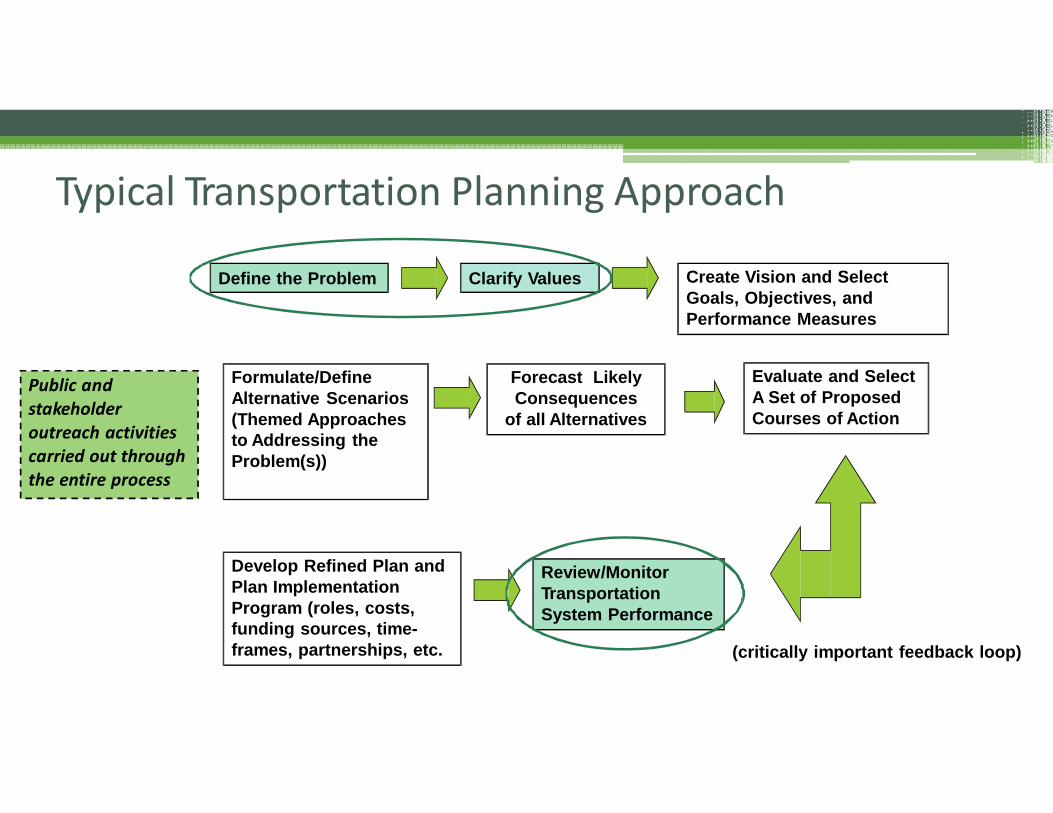
Typical Transportation Planning Approach
Create Vision and Select
Goals, Objectives, and
Performance Measures
Forecast Likely
Consequences
of all Alternatives
Define the Problem Clarify Values
Formulate/Define
Alternative Scenarios
(Themed Approaches
to Addressing the
Problem(s))
Evaluate and Select
A Set of Proposed
Courses of Action
Review/Monitor
Transportation
System Performance
Develop Refined Plan and
Plan Implementation
Program (roles, costs,
funding sources, time-
frames, partnerships, etc. (critically important feedback loop)
Public andstakeholder outreach activitiescarried out through the entire process
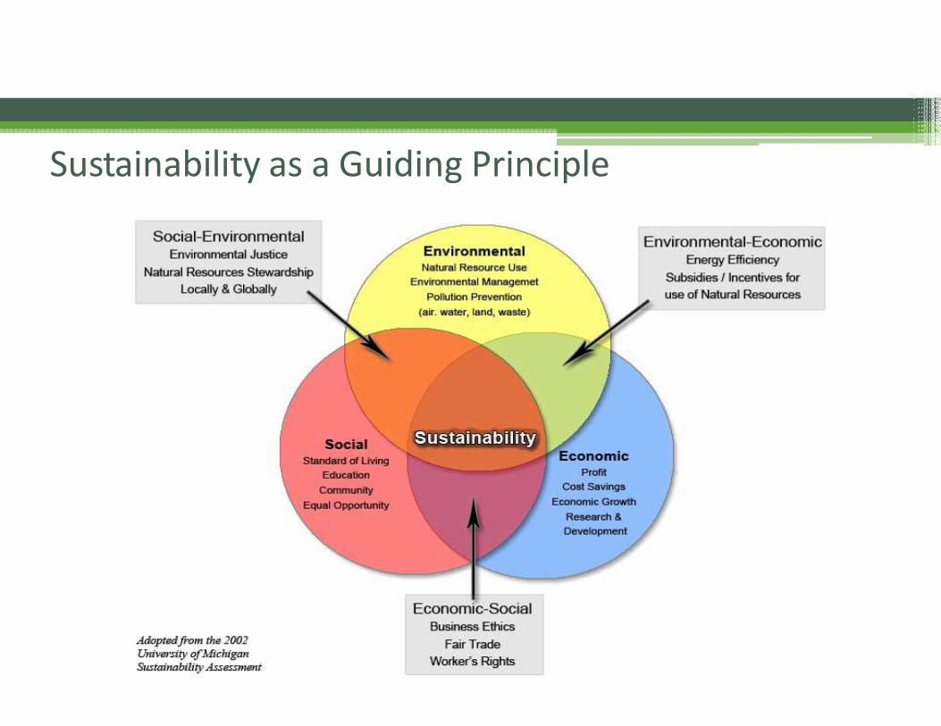
Sustainability as a Guiding Principle
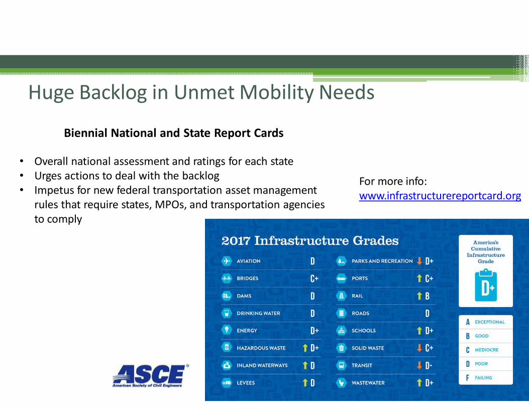
Biennial National and State Report Cards
• Overall national assessment and ratings for each state• Urges actions to deal with the backlog• Impetus for new federal transportation asset management
rules that require states, MPOs, and transportation agenciesto comply
Huge Backlog in Unmet Mobility Needs
For more info: www.infrastructurereportcard.org
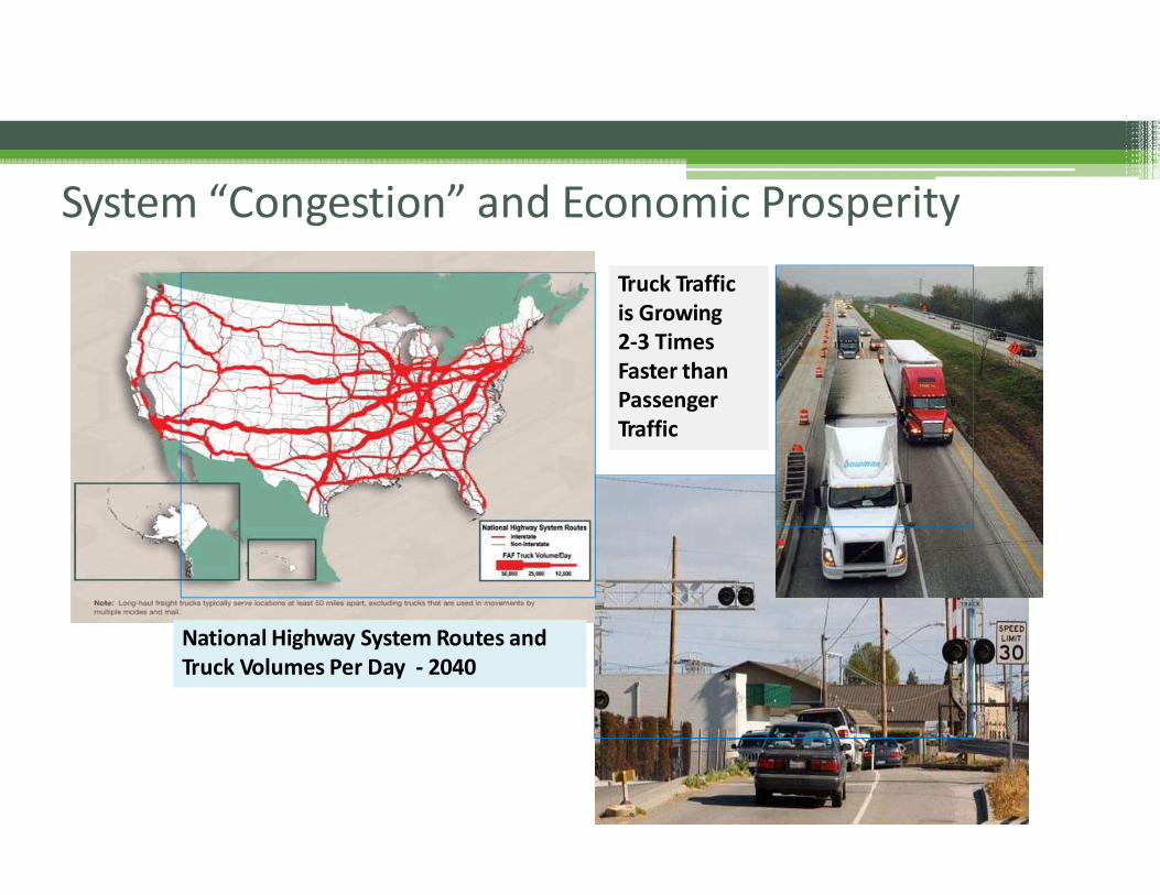
National Highway System Routes andTruck Volumes Per Day ‐ 2040
Truck Traffic is Growing2‐3 Times Faster thanPassenger Traffic
System “Congestion” and Economic Prosperity
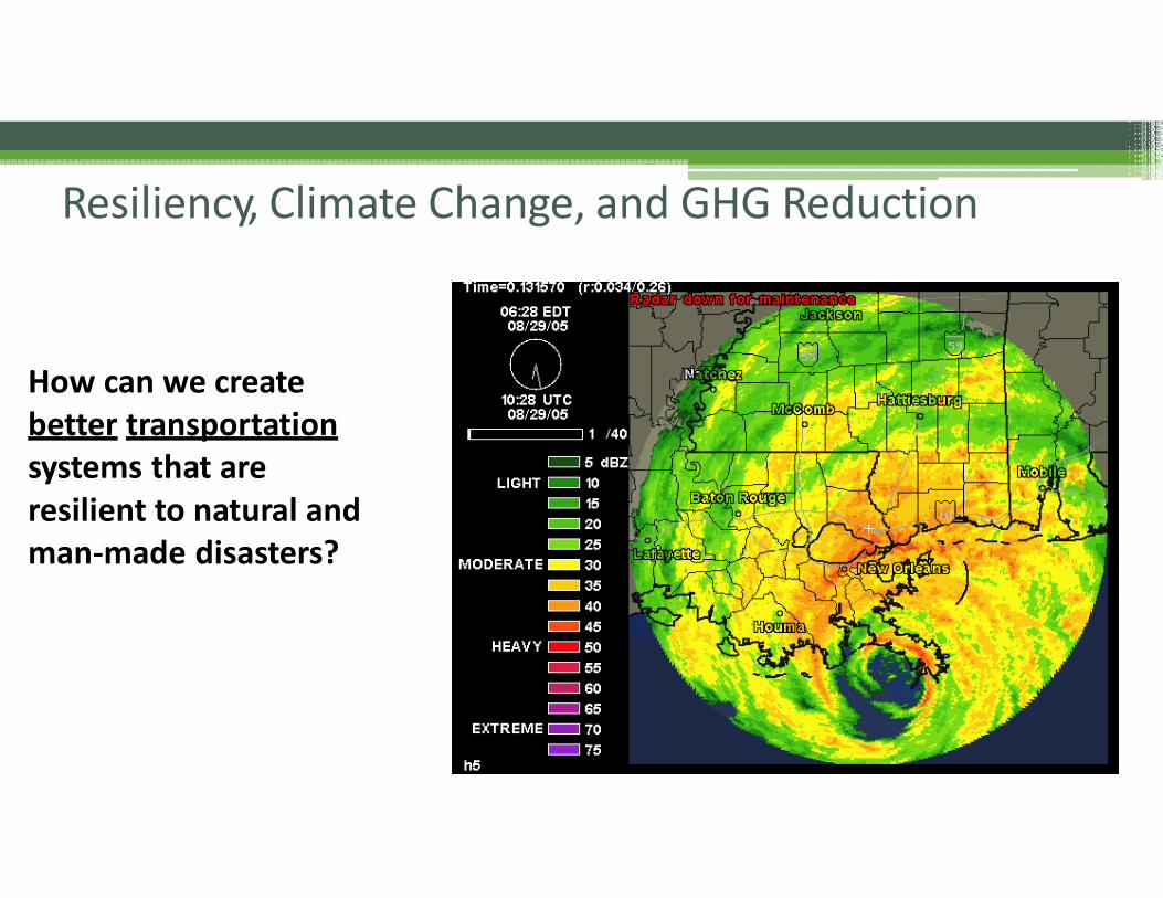
How can we createbetter transportationsystems that areresilient to natural and man‐made disasters?
Resiliency, Climate Change, and GHG Reduction
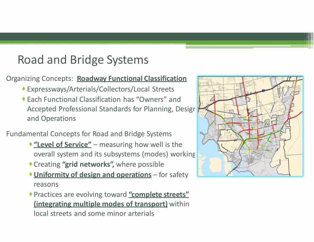
Organizing Concepts: Roadway Functional Classification
Expressways/Arterials/Collectors/Local Streets
Each Functional Classification has “Owners” and Accepted Professional Standards for Planning, Design, and Operations
Fundamental Concepts for Road and Bridge Systems
“Level of Service” – measuring how well is theoverall system and its subsystems (modes) working
Creating “grid networks”, where possible
Uniformity of design and operations – for safetyreasons
Practices are evolving toward “complete streets”(integrating multiple modes of transport) within local streets and some minor arterials
Road and Bridge Systems
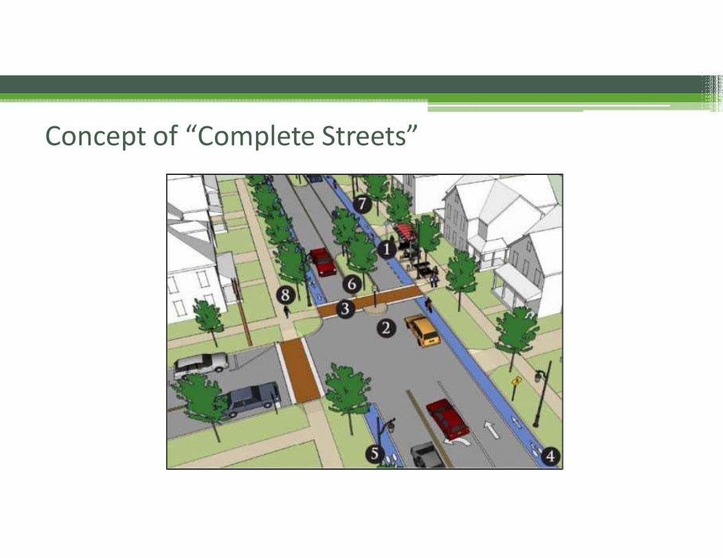
Concept of “Complete Streets”
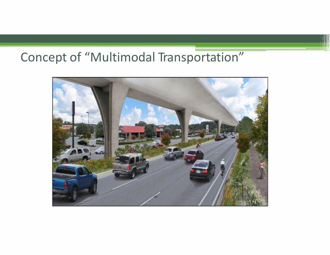
Concept of “Multimodal Transportation”
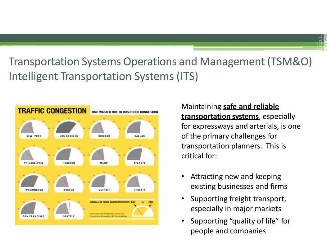
Transportation Systems Operations and Management (TSM&O)Intelligent Transportation Systems (ITS)
Maintaining safe and reliabletransportation systems, especiallyfor expressways and arterials, is oneof the primary challenges for transportation planners. This iscritical for:
• Attracting new and keepingexisting businesses and firms
• Supporting freight transport,especially in major markets
• Supporting “quality of life” for people and companies
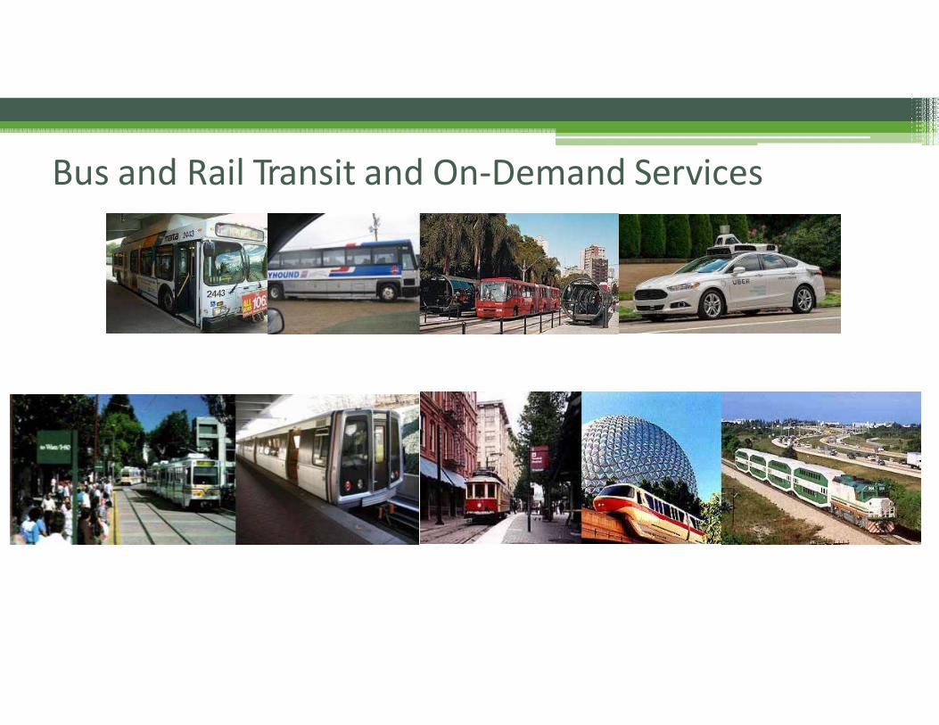
Bus and Rail Transit and On‐Demand Services
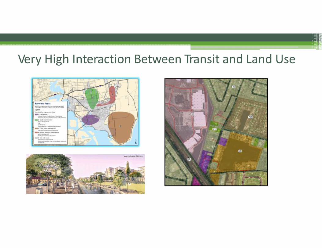
Very High Interaction Between Transit and Land Use
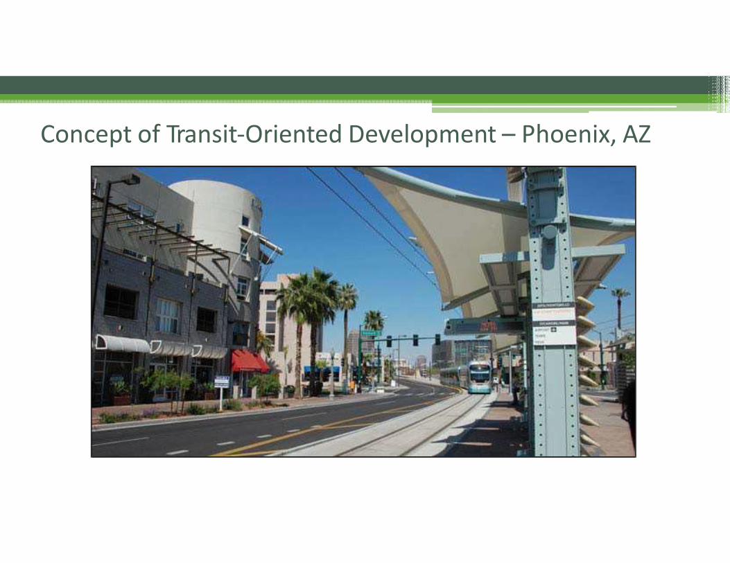
Concept of Transit‐Oriented Development – Phoenix, AZ
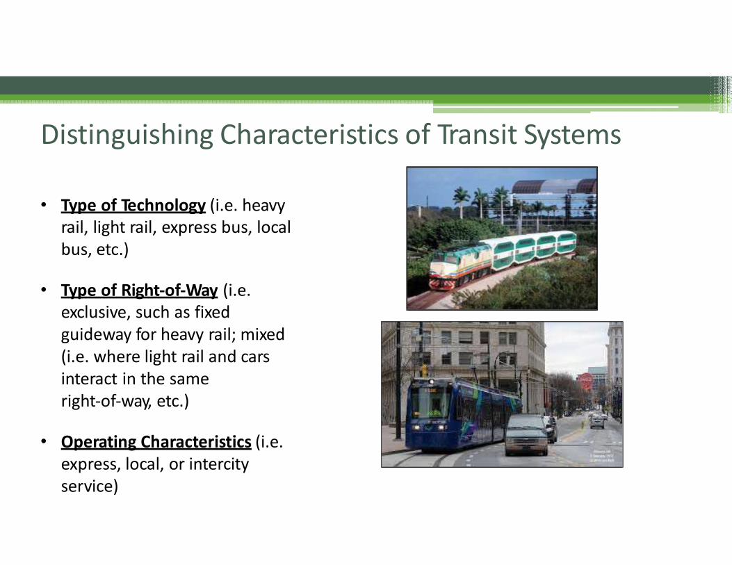
Distinguishing Characteristics of Transit Systems
• Type of Technology (i.e. heavyrail, light rail, express bus, localbus, etc.)
• Type of Right‐of‐Way (i.e. exclusive, such as fixed guideway for heavy rail; mixed (i.e. where light rail and cars interact in the sameright‐of‐way, etc.)
• Operating Characteristics (i.e.express, local, or intercityservice)
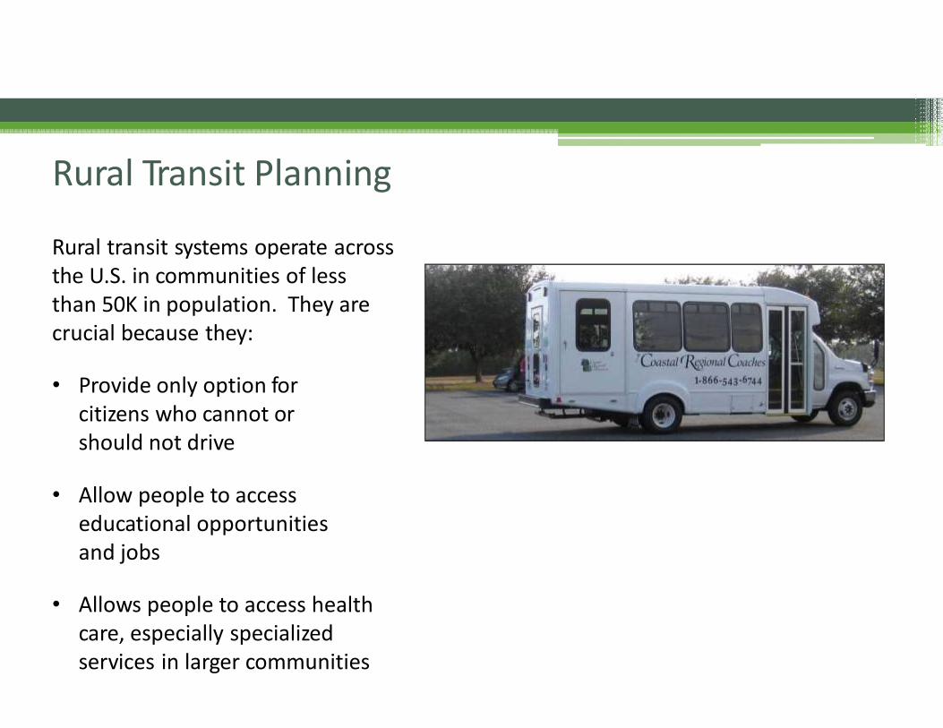
Rural transit systems operate acrossthe U.S. in communities of lessthan 50K in population. They arecrucial because they:
• Provide only option for citizens who cannot or should not drive
• Allow people to accesseducational opportunitiesand jobs
• Allows people to access healthcare, especially specializedservices in larger communities
Rural Transit Planning
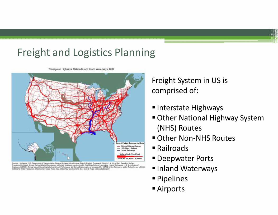
Freight System in US is comprised of:
▪ Interstate Highways▪Other National Highway System
(NHS) Routes▪Other Non‐NHS Routes▪Railroads▪Deepwater Ports▪ Inland Waterways▪ Pipelines▪Airports
Freight and Logistics Planning
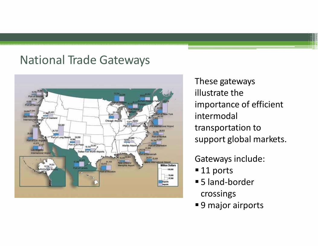
These gatewaysillustrate theimportance of efficientintermodal transportation tosupport global markets.
Gateways include:▪ 11 ports▪ 5 land‐border
crossings▪ 9 major airports
National Trade Gateways
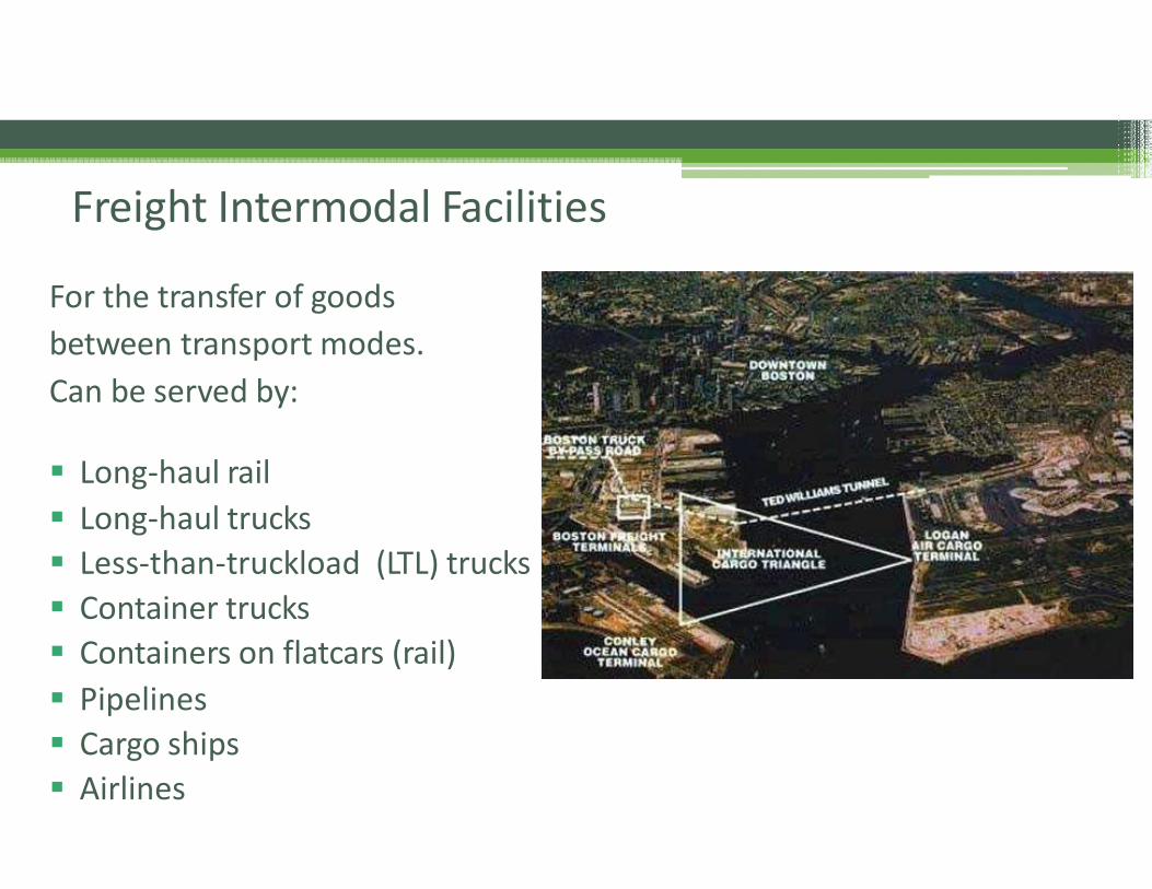
For the transfer of goods
between transport modes.
Can be served by:
▪ Long‐haul rail
▪ Long‐haul trucks
▪ Less‐than‐truckload (LTL) trucks
▪ Container trucks
▪ Containers on flatcars (rail)
▪ Pipelines
▪ Cargo ships
▪ Airlines
Freight Intermodal Facilities
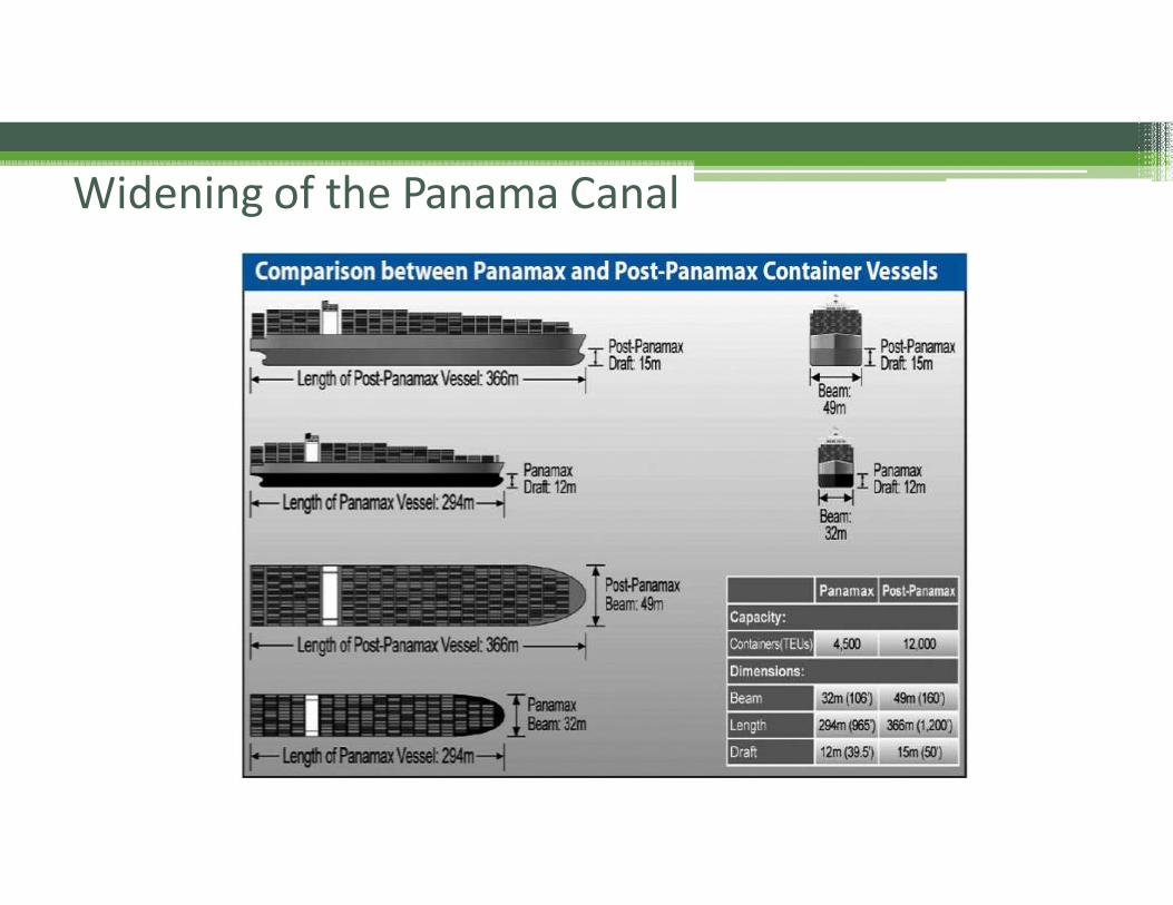
Widening of the Panama Canal
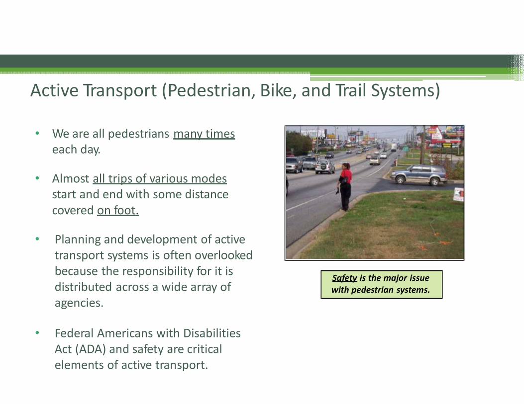
• We are all pedestrians many timeseach day.
• Almost all trips of various modesstart and end with some distancecovered on foot.
• Planning and development of activetransport systems is often overlookedbecause the responsibility for it isdistributed across a wide array ofagencies.
• Federal Americans with DisabilitiesAct (ADA) and safety are criticalelements of active transport.
Safety is the major issue with pedestrian systems.
Active Transport (Pedestrian, Bike, and Trail Systems)

Buffered Bike LanesBike Boulevards
“Sharrows”
Two‐way Cycle Tracks in Constrained Environments
Innovations in Bicycle Facilities
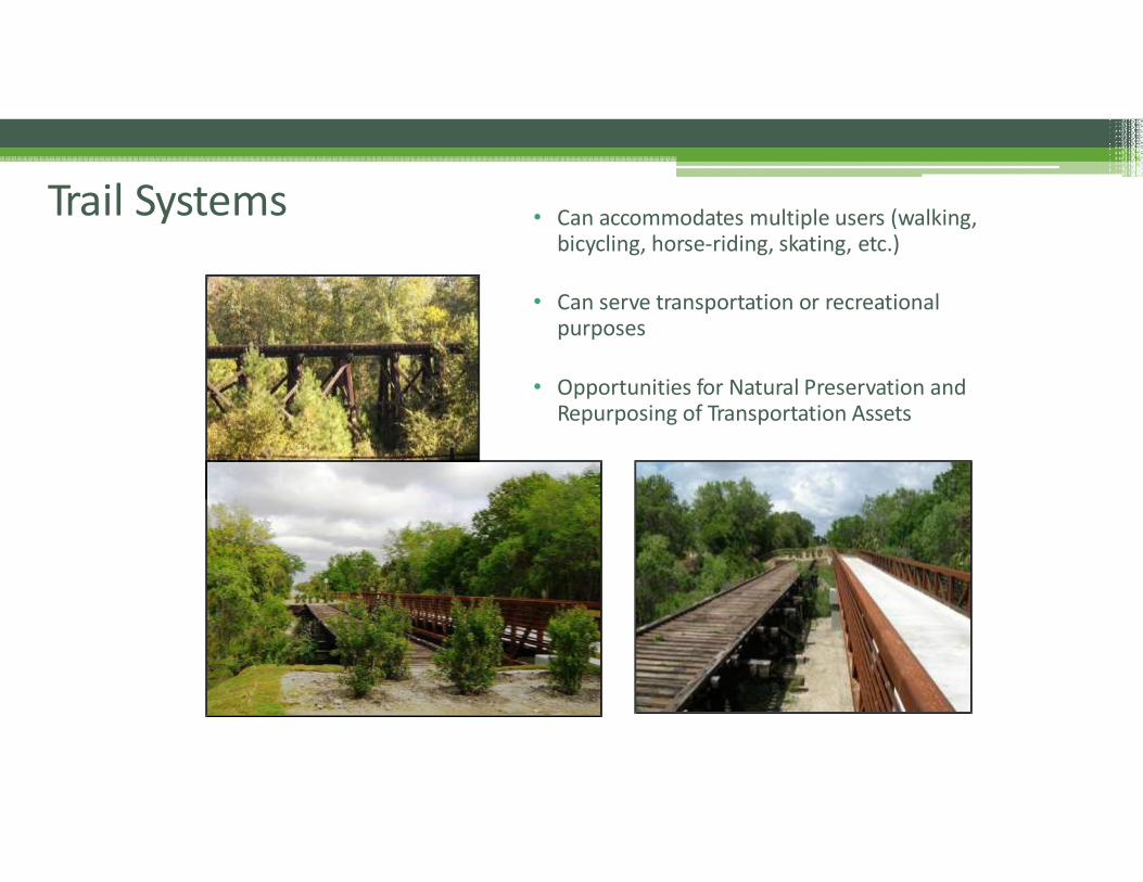
• Can accommodates multiple users (walking, bicycling, horse‐riding, skating, etc.)
• Can serve transportation or recreational purposes
• Opportunities for Natural Preservation and Repurposing of Transportation Assets
Trail Systems
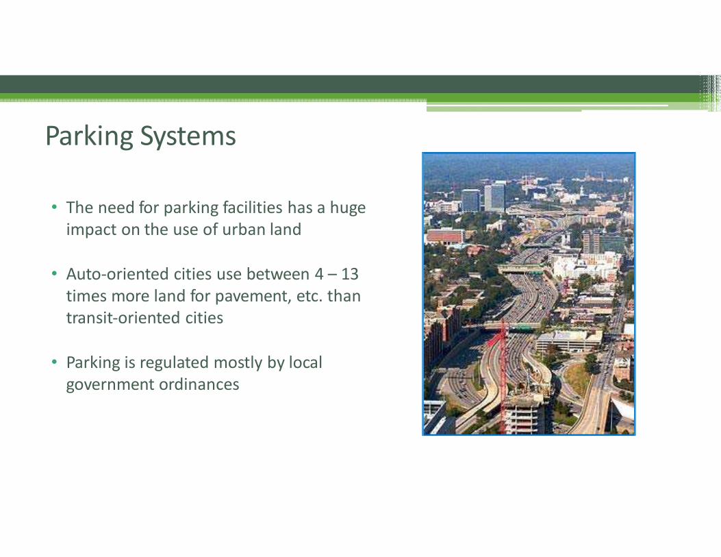
• The need for parking facilities has a huge impact on the use of urban land
• Auto‐oriented cities use between 4 – 13times more land for pavement, etc. thantransit‐oriented cities
• Parking is regulated mostly by localgovernment ordinances
Parking Systems
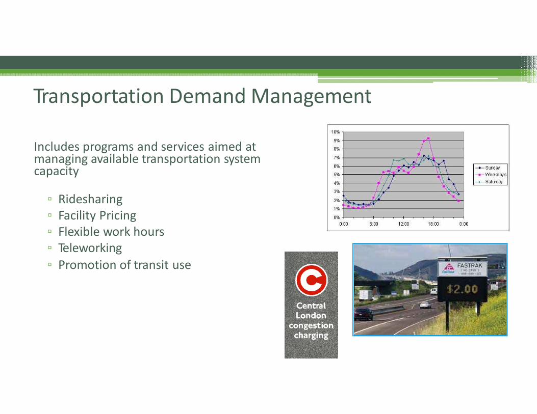
Transportation Demand Management
Includes programs and services aimed at managing available transportation systemcapacity
▫ Ridesharing▫ Facility Pricing▫ Flexible work hours▫ Teleworking
▫ Promotion of transit use
Infrastructure Planning
• Planning Principles• Approach, Practices, and Tools• Range of Community Infrastructure Systems
• Water Treatment and Distribution• Wastewater Collection, Treatment, and Disposal• Solid Waste Collection, Treatment and Disposal
• Communications Systems• Power/Energy Systems• Ground Transportation (various modes)• Community Facilities• Green Infrastructure• Blue Infrastructure• Integrated Planning
Infrastructure Planning
• Additional Infrastructure Systems Supporting Communities• Airfields and Other Aviation
Facilities• Water Resource Developments(i.e. irrigation, hydroelectric power, flood control, recreation, and navigation)
• Public housing
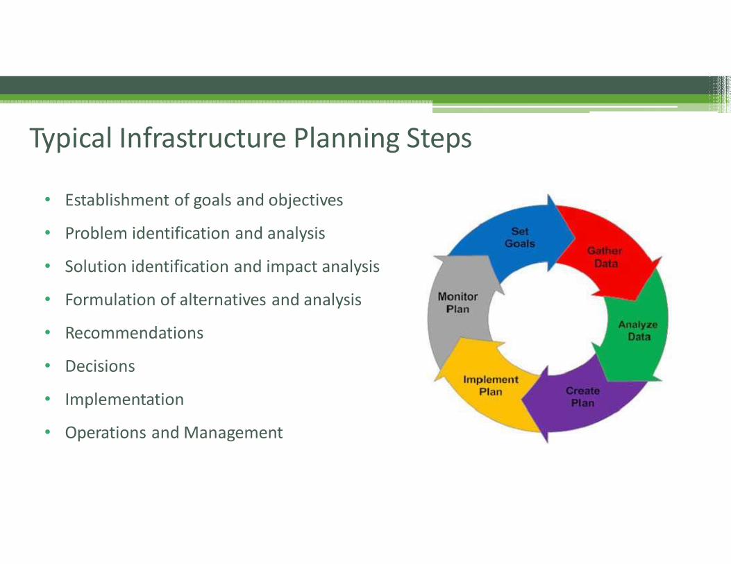
• Establishment of goals and objectives
• Problem identification and analysis
• Solution identification and impact analysis
• Formulation of alternatives and analysis
• Recommendations
• Decisions
• Implementation
• Operations and Management
Typical Infrastructure Planning Steps
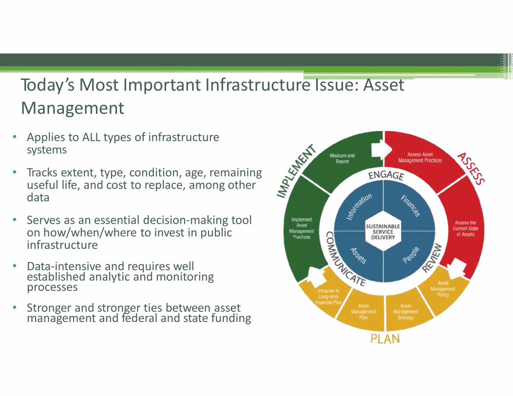
• Applies to ALL types of infrastructuresystems
• Tracks extent, type, condition, age, remaininguseful life, and cost to replace, among otherdata
• Serves as an essential decision‐making toolon how/when/where to invest in publicinfrastructure
• Data‐intensive and requires well established analytic and monitoring processes
• Stronger and stronger ties between asset management and federal and state funding
Today’s Most Important Infrastructure Issue: Asset Management
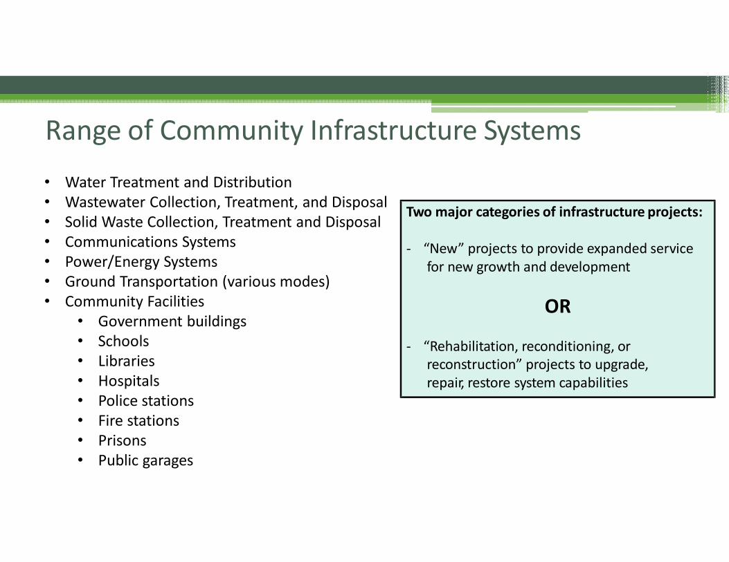
• Water Treatment and Distribution• Wastewater Collection, Treatment, and Disposal• Solid Waste Collection, Treatment and Disposal• Communications Systems• Power/Energy Systems• Ground Transportation (various modes)• Community Facilities
• Government buildings• Schools• Libraries• Hospitals• Police stations• Fire stations• Prisons• Public garages
Range of Community Infrastructure Systems
Two major categories of infrastructure projects:
‐ “New” projects to provide expanded servicefor new growth and development
OR
‐ “Rehabilitation, reconditioning, orreconstruction” projects to upgrade,repair, restore system capabilities
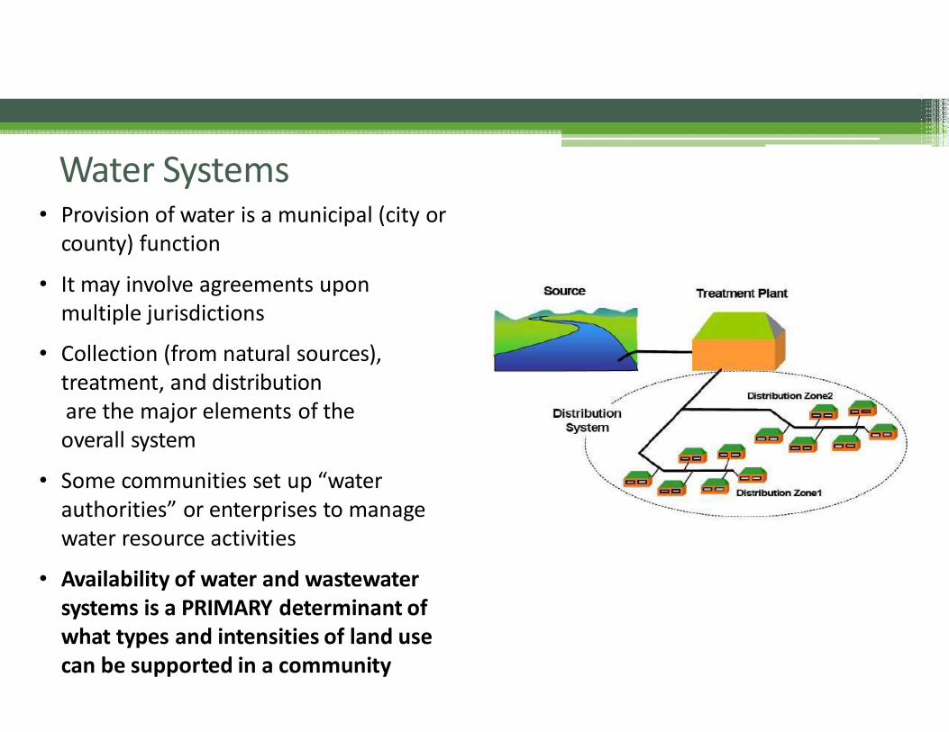
Water Systems• Provision of water is a municipal (city or
county) function
• It may involve agreements uponmultiple jurisdictions
• Collection (from natural sources),treatment, and distributionare the major elements of theoverall system
• Some communities set up “waterauthorities” or enterprises to managewater resource activities
• Availability of water and wastewatersystems is a PRIMARY determinant ofwhat types and intensities of land use can be supported in a community
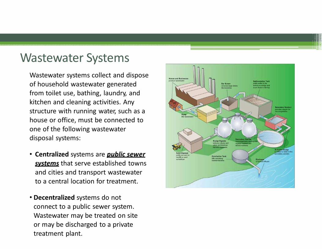
Wastewater SystemsWastewater systems collect and disposeof household wastewater generatedfrom toilet use, bathing, laundry, andkitchen and cleaning activities. Anystructure with running water, such as ahouse or office, must be connected toone of the following wastewater disposal systems:
• Centralized systems are public sewersystems that serve established towns and cities and transport wastewater to a central location for treatment.
• Decentralized systems do notconnect to a public sewer system. Wastewater may be treated on site or may be discharged to a private treatment plant.
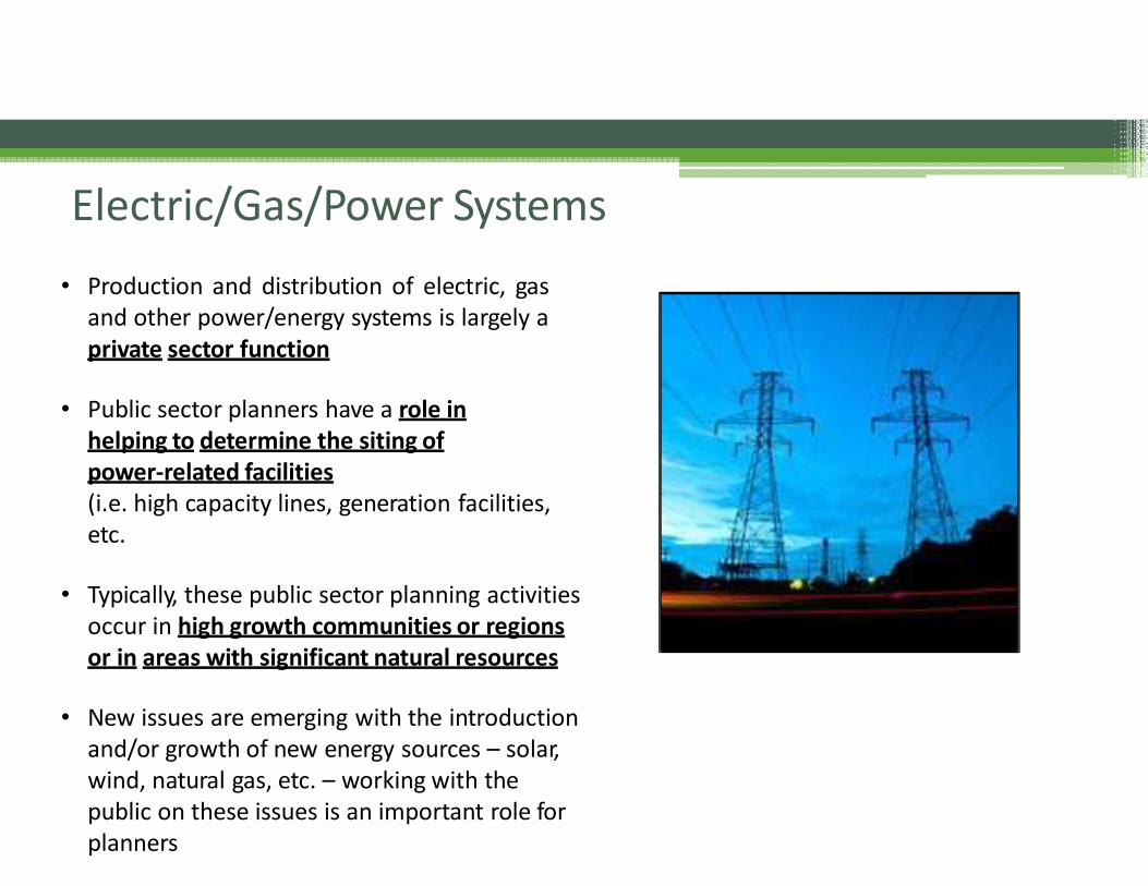
Electric/Gas/Power Systems
• Production and distribution of electric, gasand other power/energy systems is largely aprivate sector function
• Public sector planners have a role inhelping to determine the siting ofpower‐related facilities(i.e. high capacity lines, generation facilities,etc.
• Typically, these public sector planning activities occur in high growth communities or regionsor in areas with significant natural resources
• New issues are emerging with the introduction and/or growth of new energy sources – solar,wind, natural gas, etc. – working with thepublic on these issues is an important role for planners
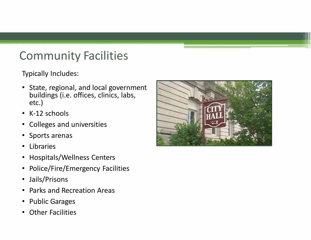
Community Facilities
Typically Includes:
• State, regional, and local government buildings (i.e. offices, clinics, labs,etc.)
• K‐12 schools
• Colleges and universities
• Sports arenas
• Libraries
• Hospitals/Wellness Centers
• Police/Fire/Emergency Facilities
• Jails/Prisons
• Parks and Recreation Areas
• Public Garages
• Other Facilities
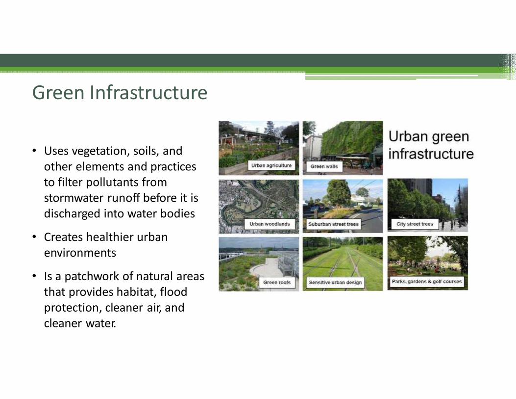
Green Infrastructure
• Uses vegetation, soils, and other elements and practicesto filter pollutants from stormwater runoff before it is discharged into water bodies
• Creates healthier urban environments
• Is a patchwork of natural areasthat provides habitat, flood protection, cleaner air, and cleaner water.
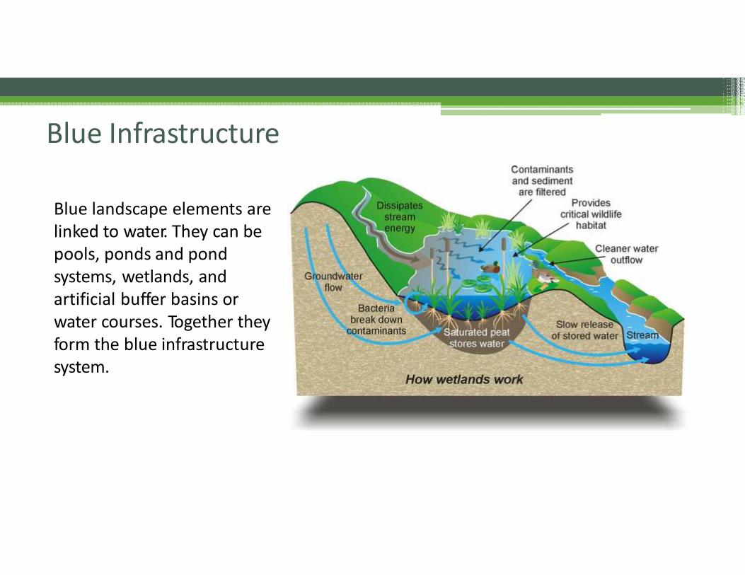
Blue Infrastructure
Blue landscape elements arelinked to water. They can bepools, ponds and pondsystems, wetlands, and artificial buffer basins or water courses. Together theyform the blue infrastructuresystem.
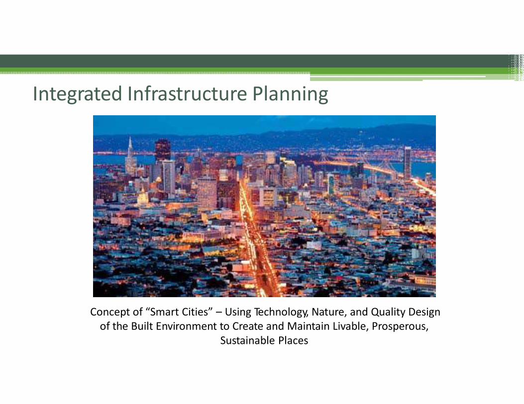
Integrated Infrastructure Planning
Concept of “Smart Cities” – Using Technology, Nature, and Quality Design of the Built Environment to Create and Maintain Livable, Prosperous,
Sustainable Places
Claudia Bilotto, AICP
Atlanta Area Manager
WSP
404-364-2651
Thank You for Attending Today