Embed Size (px)
Citation preview
© OpenStreetMap (and) contributors, CC-BY-SA
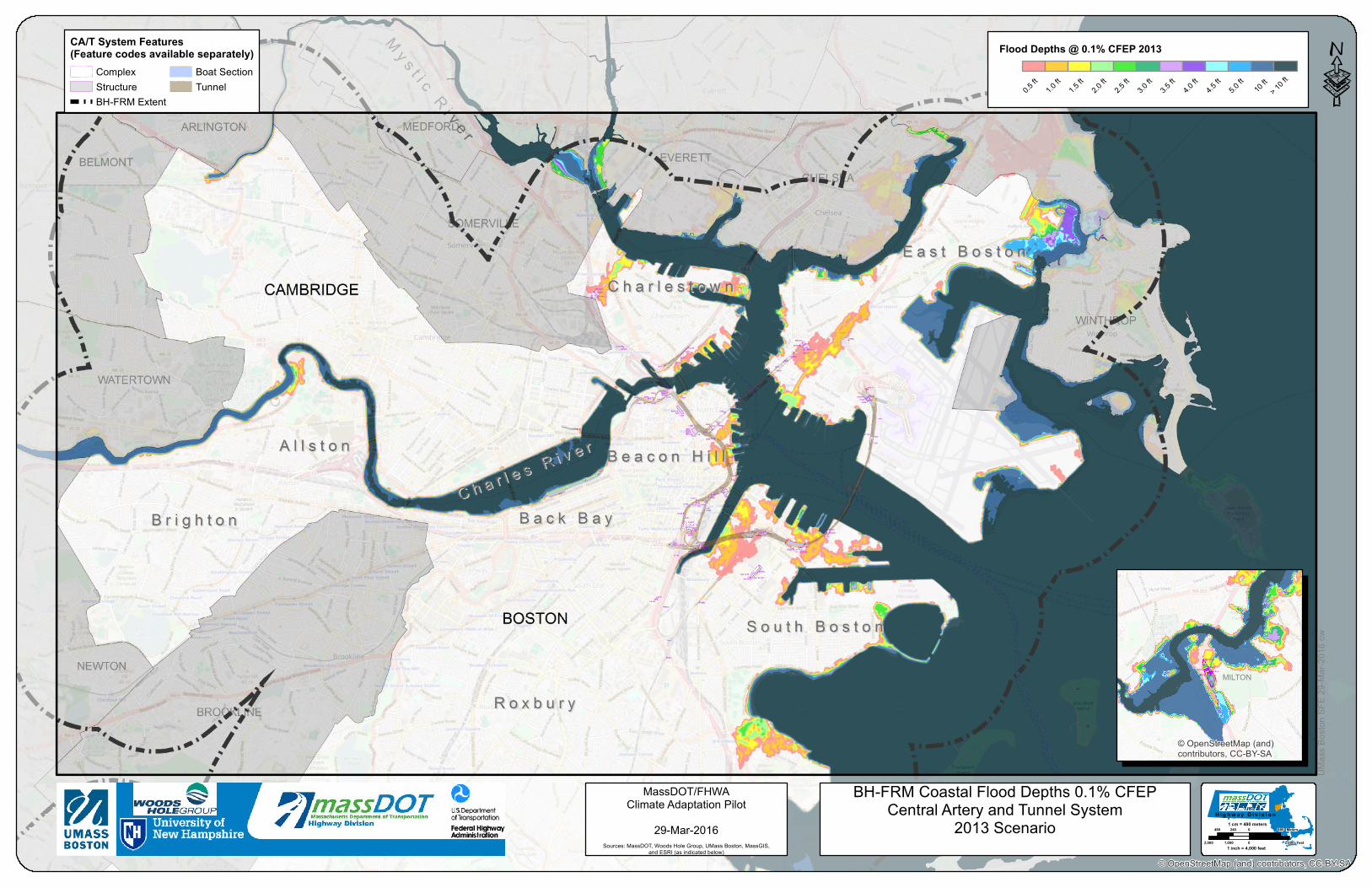
BH-FRM Coastal Flood Depths 0.1% CFEPCentral Artery and Tunnel System
2013 Scenario
MassDOT/FHWAClimate Adaptation Pilot
29-Mar-2016Sources: MassDOT, Woods Hole Group, UMass Boston, MassGIS,
and ESRI (as indicated below)
UMas
s Bos
ton SF
E 29-M
ar-20
16 cw
CA/T System Features(Feature codes available separately)
ComplexStructureBH-FRM Extent
Boat SectionTunnel
H i g h w a y D i v i s i o n1 cm = 480 meters
480 0 480240 Meters
2,000 0 2,0001,000 Feet1 inch = 4,000 feet
MILTOND6 FDG
D6D-D1-AD6D-D1-D
D6D-D1-C
D6D-D1-B
D6D-DC01
© OpenStreetMap (and)contributors, CC-BY-SA
Flood Depths @ 0.1% CFEP 2013
0.5 ft
1.0 ft
1.5 ft
2.0 ft
2.5 ft
3.0 ft
3.5 ft
4.0 ft
4.5 ft
5.0 ft 10
ft> 1
0 ft ·