Embed Size (px)
Citation preview
2013. 10
Hyo Hyun Sung Eunmi Chang
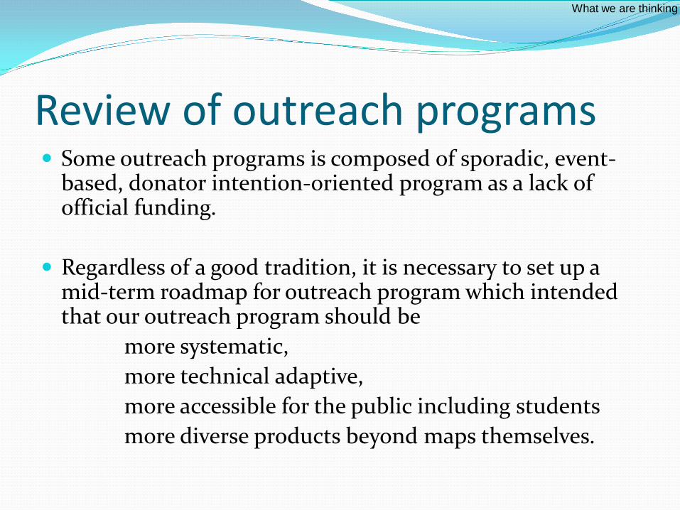
Review of outreach programs Some outreach programs is composed of sporadic, event-
based, donator intention-oriented program as a lack of official funding.
Regardless of a good tradition, it is necessary to set up a mid-term roadmap for outreach program which intended that our outreach program should be
more systematic, more technical adaptive, more accessible for the public including students more diverse products beyond maps themselves.
What we are thinking
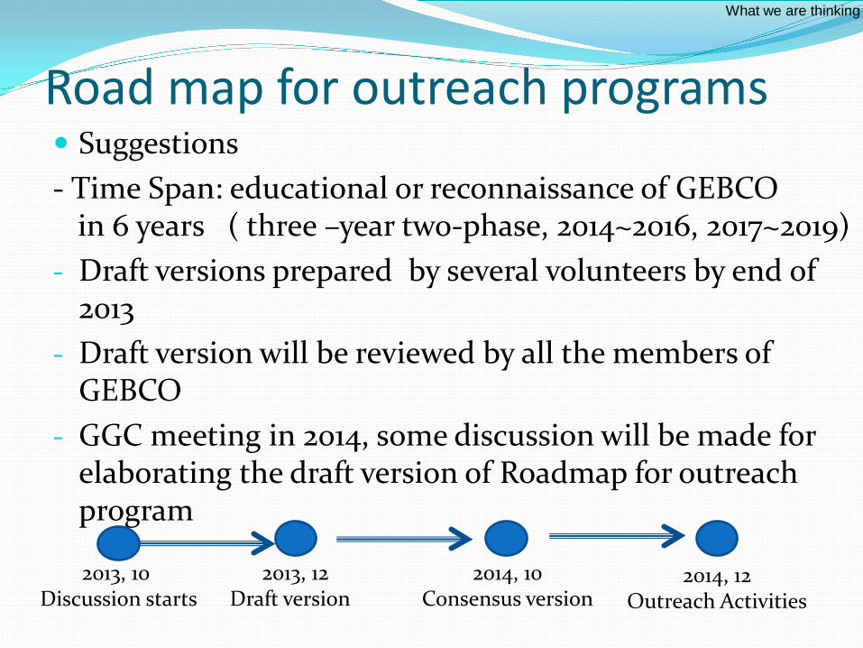
Road map for outreach programs Suggestions - Time Span: educational or reconnaissance of GEBCO
in 6 years ( three –year two-phase, 2014~2016, 2017~2019) - Draft versions prepared by several volunteers by end of
2013 - Draft version will be reviewed by all the members of
GEBCO - GGC meeting in 2014, some discussion will be made for
elaborating the draft version of Roadmap for outreach program
What we are thinking
2013, 10 Discussion starts
2013, 12 Draft version
2014, 10 Consensus version
2014, 12 Outreach Activities
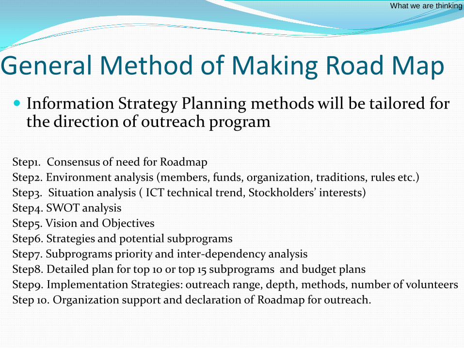
General Method of Making Road Map Information Strategy Planning methods will be tailored for
the direction of outreach program
Step1. Consensus of need for Roadmap Step2. Environment analysis (members, funds, organization, traditions, rules etc.) Step3. Situation analysis ( ICT technical trend, Stockholders’ interests) Step4. SWOT analysis Step5. Vision and Objectives Step6. Strategies and potential subprograms Step7. Subprograms priority and inter-dependency analysis Step8. Detailed plan for top 10 or top 15 subprograms and budget plans Step9. Implementation Strategies: outreach range, depth, methods, number of volunteers Step 10. Organization support and declaration of Roadmap for outreach.
What we are thinking

For examples
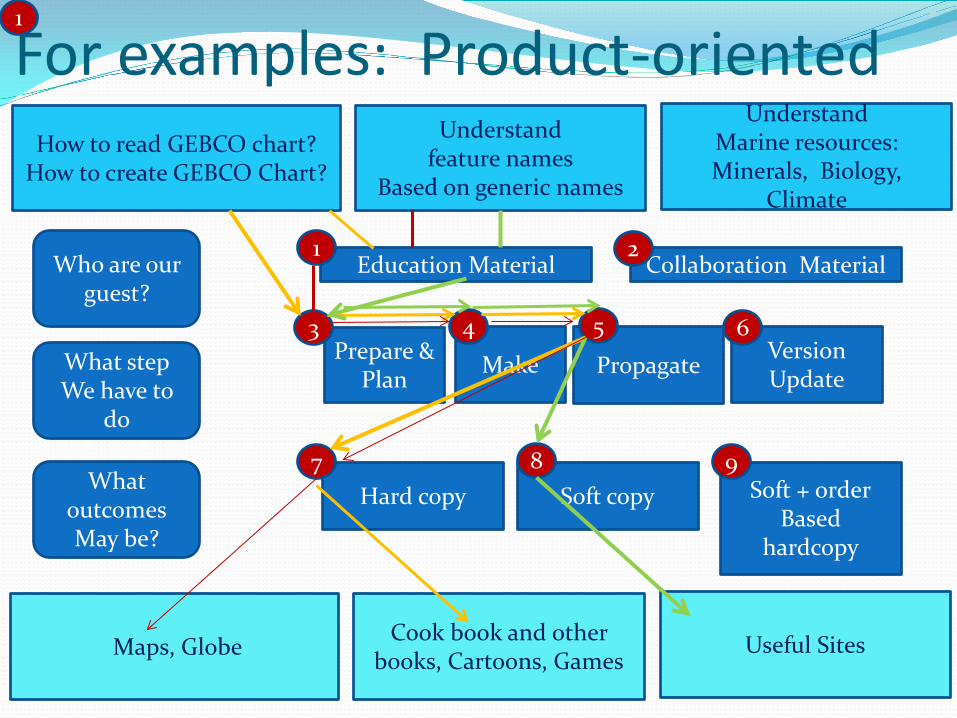
Hard copy Soft copy:
GEBCO Webmap Service
Soft + order Based
hardcopy
Education Material
Make Prepare & Plan Propagate Version
Update
Collaboration Material Who are our guest?
What step We have to
do
What outcomes May be?
1 2
3 4 5 6
7 8 9
Hard copy Soft copy Soft + order Based
hardcopy
Education Material
Make Prepare & Plan Propagate Version
Update
Collaboration Material Who are our guest?
What step We have to
do
What outcomes May be?
1 2
3 4 5 6
7 8 9
How to read GEBCO chart? How to create GEBCO Chart?
Understand feature names
Based on generic names
Understand Marine resources: Minerals, Biology,
Climate
Maps, Globe Cook book and other books, Cartoons, Games
Useful Sites
For examples: Product-oriented 1
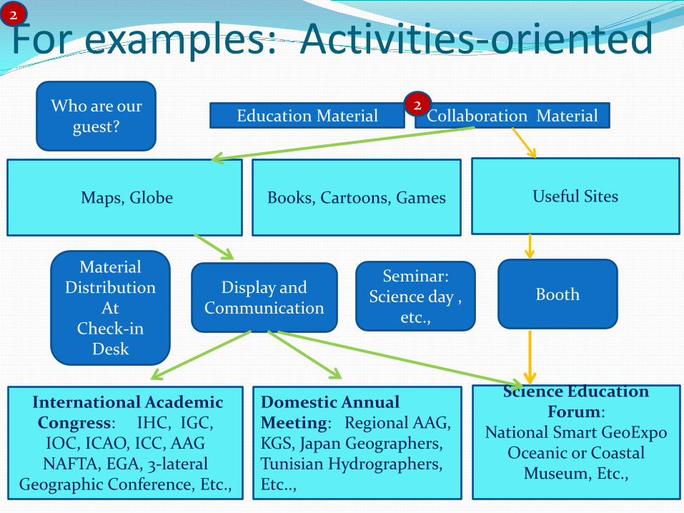
For examples: Activities-oriented 2
Education Material Collaboration Material Who are our guest?
2
Maps, Globe Books, Cartoons, Games Useful Sites
Booth Seminar:
Science day , etc.,
Material Distribution
At Check-in
Desk
Display and Communication
International Academic Congress: IHC, IGC, IOC, ICAO, ICC, AAG NAFTA, EGA, 3-lateral
Geographic Conference, Etc.,
Domestic Annual Meeting: Regional AAG, KGS, Japan Geographers, Tunisian Hydrographers, Etc..,
Science Education Forum:
National Smart GeoExpo Oceanic or Coastal
Museum, Etc.,
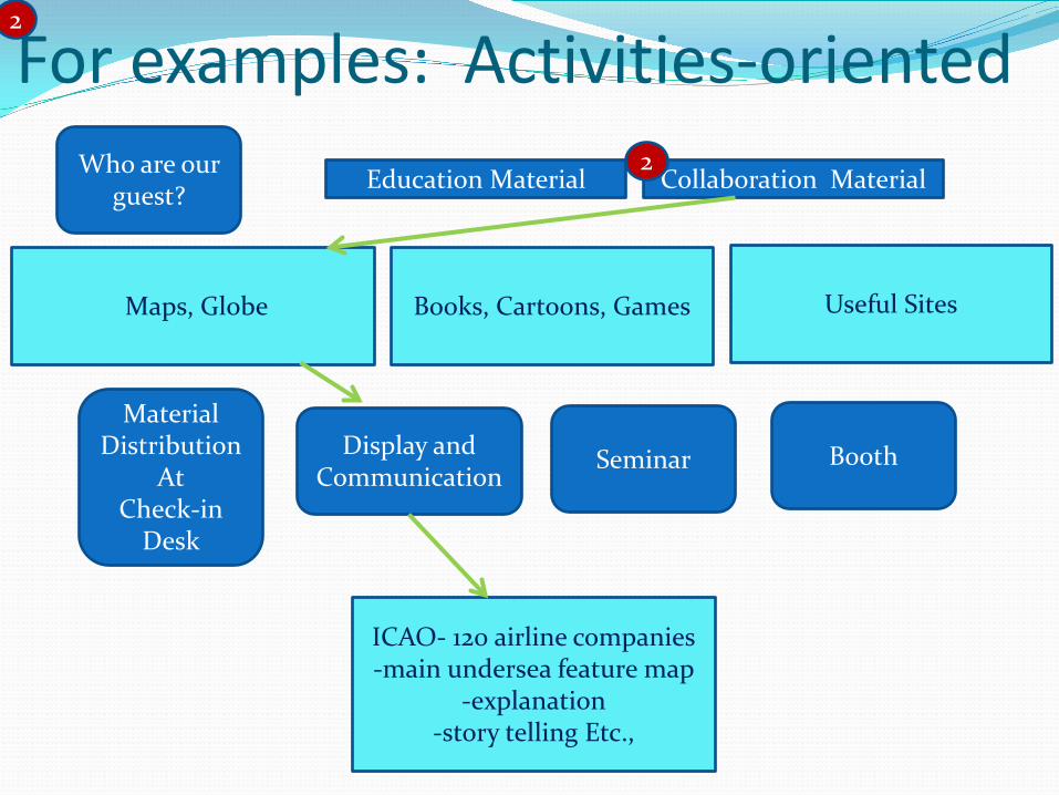
Education Material Collaboration Material Who are our guest?
2
Maps, Globe Books, Cartoons, Games Useful Sites
Booth Seminar
Material Distribution
At Check-in
Desk
Display and Communication
ICAO- 120 airline companies -main undersea feature map
-explanation -story telling Etc.,
For examples: Activities-oriented 2
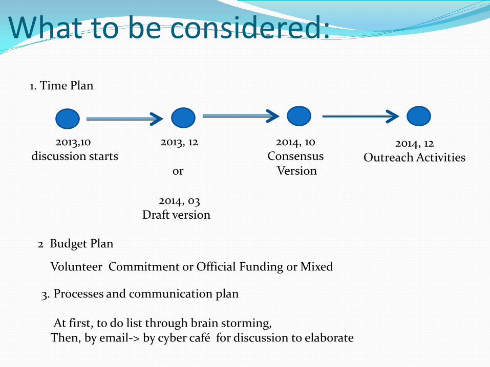
2013,10 discussion starts
2013, 12
or
2014, 03 Draft version
2014, 10 Consensus
Version
2014, 12 Outreach Activities
What to be considered:
Volunteer Commitment or Official Funding or Mixed
1. Time Plan
2 Budget Plan
3. Processes and communication plan At first, to do list through brain storming, Then, by email-> by cyber café for discussion to elaborate
Effects of outreach program Awareness of GEBCO activities Lead societies toward Sustainable development More investments on Hydrographic Survey and Ocean
Mapping
Thank you !
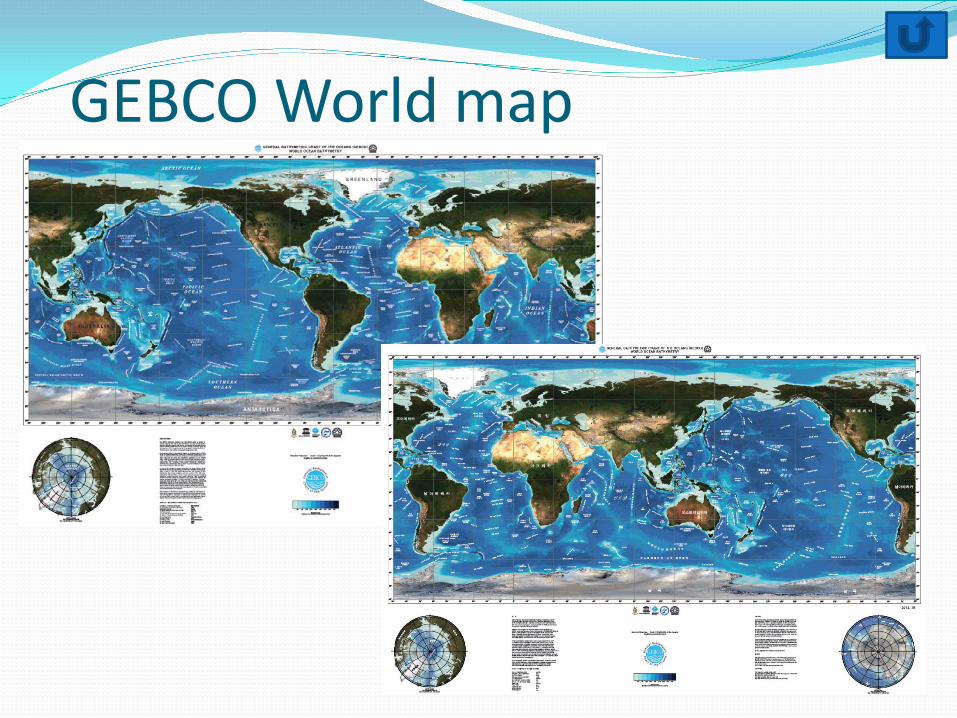
GEBCO World map
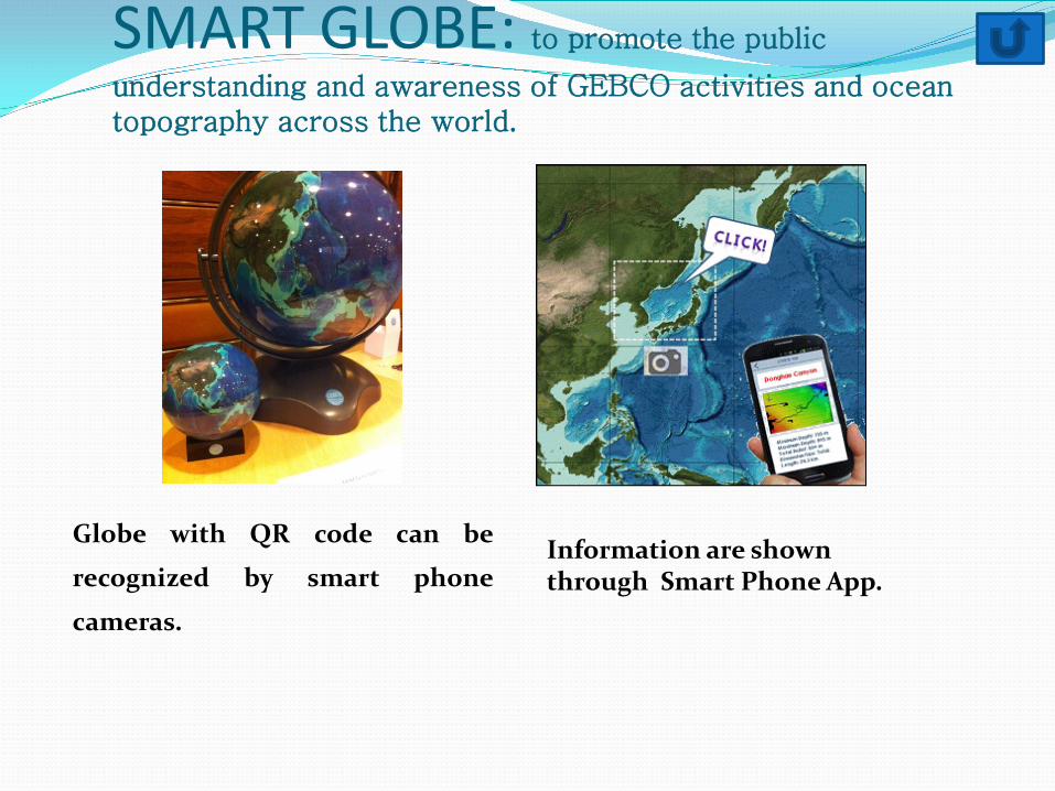
SMART GLOBE: to promote the public
understanding and awareness of GEBCO activities and ocean topography across the world.
Globe with QR code can be
recognized by smart phone
cameras.
Information are shown through Smart Phone App.
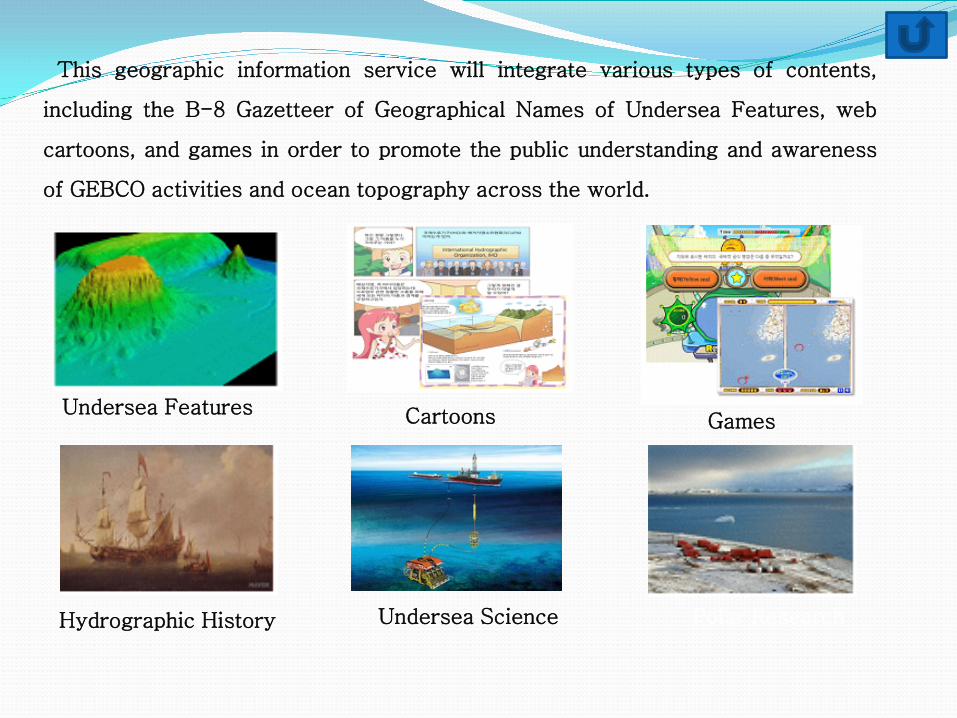
This geographic information service will integrate various types of contents,
including the B-8 Gazetteer of Geographical Names of Undersea Features, web
cartoons, and games in order to promote the public understanding and awareness
of GEBCO activities and ocean topography across the world.
Undersea Features Cartoons Games
Hydrographic History Undersea Science Polar Research
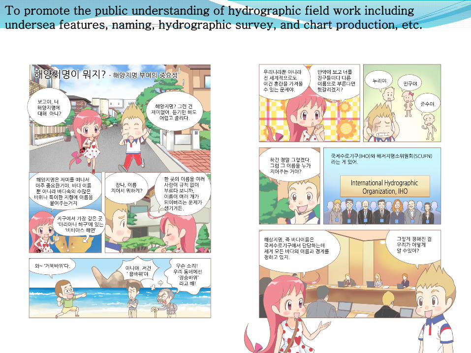
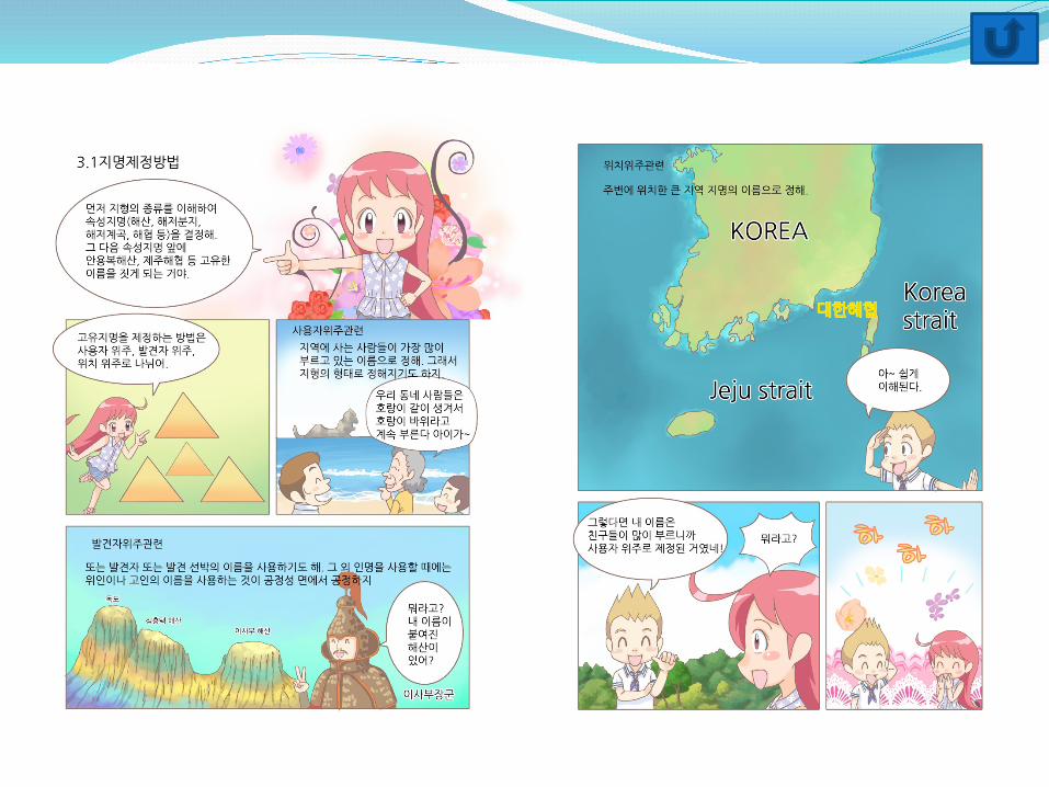
To promote the public understanding of hydrographic field work including undersea features, naming, hydrographic survey, and chart production, etc.
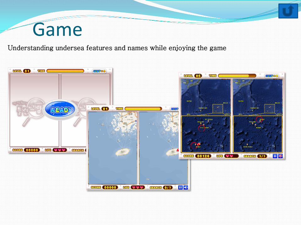
Understanding undersea features and names while enjoying the game
Game
International Symposium on Application of Marine Geophysical Data and Undersea Feature Names
International symposium has been held since 2006 Purpose: To set a stage for continuous discussions, exchanges of ideas and
information, and the building of an international network of scholars, professionals, and administrators in the fields of identifying and naming undersea features and related techniques
Approximately 50 articles were presented.
Main subjects : Enhancement in Technologies of Undersea Feature Measurements Management and History of Marine Geographical Names
The 8th international symposium will be held in Busan, Oct. 30-31, 2013
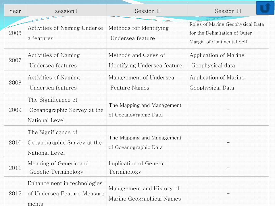
Year session I Session II Session III
2006 Activities of Naming Underse
a features
Methods for Identifying
Undersea feature
Roles of Marine Geophysical Data
for the Delimitation of Outer
Margin of Continental Self
2007 Activities of Naming
Undersea features
Methods and Cases of
Identifying Undersea feature
Application of Marine
Geophysical data
2008 Activities of Naming
Undersea features
Management of Undersea
Feature Names
Application of Marine
Geophysical Data
2009
The Significance of
Oceanographic Survey at the
National Level
The Mapping and Management
of Oceanographic Data -
2010
The Significance of
Oceanographic Survey at the
National Level
The Mapping and Management
of Oceanographic Data -
2011 Meaning of Generic and
Genetic Terminology
Implication of Genetic
Terminology -
2012
Enhancement in technologies
of Undersea Feature Measure
ments
Management and History of
Marine Geographical Names -
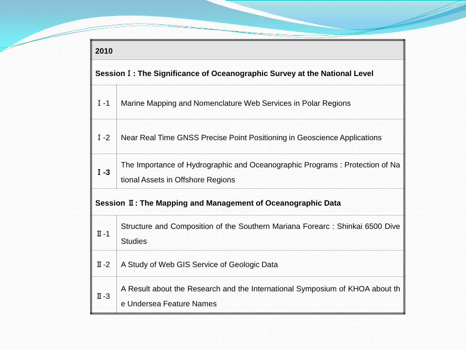
2010
SessionⅠ: The Significance of Oceanographic Survey at the National Level
Ⅰ-1 Marine Mapping and Nomenclature Web Services in Polar Regions
Ⅰ-2 Near Real Time GNSS Precise Point Positioning in Geoscience Applications
Ⅰ-3 The Importance of Hydrographic and Oceanographic Programs : Protection of Na
tional Assets in Offshore Regions
Session Ⅱ: The Mapping and Management of Oceanographic Data
Ⅱ-1 Structure and Composition of the Southern Mariana Forearc : Shinkai 6500 Dive
Studies
Ⅱ-2 A Study of Web GIS Service of Geologic Data
Ⅱ-3 A Result about the Research and the International Symposium of KHOA about th
e Undersea Feature Names
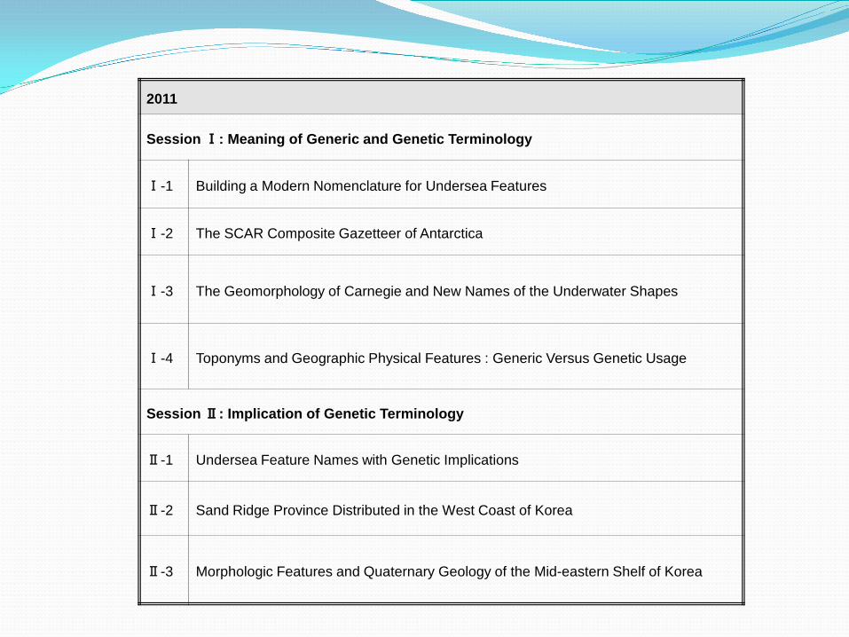
2011
Session Ⅰ: Meaning of Generic and Genetic Terminology
Ⅰ-1 Building a Modern Nomenclature for Undersea Features
Ⅰ-2 The SCAR Composite Gazetteer of Antarctica
Ⅰ-3 The Geomorphology of Carnegie and New Names of the Underwater Shapes
Ⅰ-4 Toponyms and Geographic Physical Features : Generic Versus Genetic Usage
Session Ⅱ: Implication of Genetic Terminology
Ⅱ-1 Undersea Feature Names with Genetic Implications
Ⅱ-2 Sand Ridge Province Distributed in the West Coast of Korea
Ⅱ-3 Morphologic Features and Quaternary Geology of the Mid-eastern Shelf of Korea
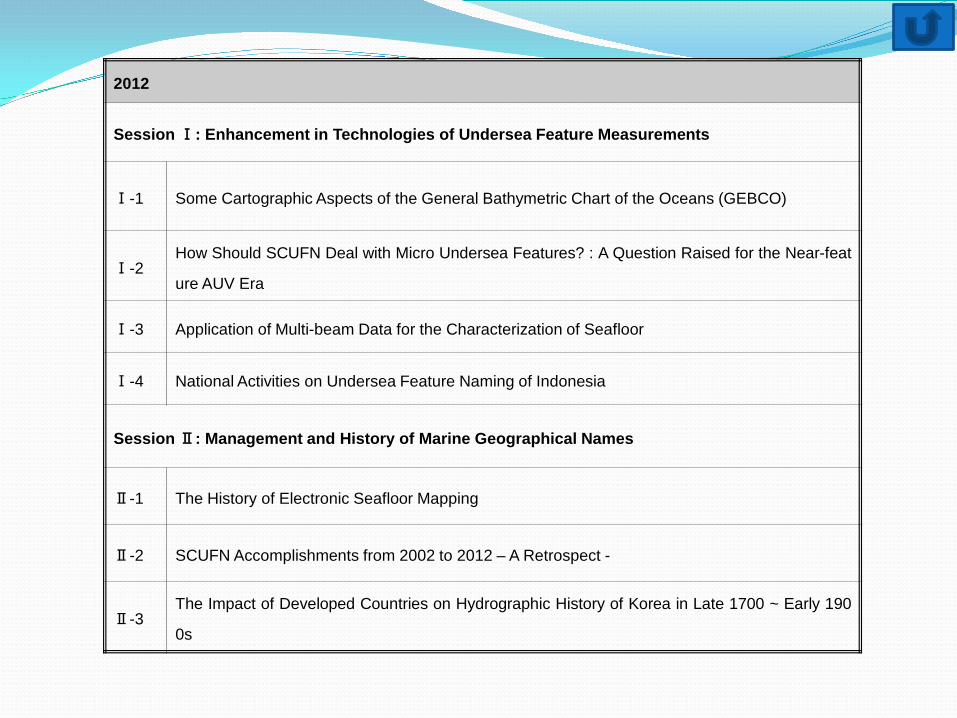
2012
Session Ⅰ: Enhancement in Technologies of Undersea Feature Measurements
Ⅰ-1 Some Cartographic Aspects of the General Bathymetric Chart of the Oceans (GEBCO)
Ⅰ-2 How Should SCUFN Deal with Micro Undersea Features? : A Question Raised for the Near-feat
ure AUV Era
Ⅰ-3 Application of Multi-beam Data for the Characterization of Seafloor
Ⅰ-4 National Activities on Undersea Feature Naming of Indonesia
Session Ⅱ: Management and History of Marine Geographical Names
Ⅱ-1 The History of Electronic Seafloor Mapping
Ⅱ-2 SCUFN Accomplishments from 2002 to 2012 – A Retrospect -
Ⅱ-3 The Impact of Developed Countries on Hydrographic History of Korea in Late 1700 ~ Early 190
0s
Smart Globe with GEBCO World Map and Gazetteer
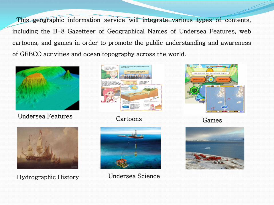
This geographic information service will integrate various types of contents,
including the B-8 Gazetteer of Geographical Names of Undersea Features, web
cartoons, and games in order to promote the public understanding and awareness
of GEBCO activities and ocean topography across the world.
Undersea Features Cartoons Games
Hydrographic History Undersea Science Polar Research