Embed Size (px)
Citation preview
2007 SATURN User Group MeetingIntegrating SATURN with GIS
19th October 2007 Erik R Nielsen
All mapping: © Crown copyright 2006. All rights reserved.
Date (if applicable) Presentation Title
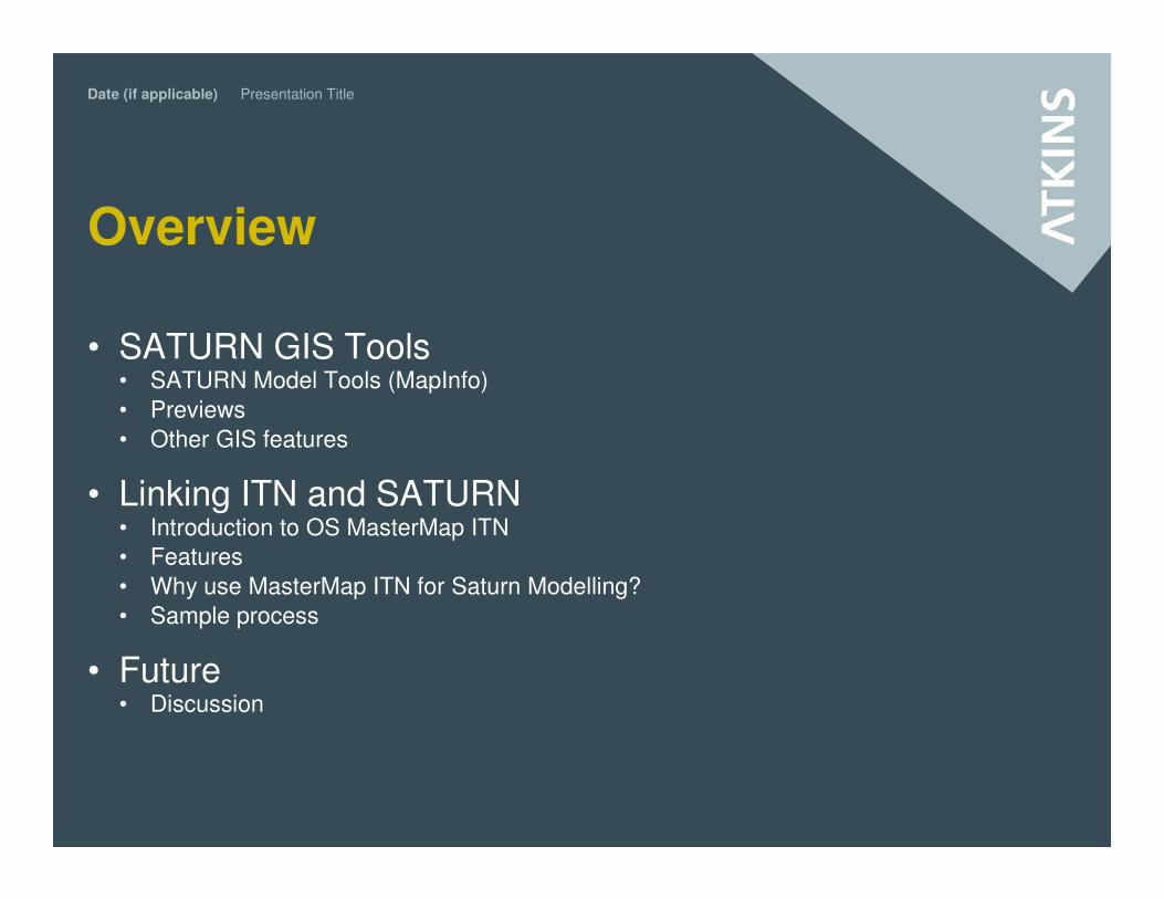
Overview
• SATURN GIS Tools• SATURN Model Tools (MapInfo)
• Previews
• Other GIS features
• Linking ITN and SATURN• Introduction to OS MasterMap ITN
• Features
• Why use MasterMap ITN for Saturn Modelling?
• Sample process
• Future • Discussion
Date (if applicable) Presentation Title
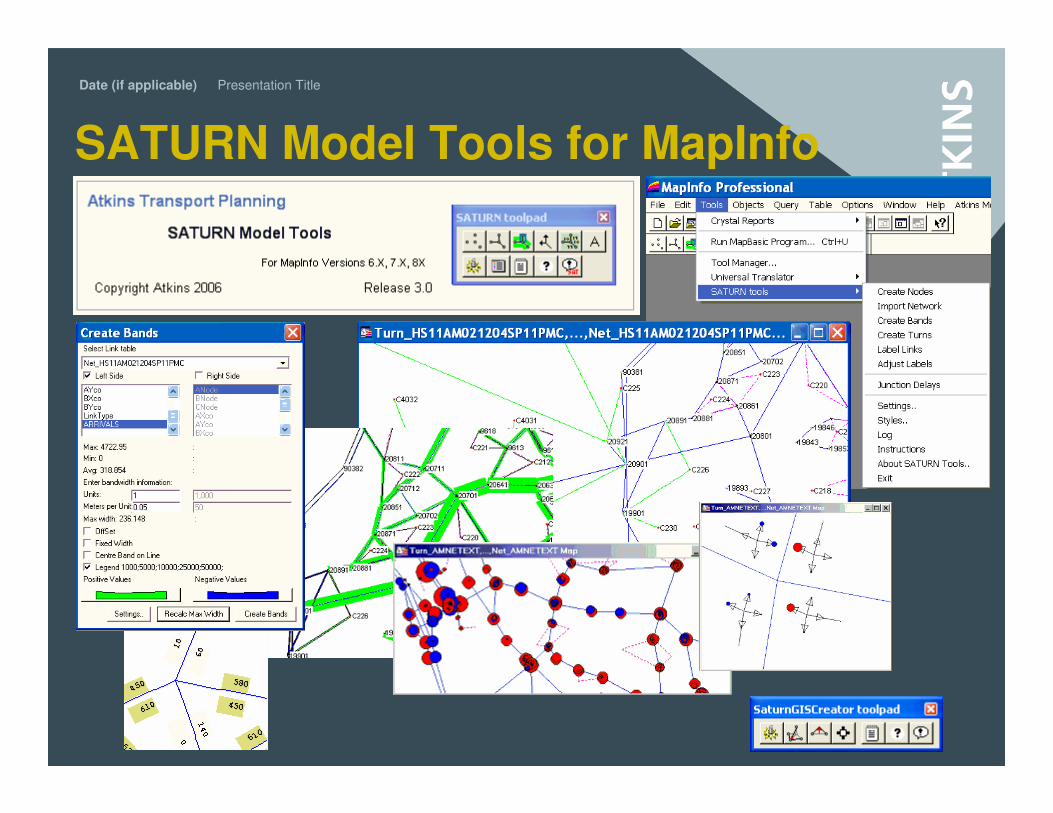
SATURN Model Tools for MapInfo
Date (if applicable) Presentation Title
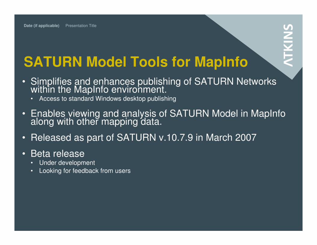
SATURN Model Tools for MapInfo
• Simplifies and enhances publishing of SATURN Networks within the MapInfo environment. • Access to standard Windows desktop publishing
• Enables viewing and analysis of SATURN Model in MapInfo along with other mapping data.
• Released as part of SATURN v.10.7.9 in March 2007
• Beta release• Under development
• Looking for feedback from users
Date (if applicable) Presentation Title
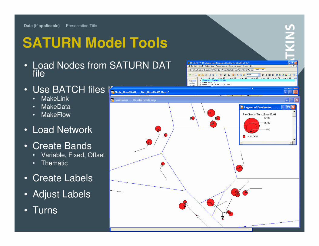
SATURN Model Tools
• Load Nodes from SATURN DAT file
• Use BATCH files to dump Network• MakeLink
• MakeData
• MakeFlow
• Load Network
• Create Bands• Variable, Fixed, Offset
• Thematic
• Create Labels
• Adjust Labels
• Turns
Date (if applicable) Presentation Title
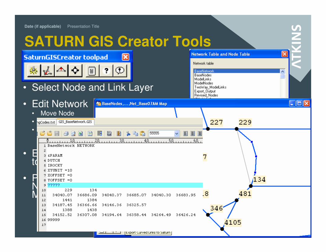
SATURN GIS Creator Tools
• Select Node and Link Layer
• Edit Network • Move Node
• Create Vertix
• Move Vertix
(+CTRL)
• Export Data to SATURN
• Preview of Network Matcher
Date (if applicable) Presentation Title
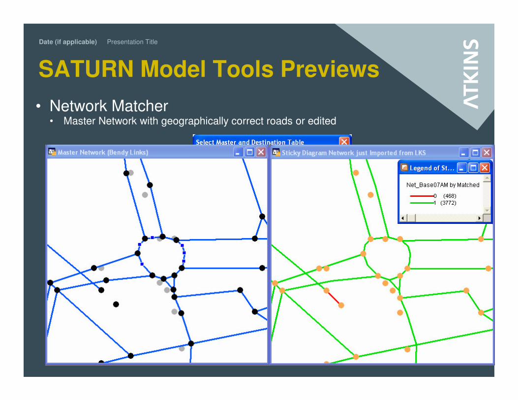
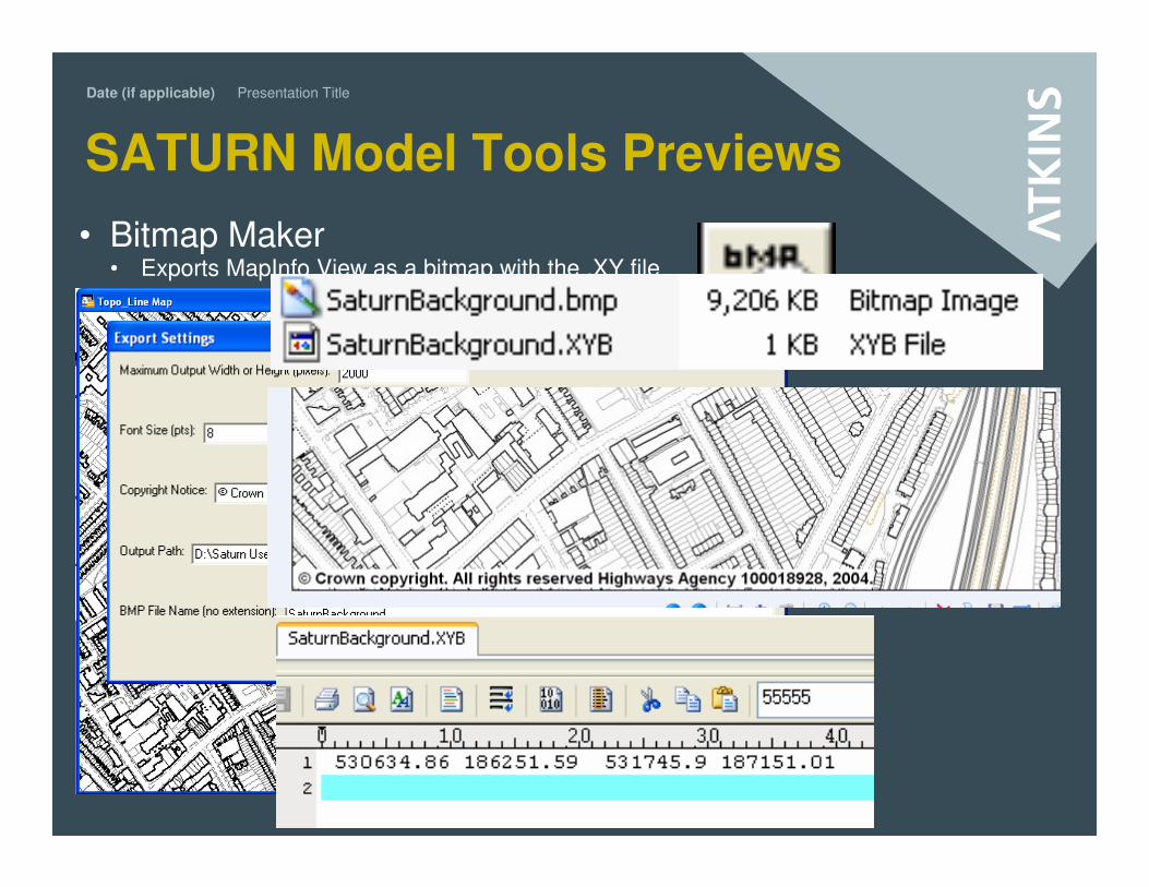
SATURN Model Tools Previews
• Network Matcher• Master Network with geographically correct roads or edited
Date (if applicable) Presentation Title
SATURN Model Tools Previews
• Bitmap Maker• Exports MapInfo View as a bitmap with the .XY file
• Where to download them
• http://www.saturnsoftware.co.uk/
Date (if applicable) Presentation Title
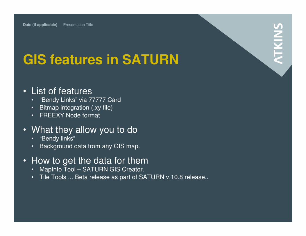
GIS features in SATURN
• List of features• “Bendy Links” via 77777 Card
• Bitmap integration (.xy file)
• FREEXY Node format
• What they allow you to do• “Bendy links”
• Background data from any GIS map.
• How to get the data for them• MapInfo Tool – SATURN GIS Creator.
• Tile Tools ... Beta release as part of SATURN v.10.8 release..
Date (if applicable) Presentation Title
Linking ITN and SATURN
Making the most of GIS data from the outset.
Date (if applicable) Presentation Title
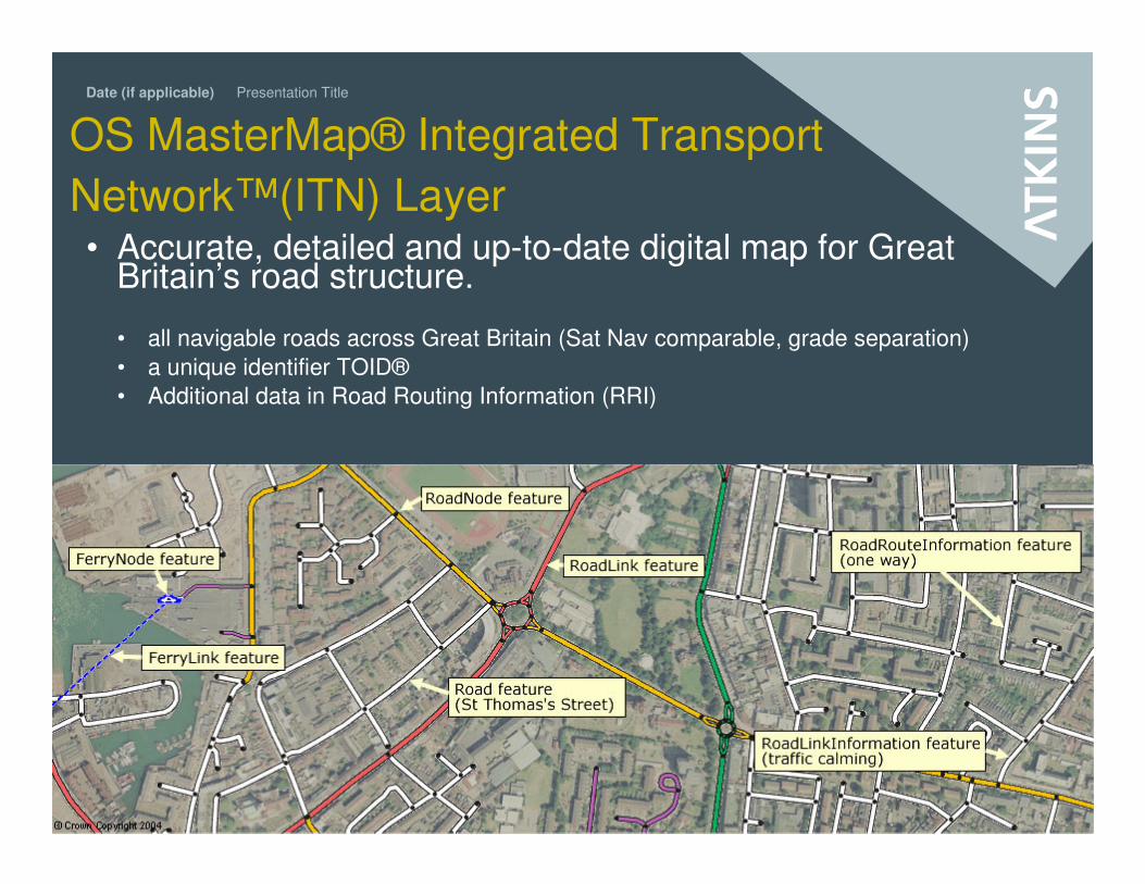
OS MasterMap® Integrated Transport
Network™(ITN) Layer• Accurate, detailed and up-to-date digital map for Great
Britain’s road structure.
• all navigable roads across Great Britain (Sat Nav comparable, grade separation)
• a unique identifier TOID®
• Additional data in Road Routing Information (RRI)
Date (if applicable) Presentation Title
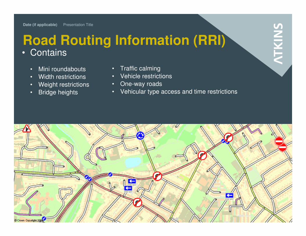
Road Routing Information (RRI) • Contains
• Mini roundabouts
• Width restrictions
• Weight restrictions
• Bridge heights
• Traffic calming
• Vehicle restrictions
• One-way roads
• Vehicular type access and time restrictions
Date (if applicable) Presentation Title
How it can benefit you (generally)• If you…
• …have the responsibility for planning, scheduling or providing geographic information to
your employees, customers or the public, it is important to use the latest and most
accurate information available. The ITN Layer has a continuous programme of revision
capturing real-world change at the same detailed level nationwide. Changes in the data
are made available every six weeks.
• …need a common standard of reference to allow different data systems to
communicate with each other, the ITN Layer and TOID infrastructure allow you to have
that common reference point.
• …need to create and maintain the National Street Gazetteer to level 3, the ITN Layer
supports this.
• …have the additional responsibility of planning and scheduling traceable loads. Using
the RRI, users can realise significant benefits in increased customer satisfaction and
reduced-expenses journey planning
Date (if applicable) Presentation Title
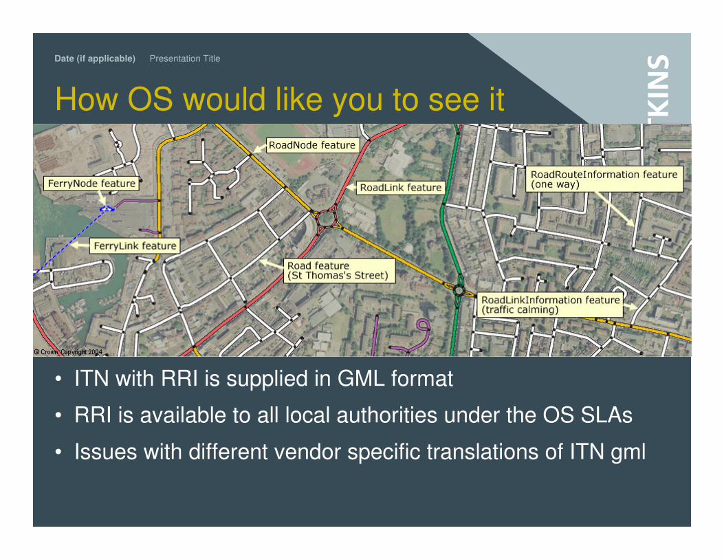
How OS would like you to see it
• ITN with RRI is supplied in GML format
• RRI is available to all local authorities under the OS SLAs
• Issues with different vendor specific translations of ITN gml
Date (if applicable) Presentation Title
ITN benefits the modelling process
• More accurate base data• Predefined road classes
• One way streets, Banned turns, Speed bumps
• Up to date
• Standard reference network for exchanging information with model output users• Air quality
• Noise mapping
• Scheme prioritisation
• Social inclusion
• Improved presentation of results
• Network that can interact soundly with surroundings• Cross referencing to real gis data (counts, network inventory, base mapping etc)
• Buffer analysis
Date (if applicable) Presentation Title
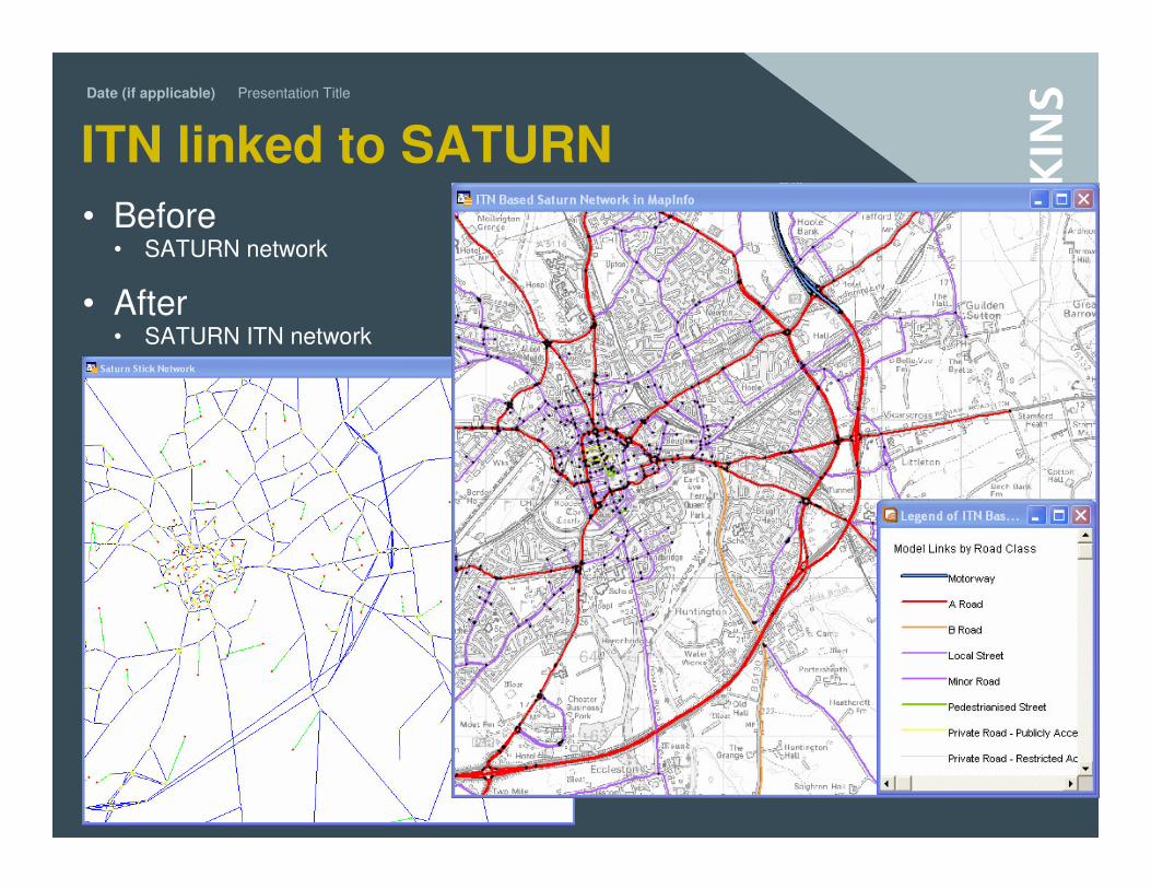
ITN linked to SATURN
• Before• SATURN network
• After• SATURN ITN network
Walk through the process• Supply of ITN
• Translation to GIS format
• Special Model Network Referencing ITN
• SATURN buffer network with capacity index
• Dealing with conflation issues
Date (if applicable) Presentation Title
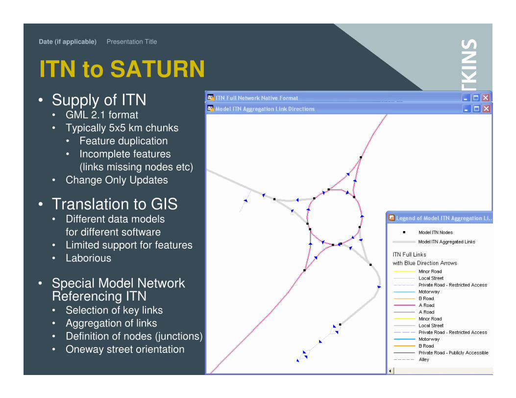
ITN to SATURN
• Supply of ITN • GML 2.1 format
• Typically 5x5 km chunks
• Feature duplication
• Incomplete features
(links missing nodes etc)
• Change Only Updates
• Translation to GIS• Different data models
for different software
• Limited support for features
• Laborious
• Special Model Network Referencing ITN• Selection of key links
• Aggregation of links
• Definition of nodes (junctions)
• Oneway street orientation
Date (if applicable) Presentation Title
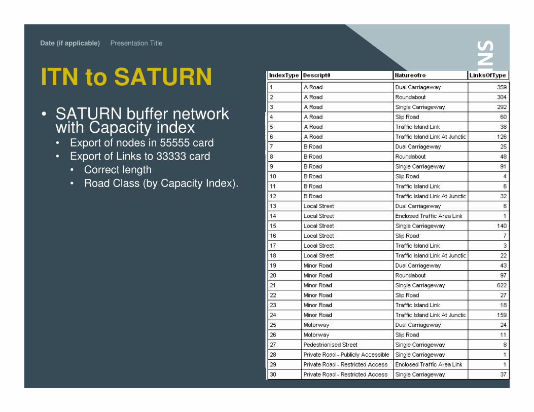
ITN to SATURN
• SATURN buffer network with Capacity index• Export of nodes in 55555 card
• Export of Links to 33333 card
• Correct length
• Road Class (by Capacity Index).
Date (if applicable) Presentation Title
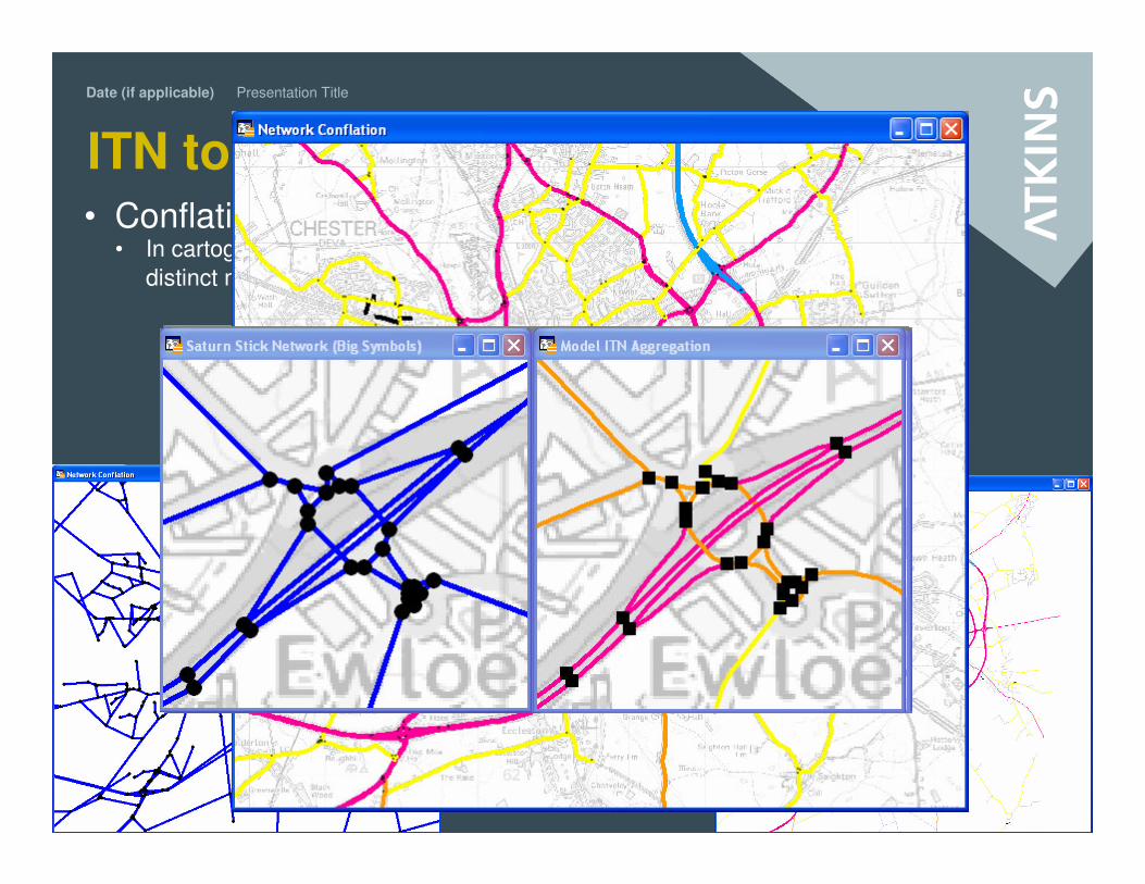
ITN to SATURN• Conflation Challenges
• In cartography, conflation refers to the act of combining two
distinct maps into one new map
• Ireversible, inaccurate, self contradicting
• Preserving an unambiguous relation
Date (if applicable) Presentation Title
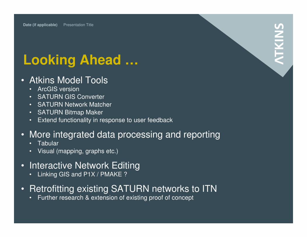
Looking Ahead …
• Atkins Model Tools• ArcGIS version
• SATURN GIS Converter
• SATURN Network Matcher
• SATURN Bitmap Maker
• Extend functionality in response to user feedback
• More integrated data processing and reporting• Tabular
• Visual (mapping, graphs etc.)
• Interactive Network Editing• Linking GIS and P1X / PMAKE ?
• Retrofitting existing SATURN networks to ITN• Further research & extension of existing proof of concept