Embed Size (px)
Citation preview

2006 Greater Everglades Ecosystem Restoration Conference
Planning, Policy and Science
Program & Abstracts June 5-9, 2006
Buena Vista Palace Lake Buena Vista, Florida

June 5-9, 2006 Lake Buena Vista, Florida
i
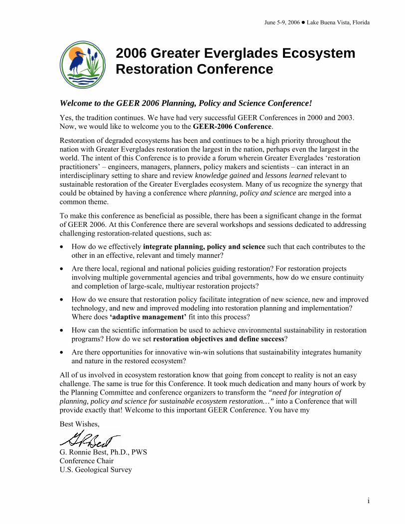
2006 Greater Everglades Ecosystem Restoration Conference
Welcome to the GEER 2006 Planning, Policy and Science Conference!
Yes, the tradition continues. We have had very successful GEER Conferences in 2000 and 2003. Now, we would like to welcome you to the GEER-2006 Conference.
Restoration of degraded ecosystems has been and continues to be a high priority throughout the nation with Greater Everglades restoration the largest in the nation, perhaps even the largest in the world. The intent of this Conference is to provide a forum wherein Greater Everglades ‘restoration practitioners’ – engineers, managers, planners, policy makers and scientists – can interact in an interdisciplinary setting to share and review knowledge gained and lessons learned relevant to sustainable restoration of the Greater Everglades ecosystem. Many of us recognize the synergy that could be obtained by having a conference where planning, policy and science are merged into a common theme.
To make this conference as beneficial as possible, there has been a significant change in the format of GEER 2006. At this Conference there are several workshops and sessions dedicated to addressing challenging restoration-related questions, such as:
• How do we effectively integrate planning, policy and science such that each contributes to the other in an effective, relevant and timely manner?
• Are there local, regional and national policies guiding restoration? For restoration projects involving multiple governmental agencies and tribal governments, how do we ensure continuity and completion of large-scale, multiyear restoration projects?
• How do we ensure that restoration policy facilitate integration of new science, new and improved technology, and new and improved modeling into restoration planning and implementation? Where does ‘adaptive management’ fit into this process?
• How can the scientific information be used to achieve environmental sustainability in restoration programs? How do we set restoration objectives and define success?
• Are there opportunities for innovative win-win solutions that sustainability integrates humanity and nature in the restored ecosystem?
All of us involved in ecosystem restoration know that going from concept to reality is not an easy challenge. The same is true for this Conference. It took much dedication and many hours of work by the Planning Committee and conference organizers to transform the “need for integration of planning, policy and science for sustainable ecosystem restoration…” into a Conference that will provide exactly that! Welcome to this important GEER Conference. You have my
Best Wishes,
G. Ronnie Best, Ph.D., PWS Conference Chair U.S. Geological Survey

2006 Greater Everglades Ecosystem Restoration Conference
ii

June 5-9, 2006 Lake Buena Vista, Florida
iii
Table of Contents
GEER Science Conference Program Committee .......................................v
Conference Purpose......................................................................................vi
Abstract Book Organization........................................................................vi
Greater Everglades Information Systems & Services on the Web ........ vii
Program Agenda ...........................................................................................ix
Poster Directory ..........................................................................................xix
Exhibitors and Contributing Partners ...................................................xxvi
List of Participants ................................................................................. xxvii
GEER Abstracts.............................................................................................1
Author Index ..............................................................................................259
Notes ............................................................................................................265

2006 Greater Everglades Ecosystem Restoration Conference
iv

June 5-9, 2006 Lake Buena Vista, Florida
v
GEER Science Conference Program Committee
William S. Arnold, Florida FWCC Fish and Wildlife Research Institute
Don Axelrad, Florida Department of Environmental Protection
G. Ronnie Best [Conference Chair], U.S. Geological Survey
Jim Boone, U.S. Army Corps of Engineers
Laura Brandt, U.S. Fish and Wildlife Service
Edwin Brown, U.S. Army Corps of Engineers
Gwen Burzycki, Miami-Dade Dept. of Environmental Resources Management
Michael Campbell, U.S. Army Corps of Engineers
Kim Chuirazzi, South Florida Water Management District
Terry Doyle, U.S. Fish and Wildlife Service
Michael Eng, U.S. Institute for Environmental Conflict Resolution
Vic Engel, National Park Service
Andrew Gottlieb, Everglades Project Joint Venture
David Hallac, National Park Service
Jud Harvey, U.S. Geological Survey
Matt Harwell, U.S. Fish and Wildlife Service
Lorraine Heisler, U.S. Fish and Wildlife Service
Aaron Higer, U.S. Geological Survey (Retired)
April Huffman, South Florida Water Management District
Shawn Komlos, U.S. Army Corps of Engineers
Elmar Kurzbach, U.S. Army Corps of Engineers
Frank J. Mazzotti, University of Florida
Agnes McLean, South Florida Water Management District
Carol Mitchell, National Park Service
John Ogden, South Florida Water Management District
Timothy Pinion, U.S. Fish and Wildlife Service
Patrick Pitts, U.S. Fish and Wildlife Service
Larry Richardson, U.S. Fish and Wildlife Service
Fred Sklar, South Florida Water Management District
Tom St. Clair, Everglades Partners Joint Venture
Joseph Walsh, Florida Fish and Wildlife Conservation Commission
Lynn Wingard, U.S. Geological Survey

2006 Greater Everglades Ecosystem Restoration Conference
vi
Conference Purpose
Sustainable restoration of the Greater Everglades requires effective integration of Planning, Policy and Science. The purpose of the Greater Everglades Ecosystem Restoration (GEER) Conference is to provide a forum for restoration practitioners – decision makers, engineers, planners, resource managers, scientists – to share their knowledge and challenges concerning restoration of this national treasure – the Greater Everglades. So, what is this vast and wonderful system we call the Greater Everglades? The Greater Everglades is an interlinked complex of natural and human ecosystems from the Kissimmee River at the top through Lake Okeechobee, the Loxahatchee and St. Lucie estuaries to the east and the Caloosahatchee Estuary to the west, southward to the Everglades and Florida Bay with the Keys at the bottom; and, from Biscayne Bay and other coastal systems on the east to Big Cypress, Ten Thousand Islands and other coastal systems on the west.
Abstract Book Organization
This abstract book is organized in alphabetical order by presenting author and title. A detailed author index appears at the back of this book to assist you with finding a particular author’s work. This publication will be available online after the conference through the following web site: www.conference.ifas.ufl.edu For more information about G.E.E.R., contact the Conference Chair:
G. Ronnie Best, PhD, PWS, Conference Chair Coordinator, Greater Everglades Priority Ecosystems Science United States Geological Survey c/o University of Florida/IFAS Fort Lauderdale Research and Education Center 3205 College Avenue Fort Lauderdale, FL 33314-7799 PHONE: 954-577-6354 FAX: 954-577-6347 PHONE (CELL): 954-658-4676 EMAIL: [email protected] WEB SITE: SOFIA.usgs.gov

June 5-9, 2006 Lake Buena Vista, Florida
vii
Greater Everglades Information Systems & Services on the Web Across Trophic Level System Simulation (ATLSS) USGS Biological Resources Division http://atlss.org/
Arthur R. Marshall Loxahatchee National Wildlife Refuge http://loxahatchee.fws.gov/home/default.asp
A.R.M Loxahatchee National Wildlife Refuge Enhanced Water Quality Monitoring and Modeling http://sofia.usgs.gov/lox_monitor_model/
Aquatic Cycling of Mercury in the Everglades (ACME) USGS Mercury Project http://infotrek.er.usgs.gov/doc/mercury/acme.html
Big Cypress Basin Regional Research Database Fish and Wildlife Research Institute (FWRI) and Florida Gulf Coast University http://ocean.floridamarine.org/bcb/
Big Cypress National Preserve http://www.nps.gov/bicy/
Comprehensive Everglades Restoration Plan (CERP) http://www.evergladesplan.org/
Coastal and Estuarine Data/Document Archeology and Rescue (CEDAR) NOAA Miami Regional Library http://www.aoml.noaa.gov/general/lib/CEDAR.htm
Everglades Litigation Collection University of Miami School of Law Library http://exchange.law.miami.edu/everglades/
Everglades National Park http://www.nps.gov/ever
Everglades Online Database Florida International University/Florida Center for Library Automation http://everglades.fiu.edu/eol/index.html
Everglades Restoration Archives of [email protected] http://lists.sierraclub.org/Archives/commons-everglades.html
Everglades Village - An Electronic Community for South Florida http://www.evergladesvillage.net/
Extension Digital Information Source (EDIS) University of Florida /Institute of Food and Agricultural Sciences http://edis.ifas.ufl.edu/
Florida Coastal Everglades Long Term Ecological Research http://fcelter.fiu.edu/
Florida Department of Environmental Protection - Everglades Restoration http://www.dep.state.fl.us/secretary/everglades/
The Living Everglades South Florida Water Management District http://glades.sfwmd.gov/empact/home/index.shtml
Reclaiming the Everglades: South Florida’s Natural History 1884-1934 Florida International Univ., Univ. of Miami, Historical Museum of South Florida, Florida Ctr. for Library Automation http://everglades.fiu.edu/reclaim/index.html
South Florida Ecosystem Restoration Task Force http://www.sfrestore.org/
South Florida Information Access (SOFIA) USGS Greater Everglades Priority Ecosystems Science http://sofia.usgs.gov/
South Florida Publications USGS Greater Everglades Priority Ecosystems Science http://sofia.usgs.gov/pubsdb/search.php
South Florida Water Management District – Everglades http://www.sfwmd.gov/site/index.php?id=17
Technical Publications Search, South Florida Water Management District http://sfwmd.ces.fau.edu/display_browse.php
TIME (Tides and Inflows in the Mangroves of the Everglades) http://time.er.usgs.gov/
Water Resources of Florida – Real Time Data USGS Water Resources Division http://waterdata.usgs.gov/fl/nwis/rt
PLEASE NOTE: This is not meant to be a comprehensive list of Everglades-related websites, but only an initial directory. Web addresses are subject to change without notice.

2006 Greater Everglades Ecosystem Restoration Conference
viii

June 5-9, 2006 Lake Buena Vista, Florida
ix
Program Agenda

2006 Greater Everglades Ecosystem Restoration Conference
x

June 5-9, 2006 Lake Buena Vista, Florida
xi

2006 Greater Everglades Ecosystem Restoration Conference
xii

June 5-9, 2006 Lake Buena Vista, Florida
xiii

2006 Greater Everglades Ecosystem Restoration Conference
xiv

June 5-9, 2006 Lake Buena Vista, Florida
xv

2006 Greater Everglades Ecosystem Restoration Conference
xvi

June 5-9, 2006 Lake Buena Vista, Florida
xvii

2006 Greater Everglades Ecosystem Restoration Conference
xviii

June 5-9, 2006 Lake Buena Vista, Florida
xix
GEER Poster Directory
All GEER Posters will be on display from 7:30am, Tuesday, June 6 through 12noon, Friday, June 9. Two formal poster sessions are scheduled on Tuesday and Thursday evenings from 5:00pm-8:00pm. Presenters will be stationed at their posters from 6:00pm-7:00pm. Poster Number
67........ Community Shifts Resulting from Anthropogenic Manipulation of the Caloosahatchee Watershed: Mollusk Assemblages as Indicators of Environmental Change – Jorge Agobian, Florida Gulf Coast University, College of Arts & Sciences, Fort Myers, FL
27........ Observed Marine-Sediment Depositions from Hurricane Wilma along the Shark River Estuary, Everglades National Park, Florida – Gordon Anderson, USGS-FISC, Homestead, FL
77........ Selection of Vital Signs for the National Park Services South Florida / Caribbean Inventory and Monitoring Network – Andrea Atkinson, National Park Service, South Florida / Caribbean Network, Palmetto Bay, FL
51........ Modeling Water Flow in the Water Conservation Area 1 Using Interferometric Synthetic Aperture Radar (InSAR) Observations – Bernardo Bieler, University of Miami, Department of Civil, Architectural and Environmental Engineering, Coral Gables, FL
28........ Hurricane Impacts to Tree Islands in Arthur R. Marshall Loxahatchee National Wildlife Refuge, Florida – Laura Brandt, Fish and Wildlife Service, A.R.M. Loxahatchee NWR, Boynton Beach, FL
68........ Implications for Oyster Reef Restoration through Taphonomic Comparisons of Modern and Pliocene Crassostrea sp. – Amanda Bridges, Florida Gulf Coast University, Fort Myers, FL
32........ The ATLSS Fire Model – Eric Carr, The Institute for Enviromental Modeling, Unversity of Tennessee, Knoxville, TN
31........ Integrating ATLSS Models: Fulfilling the Promise of Multi-Modeling for Everglades Restoration – Eric Carr, The Institute for Enviromental Modeling, Unversity of Tennessee, Knoxville, TN
3.......... The Role of the American Crocodile (Crocodylus acutus) as an Indicator of Ecological Change in Everglades Ecosystems – Michael Cherkiss, University of Florida, Fort Lauderdale Research and Education Center, Davie, FL
2.......... Linking Hydrologic Modeling and Ecologic Modeling: Application of a Spatially-Explicit Species Index (SESI) Model for Adaptive Ecosystem Management in the Everglades Mangrove Zone of Florida Bay – Jon Cline, Case Western Reserve University, Department of Biology, Cleveland, OH
78........ Environmental Restoration Projects in the Kissimmee Basin: Restoring Natural Corridors – David Colangelo, SFWMD, Watershed Mgmt/Kissimmee, West Palm Beach, FL
15........ Application of a Dynamic Clustering Algorithm to the Water-Level Hydrographs of the EDEN Hydrologic Network – Paul Conrads, USGS, SCWSC, Columbia, SC
16........ Estimating Water Depths at Ungaged Locations in the Florida Everglades Using Artificial Neural Networks – Paul Conrads, USGS, SCWSC, Columbia, SC
9.......... Interagency Manatee Task Force and Everglades Restoration – Penny Cook, Florida Fish and Wildlife Conservation Commission, Fish and Wildlife Research Institute, Tequesta, FL

2006 Greater Everglades Ecosystem Restoration Conference
xx
Poster Number
33 ........ Modeling Snail Kite Population Viability in a Variable Hydrologic Environment – Donald DeAngelis, U.S. Geological Survey, Florida Integrated Science Center, Coral Gables, FL
79........ Nuisance Species in Freshwaters: A Review of Causes, Treatments, and Costs – Joseph DePinto, Limno-Tech, Inc., Ann Arbor, MI
46........ The Influence of Calcium on Phosphorus Removal and Retention in Submerged Aquatic Vegetation Communities in South Florida Wetlands – Forrest Dierberg, DB Environmental, Inc., Rockledge, FL
83........ Response Surface Analysis of Salinity and Temperature for Subtropical Crassostrea virginica – Julian DiGialleonardo, BEM Systems Inc., West Palm Beach, FL
84........ Exploring Citizen Participation Opportunities in Everglades Restoration Efforts – Alyssa Dodd, Palm Beach County/UF IFAS Extension, West Palm Beach, FL
54........ Options for Accelerating Recovery of Phosphorus Impacted Areas of the Florida Everglades – Thomas Dreschel, South Florida Water Management District, Everglades Division (MSC 4440), West Palm Beach, FL
85........ Age, Staged Evolution, and Natural Disturbance of Corkscrew Swamp, Southwest Florida – Michael Duever, SFWMD, Lower West Coast Regional Service Center, Fort Myers, FL
5.......... Solution Holes in The Rocky Glades Region of Everglades National Park: Sources or Sinks for Non-indigenous Fishes? – Krissy Dunker, USGS, Florida Integrated Science Center, Homestead, FL
41........ Seasonal Plant Water Uptake Patterns in the Saline Southeast Everglades Ecotone – Sharon Ewe, Florida International University, Southeast Environmental Research Cener, Miami, FL
86........ Science in the Everglades: The Interface of Scientists and Managers – Holly Fling, Duke Nicholas School of the Environment, Durham, NC
87........ Detection and Implications for Management of Lygodium microphyllum on Tree Islands in Water Conservation Areas – Mary Ann Furedi, Florida Atlantic University, Department of Biological Sciences, Davie, FL
88........ Reconstruction of Historical Vegetation Patterns in Freshwater Wetlands of the Florida Everglades: A Molecular Marker Approach – Min Gao, Florida International University, Chemistry and Biochemistry, Miami, FL
56........ Iron-Silicone Polymer Composites as Surrogate Passive Samplers for Organic Contaminants in Biota from Protected South Florida Environments – Piero Gardinali, Florida International University, Chemistry/SERC, Miami, FL
55........ Emergent Pollutants of Concern (EPOCS) in South Florida Surface Waters: What and Where to Look For? – Piero Gardinali, Florida International University, Chemistry/SERC, Miami, FL
6.......... The Effect of Hydroperiod on the Growth of the Crayfish Species Procambarus alleni and P. fallax: Two Keystone Species in the Florida Everglades – Matthew Gardner, Florida Atlantic University, Environmental Science, Davie, FL

June 5-9, 2006 Lake Buena Vista, Florida
xxi
Poster Number
50........ Relationships between Sediment Characteristics and Sediment-Water P Exchange in an Everglades Stormwater Treatment Area – Kevin Grace, DB Environmental, Inc., Rockledge, FL
42........ Fish Food-web Structure in the Everglades Oligohaline Zone Revealed by d13C and d15N Stable Isotope Analyses – David Green, Florida International University, Audubon of Florida, Tavernier, FL
43........ Estimating Production Origins and Trophic Placement of Biota in Forested-Wetland Food Webs: Preliminary Results from Stable Isotopes – David Green, Audubon of Florida, Tavernier, FL
35........ Ecological and Genetic Profiles of Everglades Diamondback Terrapins, a Potential Indicator Species – Kristen Hart, USGS, Center for Coastal and Watershed Studies, St. Petersburg, FL
14........ Application of the Everglades Depth Estimation Network (EDEN) to Monitoring and Restoration – Philip Heidemann, Florida Atlantic University, Dept. of Biological Sciences, Boca Raton, FL
12........ The South Florida Information Access (SOFIA) System – Heather Henkel, USGS, St. Petersburg, FL
7.......... The Relationship between Burrowing Behavior of Everglades Crayfish, Procambarus alleni, and Wetland Groundwater Elevations – April Huffman, South Florida Water Management District, CERP Planning Dept./RECOVER Division, West Palm Beach, FL
47........ Spatial Profiles of Water Column Phosphorus Species within an Everglades Stormwater Treatment Area – Scott Jackson, DB Environmental, Inc., Rockledge, FL
89........ Nutrient Limitation in a Forested Wetland on the Big Cypress Seminole Indian Reservation – Alyssa Jacobs, Seminole Tribe of Florida, Water Resource Management Department, Clewiston, FL
75........ Comparison of Distribution Patterns of Ceratopogonid Midges along Nutrient Gradients in the Everglades Ecosystem – Richard Jacobsen, USGS, Homestead, FL
76........ A Key to the Pupal Exuviae of Chironomidae in Everglades National Park – Richard Jacobsen, USGS, Homestead, FL
57........ Modeling Phosphorus Transport and Cycling in a Large Treatment Wetland – Andrew James, University of Florida, Soil and Water Science Dept., Gainesville, FL
36........ Amphibian Communities as Indicators of Restoration Success in the Greater Everglades Ecosystem – Valerie Johnson, University of Florida, Department of Wildlife Ecology and Conservation, Ochopee, FL
18........ An Evaluation of Airborne Remote-Sensing Technologies for Everglades Solution-Hole Detection and Characterization – John Jones, USGS, Eastern Geographic Science Center, Reston, VA
11........ Everglades Depth Estimation Network (EDEN) Digital Elevation Model Research and Development – John Jones, USGS, Eastern Geographic Science Center, Reston, VA

2006 Greater Everglades Ecosystem Restoration Conference
xxii
Poster Number
37 ........ Wildlife Presence on Tree Islands in Everglades Water Conservation Area 3A in Relation to Tree Island Morphology, Vegetation Characteristics, and Spatial and Temporal Changes – Jennifer Ketterlin, FL Fish and Wildlife Conservation Commission, Sunrise, FL
48........ Effects of Phosphorus Loading on P Removal Performance and Sediment P Accrual in an Everglades Stormwater Treatment Area Wetland – Michelle Kharbanda, DB Environmental, Inc., Rockledge, FL
90........ SAR Interferometric Coherence Analysis of Wetlands in South Florida – Sang-Wan Kim, University of Miami, Marine Geology and Geophysics, Miami, FL
38........ Fish Introductions into Everglades Wetlands: An Unforeseen Consequence of Restoration – Jeffrey Kline, Everglades National Park, Homestead, FL
91........ Enhancing BMP Performance in the Everglades Agricultural Area – Timothy Lang, University of Florida, Everglades Research and Education Center, Belle Glade, FL
8.......... Effects of Hydrological Restoration on Manatees: A Research Program to Integrate Data, Models and Long-term Monitoring across the Ten Thousand Islands and Everglades – Catherine Langtimm, U.S. Geological Survey, Florida Integrated Science Center, Gainesville, FL
21........ Distribution, Abundance, and Diversity of Freshwater Fishes in Big Cypress National Preserve – Shawn Liston, Audubon of Florida, Homestead, FL
69........ Relative Roles of Abiotic Stress and Predation by Non-Indigenous African Jewelfish (Hemichromis letourneuxi) on Native Fishes in Rocky Glades Solution Holes – Shawn Liston, Audubon of Florida, Tavernier, FL
19........ Distribution and Life History of the Endemic Miami Cave Crayfish (Procambarus Milleri) in Southern Florida – William Loftus, USGS, Homestead, FL
20........ Diet and Trophic Position of Introduced Asian Swamp Eels from Disjunct Florida Locations – William Loftus, USGS, Homestead, FL
INSIDE ... Demonstration of Integrated Physical and Ecological Models to Assess Restoration Impacts BOOTH on Fish, Roseate Spoonbills and American Crocodiles in Northeastern Florida Bay – 7 Jerry Lorenz, Audubon of Florida, Tavernier Science Center, Tavernier, FL
1.......... Habitat Suitability Index for Roseate Spoonbills Nesting in Northeastern Florida Bay – Jerry Lorenz, Audubon of Florida, Tavernier Science Center, Tavernier, FL
44........ Pigment-Based CHemotaxonomic Evaluation of Everglades Periphyton Communities – Bill Louda, Florida Atlantic University, Organic Geochemistry GRoup, Boca Raton, FL
92........ Comprehensive Everglades Restoration Plan: Red, Yellow, or Green? – John Marshall, Arthur R. Marshall Foundation & FL Env Inst, Inc, President, West Palm Beach, FL
23........ The Academy of Environmental Science and Technology at Forest Hill High School Presents a Unique Curriculum Based on Integration of Coursework and Field Experience – Shawn McCall and Erin Myers, School District of Palm Beach County, Forest Hill Community High School, West Palm Beach, FL
70........ Modeling Analysis of Florida Bays Seagrass Community Composition: The Importance of Sediment Characteristics, Water Quality, and Salinity – Amanda McDonald, South Florida Water Management District, Coastal Ecosystems Division, West Palm Beach, FL

June 5-9, 2006 Lake Buena Vista, Florida
xxiii
Poster Number
29........ Hurricane-Induced Conversion of Mangrove Forest to Mudflat: Impacts on Nekton, Big Sable Creek, Florida – Carole McIvor, U.S. Geological Survey, Florida Integrated Science Center, St Petersburg, FL
58........ Freshwater and Nutrient Fluxes to Coastal Waters of Everglades National Park -- A Synthesis – Benjamin McPherson, USGS, Tampa, FL
66........ Water Depth Patterns within the Decomp Project Footprint -- Hopeful for Restoration? – Christopher McVoy, South Florida Water Management District, Everglades Division, West Palm Beach, FL
71........ Long-Term Patterns in the Community Structure of Fishes in Johnson Key Basin, Western Florida Bay, 1984 - 2005 – Patricia Mumford, Southeast Environmental Research Center, FIU, Indian Harbour Beach, FL
72........ Atypical Salinity and Temperature Cycles and the Effect on Selected Florida Bay Organisms – James Murray, USGS, Geologic Division, Reston, VA
49........ Patrick Owens--Effectiveness of Everglades Stormwater Treatment Areas for Improving Water Clarity – Patrick Owens, DB Environmental, Inc., Rockledge, FL
13........ Surfacing Daily Everglades Water Depths for the Everglades Depth Estimation Network – Monica Palaseanu-Lovejoy, University of Florida, Ft. Lauderdale Research and Education Center, Ft. Lauderdale, FL
17........ A User Interface to the Everglades Depth Estimation Network (EDEN) – Leonard Pearlstine, University of Florida, Ft. Lauderdale Research and Education Center, Ft. Lauderdale, FL
59........ A Tale of Two Designs: CERP Trophic Monitoring versus R-EMAP 2005 – Tom Philippi, Florida International University, Biology and FCE-LTER, Miami, FL
45........ Landscape Analysis of Tree Island Head Vegetation in Water Conservation Area 3, Florida – Timothy Pinion, US Fish and Wildlife Service, South Florida Ecological Services Office, Vero Beach, FL
INSIDE ... A Prototype Electronic Atlas Utilizing Static Maps – Susan D. Price, Eastern Geographic BOOTH Science Center, U.S. Geological Survey, Reston, VA, USA 5 & 6
60........ An Ecological Risk Assessment of Pesticides and Metals from a Three-Year Monitoring Study For Everglades and Biscayne National Parks – Gary Rand, Florida International University, Southeast Environmental Research Center, Ecotoxicology, North Miami, FL
80........ Habitat Relations among Seagrass-Associated Fish and Shrimp in Southern Biscayne Bay, Florida – David Reed, FIU, SERC, Miami, FL
4.......... Seasonal Fish-Community Patterns in Upstream Reaches of Coastal Rivers in Everglades National Park, Florida – Jennifer Rehage, U.S. Geological Survey, Homestead, FL
81........ Monitoring Regional Patterns in the Distribution of Seagrass-Associated Fish and Invertebrates in Southern Florida – Michael Robblee, USGS/Everglades National Park, Homestead, FL

2006 Greater Everglades Ecosystem Restoration Conference
xxiv
Poster Number
34 ........ A Preview of Input Data for the Natural Systems Regional Simulation Model (NSRSM) v1.1 – Winifred Said, South Florida Water Management District, Hydrologic and Environmental Systems Modeling Department, West Palm Beach, FL
65........ Sheet Flow in the Ridge and Slough Landscape of Everglades Water Conservation Area 3A – Raymond Schaffranek, U.S. Geological Survey, Reston, VA
39........ Enhancing the Recovery of Threatened and Endangered Species through Aquatic Refugia – Melinda Schuman, Conservancy of Southwest Florida, Environmental Science, Naples, FL
93........ Diverse Mineral Layers Within Peaty Sediments of Everglades Tree-Islands – Margo Schwadron, U.S. National Park Service, SEAC, Tallahassee, FL
40........ Landscape Evaluation Measures for Inland Southwest Florida Feasibility Study: Wading Birds, Amphibian, Aquatic Fauna and Large Mammal – Zongbo Shang, University of Florida / IFAS, Ft. Lauderdale Research and Education Center, Fort Lauderdale, FL
26........ Invertebrate Community Comparisons among Oligotrophic Everglades Marshes with Contrasting Alkalinity – Robert Shuford, South Florida Water Mgt District, Watershed Mgt./Everglades, West Palm Beach, FL
10........ Manatee Habitat Use within Everglades National Park: Data Summary and Management Implications – Daniel Slone, USGS, Florida Integrated Science Center, Gainesville, FL
94........ Mangroves are Not Adapted to Hurricanes: Comparative Impacts of Four Hurricanes on Mangrove Forests in the Southwest Coastal Everglades ("Labor Day", Donna, Andrew and Wilma) – Thomas Smith III, US Geological Survey, Florida Integrated Science Center, St. Petersburg, FL
53........ New Web-Based Approach for Summarizing Watershed Conditions in the South Florida Water Management District – Robert Sobczak, Big Cypress National Preserve, Resource Management, Ochopee, FL
95........ Everglades Evolution in Northern Shark Slough: Ages, Stages, and Prehistoric Disturbance – Peter Stone, SC DHEC, Columbia, SC
52........ Integrating Satellite and Surface Measurements to Compute Potential and Reference Evapotranspiration throughout Florida – David Sumner, U.S. Geological Survey, Orlando, FL
61........ Freshwater Periphyton Communities in the Greater Everglades: An Update on Performance Measures – Serge Thomas, Southeast Environmental Research Center, Miami, FL
25........ Monitoring Impacts of the S-332 Structures on Aquatic Fauna of the Rocky Glades – Joel Trexler, Florida International University, Biological Sciences, Miami, FL
73........ Biogeochemical Connectivity in a Complex Wetland Landscape: Mechanisms of N Sequestration in Tree Islands of the Southern Everglades – Tiffany Troxler-Gann, Florida International University, Southeast Environmental Research Center, Miami, FL
74........ Estimating Relative Uncertainty in Model Input TP Concentration Data – Naiming Wang, South Florida Water Management District, Hydrologic and Environmental Systems Modeling, West Palm Beach, FL

June 5-9, 2006 Lake Buena Vista, Florida
xxv
Poster Number
24........ Recovering the Endangered Smalltooth Sawfish Population: The Importance of South Florida Ecosystems – Tonya Wiley, Mote Marine Laboratory, Center for Shark Research, Sarasota, FL
64........ Utilizing the TIME Model to Simulate Comprehensive Everglades Restoration Plan (CERP) Scenarios for the Florida Bay and Florida Keys Feasibility Study (FBFKFS) – Melinda Wolfert, U.S. Geological Survey, Fort Lauderdale, FL
30........ Northeastern Florida Bay Estuarine Creek Response During the 2004-05 Hurricane Seasons – Jeff Woods, U.S. Geological Survey, FISC Ft. Lauderdale, Ft. Lauderdale, FL
82........ Naples Bay Past and Present: A Chronology of Disturbance to an Estuary – Kathy Worley, The Conservancy of SW FLorida, Environmental Science, Naples, FL
63........ New Requirements of Freeboard Design for the C-43 West Storage Reservoir – Jing-Yea Yang, Stanley Consultants Inc., Water Resources, West Palm Beach, FL
62........ Northeastern Florida Bay and Joe Bay Estuarine Creek Data, 2001-2005 – Mark Zucker, USGS, Ft. Lauderdale, FL

2006 Greater Everglades Ecosystem Restoration Conference
xxvi
Exhibitors and Contributing Partners
ANAMAR Environmental Consulting
DB Environmental, Inc.
National Park Service
RSI
Scheda Ecological Associates, Inc.
South Florida Ecosystem Restoration Task Force
South Florida Water Management District
University of Florida, Institute of Food and Agricultural Sciences (UF/IFAS) - School of Natural Resources and Environment
US Army Corps of Engineers
US Department of the Interior
US Fish and Wildlife Commission
US Geological Survey
YSI / Sontek, Southeast Region

June 5-9, 2006 Lake Buena Vista, Florida
xxvii
List of Participants

2006 Greater Everglades Ecosystem Restoration Conference
xxviii

June 5-9, 2006 Lake Buena Vista, Florida
xxix
Daniel Abecassis US Army Corps of Engineers 701 San Marco Boulevard Jacksonville FL 32207-8175 PH: 904-232-1703 FX: EMAIL: [email protected]
Evan Adams Univ of Florida 110 Newins-Ziegler Hall Gainesville FL 32611 PH: 352-846-1260 FX: EMAIL: [email protected]
Jorge Agobian Florida Gulf Coast University 10501 FGCU Blvd Fort Myers FL 33965 PH: 239-590-1000 FX: EMAIL: [email protected]
George Aiken US Geological Survey 3215 Marine Street Boulder CO 80303 PH: 303-541-3036 FX: 303-447-2505 EMAIL: [email protected]
Gordon Anderson US Geological Survey 40001 SR 9336 Homestead FL 33034 PH: 305-242-7800 ext 7891 FX: 305-242-7836 EMAIL: [email protected]
Thomas Anderson Everglades National Park 40001 SR 9336 Homestead FL 33034 PH: 305-242-7358 FX: EMAIL: [email protected]
Stuart Appelbaum US Army Corps of Engineers PO Box 4970 Jacksonville FL 32232-0019 PH: 904-232-2238 FX: EMAIL: [email protected]
Charles Appleby US EPA 980 College Station Rd Athens GA 30605 PH: 706-355-8555 FX: 706-355-8803 EMAIL: [email protected]
Jeanne Arceneaux Univ of Louisiana PO Box 42347 Lafayette LA 70504-2347 PH: 337-482-0651 FX: 337-482-0698 EMAIL: [email protected]
Tom Armentano Consultant 310 Lake Padgett Drive Land O Lakes FL 34639 PH: 813-996-7766 FX: EMAIL: [email protected]
Thomas Armstrong US Geological Survey 906 National Center Reston VA 20192 PH: 703-648-6917 FX: 703-648-6937 EMAIL: [email protected]
Steve Ashby US Army Corps of Engineers 3909 Halls Ferry Road Vicksburg MS 39180-6199 PH: 601-634-2387 FX: 601-634-2430 EMAIL: [email protected]
Andrea Atkinson National Park Service 18001 Old Cutler Rd Suite 419 Palmetto Bay FL 33157 PH: 305-252-0347 FX: 305-253-0463 EMAIL: [email protected]
Don Axelrad Florida DEP 3900 Commonwealth Blvd MS 200 Tallahassee FL 32399-3000 PH: 850-245-3007 FX: 850-245-3147 EMAIL: [email protected]
Kiren Bahm Everglades National Park 950 N Krome Avenue 3rd Floor Homestead FL 33030 PH: 305-224-4257 FX: 305-224-4147 EMAIL: [email protected]
Krystal Baird FAU/BEM Systems 1601 Belvedere Road Suite 305S West Palm Beach FL 33406 PH: 561-615-2210 FX: EMAIL: [email protected]
Pinar Balci South Florida Water Mgmt 3301 Gun Club Road West Palm Beach FL 33406 PH: 561-682-6775 FX: 561-682-5990 EMAIL: [email protected]
Tomma Barnes Univ of Florida 3205 College Ave Davie FL 33314 PH: 954-577-6304 FX: EMAIL: [email protected]
Ian Bartoszek The Conservancy of Southwest Florida 1450 Merrihue Drive Naples FL 34102 PH: 239-403-4223 FX: 239-262-5872 EMAIL: [email protected]
Richard Batiuk US EPA 410 Severn Ave Suite 109 Annapolis MD 21403 PH: 800-968-7229 ext 731 FX: 410-267-5777 EMAIL: [email protected]
Michael Bauer City of Naples 280 RIverside Circle Naples FL 34102 PH: 239-213-1031 FX: 239-213-7130 EMAIL: [email protected]
Brian Beckage Univ of Vermont Marsh Life Sciences Burlington VT 05405 PH: 802-656-0197 FX: EMAIL: [email protected]
Carrie Beeler US DOI FIU OE 148 Miami FL 33199 PH: 305-348-6745 FX: EMAIL: [email protected]
Chris Belden US Fish & Wildlife Service 1339 20th Street Vero Beach FL 32960 PH: 772-562-3909 ext 237 FX: EMAIL: [email protected]
Christopher Bernhardt Univ of Pennsylvania 926A National Center Reston VA 20192 PH: 703-648-6914 FX: EMAIL: [email protected]
Ronnie Best US Geological Survey c/o 3205 College Ave Ft Lauderdale FL 33314 PH: 954-577-6354 FX: 954-577-6347 EMAIL: [email protected]
Carol Biagiotti-Griggs St Johns River Water Mgmt 975 Keller Road Altamonte Springs FL 32714 PH: 407-659-4828 FX: 407-659-4805 EMAIL: [email protected]
Becky Blanchard Univ of Florida PO Box 116350 Gainesville FL 32611 PH: 352-392-2425 FX: 352-846-2150 EMAIL: [email protected]
William Bokey US EPA 980 College Station Road Athens GA 30605 PH: 706-355-8604 FX: EMAIL: [email protected]
Robert Bruce Boler Everglades National Park 950 N Krome Ave 3rd Floor Homestead FL 33030 PH: 305-224-4234 FX: 305-224-4147 EMAIL: [email protected]
James Boone US Army Corps of Engineers PO Box 4960 Jacksonville FL 32232-0019 PH: 904-232-1877 FX: 904-232-1251 EMAIL: [email protected]
Timothy Boozer US Geological Survey 7920 NW 71st Street Gainesville FL 32653 PH: 352-264-3516 FX: 352-378-4956 EMAIL: [email protected]
Rena Borkhataria Univ of Florida 27963 SW 136th Pl Homestead FL 33032 PH: 786-243-1874 FX: EMAIL: [email protected]

2006 Greater Everglades Ecosystem Restoration Conference
xxx
Stephen Bousquin South Florida Water Mgmt 3301 Gun Club Road MSC 4750 West Palm Beach FL 33406 PH: 561-682-2719 FX: EMAIL: [email protected]
Laura Brandt US Fish & Wildlife Service 10216 Lee Road Boynton Beach FL 33437 PH: 561-248-9016 FX: 516-735-6008 EMAIL: [email protected]
Henry Briceno Florida International University 11200 SW 8th St Bldg OE #148 Miami FL 33199 PH: 305-348-1269 FX: 305-348-4096 EMAIL: [email protected]
Amanda Bridges Florida Gulf Coast University 10501 FGCU Blvd Fort Myers FL 33965 PH: 239-590-1000 FX: EMAIL: [email protected]
Matt Brien Univ of Florida 3205 College Avenue Fort Lauderdale FL 33314 PH: 954-577-6304 FX: EMAIL: [email protected]
Brenda Brooks-Solveson CREW Land & Water Trust 23998 Corkscrew Rd Estero FL 33928 PH: 239-657-2253 FX: 239-657-8392 EMAIL: [email protected]
Amy Brossard US Geological Survey 224 W Central Parkway Suite 1006 Altamonte Springs FL 32714 PH: 407-865-6725 FX: 407-865-6725 EMAIL: [email protected]
Joan Browder NOAA Fisheries 75 Virginia Beach Drive Miami FL 33149 PH: 305-361-4270 FX: 305-361-4478 EMAIL: [email protected]
David Brown US GAO 441 G St NW Washington DC 20548 PH: 202-512-6196 FX: EMAIL: [email protected]
Edwin Brown US Army Corps of Engineers 701 San Marco Blvd. Jacksonville FL 32207 PH: 904-232-3647 FX: EMAIL: [email protected]
Mark Brown Univ of Florida PO Box 116350 Gainesville FL 32611 PH: 352-392-2425 FX: 352-846-2150 EMAIL: [email protected]
Michael Brown South Florida Water Mgmt 3301 Gun Club Rd West Palm Beach FL 33406 PH: 561-682-2256 FX: EMAIL: [email protected]
Cheryl Buckingham RECOVER - US Army Corps of Engineers PO Box 4970 Jacksonville FL 32232-0019 PH: 904-232-2747 FX: 904-232-1434 EMAIL: [email protected]
James Burch Big Cypress National Preserve 33100 Tamiami Trail East Ochopee FL 34141 PH: 239-695-1111 FX: 239-695-3901 EMAIL: [email protected]
Marie Burns US Army Corps of Engineers 701 San Marco Blvd Jacksonville FL 32207 PH: 904-232-3943 FX: 904-232-3442 EMAIL: [email protected]
Gwen Burzycki Miami-Dade DERM 33 SW Second Avenue Miami FL 33130 PH: 305-372-6569 FX: 305-372-6630 EMAIL: [email protected]
Susan Butler ASci Corporation 2201 NW 40th Terrace Gainesville FL 32605 PH: 352-264-3557 FX: 352-374-8080 EMAIL: [email protected]
Michael Byrne US Geological Survey 1400 Colonial Blvd Suite 70 Ft Myers FL 33907 PH: 239-275-8448 FX: 239-275-6820 EMAIL: [email protected]
Yong Cai Florida International University University Park Miami FL 33199 PH: 305-348-6210 FX: 305-348-3772 EMAIL: [email protected]
Michael Campbell US Army Corps of Engineers 7701 Telegraph Road Alexandria VA 22315 PH: 703-428-6538 FX: 703-428-3732 EMAIL: [email protected]
Lisa Cannon South Florida Water Mgmt 3301 Gun Club Road West Palm Beach FL 33406 PH: 561-682-6312 FX: EMAIL: [email protected]
Lynette Cardoch BEM Systems Inc 1601 Belvedere Road Suite 305S West Palm Beach FL 33406 PH: 561-615-2210 FX: EMAIL: [email protected]
Paul Carlson Florida Marine Research Institute 100 8th Ave SE St Petersburg FL 33701 PH: 727-896-8626 FX: 727-823-0166 EMAIL: [email protected]
Eric Carr The Institute for Environmental Modeling 1416 Circle Drive Knoxville TN 37996-1610 PH: 865-686-9913 FX: EMAIL: [email protected]
Michelle Casler Univ of Florida 3205 College Ave Davie FL 33314 PH: 954-577-6304 FX: EMAIL: [email protected]
Nancy Chan DB Environmental Inc 365 Gus Hipp Blvd Rockledge FL 32955 PH: 321-639-4896 FX: 321-631-3169 EMAIL: [email protected]
Kevin Chartier Univ of Florida 3205 College Ave Davie FL 33314 PH: 954-577-6304 FX: EMAIL: [email protected]
Hungjun Chen Univ of Florida 3205 College Avenue Ft Lauderdale FL 33314 PH: 954-577-6304 FX: EMAIL: [email protected]
Mike Cherkiss Univ of Florida 3205 College Ave Ft. Lauderdale FL 33314 PH: 954-577-6382 FX: EMAIL: [email protected]
Gail Chmura McGill University 805 Sherbrooke St W Montreal H3A 2K6 Canada PH: 514-926-6854 FX: 514-926-7437 EMAIL: [email protected]
Barbara Cintron US Army Corps of Engineers 701 San Marco Blvd Jacksonville FL 32207-8175 PH: 904-232-1692 FX: EMAIL: [email protected]
Ronald Clark Big Cypress National Preserve 33100 Tamiami Trail East Ochopee FL 34141-1000 PH: 239-695-1106 FX: 239-695-2084 EMAIL: [email protected]
Alice Clarke National Park Service 950 N Krome Ave Homestead FL 33030 PH: 305-224-4249 FX: 305-224-4147 EMAIL: [email protected]

June 5-9, 2006 Lake Buena Vista, Florida
xxxi
Eric Cline Florida International University 10216 Lee Rd Boynton Beach FL 33437-4796 PH: 561-676-1971 FX: EMAIL: [email protected]
Jon Cline Case Western Reserve University 10900 Euclid Ave Cleveland OH 44106-7080 PH: 216-368-3561 FX: EMAIL: [email protected]
Robert Cochran Arthur R Marshall Foundation 2805 S Dixie Hwy West Palm Beach FL 33405 PH: 561-805-8733 FX: 561-805-7357 EMAIL: [email protected]
Matthew Cohen Univ of Florida PO Box 110410 Gainesville FL 32611-0410 PH: 352-846-3490 FX: EMAIL: [email protected]
David Colangelo South Florida Water Mgmt 3301 Gun Club Road West Palm Beach FL 33406 PH: 561-682-2843 FX: EMAIL: [email protected]
Kathleen Collins South Florida Water Mgmt 3301 Gun Club Road West Palm Beach FL 33406 PH: 561-242-5520 ext 4024 FX: EMAIL: [email protected]
Paul Conrads US Geological Survey 720 Gracern Road Columbia SC 29210 PH: 803-750-6140 FX: 803-730-6181 EMAIL: [email protected]
Penny Cook Florida Fish & Wildlife Conservation Commission 578 NE 80th Ave Okeechobee FL 34974 PH: 772-260-6203 FX: 863-357-3328 EMAIL: [email protected]
Tommy Cook St Johns River Water Management District 525 Community College Parkway Palm Bay FL 32909 PH: 321-409-2117 FX: EMAIL: [email protected]
Hillary Cooley Everglades National Park 40001 State Road 9336 Homestead FL 33035 PH: 305-242-7875 FX: 305-242-7855 EMAIL: [email protected]
Jennifer Cope St Johns River Water Management District 525 Community College Parkway Palm Bay FL 32909 PH: 321-984-4940 FX: EMAIL: [email protected]
Carlos Coronado-Molina South Florida Water Mgmt 3301 Gun Club Rd West Palm Beach FL 33406 PH: 561-686-8800 ext 4547 FX: 561-681-6310 EMAIL: [email protected]
Stacey Cote DB Environmental Inc 365 Gus Hipp Blvd. Rockledge FL 32955 PH: 321-639-4896 FX: 321-631-3169 EMAIL: [email protected]
Kimberly Cressman Sanibel-Captiva Conservation Foundation 900A Tarpon Bay Rd Sanibel FL 33957 PH: 912-230-0365 FX: EMAIL: [email protected]
Thomas Cronin US Geological Survey Mail Stop 926A Reston VA 20192 PH: 703-648-6363 FX: 703-648-6953 EMAIL: [email protected]
Ed Currie US Army Corps of Engineers 701 San Marco Blvd Jacksonville FL 32207 PH: 904-232-2073 FX: 904-232-3696 EMAIL: [email protected]
Carol Daniels National Park Service RSMAS-MGG/ 4600 Rickenbacker Cswy Miami FL 33149-1098 PH: 305-421-4904 FX: 305-421-4979 EMAIL: [email protected]
Robert Daoust BEM Systems Inc 1601 Belvedere Road Suite 305S West Palm Beach FL 33406 PH: 561-615-2210 FX: 561-615-2490 EMAIL: [email protected]
Phil Darby Univ of West Florida 11000 University Parkway Pensacola FL 32514 PH: 850-474-2647 FX: 850-474-2749 EMAIL: [email protected]
Marjorie Davenport US Geological Survey 3850 Holcomb Bridge Road Suite 160 Norcross GA 30092 PH: 770-409-7703 FX: 770-409-7725 EMAIL: [email protected]
Sarah Davis Florida Gulf Coast University 10501 FGCU Boulevard South Fort Myers FL 33965 PH: 239-590-7174 FX: 239-590-7200 EMAIL: [email protected]
Steve Davis Ibis Ecosystem Associates 92 Spruce Ct 1764 Sapphire NC 28774 PH: 828-743-9236 FX: EMAIL: [email protected]
Donald DeAngelis US Geological Survey PO Box 249118 Coral Gables FL 33124 PH: 305-284-1690 FX: 305-284-3039 EMAIL: [email protected]
Thomas DeBusk DB Environmental Inc 365 Gus Hipp Blvd Rockledge FL 32955 PH: 321-631-0601 FX: 321-631-3169 EMAIL: [email protected]
Donald Deis Environmental Partners Joint Venture/PBS&J 7406 Fullerton Street Suite 305 Jacksonville FL 32256 PH: 904-363-6100 FX: 904-363-8811 EMAIL: [email protected]
Joseph Delfino Univ of Florida PO Box 116450 Gainesville FL 32611 PH: 352-392-9377 FX: 352-846-2150 EMAIL: [email protected]
Joseph DePinto Limno-Tech Inc 501 Avis Drive Ann Arbor MI 48108 PH: 734-332-1200 FX: 734-332-1212 EMAIL: [email protected]
Gregory Desmond US Geological Survey 12201 Sunrise Valley Drive MS521 Reston VA 20192 PH: 703-648-4728 FX: 703-648-4603 EMAIL: [email protected]
Forrest Dierberg DB Environmental Inc 365 Gus Hipp Blvd Rockledge FL 32955 PH: 321-639-4896 FX: 321-631-3169 EMAIL: [email protected]
Drew Dietrich Arthur R Marshall Foundation 2805 S Dixie Hwy West Palm Beach FL 33405 PH: 561-805-8733 FX: 561-805-7357 EMAIL: [email protected]
Julian DiGialleonardo FAU/BEM Systems 1601 Belvedere Road Suite 305S West Palm Beach FL 33406 PH: 561-615-2210 FX: EMAIL: [email protected]
Alyssa Dodd Univ of Florida 559 N Military Trail West Palm Beach FL 33415 PH: 561-233-1725 FX: 561-233-1768 EMAIL: [email protected]
Douglas Donalson Everglades National Park/Univ of Florida 950 N Krome Ave Homestead FL 33030 PH: 305-224-4241 FX: 305-224-4147 EMAIL: [email protected]

2006 Greater Everglades Ecosystem Restoration Conference
xxxii
Quan Dong National Park Service 950 N Krome Ave Homestead FL 33030 PH: 305-224-4227 FX: EMAIL: [email protected]
Robert Doren US DOI Florida Intl Univ UP-SERC-OE 148 Miami FL 33199 PH: 305-348-6721 FX: EMAIL: [email protected]
Nathan Dorn Florida Atlantic University 2912 College Avenue Davie FL 33314 PH: 954-236-1315 FX: EMAIL: [email protected]
Terry Doyle US Fish & Wildlife Service 3860 Tollgate Blvd. Suite 300 Naples FL 34114 PH: 239-353-8442 ext 228 FX: 239-353-8640 EMAIL: [email protected]
Thomas Doyle US Geological Survey 700 Cajundome Blvd Lafayette LA 70506 PH: 337-266-8647 FX: 337-266-8592 EMAIL: [email protected]
Thomas Dreschel South Florida Water Mgmt 3301 Gun Club Road MSC 4440 West Palm Beach FL 33406 PH: 561-682-6686 FX: 561-682-5529 EMAIL: [email protected]
Maureen Driscoll US GAO 10 Causeway Street #575 Boston MA 02222 PH: 617-788-0540 FX: EMAIL: [email protected]
Kim Dryden US Fish & Wildlife Service 3860 Tollgate Blvd Suite 300 Naples FL 34114 PH: 239-353-2873 FX: EMAIL: [email protected]
Paul DuBowy US Army Corps of Engineers PO Box 4970 Jacksonville FL 32232 PH: 904-232-1628 FX: EMAIL: [email protected]
Michael Duever South Florida Water Mgmt 2301 McGregor Blvd Fort Myers FL 33901 PH: 800-432-2045 ext 7785 FX: 239-338-2936 EMAIL: [email protected]
Dennis Duke US Army Corps of Engineers PO Box 4970 Jacksonville FL 32232 PH: 904-232-2584 FX: 904-232-1251 EMAIL: [email protected]
Truman Duncan Miccosukee Tribe Hwy US 41 Mile Marker 70 Miami FL 33194 PH: 305-223-8380 FX: 305-894-5225 EMAIL: [email protected]
Kristine Dunker National Audubon Society - USGS 40001 State Road 9336 Homestead FL 33034 PH: 305-242-7834 FX: 305-242-7836 EMAIL: [email protected]
Robert Dunne US Army Corps of Engineers 701 San Marco Blvd Jacksonville FL 32207 PH: 904-232-1539 FX: EMAIL: [email protected]
James M. Dupes US Army Corps of Engineers PO Box 4970 Jacksonville FL 32232-0019 PH: 904-232-1689 FX: 904-899-5095 EMAIL: [email protected]
Salyna Dvorovy Arthur R Marshall Foundation 2805 S Dixie Hwy West Palm Beach FL 33405 PH: 561-805-8733 FX: 561-805-7357 EMAIL: [email protected]
Melanie Edwards US EPA 400 North Congress Blvd Suite 120 West Palm Beach FL 33460 PH: 772-538-8544 FX: EMAIL: [email protected]
Gretchen Ehlinger Everglades Partners Joint Venture 701 San Marco Blvd. Suite 1201 Jacksonville FL 32207 PH: 904-232-1682 FX: 904-232-1056 EMAIL: [email protected]
Michael Eng US Institute for Environmental Conflict Resolution 130 South Scott Avenue Tucson AZ 85747 PH: 520-670-5299 FX: EMAIL: Email: [email protected]
Victor Engel Everglades National Park 950 N Krome Avenue Homestead FL 33030 PH: 305-224-4237 FX: 305-224-4147 EMAIL: [email protected]
James Entry Everglades National Park 2267 Hillcrest drive Twin Falls ID 83301 PH: 208-423-6553 FX: EMAIL: [email protected]
Andrew Erickson US Geological Survey (Constract) 1400 Colonial Blvd Suite 70 Ft Myers FL 33907 PH: 239-275-8448 FX: 239-275-6820 EMAIL: [email protected]
David Evans NOAA/CCFHR 101 Pivers Island Rd Beaufort NC 28516 PH: 252-728-8752 FX: 252-728-8784 EMAIL: [email protected]
James Evans City of Sanibel 800 Dunlop Road Sanibel FL 33957 PH: 239-472-3700 FX: EMAIL: [email protected]
Sharon Ewe Florida International University 11800 SW 8th Street Miami FL 33199 PH: 305-348-7319 FX: EMAIL: [email protected]
Julio Fanjul South Florida Water Mgmt 3301 Gun Club Road West Palm Beach FL 33406 PH: 561-682-2769 FX: EMAIL: [email protected]
Christopher Farrell Audubon of Florida 444 Brickell Ave Suite 850 Miami FL 33131 PH: 305-371-6399 ext 136 FX: 305-371-6398 EMAIL: [email protected]
Eduardo Figueroa US Geolgoical Survey 3110 SW 9th ave Ft Lauderdale FL 33315 PH: 954-377-5933 FX: 954-377-5901 EMAIL: [email protected]
Harold Fitz South Florida Water Mgmt 3301 Gun Club Rd West Palm Beach FL 33406 PH: 561-682-2080 FX: EMAIL: [email protected]
Steve Fitzgibbons Everglades Partnership Joint Venture 701 San Marc Blvd Suite 1201 Jacksonville FL 32207 PH: 904-232-3953 FX: 904-232-1056 EMAIL: [email protected]
Holly Fling Duke University/Univ of Florida 2314 West Club Blvd Durham NC 27705 PH: 617-312-6418 FX: EMAIL: [email protected]
Bradley Foster US Army Corps of Engineers 701 San Marco Blvd Jacksonville FL 32207 PH: 904-232-2110 FX: EMAIL: [email protected]
Peter Frederick Univ of Florida PO Box 110430 Gainesville FL 32611 PH: 352-846-0565 FX: 352-846-2150 EMAIL: [email protected]

June 5-9, 2006 Lake Buena Vista, Florida
xxxiii
Katie Fuhr City of Naples 280 Riverside Circle Naples FL 34102 PH: 239-213-7120 FX: 239-213-7130 EMAIL: [email protected]
Ikuko Fujasaki Univ of Florida 3205 College Ave Davie FL 33314 PH: 954-577-6381 FX: EMAIL: [email protected]
Mary Ann Furedi Florida Atlantic University 2912 College Ave Davie FL 33314 PH: 954-236-1169 FX: 954-236-1099 EMAIL: [email protected]
John Galvez US Fish & Wildlife Service 1339 20th Street Vero Beach FL 32960 PH: 772-562-3909 ext 314 FX: 772-562-4288 EMAIL: [email protected]
George Gann The Institute for Regional Conservation 22601 SW 152 Avenue Miami FL 33170 PH: 305-247-6547 FX: 305-245-9797 EMAIL: [email protected]
Min Gao Florida International University 11200 SW 8th St Miami FL 33199 PH: 305-348-3118 FX: EMAIL: [email protected]
Martha Garcia US Geological Survey 301 National Center Reston VA 20192 PH: 703-648-6960 FX: EMAIL: [email protected]
Matthew Gardner Florida Atlantic University 2912 College Ave Davie FL 33314 PH: 954-236-1115 FX: 954-236-1099 EMAIL: [email protected]
Andrea Gaughan Univ of Florida PO Box 116350 Gainesville FL 32611 PH: 352-392-2425 FX: 352-846-2150 EMAIL: [email protected]
Michael George US Army Corps of Engineers 106 South 15th Street Omaha NE 68102 PH: 402-221-7176 FX: 402-221-7164 EMAIL: [email protected]
Paul Glaser Univ of Minnesota Pillsbury Hall Minneapolis MN 55455 PH: 612-624-8395 FX: 612-625-3819 EMAIL: [email protected]
Robert Glover US Geological Survey 12201 Sunrise Valley Drive/MS 521 Reston VA 20192 PH: 703-648-5056 FX: 703-648-4603 EMAIL: [email protected]
Jason Godin US Fish & Wildlife Service 3301 Gun Club Road West Palm Beach FL 33406 PH: 561-682-2812 FX: EMAIL: [email protected]
Andrew Gottlieb PBS&J 3230 Commerce Place Suite A West Palm Beach FL 33407 PH: 561-689-7275 ext 228 FX: EMAIL: [email protected]
Kevin Grace DB Environmental Inc 365 Gus Hipp Blvd Rockledge FL 32955 PH: 321-639-4896 FX: 321-631-3169 EMAIL: [email protected]
Gregory Graves Florida DEP 1801 SE Hillmoor Drive Port Saint Lucie FL 34952 PH: 772-398-2806 FX: 772-398-2815 EMAIL: [email protected]
David Green Audubon of Florida/FIU 115 Indian Mound Trail Tavernier FL 33070 PH: 305-852-5318 FX: EMAIL: [email protected]
Kathleen Greenwood Florida DEP 2600 Blair Stone Rd Tallahassee FL 32399 PH: 850-245-8677 FX: 850-245-8686 EMAIL: [email protected]
Betty Grizzle Everglades Foundation 18001 Old Cutler Road Suite 625 Palmetto Bay FL 33157 PH: 305-251-0301 FX: 305-251-0039 EMAIL: [email protected]
Louis Gross Univ of Tennessee EEB Dept. - 569 Dabney Hall Knoxville TN 37996-1610 PH: 865-974-4295 FX: 865-974-3067 EMAIL: [email protected]
Sarah Grubs Seminole Tribe of Florida HC-61 Box 46 Clewiston FL 33440 PH: 863-902-3200 ext 1411 FX: 863-902-3203 EMAIL: [email protected]
Lisa Gued US Army Corps of Engineers 701 San Marco Blvd Jacksonville FL 32207 PH: 904-232-1793 FX: 904-232-3665 EMAIL: [email protected]
Boyd Gunsalus South Florida Water Mgmt 210 Atlanta Avenue Stuart FL 34994 PH: 772-223-2600 ext 3606 FX: 772-223-2608 EMAIL: [email protected]
Karen Gustin National Park Service 33100 Tamiami Trail E Ochopee FL 34141 PH: 239-695-1103 FX: 239-695-0416 EMAIL: [email protected]
Alan Hall BPC Group Inc 6925 Lake Ellenor Drive Suite 112 Orlando FL 32809 PH: 561-670-3047 FX: 407-857-3154 EMAIL: [email protected]
David Hallac Everglades National Park 950 N Krome Avenue Homestead FL 33030 PH: 305-224-4239 FX: 305-224-4147 EMAIL: [email protected]
Richard Hamann Univ of Florida PO Box 117629 Phelps Lab Museum Road Gainesville FL 32611 PH: 352-392-2237 FX: 352-846-2150 EMAIL: [email protected]
Jawed Hameedi NOAA 1305 East-West Highway Silver Spring MD 20910 PH: 301-713-3034 FX: EMAIL: [email protected]
Layne Hamilton US Fish & Wildlife Service 3860 Tollgate Blvd Suite 300 Naples FL 33905 PH: 239-353-8442 ext 227 FX: 239-353-8640 EMAIL: [email protected]
Rachael Harris Florida Atlantic University 777 Glades Rd Boca Raton FL 33431 PH: 561-297-0671 FX: EMAIL: [email protected]
Richard Harrison US Geological Survey National Center 926A 12201 Sunrise Valley Drive Reston VA 20192 PH: 703-648-6900 FX: 703-648-6953 EMAIL: [email protected]
Kristen Hart US Geological Survey 600 4th St South St. Petersburg FL 33701 PH: 727-803-8747 ext 3046 FX: 727-803-2032 EMAIL: [email protected]
Steve Hartley US Geological Survey 700 Cajundome Blvd Lafayette LA 70506 PH: 337-266-8543 FX: EMAIL: [email protected]

2006 Greater Everglades Ecosystem Restoration Conference
xxxiv
Marta Hartmann Univ of Florida PO Box 110540 Gainesville FL 32611-0540 PH: 352-392-0502 ext 222 FX: 352-392-9585 EMAIL: [email protected]
Frank Hartvelt Consultant, Water & Environmental Mgmt 4/1 Le Vesinet Drive Hunters Hill NSW 2110 Australia PH: 61298176996 FX: 61298176996 EMAIL: [email protected]
Judson Harvey US Geological Survey 12201 Sunrise Valley Drive Reston VA 20192 PH: 703-648-5876 FX: EMAIL: [email protected]
Matthew Harwell US Fish & Wildlife Service 10216 Lee Road Boynton Beach FL 33437 PH: 561-735-6005 FX: 561-735-6008 EMAIL: [email protected]
Kenneth Hayman Florida DEP 3900 Commonwealth Blvd MS 35 Tallahassee FL 32399-3000 PH: 850-245-2242 FX: 850-245-2297 EMAIL: [email protected]
Rebecca Hayman Florida Fish & Wildlife Conservation Commission 8122 Hwy 441 SE Okeechobee FL 34974 PH: 863-462-5195 FX: 863-462-5133 EMAIL: [email protected]
Guoqing He Everglades National Park 950 N Krome Ave 3rd Floor Homestead FL 33030 PH: 305-224-4232 FX: 305-224-4147 EMAIL: [email protected]
Paul Hearn US Geological Survey 12201 Sunrise Valley Drive/MS 521 Reston VA 20192 PH: 703-648-6287 FX: 703-648-4603 EMAIL: [email protected]
Courtney Heckler Seminole Tribe of Florida HC 61 BOX 46 Clewiston FL 33440 PH: 863-902-3200 ext 1409 FX: 863-902-3203 EMAIL: [email protected]
Philip Heidemann Florida Atlantic University 777 Glades Road Boca Raton FL 33431 PH: 561-297-0671 FX: EMAIL: [email protected]
Lorraine Heisler US Fish & Wildlife Service 1339 20th Street Vero Beach FL 32960 PH: 772-562-3909 ext 264 FX: EMAIL: [email protected]
Colin Henderson TY Lin International/HJ Ross 201 Alhambra Circle Suite 900 Coral Gables FL 33134 PH: 305-567-1888 FX: 305-567-1771 EMAIL: [email protected]
Douglas Henderson ReMetrix LLC 11550 N Meridian Suite 600 Carmel IN 46032 PH: 317-580-8035 FX: EMAIL: [email protected]
Heather Henkel US Geological Survey 600 4th St South St Petersburg FL 33701 PH: 727-803-8747 ext 3028 FX: 727-803-2032 EMAIL: [email protected]
Edgar Hernandez US Geological Survey 3110 SW 9th Ave Fort Lauderdale FL 33315 PH: 954-377-5958 FX: 954-377-5901 EMAIL: [email protected]
John Hess US Army Corps of Engineers 701 San Marco Blvd Jacksonville FL 32207-8175 PH: 904-232-2524 FX: 904-232-3665 EMAIL: [email protected]
Michelle Heupel Mote Marine Laboratory 1600 Ken Thompson Parkway Sarasota FL 34236 PH: 941-388-4441 FX: EMAIL: [email protected]
Aaron Higer ETI Professionals Inc 6423 NW 24th Street Boca Raton FL 33434 PH: 561-482-1108 FX: EMAIL: [email protected]
Dianna Hogan US Geological Survey 12201 Sunrise Valley Drive/MS 521 Reston VA 20192 PH: 703-648-7240 FX: 703-648-4603 EMAIL: [email protected]
Charles Hooper US EPA 980 College Station Road Athens GA 30605 PH: 706-355-8504 FX: 706-355-8508 EMAIL: [email protected]
Todd Hopkins US Fish & Wildlife Service 1339 20th Street Vero Beach FL 32960 PH: 772-562-3909 ext 316 FX: EMAIL: [email protected]
Lindsey Hord Florida Fish & Wildlife Conservation Commission 8122 Hwy 441 SE Okeechobee FL 34974 PH: 863-462-5195 FX: 863-462-5133 EMAIL: [email protected]
Yong Huang Yale University 21 Sachem St New Haven CT 06511 PH: 203-432-3068 FX: EMAIL: [email protected]
April Huffman South Florida Water Mgmt 3301 Gun Club Road West Palm Beach FL 33406 PH: 561-682-6605 FX: EMAIL: [email protected]
Eric Hughes US EPA 701 San Marco Blvd 4West Jacksonville FL 32207 PH: 904-232-2464 FX: EMAIL: [email protected]
Herbert Ingley III Univ of Florida PO Box 116300 Gainesville FL 32611 PH: 352-392-9929 FX: 352-846-2150 EMAIL: [email protected]
Scott Jackson DB Environmental Inc 365 Gus Hipp Blvd Rockledge FL 32955 PH: 321-639-4896 FX: 321-631-3169 EMAIL: [email protected]
Alyssa Jacobs Seminole Tribe of Florida HC 61 Box 46 Clewiston FL 33440 PH: 863-902-3200 ext 1413 FX: 863-902-3203 EMAIL: [email protected]
Richard Jacobsen US Geological Survey 40001 State Road 9336 Homestead FL 33034 PH: 305-242-7801 FX: 305-242-7836 EMAIL: [email protected]
Andrew James Univ of Florida 2169 McCarty Hall Gainesville FL 32611-0290 PH: 352-392-1951 ext 218 FX: EMAIL: [email protected]
James Jawitz Univ of Florida 2169 McCarty Hall Gainesville FL 32611 PH: 352-392-1951 ext 203 FX: 352-392-3902 EMAIL: [email protected]
Brian Jeffery Univ of Florida 3205 College Ave Davie FL 33314 PH: 954-577-6354 FX: EMAIL: [email protected]
Darlene Johnson Univ of Miami 75 Virginia Beach Drive Miami FL 33149 PH: 305-361-4490 FX: 305-361-4478 EMAIL: [email protected]

June 5-9, 2006 Lake Buena Vista, Florida
xxxv
Robert Johnson National Park Service 950 N Krome Ave Homestead FL 33030 PH: 305-224-4240 FX: 305-224-4147 EMAIL: [email protected]
Stephanie Johnson National Research Council 500 Fifth St NW Washington DC 20001 PH: 202-334-3385 FX: EMAIL: [email protected]
Val Johnson Univ of Florida Big Cypress National Preserve Ochopee FL 34141 PH: 239-695-1148 FX: 239-695-3901 EMAIL: [email protected]
James Johnston US Geological Survey National Wetlands Research Center 700 Cajundome Blvd Lafayette LA 70506 PH: 337-266-8556 FX: 337-266-8616 EMAIL: [email protected]
David Jones Dewberry 2101 Crestmont Court Valrico FL 33594 PH: 813-857-4518 FX: 813-662-6709 EMAIL: [email protected]
John Jones US Geological Survey 12201 Sunrise Valley Dr./MS 521 Reston VA 20192 PH: 703-648-5543 FX: 703-648-4603 EMAIL: [email protected]
Linda Jones St Johns River Water Mgmt 525 Community College Parkway Palm Bay FL 32909 PH: 321-409-2124 FX: EMAIL: [email protected]
Sonya Jones US Geological Survey 3850 Holcomb Bridge Road Suite 160 Norcross GA 30092-2202 PH: 770-409-7705 FX: 704-097-7725 EMAIL: [email protected]
Rebecca Jordan St Johns River Water Mgmt 525 Community College Parkway Palm Bay FL 32909 PH: 321-409-2125 FX: EMAIL: [email protected]
Shu Ju Univ of Miami 1301 Memorial Dr. Coral Gables FL 33146 PH: 305-284-2130 FX: EMAIL: [email protected]
Peter Kalla US EPA 980 College Station Road Athens GA 30605 PH: 706-355-8778 FX: 706-355-8726 EMAIL: [email protected]
William Kanapaux Univ of Florida PO Box 116350 Gainesville FL 32611 PH: 352-392-2425 FX: 352-846-2150 EMAIL: [email protected]
Jeffrey A Keay US Geological Survey 7920 NW 71st Street Gainesiville FL 32653 PH: 352-264-3515 FX: EMAIL: [email protected]
Pete Kendrick US Army Corps of Engineers 701 San March Blvd Jacksonville FL 32207 PH: 904-232-1912 FX: EMAIL: [email protected]
Don Kent CWF 365 Gus Hipp Boulevard Rockledge FL 32955 PH: 321-639-4982 FX: EMAIL: [email protected]
Jenny Ketterlin Univof Florida 3205 College Ave Davie FL 33314 PH: 954-577-6304 FX: EMAIL: [email protected]
Michelle Kharbanda DB Environmental Inc 365 Gus Hipp Blvd Rockledge FL 32955 PH: 321-639-4896 FX: 321-631-3169 EMAIL: [email protected]
Gregory Kiker Univ of Florida PO Box 110570 Gainesville FL 32611-0570 PH: 352-392-1864 ext 291 FX: 352-392-4092 EMAIL: [email protected]
Sang-Wan Kim Univ of Miami 4600 Rickenbacker Causeway Miami FL 33149 PH: 305-421-4909 FX: EMAIL: [email protected]
Dan Kimball National Park Service 40001 State Road 9336 Homestead FL 33034-6733 PH: 305-242-7710 FX: 305-242-7711 EMAIL: [email protected]
Suzette Kimball US Geological Survey 11649 Leetown Road Kearneysville WV 25430 PH: 304-724-4500 FX: 304-724-4505 EMAIL: [email protected]
Teresa Kincaid US Army Corps of Engineers Clock Tower Building 205 Rodman Avenue Rock Island IL 61204 PH: 309-794-5227 FX: 309-794-5181 EMAIL: [email protected]
Jack Kindinger US Geological Survey 600 Fourth Street South St. Petersburg FL 33701 PH: 727-803-8747 ext 3002 FX: 727-803-2030 EMAIL: [email protected]
Jeffrey Kline Everglades National Park 40001 State Road 9336 Homestead FL 33034 PH: 305-242-7825 FX: 305-242-7836 EMAIL: [email protected]
Shawn Komlos US Army Corps of Engineers 3301 Gun Club Road West Palm Beach FL 33406 PH: 561-682-2249 FX: 561-640-2849 EMAIL: [email protected]
Heather Kostura CNI Technology 7100 N Classen Blvd Ste 400 Oklahoma City OK 73116 PH: 405-767-6900 FX: 405-767-1188 EMAIL: [email protected]
Kevin Kotun Everglades National Park 950 N Krom Ave Homestead FL 33030 PH: 305-224-4229 FX: 305-224-4147 EMAIL: [email protected]
Casey Kruse US Army Corps of Engineers PO Box 710 Yankton SD 57078 PH: 402-667-2580 FX: 402-667-2588 EMAIL: [email protected]
Wasantha Lal South Florida Water Mgmt 3301 Gun Club Rd West Palm Beach FL 33406 PH: 561-682-6826 FX: EMAIL: [email protected]
Catherine Langtimm US Geological Survey 2201 NW 40th Terrace Gainesville FL 32605 PH: 352-372-2571 FX: EMAIL: [email protected]
Laurel Larsen Univ of Colorado 428 UCB Boulder CO 80309 PH: 303-735-0404 FX: 303-492-7317 EMAIL: [email protected]
Alfred Light St Thomas University 16401 NW 37th Ave Miami Gardens FL 33054-6492 PH: 305-623-2315 FX: 305-623-2390 EMAIL: [email protected]
Shawn Liston Audubon of Florida 115 Indian Mound Trail Tavernier FL 33070 PH: 305-242-7842 FX: EMAIL: [email protected]

2006 Greater Everglades Ecosystem Restoration Conference
xxxvi
Guangliang Liu Florida International University 11200 SW 8th St Miami FL 33199 PH: 305-348-6235 FX: 305-348-3772 EMAIL: [email protected]
Stanley Locker Univ of South Florida 140 7th Ave South St Petersburg FL 33701 PH: 727-553-1502 FX: EMAIL: [email protected]
Thomas Lodge Thomas E Lodge Ecological Advisors Inc 2420 Indian Mound Trail Coral Gables FL 33134 PH: 305-446-6568 FX: 305-446-8224 EMAIL: [email protected]
Kent Loftin SynInt Inc 9756 SE Cabot Street Hobe Sound FL 33455 PH: 561-307-2618 FX: 772-546-1126 EMAIL: [email protected]
William Loftus US Geological Survey 40001 State Road 9336 Homestead FL 33034 PH: 305-242-7835 FX: EMAIL: [email protected]
Nadia Lombardero ANAMAR Environmental Consulting 2106 NW 67th Place Suite 5 Gainesville FL 32653 PH: 352-377-5770 FX: 352-378-7620 EMAIL: [email protected]
Christian Lopez US Geological Survey 3110 SW 9th Ave Fort Lauderdale FL 33315 PH: 954-377-5900 FX: 954-377-5901 EMAIL: [email protected]
Jerry Lorenz Audubon of Florida 115 Indian Mound Trail Tavernier FL 33070 PH: 305-852-5092 FX: EMAIL: [email protected]
Michael Lott Florida Atlantic University 2912 College Avenue Davie FL 33314 PH: 954-236-1157 FX: 954-236-1099 EMAIL: [email protected]
William Louda Florida Atlantic University 777 Glades Road Boca Raton FL 33431 PH: 561-297-3309 FX: 561-297-2759 EMAIL: [email protected]
Chris Madden Coastal Ecosystems 8894 Belvedere Rd West palm Beach FL 33411 PH: 561-686-8800 ext 4647 FX: 561-791-4077 EMAIL: [email protected]
Marguerite Madden Univ of Georgia Department of Geography Athens GA 30602 PH: 706-542-2379 FX: 706-542-2388 EMAIL: [email protected]
Gary Mahon US Geological Survey 3110 SW 9th Ave Ft Lauderdale FL 33315-3025 PH: 850-694-0033 FX: 954-377-5901 EMAIL: [email protected]
Michele Maierhofer CNI Technology 7100 N Classen Blvd Suite 400 Oklahoma City OK 73116 PH: 405-767-6900 FX: 405-767-1188 EMAIL: [email protected]
Darlene Marley South Florida Water Mgmt 3301 Gun Club Road West Palm Beach FL 33406 PH: 561-682-2172 FX: EMAIL: [email protected]
John Marshall Arthur R Marshall Foundation 2805 S Dixie Highway West Palm Beach FL 33405 PH: 561-805-8733 FX: 561-805-7359 EMAIL: [email protected]
Julien Martin Univ of Florida Bldg 810 Gainesville FL 32611 PH: 352-846-0534 FX: EMAIL: [email protected]
Melissa Martin Univ of Florida PO Box 116350 Gainesville FL 32611 PH: 352-392-2425 FX: 352-846-2150 EMAIL: [email protected]
Marty Matlock Univ of Arkansas 233 Engineering Hall Fayetteville AR 72701 PH: 479-575-2849 FX: 479-575-2846 EMAIL: [email protected]
Monty Matlock Pawnee Nation PO Box 470 Pawnee OK 74058 PH: 918-762-3655 FX: 918-762-3655 EMAIL: [email protected]
John Maxted South Florida Water Mgmt 3301 Gun Club Road West Palm Beach FL 33406 PH: 561-682-6778 FX: 561-681-6264 EMAIL: [email protected]
Greg May South Florida Ecosystem Restoration Task Force c/o FIU SERC OE 148 Miami FL 33199 PH: 305-348-1665 FX: 305-348-1667 EMAIL: [email protected]
Joyce Mazourek US Fish & Wildlife Service 1 Wildlife Drive Sanibel FL 33957 PH: 239-472-1100 ext 231 FX: EMAIL: [email protected]
Frank Mazzotti Univ of Florida 3205 College Ave Ft Lauderdale FL 33314 PH: 954-557-6304 FX: EMAIL: [email protected]
Shawn McCall Forest Hill Community High School 6901 Parker Ave West Palm Beach FL 33405 PH: 561-540-2484 FX: EMAIL: [email protected]
Mindy McCallum Louisiana State University 203 Life Sciences Building Baton Rouge LA 70803 PH: 225-578-6579 FX: EMAIL: [email protected]
Anne McCarthy Florida DEP 400 N Congress Ave Suite 200 West Palm Beach FL 33401 PH: 561-681-6706 FX: 561-681-6755 EMAIL: [email protected]
Linda McCarthy FDACS c/o SFWMD PO Box 24680 West Palm Beach FL 33458 PH: 561-682-2845 FX: 561-682-5060 EMAIL: [email protected]
Paul McCormick US Geological Survey 11649 Leetown Road Kearneysville WV 25430 PH: 304-724-4478 FX: 304-724-4465 EMAIL: [email protected]
Amanda McDonald South Florida Water mgmt 8894 Belvedere Rd West Palm Beach FL 33411 PH: 561-753-2400 ext 4648 FX: EMAIL: [email protected]
Carole McIvor US Geological Survey 600 4th Street S St Petersburg FL 33701 PH: 727-803-8747 FX: EMAIL: [email protected]
Agnes McLean South Florida Water Mgmt 3301 Gun Club Road West Palm Beach FL 33406 PH: 561-682-6493 FX: EMAIL: [email protected]
Robert McMullen Gannett Fleming Inc 7300 Corporate Center Drive Miami FL 33126 PH: 786-845-9540 FX: 786-845-6802 EMAIL: [email protected]

June 5-9, 2006 Lake Buena Vista, Florida
xxxvii
Callie McMunigal US Fish & Wildlife Service 1339 20th Street Vero Beach FL 32960 PH: 772-562-3909 ext 226 FX: EMAIL: [email protected]
Benjamin McPherson US Geological Survey 10500 University Center Dr Tampa FL 33612 PH: 813-975-8620 FX: 813-975-0839 EMAIL: [email protected]
Robert McTear Florida DEP 2600 Blair Stone Rd Tallahassee FL 32399 PH: 850-245-8467 FX: EMAIL: [email protected]
Christopher McVoy South Florida Water Mgmt 3301 Gun Club Road West Palm Beach FL 33406 PH: 561-682-6775 FX: 561-682-5990 EMAIL: [email protected]
Ehab Meselhe Univ of Louisiana PO Box 42347 Lafayette LA 70504-2347 PH: 337-482-0651 FX: 337-482-0698 EMAIL: [email protected]
Frank Metzler Everglades Partners Joint Venture San Marco Blvd Suite 1201 Jacksonville FL 32207 PH: 904-232-1737 FX: 904-232-1056 EMAIL: [email protected]
Eric Milbrandt Sanibel Captiva Conservation Foundation 900A Tarpon Bay Rd Cape Coral FL 33957 PH: 239-209-1814 FX: EMAIL: [email protected]
Steven Miller St Johns River Water Mgmt PO Box 1429 Palatka FL 32178 PH: 386-329-4387 FX: 386-329-4329 EMAIL: [email protected]
William Miller Loxahatchee NWR 10216 Lee Road Boynton Beach FL 33437 PH: 561-735-6039 FX: EMAIL: [email protected]
Carol Mitchell Everglades National Park 950 N Krome Ave 3rd Floor Homestead FL 33030 PH: 305-224-4253 FX: 305-224-4147 EMAIL: [email protected]
Corin Moenter US Geological Survey 224 W Central Parkway Suite 1006 Altamonte Springs FL 32714 PH: 407-865-6725 FX: 407-865-6733 EMAIL: [email protected]
Matthew Morrison South Florida Water Mgmt PO Box 24680 West Palm Beach FL 33416 PH: 561-682-2758 FX: 561-682-5704 EMAIL: [email protected]
Steve Mortellaro US Fish & Wildlife Service 1339 20th Street Vero Beach FL 32960 PH: 772-562-3909 ext 322 FX: EMAIL: [email protected]
Stephen Mulkey Univ of Florida PO Box 110230 Gainesville FL 32611-0230 PH: 352-392-7622 FX: 352-846-2856 EMAIL: [email protected]
Patricia Mumford Florida International University 224 Waterside Drive Indian Harbor FL 32937 PH: 321-777-1168 FX: EMAIL: [email protected]
John Murray CREW Land & Water Trust 23998 Corkscrew Road Estero FL 33928 PH: 239-657-2253 FX: 239-657-8392 EMAIL: [email protected]
Mark Musaus US DOI 10216 Lee Road Boynton Beach FL 33437 PH: 561-732-3684 FX: 561-369-7190 EMAIL: [email protected]
Erin Myers Forest Hill Community High School 6901 Parker Ave West Palm Beach FL 33505 PH: 561-540-2484 FX: 561-540-2440 EMAIL: [email protected]
William Neimes US Army Corps of Engineers 701 San Marco Blvd Jacksonville FL 32207 PH: 904-232-3484 FX: EMAIL: [email protected]
Mindy Nelson Independent Consultant 75 Virginia Beach Drive Miami FL 33149 PH: 305-529-1828 FX: 305-361-4478 EMAIL: [email protected]
Jennifer Nelson Florida DEP PO Box 2549 Fort Myers FL 33902 PH: 239-332-6975 FX: EMAIL: [email protected]
Stephen Newman US Army Corps of Engineers 72 Lyme Road Hanover NH 03755 PH: 603-646-4307 FX: EMAIL: [email protected]
Erin Nocera Forest Hill High School 6901 Parker Ave West Palm Beach FL 33505 PH: 561-540-2484 FX: 561-540-2440 EMAIL: [email protected]
Gregory Noe US Geological Survey 430 National Center Reston VA 20192 PH: 703-648-5826 FX: EMAIL: [email protected]
Shannon Norris DB Environmental Inc 365 Gus Hipp Blvd Rocklege FL 32955 PH: 321-639-4896 FX: 321-631-3169 EMAIL: [email protected]
Martha Nungesser South Florida Water Mgmt 3301 Gun Club Rd West Palm Beach FL 33406 PH: 561-682-6614 FX: EMAIL: [email protected]
Jayantha Obeysekera South Florida Water Mgmt 3301 Gun Club Rd West Palm Beach FL 33406 PH: 561-682-6503 FX: EMAIL: [email protected]
John Ogden South Florida Water Mgmt 3301 Gun Club Road West Palm Beach FL 33406 PH: 561-682-6772 FX: EMAIL: [email protected]
Danielle Ogurcak Univ of Florida 3205 College Ave Davie FL 33314 PH: 954-577-6304 FX: EMAIL: [email protected]
William Orem US Geological Survey 956 National Center Reston VA 20192 PH: 703-648-6273 FX: 703-648-6419 EMAIL: [email protected]
Peter Ortner NOAA/AOML 4301 Rickenbacker Cswy Miami FL 33149 PH: 305-361-4374 FX: EMAIL: [email protected]
Roland Ottolini Lee County BOCC 1500 Monroe Street Fort Myers FL 33901 PH: 239-479-8109 FX: 239-479-8108 EMAIL: [email protected]
John Outland Florida DEP 3900 Commonwealth Blvd. MS 45 Tallahassee FL 32399 PH: 850-245-2089 FX: 850-245-2147 EMAIL: [email protected]

2006 Greater Everglades Ecosystem Restoration Conference
xxxviii
Dianne Owen Florida Atlantic University 2912 College Avenue Davie FL 33314 PH: 954-236-1085 FX: 954-236-1099 EMAIL: [email protected]
Patrick Owens DB Environmental Inc 365 Gus Hipp Blvd Rockledge FL 32955 PH: 321-639-4896 FX: 321-631-3169 EMAIL: [email protected]
Robert Pace US Fish & Wildlife Service 1339 20th Street Vero Beach FL 32960 PH: 772-562-3909 ext 239 FX: EMAIL: [email protected]
Matt Pachla US.Geological Survey 224 W Central Parkway Suite 1006 Altamonte Springs FL 32714 PH: 407-865-6725 FX: 407-865-6733 EMAIL: [email protected]
Charles Padera PBS&J 7406 Fullerton Street Suite 350 Jacksonville FL 32256 PH: 904-363-6100 FX: 904-363-8811 EMAIL: [email protected]
Monica Palaseanu Univ of Florida 3205 College Ave Davie FL 33314 PH: 954-577-6381 FX: EMAIL: [email protected]
Eduardo Patino Patino US Geological Survey 1400 Colonial Blvd Suite 70 Ft. Myers FL 33907 PH: 239-275-8448 FX: 239-275-6820 EMAIL: [email protected]
Christopher Patterson Arthur R Marshall Foundation 2805 S Dixie Hwy West Palm Beach FL 33405 PH: 561-805-8733 FX: 561-805-7357 EMAIL: [email protected]
Matt Patterson National Park Service 18001 Old Cutler Road Suite 419 Palmetto Bay FL 33157 PH: 305-252-0347 FX: 305-253-0463 EMAIL: [email protected]
Rachel Pawlitz Univ of Florida PO Box 116350 Gainesville FL 32611 PH: 352-392-2425 FX: 352-846-2150 EMAIL: [email protected]
Leonard Pearlstine Univ of Florida 3205 College Ave Davie FL 33314 PH: 954-577-6335 FX: EMAIL: [email protected]
Nancy Peterson Univ of Florida PO Box 110230 Gainesville FL 32611-0230 PH: 352-392-7622 FX: 352-846-2856 EMAIL: [email protected]
Michael Peyton US EPA 980 College Station Road Athens GA 30605 PH: 706-355-8504 FX: 706-355-8508 EMAIL: [email protected]
Richard Pfeuffer South Florida Water Mgmt 3301 Gun Club Road West Palm Beach FL 33406 PH: 561-682-6806 FX: 561-682-6051 EMAIL: [email protected]
Tom Philippi Florida International University FIU University Park Campus Miami FL 33199 PH: 305-348-1876 FX: 305-348-1986 EMAIL: [email protected]
Timothy Pinion US Fish & Wildlife Service 1339 20th Street Vero Beach FL 32960 PH: 772-562-3909 FX: EMAIL: [email protected]
Patrick Pitts US Fish & Wildlife Service 1339 20th Street Vero Beach FL 32960 PH: 772-562-3909 FX: EMAIL: [email protected]
David Policansky National Research Council 500 Fifth St NW Washington DC 20001 PH: 202-334-2234 FX: EMAIL: [email protected]
Tom Poulson Arthur R Marshall Foundation 2805 South Dixie Highway West Palm Beach FL 33405 PH: 561-805-8733 FX: 561-805-7357 EMAIL: [email protected]
Erik Powers Univ of Florida Bldg 810 University of Florida Gainesville FL 32611 PH: 352-846-0640 FX: EMAIL: [email protected]
Matthew Previte YSI / Sontek 1700/1725 Brannum Lane Yellow Springs OH 45387 PH: 800-897-4151 FX: EMAIL: [email protected]
Susan Price US Geological Survey 12201 Sunrise Valley Dr/MS 521 Reston VA 20192 PH: 703-648-6692 FX: 703-648-4603 EMAIL: [email protected]
Narcisa Pricope Univ of Florida PO Box 116350 Gainesville FL 32611 PH: 352-392-2425 FX: 352-846-2150 EMAIL: [email protected]
Lawrence Pugh NOAA/NCCOS 1305 East West Hwy Silver Spring MD 20910 PH: 301-713-3338 FX: 301-713-4044 EMAIL: [email protected]
Andrew Pursch ITT-Visual Information Solutions 4990 Pearl East Circle Boulder CO 80301 PH: 303-413-3944 FX: EMAIL: [email protected]
Noorie Rajvanshi Univ of Florida PO Box 116350 Gainesville FL 32611 PH: 352-392-2425 FX: 352-846-2150 EMAIL: [email protected]
Orlando Ramos-Gines US Army Corps of Engineers 701 San Marco Blvd Jacksonville FL 32207 PH: 904-231-1662 FX: EMAIL: [email protected]
Michelle Rau ANAMAR Environmental Consulting 2106 NW 67th Place Suite 5 Gainesville FL 32653 PH: 352-377-5770 FX: 352-378-7620 EMAIL: [email protected]
Joseph Redican US Army Corps of Engineers 701 San Marco Blvd Jacksonville FL 32207 PH: 904-232-2479 FX: EMAIL: [email protected]
David Reed FIU/SERC OE Room 148 University Park Campus Miami FL 33199 PH: 305-348-6997 FX: 305-348-7896 EMAIL: [email protected]
Jennifer Rehage US Geological Survey 40001 State Road 9336 Homestead FL 33134 PH: 305-242-7842 FX: 305-234-7836 EMAIL: [email protected]
James Reid US Geological Survey 2201 NW 40th Terrace Gainesville FL 32605 PH: 352-264-3546 FX: EMAIL: [email protected]
Salvador Resurreccion US Army Corps of Engineers 701 San Marco Blvd Jacksonville FL 32207-8175 PH: 904-232-1850 FX: EMAIL: [email protected]

June 5-9, 2006 Lake Buena Vista, Florida
xxxix
Gregg Reynolds Everglades National Park 950 N Krome Ave 3rd Floor Homestead FL 33030 PH: 305-224-4232 FX: 305-224-4147 EMAIL: [email protected]
Jennifer Richards Florida International University 11200 SW 8th St Miami FL 33199 PH: 305-348-3102 FX: 305-348-1986 EMAIL: [email protected]
Larry Richardson US Fish & Wildlife Service 3860 Tollgate Blvd Suite 300 Naples FL 34114 PH: 239-353-8442 FX: 239-353-8640 EMAIL: [email protected]
Thomas Ries Scheda Ecological Associates Inc 5892 E Fowler Ave Tampa FL 33617 PH: 813-989-9600 FX: 813-989-9670 EMAIL: [email protected]
Rosanna Rivero Univ of Florida PO Box 110290 Gainesville FL 32611-0290 PH: 352-392-1951 ext 233 FX: EMAIL: [email protected]
Michael Robblee US Geological Survey 3100 SW 9th Avenue Fort Lauderdale FL 33316 PH: 305-242-7832 FX: 305-242-7836 EMAIL: [email protected]
Tish Robertson Florida International University 12000 SW 8th St Miami FL 33199 PH: 305-348-4032 FX: EMAIL: [email protected]
Colleen Rochelle NOAA 101 Pivers Island Beaufort NC 28516 PH: 252-725-1102 FX: EMAIL: [email protected]
Gary Roderick Martin County 2401 SE Monterey Road Stuart FL 34996 PH: 772-219-4980 FX: EMAIL: [email protected]
Barry Rosen US Fish & Wildlife Service 1339 20th Street Vero Beach FL 32960 PH: 772-562-3909 ext 299 FX: EMAIL: [email protected]
Michael Ross Florida International University University Park/OE148 Miami FL 33199 PH: 305-348-1420 FX: EMAIL: [email protected]
Hedy Rossmeissl US Geological Survey 600 Fourth Street South St Petersburg FL 33701 PH: 727-803-8747 ext 3002 FX: 727-803-2030 EMAIL: [email protected]
Arthur Roybal US Fish & Wildlife Service 1339 20th Street Vero Beach FL 32960 PH: 772-562-3909 FX: EMAIL: [email protected]
David Rudnick South Florida Water Mgmt 3301 Gun Club Rd West Palm Beach FL 33406 PH: 561-682-6561 FX: EMAIL: [email protected]
Sandra Russo Univ of Florida PO Box 113225 Gainesville FL 32611 PH: 352-392-5834 FX: 352-846-2150 EMAIL: [email protected]
Ken Rutchey South Florida Water Mgmt 3301 Gun Club Road West Palm Beach FL 33406 PH: 561-682-6775 FX: EMAIL: [email protected]
Jay Sah Florida International University University Park OE-148 Miami FL 33199 PH: 305-348-6066 FX: 305-348-4096 EMAIL: [email protected]
Winnie Said South Florida Water Mgmt 3301 Gun Club Rd West Palm Beach FL 33406 PH: 561-682-6612 FX: 561-682-5403 EMAIL: [email protected]
Rock Salt US DOI 11200 SW 8th St FIU SERC OE 148 Miami FL 33199 PH: 305-348-1665 FX: 305-348-1667 EMAIL: [email protected]
Colin Saunders Florida International University 11200 SW 8th St Miami FL 33199 PH: 305-348-7319 FX: 305-348-4096 EMAIL: [email protected]
Michael Savarese Florida Gulf Coast University 10501 FGCU Blvd South Ft Myers FL 33965 PH: 239-590-7165 FX: 239-590-7200 EMAIL: [email protected]
Raymond Schaffranek US Geological Survey 430 National Center Reston VA 20192 PH: 703-648-5891 FX: 703-648-5484 EMAIL: [email protected]
Sandy Scheda Scheda Ecological Associates Inc 5892 E Fowler Ave Tampa FL 33617 PH: 813-989-9600 FX: 813-989-9670 EMAIL: [email protected]
Dan Scheidt US EPA 980 College Station Road Athens GA 30605 PH: 706-355-8724 FX: 706-355-8726 EMAIL: [email protected]
William Schill US Geological Survey 11649 Leetown Road Kearneysville WV 25430 PH: 304-724-4438 FX: EMAIL: [email protected]
Stephanie Schopmeyer Florida Atlantic University 777 Glades Road Sanson Science 251 Boca Raton FL 33431 PH: 561-297-0585 FX: 561-297-2749 EMAIL: [email protected]
Melinda Schuman The Conservancy of Southwest Florida 1450 Merrihue Drive Naples FL 34102 PH: 239-403-4223 FX: EMAIL: [email protected]
Margo Schwadron National Park Service 2035 E Paul Dirac Dr Johnson Bldg Suite 120 Tallahassee FL 32310 PH: 850-580-3011 ext 238 FX: 850-580-2884 EMAIL: [email protected]
Leonard Scinto Florida International University 11200 SW 8th St Miami FL 33199 PH: 305-348-1965 FX: 305-348-4096 EMAIL: [email protected]
Liberta Scotto US Fish & Wildlife Service 1339 20th Street Vero Beach FL 32960 PH: 772-562-3909 FX: EMAIL: [email protected]
Nicasio Sepulveda US Geological Survey 12703 Research Parkway Orlando FL 32826 PH: 407-803-5500 FX: 407-382-2514 EMAIL: [email protected]
Jamie Serino South Florida Water Mgmt 3301 Gun Club Road West Palm Beach FL 33406 PH: 561-682-6775 FX: 561-682-5990 EMAIL: [email protected]
Mark Shafer US Army Corps of Engineers 701 San Marco Blvd Jacksonville FL 32207 PH: 904-232-3594 FX: EMAIL: [email protected]

2006 Greater Everglades Ecosystem Restoration Conference
xl
Zongbo Shang Univ of Florida 3205 College Ave Davie FL 33314 PH: 954-577-6304 FX: EMAIL: [email protected]
Dilip Shinde Everglades National Park 950 N Krome Ave 3rd Floor Homestead FL 33030 PH: 305-224-4201 FX: 305-224-4147 EMAIL: [email protected]
Eliza Shively Everglades Partners Joint Venture 701 San Marco Blvd Suite 1201 Jacksonville FL 32258 PH: 904-232-2011 FX: 904-232-1056 EMAIL: [email protected]
Robert Shuford South Florida Water Mgmt 3301 Gun Club Road West Palm Beach FL 33406 PH: 561-686-8800 ext 4579 FX: 561-681-6310 EMAIL: [email protected]
David Sikkema National Park Service 950 N Krome Ave Homestead FL 33030-4443 PH: 305-224-4214 FX: EMAIL: [email protected]
Noah Silverman US Geological Survey 600 4th Street St Petersburg FL 33701 PH: 727-803-8747 FX: 727-803-2031 EMAIL: [email protected]
Marc Simard NASA/Caltech/Jet Propulsion Laboratory MS 300-319D 4800 Oak Grove Dr Pasadena CA 91109 PH: 818-354-6972 FX: 818-393-5184 EMAIL: [email protected]
Patti Sime South Florida Water Mgmt 3301 Gun Club Road West Palm Beach FL 33406 PH: 561-236-4051 FX: EMAIL: [email protected]
Fred Sklar South Florida Water Mgmt 3301 Gun Club Road West Palm Beach FL 33406 PH: 561-682-6775 FX: EMAIL: [email protected]
Matthew Slocum Louisiana State University 203 Life Sciences Building Baton Rouge LA 70803 PH: 225-772-0646 FX: EMAIL: [email protected]
Daniel Slone US Geological Survey 2201 NW 40th Terr Gainesville FL 32606 PH: 352-264-3551 FX: 352-374-8080 EMAIL: [email protected]
Craig Smith Everglades National Park 40001 State Road 9336 Homestead FL 33034 PH: 305-242-7849 FX: 305-242-7836 EMAIL: [email protected]
Thomas Smith III US Geological Survey 600 Fourth Street South St Petersburg FL 33701 PH: 727-803-8747 FX: EMAIL: [email protected]
James Snyder US Geological Survey 33100 Tamiami Trail E. Ochopee FL 34141 PH: 239-695-1180 FX: EMAIL: [email protected]
Kenneth Snyder St Johns River Water Mgmt 525 Community College Parkway Palm Bay FL 32909 PH: 321-409-2123 FX: EMAIL: [email protected]
Robert Sobczak Big Cypress National Preserve 33100 Tamiami Trail East Ochopee FL 34141 PH: 239-695-1151 FX: EMAIL: [email protected]
Lars Soderqvist US Geological Survey 1400 Colonial Blvd #70 Fort Myers FL 33907 PH: 239-275-8448 FX: 239-275-6820 EMAIL: [email protected]
Rick Solis US Geological Survey 3110 NW 9th Avenue Ft. Lauderdale FL 33315 PH: 954-377-5948 FX: 954-377-5901 EMAIL: [email protected]
Roy Sonenshein US Geological Survey 3110 SW9th Avenue Ft. Lauderdale FL 33315 PH: 954-377-5924 FX: 954-377-5901 EMAIL: [email protected]
Wendy Sotera Scheda Ecological Associates Inc 1486-E Skees Road West Palm Beach FL 33411 PH: 561-689-9198 FX: 561-253-0898 EMAIL: [email protected]
Tom St Clair Everglades Partners Joint Venture 701 San Marco Blvd Suite 1201 Jacksonville FL 32207 PH: 904-232-1774 FX: 904-232-1056 EMAIL: [email protected]
Jennifer Stan Florida DEP 3900 Commonwealth Blvd MS 49 Tallahassee FL 32399-3000 PH: 850-245-2146 FX: 850-245-2117 EMAIL: [email protected]
Janet Starnes South Florida Water Mgmt 2301 McGregor Boulevard Ft Myers FL 33901 PH: 239-338-2929 ext 7735 FX: 239-338-2936 EMAIL: [email protected]
Lisa Sterling Everglades Partners Joint Venture 701 San Marco Blvd Suite 1201 Jacksonville FL 32258 PH: 904-232-1560 FX: EMAIL: [email protected]
Barbara Stinson Meridian Institute PO Box 1829 Dillon CO 80435 PH: 970-513-8340 FX: EMAIL: [email protected]
Marilyn Stoll US Fish & Wildlife Service 1339 20th Street Vero Beach FL 32960 PH: 772-562-3909 FX: EMAIL: [email protected]
Peter Stone SC DHEC 2600 Bull St Columbia SC 29201 PH: 803-898-4151 FX: EMAIL: [email protected]
David Strong US Geological Survey 12201 Sunrise Valley Drive MS 521 Reston VA 20192 PH: 703-648-6193 FX: 703-648-4603 EMAIL: [email protected]
David Sumner US Geological Survey 12703 Research Parkway Orlando FL 32826 PH: 407-865-7575 FX: EMAIL: [email protected]
Donatto Surratt US DOI 10216 Lee Road Boynton Beach FL 33437 PH: 561-735-6003 FX: 561-735-6008 EMAIL: [email protected]
Steve Sutterfield US Army Corps of Engineers 701 San Marco Jacksonville FL 32207-8175 PH: 904-232-1101 FX: 904-232-3442 EMAIL: [email protected]
Eric Swain US Geological Survey 3110 SW 9th Avenue Fort Lauderdale FL 33315 PH: 954-377-5925 FX: 954-377-5901 EMAIL: [email protected]
David Swift South Florida Water Mgmt 3301 Gun Club Rd West Palm Beach FL 33406 PH: 561-682-6703 FX: 561-681-6264 EMAIL: [email protected]

June 5-9, 2006 Lake Buena Vista, Florida
xli
Brad Tarr US Army Corps of Engineers 701 San Marco Blvd Jacksonville FL 32207 PH: 904-232-3582 FX: EMAIL: [email protected]
Jim Tate US DOI 1849 C St NW Washington DC 20240 PH: 202-208-4693 FX: 202-208-2547 EMAIL: [email protected]
Larry Taylor US Army Corps of Engineers 701 San Marco Blvd. 5E Jacksonville FL 32207 PH: 904-232-1911 FX: 904-232-3696 EMAIL: [email protected]
Pamela Telis US Geological Survey 701 San Marco Blvd Jacksonville FL 32207 PH: 904-232-2602 FX: 904-899-5097 EMAIL: [email protected]
Bob Ternes RSI 4990 Pearl East Circle Boulder CO 80301 PH: 303-413-3982 FX: EMAIL: [email protected]
Darcy Thomas Univ of Florida 3205 College Ave Davie FL 33314 PH: 954-577-6381 FX: EMAIL: [email protected]
Daryl Thomas US Fish & Wildlife Service 3860 Tollgate Blvd Suite 300 Naples FL 34114 PH: 239-353-6850 FX: EMAIL: [email protected]
Serge Thomas Florida International University OE-148 UP Miami FL 33199 PH: 305-348-7479 FX: 305-348-6202 EMAIL: [email protected]
David Tipple US Army Corps of Engineers PO Box 4970 Jacksonville FL 32232 PH: 904-232-1362 FX: 904-232-1251 EMAIL: [email protected]
Michael Tobin Florida Atlantic University 2912 College Ave Davie FL 33314 PH: 954-236-1115 FX: 954-236-1099 EMAIL: [email protected]
Arturo Torres US Geological Survey 3110 SW 9th Ave Ft Lauderdale FL 33315 PH: 813-215-4500 FX: EMAIL: [email protected]
Tim Towles Florida Fish & Wildlife Conservation Commission 255 154th Ave Vero Beach FL 32968 PH: 772-778-5094 FX: EMAIL: [email protected]
Joel Trexler Florida International University 11200 SW8th Street Miami HI 33199 PH: 305-348-1966 FX: 305-348-1986 EMAIL: [email protected]
Tiffany Troxler-Gann Florida International University 11200 SW 8th St OE 148 MIami FL 33199 PH: 305-348-1453 FX: EMAIL: [email protected]
Douglas Trudeau US Geological Survey 10500 University Center Dr Suite 215 Tampa FL 33612 PH: 813-975-8620 FX: 813-975-0839 EMAIL: [email protected]
Jonathan Tuma Univ of Florida PO Box 116350 Gainesville FL 32611 PH: 352-392-2425 FX: 352-846-2150 EMAIL: [email protected]
Cristina Ugarte-Whelan Univ of Florida 40001 State Road 9336 Homestead FL 33034 PH: 305-242-7809 FX: 305-242-7836 EMAIL: [email protected]
Arnold van der Valk Iowa State University 141 Bessey Hall Ames IA 50011-1020 PH: 515-294-4374 FX: EMAIL: [email protected]
Joel VanArman South Florida Water Mgmt PO Box 24680 West Palm Beach FL 33406 PH: 561-682-6715 FX: 561-682-5715 EMAIL: [email protected]
Peggy VanArman Palm Beach Atlantic University PO Box 24708 West Palm Beach FL 33416-4708 PH: 561-803-2287 FX: 561-803-2390 EMAIL: [email protected]
James Vearil US Army Corps of Engineers 701 San Marco Blvd. Jacksonville FL 32207 PH: 904-232-1591 FX: 904-232-1434 EMAIL: [email protected]
Les Vilchek US Fish & Wildlife Service 1339 20th Street Vero Beach FL 32960 PH: 772-562-3909 FX: 772-562-4288 EMAIL: [email protected]
John Volin Florida Atlantic University 2912 College Ave Davie FL 33314 PH: 954-236-1115 FX: 954-236-1099 EMAIL: [email protected]
Elmar vonKurzbach US Army Corps of Engineers PO Box 4970 Jacksonville FL 32232-0019 PH: 904-232-2325 FX: 904-232-1434 EMAIL: [email protected]
Michael Waldon US Fish & Wildlife Service 10216 Lee Road Boynton Beach FL 33437 PH: 561-735-6006 FX: 561-735-6008 EMAIL: [email protected]
Michele Walts Seminole Tribe of Florida HC 61 Box 46 Clewiston FL 33440 PH: 863-902-3200 ext 1413 FX: 863-902-3203 EMAIL: [email protected]
Naiming Wang South Florida Water Mgmt 3301 Gun Club Road West Palm Beach FL 33406 PH: 561-682-2123 FX: 561-682-5124 EMAIL: [email protected]
Chris Warn Weston Solutions Inc 1644 Bayonne St Sarasota FL 34231 PH: 941-918-2182 FX: 941-918-2183 EMAIL: [email protected]
Shimon Wdowinski Univ of Miami 4600 Rickenbacker Causeway Miami FL 33149-1098 PH: 305-421-4730 FX: EMAIL: [email protected]
Jess Weaver US Geological Survey 3850 Holcomb Bridge Road Suite 160 Norcross GA 30092-2202 PH: 770-409-7701 FX: 770-409-7725 EMAIL: [email protected]
Paul Wetzel Smith College Clark Science Center Northampton MA 01063 PH: 413-268-3115 FX: 413-585-3786 EMAIL: [email protected]
Kevin Whelan National Park Service 18001 Old Cutler Road Suite 419 Miami FL 33157 PH: 305-252-0347 FX: 305-253-0463 EMAIL: [email protected]
John Wickham NOAA 1305 East West Highway #8219 Silver Spring MD 20910-3282 PH: 301-713-3338 ext 156 FX: 301-713-4044 EMAIL: [email protected]
2006 Greater Everglades Ecosystem Restoration Conference
xlii
Tonya Wiley Mote Marine Laboratory 1600 Ken Thompson Parkway Sarasota FL 34236 PH: 941-388-4441 FX: 941-388-4312 EMAIL: [email protected]
Debra Willard US Geological Survey 12201 Sunrise Valley Drive Reston VA 20192 PH: 703-648-5320 FX: 703-648-6953 EMAIL: [email protected]
Margaret Wilson US Fish & Wildlife Service 1339 20th Street Vero Beach FL 32960 PH: 772-562-3909 FX: EMAIL: [email protected]
Lynn Wingard US Geological Survey MS 926A National Center 12201 Sunrise Valley Drive Reston VA 20192 PH: 703-648-5352 FX: 703-648-6953 EMAIL: [email protected]
Melinda Wolfert US Geological Survey 3110 SW 9th Ave Fort Lauderdale FL 33315 PH: 954-377-5955 FX: 954-377-5901 EMAIL: [email protected]
Molly Wood US Geological Survey 224 W Central Parkway Suite 1006 Altamonte Springs FL 32714 PH: 407-865-6725 ext 160 FX: 407-865-6733 EMAIL: [email protected]
Jeff Woods US Geological Survey 3110 SW 9th Ave Ft Lauderdale FL 33315 PH: 954-377-5950 FX: EMAIL: [email protected]
Kathy Worley The Conservancy of Southwest Florida 1450 Merrihue Drive Naples FL 34102 PH: 239-403-4223 FX: 239-262-5872 EMAIL: [email protected]
Dewey Worth South Florida Water Mgmt PO Box 24680 West Palm Beach FL 33416 PH: 561-682-2711 FX: 561-682-5704 EMAIL: [email protected]
Jennifer Wozencraft US Army Corps of Engineers 7225 Stennis Airport Road Suite 100 Kiln MS 39553 PH: 228-252-1114 FX: EMAIL: [email protected]
Jocelyn Wromas Sonshine Communications 975 N Miami Beach Blvd North Miami Beach FL 33162 PH: 305-948-8063 FX: 305-948-8074 EMAIL: [email protected]
Jing-Yea Yang Stanley Consultants Inc 1601 Belvedere Road Suite 400E West Palm Beach FL 33406 PH: 561-712-2257 FX: 561-689-3003 EMAIL: [email protected]
Josh Yates US Geological Survey 224 W Central Parkway Suite 1006 Altamonte Springs FL 32714 PH: 407-865-6725 FX: 407-865-6733 EMAIL: [email protected]
Paul Young US Geological Survey 12201 Sunrise Valley Drive Reston VA 20192 PH: 703-648-5115 FX: EMAIL: [email protected]
Mike Zimmerman Everglades National Park 950 N Krome Ave 3rd Floor Homestead FL 33030 PH: 305-224-4267 FX: 305-224-4147 EMAIL: [email protected]
Mark Zucker US Geological Survey 3110 SW 9th Ave Ft. Lauderdale FL 33315 PH: 954-377-5952 FX: 954-377-5901 EMAIL: [email protected]
Christa Zweig Univ of Florida Box 110485 Bldg 810 Gainesville FL 32611-0485 PH: 352-846-0639 FX: 352-846-0841 EMAIL: [email protected]

June 5-9, 2006 Lake Buena Vista, Florida
1
Abstracts
• Listed alphabetically by presenting author and title. • Presenting author appears in bold.

2006 Greater Everglades Ecosystem Restoration Conference
2

June 5-9, 2006 Lake Buena Vista, Florida
3
Sublethal Effects of Chronic Methylmercury Exposure on Foraging Behavior and Endocrine Development in Juvenile White Ibises (Eudocimus albus) Evan M. Adams and Peter C. Frederick Department of Wildlife Ecology and Conservation, University of Florida Although the higher trophic levels of the Everglades aquatic food web have been highly contaminated with mercury since the late 1980s, there is too little scientifically based information available to predict the effects of mercury on ecological dynamics and functions. This study was designed to experimentally investigate the effects of methylmercury on behavior, endocrine development, and reproduction of long-legged wading birds. We collected pre-fledgling White Ibises (Eudocimus albus) from both the Everglades and northern Florida, and raised them in a 13,000 sq. ft. free-flight open-air aviary in Gainesville, FL, USA on diets that approximated the range of methylmercury exposure in the central Everglades during the mid-90’s (0, 0.05, 0.1, 0.3 mg methylmercury/kg food consumed/day). To measure whether methylmercury consumption affects group foraging efficiency we examined the effect of dose group on numbers of live fish (fathead minnows; Pimephales promelas) remaining following group foraging events in artificial ponds, while varying levels of structural complexity within the pond. We found significant overall effects of both complexity level (P< 0.0001) and mercury treatment group (P = 0.03) on foraging efficiency. However, this effect was not linear with dose, and the middle two treatment groups were more efficient foragers than both the control and high groups (not significantly different from one another). Two possible explanations are possible for this pattern: 1) the birds were stimulated at the low and medium dose levels (hormesis) and/or 2) the experiment was confounded by effects of either group membership or cage location. Additionally, we have demonstrated that food consumption is inhibited by methylmercury but body mass (of individual birds) is negatively correlated with methylmercury exposure. Currently, the relationship between methylmercury to food consumption, foraging and body condition does not appear to be linear and consistent. In previous work, we have shown that 1) mercury can act to alter reproductive hormones in adult white ibises, and 2) an 80-90% reduction in methylmercury in the Everglades during the 1990s has been temporally correlated with an approximately three-fold increase in White Ibis (and other wading bird) breeding numbers. While this is suggestive that methylmercury contamination may have had a depressive effect on wading bird breeding by affecting reproductive hormones, the evidence remains only correlative. To help understand the possible physiological links of these relationships using experimental data, we also present analyses of the effect of Everglades- relevant methylmercury exposure on juvenile ibis fecal hormones (progesterone, testosterone, and estradiol). Contact Information: Evan M. Adams, Department of Wildlife Ecology and Conservation, University of Florida/IFAS, 110 Newins-Ziegler Hall, Gainesville, FL 32611 USA, Phone: 352 846 1260, Email: [email protected]

2006 Greater Everglades Ecosystem Restoration Conference
4
Community Shifts Resulting from Anthropogenic Manipulation of the Caloosahatchee Watershed: Mollusk Assemblages as Indicators of Environmental Change
Jorge N. Agobian and Michael Savarese College of Arts and Sciences, Florida Gulf Coast University, Fort Myers, FL, USA The Caloosahatchee Estuary, located in Southwest Florida, drains from Lake Okeechobee to the Gulf of Mexico. Since the 1880s, the hydrology of the Caloosahatchee watershed has been extensively altered by land and canal development. The most significant result of these alterations is an artificial connection to Lake Okeechobee. This connection is used to discharge excess freshwater into the Gulf of Mexico, resulting in decreased salinity throughout the estuary. The Caloosahatchee Estuary supports over 500 species of benthic macroinvertebrates. These organisms are an important part of the trophic web and play a significant role in the sedimentary regime of the estuary. Because the majority of these macroinvertebrates are sessile, they are especially vulnerable to environmental stressors and changes in water quality. Mollusks make up a large part of the Caloosahatchee’s macroinvertebrate fauna. As such, they are useful proxies for interpreting pre- and post-anthropogenic water quality within the river. The comparison of life and death assemblages of mollusks is a standard approach for evaluating and interpreting paleoecological data. There is, however, some uncertainty over the degree of fidelity garnered by such a comparison. This study seeks to address some of these uncertainties by determining whether life-death assemblage fidelity resolution is high enough to observe differences or similarities among communities over a relatively short (≈150 years) timespan. To that end, the study compares life and death assemblages of mollusks along the present-day salinity gradient down the Caloosahatchee’s estuarine axis. The results from this analysis will be used to determine what environmental parameters control their temporal and spatial variability. The study took place between June 2005 and January 2006. Four different sites were sampled along the lower reaches of the Caloosahatchee River. The rank-order and abundance of the live and dead communities were compared via Spearman’s rank-order correlation. In addition, the in situ collection was compared to the South Florida Water Management District’s invertebrate records database using a detrended correspondence analysis. Preliminary results show differences between the life and dead assemblages, and between the life assemblages at each site. Clearly, salinity dictates the composition of the live communities. Further analysis will resolve whether this pattern also occurs within the dead communities. Contact Information: Jorge N. Agobian, College of Arts & Sciences, Florida Gulf Coast University, 10501 FGCU Boulevard South, Fort Myers, FL 33965 USA, Phone: 239-595-7663, Email: [email protected]

June 5-9, 2006 Lake Buena Vista, Florida
5
Dissolved Organic Matter and Mercury in the Everglades: Implications for Ecosystem Restoration George Aiken1, David P. Krabbenhoft2, William H. Orem1 and Cynthia C. Gilmour3 1U.S. Geological Survey, Water Resources Discipline, Boulder, CO USA 2U.S. Geological Survey, Water Resources Discipline, Middleton, WI USA 3U.S. Geological Survey, National Center, Reston, VA USA 4Smithsonian Environmental Research Center, Edgewater, MD USA
A number of biogeochemical processes that influence the fate, bioavailability and transport of mercury (Hg) in the Florida Everglades are mediated by the interactions of Hg with dissolved organic matter (DOM). In our research, we chemically characterized DOM from regions of the Everglades exhibiting different concentrations of methylmercury and are attempting to understand the influences of these organic matter samples on the biogeochemistry of Hg. These studies demonstrated that, in general, DOM binds mercury very strongly, exerts strong controls on Hg solubility and, in environments with active sulfate reduction, has a strong influence on Hg availability to methylating microbes. However, DOM from different areas of the Everglades exhibits different degrees of Hg reactivity. Chemical characteristics, such as differences in polarity, aromatic carbon content, reduced sulfur content, and carboxyl content are significant factors in controlling DOM reactivity with Hg. Field studies have shown that the amount and nature of DOM in the Everglades are dependent on the dominant vegetation types, biogeochemical processes, hydroperiod, interactions of surface water with peat pore waters, and amounts of canal water. Areas strongly influenced by the Everglades Agricultural Area had higher DOM concentrations, were more aromatic, and more reactive with Hg species than DOM from more pristine areas in the Everglades. In addition to influencing Hg biogeochemistry in the Everglades, DOM also controls a number of environmental processes that are important for ecosystem function, including: the absorption of light, mineral dissolution/precipitation, transport of hydrophobic compounds (such as pesticides), and the transport and reactivity of metals (such as copper). Understanding the factors that control the amount and chemistry of DOM is relevant for the successful execution of the Comprehensive Everglades Restoration Plan. Proposed attempts to return the Everglades to more natural flow conditions will result in changes to the current transport of DOM from the Everglades Agricultural Area and the northern conservation areas to Florida Bay. In part, the restoration plan calls for increasing water flow throughout the Everglades by removing some of the man-made barriers to flow in place today. The land and water use practices associated with the plan will likely result in changes in the quality, quantity and reactivity of DOM located throughout the greater Everglades ecosystem. Our data suggest that the long-term ecological and geochemical effects of introducing reactive organic matter to pristine areas in the Everglades and, ultimately, to Florida Bay should be assessed. Contact Information: George Aiken, U.S. Geological Survey, 3215 Marine St. Suite E-127, Boulder, CO 80303 USA. Phone: 303-541-3036, Fax: 303-447-2505, Email: [email protected]

2006 Greater Everglades Ecosystem Restoration Conference
6
Observed Marine-Sediment Depositions from Hurricane Wilma along the Shark River Estuary, Everglades National Park, Florida Gordon H. Anderson1, Thomas J. Smith III1, Ginger Tiling2, Greg A. Ward3 and Arthur D. Cohen4 1U.S. Geological Survey, Florida Integrated Science Center, St. Petersburg, FL, USA 2ETI Professionals, St. Petersburg, FL, USA 3Computer Sciences Corporation, St. Petersburg, FL, USA 4Dept. Geological Sciences, University of South Carolina, Columbia, SC, USA Hurricanes have crossed from west to east over the southwest coastal Everglades only twice in the last hundred years (1948 and 1910). On October 24, 2005, Hurricane Wilma moved across the Gulf of Mexico (GOM) from the Yucatan Peninsula, making landfall south of Everglades City, Florida with sustained west winds of 105 knots (Category 3 on the Saffir-Simpson Hurricane Scale). Wilma affected the remote southwest mangrove coastal zone of Everglades National Park with both wind and water. A storm surge of more than three meters was estimated at the entrance of the Shark, Harney, Broad, and Lostmans river estuaries. Marine coastal deposits were observed at all four rivers. We documented the presence/absence of storm surge marine sediments transported and deposited along the Shark River and measured the sediment depths. The mangrove-forest sediment is composed of autochthonous, brown-colored, peat with little mineral-soil content (<2%). The storm surge deposited large amounts of gray marine sediment on top of the peat surface, with a mud layer that spread from 60-300 m inland from the river channel. Within weeks after the storm, we took cores at 14 sites along the Shark River from the GOM to Tarpon Bay (~ 14 km). We found marine lime mud on the peat surface, in thicknesses from 13 to 64 mm (average observed depth - 36 mm) in ten of the fourteen sample cores. Sediment deposits terminated abruptly at 12 km upriver from the GOM, suggesting insufficient storm energy for farther transport upstream. The largest sediment deposit (64 mm) was observed about three km from the GOM. Based on our preliminary measurements, marine sediment-deposition volume along the Shark River was estimated to be more than 27,000 m3-approximately 40,000 metric tons of sediment. Contact Information: Gordon H. Anderson, USGS FISC-Everglades Field Station, 40001 S.R. 9336, Homestead, FL 33034, USA, Phone: 305-242-7891, Fax 305-242-7836, Email: [email protected]

June 5-9, 2006 Lake Buena Vista, Florida
7
Data Quality Assurance for Everglades R-EMAP Phase III Charles G. Appleby, Daniel J. Scheidt and Peter I. Kalla
U. S. EPA Region 4, Athens, GA, USA The USEPA Everglades Regional Environmental Monitoring and Assessment Program is a multi-media effort that uniformly samples marsh soil, pore water, surface water, periphyton, and mosquitofish throughout the entirety of the freshwater Everglades. In-situ data are documented in the field, and eight analytical labs are contracted to perform nutrient, anion, mercury, and other analyses for samples collected at over 250 Everglades sampling stations. Data quality in any survey study, but especially in one of this size, must be part of project planning and execution from start to finish. The Comprehensive Everglades Restoration Plan has recognized the importance of data quality, resulting in the adoption of Quality Assurance System Requirements. In response, the development and implementation of the quality system for Everglades R-EMAP Phase III are presented here. In this study, quality assurance was treated as an essential, co-equal component of the project, from earliest efforts in project planning, during field sampling events and subsequent laboratory work, and through to final data review and validation. For this $1.6 million project, the investment in quality assurance exceeds $100,000. While data qualification is anathematic to many researchers, one goal of this study was to produce data of known and documented quality that met pre-defined project goals and data quality objectives. Out of approximately 25,000 data points examined, only 2 have been rejected as unusable. Contact Information: Charles Appleby, U.S. EPA, Region 4 Laboratory, 980 College Station Road, Athens, GA 30605, Phone: 706-355-8555, Fax: 706-355-8803, Email: [email protected]

2006 Greater Everglades Ecosystem Restoration Conference
8
Arthur R. Marshall Loxahatchee National Wildlife Refuge Water Budget Model Ehab A. Meselhe1, Jeanne C. Arceneaux1, Alonso G. Griborio1, Emad Habib1 and Michael G. Waldon2 1Center for Louisiana Inland Water Studies, University of Louisiana at Lafayette, Lafayette, LA, USA 2Department of Interior Everglades Program Team – U.S. Fish and Wildlife Services, Boynton Beach, FL, USA The Arthur R. Marshall Loxahatchee National Wildlife Refuge also known as Water Conservation Area 1 (WCA-1) is 143,238 acres (58,000 ha) and is located approximately seven miles west of Boynton Beach, FL where it is all that remains of the northern Everglades in Palm Beach County, FL. According to the U.S. Fish and Wildlife Services (USFWS) there have been changes in the water quantity, timing, and quality that are introducing negative impacts to the Loxahatchee Refuge’s ecosystem. Therefore it has become a top priority for the Loxahatchee Refuge to make certain that an appropriate water regulation schedule that will produce maximum benefits for flood control, water supply, fish and wildlife, and also to help better understand and minimize the impacts of the excessive nutrients’ loading. This paper will present the development of a water budget model for the Loxahatchee Refuge which will provide a useful tool in support of Refuge water management decisions. The water budget model was developed as a double-box model that predicts canal and marsh stages from observed inflows, outflows, precipitation, evapotranspiration, and seepage. This model evolved from an earlier model based on the water budget and constituent mass model developed by Dr. William W. Walker, Jr. Significant modifications were introduced in order to fit the needs of using the model as a management and analysis tool. The major modifications to Walker’s model include: (1) prediction of canal and marsh stages instead of outflow, (2) inclusion of seepage in the balance, (3) use of multiple stations in the precipitation analysis, (4) introduction of reduction factors in the evapotranspiration calculations based on marsh conditions, and (5) consideration of the U.S. Army Corps of Engineers regulation schedule where the release of water is modeled as a function of position within the regulation schedule zones. The water budget model was calibrated for the 5-year period of record between January 1, 1995 and December 31, 1999, and validated for the period of record between January 1, 2000 and December 31, 2004. Statistical analyses were completed and demonstrate the applicability of this water budget model to predict the temporal variation of water levels in both the marsh and the Refuge rim canal. The Loxahatchee Refuge water budget model is currently being evaluated to determine any further improvements which could be made to better help the Refuge in making water management decisions. Also additional efforts are being devoted to model the mass balance of water quality constituents as chloride, total phosphorus, and other nutrients which impact the ecology of the Loxahatchee Refuge. Contact Information: Jeanne C. Arceneaux, Center for Louisiana Inland Water Studies, University of Louisiana at Lafayette, P.O. Box 42347, Lafayette, LA 70504-2347 USA, Phone: 337-501-4344, Fax: 337-482-0698, Email: [email protected]

June 5-9, 2006 Lake Buena Vista, Florida
9
Adaptive Management Is Making Ten Mile Creek a Success Denise Arrieta and Patti Sime South Florida Water Management District The Ten Mile Creek Reservoir and Storm Water Treatment Area project in St. Lucie County, Florida was authorized by Congress through Section 528 of the Water Resources Development Act of 1996 and was completed in February 2006. This 550-acre reservoir and adjacent 110-acre storm water treatment area is considered a pilot project for the ongoing and future work for the Comprehensive Everglades Restoration Plan (CERP) and is a joint effort of the U.S. Army Corps of Engineers and its local partner, the South Florida Water Management District. The stormwater discharge from the project flows into the North Fork of the St. Lucie River, the largest tributary into the Southern Indian River Lagoon (IRL) described as the most biologically diverse estuary in North America. This facility is expected to improve the downstream salinity regime, reduce nutrient and sediment loading, and provide irrigation water for upstream users. It is the first of several reservoir/stormwater treatment facilities that are being constructed as part of the CERP. Many lessons learned during the project are being applied to ongoing CERP projects and a formal adaptive management project is being proposed to study operational protocols designed to maximize the environmental benefits to the downstream receiving water body. Finding answers to the uncertainties surrounding the ecological response of the coastal riverine and estuarine systems to managed water deliveries will be critical to the success of the CERP. The Ten Mile Creek project creates a unique opportunity for field testing engineering and scientific hypotheses, developing enhanced environmental operational protocols, and utilizing adaptive management tools and strategies that will provide practical knowledge and feedback mechanisms to support future design and operations of other CERP reservoir and stormwater treatment facilities. Contact Information: Denise Arrieta, P.E., Lead Civil Engineer, South Florida Water Management District, 3301 Gun Club Road, West Palm Beach, FL 33406, Email: [email protected]
Patti Sime, Lead Environmental Scientist, South Florida Water Management District, RECOVER, MSLSC, 218 Atlantic Avenue, Stuart, FL 34994, Email: [email protected]

2006 Greater Everglades Ecosystem Restoration Conference
10
Selection of Vital Signs for the National Park Service’s South Florida / Caribbean Inventory and Monitoring Network Matt Patterson1, Andrea Atkinson1, Brian Witcher1, Kevin R.T. Whelan1, Alexandra Wright1, Judd Patterson1, Jeff Miller2 and Rob Waara2 1National Park Service South Florida / Caribbean Network, Palmetto Bay, FL, USA 2National Park Service South Florida / Caribbean Network, St. John, US Virgin Islands The National Park Service Inventory and Monitoring Program divided the 270 national park units with significant natural resources in the United States and associated territories into 32 networks. Each network has the responsibility for selecting “Vital Signs”, i.e. indicators that represent the overall health or condition of park resources, and developing monitoring programs or coordinating with existing monitoring programs to effectively report the status, changes, and early warning of trends in these vital signs, for the purpose of assisting adaptive management of park resources. These vital signs can be physical, chemical, and biological elements and processes of park ecosystems that represent the overall health or condition of the park, known or hypothesized effects of stressors, or elements that have important human values. The South Florida / Caribbean Network includes four south Florida and three Caribbean parks including Everglades National Park, Big Cypress National Preserve, Biscayne National Park, Dry Tortugas National Park, Virgin Islands National Park, Buck Island Reef National Monument, and Salt River Bay National Historic Park and Ecological Preserve. The network drafted conceptual models as a prelude to vital signs selection, wherever possible drawing strongly on work already done by other groups such as the Comprehensive Everglades Restoration Plan and NOAA State of the Coral Reefs report. In January – March 2006, the National Park Service held three workshops with area experts and park staff to improve the conceptual models and identify potential vital signs. The potential vital signs were then prioritized and commented upon through an on-line web ranking process. Park superintendents and resource management staff used the prioritized list to agree upon a set of Vital Signs to monitor for the South Florida / Caribbean Network of parks. Contact Information: Andrea Atkinson, National Park Service South Florida / Caribbean Network, 18001 Old Cutler Rd., Suite 419, Palmetto Bay, FL 33157 USA, Phone: 305-252-0347, Fax: 305-253-0463, Email: [email protected]

June 5-9, 2006 Lake Buena Vista, Florida
11
Experimental Responses of Crassostrea virginica from the St. Lucie Estuary to Sequential Low Salinity Pulses and Infection by Perkinsus marinus K. D. Baird 1,2, G. Roesijadi1, J. J. DiGialleonardo1 and O. Heilmayer1 1Department of Biological Sciences, Florida Atlantic University, Boca Raton, FL, USA 2current address: BEM Systems, Inc., West Palm Beach, FL, USA Extreme changes in salinity places severe stress on biotic communities, potentially compromising the development of healthy, sustainable estuarine environments. In southeast Florida, construction of drainage projects for agriculture and urbanization have altered the volume, timing, and distribution of incoming freshwater to the St. Lucie estuary. Past research has suggested that the eastern oyster, Crassostrea virginica, can be effectively used as an indicator for the condition of this ecosystem. Natural pathogens, whose virulence functions in response to several abiotic factors, can also modify an organisms’ ability to respond appropriately to changes in salinity. A Rapid Change Experiment was conducted to determine responses in C. virginica artificially infected with the protozoan parasite, Perkinsus marinus, following changes in salinity. Responses were measured as changes in condition index and RNA/DNA ratios. Our experiment was designed to test the effects of sequential pulses of low salinity (5 and 2 ppt) on oyster condition. To determine if artificial P. marinus infection in oysters is comparable to infection in natural populations, preliminary work was done using real-time PCR to detect and quantify the amount of P. marinus injected into C. virginica. The method of artificial infection of P. marinus in oysters was significant (p>0.0003) when compared to control oysters, indicating that the method of injection of P. marinus is realistic to environmental infections. Body condition index for non-injected and injected oysters for the Rapid Change Experiment proved to be established more by salinity regimes than P. marinus infection, whereas RNA/DNA ratios appear to be a function of sampling dates and the infection status, due to variability seen in the non-injected control group. The work done here proves useful not only for the St. Lucie estuary but estuaries elsewhere. Stress imposed on an estuary due to salinity pulses can be measured by utilizing the eastern oyster. It is also important to note that P. marinus, also an indicator of estuary stress and proven to be very problematic for C. virginica, can be detected and quantified using recombinant DNA technology. Contact Information: K.D. Baird, BEM Systems, Inc., 1601 Belvedere Road, Suite 305S, West Palm Beach, FL 33406, Phone: 561-615-2210, Fax: 561-615-2490, Email: [email protected]

2006 Greater Everglades Ecosystem Restoration Conference
12
Naples Bay Restoration Update Michael R. Bauer and Katie S. Fuhr City of Naples Natural Resources Division, Naples, FL The waters of Naples Bay are considered impaired by the State of Florida due to excessive nutrient levels, high coliform counts, and the presence of heavy metals. These problems have been created by stormwater runoff from streets, golf courses, and lawns, as well as the 200 million gallons per day of freshwater entering the bay from the Golden Gate Canal system. Recently, The Conservancy of Southwest Florida (Conservancy) completed an historic habitat study with funding from the South Florida Water Management District (District) that revealed the extent of habitat loss since pre-development times. The bay has lost 70% of its mangrove fringe, 80% of its oyster beds, and 90% of its sea grass beds. The City of Naples is beginning work on the restoration of the Bay’s water quality and natural habitats with the help of the Conservancy, the District, and several other partners that include Florida Gulf Coast University (FGCU), Rookery Bay National Estuarine Research Reserve (Rookery Bay), the Big Cypress Basin, and Collier County. The City has entered into an environmental education partnership with Rookery Bay, the Collier County Extension Office and the University of Florida to develop a certification program for professional landscapers designed to educate both consumers and businesses on the effect of fertilizers and pesticides on the natural ecosystem, and proper application of these materials. The City of Naples is working on expansion of its water reuse program in an attempt to both reduce the per capita consumption of potable water and improve water quality in the Bay. Collier County is currently constructing a 50 acre water quality park that incorporates a treatment train for stormwater along with a wetland environmental education facility. This multi-million dollar project will serve as the template for a series of smaller water quality parks throughout the bay’s watershed. Both the City and County are operating a series of water quality monitoring stations in the Bay that will provide data for the establishment of TMDLs by the Florida Department of Environmental Protection in 2007, as well as determining potential locations for future restoration efforts and serving as a means of verifying restoration success. In the fall of 2005, the City and FGCU, along with 40 community volunteers, constructed two artificial oyster reefs in the Bay with funding from the District. A few months later, the reefs were seeded with oyster spat. At that time, an examination of the reef revealed that natural recruitment had already begun occurring. Restoration efforts on Naples Bay have begun. The goal is to make the Bay fishable in five years and swimmable in 10. Contact Information: Michael Bauer, City of Naples, Natural Resources, 280 Riverside Circle, Naples, FL 34102, Phone: 239-213-1031, Fax: 239-213-7130, Email: [email protected]

June 5-9, 2006 Lake Buena Vista, Florida
13
Reconstructing Historic Fire Regimes and Vegetation Patterns by Linking Landscape Models to Global Climate Brian Beckage Department of Botany, University of Vermont, Burlington, VT, USA Fire management is an essential component of the successful restoration and maintenance of the Everglades ecosystem. The fire regimes that are appropriate for the Everglades’ landscape remain poorly defined, however, and undesirable consequences are associated with the imposition of an unnatural frequency or season of fire. Prescribed fires or fire suppression that result in a lower fire frequency than is natural can lead to the loss of fire-dependent communities as well as an increased potential for destructive wildfires that are more intense, widespread and difficult to control than is natural. Overly high frequencies of prescribed fire, in contrast, can result in the loss of fire-sensitive species and changes to community structure and distribution across the landscape. The natural frequency and seasonality of fire provide a target for prescribed fire management that will best preserve species diversity and ecosystem integrity. Defining the natural fire regime in southern Florida is difficult because of the absence of historical data on the timing and frequency of fire prior to the establishment of Everglades National Park in 1948. Historic fire regimes cannot be reconstructed from dendrochronological records because trees do not produce annual rings in the subtropical environment. Fire regimes in the Everglades, however, are strongly linked to the El Niño Southern Oscillation (ENSO) through its effects on precipitation and lightning strike frequency. The close coupling of annual ENSO climatic fluctuations to the area burned annually in wildfires, through the influence of ENSO on hydrology, can provide the basis for inferring historic fire regimes, including both fire frequency and season, as well as vegetation patterns. We propose to use the relationship between climate, hydrology, and fire in the Everglades in conjunction with reconstructed patterns of ENSO climatic variation over the last 5,000 years to drive an Everglades landscape simulation model of hydrology, fire, and vegetation. The direct linking of climate to fire, hydrology, and vegetation through statistical and mechanistic submodels of component processes will allow the calculation of expected fire regimes and their variability, including frequency and season, as well as the distribution of ecological communities across the Everglades landscape under both historic conditions and future climate scenarios. Contact Information: Brian Beckage, Department of Botany, University of Vermont, Burlington, VT 05405 USA, Phone: 802-656-0197, Fax: 802-656-0440, Email: [email protected]

2006 Greater Everglades Ecosystem Restoration Conference
14
Overview of Florida Panther History and Management Chris Belden U.S. Fish and Wildlife Service, Vero Beach, FL, USA As far as we know, when Europeans first came to this country, panthers roamed most all of North and South America. However, these early settlers attempted to eradicate panthers by every means possible. By 1899, Otrum Bangs, a naturalist, reported that panthers were already restricted to peninsular Florida. By the late 1920s to mid 1930s, it was thought by many that panthers had been completely eliminated. Dave Newell, a Florida sportsman, hired the Lee brothers from Arizona in 1935 to determine if panthers still remained in Florida. They killed eight in the Big Cypress Swamp. Every survey conducted since then has confirmed that a panther population occurs in southern Florida south of the Caloosahatchee River, and no survey since then has been able to confirm a panther population outside of southern Florida. The Florida panther is the last of the species still surviving in the eastern United States. Natural genetic exchange with other panther populations ceased when the Florida panther became geographically isolated over a century ago. Isolation, reduced population size, and inbreeding resulted in loss of genetic variability and diminished health. The panther population experienced inbreeding depression that resulted in such problems as atrial septal defects, a high rate of unilateral cryptorchidism, low testicular and semen volumes, diminished sperm motility, and a high percentage of morphologically abnormal sperm. To address these problems, a genetic restoration program was implemented with the release of eight Texas panthers into south Florida in 1995. Since the genetic restoration program was begun, there has been an almost 3-fold increase in the panther population, increased genetic health, recolonization of areas in Big Cypress National Park and Everglades National Park that had been previously unoccupied and increased dispersal. To date, neither atrial septal defects nor cryptorchidism have been found in introgressed panthers; and sperm volume, motility, and count are higher. Panthers are wide ranging, secretive, and occur at low densities. They require large contiguous areas to meet their social, reproductive, and energetic needs. Rapid development in south Florida has compromised the ability of landscapes to support a self-sustaining panther population. Habitat loss, degradation, and fragmentation are among the greatest threats to panther survival. Panther habitat continues to be affected by urbanization, residential development, conversion to agriculture and silviculture, mining and mineral exploration, and lack of land use planning that incorporates panther conservation. Highways result in loss and fragmentation of habitat, lead to traffic related panther mortality, and encourage further human development. Florida’s human population has been steadily growing and as a result, urban/suburban areas now interface with panther habitat which increases the potential for panther-human interactions. Contact Information: Chris Belden, U.S. Fish and Wildlife Service, 1339 20th Street, Vero Beach, FL 32960 USA, Phone: 772-562-3909 x 237, Fax: 772-562-4288, Email: [email protected]

June 5-9, 2006 Lake Buena Vista, Florida
15
Modeling Water Flow in the Water Conservation Area 1 Using Interferometric Synthetic Aperture Radar (InSAR) Observations Bernardo Bieler 1, Reinaldo Garcia-Martinez1, Shimon Wdowinski2 and Fernando Miralles-Wilhelm3 1Department of Civil, Architectural and Environmental Engineering, University of Miami, Miami FL 2Division of Marine Geology and Geophysics, University of Miami, Miami, FL 3Applied Research Center, Florida International University, Miami, FL New space-based Interferometric Synthetic Aperture Radar (InSAR) observations of the Everglades wetlands provide high spatial resolution maps of water level changes that are essential for improved modeling efforts of surface water sheet flow. In this study, we model the Everglades’ Water Conservation Area 1 (WCA-1), which is used to restore, protect, and preserve water resources and wildlife in southern Florida. We use a 2D surface flow finite element model that considers the vegetation cover as a spatially roughness variable, topography data and influence of peripheral canals. The model provides the water elevation and velocity field throughout the conservation areas, based on rainfall and evaporation records, discharge inputs and outflows through managed hydraulic structures. Our study focuses on two InSAR observed water level change patterns in WCA-1 acquired during two seasons and different weather conditions. The first pattern describes water level changes in the spring of 1998, showing a radial change caused mainly due to flow along the peripheral canals. The second pattern describes longitudinal change occurring in the fall of 2004, in the peak of hurricanes season, which caused abrupt flow income into the conservation areas. To estimate the initial vegetation roughness coefficients based on Manning’s equation we use a Supervised Image Analysis classification of WCA-1 according to remotely sensed determined vegetation maps. We then adjust these coefficients until the modeled water level changes agree with the field data. Model success is established on how well the numerical and InSAR interferogram compare. It is found that the model results improve when the number of water elevation boundary conditions increase along the WCA-1 periphery. This may indicate that the model is capturing only partially the dynamics of the area. To improve model results we are experimenting with more refined finite element meshes and changing the Manning’s dissipation term by a more realistic vegetation resistance formulation. This technique of coupling high spatial resolution InSAR images with 2D numerical modeling allows improved predictive abilities in the WCA under different weather scenarios, thus helping water resources managers and operators in their decision making. Contact Information: Bernardo M Bieler, Department of Civil, Architectural and Environmental Engineering, College of Engineering, 1251 Memorial Dr, Mc Arthur Bldg., Room 325, University of Miami, Miami FL 33146, Phone: 786-395-1505, Fax: 305-261-5735. Email: [email protected]

2006 Greater Everglades Ecosystem Restoration Conference
16
The Importance of Early Wet Season Water Levels to Dispersing Juvenile Wood Storks (Mycteria americana) in South Florida Rena R. Borkhataria1, Rebecca Hylton2 and Peter C. Frederick1. 1Department of Wildlife Ecology and Conservation, University of Florida, Gainesville, FL, USA 2Department of Zoology, North Carolina State University, Raleigh, NC, USA We quantified the use of wetlands in the Water Conservation Areas and Everglades National Park by juvenile wood storks (Mycteria Americana) in years in which water levels at the time of fledging (early wet season) were approximately average (2002), relatively low (2004) or relatively high (2003, 2005). In 2002 and 2003, juvenile birds were outfitted with satellite transmitters prior to fledging from the Tamiami West colony in Everglades National Park, while in 2004 and 2005, birds were tagged at the Palm Beach Solid Waste Authority (SWA) Rookery in Palm Beach County. In average or low water level years, fledgling wood storks frequently used Everglades wetlands prior to dying or dispersing northward (70% of fledglings in 2002, 39% of fledglings in 2004). Use was restricted to May and June in 2002, but was frequent throughout June and July in 2004. In contrast, fledglings made little use of Everglades wetlands in the years with deeper water (12% in 2003, 16% in 2005) and use did not occur past the end of June. Instead, during these wetter years, birds were found in the agricultural areas surrounding Lake Okeechobee. Water levels were high in 2003 and 2005, and it seems likely that the deeper water levels rendered most of the Everglades unsuitable as foraging habitat. Mortality was high for dispersing birds in both of these years: in 2003 and 2005, 59% and 63%, respectively, of dispersing birds died within 30 days of leaving their natal colony. In contrast, only 15% and 13% of dispersing birds died within the same time frame in 2002 and 2004, respectively. These results illustrate that when water levels are suitable, Everglades wetlands can play a crucial role in providing fledgling storks with food resources and with a relatively safe environment in which to hone their foraging skills. This study also quantifies what has been long suspected – that fledging during high and rising water conditions can be deadly to young storks, to the extent that population trends may be affected. This strongly reinforces the need to provide water conditions that encourage earlier nesting, so that fledging reliably occurs in the late dry season (April – May). Without this, successful dispersal from south Florida colonies may be restricted to years in which the rainy season is delayed or attenuated. Contact Information: Rena R. Borkhataria, Department of Wildlife Ecology and Conservation, University of Florida/IFAS, PO Box 110430, Gainesville, FL 32611 USA, Phone: 786-243-1874, Email: [email protected]

June 5-9, 2006 Lake Buena Vista, Florida
17
Initial River Channel Responses Following Phase I of the Kissimmee River Restoration Project Stephen G. Bousquin Kissimee Division, South Florida Water Management District, West Palm Beach, Florida, USA A summary of monitoring results will be presented for seven river channel metrics for which data were collected before (1971-June 1999) and after (post-February 2001) flow was restored to a portion of the Kissimmee River by Phase I of the Kissimmee River Restoration Project (KRRP). Ecologically, the Kissimmee River and its floodplain were dramatically altered by construction of canal C-38 (channelization), completed in 1971 as part of the Central and South Florida Flood Control Project, by elimination of flow in the river and elimination of most floodplain wetlands. The KRRP has the broad goal of restoration of the ecological integrity of a large section of the Kissimmee River and floodplain, primarily by backfilling the canal and reconnection of remnant river channels. Indicators of the ecological integrity goal have been monitored since the channelized period to detect changes in the river and floodplain that will result from restoration, to track progress towards integrity, and, ultimately, to gauge the success of the project by comparison of monitoring results with expectations that were based on pre-channelization conditions or other reference data. Following restoration of flow in remnant river channels, we detected changes in several indicator components of river channel habitat. Changes included a substantial decrease in the thickness of the river bottom organic layer, an increase in the concentration of dissolved oxygen, a decrease in the width of littoral vegetation beds, and formation of new sand bars at river channel bends. Associated with these habitat changes were increases in the densities of filtering-collector aquatic invertebrates, relative abundance of centrarchid fish, and mean number of swimming, fish-eating birds. The diagram below shows these responses along with hypothesized relationships among the indicators. All of the changes were in the directions predicted by the associated expectations. Although these results are only for the first of four major restoration construction phases, the last of which is projected for completion in 2012, the responses show the trends predicted by the restoration expectations, indicating progress toward the project goal of ecological integrity.

2006 Greater Everglades Ecosystem Restoration Conference
18
Monitoring results for seven river channel metrics. Data were collected before (1971-June 1999) and after (post-February 2001) flow was restored to a portion of the Kissimmee River by Phase I of the Kissimmee River Restoration Project (KRRP). The arrows show hypothesized relationships among ecosystem components and drivers. Graphs with error bars are means of multiple years of sampling (± one standard error); those without error bars are for a discrete sampling event use to represent the baseline or post-construction period. All responses are in the directions predicted by the associated expectations. Sand bars provide habitat for aquatic invertebrates and shorebirds, although monitoring results are not yet available for these taxa.
Contact Information: Steve Bousquin, Kissimmee Division MSC 4460, Watershed Management Department, South Florida Water Management District, 3301 Gun Club Road, West Palm Beach, FL 33406 USA, Phone: 561-682-2719, Fax: 561-682-5618, Email: [email protected]

June 5-9, 2006 Lake Buena Vista, Florida
19
Hurricane Impacts to Tree Islands in Arthur R. Marshall Loxahatchee National Wildlife Refuge, Florida Cristina A. Ugarte1, Laura A. Brandt2, Stefani Melvin2, Frank J. Mazzotti3, Danielle Oguracek3 and Ken G. Rice4 1School of Natural Resources and the Environment, University of Florida, Everglades National Park Field Station,
Homestead, FL, USA 2U.S. Fish and Wildlife Service, A.R.M. Loxahatchee National Wildlife Refuge, Boynton Beach, FL, USA 3Department of Wildlife Ecology and Conservation, FLREC, University of Florida, Fort Lauderdale, FL, USA 4U.S. Geological Survey, Florida Integrated Science Center, FLREC, University of Florida, Field Station, Fort
Lauderdale, FL, USA Tree islands, small wetland forested communities, imbedded in a matrix of freshwater marsh, characterize Arthur R. Marshall Loxahatchee National Wildlife Refuge in South Florida. These forests have been exposed to repeated hurricanes over the years, yet the more recent establishment and spread of invasive exotics, in addition to hurricane impacts may alter these communities and prolong recovery times. During the fall of 2004, two hurricanes, Frances and Jeanne, caused damage to these tree islands. We examined the spatial extent of damage to tree islands and tree-species across the refuge by sampling 74 islands. Each tree island was assigned an overall damage rating based on both the openness of the canopy and the type and quantity of damage received. Distance from the eye-wall of the hurricanes, tree island size, average tree height on the island, and relative abundance of invasive exotic plants were examined as predictors of damage. Over 85% of the sampled tree islands had damage. Most tree islands were found to have moderate damage. Swamp bays (Persea palustris (Raf.)Sarg.) had more snapped trunks than Dahoon Holly (Ilex cassine L.) and Wax Myrtle (Myrica cerifera L.). Tree height was the only significant predictor of damage to tree islands. Fifty eight percent of the tree islands sampled had either Lygodium microphyllum (Cav.) R. Br. and or Melaluca quinquenervia (Cav.) S.T. Blake. The only island with severe damage had abundant L. microphyllum that appeared to have caused the entire canopy to collapse. In addition, we resampled islands in 2005 after Hurricane Wilma to assess additional damage. There was more damage to islands after 2005. These hurricanes present a unique opportunity to investigate recovery patterns of tree islands in an ecosystem dominated by invasive exotics. In particular, they also provide an opportunity to examine patterns of spread and recruitment of L. microphyllum and M. quinquenervia. If damage sustained to tree islands and location of island within the refuge are important predictors of invasiveness, then managers can use this information to help prioritize exotic plant removal efforts. Contact Information: C.A. Ugarte, School of Natural Resources and the Environment, University of Florida, Everglades National Park Field Station, 40001 State Road 9336, Homestead, FL, 33034, Phone: 305-242-7869, Fax: 305-242-7836, Email: [email protected]

2006 Greater Everglades Ecosystem Restoration Conference
20
Linking Management and Science to Address Water Quality Issues in Arthur R. Marshall Loxahatchee National Wildlife Refuge Laura A. Brandt Fish and Wildlife Service, Boynton Beach, FL, USA Arthur R. Marshall Loxahatchee National Wildlife Refuge includes Water Conservation Area 1 (WCA-1), one of three water conservation areas established for flood protection, water supply, and wildlife habitat. The multiple purposes of the area can lead to management issues revolving around water quality and quantity. Because water being pumped into the refuge for flood protection and water supply is not of the same quality that is was historically, it has the potential to cause changes in refuge plant and animal communities. However, the refuge needs water to maintain the hydrology necessary to support northern Everglades ridge and slough habitat and wildlife. Refuge staff and partners have developed mechanisms to work together to identify and address key issues and questions that will improve our understanding of relationships between water quality and water management. A series of management information needs have been developed. Some of these needs are phrased as specific questions such as: At what canal stage does canal water penetrate into the marsh? How far does canal water penetrate into the marsh? Others, such as the need to analyze benefits and impacts of revisions to the refuge regulation schedule, are stated as more general questions that will require multiple studies and modeling. While many of these management information questions have been recurring in nature, our scientific understanding of the refuge has recently been enhanced. This presentation provides an overview of refuge management needs and questions and sets the stage for other presentations in the A.R.M. Loxahatchee NWR water quality session that show how recent enhancements in monitoring, research, and modeling studies are providing the data necessary to address refuge management needs. Contact Information: Laura A. Brandt, Fish and Wildlife Service, A.R.M. Loxahatchee National Wildlife Refuge, 10216 Lee Rd., Boynton Beach, FL 33437 USA, Phone: 561-248-9016, Fax: 561-735-6008, Email: [email protected]

June 5-9, 2006 Lake Buena Vista, Florida
21
Tree Island Studies in Arthur R. Marshall Loxahatchee National Wildlife Refuge Laura A. Brandt1 and Frank J. Mazzotti2 1Fish and Wildlife Service, Boynton Beach, FL, USA 2University of Florida, Fort Lauderdale, FL USA Tree islands are the signature feature of the interior marsh of Water Conservation Area 1, a part of Arthur R. Marshall Loxahatchee National Wildlife Refuge (refuge). In 1999 a multi-year cooperative program was initiated to collect baseline data on ecology and function of tree islands in the refuge. Studies included work on wildlife occurrence, effects of exotics, topography, tree island condition, paleoecology, and effects of hurricanes. Most studies have been conducted on small bayhead islands that have formed from peat “pop-ups”. Studies have been conducted by refuge staff, interns, graduate students, and University, USGS, and South Florida Water Management District scientists. Seventy-nine vertebrates and 19 plant species were recorded during initial surveys for occurrence of species on pop-up bayhead islands. Additional studies have added to the plant species list. Species richness was similar among islands, while similarity ranged from 35% to 70%. Islands with heavy cover of the exotic fern, Lygodium microphyllum, did not have lower species richness, but did have differences in plant composition. Richness and similarity values for vegetation were lower than those recorded for tear-drop shaped islands in wetlands south of the refuge, probably due to differences in island topography and geographic location. Sampled tree islands did not have a distinctive tail. Maximum tree island height averaged 0.84 m (range 0.69 to 0.97 m). Average height for all islands combined was 0.4 m. Topographic information was used in conjunction with hydrologic data to examine how inundation depth and duration may be affecting tree islands. Average duration of water level above median tree island height was 225±27 days for the central area and 350±71 days for the south-central area. These data suggest that recent water level conditions within the southern part of the refuge may not be optimal for long-term sustainability of tree islands. Additional work on tolerances of vegetation on refuge tree islands is needed to determine sustainable conditions. A study to develop a rapid assessment protocol that should help with addressing these issues has been initiated. Over 85% of tree islands sampled after hurricanes Frances and Jeanne suffered some type of damage. Most islands had moderate damage which included snapped trunks and fallen trees. Additional damage was sustained during hurricane Wilma in 2005. Studies are underway to follow post-hurricane patterns of colonization of Lygodium microphyllum. Information on responses of tree islands to hurricanes will be important for understanding relative effects of other stressors such as hydrology and exotic species on tree island sustainability. Work conducted in the refuge over the last six years by numerous individuals provides a foundation for developing strategies for maximizing tree island sustainability in the refuge. Contact Information: Laura A. Brandt, Fish and Wildlife Service, A.R.M. Loxahatchee National Wildlife Refuge, 10216 Lee Rd., Boynton Beach, FL 33437 USA, Phone: 561-248-9016, Fax: 561-735-6008, Email: [email protected]

2006 Greater Everglades Ecosystem Restoration Conference
22
What is Driving Long-term Declines in TOC, TON and TP Export from the Everglades Mangrove Forests? Henry O. Briceño and Joseph N. Boyer Southeast Environmental Research Center, Florida International University, Miami, FL USA A water quality monitoring program was initiated in the estuaries and coastal waters of South Florida in order to determine sources, loads, and fate of terrestrial nutrients. Each of the 22 stations in Whitewater Bay was sampled monthly beginning in September 1992; the Ten Thousand Islands sampling began in September 1994 at 25 sites. Temporal trends of this 10 year time series were quantified by simple regression with significance set at P<0.05. The order of decline is TOC>TON>TP, where TOC shows sustained rates of decline of up to 35 uM TOC yr-1 (2%/yr). These changes are occurring mostly at the upstream sites, leading us to postulate that some fundamental change in the function of the terrestrial ecosystem is involved. No changes in atmospheric N input, sulfate concentrations, or pH were noted. We have detected a significant relationship between TOC concentration and the long-term precipitation cycle in the Everglades, which seems to indicate that climatic trends and cycles, including extreme events, may be the driving force behind the observed changes. Contact Information: Henry O. Briceño, Southeast Environmental Research Center, Florida International University, 11200 SW 8th St., Bldg. OE #148, Miami, FL 33199, USA, Phone: 305-348-3095; Fax: 305-348-4096, Email:[email protected]

June 5-9, 2006 Lake Buena Vista, Florida
23
Implications for Oyster Reef Restoration through Taphonomic Comparisons of Modern and Pliocene Crassostrea sp. Amanda Bridges1, Michael Savarese1, Roger W. Portell2 and David A. T. Harper3 1College of Arts and Science, Florida Gulf Coast University, Fort Myers, FL, USA 2Florida Museum of Natural History, University of Florida, Gainesville, USA 3University of Copenhagen, Geological Museum, Copenhagen K, Denmark The American oyster, Crassostrea virginica, is a keystone species in estuaries along the Gulf of Mexico and the Atlantic seaboard. Locally in southwest Florida oysters are currently being used by resource managers and restoration coordinators to indicate the health of an estuary. The largest and healthiest oyster reefs are found in estuarine waters, typically with salinities of less than fifteen psu. Oyster growth is influenced by environmental conditions such as temperature, salinity, time exposed to air, turbidity, and availability of food. Large crassostreids are found within Cenozoic deposits throughout the Caribbean and the Gulf of Mexico. The question of interest is whether or not these large fossil oysters and the modern Crassostrea virginica reefs are growing under similar environmental conditions. If not, this has implications for the use of oysters as indicators of estuarine health.
Immense Pliocene Crassostrea sp. were collected from the subunit 2 of the Seroe Domi Formation along the shores of Caracasbaai in Curacao, Netherland Antilles. The paleoenvironmental conditions are being investigated by analyzing the taphonomy of the oyster valves and the composition of associated fauna. The oysters are very large when compared to modern Crassostrea sp., ranging up to 29.6 cm in length. Several large clusters of oysters in life position were observed; ranging up to 35 cm in height and 60 cm in width. Hermatypic corals are present immediately above and below the oyster horizon, and ahermatypic corals are present within the oyster bed. Mudcreepers (Family Potamididae) were found to be a common faunal component within the oyster bed. Bioersion of oyster valves was primarily attributed to Entobia and Meandropolydora. Oyster spat was the only encrustation present. The oysters’ large size may be attributed to a longer life span or an increased rate of growth. Although the paleosalinity of this environment is presently unclear, these oysters most likely developed in nutrient-enriched waters of low clarity. Oysters are currently being used to monitor estuarine health locally in southwest Florida, in regards to the release of freshwater from Lake Okeechobee and in regards to the restoration project in the Ten Thousand Islands. Information achieved from this study could have repercussions for how freshwater is managed locally in the future. Results from this study could also have implications for the placement of restored oyster beds. Contact Information: Amanda Bridges, College of Arts and Sciences, Florida Gulf Coast University, 10501 FGCU Boulevard South, Fort Myers, FL 33965 USA, Phone:239-992-4916, Email: [email protected]

2006 Greater Everglades Ecosystem Restoration Conference
24
Transference of Everglades Science and Engineering to the International Community Richard Meganck1, Mark Brown2 and Stan Bronson3 1UNESCO-IHE, The Institute for Water Education, Delft, Holland
2Environmental Engineering Department, University of Florida, Gainesville, FL, USA 3Florida Earth Foundation, West Palm Beach, Florida, USA In an effort to facilitate the transference of Everglades science and engineering knowledge to the international community, Florida Earth Foundation has developed three new partnerships. The first, a partnership with the Institute for Water Education (UNESCO-IHE), brings graduate students from developing countries from all over the world to Florida as a part of IHE’s standard curriculum. The first course developed is on hydrologic and ecological modeling, which will be followed by a course on wetlands ecology. The second, with the University of Florida’s IGERT Adaptive Management of Wetlands Program, exposes IGERT scholars to the Everglades landscape, followed by investigative explorations of Botswana, Northern Australia, the Yucatan Peninsula and the Brazilian Pantanal. The third program, which a partnership with the Social Impact Assessment Center in New York, brings international officials to the Everglades, beginning with the Niger Delta Development Commission. As an umbrella for outreach, Florida Earth and its international partners are officially launching its “Florida to the World” program, which highlights these world-wide educational endeavors. Both IHE and IGERT students will be at the 2006 GEER conference and have the opportunity to engage scientists and others in attendance and take back to their prospective countries lessons learned. Contact Information: Stan Bronson, Executive Director, Florida Earth Foundation, 2005 Vista Parkway, Suite 102, West Palm Beach, Florida 33411, USA, Phone: (561) 686-3688, Fax: (561) 689-3689, Email: [email protected]

June 5-9, 2006 Lake Buena Vista, Florida
25
Analysis and Modeling of Sediment and Metal Processes in St. Lucie Estuary Jian Shen1, Z. Ji1 and Joan A. Browder2 1Applied Environmental Engineering, LLC, Naples, FL, USA 2Southeast Fisheries Science Center, NOAA, Miami, FL, USA There is a widespread contamination of sediment beds in many urban-industrial rivers, lakes, harbors, and estuaries with heavy metals and toxic chemicals. Credible modeling tools are needed to quantitatively evaluate the impacts of point sources, nonpoint sources, and internal transport processes for management decision-making. The challenge is to apply coupled hydrodynamic, sediment, and heavy metal and toxic chemical models to the study of a surface water system. The St. Lucie Estuary (SLE) is a riverine estuary located on the East coast of South Florida. Biotas of the SLE may be stressed by excessive heavy metals and toxic chemicals, especially copper (Cu). Pesticides residues and heavy metals originating in the watershed tend to accumulate in sediments and become part of the food chain leading to fish and protected species such as bottlenose dolphin. This study was focused on the modeling of sediment and copper processes in the St. Lucie system and was based on previous hydrodynamic and water quality modeling studies of the SLE. The SLE copper model consists of four interrelated model components: 1) copper sources to the SLE, 2) hydrodynamic transport, 3) sediment transport, deposition, and resuspension, and 4) copper cycling in the water column and sediment bed. The developed model was applied to simulate the fate and transport of copper in the SLE. The modeling results were compared with available data in the area and were qualitatively consistent with the measured Cu data. The model also was applied to explain the Cu deposition patterns revealed in the measured data. As part of the modeling effort, the Cu deposition pattern in the SLE was analyzed based on measured Cu concentration data in the sediment bed in 1982 and 2002. It was found that Cu concentration increased by 100 - 200% in the North Fork in the 20 years. In the South Fork, the Cu concentration increased by about 100 %. The Cu concentration increased slightly from 1982 to 2002 in the middle estuary and was more or less the same in the area near the entrance to the estuary. Measured Cu concentrations in the water column in 2002 were also analyzed to identify the spatial pattern. The study raised certain questions and identified a sensitivity of results to certain input data for which local information is needed. After these data are acquired and the SLE model is calibrated and verified, the model will provide a useful tool for the management of CU and other toxic substances in the SLE. Contact Information: Joan Browder, Southeast Fisheries Science Center, NOAA, Miami, FL, USA, Phone: 305-361-4270, Fax: 305-361-4478, Email: [email protected]
2006 Greater Everglades Ecosystem Restoration Conference
26
Analysis of the Prevalence of Abnormal Fish in the St. Lucie and Nearby Estuarine Systems Joan A. Browder, C. Mindy Nelson and M. Kandrashoff Southeast Fisheries Science Center, NOAA Fisheries Service, Miami, FL USA The prevalence of abnormal fish reflects the combined effects of all physiological stressors and indicates the relative ecological health of an estuarine system. Trends in the prevalence of abnormal fish provide a means to assess the progress of restoration efforts. In a NOAA Fisheries study begun in November 1996, the fish in the St. Lucie system are being sampled with hook and line to quantify the prevalence of abnormal fish, examine sources of variation, and explore potential causal factors. The project was expanded in 2000 to include nearby reference areas. The full St. Lucie database through July 2005 contained 41,843 fish in 65 species. Irish pompano (Diapterus auratus), silver porgy (Diplodus argenteus), and gray snapper (Lutjanus griseus) were the most numerous species caught. The most frequent abnormalities observed in the St. Lucie system were: “LUHE”, a combined category that included skin or fin erosion, ulceration, or hemorrhaging; structural anomalies associated with skeleton or fins (DEF); chromatophore clusters (CC); scale disorientation (SD); parasite infestations (P); and lateral line anomalies (LL). Fin erosion (FR) was the major component of LUHE. Abnormalities were found in 55 species from the St. Lucie System. Logistic regression was used to standardize abnormality prevalence by species, sampling time, and location in a dataset of the 30 most abundant species in samples. The standardized prevalence of fish with any abnormality varied among species from 0.9941% to 47.82%. Ladyfish (Elops saurus), hairy blenny (Labrisomus nuchipinnis), and checkered and northern puffers (Sphoeroidis testidenus and S. maculatus) had the lowest prevalence of abnormalities overall, while crevalle jack (Caranx hippos), sheepshead (Archosargus probatocephalus), hardhead catfish (Arius felis), and silver porgy had the highest. The standardized prevalence of DEF varied from 0.0054% to 3.4129%. The standardized prevalence of LUHE varied from 0.2364% to 27.8265%. Spanish mackerel (Scomberomorus maculatus), porcupine fish (Diodon hystris) and ladyfish had the lowest prevalence of LUHE, and sheepshead, Atlantic stingray (Dasyatis sabina), schoolmaster snapper (L. apodus), and gray snapper had the highest. Standardized abnormality prevalence was greater in the upstream estuary (SLES) than in the downstream inlet and reef (SLIN). A continuous decrease in the probability of abnormal fish was apparent along a gradient of decreasing freshwater influence for all abnormality types except DEF. Statistically significant relationships were found between abnormality prevalence and freshwater discharges from the three major canals emptying into the St. Lucie system. Odds ratios were used to compare the prevalence of abnormal fish in the St. Lucie system (estuary and inlet, SLES and SLIN to that in the reference (REF) areas, Jupiter Inlet (JUP), Loxahatchee River (LOX), Ft. Pierce Inlet (FPIN), Western Indian River at Ft. Pierce (FPW), for the period July 2000–July 2005. Fin erosion in gray snapper was significantly higher in SL than in REF and significantly higher in SLES than in SLIN, LOX, or FPW. CC in silver porgy was significantly higher in SLIN than in JUP, FPIN, or the combined JUP and FPIN. Contact Information: Joan Browder, Southeast Fisheries Science Center, 75 Virginia Beach Dr., Miami, FL 33149, Phone: 305-361-4270, Fax: 305-361-4478, Email: [email protected]

June 5-9, 2006 Lake Buena Vista, Florida
27
Development of Water Quality Targets and Performance Measures for the Northern Estuaries Edwin Brown1 and Gretchen Ehlinger2 1U.S. Army Corps of Engineers, Jacksonville, FL USA 2Everglades Joint Partners Venture, Jacksonville, FL USA REstoration COordination and VERification (RECOVER) completed a series of evaluations relative to the Interim Comprehensive Everglades Restoration Plan (CERP) Update (ICU) and annual report. Evaluating the effects of CERP on Water Quality (WQ) was limited because Performance Measures (PM) were not final and predictive models are not developed. This handicapped this aspect of the analysis and poses challenges to Adaptive Management and the capability of defining success. This is especially true for the Northern Estuaries (NE) of CERP (St Lucie Estuary, Caloosahatchee Estuary, Loxahatchee River Estuary, and Lake Worth Lagoon Estuary). WQ models for CERP Estuaries have several challenges. First, they are limited to geographically isolated components of the Northern and Southern Estuaries. Second, these models are not uniform in all nutrients and do not have common parameters. Third, the developmental period and application of comprehensive WQ models for the Northern and Southern Estuaries are several years in the future. Fourth, these models will require advances in computing power relative to smaller area grids. Finally, WQ targets have not been developed for estuary components and each estuary has different WQ baseline conditions within the estuary. In the interim, a strategy was proposed until comprehensive models are on line. This involves a methodology for estimating the effects of CERP on WQ at inflow points to the estuary and comparison against existing downstream baselines. Targets will be based upon median estuary values. These will be modified and adapted as results from the RECOVER Monitoring Assessment Plan (MAP) monitor changes in WQ and its effects on ecosystem components. The interim strategy for the NE WQ includes evaluating Total Phosphorus (TP) and Total Nitrogen (TN) concentrations inflow points (eg. S-80, S-79, S-155, and S-50 Structures), using data from South Florida Water Management District DB-Hydro databases and developing a trend of data over 5 years which would show the direction of the concentrations either towards or away from an initial target (such as median estuary concentrations). Targets will be refined as data from the MAP is received and scores will be developed as percent towards achieving the target for both TP and TN. This strategy can be exported to other regions of CERP. Contact Information: Edwin Brown, U.S. Army Corps of Engineers, 701 San Marco Blvd., Jacksonville, FL 32207 USA, Phone: 904-232-3647, Fax: 904-232-3665, Email: [email protected]

2006 Greater Everglades Ecosystem Restoration Conference
28
Distribution of Total and Methyl Mercury in Everglades Soil, Floc, Periphyton, and Mosquitofish Guangliang Liu1, Yong Cai1 and Peter Kalla2 1Department of Chemistry & Biochemistry and Southeast Environmental Research Center, Florida International
University, Miami, FL 2U.S. Environmental Protection Agency, Region 4, Science and Ecosystem Support Division, Athens, GA The distribution of Hg (total mercury, THg, and methylmercury, MeHg) amongst multimedia environment and its implication on the fate of Hg, especially on a large scale throughout the entire Everglades ecosystem, are not fully understood. Summarized here are the preliminary results with respect to the distribution pattern of THg and MeHg in different environmental media through a comprehensive multimedia design in which the sample collection included surface water, marsh soil, floc, periphyton, and fish. THg concentrations in floc, periphyton, and soil samples varied from 18.67 through 262.9 ng/g, 1.85 through 106.3 ng/g, and 9.30 through 272.5 ng/g, respectively, with median concentrations of 87.07, 11.57, and 112.7 ng/g, respectively. It was observed that THg levels were statistically significantly (p<0.001) increased in the order of periphyton < floc < soil. The ranges of MeHg concentrations in floc, periphyton, and soil samples varied 0.28 through 36.51 ng/g, 0.05 through 8.32 ng/g, and 0.08 through 11.28 ng/g. Correspondingly, the medians of MeHg concentration were observed to be 2.84, 0.71, and 0.93 ng/g in floc, periphyton, and soil. The results of statistical analysis showed that MeHg concentrations in floc were significantly higher (p<0.001) than those in soil and periphyton, between which there was no significant difference in statistics (p=0.4331). THg concentration in mosquitofish ranged from 5.56 through 267.65 ng/g, with a median of 54.74 ng/g. Periphyton was observed to contain comparable concentrations of MeHg as soil despite the fact that THg concentrations in periphyton were lower by six times than that in soil. Periphyton, consisting of living algae, bacteria, detrital particulate organic matter, and, in some cases, particulate calcium carbonate, appeared to be an important site for Hg methylation. As a prominent feature throughout the Everglades, periphyton could be partially responsible for bioaccumulation of Hg in fish and wading birds along the food chain because it, at the base of the Everglades food web, may serve as a primary food source for numerous species. The floc layer on top of soil, also high in MeHg concentration, plays an important role in Hg methylation, transport, uptake and bioaccumulation in the ecosystem. It comprises suspended organic materials containing mostly detritus from macrophytes, along with algal inputs from periphyton, which, in addition to in its situ production, may contribute to the high concentration of MeHg in floc. Due to its light weight, floc can be easily transported by water flow, which consequently transfers Hg species present in the floc layer wherever the floc itself is transported. Contact Information: Yong Cai, Department of Chemistry and Biochemistry, Florida International University, University Park, Miami, FL 33199, Phone: 305-348-6210, Fax: 305-348-3772, Email: [email protected]

June 5-9, 2006 Lake Buena Vista, Florida
29
Historic, Current, And Future Seagrass Distribution In Florida And Biscayne Bays: Assessing The Impacts Of Water Diversion And Everglades Restoration Paul Carlson1, Kevin Madley1, Penny Hall1, Jim Burd1, Nathaniel Morton1, Patti Sime2, April Huffman3 and Teresa Coley3 1Florida Fish and Wildlife Conservation Commission, Fish and Wildlife Research Institute, St. Petersburg, FL, USA 2South Florida Water Management District, Stuart, FL, USA 3South Florida Water Management District, West Palm Beach, FL, USA Current seagrass distribution and species composition in Florida and Biscayne Bays reflect decades of human impact on the hydrology of the Everglades and the Bays. Consequently, one widely accepted goal of the Comprehensive Everglades Restoration Plan (CERP) is the reestablishment of more natural seagrass distribution patterns . Anecdotal observations indicate that, as a consequence of lower, and fluctuating, salinity in the past, seagrass distribution was more patchy along the northern portion of Florida Bay and turtle grass was much less abundant. Scientists and managers anticipate that restoration of more normal water flow patterns through the Everglades will lower salinities in northern Florida Bay, causing shifts in seagrass abundance and species composition. Restoration of natural flows and salinity regimes in Biscayne Bay are also expected to extend the range of shoal grass in the nearshore environment. The purpose of the CERP Monitoring and Assessment Program Task 3.2.3.4 (Large-scale remote sensing of submerged aquatic vegetation) is to assess and monitor changes in seagrass distribution caused by CERP restoration activities. For that purpose, benchmark natural-color aerial photography (1:24,000 scale) of Florida Bay seagrass cover was flown in spring 2004, and digital aerial imagery of benthic habitats in Biscayne Bay was acquired in spring 2005. Continuous and patchy seagrass distribution in Florida Bay were mapped in 2005 by Avineon from the 2004 photography, and Biscayne Bay benthic habitats will be mapped in 2006. Previous seagrass maps for Florida Bay were based on aerial photography in the 1980’s and 1990’s, providing a rough estimate of decadal-scale changes in seagrass cover. Benthic habitat maps for Biscayne Bay based on 1992 aerial photography are also available for comparison to the 2005 imagery. In addition to seagrass maps, we are also testing the utility of the 2004 and 2005 imagery and landscape metrics to describe and monitor changes in the distribution, size, and shape of seagrass patches. Initial results are promising, but are limited by the scale and quality of imagery. Contact Information: Paul R. Carlson, Research Scientist, Florida Fish and Wildlife Conservation Commission, Florida Marine Research Institute, 100 8th Avenue SE, St. Petersburg, FL 33701, Phone: 727-896-8626 x 4104, Fax: 727-823-0166, Email: [email protected]

2006 Greater Everglades Ecosystem Restoration Conference
30
The ATLSS Fire Model Scott M. Duke-Sylvester1, Brian Beckage2 and Louis Gross1 1The Institute for Environmental Modeling, University of Tennessee, Knoxville, TN, USA 2Department of Botany, University of Vermont, Burlington, VT, USA
Presented by: Eric Carr The Institute for Environmental Modeling, University of Tennessee, Knoxville, TN, USA We present a fire model developed as part of the Across Trophic Level System Simulation (ATLSS) project, a multimodeling approach for evaluating the potential effects of hydrologic restoration on various biotic components of the Everglades ecosystem. The model (FMod) takes account of four of the most important factors driving fires: hydrology, fire history, vegetation and wind. The model has been developed to address scientific issues associated with the interaction of multiple physical and biological factors affecting the spatially-heterogeneous Everglades landscape. The model also provides a standard basis to evaluate the impacts of alternative hydrologic plans on fires and will be linked to the ATLSS vegetation succession model. FMod is spatially explicit and generally operates at a 500x500 meter resolution across the remaining natural Everglades. For each year, the model estimates the area burned by hot and cool fires. Cool fires are taken to be those that remove surface fuels and standing vegetation of some herbaceous species, but which do not kill existing plants and do not burn soils. Cool fires allow the development of different fire climax communities, depending on local fire frequencies. Hot fires can completely remove local plant communities, including tree species. They can also burn soils, lowering local topography and can result in a shift to early successional species and communities. The spread of fires across the landscape is a stochastic process that is modeled in three steps. First local biological and physical factors are combined to determine the probability that a 500x500 meter cell will burn. The type of vegetation is the biological factor driving fires in this model. Each vegetation type is characterized in terms of the minimum and maximum probability of burning. Local hydrologic and fire history are the physical factors driving fires and are used to select a specific probability from the range determined by the vegetation type. Larger numbers of years since previous fire and shorter hydroperiods are associated with burn probabilities closer to an upper limit imposed by the local vegetation type. Shorter time since last fire and longer hydroperiods are associated with burn probabilities closer to the lower limit imposed by the vegetation type. In the next step, fires are started on the landscape as the result of lightning strikes. In the final step, fires are spread across the landscape based on the burn probabilities for each 500x500 meter cell, adjusted for the effects of prevailing wind direction. We present the application of the FMod to three hydrologic scenarios, making use of spatial output and a non-spatial summary time series to compare the scenarios. In addition we will present the results of a sensitivity analysis for several key model parameters and assumptions. Contact Information: Scott M. Duke-Sylvester, The Institute for Environmental Modeling, University of Tennessee, 569 Dabney Hall, Knoxville, TN, 37996-1610 USA, Phone: 865-974-0223, Fax: 865-974-3067, Email: [email protected]

June 5-9, 2006 Lake Buena Vista, Florida
31
Integrating ATLSS Models: Fulfilling the Promise of Multi-Modeling for Everglades Restoration Dali Wang2, Michael Harmon2, Nicholas A. Buchanan2, Eric Carr1 and Louis J. Gross1 1The Institute for Environmental Modeling, University of Tennessee, Knoxville, TN 2Department of Computer Science, University of Tennessee, Knoxville, TN The Across Trophic-Level System Simulation (ATLSS) project has produced a set of Spatially Explicit Species Index (SESI) models, population demography models, and ecosystem process models that have been applied to evaluate hydrologic scenarios for Everglades restoration. The models run at varying spatial and temporal scales based on individual model requirements. Difference in model design and the need for a high performance computing environment require attention to the integration and data management within and between models. The ATLSS Exchange was developed and implemented to meet these needs. Recent release of the ESRI ArcEngine library for the Solaris and Linux environment led us to examine the extent to which ArcEngine could be leveraged to facilitate data management within the ATLSS Exchange. Model integration requires the ability to manage, transform, and move data between the various models. The ATLSS Exchange provides the framework to explicitly define data access between models and implement data transfer on both serial and parallel computers. Model and data synchronization can be handled in several and can be performed with and without extensive data buffering. We describe how the ATLSS Exchange is being used to integrate the ATLSS SESI Wading Bird and the Parallel Fish models. Future application to the ATLSS Vegetation Succession model and other ATLSS models will also be presented. We also present initial results from our effort to link ATLSS with ESRI ArcEngine. ArcEngine is the underlying code that provides the functionality within ArcMap. The ATLSS models utilizing ArcEngine can access many of the ArcMap functions from within the models. An example is using ArcEngine functions to directly read and write ESRI proprietary data formats for model input and output. An implementation of a basic GIS interface through ArcEngine on the Linux platform for model control and observation will also be presented. The performance of ArcEngine for computational computing will also be presented with regard to determining areas for effective implementation. Contact Information: Eric Carr, The Institute for Environmental Modeling, 569 Dabney Hall, University of Tennessee, Knoxville, TN 37996 USA, Phone: 865-974-0223, Email: [email protected]

2006 Greater Everglades Ecosystem Restoration Conference
32
Variable-mesh ATLSS Models: Keeping Pace with the Future of Hydrologic Modeling for Everglades Restoration Scott M. Duke-Sylvester, Eric A. Carr, Louis J. Gross and Jane Comiskey
Department of Ecology and Evolutionary Biology, University of Tennessee, Knoxville, TN
The Across Trophic-Level System Simulation (ATLSS) project has produced a set of Spatially Explicit Species Index (SESI) models, population demography models, and ecosystem process models. These models have been applied to provide a relative assessment of biotic responses to alternative water-management scenarios as part of the Comprehensive Everglades Restoration Plan (CERP). In the past, hydrologic data for these scenarios have been produced by the South Florida Water Management Model (SFWMM), which uses an underlying uniform spatial grid of square cells. Future scenarios will be produced by hydrologic models that employ variable spatial grids and meshes across the model area of southern Florida. ATLSS has undertaken a project to enable our models to process hydrologic data from these variable-mesh hydrologic models, including MODBRANCH, WASH123D, and the South Florida Regional Simulation Model (SFRSM), while maintaining compatibility with the SFWMM. We describe two main components of this project: (a) developing new Landscape v3.0 classes to handle hydrologic input in multiple underlying shapes and spatial resolutions; and (b) modification of the ATLSS SESI models to utilize the new Landscape classes. We describe components of the conversion process and the basic tools we developed for input conversion, formatting, and data storage. Processing variable grids requires a mechanism for implementing geo-referencing and connectivity that is independent of cell shape and relative position. To accomplish these goals, the revised Landscape classes implement a separation of data storage, shape information, and interconnectivity. These three components are then wrapped to produce a unit called a Landscape Object. The new Landscape classes now provide ATLSS models with the flexibility to handle varying spatial resolutions and underlying shapes (e.g. points, triangles, squares, and rectangles). This functionality will allow hydrologic data from variable-mesh models to be stored, accessed, and processed within the Landscape v3.0 classes, enabling ATLSS models to maintain a single set of code and run a common set of algorithms for all proposed hydrology meshes. The SESI White-tailed Deer model was modified to use the new Landscape classes as a template for conversion of other ATLSS models. We present results of trial simulations of the mesh-based Deer model with available hydrologic data from SFRSM. This project was undertaken in support of Critical Ecosystem Studies Initiatives (CESI) restoration goals that require a defensible scientific methodology to compare and contrast impacts to biota at the spatial and temporal scales of the alternative hydrologic plans being produced. Contact Information: Eric A. Carr, Department of Ecology and Evolutionary Biology, University of Tennessee, Knoxville, TN 37919-1610, Phone: 865-974-0223, Fax: 865-974-3067, Email: [email protected]

June 5-9, 2006 Lake Buena Vista, Florida
33
The Role of the American Crocodile (Crocodylus acutus) as an Indicator of Ecological Change in Everglades Ecosystems Michael S. Cherkiss1, Mark Parry1, Kenneth G. Rice2, Laura A. Brandt3 and Frank J. Mazzotti1 1University of Florida, Department of Wildlife Ecology and Conservation, Fort Lauderdale, FL 2U.S. Geological Survey, Florida Integrated Science Center, Fort Lauderdale, FL 3U.S. Fish and Wildlife Service, Arthur R. Marshall Loxahatchee National Wildlife Refuge, Boynton Beach, FL The American crocodile (Crocodylus acutus) is a primarily coastal crocodilian that occurs in parts of Mexico, Central and South America, the Caribbean, and southern Florida. Development to support a rapidly growing human population in Florida along the coastal areas of Palm Beach, Broward, Dade, and Monroe Counties has been the primary factor endangering the United States crocodile population. This loss of habitat principally affected the nesting range of crocodiles, restricting nesting to a small area of northeastern Florida Bay and northern Key Largo by the early 1970's. When crocodiles were declared endangered in 1975, scant data were available for making management decisions. Field and laboratory data suggested that low nest success and high hatchling mortality provided a dim prognosis for survival. Results of intensive studies conducted during the late 1970's and early 1980's by the National Park Service, Florida Game and Fresh Water Fish Commission (now Florida Fish and Wildlife Conservation Commission), and Florida Power and Light Company resulted in a more optimistic outlook for crocodiles in Florida. Monitoring programs were established for all three nesting locations. These monitoring programs focused on nesting ecology and growth and survival of crocodiles. New issues face crocodiles in Florida today. Florida and Biscayne bays have undergone a number of changes that have caused a great deal of concern for the health of these ecosystems. Efforts are being made to improve Florida Bay and Biscayne Bay. Monitoring of crocodiles has continued, with dual purposes of assessing status of the population and evaluating ecosystem restoration efforts. As with other species of wildlife in southern Florida, the survival of crocodiles and success of their nests have been linked to regional hydrographic conditions, especially rainfall, water level, and salinity. Alternatives for improving water delivery into South Florida estuaries may change salinities, water levels, and availability of nesting habitat in receiving bodies of water. In South Florida, there is a unique opportunity to integrate endangered species recovery and conservation with ecosystem restoration and management. We review results of monitoring programs for C. acutus that have been used as a basis for assessing ecosystem response to restoration projects. Contact Information: Frank J. Mazzotti, University of Florida Fort Lauderdale Research and Education Center, 3205 College Ave., Ft. Lauderdale, Florida, 33314; Phone: 954-577-6304, Fax: 954-475-4125, Email: [email protected].

2006 Greater Everglades Ecosystem Restoration Conference
34
Non-pollen Microfossils as Indicators of Past Hydroperiod in the Everglades Gail L. Chmura1, Peter A. Stone2 and Michael S. Ross3 1Department of Geography, McGill University, Montreal, QC, Canada 2Bureau of Water, SC Department of Health and Environmental Control; Columbia, SC; USA 3Southeast Environmental Research Center, Florida International University, Miami, FL; USA Paleoenvironmental research can provide knowledge of past environmental conditions, thus help establish realistic restoration goals for the Everglades. Interpretations based upon pollen and plant spores are useful, but additional types of evidence can be derived by other microfossils present on the palynologist’s microscope slide. We examined the abundances of microfossils of algae, fungi, cyanobacteria and testate amoebae found in sediments cored from three tree islands in Shark River Slough. Based upon pollen observed, we classified paleovegetation zones as slough, sawgrass marsh, tree island edge, or tree island – which represent decreasing hydroperiods. Using this context we assessed the potential of various algae, fungi, cyanobacteria and testate amoebae as indicators of hydroperiod. Fungi and testate amoebae are useful indicators of short hydroperiod as their appearance coincides with tree island development. Tree island soils had high quantities of fungal material, mostly associated with plant roots, and the mycorrhizal Glomus was abundant. Based upon studies of modern ecosystems we would expect Glomus chlamydospores to be most abundant in dry soils – in the Everglades the driest ecosystem is the tree island. Testate amoebae were only found in tree island deposits. The cyanobacterium Gloeotrichia was found in deposits from marshes and sloughs as well as tree islands, but only in the lowermost portion of the tree island deposits (thus earliest in its development). The algae Botryococcus and Zynemataceae zygospores were found in all deposits, but were less abundant in the tree island deposits. Both groups are probably part of the periphyton flora, but Botryococcus has not been recorded in phycological studies of the Everglades. We hypothesize that shifts in hydroperiod in the vicinity of tree islands are indicated by the reciprocal abundance of the meriplanktonic Gloeotrichia and mycorrhizal Glomus. Neither should be found in deep water sloughs, as light would be limiting to Gloeotrichia and saturated soils limiting to Glomus. If water depths in sloughs decline (due to changes in hydrologic regime or peat accretion) light availability would increase, allowing growth of Gloeotrichia which would persist until light availability again becomes limiting. Saturated soils would still be limiting to Glomus. Under a continually declining hydroperiod development of a closed tree island canopy eventually would make light limiting to Gloeotrichia. We did not find Gloeotrichia in the upper levels of tree island zones which probably indicates increasing closure of the tree canopy. Contact Information: Gail L. Chmura, Department of Geography, McGill University, 805 Sherbrooke St. W., Montreal, QC Canada H3A 2K6, Phone: 514-398-4958, Fax: 514-398-7437, Email: [email protected]

June 5-9, 2006 Lake Buena Vista, Florida
35
A Review of Research Conducted at the Loxahatchee Impoundment Landscape Assessment (LILA) Project Eric Cline Southeast Environmental Research Center, Florida International University, Miami, FL, USA The Loxahatchee Impoundment Landscape Assessment (LILA) project is underway in the Arthur R. Marshall Loxahatchee National Wildlife Refuge and will assist in developing performance measures for Everglades restoration. The project site consists of four 17-acre impoundments, and includes a re-circulating water system that provides precise control over water levels. Each impoundment is constructed to physically mimic the Everglades landscape. Water depths and flows are manipulated to induce responses by wildlife, tree island, and ridge and slough communities. Scientists and engineers use the project to test restoration plans on a small scale before applying them to the large-scale Everglades ecosystem. This presentation will review the research that has taken place at LILA over the two years. Projects include sediment transport, crayfish dispersal, tree island seedling tolerance to climate extremes, and seedling protection. Contact Information: Eric Cline, SERC, Florida International University, 11200 SW 8th ST, University Park, Miami, FL 33199 USA, Phone: 561.681.2500 X 4596, Email: [email protected]

2006 Greater Everglades Ecosystem Restoration Conference
36
Linking Hydrologic Modeling and Ecologic Modeling: Application of a Spatially-Explicit Species Index (SESI) Model for Adaptive Ecosystem Management in the Everglades Mangrove Zone of Florida Bay Jon C. Cline1, Jerome J. Lorenz2 and Eric D. Swain3 1Department of Biology, Case Western Reserve University, Cleveland, Ohio, USA 2Audubon of Florida, Tavernier Science Center, Tavernier, FL, USA 3USGS Center for Water and Restoration Science, Ft. Lauderdale, FL, USA
The Across Trophic Levels System Simulator (ATLSS) is a collection of ecological models designed to assess the impact of changes in hydrology on a suite of higher trophic level species of the southern Florida ecosystem. ATLSS requires hydrologic input to assess the effects of alternative proposed restoration scenarios on trophic structure. An ATLSS model (ALFISH) for functional fish groups in freshwater marshes in the Everglades of southern Florida has been extended to create a new model (ALFISHES) to evaluate the spatial and temporal patterns of fish density in the resident fish community of the Everglades mangrove zone of Florida Bay. The ALFISHES model combines field data with hydrologic data from the Southern Inland and Coastal System (SICS) model to assess the impact of salinity on fish biomass. Model outputs from both SICS and ALFISHES are used as input for another ATLSS model, a Spatially-Explicit Species Index (SESI) model, which has been designed to assess effects of restoration scenarios on the relative potential for breeding and/or foraging success of the Roseate Spoonbill (Ajaia ajaja), a key indicator species, in northeastern Florida Bay. To facilitate linkage of hydrologic and ecological model components, we used a multi-modeling approach. We report on recent advances in the development of a generic multi-level modeling framework for ecological modeling. The model framework includes an XML-based metadata format, support for a model repository allowing dynamic loading of model components specified by metadata, and a simulation server that provides a DEVS (Discrete Event System Specifications) environment for assembling and running hierarchical, modular models. An object model that includes support for open geospatial data standards for grid coverages and simple features is used to exchange model state information between model components and between the simulation server and a user-friendly GIS client. Contact Information: Jon C. Cline, Department of Biology, Case Western Reserve University, 10900 Euclid Avenue, Cleveland, OH 44106-7080, Phone: 216-368-3561, Fax: 216-368-4672, Email: [email protected]

June 5-9, 2006 Lake Buena Vista, Florida
37
Developing a Rapid Ecosystem Performance Indicator based on NIR Spectroscopy of Everglades Soils Matthew J. Cohen, Sabine Grunwald, Mark W. Clark and K. Ramesh Reddy Soil and Water Science, University of Florida, Gainesville, FL, USA Restoration of the Everglades is among the world's largest and most complex ecosystem restoration projects. As implementation of the Comprehensive Everglades Restoration Program (CERP) begins, scientists and policy makers are seeking performance measures for assessing ecosystem response that are sensitive, specific and feasible over large areas and frequent sampling. Numerous studies have demonstrated the robust utility of soils for indicating ecosystem degradation and recovery trajectories, but sampling and analysis constraints for large area assessment of soils are formidable hurdles to their use as routine performance measures. Here we develop models that employ diffuse reflectance spectroscopy in the visible and near infrared regions from a large archive (n ~ 3200) of Everglades soils for rapid inference of a wide array of soil performance metrics. Results suggest that spectroscopy can be reliably used as a proxy for analytical assessment of soils for many of these metrics; relative performance determinant (RPD) values, which scale model efficiency across soil parameters, were above 2.0 (excellent) for most parameters and above 1.5 for all. Further, spectra can be used to discriminate between soil and biological floc material (validation accuracy = 94%) which is of considerable utility for understanding spatial ecosystem responses to restoration activities. Finally, spectra are used to distinguish between peats deposited by different vegetative communities, which may have application for ecosystem back-casting and assessment of successional trajectories. These results coupled with the time and cost savings of spectral analysis methods and concurrent developments in field deployment of spectral sensors suggest that spectroscopy may provide a useful tool for large area assessment that can be used in service of restoration monitoring. We offer proposals for future implementation. Contact Information: Matthew J. Cohen, Soil and Water Science Department, University of Florida/IFAS, 106 Newell Hall, Gainesville FL 32611-0510 USA, Phone: 352-392-1804 x 348, Fax: 352-392-3399, Email: [email protected]

2006 Greater Everglades Ecosystem Restoration Conference
38
Environmental Restoration Projects in the Kissimmee Basin: Restoring Natural Corridors David J. Colangelo Watershed Management Department, Kissimmee Division, South Florida Water Management District,
West Palm Beach, FL, USA Natural or “wildlife” corridors are sections of land and/or water that join fragmented habitats and allow for the movement of fish and wildlife as well as plant seed from one area to another, preserving the genetic diversity of populations. Between 1962 and 1971, the hydrology of the Kissimmee Basin was dramatically altered by the Central and South Florida Flood Control project. The project included installation of water control structures, widening of connections between lakes and channelization of the Kissimmee River. As a result, flood control in the region was vastly improved. Environmental impacts of the project included fragmentation of wetland habitats due to regulated water levels and drainage of wetlands. Approximately 150 km2 of floodplain wetlands along the Kissimmee River were impacted which resulted in degraded fish and wildlife resources. The South Florida Water Management District and/or US Army Corps of Engineers are sponsoring four environmental restoration projects of varying size, scope and level of completion in the Kissimmee Basin. The Kissimmee River Restoration Project is the largest and has the unique goal of restoring ecological integrity to the river and floodplain ecosystem along approximately one third of the length of the historic river, by reconnecting 70 km of river channel and floodplain wetlands. The goal of three floodplain marsh restoration projects; Rattlesnake Hammock Marsh, Packingham Slough Marsh, and Catfish Creek/Rolling Meadows Marsh is to enhance habitat for fish and wildlife by restoring a more natural hydroperiod to approximately 13 km2 of previously drained floodplain wetlands. When combined with existing and future conservation easement lands, (federal, state and private) these projects have the potential to restore or enhance natural corridors that may have been lost or degraded due to changes in hydrology and land use. Upon completion of these projects, a natural corridor stretching from the southern end of the Kissimmee River Restoration project well into the Kissimmee Upper Chain of Lakes will be reconnected or enhanced. Contact Information: David J. Colangelo, Watershed Management Department, Kissimmee Division, South Florida Water Management District, 3301 Gun Club Road, West Palm Beach, FL, 33406 USA, Phone: 561-682-2843, Email: [email protected]

June 5-9, 2006 Lake Buena Vista, Florida
39
Application of a Dynamic Clustering Algorithm to the Water-Level Hydrographs of the EDEN Hydrologic Network Paul A. Conrads1 and Edwin A. Roehl, Jr.2 1USGS South Carolina Water Science Center, Columbia, SC, USA 2Advanced Data Mining, LLC Greenville, SC, USA To develop accurate empirical models of water levels in the Everglades, it is necessary to group continuous gaging stations that exhibit similar hydrologic responses. Artificial neural networks (ANN) are a non-linear multivariate empirical modeling technique that has produced good results in other hydrologic systems. Given the behavioral discontinuities of various “compartments” in the Everglades, and that ANN models are generally ill suited to synthesizing discontinuous functions, a divide-and-conquer approach was needed to the segment disparate behaviors. A time-series clustering algorithm was applied to a 5-year dataset of water-level hydrographs of the Everglades Depth Estimation Network (EDEN) data to subdivide data into classes having similar behaviors. The hydrographs of all the stations were cross-correlated to produce a matrix of Pearson coefficients. Each row and column represented a different gaging station and its behavioral similarity to each of the other gaging stations. The rows were then clustered using the k-means algorithm. The number of classes was determined by the sensitivity of the mean square error to k. Inspection showed that the members of a class were similar, and dissimilar to those in other classes. Not surprisingly, there were gradations of similarity class-to-class. An important side benefit of time series clustering is that it identifies redundant data, largely answering the questions of, “Which monitoring stations should be moved and where should they be moved to?” Cascaded ANN sub-models were developed for each class to optimally model behaviors that evolve on different time scales. Contact Information: Paul A. Conrads, USGS South Carolina Water Science Center, Stephenson Center – Suite 129, 720 Gracern Road, Columbia SC, 29210 USA, Phone: 803.750.6140, Fax: 803.750.6181, Email: [email protected]

2006 Greater Everglades Ecosystem Restoration Conference
40
Estimating Water Depths at Ungaged Locations in the Florida Everglades Using Artificial Neural Networks Paul A. Conrads1 and Edwin A. Roehl, Jr.2 1USGS South Carolina Water Science Center, Columbia, SC, USA 2Advanced Data Mining, Greenville, SC, USA The real-time Everglades Depth Estimation Network (EDEN) has been established to support a variety of scientific and water management purposes. The expansiveness of the Everglades, limited number of gaging stations, and extreme sensitivity of fauna to small changes in water depth has created a need for accurately predicting water depths at locations between the gages. This has been challenging because an ultra low gradient makes interactions between meteorology, vegetation, topology, and hydrology very complex. Linear techniques such as interpolation and ordinary least-squares regression and have under-performed because of the system’s non-linear dynamics. This paper presents an alternative approach that employs artificial neural network (ANN) models to perform multivariate, non-linear interpolation between gaging stations. Using a combination of static and dynamic variables, predictions are generated in two modeling steps. The dynamic variables were 30-month time series of daily water depths at 16 stations and water levels relative to sea level at 3 other stations. Static variable values were obtained from a previously developed GIS application having a 400 square-meter grid. They included cell coordinates and percentages of vegetation types (slough, prairie, sawgrass, or upland) for approximately 2300 cells, covering 370 square kilometers. The first ANN model interpolates mean water depths (for the period of record) from input static variables and mean water depths and levels at the gaging stations. The second ANN model predicts day-to-day variability about the interpolated means using a combination of static and dynamic variable inputs. A complete interpolation at a given cell is computed by summing the outputs of both models. Six of the water-depth gages were withheld from model development to validate model accuracy. Prediction accuracy was greatly improved, resulting in an average root mean square prediction error at validation gages of only 3 centimeters (0.1 feet), or 4 percent of the dynamic range.
Contact Information: Paul A. Conrads, USGS South Carolina Water Science Center, Stephenson Center – Suite 129, 720 Gracern Road, Columbia SC, 29210 USA, Phone: 803.750.6140, Fax: 803.750.6181, Email: [email protected]

June 5-9, 2006 Lake Buena Vista, Florida
41
Using Artificial Neural Network Models to Integrate Hydrologic and Ecological Studies of the Snail Kite Falcon in the Everglades, USA Paul A. Conrads1, Ruby Daamen2, Edwin A. Roehl2, Wiley M. Kitchens3 and Christa Zweig3 1USGS South Carolina Water Science Center, Columbia, S.C. USA 2Advanced Data Mining, Greenville, S.C., USA 3USGS Florida Cooperative Fish and Wildlife Research Unit, Gainesville, FL., USA Hydrologists and ecologists have been working on integrating a long-term hydrologic data network and a short-term ecological database to support ecological models of the habitat of the snail kite, a threatened and endangered bird. Hydroperiods of water depths have a significant affect on the nesting and foraging of the snail kite. Data mining techniques, including artificial neural network (ANN) models, were applied to simulate the hydrology of snail kite habitat in the Water Conservation Area 3A. Seventeen water-depth recorders are co-located at transects where extensive plant sampling is ongoing. These continuous recorders were established in 2002. A long-term network of three water-level recorders has been maintained since 1991 by the USGS. Using inputs representing the three long-term gages, very accurate ANN models were developed to predict the water levels at the 17 short-term sites. The models were then used to hindcast water levels at the 17 short-term sites back to 1991. The result was extended water-level records to help scientists better learn how the snail kite’s habitat is affected by changing hydrology. A Decision Support System (DSS) was developed to disseminate the models in an easily used package. The DSS is a MS ExcelTM/VBA application that integrates the models and database with interactive controls and streaming graphics to run long-term simulations. As part of the Everglades restoration Interim Operating Plan (IOP), a regional hydrologic model is used to generate water levels for alternative flow regulation schedules. The alternative IOP water levels are input to the DSS to predict the hydrology of the snail kite habitat. The application demonstrates how very accurate empirical models can be built directly from data and readily deployed to end-users to support interdisciplinary studies. Contact Information: Paul A. Conrads, USGS South Carolina Water Science Center, Stephenson Center – Suite 129, 720 Gracern Road, Columbia SC, 29210 USA, Phone: 803.750.6140, Fax: 803.750.6181, Email: [email protected]

2006 Greater Everglades Ecosystem Restoration Conference
42
Interagency Manatee Task Force and Everglades Restoration Penny M. Cook1, Liberta E. Scotto2 and Steve Mortellaro2 1Florida Fish and Wildlife Conservation Commission, Tequesta, FL, USA 2U.S. Fish and Wildlife Service, South Florida Ecological Services office, Vero Beach, FL, USA In 2000, Congress authorized the Comprehensive Everglades Restoration Plan (CERP), a 50-year effort to restore Florida’s remaining Everglades, while providing sufficient water supply and flood control to south Florida’s growing population. While restoring the Everglades, the CERP may have unintended consequences for the Florida manatee (Trichechus manatus latirostris). An Interagency Manatee Task Force (Task Force) was formed under the auspices of the Florida Manatee Recovery and Implementation Team to provide management recommendations to eliminate ongoing adverse effects and prevent future CERP/manatee interactions. The Task Force consists of representatives from planning, policy and research divisions of Federal, State and local agencies which have agreed to maintain a standing team for the entire duration of CERP implementation. The Task Force recently developed the Manatee Conservation Guidelines for Comprehensive Everglades Restoration Plan Implementation (Guideline) which: (1) identifies existing manatee accessibility to CERP projects; (2) recommends blocking manatee access into specific canals to prevent the risk of entrapment; (3) identifies and recommends procedures to avoid and minimize adverse effects to manatees during CERP construction activities and (4) includes a CD containing a GIS map that allows the user to identify manatee access at individual structures and canals. Task Force members collected data pertaining to manatee habitat suitability in the Central and Southern Florida Project (C&SF) canal system. Data collection focused on manatee accessibility, mortalities and rescues, forage, temperature, canal configurations, refugia, structure type and abundance, boat ramps, and watercraft usage. A matrix was developed as a management tool to identify areas of risk to manatees during and after CERP implementation. The Task Force made a recommendation that barriers be placed at 10 structures to prevent manatee access into the majority of the Everglades Agricultural Area (EAA) within the C&SF where risk is the highest for cold stress related mortalities and entrapments. The South Florida Water Management District and the U.S. Army Corps of Engineers have accepted this recommendation and planning for the barriers is currently underway. The Guideline provides a map depicting manatee accessibility in the C&SF before and after barrier placement. The Guideline also provides protocols to avoid adverse effects to manatees in various construction activities including blasting and culvert placement and provides information on requirements for qualified Manatee Observers. The Guideline is designed as a living document which will change as new data are collected and as the ecosystem responds to CERP hydrologic changes. Adaptive management will be applied to future decisions affecting manatees. Contact Information: Penny M. Cook, Florida Fish and Wildlife Conservation Commission, Fish and Wildlife Research Institute, P.O. Box 3478, Tequesta, FL 33469 USA, Phone: 772-216-5420, Fax: 561-743-6228, Email: [email protected]

June 5-9, 2006 Lake Buena Vista, Florida
43
Aboveground Ecological Process on Tree Islands in the Everglades as a Function of Hydrological Heterogeneity C. Coronado-Molina, M. Korvela and F. Sklar South Florida Water Management District, West Palm Beach, FL
Since tree islands are ecologically important and given their potential use as indicators of a healthy Everglades ecosystem, the South Florida Water Management District has implemented a comprehensive tree island research and monitoring program to assess current conditions of this crucial component of the Everglades landscape. The main objectives of this program are a) characterize spatial and temporal long-term patterns of litterfall production, tree growth, and forest structure, and b) determine the effects of water level fluctuations on below and aboveground processes on tree islands. To accomplish these objectives permanent plots were established on nine tree islands to examine how hydrology has shaped the current forest structure and soil properties in Water Conservation Area (WCA) 3. Study sites represented a hydrologic gradient ranging from low water levels with short hydroperiods in northern WCA 3 to high water levels with longer hydroperiods in southern WCA 3. In general, tree species diversity tended to be highest on these centrally located tree islands with moderate hydrologic regimes. Canonical correspondence analysis indicated that both depth and hydroperiod explained 26% of the variability of the presence/absence of woody species, and that soil total phosphorus explained only 10 % of the presence/absence variability. A complexity index (CI), which takes into consideration basal area, stem density, canopy height, and diversity, was used as an indicator of tree island health. Islands with “moderate” hydrologic regimes had the highest CI values due to a high degree of ecological maturity (i.e., high basal area and stem densities). Litterfall patterns show that tree islands with long hydroperiods (8-10 months) have lower litterfall production rates relative to tree islands with short hydroperiod (4-6 months). Over the study period, litterfall production for the two island types has been 0.90 g/m2/day, and 1.65 g/m2/day for long and short hydroperiod tree islands, respectively. Patterns of tree growth showed that hydroperiod significantly affected the growth patterns of A. glabra and S. caroliniana which had higher growth rates on tree islands subjected to short hydroperiod. Growth rates of other tree species were not significantly affected by water level fluctuations. The relationship between hydrologic patterns and aboveground primary production processes suggests that a single, simple hydrologic restoration target is further complicated by how different environments are best suited for different tree species. Contact Information: Carlos A. Coronado-Molina, SFWMD, Everglades, 3301 Gun Club Rd, West Palm Beach, FL 33406, Phone: 651-686-8800 ext.4547, Fax: 561-681-6310, Email: [email protected]

2006 Greater Everglades Ecosystem Restoration Conference
44
Climate Variability, Sea-level Rise, and Coastal Ecosystem Restoration T. M. Cronin1, L. B. Wingard1, G. S. Dwyer2, P. K. Swart3, D. A. Willard1and H. Walker4 1Mail Stop 926A US Geological Survey, Reston, VA 2Division of Earth and Ocean Sciences, Nicholas School of the Environment and Earth Sciences, Duke University
Durham, NC 3Division of Marine Geology and Geophysics, Rosenstiel School of Marine and Atmospheric Science, University of
Miami, Miami, FL 4Atlantic Ecology Division, National Health and Environmental Effects Research Laboratory, Office of Research
and Development, US Environmental Protection Agency, Narragansett, RI Instrumental and paleoclimate records suggest that climate variability exerts a strong influence on the functioning of coastal ecosystems, and can at times override the ecosystem response to management actions. Although this variability can include changing temperatures, storm frequencies, and hurricanes, extremes in seasonal and interannual rainfall appear to be the most important factors for most coastal ecosystems over decadal timescales. Quite distinct from climate variability, but equally important for coastal restoration and management, are impacts posed by sea-level rise. Historical and current rates and causes of sea-level rise are the subject of intense research activity. In brief, growing evidence from instrumental, satellite, glaciological, climatic, and stratigraphic records suggests that the rate of global sea-level rise may be accelerating due to anthropogenic influence on climate. Specifically, increased rates are most likely due to thermal expansion of the global ocean and the melting of alpine glaciers and certain margins of the Greenland and Antarctic Ice Sheets. While the future rates of sea level rise cannot yet be predicted, rising sea-level introduces additional complexities to the interpretation of past changes in salinity in shallow, semi-restricted bays such as Biscayne Bay, and even greater challenges to the management of low-lying coasts fringed by species such as mangroves and marshes sensitive to salinity and the rate of inundation. Although these issues are not new to coastal environmental management, growing evidence for human influence on climate suggests that one goal of coastal restoration should be a careful assessment of region-specific climatic extremes in rainfall and the rates of past and present sea-level rise and their impacts on coastal ecosystems. In this talk we will prescribe a research agenda to achieve this goal. Contact Information: T. M. Cronin, 926A, US Geological Survey, Reston, VA 20192 USA, Phone: 703-648-6363, Fax: 703-648-6953, Email: [email protected]

June 5-9, 2006 Lake Buena Vista, Florida
45
Caloosahatchee River Recovery Strategy Wayne E. Daltry and Roland Ottolini Lee County Board of County Commissioners, Lee County, Florida, USA The Caloosahatchee River is a water body that was artificially connected to Lake Okeechobee, and altered into a canal as part of various private and public navigation and drainage efforts. Over the last half decade, the receiving water bodies (the Caloosahatchee Estuary, San Carlos Bay, and lower Charlotte Harbor) have markedly deteriorated in water quality and habitat. The Lee County Board of County Commissioners is the most populous local government in the Caloosahatchee River basin. Recognizing that the County’s public health and economy were being adversely affected by the current water management regime, including the results of its own actions, the Board ahs embarked upon a river recovery strategy. The strategy has identified area specific outcomes that its strategy is to accomplish. The strategy has five components. These are management, research, legislation, media, and litigation. Each component has a different task team leader and effort, brought together to achieve the specific outcomes that are expected in the basin. The strategy is being coordinated with the municipalities within the County, and the other entities responsible for water management within the river basin. The presentation on this topic will describe the iterative program the County has embarked upon in order to restore a part of its natural heritage. Contact Information: Wayne E. Daltry, Smart Growth Department, Lee County Board of County Commissioners, 2115 2nd Street, Fort Myers, Florida, 33902-0398 USA, Phone: 239-335-2840, Fax: 239-335-2262, Email: [email protected]

2006 Greater Everglades Ecosystem Restoration Conference
46
Comparative Effects of Restoration Activities on Total Particulate Phosphorus Concentrations and Transport within Everglades Water Conservation Area 2A Robert J. Daoust1, P. Brian Garrett2, Michelle A. Ferree2, Elsa V. Krauss3 and Jana M. Newman2 1BEM Systems, Inc., West Palm Beach, FL, USA 2South Florida Water Management District, West Palm Beach, FL, USA 3Milian, Swain and Associates, Inc., West Palm Beach, FL, USA Restoration activities aimed at ameliorating conditions within the Everglades include efforts to redesign hydrologic systems to mimic natural flow, and the utilization of a variety of treatment technologies, including construction of Stormwater Treatment Areas (STAs), to reduce phosphorus (P) loads. Brought into operation in 2001, STA 2 treats water collected from southeastern basins of the Everglades Agricultural Area (EAA) through three parallel treatment cells before discharge into Water Conservation Area (WCA) 2A. The STA discharges at two locations into previously impacted areas of WCA 2A. The main area of discharge is near the S-6 structure via six box culverts. A second point of entry occurs as sheetflow across a section of degraded levee along an extension of the distribution canal southwest of the G-335 structure towards the S-7 structure. Since it began operating, STA 2 has been very effective at reducing surface water P concentrations with flow-weighted mean outflow TP concentrations of 20 μg l-1
(averaged between May 2004 and April 2005), and has discharged over 370 million m3 of water. High flows out of STA 2 may elevate discharge water velocities through the box culverts; potentially increasing entrainment of P enriched sediment located immediately downstream. While visible signs of sediment entrainment are evident at each of the six box culverts, there are no overt signs of increased sediment entrainment downstream of sheetflow inputs in WCA 2A. We examined trends of total suspended sediment (TSS) loads and total particulate phosphorus (TPP) concentrations within WCA 2A to address the question of whether water delivery method significantly affects entrainment and transport of P enriched sediment into WCA 2A. As part of a multi-year project we collected triplicate water samples monthly between August and December 2005 at stations located along three transects within WCA 2A. Each transect is oriented perpendicular to WCA 2A’s northwestern boundary with one transect immediately downstream of box culvert inputs, another downstream of sheetflow across the degraded levee, and the third located in an area relatively isolated from the influences of either discharges. The preliminary results presented here clearly indicate the water delivery method does significantly influence TPP concentrations within WCA 2A. These data suggest that particulate entrainment caused by increased water velocities associated with discharge through box culverts may elevate TPP concentrations and consequently act as a source of TPP into the interior of WCA 2A. In contrast, although TPP concentrations were slightly elevated downstream of sheetflow discharge across the degraded levee, it does not appear that this was accompanied by transport of sediment into interior portions of the marsh. Contact Information: Robert J. Daoust, BEM Systems, Inc., 1601 Belvedere Road, Suite 305S, West Palm Beach, FL 33406 USA, Phone: 561-615-2210, Fax: 561-615-2490, Email: [email protected]

June 5-9, 2006 Lake Buena Vista, Florida
47
Modeling Snail Kite Population Viability in a Variable Hydrologic Environment Wolf M. Mooij1, Julien Martin2, Wiley M. Kitchens2 and Donald L. DeAngelis3 1Netherlands Institute of Ecology, Centre for Limnology, Nieuwersluis, The Netherlands 2Florida Cooperative Fish and Wildlife Research Unit, University of Florida, Gainesville, FL, USA 3U.S. Geological Survey, Florida Integrated Science Center, Department of Biology, University of Miami, Coral
Gables, FL, USA
The Florida snail kite (Rostrhamus sociabilis) is an endangered raptor that occurs as an isolated population, currently of about 2000 birds, in the wetlands of southern and central Florida. Its exclusive prey species, the apple snail (Pomacea paludosa), is strongly influenced by seasonal changes in water abundance. Droughts during the snail kite breeding season have a direct negative effect on snail kite survival and reproduction; however, droughts are also essential to maintain aquatic vegetation types favorable to snail kite foraging for snails.
We used a spatially explicit individual-based model, EVERKITE, to determine how water-level temporal variation affects snail kite population viability under different temporal drought regimes in its wetland breeding habitat. EVERKITE is a spatially explicit, individual-based model designed as a management scenario evaluation tool for the endangered Florida snail kite. The model is part of the USGS Across Trophic Level System Simulation (ATLSS) program, and can be used to assess the viability of the snail kite population under different hydrologic scenarios. Specifically, the model is designed to project how hydrologic changes in the major wetlands of southern and central Florida affect the movement, reproductive success and mortality of the snail kite.
We focused on three causes of water-level variations that are likely to affect snail kites: (1) drought frequency; (2) drought duration; and (3) drought timing within the year. We modeled a 31-year historical period using four different scenarios in which the average water level is held constant, but the amplitude of water-level fluctuations is modified. Our results reveal that temporal variations in water levels affect snail kite population dynamics in a highly complex manner. Management implications of these results are discussed. Contact Information: Donald L. DeAngelis, U.S. Geological Survey, Florida Integrated Science Center, Department of Biology, University of Miami, P.O. Box 249118, Coral Gables, FL 33124 USA, Phone: 305-284-1690, Fax: 305-284-3039, Email: [email protected]

2006 Greater Everglades Ecosystem Restoration Conference
48
Vegetation Management in the Everglades Stormwater Treatment Areas: Opportunities and Challenges Thomas A. DeBusk, John Juston and Forrest E. Dierberg DB Environmental, Inc., Rockledge, FL, USA The original design criteria of the six Everglades Stormwater Treatment Areas (STAs) was based on spatial phosphorus (P) gradients in water and soils from the northern area of Water Conservation Area (WCA) -2A, an extensive emergent marsh region dominated by cattail and mixed cattail-sawgrass communities. In a similar fashion, the STAs were envisioned to consist of emergent macrophyte marshes, and were projected to reduce runoff total P concentrations from 140 to 50 ug/L. Research sponsored by the South Florida Water Management District (SFWMD) during the past decade has demonstrated that improved P removal performance in the STAs can be achieved by sequencing two vegetation community types within each flow path. Submerged aquatic vegetation (SAV) was found to be superior to cattail as a back-end “polishing” community, both with respect to mass P removal rates and outflow TP concentrations. As a result of this effort, many of the STA flow paths are being reconfigured to contain a front-end emergent macrophyte (typically cattail) cell followed by a back-end SAV cell. STA flow paths with healthy back-end SAV communities have achieved annual average outflow TP concentrations as low as 14 ug/L. Due to the successful proliferation and dominance by cattail in nutrient-enriched areas of the WCAs, the assumption for the STAs was that little vegetation management would be required to sustain extensive cattail stands. This has not been the case, and efforts to achieve sustainable emergent and SAV communities in STAs have proven more difficult than anticipated. For example, approximately 40% of the cattail standing crop died in STA-1W Cell 2 between May 1997 and November 1998. Following this die-off, floating cattail islands developed that scoured SAV beds in the wetland. The dramatic cattail mortality presumably was due to excessive water depths. To date, however, the depth tolerance of cattails, and the interactive effects of water depth and soil type on cattail sustainability in the STAs remains unknown. Submerged aquatic vegetation also has proven difficult to sustain, with considerable damage to SAV communities in STA-1W and STA-2 caused by the 2004 and 2005 hurricanes. In addition to storm damage, SAV mortality in STAs also has resulted from light shading by turbid waters and floating aquatic macrophytes, and herbivory, primarily by migratory waterfowl. In this presentation, we review performance of the SAV and emergent STA communities, and discuss the vegetation management challenges faced by the STAs as well as the efforts underway to establish more sustainable front-end and back-end vegetation communities. Contact Information: Thomas A. DeBusk, DB Environmental, Inc., 365 Gus Hipp Blvd. Rockledge, FL 32955 USA, Phone: 321-631-0610, Fax: 321-631-3169, Email: [email protected]

June 5-9, 2006 Lake Buena Vista, Florida
49
Applying Paleoecological Information to Target Setting for Florida Bay Restoration Donald R. Deis and the Evaluation Team, Southern Estuaries subteam Everglades Partners Joint Venture, Jacksonville, FL
The paleoecological information provided at locations within the embayments and basins provides potential insight into predevelopment conditions that can be used for target setting for modeled alternatives for the Comprehensive Everglades Restoration Project. This information demonstrates a deceasing freshwater influence over time in the embayments through changes in the molluscan assemblage from oligohaline/mesohaline fauna to predominately polyhaline fauna. Targets for the restoration of Florida Bay have been proposed to be adjusted to: (1) be more consistent with paleoecological information where it is available in certain embayments and basins, (2) be conducive to species common to desired ecological communities, (3) account for larger annual ranges that are characteristic of embayments located directly adjacent to mainland shorelines due to direct receivership of runoff; and (4) be consistent with annual ranges exhibited by the Natural System Model (NSM) and observed data. The proposed targets will result is an adjustment in the NSM and a target for the number of hypersalinity events at Whipray Basin in central Florida Bay. This presentation presents alternatives to creating and analyzing output from data sets and alternatives for comparison to these new targets. Contact Information: Donald R. Deis, Everglades Partners Joint Venture, PBS&J, 7406 Fullerton Street, Suite 350, Jacksonville, FL, 32256 USA, Phone: 904-363-6100, Fax: 904-363-8811, Email: [email protected]

2006 Greater Everglades Ecosystem Restoration Conference
50
Nuisance Species in Freshwaters: A Review of Causes, Treatments, and Costs W. Larson, E. Verhamme, A. Flynn and Joseph V. DePinto
Limno-Tech, Inc., Ann Arbor, MI, USA A literature review was conducted that focused on the economic impacts of freshwater aquatic nuisance species (ANS) in the U.S. While freshwater ANS problems were shown to exist across the country, the most significant impacts occur in the Great Lakes region and in the southeastern states, including in the Everglades. Nuisance aquatic vascular plants (weeds) are a costly problem in lakes and coastal waters throughout the U.S., particularly in the southeast. In the Florida Everglades, excessive growth of non-native aquatic plants, such as water hyacinth and water lettuce, has resulted in several deleterious impacts, which include water quality degradation, navigation impediment, and alteration of native plant and fish biodiversity. The literature indicates that the economic losses due ecological and service impacts are high and the expenditures for the control of nuisance aquatic plants are very large. In Florida alone, where, nuisance aquatic plants have invaded 96% of public lakes and rivers, the Florida DEP reported that $25 million was required in fiscal year 2003-2004 to control invasive plants in public lakes and rivers. In the Great Lakes region, the St. Lawrence Seaway represents one of the most important pathways for entry of non-indigenous ANS to the U.S., with ballast water serving as an ongoing source. Our literature review indicated that dreissenids (zebra and quagga mussels) have had the most widespread and costly impacts of any recent non-indigenous ANS. In addition, commercial and sport fisheries have suffered significant economic losses from the introduction of nuisance fish into U.S. freshwaters. Activities to address these ANS problems are largely reactive, focused on treating the symptoms, rather than eliminating the source or eradicating the species. The literature on economic impacts of ANS was found to be fairly limited, lacking a systematic empirical method of estimating costs, and some reports were not well documented. Regardless of these shortcomings, the literature reflects the enormity of the ANS problem in the U.S., both economically and in terms of impacts to the environment. Contact Information: Joseph V. DePinto, Limno-Tech, Inc., 501 Avis Drive, Ann Arbor, MI 48108, Phone: 734-332-1200, Fax: 734-332-1212, Email: [email protected]

June 5-9, 2006 Lake Buena Vista, Florida
51
Restoring Water Quality in Large Aquatic Ecosystems: Hard Lessons, Simple Truths Joseph V. DePinto1, P.L. Freedman1 and V.J. Bierman, Jr.2 1Limno-Tech, Inc., Ann Arbor, MI, USA 2Limno-Tech, Inc., Greensboro, NC, USA Scientists and resource managers have spent decades conducting monitoring, modeling and research to understand and improve water quality in large systems like the Great Lakes and its tributaries, Chesapeake Bay and its tributaries, other coastal estuaries, the Mississippi River Basin and Gulf of Mexico, and the Lake Okeechobee-Everglades system. Tens of millions of dollars have been spent studying each of these systems in an effort to manage the consequences of excess nutrients. This presentation explores hard lessons learned, expressed in the following “simple truths”, and presents specific examples from various large systems. To restore the water focus on the land. Point sources are obvious contributors and easy to control by regulation but only provide partial gains. Major restoration and long term protection require nonpoint source controls and watershed management. We see this in every major system whether it is controlling phosphorus in Lake Erie or Lake Okeechobee or controlling nitrogen in Chesapeake Bay. In ecosystem restoration, biology and physics matter, not just pollution. Restoring water quality and beneficial uses goes beyond excessive nutrients. Whether it is the importance of submerged aquatic vegetation in Chesapeake Bay, the effects of zebra mussels in the Great Lakes, or the restoration of habitat through hydrologic modifications in the Everglades, restoration efforts need to focus on biological endpoints and physical habitats, not just on excessive nutrients. Model early and often. Models have been central to the design of every major restoration plan. This has been true from early efforts by the International Joint Commission to develop target phosphorus loads to the Great Lakes, to the multi-billion dollar efforts to restore the Everglades. Models have been valuable for organizing, synthesizing and interpreting experimental data, designing monitoring programs, and conducting forecasts to inform management decisions. Models have also been useful for communicating confidence in complex technical results to stakeholders in easily understood visual formats such as GIS and computer animations. Patience and persistence are required in restoring large ecosystems. Implementation of large-scale watershed controls will require years to decades. Annual variability in precipitation-driven nonpoint sources can result in loading increases even after implementation efforts begin, thus masking potential benefits. In turn, large systems themselves may require years to decades to respond to watershed controls due to continued internal loadings from nutrient-rich sediments. Be patient, and continue to adaptively manage the system. Contact Information: Joseph V. DePinto, Limno-Tech, Inc., 501 Avis Drive, Ann Arbor, MI 48108, Phone: 734-332-1200, Fax: 734-332-1212, Email: [email protected]

2006 Greater Everglades Ecosystem Restoration Conference
52
The Influence of Calcium on Phosphorus Removal and Retention in Submerged Aquatic Vegetation Communities in South Florida Wetlands Forrest E. Dierberg, Thomas A. DeBusk, Debbie L. Irons, Patrick Owens and Scott Jackson DB Environmental, Inc., Rockledge, FL , USA Calcium (Ca) can assume a significant role in mediating the cycling and long-term storage of phosphorus (P), particularly in low iron (Fe) environments. In the northern Everglades, surface water concentrations of Ca can range from 32 to 124 mg/L (mean = 73 mg/L), whereas dissolved Fe rarely exceeds 100 µg/L. Only slightly higher soil porewater dissolved Fe concentrations (50-200 µg/L) have been reported. We therefore investigated the effects of Ca on the removal of P in the water column and stability of P in the sediment within submerged aquatic vegetation (SAV) communities using laboratory and field-scale platforms. Findings from batch and flow-through outdoor microcosms indicated that under non-limiting nutrient conditions, Ca levels can significantly influence P removal from waters within SAV beds. This was verified in longer-term and scaled-up outdoor flow-through mesocosms using Lake Okeechobee as the source water. Lake waters served as a moderate Ca (44 mg/L) and moderate alkalinity (112 mg CaCO3/L) experimental treatment. For a second treatment, lake waters were amended with Ca and alkalinity to higher concentrations (88 mg Ca/L and 185 mg CaCO3/L) comparable to those found in Everglades Agricultural Area (EAA) runoff. The Ca- and alkalinity-amended water resulted in an average SAV mesocosm outflow concentration of 29 µg/L. The reduction in TP concentration was not as high in the unamended SAV mesocosms (mean outflow concentration of 41 µg/L), indicating that increased Ca levels can enhance P reduction. Not only did dissolved Ca concentrations affect P concentrations in the water column, but high Ca levels also enhanced sediment P stability. High calcium carbonate depositional environments common to SAV-dominated mesocosms and Stormwater Treatment Area (STA) treatment cells lead to sediment P fractions associated with sediment Ca. Laboratory release experiments comparing Ca- and alkalinity-amended and unamended sediments indicated less release of sediment P to the overlying water within the amended vessels under both oxic and anoxic conditions. Although these findings indicate an enhanced P retention in Ca-enriched sediments, the importance becomes diminished in certain STA environments, such as the front end of wetland cells where heavy organic matter deposition occurs. Contact Information: Forrest E. Dierberg, DB Environmental, Inc., 365 Gus Hipp Blvd., Rockledge, FL 32955 USA, Phone: 321-639-4896, Fax: 321-631-3169, Email: [email protected]

June 5-9, 2006 Lake Buena Vista, Florida
53
Response Surface Analysis of Salinity and Temperature for Subtropical Crassostrea virginica Julian DiGialleonardo1,2, O. Heilmayer1, L. Qian1, J. Scarpa3 and G. Roesijadi1 1Department of Biological Sciences, Florida Atlantic University, Boca Raton, FL, USA 2current address: BEM Systems, Inc., West Palm Beach, FL, USA 3Harbor Branch Oceanographic Institute Inc, Aquaculture Division, Fort Pierce, FL, USA Anthropogenic modifications to the St. Lucie river watershed have significantly altered the patterns of freshwater flow, resulting in extreme changes of salinity and the subsequent decline in the health of the estuary. Since the synergistic combination of salinity and temperature effects virtually all aspects of the biology of oysters, Crassostrea virginica, has been designated as a biological indicator for the condition of this ecosystem. While much is already reported for the response of C. virginica to temperature and salinity, distinct differences exist along the distribution range warranting site specific assessments for previously unstudied populations. A modified Central Composite Inscribed response surface analysis was designed to describe the response of the local C. virginica population to a range of salinity and temperature combinations. The bivalve condition index and RNA:DNA ratio served as response measures. Our results showed that reductions in condition index are greatest at high temperature in combination with low salinity. The analysis of oyster RNA:DNA ratios showed a similar pattern of response, although, in this case, its relationship with temperature and salinity was not as strong. The final models for mean condition index and the RNA:DNA ratios explained 77.3% and 35.8% of the respective variances. Response surface analysis has proven to be a useful tool in describing the physiological response of C. virginica to a combination of environmental parameters. Contact Information: J. DiGialleonardo, BEM Systems, Inc. 1601 Belvedere Road, Suite 305S, West Palm Beach, FL 33406, Phone: 561.615.2210, Fax: 561.615.2490, Email: [email protected]

2006 Greater Everglades Ecosystem Restoration Conference
54
Exploring Citizen Participation Opportunities in Everglades Restoration Efforts Alyssa Dodd1, Mark A. Brennan2, Glenn D. Israel3 and Frank J. Mazzotti4 1Palm Beach County/UF IFAS Extension, West Palm Beach, FL, USA 2Department of Family Youth and Community Sciences, The University of Florida, Gainesville, FL, USA 3Department of Agricultural Education and Communication, The University of Florida, Gainesville, FL, USA 4Department of Wildlife Ecology and Conservation, Fort Lauderdale Research and Education Center, Fort
Lauderdale, FL, USA The University of Florida, Institute of Food and Agricultural Sciences (UF/IFAS) Extension, is currently conducting research to better understand citizen participation opportunities in Everglades restoration efforts. Approximately twenty individual Key Informant Interviews will be completed by March 2006 to identify opportunities for citizen involvement. Informants are knowledgeable spokespeople from a variety of agencies and organizations. Interview results will be used to develop a Southeast Florida Citizen Mail Survey to measure knowledge of Everglades restoration efforts, decision-making processes, participation opportunities and interest. This poster will present (1) the mixed methods research framework, (2) the Key Informant Interview survey instrument, (3) interview results, and (4) the citizen mail survey instrument. Please note final results from the citizen mail survey are expected in fall 2006. Contact Information: Alyssa Dodd, Palm Beach County/IFAS Extension, 559 N. Military Trail, West Palm Beach, FL 33415, Phone: 561-233-1724; Fax: 561-233-1768, Email: [email protected]

June 5-9, 2006 Lake Buena Vista, Florida
55
Pulsing Sheetflow, Landscape Fragmentation, and Ecological Consequences in the Everglades Quan DONG South Florida Ecosystem Office, National Park Service, Homestead, FL, USA Pulsing sheetflow characterizes the hydrology of the predrainage Everglades wetlands and shaped the configuration of the historical Everglades ecosystems. The pulsing sheetflow has many important features, including: large pulse magnitude, including certain extreme high-low events; rain-driven frequency; distinct seasonal timing and temporal trajectory with particular change rates and duration; a large spatial extent with expanding and shrinking water fronts; parallel directions; slow and uniform currents; and spatial continuity and connectivity. All these features are important to the Everglades wetlands. In last century, canals, levees, landscape compartmentalization, and water control operations severed the continuous surface sheetflow, altered flow directions, deviated flow vectors from the predrainage conditions, created artificial upstream and downstream pulses, reversed or altered the temporal patterns, and decoupled hydrologic pulses from climate seasonality and the phenological rhythm of biota. As a consequence, the abundance of native species declined, extinction risks increased for endemic sub-species, native biodiversity decreased, exotic species invaded and expanded, food web structures became distorted and destabilized, and nutrient cycling and fluxes were altered. These impacts severally damaged ecosystem functions and services. The Comprehensive Everglades Restoration Plan (CERP) was initiated to reverse the deterioration and to restore the integrity of ecosystems by “getting the water right.” However, in most documents of CERP, “the water” was represented by depth and hydroperiod. The concept of pulsing sheetflow offers a better approach for the development of performance measures, which can be used to replace the “depth and hydroperiod’ paradigm. The restoration of pulsing sheetflow should be one of the primary objectives for CERP. Contact Information: Quan Dong, NPS South Florida Ecosystem Office, 950 N. Krome Avenue, Homestead, FL 33030, USA, Phone: 305-224-4227, FAX: 305-224-4147, Email: [email protected]

2006 Greater Everglades Ecosystem Restoration Conference
56
Integrating Indicators of Success for South Florida Ecosystem Restoration Robert F. Doren US Department of Interior, Office of the Executive Director, Florida International University, Miami, FL, USA Indicators come in many different formats, forms, levels of detail or resolution, applications, organizational schemas, and environmental metrics. They also have many different purposes and applications and no one set or method of application or means of developing indicators seems to work or apply in all situations or ecosystems. However, each individualized set of indicators is designed to capture an “essence” or defining set of “features” of the ecosystem that they are intended to indicate something about. The “features” of the Greater Everglades—South Florida Ecosystem includes characteristics distinctive of the Everglades’ landscape, trophic constituents, biodiversity, and physical properties and compatibility of the human dominated system with restoration. The Science Coordination Group of the South Florida Ecosystem Restoration Task Force has developed, at the request of the Task Force, a suite of indicators for “system-wide” assessments of the ecological conditions of the natural system and compatibility of the “built-system” elements of CERP with restoration. This suite of indicators for Greater Everglades’ restoration has been developed for inclusion in the Task Force’s 2006 biennial report with the first full environmental assessment scheduled no later than the 2008 biennial report and is intended to inform the Task Force about whether overall restoration goals are being met or not. This paper discusses the methods used to identify and select the suite of indicators, independent scientific review of the suite for integration, suitability and applicability, and a tool for communicating the individual and collective results of the assessments to a manager and policy-maker audience. Contact Information: Robert F. Doren, Florida International University, University Park Campus, SERC – OE 148, Miami, Florida 33199 USA, Phone: 305-348-6721, Email: [email protected]

June 5-9, 2006 Lake Buena Vista, Florida
57
Crayfish Assemblages in the Everglades: Results from Field Patterns and Experiments Suggest Drought and Predators Determine Composition Nathan J. Dorn1,2 and Joel C. Trexler1 1Department of Biological Sciences, Florida International University, Miami, FL, USA 2Department of Biological Sciences, Florida Atlantic University, Davie, FL, USA Using nine years of data from 10 sample plots in Taylor slough (Everglades National Park) we have been exploring the spatially- and temporally-variable densities of the two crayfish (Procambarus alleni and Procambarus fallax) found in the Everglades. Densities of the two species showed significant spatial variation over scales of approximately 1 km; P. alleni densities were highest on the sides of Taylor slough while P. fallax densities were highest in the central portion of the slough. P. alleni densities increased markedly at all plots immediately following drier conditions, suggesting that P. alleni spread out and invade deeper water following droughts. P. fallax densities did not change in any obvious way with annual hydrological variation in Taylor slough.
Experiments conducted in the lab and in outdoor mesocosms from January 2004 through June 2006, indicated that P. alleni is better at surviving belowground during drought, has faster growth rates, and is the dominant competitor for territory and food. In the drought experiment larger survivors generally had deeper burrows suggesting that crayfish size may influence survival during drought. Larger maximum sizes in the field and faster growth rates probably give additional competitive and drought-tolerant advantages to P. alleni. However, predation by warmouth sunfish (Lepomis gulosus) fell more heavily on P. alleni when both species were present in the same experimental arenas. The results indicate that competition for food or territory from P. fallax does not limit P. alleni from invading the deeper portions of the slough. Instead the observations and results suggest a growth rate - predation risk tradeoff might maintain the spatial assemblage structure, similar to the life-history tradeoffs reported for species’ pairs found in other aquatic habitats. We hypothesize that the assemblage dominance and overall crayfish densities/production are determined by the spatial and temporal variation in crayfish predators and drought. Further exploration of P. fallax densities across the rest of the ecosystem will focus on correlates of P. fallax success.
Contact Information: Nathan J. Dorn, Department of Biological Sciences, Florida Atlantic University, 2912 College Avenue, Davie, FL 33314 USA, Phone: 954-236-1315, Fax: 954-236-1099, Email: [email protected]
2006 Greater Everglades Ecosystem Restoration Conference
58
Predicting Marsh-Mangrove Response and Ecotone Migration under Altered Hydrologic Flow and Changing Sea-level across Ten Thousand Islands NWR Thomas W. Doyle and Kenneth W. Krauss U.S. Geological Survey, National Wetlands Research Center, Lafayette, LA USA Major restoration projects have been proposed to restore freshwater flow across the Tamiami Trail (U.S. 41) into coastal marshes and estuaries of the northern Everglades including Big Cypress National Preserve and Ten Thousand Islands National Wildlife Refuge (TTINWR) with little or no understanding of the hydrologic coupling and potential impact to vegetation communities. Monitoring activities and models are needed to assess the hydrologic exchange across the Tamiami Trail and at the estuarine interface within the coastal watersheds of Ten Thousand Islands NWR. Under the proposed Picayune Strand Restoration Project, plugs and culverts will be installed to shunt more freshwater across the Tamiami Trail north-to-south akin to historic flows which will alter the stage, discharge, timing, and distribution of flow across the marsh/mangrove coastal margin. Monitoring activities within the coastal ecosystems of south Florida have largely been confined to a few riverine settings, most notably Taylor Slough and Shark River, in the southern Everglades. Hydroperiod calculations for existing research sites in these watersheds and at TTINWR indicate that basin mangrove settings act more like impoundments with greatly reduced ebb and flood cycles relative to gaging stations in rivers and tidal creeks. Coupling of the regional or riverine hydrology with backswamp locations varies by location and is yet poorly described and under-represented by current hydrology networks. An expanded local network of gaging stations at TTINWR is underway to provide needed data for predicting backswamp hydroperiod and hydrologic coupling under different schedules and rates of freshwater pulsing. A landscape simulation model, SELVA-MANGRO, was developed for mangrove forests of south Florida to investigate the potential impacts of climate change and freshwater flow on the quality and distribution of future mangrove habitat. The SELVA model administrates the spatial articulation of the landscape composed of habitat units and forcing functions that predict changes in hydrology and disturbance. MANGRO is an individual-based model composed of a set of species-based functions predicting the growth, establishment, and death of individual trees. Applications of the SELVA-MANGRO model for the Everglades region shows that freshwater marsh/swamp habitats will be displaced as the tidal prism increases over time as it moves upslope in the absence of hydrologic restoration. Historic map sets have been digitized to determine the process and pattern of mangrove migration with the drawdown and drainage of the Everglades over the last century. The SELVA-MANGRO model will be parameterized for TTINWR to predict how increasing freshwater flow and sea-level rise will impact future habitat quality and distribution. Contact Information: Thomas W. Doyle, U.S. Geological Survey, National Wetlands Research Center, 700 Cajundome Blvd., Lafayette, LA 70506, Phone: 337-266-8647, Fax: 337-266-8592, Email: [email protected]

June 5-9, 2006 Lake Buena Vista, Florida
59
The Ten Thousand Islands National Wildlife Refuge - Where We’ve Been, What’s Important, and Where We’re Going Terry J. Doyle
USFWS, Ten Thousand Islands National Wildlife Refuge, Naples, FL, USA The Ten Thousand Islands National Wildlife Refuge is immediately downstream of the Picayune Strand Hydrologic Restoration Project. One of the primary goals of this project is the restoration of the Ten Thousand Islands Estuary, including the Ten Thousand Islands National Wildlife Refuge. Despite this goal, relatively little attention has been paid to the current or future hydrologic conditions of this area. Extensive hydrologic work has been conducted east of the Ten Thousand Islands within Everglades National Park. Recently, there has been interest in expanding that work northwestward into the Ten Thousand Islands. This presentation will provide an overview of the current situation on the Ten Thousand Islands National Wildlife Refuge in order to provide background for the presentations and group discussion to follow. In addition to projects initiated by the refuge, several visiting investigators annually conduct restoration related studies and studies related to subtropical ecology. Several studies have recently been funded to address refuge specific restoration information needs. They include: quantification of water flows into the refuge, investigation into the dynamics of the marsh-mangrove interface relative to hydrologic conditions, and assessing and predicting the impact of hydrologic change to manatee distribution. Ultimately, these data will be used to establish baseline conditions and predict future conditions as a result of the restoration project. Several gaps remain including developing a water budget for the refuge, developing an estuarine mixing model, and factoring this information the overall hydrologic modeling efforts for the project. Contact Information: Terry J. Doyle, USFWS, Ten Thousand Islands NWR, 3860 Tollgate Blvd., Suit 300, Naples, FL 34114 USA, Phone: 239-353-8442, Fax: 239-353-8640, E-Mail: [email protected]

2006 Greater Everglades Ecosystem Restoration Conference
60
Options for Accelerating Recovery of Phosphorus Impacted Areas of the Florida Everglades Thomas Dreschel1, Susan Newman1, Shili Miao1, Scot Hagerthey1, Mark Cook1, Susan Carstenn2 and Jamie Serino1 1South Florida Water Management District Everglades Division, West Palm Beach, FL, USA 2Department of Environmental Science, Hawaii Pacific University, Kaneohe, HI, USA Phosphorus (P) enrichment from the Everglades Agricultural Area, exacerbated by changes in hydrology, have provided an environment conducive to the replacement of the Everglades sawgrass-dominated ridge and slough patterning with dense stands of cattail in Water Conservation Area 2A (WCA-2A). Farm management and storm water treatment have reduced the nutrient contribution from this runoff, but sediments are expected to remain phosphorus enriched for decades. Two research projects, one for adaptive, and the other active management, are being implemented: The Cattail Habitat Improvement (CHIP) and Fire Projects. CHIP will evaluate the utility of creating openings for improved ecosystem function by examining changes in trophic structure. The first objective is to assess whether creating openings within densely vegetated areas will sufficiently alter trophic dynamics such that wildlife diversity and abundance is increased. The first objective will be determined using a 2X2 factorial design with two treatments (created 6.25 ha openings versus controls), three replicates per treatment (blocks) and two locations (enriched and transitional). The second objective of this study will be to compare these open areas with natural slough areas to examine to what extent the structural and functional changes compare to the natural Everglades. In addition to ecosystem response comparisons (e.g., species composition and abundance), ecological change will also be measured using a relatively new approach, stoichiometry. This will result in a coupling of traditional methods of assessing the food web with the nutrient status and elemental composition of various components of the ecosystem. The Fire project will investigate critical ecosystem responses (water, soil and vegetation processes) to a natural driving force in the historic Everglades: fire. The key to whether fire can cause a shift in vegetation dominance from cattail is dependent on P biogeochemistry dynamics and storage, the available seed bank, and competition among cattail and other macrophyte species. The project will also determine if recovery driven by human manipulation is similar to natural recovery, although at an increased rate. We will employ a Before-After Control-Impact Paired Series (BACIPS) design. Two 9.0 ha plots each will be placed in highly and moderately enriched, and reference areas. This design consists of replicated sampling within the treatment and unaffected plots, using the unaffected plots (covariate) to reduce confounding temporal and extraneous variation, and hence improve predictive capability of the response to manipulations. Two of the plots will be burned multiple times and all plots will be monitored for four years to assess the influence of multiple fires on vegetation dominance and function, and on P cycling. The results of these experiments will be used to assess the potential to implement management activities to accelerate the recovery of ecological functions in this section of the Everglades. Contact Information: Thomas W. Dreschel, Everglades Division, South Florida Water Management District, 3301 Gun Club Road, MSC 4440, West Palm Beach, FL 33406 USA, Phone: 561-682-6686, Fax: 561-682-5529, Email: [email protected]

June 5-9, 2006 Lake Buena Vista, Florida
61
Can Adaptive Management Work in Everglades Restoration? Paul J. DuBowy U.S. Army Corps of Engineers, Jacksonville, FL, USA Adaptive management (AM) seeks to improve management of biological resources, particularly in areas of scientific uncertainty, by viewing program actions as tools for learning. Actions are designed so that, even if they fail, they will provide useful information for future actions. Consequently, AM is an approach for coping with the complexity of resource management, based on establishing indicators, systematically trying interventions, monitoring their effects and learning from feedback. It depends on the ability of resource managers to receive, understand and respond to positive or negative signals in the physical and social environment and to change management responses accordingly. Monitoring and evaluation are emphasized so that the interaction of different elements within ecosystems may be better understood. The Comprehensive Everglades Restoration Plan (CERP) requires a management framework that anticipates uncertainties so that CERP can build on lessons learned, thereby increasing benefits and improving the effectiveness of restoration over time. Implicit in the CERP AM framework are several obvious, yet extremely important, features that often, at best, are taken solely at face value or, at worst, are ignored. Recognition of the importance of these features is essential for not only AM success, but project success as well. First, projects under review must be based on sound science; objectives, goals and targets must be realistic and obtainable. Current Everglades restoration efforts require sufficient amounts of water and land in order to implement projects as originally conceived in the Central and Southern Florida Project Comprehensive Review Study (Yellow Book). Given current (and future) human requirements and societal needs in south Florida, water and land resources are becoming scarce for ecosystem restoration. However, project goals as set forth in the Yellow Book continue to direct restoration efforts. Given that the population of south Florida has increased by seven million people in the last half-century, project goals and determinations of success need to be reassessed. Second, the results of restoration efforts proceed at an ecological time scale; sufficient time (years) must be allowed for data from these AM assessment and evaluation programs to be gathered in order to detect ecosystem changes and to minimize the likelihood of Type I and Type II errors. Consequently, project schedules must allow sufficient time and flexibility to acquire necessary ecological and hydrological data. Third, as projects are interagency collaborations, cooperation among participating agencies (and other sovereign entities, non-governmental organization, etc.) is essential to not only develop and focus restoration efforts, but to also implement and evaluate scientific studies that are the basic underpinning of the AM strategy. Finally, acceptance by all parties that project failure is possible and a willingness to “go back to the drawing board” to redesign, refine, or replumb projects is essential if the spirit of adaptive management is to be successful in Everglades restoration. Adaptive management is a long-term, scientifically-demanding process; dumbing-down AM to accommodate short-term policy-based decisions must be avoided at all costs. Contact Information: Paul J. DuBowy, U.S. Army Corps of Engineers, CESAJ-PD-E, P.O. Box 4970, Jacksonville, FL 32232 USA, Phone: 904-232-1628, Fax: 904-232-1888, Email: [email protected]

2006 Greater Everglades Ecosystem Restoration Conference
62
Age, Staged Evolution, and Natural Disturbance of Corkscrew Swamp, Southwest Florida Peter A. Stone1, Michael J. Duever2 and John F. Meeder3 1SC DHEC, Columbia, SC 2SFWMD, Naples, FL 3 SERC FIU, Miami FL Corkscrew Swamp has a continuous sedimentary record of marsh marl and peat for the past ca. 10,600 14C years (BP, “before present”), which encompasses all the present Holocene interglacial period. It is the oldest known example of typical freshwater wetland in South Florida and its origin and later evolution reflect the wider history of this wet region. The present peatland and buried marl occupy a much older basin in marine sediments. The wetland originated after ca. 100,000 years as drier emerged land. It started as a marl-forming environment, likely a shorter-hydroperiod sparsely vegetated marsh (wet-prairie). The onset came as glacial conditions far to the north disintegrated under climatic change. Marlland persisted for about half the total wetland history, to ca. 5700-4700 BP in different spots. Then peat-forming wetland succeeded, with apparently both marsh and swamp present in different areas. This was part of the “explosion” of peatland in South Florida, most notably the huge Everglades. For peatland marsh, a longer-hydroperiod and denser marsh type is indicated, i.e., wetter conditions. (Requirements for swamp peat formation are less well known.) Possibly the rise in sea level (acting as base level for drainage) and almost certainly a climatic change with an increase in rainfall were involved in both the dry land to marlland, and later marlland to peatland transitions. Long-term infilling of the basin with up to at least 2.6 meters of shallow-water marl and peat required average water elevation to rise in concert, and this apparently gradually expanded the wetland up the gentle slopes of the basin, laterally outward over time. Some pronounced local vegetational shifts occurred within the essentially “modern” climate and hydrology of the peatland era: (1) a succession from swamp to marsh in at least part of the present central marsh, and (2) the formation of local depressions having deeper water and distinctive vegetation in parts of the cypress swamp. These local depressions (and possibly both alterations) seem to have involved severe peat-consuming fires as ultimate cause. A thin mineral layer almost certainly of ash lies at depth beneath a “lettuce [Pistia] lake” swamp depression. A 14C date on peat just above this suggests that a severe peat fire a little prior to ca. 550 BP still notably affects the vegetation at its site 5+ centuries later by lingering topographic influence. A pollen zone of altered vegetation (notably a temporary increase in Cephalanthus) perhaps relates to similar severe fire, or else possibly to yet-poorly understood mid-peatland-era hydrological shifts, likely rainfall driven (seen in the Lake-Okeechobee-Everglades system and Caribbean). A late-stage, final, one-way shift to a more fibrous peat texture and lesser mineral content in peat is of yet-unknown cause. Infilling alone alters hydrology and perhaps no external cause existed. Contact Information: Michael Duever, SFWMD, Ft. Myers, FL 33901, Phone: 239-338-2929, Email: [email protected]

June 5-9, 2006 Lake Buena Vista, Florida
63
Hydrologic Setting of Florida Panther and Ten Thousand Islands National Wildlife Refuges Michael Duever South Florida Water Management District, Fort Myers, FL, USA There are three major natural factors determining the character and distribution of freshwater plant communities in southwest Florida. The first is hydrology, which sorts out upland, wetland, and aquatic communities, and is a major influence on the other two major factors. The second is fire, which determines the successional stage on individual sites. Frequent fires typically maintain herbaceous communities. As the fire frequency declines, woody vegetation becomes more common; first with the invasion of shrubs, and then fire tolerant trees, such as pines and cypress, and finally a variety of less fire-tolerant hardwoods. The third major factor is substrate type. They are typically deep sands in the higher elevations of the upper watershed and rock or marl in the lower watershed. Organic soils occur in localized situations, but have important influences on the composition and structure of plant communities. Most of the upper watershed has been converted to agriculture or residential development, which has resulted in major planned changes in hydrologic regimes on these lands as well as unplanned changes on lands that are adjacent and downstream. Hydrologic alterations in undeveloped portions of the landscape include: 1) wetter-than-natural conditions during the wet season that result from ponding behind structures, such as roads or levees, or discharges from developed agricultural or residential lands; 2) drier-than-natural conditions during wet and/or dry seasons that result from constructed outflows, such as canal systems, and from well field drawdowns; and 3) wetter-than-natural conditions during the dry season on lands downslope of irrigated areas. Since hydrology operates both directly and indirectly to control the composition, structure and distribution of the major types of plant communities in south Florida, not surprisingly the hydrologic changes described above have already had significant affects on the character of the undeveloped portions of the watershed. This has included invasions of wetlands by upland species, altered fire regimes resulting in the destruction of natural communities from severe fires on drier sites or the succession to later seral communities with the absence of fire on wetter sites. It has caused increased fluctuations in water levels in some areas resulting in loss of organic soils and stabilization of water levels resulting in the accumulation of organics in lakes. Part of the difficulty with identifying and ameliorating these problems is that it can take years for the changes to become apparent, either because they are a result of cumulative effects or they require an infrequent major disturbance to “clear the deck” and allow the development of communities adapted to the new conditions. Another difficulty has to do with the distances over which hydrologic changes can operate. Available information indicates that significant drainage effects can extend for a mile or more into the surrounding landscape. These factors can make it difficult to relate changes in the undeveloped landscape to specific changes in the developed landscape. Contact Information: Michael Duever, South Florida Water Management District, 2301 McGregor Blvd., Fort Myers, FL 33901, USA, Phone: 239-338-2929, X-7785, Fax: 239-338-2936, Email: [email protected]

2006 Greater Everglades Ecosystem Restoration Conference
64
Solution Holes in the Rocky Glades Region of Everglades National Park: Sources or Sinks for Non-indigenous Fishes? Bradley E. Dunker1,2, Shawn E. Liston1,2, Kristine J. Dunker1,2, Jennifer S. Rehage1,2 and William F. Loftus1 1U.S. Geological Survey - Everglades National Park Field Station, Homestead, FL, USA 2Audubon of Florida, Tavernier Science Center, Tavernier, FL, USA The Rocky Glades region of Everglades National Park (ENP) is a remnant of a large, karstic, short-hydroperiod habitat that separates Shark River and Taylor Sloughs. Historically, solution holes in this region provided dry-season refuge for aquatic animals, and likely provided a source of fish colonists upon re-flooding of the marsh surface. Management of the Everglades has substantially affected Everglades hydrology, decreasing overland sheet flow and reducing hydroperiods in the Rocky Glades. Since 2000, the incidence and relative abundance of non-indigenous fishes in solution-hole refuges in the Rocky Glades have increased markedly, especially Hemichromis letourneuxi (African jewelfish), Cichlasoma bimaculatum (black acara), and C. urophthalmus (Mayan cichlid). It is unclear whether, under current water-management practices, solution holes act as sources of fish colonists upon wet-season re-flooding. If so, there is potential for non-indigenous fishes to affect the ecology of wet-season Rocky Glades marshes. In this study, we compared the community structure and abundance of fishes in solution holes at the end of the dry season with communities from adjacent marshes immediately upon re-flooding. We sampled weekly in 2002-04 (1) in solution holes during the dry season using 3-mm, wire-mesh minnow traps, and (2) on the marsh surface during the wet season in drift fences with embedded 3-mm, wire-mesh minnow traps. Although the community structure of shallow (< 40-cm max. depth) and medium-depth (41 to 80-cm max. depth) holes at the beginning of the dry season was similar to the community found on the marsh surface (dominated by native species), those holes dried annually, resulting in 100% mortality. As water levels receded during the dry season, dissolved-oxygen levels decreased dramatically, providing an increasingly adverse environment for fishes. Communities that survived through the end of the dry season in deep solution holes (≥ 80-cm max. depth) were dominated by H. letourneuxi and C. urophthalmus, which are relatively tolerant of poor water-quality. Comparisons of community structure in solution holes and marsh habitats showed substantial inter-annual variation, related to inter-annual hydrologic variation. During the 2002-03 dry season, water levels remained relatively high, resulting in similar overall fish-community structure in dry-season solution holes and wet-season marshes. In contrast, the 2003-04 dry season was severe, had significantly lower water levels, and as a result, all but two solution holes dried completely. The community structure of those solution holes at the end of the dry season was significantly different from that on the marsh surface upon re-flooding. Solution holes currently appear to serve as sinks for the entire fish community; the few that remain wet are dominated by non-indigenous fishes. Everglades restoration plans include increased water deliveries to this region, but it remains unclear how that will affect the non-indigenous fishes established there. Contact Information: William F. Loftus, U.S. Geological Survey, Florida Integrated Science Center, 40001 State Road 9336, Homestead, FL 33034, Phone: 305-242-7835, FAX: 305-242-7836, Email: [email protected]

June 5-9, 2006 Lake Buena Vista, Florida
65
Building Essential Competencies for Effective CERP Collaboration Mike Eng Senior Program Manager, U.S. Institute for Environmental Conflict Resolution, Tucson, AZ This workshop identifies essential key competencies that CERP agencies and participants need to develop for the kind of effective interjurisdictional and stakeholder collaboration that will be required if CERP is to be successfully implemented. Successful implementation of CERP will require effective and unprecedented intergovernmental collaboration and improved ways of meaningfully engaging stakeholders in decision-making. The balance of power among various interests is such that unilateral action is impossible; to be viable, solutions must be developed together. The future success of CERP going forward requires that all parties learn how to collaborate more effectively. Since differences in interests and perspectives will not be going away, agencies, organizations and stakeholders must learn how to more effectively and efficiently work through their differences to develop integrative solutions that can address a range of concerns and achieve broad support. The panel consists of project leads from within agencies, as well as third party facilitators and mediators, who have been engaged in efforts to promote collaboratively developed solutions for various CERP issues. Panel members draw upon their CERP experiences since 2000, to collectively identify essential organizational and individual core competencies for effective interagency and multi-stakeholder collaboration. The product of the workshop will be a suggested list of essential collaboration competencies and proposed elements of a comprehensive strategy for building those competencies. Panel Members:
Bob Jones Director, Florida Conflict Resolution Consortium, The Florida State University, 2035 East Paul Dirac Drive,
Morgan Building, Suite 236, Tallahassee, FL 32310-4161, Phone: 850-644-6320, Email: [email protected]
Mike Eng Senior Program Manager, U.S. Institute for Environmental Conflict Resolution, 130 South Scott Avenue, Tucson,
AZ 85747, Phone: 520-670-5299, Email: [email protected]
Analee Mayes President, Consensus Builders, Inc., 4035 Henderson Blvd., Tampa, FL 33629, Phone: 813-289-8500,
Email: [email protected]
Barbara Stinson The Meridian Institute, P.O. Box 1829, Dillon, CO 80435, Phone: 970-513-8340, x203, Email: [email protected]
Kim Taplin South Florida Restoration Branch, U.S. Army Corps of Engineers Restoration Program Office, 1400 Centerpark
Blvd., Suite 750, West Palm Beach, FL 33401, Phone: 561-683-1577, x13, Email: [email protected]
Dennis Duke U.S. Army Corps of Engineers, P.O. Box 4970, Jacksonville, FL 32232-0019, Phone: 561-683-1577, x11,
Email: [email protected]
Christine Carlson South Florida Water Management District, 205 North Parrot Avenue, Suite 201, Okeechobee, FL 34972,
Phone: 561-682-6143, Email: [email protected]

2006 Greater Everglades Ecosystem Restoration Conference
66
Seasonal Plant Water Uptake Patterns in the Saline Southeast Everglades Ecotone Sharon M. L. Ewe1, Leonel da S.L. Sternberg2, Colin J. Saunders1, Vic Engel3, Greg Koch1 and Daniel L. Childers1 1Southeast Environmental Research Center, Miami, FL, USA 2University of Miami, Coral Gables, FL, USA 3Everglades National Park, Homestead, FL, USA
In the southeast Everglades, mangroves have introgressed approximately 3.5 km inland into the freshwater marshes since the 1940s. Hydrologic management of the southeastern Everglades, coupled with sea level rise, will further influence this ecosystem-level change. Our purpose was to identify if plant water uptake patterns differed among species and between seasons at the estuarine ecotone, and how these plant level dynamics could potentially contribute to ecosystem level changes being observed at the southeast saline Everglades. This estuarine ecotone site is characterized by seasonally fluctuating salinity (ranging from freshwater in the wet season to hypersaline in the dry season) and is dominated by a mix of freshwater and mangrove species. The dominant species are red mangrove (Rhizophora mangle) and sawgrass (Cladium jamaicense), interspersed with spikerush (Eleocharis sp.), sea purslane (Sesuvium portulacastrum) and some buttonwood (Conocarpus erectus). We sampled stems of the dominant species (R. mangle, C. jamaicense S. portulacastrum) within the estuarine ecotone at the end of the dry and wet seasons. We also sampled groundwater (at bedrock, ≈ 1 m deep), soilwater, and surface standing water. Surface and groundwater water salinity was measured and the oxygen (δ18O) and hydrogen (δD) isotopic ratios were determined in cryogenically extracted water from all the samples. In the dry season, due to higher evaporation rates, surface and shallow soil interstitial water isotopic signatures (δ18O and δD) were more enriched (4-6‰ δ18O, 24-35‰ δD) than in the wet season. However, no seasonal difference was observed in the groundwater. Dry season groundwater (23 practical salinity units (PSU)) was less saline than the surface water (43 PSU) while in the wet season, this pattern was reversed (16 PSU groundwater, 0 PSU surface water). Based on a dual end-member water-source (i.e. ground vs. soilwater) equation, we estimated that R. mangle was utilizing on average 55% groundwater while C. jamaicense and S. portulacastrum were utilizing 100% soilwater during the dry season. All species however shifted to 100% shallow soilwater usage during the wet season. As soil and groundwater δ18O were significantly correlated with salinity (r² = 0.929), we were able to extrapolate plant stem water salinity based on their δ18O signatures. Therefore, we were able to determine that R. mangle was utilizing water of approximately 25.4 ± 1.4 PSU while the freshwater species were utilizing water of 38.8 ± 2.3 PSU. Based on the salinity of the water that C. jamaicense and S. portulacastrum are utilizing in the dry season it is likely that these plants, which are intolerant of prolonged exposure to hypersaline conditions during the dry season, will be come locally extinct in the near future. The greater goal of this research is to identify the locations and rates of vegetation change at this fresh-brackish water interface along the southeastern Everglades and project the future trajectory of this ecotone. Future work includes paleoecological sampling, and modeling the estimated time to sawgrass extinction in the southeastern Everglades ecotone. Contact Information: Sharon Ewe, Southeast Environmental Research Center, Miami, FL 33199, Phone: 305-348-7319, Email: [email protected]

June 5-9, 2006 Lake Buena Vista, Florida
67
Advances in Integrated Ecological Assessment Using the Everglades Landscape Model H. Carl Fitz Hydrologic and Environmental Systems Modeling Department, South Florida Water Management District, West
Palm Beach, FL, USA The Everglades Landscape Model (ELM, http://www.sfwmd.gov/org/wrp/elm) is a spatially distributed simulation model of integrated ecosystem processes within the mosaic of habitats of the greater Everglades. Development and refinement of the ELM has focused on synthesizing fundamental ecosystem processes, extrapolating research insights of local scale dynamics into broader spatial and temporal scales. The model integrates the direct and indirect interactions among simple code modules of hydrology, nutrient & soil processes, macrophyte & periphyton dynamics, and habitat succession. In assembling a complex system from these flexible modules, the scaleable framework of the ELM provides the tools to investigate research and management hypotheses involving landscape change. In its regional (~10,000 km2) application at 1 km2 grid resolution, the current ELM version 2.5 is available to assess relative differences in ecological performance of Everglades water management plans - at decadal time scales. Hydrologic performance of the ELM is comparable to the South Florida Water Management Model within the Everglades. While consistency with that primary tool for Everglades water management is important, the focus of ELM is on the associated ecological assessment. Several model Performance Measures may be used in this interim model version. These include phosphorus (P) concentration in the surface water, and net P accumulation in the ecosystem. Extensive data are available for calibrating-validating surface water P concentrations; during a 2-decade period, the model has a 1 ug/L median bias in predictions of that Performance Measure within the marshes. Predicted P accumulation along a multiple- decade eutrophication gradient shows a high degree of concordance with P accumulation estimates from radionuclide markers. With other predicted ecological attributes and rates being consistent with available observations, there is strong evidence of model skill in predicting eutrophication trends across the scales of interest in Everglades landscape analysis. Hydrology and nutrient dynamics are fundamental drivers of the Everglades ecology. However, the primary goals of the ELM involve assessing other measures of ecosystem performance. Using the same model code and parameters, finer-scaled applications (with 100-1000 m grids) in WCA-2A are the principal test beds for assimilating advances in process-oriented ecological research. Comprehensive field efforts are targeting some of the uncertainties associated with the recovery of previously impacted areas. Enhanced understanding of the effects of fire on soil and vegetation processes will be reflected in more refined model performance. Hierarchical sensitivity analyses have confirmed the importance of the rate processes associated with soils, including the contributions from the overlying floc layer and live plant/periphyton material. Continued advancements in understanding these interactions, in combination with understanding the effects of flow on these components, will provide the scientific insight into restoration potentials – which can be extrapolated across larger spatio-temporal scales via simulation. Contact Information: H. Carl Fitz, 4512 Model Application Support Unit, Hydrologic and Environmental Systems Modeling Department, SFWMD, 3301 Gun Club Rd., West Palm Beach, FL, 33406 USA, Phone: 561-746-0471, Email: [email protected]

2006 Greater Everglades Ecosystem Restoration Conference
68
Science in the Everglades: The Interface of Scientists and Managers Holly Fling1, Kathi Beratan1 and Frank Mazzotti2 1Nicholas School of the Environment and Earth Sciences Duke University, Durham, NC USA. 2Department of Wildlife Ecology and Conservation University of Florida, Ft. Lauderdale, FL USA (HF & FM). Large-scale ecosystems play a critical role in sustaining ecological integrity and stability, and in retaining important ecosystem services. The Florida Everglades is a valuable biological and ecological national treasure that has been severely degraded from flow alteration and development. The Comprehensive Everglades Restoration Plan (CERP), passed in 2000, is a joint federal, state, tribal, and local project that aims to improve water quality and quantity, and ecological functions while continuing to provide water supply and flood control. Implementation of CERP’s restoration has been slower than planned; many factors have been suggested as contributing to implementation problems. This research uses qualitative and quantitative analyses to address barriers that have prevented effective science communication and CERP implementation. Data was gathered through semi-structured interviews with upper-level scientists and managers involved with CERP. Barriers identified include the involvement of multiple stakeholders with conflicting agendas, historical mistrust among participants, and poor interpersonal relations among organizations and individuals. Recommendations for CERP and other large-scale ecosystem restoration projects include the designation of a specific and well-defined pathway for scientific communication, co-location of participants working on related activities, and the creation of a diverse restoration task force that is independent of agency affiliation. Contact Information: Holly Fling, Duke University. 2314 West Club Blvd. Durham, NC 27705, USA, Phone: (919) 286-3008, Email: [email protected].

June 5-9, 2006 Lake Buena Vista, Florida
69
Detection and Implications for Management of Lygodium microphyllum on Tree Islands in Water Conservation Areas Mary Ann Furedi1, J. C. Volin1, M.S. Korvela2, S. Miao2 and L. Rodgers III3 1Department of Biological Sciences, Florida Atlantic University, Davie, FL, USA 2Everglades Division, South Florida Water Management District, West Palm Beach, FL USA
3Vegetation Management Division, South Florida Water Management District, West Palm Beach, FL USA
Among Florida’s non-indigenous invasive flora, Lygodium microphyllum, Old World climbing fern, is one of the most threatening species to the greater Everglades ecosystem. A combination of life-history traits and a lack of natural enemies enable L. microphyllum to invade both disturbed and undisturbed areas. The spread of L. microphyllum to tree islands in Water Conservation Area 3 (WCA-3) is a great concern for scientists and land managers. Because of the close proximity of tree islands in WCA-3 to source populations, they may be susceptible to invasion by L. microphyllum. Therefore, the Everglades Division of South Florida Water Management District (SFWMD) initiated a collaborative effort with researchers at Florida Atlantic University to inventory tree islands in WCA-3A for the presence of L. microphyllum. Randomly selected islands are surveyed for L. microphyllum using a transect sampling approach. Transects are oriented in an east to west direction and traverse each island from slough to slough. Each transect is separated by a distance of 20 m. Of the islands surveyed thus far, 9% contain at least one L. microphyllum infestation (5 out of 55 islands). All L. microphyllum infestations are similar in size, structure, and location within each island. Vegetation assemblages and hydrology are similar on most islands, which indicates that L. microphyllum invasion in this region may be at an early stage. However, this may suggest that most islands in the area are susceptible to invasion. To address the likely spread of invasive species in the central Everglades, Everglades Division of SFWMD, in collaboration with the Districts Vegetation Management Division, is developing a strategic control program to manage invasive species infestations on tree islands within the WCA’s. Its primary objective is to develop a cost-effective approach to rapidly locate and treat small populations in remote, closed-canopied communities where standard remote surveying methods are inadequate. An operational model that incorporates planning, budgeting, and a GIS-based management tracking system is being developed. Contact Information: M. Furedi, Department of Biological Sciences, Florida Atlantic University, 2912 College Avenue, Davie, FL 33314 USA, Phone: 954-236-1169; Fax 954-236-1099, Email: [email protected]

2006 Greater Everglades Ecosystem Restoration Conference
70
Using Hydrological Data to Determine Tree Island Elevation Mary Ann Furedi1, J. C. Volin1, C. Coronado-Molina2 and F. H. Sklar2 1Department of Biological Sciences, Florida Atlantic University, Davie, FL, USA 2Everglades Division, South Florida Water Management District, West Palm Beach, FL, USA Tree islands are a unique and important feature of the Florida Everglades. They support the highest diversity of plant species in the central Everglades and also provide essential habitat for a wide variety of fauna and serve as a refuge during high water events. These primary functions of tree islands are dependent on tree island elevation and hydroperiod. Tree island elevation determines how much and for how long the island will be inundated annually. Given that tree island elevations are usually less than 1m higher than the surrounding wetlands, relatively small changes in water depth and duration can result in significant changes in plant communities, their health, and sustainability. In turn, these alterations may profoundly affect the size of the drier portions of tree islands that provide scarce habitat for less flood-tolerant plants and associated wildlife. Therefore, knowledge of tree island elevations and the effects of hydrological changes on island species composition is necessary to guide restoration efforts and make predictions about future tree island health. However, little elevational data exists for tree islands occurring in the Everglades. The objective of this ongoing research is to determine the elevations of tree islands in Water Conservation Areas 3A and 3B (WCA-3A and WCA-3B). To calculate tree island elevation relative to the surrounding slough, hydrological data are collected from a known benchmark and from randomly selected points on the head of the tree island. We will discuss preliminary findings and possible applications for these data. Contact Information: M. Furedi, Department of Biological Sciences, Florida Atlantic University, 2912 College Avenue, Davie, FL 33314 USA, Phone: 954-236-1169, Fax 954-236-1099, Email: [email protected]

June 5-9, 2006 Lake Buena Vista, Florida
71
Effects of Patch Size on Population Dynamics and Genetic Structure of Small Mammals in the Everglades M. Gaines1, H. Beck2, D. Williams1, Y. Wang1, M. Fernandes1, J. Warren1 and D. DeAngelis1 1Department of Biology, University of Miami, Coral Gables, FL USA 2Department of Biology, Towson University, Towson, MD USA Tree islands in the Everglades prairie provide a unique opportunity to study how patch size and habitat fragmentation affect population dynamics and genetic structure in two small mammal species, the marsh rice rat (Oryzomys palustris) and hispid cotton rat (Sigmodon hispidis). Rice rats had the highest densities on small islands, while survivorship and reproductive activity was not affected by island size. Cotton rats had the highest densities and reproductive activity on large islands. The rice rat was not affected by the presence of water. In contrast, abundance, survival, and reproduction of cotton rats were lower on the islands when there was water in the prairie matrix. A greater proportion of rice rats switched islands compared to cotton rats both in the presence and absence of water. We studied the effects of interspecific competition using a reciprocal removal experiment. Rice rats increased in abundance and shifted its habitat use when cotton rats were removed. Cotton rats had lower abundance and shifted its habitat use when rice rats were removed. This experimental manipulation suggests that the presence of cotton rats have a negative effect on rice rats but surprisingly the presence of rice rats have a positive effect on cotton rats. A fine scale spatial autocorrelation of rice rats using microsatellite markers indicated that individuals that inhabit the same or adjacent tree islands are less similar genetically then expected compared to more distant islands. This result suggests possible inbreeding avoidance. Consistent with this species high vagility genetic subdivision among tree islands was low. Contact Information: M. Gaines, Department of Biology, University of Miami, Coral Gables, FL 33124 USA, Phone: 305-284-5058, Fax: 305-284-8278, Email: [email protected]

2006 Greater Everglades Ecosystem Restoration Conference
72
Reconstruction of Historical Vegetation Patterns in Freshwater Wetlands of the Florida Everglades: A molecular Marker Approach Min Gao1, Colin Saunders2, Daniel Childers2 and Rudolf Jaffé1 1Florida International University, Department of Chemistry and Biochemistry, Miami, FL, USA 2Florida International University, Department of Biology, Miami, FL, USA South Florida’s Everglades have changed considerably due to natural variability and human management of hydrology, fire regimes, and nutrient loading. Since these wetlands are a key natural resource in the region, by protecting its water quality, providing habitat for a wide variety of plants and animals and reducing flood damage, its restoration has been considered vital to sustain development in South Florida. It is hypothesized that the restoration efforts will increased freshwater flow will bring about changes in organic matter dynamics of ENP (Everglades National Park) through alterations of vegetation domination, the types of organic materials (OM) transported and preservation of organic matter in the sediments/soils. Therefore, understanding current organic matter dynamics and that of the past is critical to predicting the responses of the current system to restoration activities.. In this study, peat/marl sediment cores and vegetation samples were taken from the two major drainage systems of ENP, namely Taylor Slough and Shark Slough with the objective to determine the sources of organic matter as well as the extent of its preservation and diagenesis using multiple geochemical approaches. Coupled with vegetation surveys of the current ecosystem and vegetation seeds data of the soil cores, these geochemical proxies showed significant down-core changes, suggesting that the vegetation dominance changed from more wet prairie, Eleocharis dominated environments to more freshwater marsh, Cladium dominated environments after the reduction in water supply to ENP. The molecular characterization of organic matter in Everglades soils can therefore be utilized to assess ecosystem changes due to natural and human influence and to predict the response of ecosystem to the future restoration efforts. Contact Information: Min Gao, Florida International University, Department of Chemistry and Biochemistry, 11200 SW 8 Street, Miami, FL 33199 USA, Phone: 305-348-3118, Fax: 305-348-3772, Email: [email protected]

June 5-9, 2006 Lake Buena Vista, Florida
73
Emergent Pollutants of Concern (EPOCS) in South Florida Surface Waters: What and Where to Look For? Piero Gardinali1,2, Simrat Singh1 and Arlette Azua1 1Department of Chemistry & Biochemistry, Florida International University, Miami, FL 2Southeast Environmental Research Center (SERC), Florida International University, Miami, FL Emergent pollutants of concern or EPOCs are often defined as an extensive list of relatively new pollutants with a large variety of chemical functionalities and effects that could not be grouped with traditional contaminants such as pesticides, herbicides, industrial chemicals etc. The definition of EPOCs has evolved into the concept of “micro-constituents” and is often related to chemicals that degrade the quality of surface waters and are broadly related to human-derived wastewaters. One thing that micro-constituents have in common is that they were created to produce a biological effect thus their release could affect multiple biological endpoints. Estrogen mimics, antibiotics, antibacterials, mutagenic and cytotoxic compounds have been included in this list. Analysis of EPOCs could be a cumbersome procedure since multiple analytical methods must be used to include the large number of target functionalities. Because of this, routine monitoring for micro-constituents has been largely limited by budgetary issues. With the increasing pressure from urban development and the expanding demand for drinking water the need for water reclamation and water reuse has hit a new high. This study reports the routine monitoring of a selected group of “micro-constituents” in surface waters from freshwater canals, rivers and coastal areas in South Florida and their use to assess water quality problems. Five (5) pharmaceuticals and personal care products and a group of fourteen (14) natural and synthetic hormones and steroids were used to assess coastal environments affected by the presence of wastewater intrusions. Since, most of South Miami-Dade county and the Florida Keys do not have modern sewage treatment plants and rely heavily on the use of septic systems; a comprehensive assessment of different human waste contamination markers was conducted in several model environments. The compounds more frequently detected were: Coprostanol, Estrone, Caffeine, Triclosan and DEET. However, micro constituents such as Estrone, and Caffeine, proved to be more useful as markers for impacted places such as the Miami River, the canals near the South Dade municipal landfill and canals in the Florida Keys with limited water circulation. The presence of coprostanol, and high concentrations of Estrone (up to 5.25 ng/L) and Caffeine (up to 800 ng/L) were the best indicators of locations affected by wastewater intrusions. Co-occurrence trends were observed between the hormones (Estrone) and Caffeine. However, no correlations have yet been established between the former compounds and other personal care products (DEET, Triclosan or Bisphenol-A). The repetitive sampling along the C-1 canal confirmed the potential use of pharmaceuticals, in particular Caffeine and Estrone, as stable tracers of wastewater intrusions. Contact Information: Piero R. Gardinali, Department of Chemistry & Biochemistry and Southeast Environmental Research Center (SERC) Florida International University, 11200 SW 8th Street,CP-328, Miami, Florida 33199, Phone (305)348-6354, Fax (305) 348-4096, Email: [email protected]

2006 Greater Everglades Ecosystem Restoration Conference
74
Iron-Silicone Polymer Composites as Surrogate Passive Samplers for Organic Contaminants in Biota from Protected South Florida Environments Piero Gardinali1,2 and Stephanie K. Bell1 1Department of Chemistry & Biochemistry, Florida International University, Miami, FL 2Southeast Environmental Research Center (SERC), Florida International University, Miami, FL Herbicides and pesticides are found in ground water, freshwater, and saltwater environments and have shown potential for long range transport throughout sensitive ecosystems. Contaminants found in aquatic environments originate from both agriculture as well as urban landscapes and are easily transported between compartments via water runoff. Due to this, water analysis is the preferred tool to assess their occurrence. However, hydrophobic and persistent pollutants tend to preferentially accumulate in organic rich phases such as soils and biological tissue. In this case, collection of sediments/soils or organisms is required. Atrazine is the most used herbicide in the US and rather ubiquitous in freshwater environments in South Florida. Chlorinated pesticides are also a common occurrence in sediments and organisms collected in areas of the Greater Everglades where past and present agricultural practices have left a clear anthropogenic signature of compounds such as DDT, endosulfan and their respective metabolites. Our previous studies have shown that endosulfan sulfate accumulates rather easily in small fish like mosquito fish and other species in the lower reaches of the C-111 Basin. Since assessment of contaminants in sensitive environments like National Parks Preserves and Sanctuaries requires the collection of valuable, sometimes protected, organisms a surrogate passive sampler that mimics their environmental response would be a valuable alternative to specimen collection. This study introduces the use of silicone polymer composites (Fe-PDMS) as passive sampling media to pre-concentrate a wide range of analytes from environmental settings. The composite samplers were assessed for their adsorption/absorption properties by performing lab experiments with two model herbicides and by assessing the uptake from sediments contaminated with endosulfan sulfate and p,p’-DDE (S-178). In addition, environmental deployments were conducted at the S-178 structure in the C-111 Basin where the composites were left for a three week period. Fe-PDMS composites showed good accumulation of herbicides and pesticides from freshwater and their absorption/adsorption mechanisms was correlated with their Kow’s. In addition the Fe-PDMS composites were able to accumulate both endosulfan sulfate and p,p’-DDE from direct exposure to sediments and or canal water. Deployment in the C-111 canal showed important but variable uptakes with BCFs of up to 500 for endosulfan sulfate and 70 for chlorpyrifos respectively.. These results provide enough evidence that simple passive samplers could be developed for non-intrusive non-destructive assessment of protected environmental compartments. However, the technique is still exploratory and meant to be a qualitative rather than quantitative approach to evaluate contamination. Contact Information: Piero R. Gardinali, Department of Chemistry & Biochemistry and Southeast Environmental Research Center (SERC) Florida International University, 11200 SW 8th Street,CP-328, Miami, Florida 33199, Phone (305)348-6354, Fax (305) 348-4096 , Email: [email protected]

June 5-9, 2006 Lake Buena Vista, Florida
75
Occurrence and Distribution of Contaminants in Biotic and Abiotic Samples from Everglades National Park and Biscayne National Park Piero Gardinali1,2, Adolfo Fernandez2, Gary Rand2,3, William Perry4, Mark Cejas2, Yong Cai1,2, and Rudolf Jaffe1,2 1Department of Chemistry & Biochemistry, Florida International University, University Park, Miami, FL 2Southeast Environmental Research Center (SERC) , Florida International University, University Park, Miami, FL 3Department of Environmental Studies, Florida International University, University Park, Miami, FL 4Everglades National Park, Homestead, FL This study provides a detailed survey of the presence, concentration levels, and spatial distribution of organic and inorganic contaminants in sediment and tissue samples collected within Everglades and Biscayne National Parks. Sediment sampling was based on the assumption that regions of ENP located near the Homestead Agricultural area (HAA) are more prone to chemical residue deposition, exposure and biological effects than the Western boundary of ENP. Sediments were collected (in multiple instances) from 26 sites in ENP, 9 sites in BNP and 4 sites in FB. Analysis of biological tissue was conducted on small fish at a total of 20 sites corresponding to the sediment collections. Selection of fish was restricted to species with limited mobility thus reflecting the occurrence of stressors in localized areas near the sources. Data from the 3-year monitoring program revealed several key points: past and present use agrochemicals (mainly DDT, endosulfan, and their major metabolites; and copper) and urban derived contaminants such as heavy metals (lead, chromium, nickel and zinc), metalloids like arsenic, polycyclic aromatic hydrocarbons (PAHs) and polychlorinated biphenyls (PCBs) were detected in several areas within ENP and BNP. However, the general concentrations of contaminants in both sediment and fish tissue are generally low in comparison to impacted areas near heavily urbanized and industrialized settings and similar to those found in relatively pristine areas. For example, when compared with data generated by the NOAA National Status and Trends Program (NS&T) the levels of organochlorine compounds rank well below the national mean pooled concentrations. Risk analysis did identify a handful of contaminants that will require additional long-term monitoring to assess future trends and insure proper resource management. It is clear that anthropogenic activities have resulted in the enrichment of certain contaminants at various locations throughout the study area. Indications of trace metal enrichment, presence of PCBs at Black Point Marina, systematic detection of p,p’-DDE along the canal systems and the nearby marshes and a quasi-ubiquitous presence of endosulfan sulfate residues along the eastern border of ENP are clear examples of increased anthropogenic stress. Tissue body burden data show obvious indications that currently used pesticides such as endosulfan are accumulating in fish. Further studies are necessary to assess the effects of long-term chronic exposure particularly to higher trophic level organisms where biomagnification could be important. Endosulfan sulfate was detected in 87% of the tissue samples and 64% of the sediment samples analyzed in this study. Although the risk estimation does not point out to endosulfan or its metabolite as chemicals of potential ecological concern (COPEC) the assessment is probably biased due to the lack of benchmark exposure data (or appropriate environmental criteria). Contact Information: Piero R. Gardinali, Department of Chemistry & Biochemistry and Southeast Environmental Research Center (SERC) Florida International University, 11200 SW 8th Street,CP-328, Miami, Florida 33199, Phone (305)348-6354, Fax (305) 348-4096, Email: [email protected]

2006 Greater Everglades Ecosystem Restoration Conference
76
The Effect of Hydroperiod on the Growth of the Crayfish Species Procambarus alleni and P. fallax: Two Keystone Species in the Florida Everglades John C. Volin, Matthew D. Gardner and Michael S. Lott Environmental Science Department, Florida Atlantic University, Davie, Florida, USA The Everglades ecosystem is home to two species of freshwater crayfish: the Everglades crayfish Procambarus alleni and the slough crayfish P. fallax. These species play a key ecological role in the Everglades ecosystem by transporting energy from primary producers to higher trophic levels. Alteration of the natural hydrological conditions once found in the Everglades, largely due to anthropogenic modification and water management practices, has caused widespread ecological disturbance and negatively affected a number of key functional groups. The most noticeable reductions have likely taken place among the wading birds. It is hypothesized that wading bird populations have been negatively impacted by reduced productivity within their forage base. Since crayfish are a key component in the diet of several wading bird species, it is essential to understand the factors that regulate crayfish production in order to restore trophic links between functional groups in the Everglades ecosystem. In order to determine how hydroperiod might effect production in the Everglades crayfishes, we performed a replicated mesocosm study, designed to test the effect of hydroperiod on crayfish growth. Crayfish were collected from the Florida Everglades and individually grown in 18 l containers for a total of 233 days. Each individual was subject to one of three hydroperiod treatments: 77 days, 154 days, and 233 days (control) of inundation. Crayfish in the reduced hydroperiod treatments were forced into burrows by slowly lowering surface water at a rate similar to that observed in the field. We collected length/weight data every 77 days and a subsample of crayfish were harvested and dried so that a wet-dry mass conversion could be formulated. We calculated the relative growth rate (RGR) of each individual at the end of each time period. The growth of both crayfish species in the shortened hydroperiod treatments was significantly less than those in long hydroperiod treatments. Among the crayfish, P. alleni grew significantly faster and larger throughout the study than P. fallax. In burrows, P. fallax underwent a greater reduction in dry mass than P. alleni. The rapid RGR of P. alleni is potentially an adaptation to living in shorter hydroperiod environments as opposed to P. fallax which are more abundant in longer hydroperiod sloughs. Additionally, P. alleni’s ability to resist drought better than P. fallax may help explain the distribution of theses species in their respective environments. Shortened hydroperiods have the potential to reduce crayfish production because fecundity is highly correlated with females mass. Crayfish that were forced to burrow also provide less nutritional value than those from long hydroperiod sites because they must use their own body mass to survive during drought conditions. The results of this study indicate that lengthening hydroperiods in the Everglades ecosystem may have a positive effect on crayfish productivity. Contact Information: Matthew D. Gardner, Environmental Science Department, Florida Atlantic University, 2912 College Avenue, Davie, FL 33431 USA, Phone: 954-236-1157, Fax: 954-236-1099, Email: [email protected]

June 5-9, 2006 Lake Buena Vista, Florida
77
Soil Profiles from the Florida Everglades and Their Relation to the Startigraaphy of Boreal Patterned Peatlands Paul Glaser1, John Volin2, Tom Givnish3 and Joe Donovan4 1Department of Geology & Geophysics, University of Minnesota, Minneapolis, MN 2Environmental Sciences, Florida Atlantic University, Davie, FL 3Department of Botany, University of Wisconsin, Madison, WI 4Department of Geology/Geography,West Virginia University Morgantown WV We recovered and analyzed 50 cores from 4 study areas in WCA 3A, 3B, and Northeast Shark River Slough of the Florida Everglades to reconstruct the past development of this ecosystem. Although the Everglades is one of the largest patterned wetlands in North America, its sediments differ markedly from those in boreal patterned peatlands. These different sediment properties pose 4 important challenges for paleoenvironmental analysis. First, the upper part of the sediment profile consists of very soft flocculent sediment that is impossible to core and section with standard peat corers. Second, the sediment profiles are usually less than 1.5 m deep raising potential problems related to bioturbation, mechanical mixing of sediments, and contamination of radiocarbon samples by rootlets. Third, the sediments contain a significant fraction of carbonate minerals indicating that bulk samples for radiocarbon dating may be contaminated by the "reservoir effect" in which aquatic macrophytes and algae assimilate bicarbonate dissolved from calcite. Fourth, the large fraction of carbonate in these sediments requires a different set of developmental models for linking vegetation patterning to differential rates of organic sediment accumulation. To address the first problem, we designed and successfully tested a new device for coring and sectioning the very soft sediment located just below the sediment/water interface. This new device is easy to use, will not jam, and is sufficiently strong to recover and section a complete core from the upper sediment/water interface to the basal limestone bedrock. We addressed the second problem by a detailed analysis of the sediment stratigraphy. The major pollen zones of a core from the Northeast Shark River Slough, for example correspond to the important lithologic units in this core rather than sorting by grain size, which would be the likely product of mechanical mixing.. It was therefore concluded that the cores contained reliable indicators for paleoenvironmental change in the Everglades region. A major finding of the initial core descriptions was that the Everglades sediments contain a significant fraction of inorganic minerals particularly carbonates that often exceed 75% of the sediment's dry mass. These marl layers vary in depth, thickness, and composition across both local and regional transects. We are addressing the problem this poses for dating the older sediments by relying on AMS radiocarbon dating of pine-pollen extracts where possible and in other cases by charcoal. Contact Information: Paul H. Glaser, Department of Geology & Geophysics, Pillsbury Hall, University of Minnesota, Minneapolis, MN 55455 USA, Phone: 612-624-8395, Fax: 612-625-3819, E-mail [email protected]

2006 Greater Everglades Ecosystem Restoration Conference
78
The Effects of Varying Conductivity on Everglades Periphyton Community Structure Andrew Gottlieb1, 2, Scot Hagerthey2, Robert Shuford2, Debbie Kilbane2,3 and Sue Newman2 1PBS&J, Environmental Services, Everglades Division, Jacksonville, FL, USA 2SFWMD, Everglades Division, West Palm Beach, FL, USA 3Marine Resources Inc., Stuart, FL, USA The Everglades system is less than half of its original 10,000 km2 area and is now a highly controlled system of dikes, levees, canals and marshes. Canals have led to the rapid transfer of nutrients and biota between habitats. The focus of our study was to determine the effects of increasing and decreasing conductivity on Everglades periphyton communities. In October 2003, samples were collected in nutrient-poor habitats from the Loxahatchee National Wildlife Refuge (LNWR) and from Water Conservation Area 2A (WCA2A), low and high conductivity sites, respectively. A series of seven conductivity treatments, with three replicates, ranging from 77 µS/cm to 842 µS/cm were established and monitored for one month. Water samples were collected weekly and analyzed for calcium, chloride, silica, TP, TN, and TC. Initially, periphyton mats from LNWR had significantly greater relative diatom and desmid abundance than mats from WCA-2A while mats from WCA2A were dominated by filamentous cyanobacteria. A significant decline in diatom and desmid abundance occurred in LNWR samples treated with high conductivity water for one month. A simultaneous increase in filamentous cyanobacteria was also observed in these samples. Samples from WCA2A grown in both high and low conductivity waters showed a decline in filamentous cyanobacteria with simultaneous increases in colonial cyanobacteria. Overall treatment effects on community structure can be broken into two groups, high (> 442 µS/cm) and low (< 253 µS/cm ) conductivity treatments. There was large variability in the conductivity optima and tolerances of algal taxa from both sources. Optima ranged from 143 to 765 µS/cm. Only 7 taxa had optima ≤ 320, while 80 taxa had optima > 320 µS/cm. The taxa with optima below 320 included two desmids (Penium sp. and Onychonema sp.) and two diatoms (Eunotia sp. and Brachysira neoexilis). Several other desmids were common in the optima range from 300-400, while cyanobacteria, diatoms and other green algae dominated the 400-800 µS/cm range. These results have implications in food web dynamics, nutrient cycling, and primary production. As Everglades restoration activities progress and decompartmentalization of marshes occurs, marsh conductivity will likely be affected and influence periphyton structure and function. Contact Information: Andrew Gottlieb, PBS&J, 701 San Marco Blvd. Suite 1201, Jacksonville, FL 32207, USA, Phone:(904) 232-3953, Fax: (904) 232-1056, Email: [email protected]

June 5-9, 2006 Lake Buena Vista, Florida
79
Relationships between Sediment Characteristics and Sediment-Water P Exchange in an Everglades Stormwater Treatment Area Kevin A. Grace, Forrest E. Dierberg, Nancy L. Chan and Thomas A. DeBusk DB Environmental, Inc., Rockledge, FL, USA Six large treatment wetlands, known as Stormwater Treatment Areas (STAs), have been constructed in south Florida for removing phosphorus (P) from drainage waters. Much of the P removed from the water column in STAs is sequestered in the sediments. As P-laden sediment accumulates over time, it is possible that the diffusive flux of P from the sediment to the water column will increase. If large enough in magnitude, this internal sediment-to-water P flux may potentially impair STA effectiveness by increasing outflow P concentrations. We collected sediments, porewater, surface water and macrophyte vegetation samples from 18 stations throughout STA-2 Cell 3 to spatially characterize trends in P enrichment. In laboratory sediment-water flask incubations, the P concentrations in the water overlying the sediments stabilized after 10-14 days. We used the water column soluble reactive phosphorus concentration after 14 days (SRP14) as an indicator of the “equilibrated background concentration” for each soil. SRP14 for inflow-region soils (66-99 µg L-1) was greater than for outflow-region soils (<2-9 µg L-1). Intermediate locations within the Cell 3 flow path exhibited SRP14 values from < 2-77 µg L-1, within the range of the inflow and outflow regions. Among the eighteen sediments, SRP release rates over 14 days ranged from 0.00 – 0.39 mg SRP m-2 day-1. Sediment TP, porewater SRP and bulk density, incorporated in a multiple regression model, provided the best prediction of sediment SRP release (r2 = 0.77). Other parameters, including NaHCO3–extractable sediment-P, sediment microbial biomass P (SMBP), sediment nitrogen, sediment and porewater calcium, inorganic and organic carbon, chlorophyll a and macrophyte vegetation, were less informative for predicting variations in SRP14. Further verification of these sediment-parameter relationships is presented using similar data from STA-1W and Water Conservation Area 2A, a nearby wetland that receives STA-treated waters. Results from these analyses should prove useful in selecting the appropriate sediment parameters to measure for predicting the long-term sustainability of P removal by STA wetlands. Contact Information: Kevin A. Grace, DB Environmental, Inc., 365 Gus Hipp Blvd. Rockledge, FL 32955 USA, Phone: 352-262-8987, Fax: 352-491-0964, Email: [email protected]

2006 Greater Everglades Ecosystem Restoration Conference
80
Copper Concentrations in St. Lucie and Indian River Lagoon Estuaries Gregory A. Graves Florida Department Environmental Protection, Port Saint Lucie, FL, USA The St. Lucie Estuary is currently slated for TMDL development for copper in the water column in the year 2008. Recent NOAA studies (May 2005) have indicated that copper concentrations in the St. Lucie estuary sediments are sufficiently high in some areas that they may inhibit benthic communities. The source of copper found in these estuarine sediments inarguably was runoff from basins where use of copper as a fungicide and algaecide is known to be high. To better define the spatial resolution and extent of copper contamination in both the St. Lucie Estuary and Indian River Lagoon, an intensive sample collection effort was conducted by DEP in a collaborative effort with NOAA in July 2005. One particular concern addressed by the sampling design was whether contaminated sediments from the St. Lucie Estuary were being “pumped” northward into the Southern Indian River Lagoon via tidal action. Over 100 randomly stratified sampling site locations were evaluated by compositing triplicate samples in the field. Samples were analyzed for total (i.e., rigorous digestion procedure) copper, arsenic, aluminum, zinc and iron, as well as grain size, total organic carbon, and acid volatile sulfide (AVS). Contact Information: Gregory A. Graves, Florida Department Environmental Protection, Southeast District – Port Saint Lucie Branch Office, 1801 SE Hillmoor Drive, Port Saint Lucie FL 34952, Phone: (772) 398-2806, Email: [email protected]

June 5-9, 2006 Lake Buena Vista, Florida
81
Implementation of the Monitoring and Assessment Program for Everglades Restoration Gregory A. Graves Florida Department Environmental Protection, Port Saint Lucie, FL, USA The scientific and technical information generated by the $10-million per year CERP Monitoring and Assessment Plan (MAP) is the primary tool by which the REstoration COordination and VERification (RECOVER) program will assess the performance of CERP and formulate adaptive management strategies for cases where expectations may not be fully realized. To communicate this scientific information, the MAP will generate annual System Status Reports (SSR) describing and interpreting ecosystem responses to CERP projects. These reports will be provided both to managers and the public to keep all concerned apprised of the progress CERP will make to restore the ecosystems in South Florida. The overarching goal of the MAP is to have a single, integrated, system-wide monitoring and assessment plan that will be used and supported by all participating agencies and tribal governments for tracking and measuring the performance of CERP. The CERP monitoring program is structured to be logistically and economically feasible, and thus sustainable over the long term. The foundations of the MAP are peer-reviewed Conceptual Ecological Models (CEMs) which identify key relationships and processes within each major physiographic region targeted for restoration by CERP. The CEMs are used to identify the ecological premises underpinning CERP restoration goals and objectives, i.e., the set of causal hypotheses with which to test and track CERP’s progress and eventual success. Region-specific Performance Measures (PMs) are based upon these hypotheses and specify the direction of change expected as a result of CERP implementation. Many PMs include quantifiable targets that will be compared with future monitoring results. The MAP aims to provide data at appropriate spatial and temporal scales with which to evaluate these interrelated hypotheses, performance measures, expectations and targets. The development of a scientifically rigorous monitoring and assessment plan is an essential element of adaptive management (AM) and the CERP AM Program. As monitoring is implemented and the assessment process begins, the real-world information gained will be used to examine the validity of original assumptions, suggest new or revised hypotheses, and adapt the MAP monitoring plan or its priorities to reflect new or emerging understanding of the ecosystem, as well as incorporate advances in both science and the technology to accomplish that science. Contact Information: Gregory A. Graves, Florida Department Environmental Protection, Southeast District – Port Saint Lucie Branch Office, 1801 SE Hillmoor Drive, Port Saint Lucie FL 34952, Phone: (772) 398-2806, Email: [email protected]

2006 Greater Everglades Ecosystem Restoration Conference
82
Estimating Production Origins and Trophic Placement of Biota in Forested-Wetland Food Webs: Preliminary Results from Stable Isotopes David P. Green1,2, William F. Loftus1 and Carole C. McIvor3 1U.S. Geological Survey, Florida Integrated Science Center, Homestead, FL, USA 2Audubon of Florida, Tavernier Science Center, Tavernier, FL, USA 3U.S. Geological Survey, Florida Integrated Science Center, Coastal and Watershed Studies, St. Petersburg,
FL, USA South Florida is currently the focus of major restoration efforts. Although food web and community-structure data have been collected in Everglades graminoid marshes, similar information from most other major south Florida ecosystems is limited. The fringing mangroves of Shark River, Everglades National Park, and the freshwater cypress domes in Big Cypress National Preserve provide ideal locations for interpreting the trophic patterns of fish and invertebrate communities in the forested wetlands of southern Florida. We are conducting baseline food-web studies in mangrove forested wetlands along the Shark/Harney rivers, and in the freshwater cypress swamps of the Big Cypress National Preserve. In conjunction with related Everglades studies, this study will contribute to a more comprehensive and integrated view of food webs across the natural landscape of south Florida. Stable-isotope analyses of carbon (δ13C) and nitrogen (δ15N) are powerful techniques for interpreting pathways of energy flow in food webs and the trophic positions of higher consumers. We are characterizing primary producers (primarily vascular plants and benthic microalgae) at the base of mangrove and cypress food webs. When possible, we attempt to collect consumer groups common to both types of forested wetlands to enable comparisons between them (e.g., grazing amphipods, herbivorous snails, and carnivorous fishes). We continue to collect samples for analysis three times annually from the mangrove and cypress systems. Here, we present preliminary stable-isotope data collected in 2005. Preliminary data show that detrital pathways are important in the forested wetlands. Data collected from the cypress system indicate that animals are likely moving from shallow, seasonally flooded prairies into the deeper cypress forests during dry seasons; further sampling will allow us to test this hypothesis. Our baseline characterizations of forested wetland food webs prior to restoration actions will enable examination of shifts in trophic structure in the mangrove and cypress systems resulting from those activities. Similarly, our food-web analyses will aid in the overall understanding of aquatic-community structure and trophic processes in these ecosystems. Contact Information: David P. Green, Audubon of Florida, Tavernier Science Center, 115 Indian Mound Trail, Tavernier, FL 33070, USA, Phone: 305-852-5318, Fax: 305-852-8012, Email: [email protected]

June 5-9, 2006 Lake Buena Vista, Florida
83
Fish Food-web Structure in the Everglades Oligohaline Zone Revealed by δ13C and δ15N Stable Isotope Analyses David P. J. Green1,2 and Joel C. Trexler1 1Department of Biological Sciences, Florida International University, Miami, FL, USA 2Audubon of Florida, Tavernier Science Center, Tavernier, FL, USA We studied fish community dynamics along two oligohaline gradients in the southern Everglades National Park to document patterns of standing crops, species composition, and food-web relationships. We used δ13C stable isotope analyses to determine primary energy inputs to higher trophic levels and δ15N stable isotope analyses to illustrate the among-slough variation in food-chain length. We report spatial and temporal patterns in stable isotopic signatures from a five-year study of fish communities. We found that δ13C and δ15N values of key oligohaline fish species varied considerably, but the trends are not consistent with any seasonal or hydrologic fluctuations. Trophic fractionation is the enrichment or depletion of δ13C or δ15N values resulting from biochemical processes between prey and its predator. δ13C shows weak enrichment, allowing it to be a useful determinant for energy inputs, while δ15N is typically enriched by 3.4‰ in consumer tissue relative to prey tissue, which defines trophic levels. Energetic demands vary along the salinity gradient associated with physiological stress from osmoregulation, and this may affect isotopic fractionation. We used aquarium and field mesocosm studies to estimate the effect of salinity gradients on fractionation of carbon and nitrogen isotopes in tissues of two species of fish (Poecilia latipinna and Gambusia holbrooki) by calibrating their rate of turnover in muscle and liver tissue. Liver tissues reflected the δ13C value of the bulk diet by Day 20 for sailfin mollys and by Day 5 for mosquitofish. Soma tissues display a much longer turnover rate and did not completely reflect their predicted values by the end of the experiment for either fish species. Lipids were extracted and showed no difference in sailfin molly soma tissues with and without lipids. However, liver tissues with lipids extracted were consistently enriched by 1‰ relative to liver tissues with lipids present. Isotopic baseline species, Poecilia latipinna (algae feeder) and Hyalella azteca (detritivores), were used when comparing across systems to control for temporal and spatial variation in δ13C and δ15N values of primary producers. These results add to the understanding of differential fractionation of δ13C and δ15N among fish tissues and provide an important link between physiological and field food-web studies. Contact Information: David P. Green, Audubon of Florida, Tavernier Science Center, 115 Indian Mound Trail, Tavernier, FL 33070 USA, Phone: 305-852-5318, Fax: 305-852-8012, Email: [email protected]

2006 Greater Everglades Ecosystem Restoration Conference
84
The ATLSS Vegetation Succession Model Scott M. Duke-Sylvester1, Brian Beckage2, Louis J. Gross1 and Paul Wetzel3 1The Institute for Environmental Modeling, University of Tennessee, Knoxville, TN, USA 2Department of Botany, University of Vermont, Burlington, VT, USA 3Department of Biological Sciences, Smith College, Northampton, MA USA We present a vegetation succession model developed as part of the Across Trophic Level System Simulation (ATLSS) project, a multimodel designed to evaluate the potential effects of hydrologic restoration on various biotic components of the South Florida system. The model (VSMod) takes account of three of the most important factors driving succession in the Everglades: hydrology, fire and nutrients. VSMod has been developed to address scientific issues associated with the interaction of multiple environmental factors in the spatially-heterogeneous landscape of South Florida, to provide a standard basis to evaluate the impacts of alternative hydrologic plans on the vegetative landscape of the region, and to be linked to a variety of other ATLSS models for other trophic components. VSMod is spatially explicit, generally operates at a spatial resolution of 500 m, and uses vegetation alliances based upon the Florida GAP map with a focus on the natural portions of the Everglades. The model time step is one year, though it takes account of within-year changes in hydrology, fire and nutrients. The model is framed as a Markov chain which specifies how the vegetation type within a particular 500 m landscape cell transitions from one year to the next. The transition rules depend upon the current vegetation type in the cell, the vegetation types in neighboring cells, the history of hydrology and fire in the cell and the nutrient changes in the cell. Each of these factors change from location to location and over time. Each vegetation type is characterized by its tolerance to the environmental factors, and the transition probabilities depend upon these tolerances. As long as environmental conditions are within the tolerance range for a vegetation type, that type will continue to occupy that site. When conditions are no longer appropriate for a vegetation type, there is a chance that a new type will occupy the site. VSMod assumes that vegetation responds to hydroperiod as a measure of the hydrologic conditions. Transition probabilities depend upon whether hydroperiod is increasing or decreasing over certain time periods and the magnitude of this change. The model includes two general classes of fire, hot and cool, with differing effects on vegetation transition probabilities based upon the time since the last fire. VSMod also includes the effect of total phosphorus (TP) with a component that models the spatial spread of TP from various input sources. Interactions between the three environmental factors modify the transition probabilities between vegetation types. We will present the application of VSMod to three hydrologic scenarios, making use of spatial output as well as percent cover summary time series to compare the scenarios. Additionally, we present the results of several different fire scenarios to illustrate how fire and hydrology interact in affecting the projected succession dynamics. Contact Information: Scott M. Duke-Sylvester, The Institute for Environmental Modeling, University of Tennessee, 569 Dabney Hall, Knoxville, TN, 37996-1610 USA, Phone: 865-974-0223, Fax: 865-974-3067, Email: [email protected]
Lou Gross, University of Tennessee, The Institute for Environmental Modeling, 569 Dabney Hall, Knoxville, TN 37996-1610, Phone: 865-974-0223, Fax: 865-974-3076, Email: [email protected],

June 5-9, 2006 Lake Buena Vista, Florida
85
St. Lucie Estuary and Southern Indian River Lagoon: Watershed Water Quality Summary Boyd E. Gunsalus South Florida Water Management District, Martin/St. Lucie Service Center, Stuart, FL The St. Lucie Estuary and Southern Indian River Lagoon (SLE/IRL) watershed comprises approximately 728,000 acres in Martin and St. Lucie counties. The watershed contains 15 hydrologic basins, sub-basins and over 40 named tributaries. Within the watershed approximately 355,500 acres are in agricultural production and 106,150 acres in urban development. A majority of the surface water runoff enters the SLE/IRL from five (5) major canals that originate in western Martin and St. Lucie counties. The South Florida Water Management District has collected water quality samples at most of these canal outfalls since 1979. This portion of the watershed is predominately agricultural production (70%) with 1% in urban land use. This long-term routine monitoring network collects grab samples monthly (nutrients, major ions, metals and physical parameters), while autosamplers are used to collect weekly flow/time proportional composite samples (Nutrients). In addition to water quality data, daily flow discharges and daily rainfall measurements are also collected. Currently, these drainage basins include approximately 494,000 acres, which is equivalent to sixty eight percent (68%) of the entire watershed. The remaining 32 percent of the SLE/IRL watershed are predominately urban land use (40%) and one percent (1%) agricultural production. To better define urban contributions, thirty-eight (38) urban tributaries within the watershed of the SLE/IRL have been monitored bi-weekly since November 2001. These urban tributary sites are monitored for nutrients, metals and physical parameters. In addition, representative sites have been instrumented to measure flow as well as quality. Material loads for the urban service area will be quantified using this data associated with a watershed water quality model currently under development. The collected data are used to establish background or baseline data sets used to assist in characterizing sub-basin and tributary water quality behavior. These data will aid in determining source identification areas, prioritize resource allocations, model development, calibration and verification. Water quality findings for the SLE/IRL watershed will be presented with an emphasis on total phosphorus, ammonia, nitrate/nitrite and total copper. Contact Information: Boyd E. Gunsalus, South Florida Water Management District, Martin/St. Lucie Service Center, 218 Atlanta Ave., Stuart, FL 34994, Phone: 772-223-2600, Fax: 772-223-2698, Email: [email protected]

2006 Greater Everglades Ecosystem Restoration Conference
86
Using Continuous Simulation Modeling to Optimize Impoundment Operations to Achieve Ecological Objectives Kathy Collins1 and Alan Hall2 1Accelr8 Project Manager, South Florida Water Management District, West Palm Beach, FL 2BPC Group, Inc., Orlando, FL The “Accelr8” program is a 5-year, $1.5 billion expedited design and construction initiative of the state of Florida being implemented by the South Florida Water Management District for the purposes of achieving early restoration successes for the Greater Everglades Ecosystem. One of the first projects to be constructed under this initiative will be the Acme Basin B Project in Palm Beach County, Florida. This project is designed to eliminate existing direct discharges of suburban storm water into the Arthur R. Marshall Loxahatchee National Wildlife Refuge, located at the top of the Everglades system. This project must be fully operational by December 31, 2006 in order to comply with state law and federal agreements. Early in the design process it became clear that the performance of the design components in relation to the ecological criteria could not be predicted without a calibrated continuous hydrologic and hydraulic simulation model. Even the most basic design decision of whether to build a passive wetland system or a managed impoundment was not possible without knowledge of the relative operational performance of these configurations. A continuous simulation model was built for the design process that provided a daily simulation of hydrologic and hydraulic processes of the alternatives over a 36-year period of simulation. The model was designed to be adaptable such that alternative operational scenarios also could be simulated. The result of this simulation modeling was the construction of a 360-acre above ground impoundment for the temporary storage and treatment of storm water from the approximate 9,000-acre Basin B area. By incorporating alternative designs and operational schemes the final impoundment design was able to remove approximately 30% of the annual phosphorus loading from the runoff. This provided a pre-treatment component for the system which in turn improved the overall treatment efficiencies of the regional Stormwater Treatment Area (STA-1E). Additional benefits of the model was the identification of operational refinements that allowed for the retention of water within the local basins such that water supply requirements could be met without tapping the Everglades system to meet supplemental irrigation needs. This provided the added ecological benefit of keeping the best quality water within the Everglades ecosystem. Also by using the impoundment releases to maintain canal stages within Basin B seepage out of the Everglades system is reduced. The model was sufficiently detailed to allow the design team to clearly elucidate the operational criteria, rules and performance parameters for the constructed system to ensure that the ecological benefits were realized. Contact Information: Charles Alan Hall, PE, BPC Group, Inc., 6925 Lake Ellenor Drive, Suite 112, Orlando, FL 32809, Phone: 561-670-3047, Fax: 407-857-3154, Email: [email protected]

June 5-9, 2006 Lake Buena Vista, Florida
87
Use of Interim Goals for Adaptive Management of the Everglades Ecosystem David E. Hallac1 and A. McLean2 1South Florida Natural Resources Center, Everglades National Park, Homestead, FL, USA 2South Florida Water Management District, West Palm Beach, FL, USA The Comprehensive Everglades Restoration Plan (CERP) is guided by Programmatic Regulations that require the establishment of “Interim Goals" to provide a means of tracking success in restoring south Florida's natural areas. Interim Goals reflect the predicted incremental accomplishment of the expected performance of 20 ecological indicators at 5-year increments throughout the implementation of the CERP. Interim goals were developed through use of hydrologic simulation models and secondary ecological models to provide response predictions. Interim goals were developed from these predicted responses regardless of the prediction’s trajectory. Restoration trajectories for some indicators were not always positive and the magnitude of indicator increases was not always large. The lack of predicted large-magnitude responses can be a challenge for adaptive management because ecological model outputs may not always indicate predictions that a restoration program would aspire towards meeting. The CERP adaptive management program can utilize the interim goals as benchmarks and compare results of ongoing monitoring to assist in adaptively managing the implementation of CERP projects. Predicted restoration responses are useful in an adaptive management framework because they help manage restoration expectations by illustrating recovery dynamics, time-lags in restoration responses, and by setting realistic restoration benchmarks that are justified by the current state of ecological models. The development of interim goals for the CERP contrasts with interim goal development for other large-scale restoration projects, many of which have developed desired restoration goals. Desirable restoration benchmarks are also useful adaptive management tools. They provide a strong driver for continual improvement and help restoration planners focus on all aspects of ecosystem restoration. Adaptive management programs that employ both predicted and desirable interim goals may be most successful in ecosystem restoration projects. The continual comparison of predicted and desirable interim goals can allow adaptive management before implementation of a project; these assessments can highlight weaknesses in a current plan and allow adaptive modification early and before significant resources are committed. Contact Information: David E. Hallac, South Florida Natural Resources Center, Everglades National Park, 950 North Krome Avenue, Homestead, FL 33030 USA, Phone: 305-224-4239, Fax: 305-224-4147, Email: [email protected]

2006 Greater Everglades Ecosystem Restoration Conference
88
Environmental Conditions in the St. Lucie Estuary, Florida and the Need for an Integrated Assessment Jawed Hameedi, Ed Johnson and Kimani Kimbrough National Centers for Coastal Ocean Science, NOAA, Silver Spring, MD, USA The St. Lucie Estuary and adjacent watershed have been highly altered in recent years from increased human population growth, intensive agriculture and related activities, and periodic release of large amounts of freshwater from Lake Okeechobee. This alteration is reflected in degradation of the estuary’s water quality and health of its biological resources. Since the St. Lucie Estuary is hydrologically connected to the Everglades, an assessment of its environmental conditions is also pertinent to the larger ecosystem restoration and freshwater management efforts in South Florida. NOAA recently completed a study to characterize the St. Lucie Estuary in terms of toxic contamination and environmental toxicity using the sediment quality triad approach. Based on the study results, it can be surmised that sediment contamination in the estuary is low to moderate. Unlike other toxic chemicals, copper levels in the sediment were generally high and exceeded threshold values for toxicological significance. Sediment toxicity data, based on samples collected in 2001 and 2003, showed a varied response depending on the test species and toxicological end points. However, in nearly all cases there was greater incidence of toxicity in samples from the North Fork and South Fork and much less at the mouth of the estuary and at sites in southern Indian River Lagoon and Jupiter Inlet. The study results point to copper as a contaminant of concern. The observed levels of copper in the deployed oysters ranged from 373 to 505 ppm (dry weight), exceeding the 85th percentile (360 ppm) of NOAA’s nationwide data for oysters (Mussel Watch data). Potentially adverse biological effects of such high copper concentration were indicated by increased lysosomal destabilization in deployed oysters. Further research is underway to develop a hydrodynamic model to examine the transport and fate of copper in the estuary use different a variety of source terms. However, it remains debatable whether the observed levels of copper in the estuary are adversely affecting the flow of products (such as fish) or services (such as recreation) of the estuary, based on established criteria or guidelines, or whether they suggest signals of change in relationships among key ecological attributes that would affect future delivery of products and services. A logical next step in the study of the St. Lucie Estuary is to synthesize information from the suite of studies that have been funded by the St. Lucie River Issues Team, preferably using the “integrated assessment” (IA) protocols that focus on management needs of scientific data and provide a means of data integration and determining priority of research needs. Contact Information: Jawed Hameedi, NOAA, N/SCI1, 1305 East-West Highway, Silver Spring, MD 20910, USA, Phone: (301) 713-3034x170, Fax: (301) 713-4388, Email: [email protected]

June 5-9, 2006 Lake Buena Vista, Florida
89
Habitat Characteristics Affecting Prey Vulnerability to Avian Predation in the Florida Everglades Dale E. Gawlik and Rachael Harris Department of Biological Sciences, Florida Atlantic University, Boca Raton, FL, USA The vulnerability of prey to capture plays a fundamental role in determining overall prey availability for wading birds. Multiple environmental factors, such as microtopography and structural complexity, can act to decrease prey vulnerability and thereby influence predator response. Currently, little data exists regarding how structural complexity within aquatic systems might 1) reduce prey vulnerability to avian predation, or 2) how vegetation density might affect avian foraging success. To investigate the relationship between prey vulnerability and structural complexity, we conducted two studies at different spatial scales. The first study was a pilot experiment in which we manipulated vegetation density within three enclosures constructed in a shallow marsh. We measured the time interval between prey captures made by Snowy Egrets (Egretta thula) foraging within three prey-stocked 25m2 enclosures to determine how structural complexity may influence foraging efficiency. Vegetation densities in each enclosure were 0 L/m2, 2 L/m2, and 5 L/m2 of submerged Utricularia spp. The second study was an observational field study conducted throughout the Florida Everglades in which we measured habitat characteristics, such as water depth, periphyton mat, and vegetation density at random sites and at sites with flocks of foraging wading birds to determine if site characteristics influence system-wide foraging patterns. Results from the experiment indicated that there was no significant difference in capture intervals among vegetation treatments. However, mean capture intervals in treatments containing vegetation were nearly twice as long as in the open treatment, suggesting that the open treatment was a better foraging site. The lack of statistical significance in our experiment was probably related to the small sample sizes during the pilot study. This experiment will be replicated during a second year of study. The sampling study results indicated that birds selected foraging sites which contained a much higher density of large (> 2 cm) prey than random locations (110±53 and 60±10 fish/m2, respectively). Microtopographic variations along transects was less at foraging sites than at random sites (CV=76.17and 121.74, respectively). Periphyton mat, which may inhibit visually foraging wading birds, was higher at foraging sites than at random sites. However, floating mat only comprised 4% of the total surface area of the sloughs at foraging sites so that these habitats were still quite open areas. There was not a significant difference in vegetation density, emergent or submerged, between random (emergent =31.11±21.28, submerged = 24.13±6.55) and foraging (emergent = 13.63±1.20, submerged = 20.38±4.15) sites. Previous work has suggested evidence that other environmental parameters such as water depth, and prey size and density, could be more influential than vegetation density in attracting large foraging flocks of wading birds. Additional years of sampling will address these issues and also aid in identifying the most important environmental variables affecting prey vulnerability and producing system-wide foraging patterns. Contact Information: Rachael Harris, Department of Biological Science, Florida Atlantic University, 777 Glades Rd., Sanson Science, Boca Raton, FL 33431 USA, Phone: 561-297-0671, Email: [email protected]

2006 Greater Everglades Ecosystem Restoration Conference
90
Ecological and Genetic Profiles of Everglades Diamondback terrapins, a Potential Indicator Species Kristen M. Hart and Carole C. McIvor
US Geological Survey, Center for Coastal and Watershed Studies, St. Petersburg, FL Diamondback terrapins (Malaclemys terrapin) are long-lived turtles that exist as continuously distributed geographic populations along North America’s Atlantic and Gulf coasts. Residing in salt marshes, mangroves, and tidal tributaries, the terrapin is the only North American turtle that lives exclusively in brackish water. One of the top predators of benthic macrofauna in the estuarine food chain, terrapins may play an important ecological role, and may thus be particularly suitable for monitoring as an indicator species. Because the vital rates and population structure for terrapins are poorly understood, we initiated a mark-release-recapture (MRR) study in the Big Sable Creek (BSC) complex of Everglades National Park, Southwest FL. We collected data from 300 terrapins over 5 sampling occasions from November 2001 through October 2003 (29 sampling days) to estimate adult survival rate, capture probability, and abundance of mangrove terrapins. Additionally, we conducted noninvasive blood sampling of each individual for molecular genetic analysis. To determine the ecological and evolutionarily relevant management units for the species, we isolated microsatellite DNA from all blood samples to test the hypothesis that M. terrapin throughout their range comprise one single, homogeneous population. Furthermore we tested the hypothesis that male and female terrapins disperse equally. We established the first adult survival rate (φ = 0.79) and population estimate (mean N = 1545 individuals) for mangrove terrapins, and we determined that their distribution within Big Sable Creek lies largely in unsurveyed habitat in headwater streams. Terrapin captures often occurred in and around submerged algal-covered logs. Such habitat contains a diversity of algal species, and microhabitat structure (i.e., brush piles, peat slabs, etc.). These features may be important to consider when planning habitat restoration efforts for this and other coastal species of mangrove fauna. Genetic analysis of 12 microsatellite markers in all turtles collected (N=1409 rangewide, N= 260 from 4 sites in south Florida) revealed a unique, multi-locus genotype for each individual. Overall, we found that that M. terrapin throughout their range exist as at least six distinct metapopulations or regional management units (MUs). These MUs do not coincide with previous morphologically-based subspecies designations. Within each MU, males act as dispersers of genetic material, facilitating gene flow among subpopulations. In Florida, terrapins from BSC are more similar genetically to other terrapins from Florida Bay, rather than to terrapins from St. Petersburg, FL. Our findings showed that Florida may have as many as 4 different MUs, which may pose a significant challenge for effective management strategies. Contact Information: Kristen M. Hart, US Geological Survey, Center for Coastal and Watershed Studies, 600 Fourth Street South, St. Petersburg, FL 33701 USA, Phone: 727-803-8747 x3046, Fax: 727-803-2032, Email: [email protected]

June 5-9, 2006 Lake Buena Vista, Florida
91
Development of a Conceptual Model of Everglades Landscape Dynamics (WORKSHOP) Jud Harvey1 and Fred Sklar2 – Facilitators 1U.S. Geological Survey, Reston, VA, 2South Florida Water Management District, West Palm Beach, FL The purpose of the workshop is to develop a conceptual model to focus research and narrow uncertainties about restoring landscape pattern and ecological function in the central Everglades. The ridge and slough landscape of the Everglades is the product of complex feedbacks between hydrologic and ecological processes. Degradation of the ridge and slough landscape during the past century is well documented – less certain are the processes that have led to the degradation. Feedbacks between sheet flow, organic matter transport and nutrient retention, plant productivity and decomposition, and resulting soil buildup and/or erosion are known to be involved, but the relative importance of these interrelationships in maintaining species composition and ecological functions of the ridge and slough ecosystem are not well enough understood. Those feedbacks are also involved in the physical and biological processes that determine the forms of storage and rates of movement of contaminants being transported with flowing water toward downstream receiving waters. One of the centerpiece projects of Everglades restoration called Decompartmentalization outlines a plan to restore sheet flow to its former pre-drainage levels as a means to conserve landscape pattern, species composition, and ecological function of the ridge and slough ecosystem. While the primary drivers of landscape change are generally known, the complex interrelationships which will determine the reversibility of landscape degradation remains uncertain. One important tool that is currently unavailable is a conceptual model of ridge and slough landscape dynamics to aid initially in identifying the major uncertainties and to serve in the future to adaptively guide Decompartmentalization. The workshop aims to bring together scientists, managers, and stakeholders seeking to contribute their knowledge or hoping to learn more about the interrelationships between hydrology, organic matter transport, and landscape dynamics in the ridge and slough environment of the Greater Everglades Ecosystem. The workshop will feature invited panelists who will respond to the challenge by offering their candidate conceptual models. Panel discussion and audience participation will discuss and critique the models and address the following question,
“How Will Restored Sheet Flow Reverse the Degradation of the Ridge and Slough Landscape?”.
Posting of workshop notes, graphics, and continuing commentary will promote the further evolution of a conceptual model to guide sheet-flow restoration in the Everglades. Contact Information: Jud Harvey, U.S. Geological Survey, 430 National Center, Reston, VA 20192, USA, Phone: (703) 648-5876; Email: [email protected]
Fred Sklar, South Florida Water Management District, 3301 Gun Club Road, West Palm Beach, FL 33578, USA, Phone: 561-682-6504; Email: [email protected]

2006 Greater Everglades Ecosystem Restoration Conference
92
Understanding Linkages between Sheet Flow and Suspended Sediment Transport Processes in the Ridge and Slough Landscape Jud Harvey1, Greg Noe1, Ray Schaffranek1, Jim Saiers2, Yong Huang2 and Laurel Larsen3 1U.S. Geological Survey, Reston, VA 2Yale University, New Haven, CT 3 University of Colorado, Boulder, CO A century of water management has reduced flow and decreased hydrologic connectivity in the central Everglades, and these changes are hypothesized to be the root cause of degradation of the unique structure and function of the Everglades ridge and slough landscape. One of the guiding principles of restoration is to remove flow barriers and increase sheet flow with an aim to restore natural hydro-patterns and conserve remaining ridge and slough. The degree to which degraded areas of ridge and slough can be restored is debatable and needs to be tested because the relative importance of controlling factors is not yet well enough understood. These uncertainties also are entwined with concerns about water quality, in particular, how increased sheet flow could affect transport of phosphorus from upstream eutrophic areas. Important factors involved in the creation and maintenance of ridge and slough landscape structure are thought to include sheet flow and its interactions with organic matter transport, nutrient retention, plant productivity and decomposition, and resulting soil buildup and/or erosion (Science Coordination Team, 2003). The hydrologic components have historically received relatively little attention (National Research Council, 2003). Our group is addressing that need through research to answer the question “How does variability in sheet flow velocities influence sources, transport rates, and removal mechanisms of suspended sediment and particle-associated phosphorus?”. We have begun investigations in a region of the water conservation areas with remnant but identifiable ridge and slough landscape structure. The research site (WCA-3A-5) has dock access to a Cladium ridge and an adjacent Nymphaea slough. Measurements that began in August 2005 in both ridge and slough include: continuous measurements of water depth, wind speed and direction, air temperature and water temperature profiles, specific conductivity and velocity at fixed depths in the ridge and slough; monthly measurements of vertical velocity profiles and sampling of suspended particulates and associated nutrients in the water column; and additional vegetation clip plots, and soil core and porewater sampling. In November 2005 tracer transport experiments were conducted in two (5-m long by 1-m wide) flumes, one located on the ridge and the other in the slough, into which solute tracers and fluorescent particle tracers (1 :m) were injected at different depths of the water column. Site WCA-3A-5 is an excellent “reference” site for comparison with transport conditions at sites with more degraded ridges and sloughs, and also an excellent site to revisit to assess changes associated with restoration. We plan to continue measurements and experimentation at site WCA-3A-5, and also possibly add an “early response” site, i.e. a site with substantially degraded ridge and slough topography located downstream of a significant barrier removal (likely in WCA-3B). Our proposed work stresses the need for research at both “reference” and “early response” sites to test hypotheses and to guide adaptive management planning for the optimal conservation of ridge and slough landscape features across gradients in eutrophication, hydrologic connectivity, and differing degrees of topographic degradation. Contact Information: Jud Harvey, U.S. Geological Survey, 430 National Center, Reston, VA 20192, USA, Phone: (703) 648-5876; Email: [email protected]

June 5-9, 2006 Lake Buena Vista, Florida
93
The Hierarchical Assessment Strategy and Framework for the RECOVER Monitoring and Assessment Plan Matt Harwell and the RECOVER Integrative Assessment Team Loxahatchee National Wildlife Refuge, Boynton Beach, FL Two years ago, the Monitoring and Assessment Plan (MAP) yielded a significant document on how to characterize the ecosystems of South Florida as it related to regional changes anticipated by the overall Comprehensive Everglades Restoration Plan. In the original MAP, a placeholder for how to assess monitoring data was one-page long. Since then, a sub-team of the RECOVER Assessment Team has developed an assessment strategy for the Monitoring and Assessment Plan (MAP 2) at @ 200 pages in length. The framework for the assessment strategy for Everglades restoration is comprised of a series of hierarchical components, beginning with the fundamental building blocks: the ability to detect change of a particular monitoring component of interest, and the establishment of a pre-CERP reference condition. The choice of monitoring components (sometimes called ecosystem indicators, valued ecosystem components, or performance measures) is explicitly linked to the conceptual ecological models that have been developed for the many components of South Florida. More importantly, those conceptual models have resulted in the generation of “CERP hypotheses” which characterize our current best understanding of how the ecosystem functions, in particular as we think it responds to anthropogenic influences that CERP is likely to modify. Clusters of the hypotheses (e.g., a handful of CERP hypotheses related to seagrasses in Florida Bay) make up the next hierarchical level of assessment as we are interested in more than just how a list of performance measures respond to restoration efforts. Finally, the system-wide status of the ecosystem will be assessed through a synthesis and integration at lower levels from the performance measures to the hypothesis clusters. Mirroring the assessment strategy is a hierarchical approach for preparing these assessments. At the building blocks level, the majority of the efforts are conducted by individual Principle Investigators. At the hypothesis assessment and higher level, teams (called modules) of interdisciplinary, multi-agency experts for a particular geographic region tackle assessments in a multiple lines-of-evidence approach. The reporting mechanisms are also hierarchical in nature and are presented. In 2006, the first “proof-of-concept” test of this assessment strategy will be undertaken with selected examples from a number of geographical regions. The intent of this exercise is to not prove the strategy is successful, but to test how well the approach works. A significant component of this System-Status Report will focus on the “lessons learned” from the exercise to better refine the assessment strategy, and our understanding of the ecosystem, for the future. Contact Information: Matt Harwell, A.R.M. Loxahatchee National Wildlife Refuge, 10216 Lee Rd., Boynton Beach, FL 33437 USA, Phone: 561-735-6005, Fax: 561-735-6008, Email: [email protected]

2006 Greater Everglades Ecosystem Restoration Conference
94
Integrating Results of Recent Scientific Findings on Wetlands of Arthur R. Marshall Loxahatchee National Wildlife Refuge – Applied Science Linkages for Management Matthew C. Harwell Fish and Wildlife Service, Boynton Beach, FL At conferences and workshops in the past, there has been a solid level of new information presented about A.R.M. Loxahatchee National Wildlife Refuge. One of the unique things about this particular session on Refuge issues is that we are able to discuss substantive increases in knowledge about hydrology and water quality of the Refuge as it relates to applied science needs for making sound management decisions. As discussed at the beginning of this session, the multiple purposes that the Refuge tries operate under can lead to management issues revolving around tradeoffs between water quality and quantity. For example, one of the bigger-picture management questions for the Refuge is: What impact does water management operations have on the ecology of the Refuge? This is challenging to answer because associating water management activities to interior marsh ecological conditions is complex. This question can be broken down into several components which are easier to understand. First, relationships between structure operations and water movement into and out of the perimeter canal needs to be examined. Second, the extent of water movement into the interior marsh from the canal needs to be determined. Third, the relationship between canal/marsh water movement and the water quality of the interior marsh needs to be understood. Finally, relationships between water quality and ecology in the interior marsh need to be determined. Presentations made at this Loxahatchee session tackle a number of these components, including: (1) tracking canal water penetration into the Refuge interior (Dr. Donatto Surratt), (2) development of hydrodynamic modeling tools (Dr. Mike Waldon; Dr. Ehab Mesehle and colleagues from U. Louisiana - Lafayette); and (3) ecological effects of high-mineral content on vegetation found in the Refuge (Dr. Paul McCormick, USGS) Integrating findings from these studies, in turn, provide the puzzle pieces needed to help answer Refuge management questions from an applied science perspective. One example of a real-world application of findings from these studies includes the need to analyze benefits and impacts of potential revisions to the Refuge regulation schedule. Contact Information: Matt Harwell, A.R.M. Loxahatchee National Wildlife Refuge, 10216 Lee Rd., Boynton Beach, FL 33437 USA, Phone: 561-735-6005, Fax: 561-735-6008, Email: [email protected]

June 5-9, 2006 Lake Buena Vista, Florida
95
Application of the Everglades Depth Estimation Network (EDEN) to Monitoring and Restoration Philip M. Heidemann1, Dale E. Gawlik1, Leonard Pearlstine2, ZongBo Shang2, Bryan Botson1, Rachael Harris1, Frank Mazzotti2 and Aaron Higer3 1Department of Biological Sciences, Florida Atlantic University, Boca Raton, FL, USA 2Fort Lauderdale Research and Education Center, University of Florida, Davie, FL, USA 3Priority Ecosystem Science Program, US Geological Survey, Boca Raton, FL, USA
The Everglades Depth Estimation Network (EDEN) is intended to support the Monitoring and Assessment Plan (MAP) of the Comprehensive Everglades Restoration Project (CERP). The primary goal of the MAP is to develop a single system-wide monitoring and assessment program that can be used by all participating agencies to evaluate system responses to CERP alternatives. To achieve this objective, the MAP will need accurate and integrated hydrologic data for the entire system, because restoration alternatives will be evaluated based on their affects on hydrology and the resulting changes to the Everglades ecosystem biota. There is currently no single network that provides real-time water stage data across the greater Everglades. EDEN was designed to provide accurate water depths throughout the Everglades, by using real-time gages and relating gage data to ungaged areas through ground elevation comparisons. We consider three important uses for such data by Principle Investigators involved with biological monitoring projects. First, the real-time availability of the EDEN data will allow investigators to quickly identify sites that are at the proper water depths for biological sampling. This ability will increase sampling efficiency by reducing the number of unsuitable sites that are visited prior to sampling. Second, EDEN data could be used to develop statistical models that describe the relationship between hydrologic variables and biological response variables. For example, aerial surveys of wading birds could be combined with EDEN water depths and other habitat data to generate predictive models of bird foraging habitat. Finally, water parameters from EDEN could be used to drive existing spatially-explicit landscape suitability indices, which would provide real-time assessment of habitat conditions for selected species. This rapid assessment could be a powerful tool for water managers seeking to minimize impacts of sudden water releases or inflows. Previously, suitability indices relied on output from hydrologic models to get the necessary spatial coverage; however, such output often lagged years behind real time. In this paper we first evaluate EDEN water depths against actual water depth measurements taken in the field during 2004 and 2005 as part of the MAP Fauna Concentration Project. We measured water depths at 1-m intervals along a 100-m transect at each of 27 sampling sites in 2004 and 94 sampling sites in 2005. We then used EDEN water depths to drive a landscape suitability index for white ibis and wood storks during 2005 to determine whether the EDEN-driven suitability indices were spatially and temporally sensitive enough to detect the reversals of water recession that led to large-scale nest abandonment by wading birds. Contact Information: Philip M. Heidemann, Department of Biological Sciences, Florida Atlantic University, 777 Glades Road, Boca Raton, FL 33431 USA, Phone: 561-297-0671, Fax: 561-297-2749, Email: [email protected]

2006 Greater Everglades Ecosystem Restoration Conference
96
CERP Adaptive Management: A Strategy for Integrating Science and Management Lorraine Heisler
US Fish and Wildlife Service, Vero Beach, FL, USA
Adaptive ecosystem management depends on the integration of scientific knowledge with management needs to address challenges or opportunities that are presented by new knowledge or unanticipated ecosystem responses. The Comprehensive Everglades Restoration Plan (CERP) Adaptive Management Strategy includes a process for integrating science and management, represented as “Box 3” in the CERP Adaptive Management Framework. The goal of the Box 3 process is to identify a set of options for action that are timely, science-based and socio-economically feasible. The trigger for Box 3 is new knowledge that reveals a potential opportunity to improve conditions or solve problems in the South Florida ecosystem by modifying how CERP is implemented. This new knowledge could arise from CERP assessments of the ecosystem response, from challenges that arise during planning, or from external events or information that have system-wide implications for the CERP program. Potential responses to new knowledge could be small or large, from changes in the operation of existing projects to modifications of the comprehensive plan. The goal of Box 3 activity is to identify and evaluate options for action and to craft recommendations for management that can serve as a foundation for decisions to modify the CERP. Participation by CERP management during this phase of adaptive management is essential, because the issues that trigger Box 3 have strategic, policy, and economic implications for the CERP program as a whole. The multi-agency System Planning and Operations Team will be responsible for overseeing and coordinating the Box 3 process, which will be a multidisciplinary, collaborative effort that includes managers and scientists from multiple agencies and that reaches out to stakeholders and the public. The Box 3 process consists of scoping the issue through a structured dialogue between scientists, stakeholders and managers; developing a range of qualitatively distinct options; and analyzing these options. The product of this effort will be either an Options Report that describes alternatives and includes recommendations for management, or an Assessment Report that evaluates the progress that the CERP is making toward achieving its goals. Assessment Reports are based on periodic technical assessments of the ecosystem that are developed at least every five years and required by the CERP Programmatic Regulations. Box 3 reports are delivered to management for decisions and future direction on potential modifications to the CERP. Contact Information: Lorraine Heisler, US Fish and Wildlife Service, South Florida Ecological Services Office, 1339 20th Street, Vero Beach, FL 32960 USA, Phone: 772-562-3909 x264, Fax: 772-562-4288, Email: [email protected]

June 5-9, 2006 Lake Buena Vista, Florida
97
The South Florida Information Access (SOFIA) System Heather S. Henkel USGS Coastal and Watershed Studies, St. Petersburg, FL, USA The South Florida Information Access (SOFIA) system was created by the U.S. Geological Survey (USGS) in 1995. Its mission is to provide easy access to information about research projects and products generated as part of the USGS South Florida Priority Ecosystem Studies (PES) Program and other Federal, state, and local science providers. SOFIA provides this service by integrating information systems and tools enabling efficient storage, organization, and search and retrieval of scientific information about the south Florida ecosystem. SOFIA was designed to benefit three major user groups: USGS program managers and scientists working with the South Florida PES Program, managers and scientists working for other organizations involved with Everglades restoration, and members of the public interested in USGS research and/or the science behind the Everglades restoration effort. SOFIA is an evolving and dynamic system that builds on the ever-increasing sophistication of new information technology. The current architecture consists of three integrated components: website, data, and metadata. The SOFIA website (http://sofia.usgs.gov/) contains links to project descriptions, proposals, publications, data (through links to our data exchange site), metadata, presentations, and Contact Information, as well as general interest items, such as photographs and posters. The SOFIA site also is a portal through which you can access our extensive data sets and internet map server (IMS). Data is served by two mechanisms on the SOFIA website. The Data Exchange (http://sofia.usgs.gov/exchange/) provides access to files organized by project. The projects are further organized using six primary themes: biology, chemistry, ecology, geology, hydrology, and mapping. The second mechanism of serving data is through a web-based map server. The map server, which is being developed using ArcIMS software, will provide a means of accessing information stored in an Oracle database and the SOFIA data exchange website through a geospatial query. Large amounts of data have been collected by USGS personnel in south Florida. With good, FGDC-compliant metadata the data are available to a much wider set of customers through web-based queries. The SOFIA web site has all the available metadata accessible by several methods. There is a navigation button for Metadata and each project home page has a listing for its associated metadata for the project and for the data. Work is continuing on updating the metadata for completed projects and for remaining data sets that do not have metadata yet. Contact Information: Heather S. Henkel, USGS Florida Integrated Science Center-Coastal and Watershed Studies, 600 4th St. South, St. Petersburg, FL 33701 USA, Phone: 727-803-8747 ext. 3028, Fax: 727-803-2032, Email: [email protected]

2006 Greater Everglades Ecosystem Restoration Conference
98
A River Runs: Examination of Mobile Animal Responses to Caloosahatchee River Flow Rate as Related to Ecology, Restoration and Conservation Michelle R. Heupel1, Colin A. Simpfendorfer1 and Peter Doering2 1Mote Marine Laboratory, Sarasota, FL, USA 2South Florida Water Management District, West Palm Beach, FL, USA To examine the use of river areas by large, mobile predators we examined the residency and movement patterns of juvenile bull sharks within the lower reaches of the Caloosahatchee River. A series of 23 acoustic receivers was deployed within the Caloosahatchee to define how much of this section of the river bull sharks used and how use of the river changed through time. Sharks captured within the river were fitted with acoustic transmitters to allow their movement patterns to be tracked. Movement data were then compared to environmental conditions within the river including water temperature, salinity and flow rate. A collaborative effort between the South Florida Water Management District and Mote Marine Laboratory scientists has provided a unique opportunity to examine the movements of mobile animals in response to freshwater releases into the river. Bull sharks are capable of tolerating full freshwater conditions and are physically able to swim the length of the river and/or leave the river system. Data collected from monitored sharks revealed that sharks stay within the river for extended periods of time (up to 18 months) and tend not to move into adjacent estuaries. In addition, sharks showed a salinity preference of approximately 5-15 ppt. For example, home range size declined when river salinities were low (c. 0.2 ppt) but increased when salinity increased (c. 17 ppt). This suggests that freshwater releases into the river have a direct effect on how bull sharks use the river and how much of the river they traverse. These data provide useful information for understanding how flow rates effect animal distribution and considerations for flow restoration in this and other Everglades river systems. Contact Information: Michelle Heupel, Mote Marine Laboratory, Center for Shark Research, 1600 Ken Thompson Parkway, Sarasota, FL 34236 USA, Phone: 941-388-4441; Fax: 941-388-4312, Email: [email protected]
June 5-9, 2006 Lake Buena Vista, Florida
99
Particle Transport through Surface Waters of the Florida Everglades Yong H. Huang1, James E. Saiers1, Judson W. Harvey2 and Gregory B. Noe2 1School of Environmental Studies, Yale University, New Haven, CT, USA 2U.S. Geological Survey, Reston, VA, USA A key goal of the Everglades restoration is to increase the volume of water moving as sheet flow across the landscape. In addition to helping conserve the ridge and slough patterned landscape of the central Everglades, this planned increase in surface-water flow could influence the transport of potentially harmful chemicals, such as phosphorus, farther into the Everglades than ever before. As a significant fraction of water-column phosphorus is associated with suspended particulate matter, improved knowledge of particle transport is requisite to predicting how restoration efforts will influence phosphorus fate and distribution within the wetland. We examined the transport of suspended particles through ridge and slough ecosystems within the interior of Water Conservation Area 3A. Surface-water flumes measuring 1.0 m wide and 4.8 m long were constructed in a Nymphaea odorata slough and Cladium jamaicense ridge at site WCA-3A-5. In each flume, fluorescent latex particles with an average diameter of 1.1 μm were injected at two depths for a period of 0.5 h under forced-gradient conditions. Samples of surface water were collected before, during, and after the particle injection period from six depths at stations located 0.5 and 3.5 m down gradient from the injection source and analyzed for particle concentrations. Advection, dispersion, and particle filtration by aquatic vegetation were quantified by comparing measured particle breakthrough curves to those calculated by a two-dimensional transport model. The model-data comparisons indicate that longitudinal dispersion was an order of magnitude larger than vertical dispersion in the slough and the ridge, and that vertical dispersion of particles was greater in the ridge than in the slough. The particle advection rate in both flume experiments increased substantially from the bottom to the top of the water column, and these advection rates were greater than those calculated on the basis of measurements of volumetric discharge. This may reflect transport along preferred flow paths where the surface-water velocity exceeded the average velocity for the flume cross section. Filtration by aquatic vegetation lowered surface-water concentrations of particles and was irreversible over the time scale of our experiments. Nevertheless, particle filtration in both the ridge and slough experiments was less than that observed in a previously published particle-tracer experiment conducted in Shark River Slough. Our findings reveal that advection, dispersion, and filtration of particles vary between ridge and slough environments and that, within a particular environment, particle-transport characteristics depend on depth within the water column. The sensitivity of the particle-transport response will complicate descriptions of particle-associated phosphorus transport and suggests that additional experiments conducted under conditions outside those tested in this study will be required to advance approaches suitable for predicting the fate of phosphorus in the Everglades. Contact Information: James E. Saiers, School of Environmental Studies, Yale University, ESC 342, 21 Sachem Street, New Haven, CT 06511, USA, Phone: (203) 432-5121, Fax: (203) 432-5023, Email: [email protected]

2006 Greater Everglades Ecosystem Restoration Conference
100
The Relationship between Burrowing Behavior of Everglades Crayfish, Procambarus alleni, and Wetland Groundwater Elevations April E. Huffman and Steven D. Hill South Florida Water Management District Everglades crayfish (Procambarus alleniFaxon) are an important food resource in the trophic structure of southern Florida wetlands, particularly for wading birds. To survive the declining dry season groundwater elevations, P. alleni responds by excavating temporary burrows. Because the groundwater within P. alleni’s habitat governs the hydropattern, which is critical for aquatic fauna, we tested for a relationship between the length of P. alleni burrows and the elevation of the groundwater elevation. The resulting relationship was found to have a significant correlation (p<. 0002, r2 =0.92). P. alleni ‘s burrowing provides a quantitative measurement of behavioral response of a key wetland species to declining groundwater elevations. Contact Information: April E. Huffman, CERP Planning Department, South Florida Water Management District, 3301 Gun Club Road, West Palm Beach, FL 33406, USA, Phone: 561-682-6605, Fax: 561-682-0100, Email: [email protected]

June 5-9, 2006 Lake Buena Vista, Florida
101
Testing the Survival Threshold of Two Crayfish Species, Procambarus alleni and Procambarus fallax, to Lack of Water April E. Huffman RECOVER Division, CERP Planning Department, South Florida Water Management District, West Palm Beach, FL Procambarus alleni and Procambarus fallax are two freshwater crayfish species endemic to the central and southern Florida peninsula. They both inhabit the shallow, seasonally fluctuating wetlands common to this area, including both hydrologically isolated wetlands and the Everglades. P. alleni digs shallow, simple, temporary burrows when the local wetland environ-ment undergoes seasonal drydown, which in some years results in a complete loss of surface water. P. fallax typically inhabits longer hydroperiod wetlands, and is not reported to construct burrows. Water resource issues such as consumptive water use, land use change, and Everglades restoration, all resulting in wetland hydroperiod alteration, may have an effect on these species. An experiment was developed to test the effect hydroperiod length had on each species. This experiment consisted of test mesocosms simulating various dry season durations. P. alleni had a much higher survival rate than P. fallax. The P. alleni sample populations declined gradually over time, with a peak mortality of 50% occurring between 150 and 180 dry days. Conversely, P. fallax sample populations experienced a much steeper initial decline, with 84% mortality within the first 30 dry days. These two species appear to use different strategies, reflective of their optimum natural habitat, to resist and survive dryout conditions. Contact Information: April E. Huffman, RECOVER Division, CERP Planning Department, South Florida Water Management District, 3301 Gun Club Road, West Palm Beach, FL 33406, USA, Phone: 561-682-6605, Fax: 561-682-0100, Email: [email protected]

2006 Greater Everglades Ecosystem Restoration Conference
102
Spatial Profiles of Water Column Phosphorus Species within an Everglades Stormwater Treatment Area Scott Jackson, Forrest E. Dierberg, Thomas A. DeBusk and Kevin Grace DB Environmental, Inc., Rockledge, FL, USA The Everglades Stormwater Treatment Areas (STAs) are comprised of multiple wetland cells, many of which have extremely long flow paths (up to 4.7 km). The large size of these wetlands facilitates effective P removal, and also supports widely varying micro-environmental (e.g., vegetation type, density) conditions. This spatial diversity in micro-environments, in turn, can influence phosphorus (P) removal and cycling within the wetland.
In order to characterize phosphorus removal and cycling within an STA flow path, we collected water samples on 23 occasions over 2.5 years from locations along nine transects established perpendicular to flow within Stormwater Treatment Area 2 (STA 2) Cell 3. This 898-ha wetland receives primarily agricultural drainage water (ADW) and is dominated by submerged aquatic vegetation (SAV). Samples were characterized with respect to total P, soluble reactive P (SRP), dissolved organic P (DOP) and particulate P (PP) concentrations.
Our sampling efforts revealed several unique factors related to internal P cycling within STAs. First, outflow region TP concentrations typically were lower during moderately high flow events, as opposed to under stagnant conditions. Second, we observed considerable spatial variation in PP levels within the wetland, particularly during stagnant conditions. For example, during a high flow event in July 2004, we documented a marked decrease from an inflow TP concentration of 140 μg/L down to 16 μg/L at the outflow, with a gradual reduction in SRP and PP observed through the length of the wetland. One month earlier, under low flow conditions, even though inflow TP concentrations were much lower (45 μg/L), the outflow concentrations were higher (22 μg/L) than observed under higher flow conditions. The elevated TP concentrations under stagnant conditions may be related to internal loading of P from enriched sediments. Laboratory sediment core incubations revealed the potential for higher SRP release from the inflow region sediments (86 μg/L) than from sediments at the outflow region (4 μg/L). On one occasion, we also measured SAV biomass and water column chlorophyll a concentrations collected from stations along the wetland transects. We observed a positive correlation between chlorophyll-a concentrations and the sediment SRP release rates within our anoxic soil incubations, particularly for those stations that were lacking substantial SAV biomass. These higher chlorophyll a concentrations could account for the elevated PP levels observed in the wetland during stagnant conditions.
Contact Information: Scott Jackson, DB Environmental, Inc., 365 Gus Hipp Blvd. Rockledge, FL 32955 USA, Phone: 321-631-0610; Fax: 321-631-3169, Email: [email protected]

June 5-9, 2006 Lake Buena Vista, Florida
103
Nutrient Limitation in a Forested Wetland on the Big Cypress Seminole Indian Reservation Alyssa Jacobs1, John C. Volin2 and V. Dianne Owen2 1Water Resource Management Department, Seminole Tribe of Florida, Hollywood, FL 2Department of Biological Sciences, Florida Atlantic University, Davie, FL
The Big Cypress Swamp and the Everglades of South Florida are inherently oligotrophic ecosystems that in recent decades have been subjected to increasing agricultural inputs of phosphorus and other nutrients. Inputs of phosphorus in particular are thought to have resulted in widespread and deleterious changes in the structure and function of these ecosystems. This tenet is supported by extensive research in the herb-dominated Everglades, but there is a lack of comparable data about the impacts of phosphorus within the adjacent Big Cypress Swamp. In a 48-month field study we assessed the responsiveness of vegetation to increased inputs of phosphorus and/or other nutrients, including potassium and nitrogen. The study focused on two major tree species, Taxodium distichum and Fraxinus caroliniana, as well as understory herbaceous vegetation, in the Kissimmee Billie Slough on the Big Cypress Seminole Indian Reservation. At 1 and12-month intervals following annual nutrient applications, we measured leaf photosynthesis and nutrient status, and stem diameter growth on trees. Additionally, we monitored changes in understory herbaceous communities and light availability. Nutrient concentrations in groundwater and/or surface water were also measured at monthly intervals when water was present. We found that average phosphorus levels in the slough are slightly higher than in the herbaceous-dominated Everglades, averaging 24ugL-1. Potassium levels, which averaged 840ugL-1, were much lower than in the herbaceous-dominated Everglades. Potassium and phosphorus levels declined throughout the growing season in both surface and groundwater, but nitrogen levels did not follow this trend. In general, treatment responses indicated that potassium availability may play a role in constraining ecosystem productivity in the Big Cypress Swamp.
Contact Information: Alyssa Jacobs, Environmental Scientist, Water Resource Management Department, Seminole Tribe of Florida, HC 61 Box 46, Clewiston, FL 33440, Phone: (863) 902-3200 x 1413, Fax: (863) 902-3203, Email: [email protected]

2006 Greater Everglades Ecosystem Restoration Conference
104
Comparison of Distribution Patterns of Ceratopogonid Midges along Nutrient Gradients in the Everglades Ecosystem Richard E. Jacobsen1 and Matthew R. Williamson2 1U.S. Geological Survey, Florida Integrated Science Center, Homestead, FL, USA 2Audubon of Florida, Tavernier Science Center, Tavernier, FL, USA Ceratopogonid midges are abundant components of Everglades food webs, particularly in linking periphyton production to fish production. The fauna is estimated at between 40 to 80 species, and consequently has the potential to be quite informative for assessing marsh conditions. Unfortunately, ceratopogonids have received little attention from ecologists because the larvae of many taxa are indistinguishable and adults are difficult to identify. The pupal stage is quite distinctive in most species, however, and identification is possible using a dissecting scope. We have observed that marsh ceratopogonid communities differed near C-111 water-retention ponds, suspected to be sources of nutrient enrichment for marshes in Everglades National Park (ENP); taxa rare elsewhere in ENP marl-prairie habitats were abundant near these water sources. Although chironomid–midge tolerances to enrichment are well documented, no information exists for Ceratopogonidae species. To assess ceratopogonid response to nutrient enrichment, we surveyed midge communities along the nutrient gradient in Water Conservation Area 2A (WCA-2A). Our objectives were to (1) observe community responses (diversity, composition, and species turnover), (2) note the distribution of each species along this gradient to determine potential indicators of water quality, and (3) compare distributions of species in WCA-2A with those present in ENP near the S-332 B and C retention ponds. In WCA-2A, we collected 3 samples of midge-pupal exuviae (MPE), water samples, and soil samples from 4 sites within 3 marsh zones categorized by their degree of enrichment. All MPE collected were identified to species or morphospecies. In ENP, we used similar methods to sample marshes along transects at increasing distances from retention ponds S-332B and 332C. . Ceratopogonid communities in both regions increased in species richness and diversity with nutrient enrichment and/or proximity to suspected nutrient sources. Ordinations of ENP ceratopogonid communities showed shifts in composition near the retention ponds and L-31W outflow. In WCA-2A, communities showed profound compositional changes with increasing nutrient levels. Dasyhelea major was the most abundant species in ENP, especially in WCA-2A at unenriched sites; however, D. major was largely replaced at highly enriched sites by D. cf. pseudoincisurata and other species. In ENP, several of those species found in highly enriched WCA-2A marshes were similarly found near the retention ponds, and D. cf. pseudoincisurata was also very abundant. Our results indicate that when MPE are collected, the Ceratopogonidae may be highly informative for assessing nutrient enrichment. The abundance of species strongly associated with highly enriched marsh sites in WCA-2A in marshes near inflows from retention ponds suggests these marshes may also be subject to enrichment. Contact Information: Richard E. Jacobsen, USGS, ENP Field Station, 40001 State Road 9336, Homestead, FL 33034 USA, Phone: 305-242-7313, Fax: 305-242-7836, Email: [email protected]

June 5-9, 2006 Lake Buena Vista, Florida
105
A Key to the Pupal Exuviae of Chironomidae in Everglades National Park Richard E. Jacobsen
U.S. Geological Survey, Florida Integrated Science Center, Everglades National Park Field Station, Homestead, FL, USA
Midges in the family Chironomidae are the most abundant and species-rich group of invertebrates in the Everglades. They are a major component of Everglades food webs, particularly in linking periphyton and detritus to larger invertebrates and small vertebrate predators such as fish. As a group, chironomid midges have undergone rapid adaptive radiation and ecological diversification in freshwater systems. In this context, different chironomid species partition resources along a variety of habitat gradients concerning food type, current velocity, substrate type, particle size, temperature, dissolved-oxygen levels, and other chemical gradients. Consequently, these species are sensitive to environmental change, and are useful for assessing environmental conditions in a variety of aquatic environments. In the Everglades, chironomid midges are by far the most informative invertebrate group for assessing changes in water quality and other hydrologic conditions. Sampling midges by collecting their floating pupal exuviae is a thorough, efficient, and relatively unbiased method for acquiring data on midge-community composition. Collections of pupal exuviae represent emergence from all microhabitats simultaneously in a given area over a 1-2 day period. The process is highly time efficient because (1) samples typically yield large numbers of pupal exuviae and are relatively free of organic material, and (2) pupal exuviae can be identified to species quickly under a dissecting microscope. Until now, however, no comprehensive key was available for identifying the pupal exuviae of Everglades chironomids. This guide to the chironomid-pupal exuviae of Everglades National Park (ENP), the first regional key of its kind in North America, enables species-level identification of almost all 132 chironomid species known to occur in ENP, as well as a dozen additional species in southern Florida waters that may eventually be found in the Everglades. The guide is compiled from the examination of more than 1000 samples, collectively containing some 500,000 pupal exuviae. Samples were collected primarily from marl prairie, wet prairie, slough, and solution-hole habitats throughout the Shark River Slough and Taylor Slough basins. Additional samples were collected from borrow pits, coastal ponds and rivers, canals, drainage ditches, bromeliad cups (phytotelmata), and SFWMD infiltration basins within or adjacent to ENP. The key should also provide effective coverage for midge fauna in hard-water marshes throughout the Everglades. The key features over 350 original illustrations, additional morphological information for verifying identifications. Summaries are also provided of each species’ distribution and usefulness as an indicator of water quality and other hydrologic conditions. Revisions or new keys with expanded geographic coverage will be produced, as needed, with additional sampling from south Florida waters in the future. Contact Information: Richard E. Jacobsen, USGS, ENP Field Station, 40001 State Road 9336, Homestead, FL 33034 USA, Phone: 305-242-7313, Email: [email protected].

2006 Greater Everglades Ecosystem Restoration Conference
106
Modeling Phosphorus Transport and Cycling in a Large Treatment Wetland Andrew I. James1, Kevin A. Grace1, James W. Jawitz1, Stuart Muller2, Rafael Muñoz-Carpena2 and Eric G. Flaig3 1Soil and Water Science Department, University of Florida, Gainesville, FL, USA 2Dept. of Agricultural and Biological Engineering, University of Florida, Gainesville, FL, USA 3South Florida Water Management District, West Palm Beach, FL, USA A spatially distributed, coupled hydrologic and biogeochemical model was developed to simulate phosphorus (P) transport and cycling in wetlands. Over the past several decades, agricultural drainage waters discharged into the northern Everglades have been enriched in phosphorus (P) relative to the historic rainfall-driven inputs. A major effort has focused on the construction of a network of constructed wetlands for P removal before these waters enter the Everglades. This study describes the development of a water quality model for P transport and cycling and its application to a large constructed wetland: Cell 4 of Stormwater Treatment Area 1 West (STA 1W). STA 1W is located southeast of Lake Okeechobee on the eastern perimeter of the Everglades Agricultural Area (EAA). The dominant mechanism for flow and transport in Cell 4 is overland flow. P is removed by biological assimilation. Over many life cycles, the soils end up being significantly enriched in P. A study of the soils within STA 1W (Reddy and Graetz, 1991) prior to construction showed that the average TP content in the upper 10 cm of soil was approximately 8.3 g/m2. Water flow and TP concentrations into and out of Cell 4 were obtained from the South Florida Water Management District (SFWMD) hydrologic database (DBHydro). Mass balance calculations for the period 1995-2000 showed that between 50% and 75% of TP was removed each year. This corresponds to average areal TP loadings of 1-2 g/m2/yr in Cell 4. Most existing P models have been applied to agricultural/upland systems, and only a few are relevant to treatment wetlands such as STA 1W. Of these applicable wetland models, most are not spatially distributed. The model developed in this study solves the advection-dispersion equation on an unstructured triangular mesh using a modified Godunov-mixed finite element method (GMM) and incorporates a wide range of user-selectable functions for P cycling mechanisms. The water quality model is run in conjunction with the South Florida Water Management District Regional Simulation Model (SFWMD/RSM), which provides the hydrodynamics. Several combinations of P cycling mechanisms are demonstrated here. Model results are compared to Cell 4 TP inflow and outflow data, and changes in soil TP concentrations with time. Contact Information: Andrew I. James, Soil and Water Science Department, University of Florida, 2169 McCarty Hall, Gainesville, FL 32611-0290, USA. Phone (352) 392-1951 x218, Fax: (352) 392-3902, Email: [email protected].

June 5-9, 2006 Lake Buena Vista, Florida
107
A Model for Phosphorus Reactions and Transport in the Coastal Wetlands of Southern Florida R. Muñoz-Carpena1, J. W. Jawitz2, A. James2, K. Grace2, S. Muller1, K. L. Campbell1 and Y. Li2 1Agricultural and Biological Engineering Department, University of Florida, Gainesville, FL, USA 2Soil & Water Science Department, University of Florida, Gainesville, FL, USA Based on the number of hydrologic models developed for southern Florida, determination of appropriate strategies for Everglades’ Restoration has primarily focused on water quantity. Although water quantity is clearly an important issue, restoration plans will not succeed unless water deliveries are also of sufficient quality. Water quality modeling is one method that can be used to predict water quality changes in response to changing environmental conditions. There are a number of existing computer programs that can be used to address water quality problems. Currently the South Florida Water Management District (SFWMD) is developing a hydrodynamic regional simulation model (RSM) to solve the fully integrated 2-D overland and groundwater flow equations as well as canal and other flow equations. Because of the current emphasis on water quality in the Restoration process, water quality components specific to the area need to be developed for this and other models. A new phosphorous (P) reaction and transport model suitable for conditions present in coastal wetlands of Southern Florida has been developed and integrated into RSM. This is the product of a cooperative effort between University of Florida/USGS and SFWMD. To accomplish this a new solute transport component had to be integrated into RSM before adding the reactive biogeochemical P model. A modified time-splitting mixed FEM/Godunov method was implemented which has the advantage of being very stable with sharp front/high Peclet number problems. One of the main strengths of the resulting model is that the complexity is devised by the user through the input XML interface, usually based on data availability or intent of the application. The level of user-defined complexity can range from the simplest (i.e. analogous to settling rate Walker model) to the complex (i.e. approaching ELM-type ecological models), through some intermediate variances (i.e. some physically-based processes, with lumping). In general, the P model contains transfers between stores. Samples of strores that can be included are soil, water column (solutes), pore water, macrophytes, suspended solids (plankton), biofilm. Example of transfers are growth, senescence, settling, diffusion, etc, first order, second order and Monod types of transformations. A complete global analysis of sensitivity and uncertainty was performed on the new model, including effects of transport parameters on reactive components across different levels of complexity. The model is being tested at different scales and applied to STA-1 -4W cell. Contact Information: R. Muñoz-Carpena, Agricultural and Biological Engineering Department, University of Florida/IFAS, 101 Frazier Rogers Hall, Gainesville, FL 32611- USA, Phone: 352-392-1864 x101, Fax: 352-392- 4092, Email: [email protected]

2006 Greater Everglades Ecosystem Restoration Conference
108
Temperature, Salinity and Water Quality Variability in Biscayne Bay, 2002 to 2006 Elizabeth M. Johns1, C. R. Kelble2, P. B. Ortner1, T. N. Lee3 and R. H. Smith1 1Atlantic Oceanographic and Meteorological Laboratory, National Oceanic and Atmospheric Administration,
Miami, FL USA 2Cooperative Institute for Marine and Atmospheric Studies, University of Miami, Miami, FL, USA 3Rosenstiel School of Marine and Atmospheric Science, University of Miami, Miami, FL USA Biscayne Bay is a shallow, naturally clear-water bay located just east of Miami-Dade County, Florida which has undergone dramatic hydrologic changes over the past decades due to water management practices. These changes have resulted in a loss of diffuse freshwater flows to the Bay via the numerous small creeks and wetlands that used to exist along the shores of the Bay, and an increase in large canal-origin point source freshwater deliveries. Planned water management changes as part of the Comprehensive Everglades Restoration Plan (CERP), in particular the Biscayne Bay Coastal Wetlands Project and other similar projects, aim to restore a more historically natural pattern of freshwater to the Bay beginning in 2006 as part of the Acceler8 program. In preparation for these anticipated changes, monthly surveys to study the hydrography and water quality of Biscayne Bay were initiated collaboratively by NOAA’s Atlantic Oceanographic and Meteorological Laboratory and the University of Miami in July 2002. These surveys are conducted aboard the R/V Virginia K, and utilize a flow-through system equipped with a Seabird model 21 thermosalinograph, a Seapoint chlorophyll fluorometer, a Seapoint ultraviolet fluorometer, and a Wetlabs transmissometer to collect data while the ship is underway. The underway measurements include temperature, salinity, percent light transmission at l=660nm, chlorophyll a fluorescence, and CDOM fluorescence. The data are collected at seven-second intervals and stamped with the time and GPS position of the measurement. In addition to the underway measurements, there are 17 discrete sampling stations in Biscayne Bay. These stations are used to calibrate the underway instrumentation and to enable the underway fluorometer recordings to be converted to chlorophyll a concentration values. The resulting data products are quickly produced, high spatial resolution “snapshots” of the temperature, salinity, and water quality parameters of Biscayne Bay during the one-day period of each monthly survey. Results from the four year time series of surveys will be presented and interpreted in the context of regional patterns of episodic, seasonal and interannual meteorological and hydrological variability as well as anthropogenic forcing related to the managed water delivery system of south Florida and the changes that are expected to occur as a result of the Everglades Restoration. Contact Information: Elizabeth M. Johns, Atlantic Oceanographic and Meteorological Laboratory, National Oceanic and Atmospheric Administration, 4301 Rickenbacker Causeway, Miami, FL 33149 USA, Phone: 305-361-4360, Fax: 305-361-4412, Email: [email protected]

June 5-9, 2006 Lake Buena Vista, Florida
109
The Biscayne Bay Commercial Fisheries for Pink Shrimp, Farfantepenaeus duorarum, 1986-2005, and Relationship with Salinity and Freshwater Inflow Darlene R. Johnson1, Joan A. Browder2, Michael B. Robblee3 Jeremy Hall2, Destiny Hazra1 and Pamela Brown-Eyo2 1RSMAS, Cooperative Institute for Marine and Atmospheric Studies, University of Miami, Miami, FL USA 2Southeast Fisheries Science Center, NOAA Fisheries Service, Miami, FL USA 3Florida Integrated Science Center, USGS, Ft. Lauderdale, FL USA
The Biscayne Bay bait (1986-2005) and food (1989-2005) shrimp fisheries were examined based on dealer-reported individual vessel-trip landings data. During the 1980’s and early 1990’s, landings were consistent; the bait shrimp fishery harvesting more than the food shrimp fishery. The number of trips and landings increased during the late 1990’s through 2002 in both fisheries, after which levels of both landings decreased. During this time the food fishery harvests reached and exceeded harvest levels of those from the bait fishery. Catch/trip varied relatively little in the bait shrimp fishery compared to the food shrimp fishery. Statistical models were developed for each fishery to explore the relationship of bay salinity or freshwater flow to shrimp catch-per- unit-effort (cpue). Catch-per-unit-effort is assumed to reflect relative abundance over time of the shrimp available to each fishery. Catch/trip and catch/hour from individual trip landings records were used as the dependent variables (i.e., cpue), and month, salinity or freshwater flow, and moon illumination on night of trip were used as the independent variables. In addition, monthly or cumulative bait shrimp landings were used in the food shrimp models to examine the possible influence of the bait shrimp fishery on the food shrimp fishery. Within each fishery, catch/trip and catch/h were highly correlated and were similar predictors. Month and salinity were the significant predictors of bait shrimp cpue, while moon illumination was not an important variable. Bait shrimp cpue had a curvilinear relationship with bay salinity. Moon illumination was the most important model variable in the food shrimp model, followed, in order of importance, by salinity, month, and bait shrimp landings. Food shrimp showed a bimodal relationship with salinity. Examination of sizes of shrimp caught confirmed that each fishery exploited a different size group of shrimp. The bait shrimp fishery typically exploited shrimp less than 19 mm CL, while the food shrimp fishery harvested shrimp greater than 19 mm CL. An analysis of monthly bait shrimp cpue in relation to shrimp density, as determined from throw-trap sampling over a 3-yr period, indicated a strong statistical relationship with the throw-trap data lagged by 3 months, supporting the use of bait shrimp cpue as an index of abundance. Establishing the validity of bait shrimp cpue as an index of shrimp abundance would extend back in time (to 1986) the time series of relative shrimp abundance for analysis in relation to environmental variables such as salinity that might be affected by changes in water management. Contact Information: Darlene Johnson, Southeast Fisheries Science Center, 75 Virginia Beach Dr., Miami, FL 33149, Phone: 305-361-4490, Fax: 305-361-4478; Email:[email protected]

2006 Greater Everglades Ecosystem Restoration Conference
110
Amphibian Communities as Indicators of Restoration Success in the Greater Everglades Ecosystem Amanda N. Rice1, J. Hardin Waddle1, Valerie M. Johnson2, Kenneth G. Rice3 and Frank J. Mazzotti4 1University of Florida, Department of Wildlife Ecology and Conservation, Gainesville, FL 2University of Florida, Department of Wildlife Ecology and Conservation, Big Cypress National Preserve,
Ochopee, FL 3U.S. Geological Survey, Florida Integrated Science Center, Fort Lauderdale, FL 4University of Florida, Institute of Food and Agricultural Sciences, Fort Lauderdale Research and Education Center
(IFAC/FLREC), Fort Lauderdale, FL Declines in amphibian populations have been scientifically documented worldwide in many regions and habitat types. No single cause for these declines has been found, but stressors such as water diversion, acid precipitation, environmental contaminants, exotic predators, disease, parasites, and ultraviolet radiation have all been suggested as potential factors. Because of their susceptibility to these and other stressors, abundance in many aquatic systems, and role in transferring energy from aquatic to terrestrial habitats, amphibians are important indicators of ecosystem health. Through system-wide monitoring, Everglades amphibian communities can act as sentinels of overall ecosystem health as well as indicators of restoration success. We show that hydropattern can shape amphibian communities in the Everglades. Amphibians are present in all habitats and across the entire hydrologic gradient in the Everglades. However, species occurrence and occupancy rates (that is, the proportion of a given habitat in which a species is found) differ greatly across this gradient. Although little historic information is available concerning amphibian populations in the Everglades, we can observe differences in community structure across the current hydrologic gradient and infer historic conditions using hydrologic modeling tools such as the Natural Systems Model. For example, we can describe the past or future of a community with a restored, longer hydroperiod in Water Conservation Area 3B by observing the present community of similar hydroperiod, vegetation, elevation, etc. in Water Conservation Area 3A. Observed changes in community structure due to the hydropattern gradient include both changes in species composition (from toad to aquatic salamander dominated communities) and occupancy rates (10% to 90% by a species). The combined use of species presence and occupancy rates across the Everglades amphibian community is a powerful tool for assessing restoration effects as a single model applies to the entire Everglades system. Current observations of community structure and descriptions of historic and restored conditions can be used to establish restoration targets for (and monitoring restoration effects on) amphibian communities in the Everglades. Monitoring of species presence and occupancy on a 3 to 5-year basis should be sufficient to detect changes such as colonization or local extinction of species in the amphibian community due to restoration. Contact Information: Kenneth G. Rice, U.S. Geological Survey, Florida Integrated Science Center, 3205 College Ave., Ft. Lauderdale, Florida, 33314, Phone: 954-577-6305, Fax: 954-475-4125, Email: [email protected]

June 5-9, 2006 Lake Buena Vista, Florida
111
An Evaluation of Airborne Remote-Sensing Technologies for Everglades Solution-Hole Detection and Characterization John W. Jones1 and William Loftus2 1US Geological Survey Eastern Geographic Science Center, Reston, VA, USA 2US Geological Survey Florida Integrated Science Center-Water and Restoration Studies, Homestead, FL, USA
Aquatic animals in southern Florida wetlands must cope with seasonal environmental changes, often by moving among habitats to find refuge from drying. The highly eroded, karst landscape of the Rocky Glades in Everglades National Park once offered dry-season refuge to aquatic animals in solution holes that were conduits to groundwater before water levels were lowered by drainage. Today, the refuge quality of many solution holes has been reduced, but this habitat is the focus of scientific study for restoration. However, we need the ability to extrapolate ecological data from intensive, site-based studies to the greater landscape before the consequences on aquatic animals of manipulating groundwater levels can be forecasted. Such extrapolation requires an estimate the density of holes on the landscape, and an estimate of their depth distributions. Topographic-data planes collected for the Rocky Glades before this pilot study are too coarse for models of solution-hole habitat use by animals. Standard land-surveying techniques are too time intensive and cost prohibitive to use in determining solution-hole densities and depth distributions at the landscape level. Even if standard survey techniques were cost effective, their widespread use might compromise the wilderness features of the study area. Remote sensing is the only feasible way to acquire needed solution-hole data. The goal of our research was to develop and evaluate cost-effective methods for deriving useful information on solution-hole distribution, density, and depth in test areas of the Rocky Glades region. For this pilot study, several different airborne-image data sets were collected, including color-infrared, natural color, and Light Detection And Ranging (LIDAR). Machine-based, image-processing techniques were emphasized as the ultimate endpoint because they provide objective, systematic, and replicable methods of surface-feature mapping and are generally lower cost, less labor-intensive, and less subjective then visual-interpretation techniques. Once we had identified sets of solution holes and characterized them to the greatest extent allowed by the imagery and techniques, we checked the derived characteristics for specific solution holes against field observations on solution-hole location, size, depth, and vegetative/geologic structure. We found that correct timing and adequate spatial resolution of optical remote sensing image collection are critical and fusion of these and LIDAR data are needed to fully characterize solution-hole habitat. Finally, we fused these multi-dimensional data and created tools to allow interactive solution-hole habitat visualization and remotely sensed data exploration. This work was funded by the USGS/NPS Park-oriented Support Program, by USGS Greater Everglades Priority Ecosystem Science and Land Remote Sensing Program funding to Jones, and USGS base funding to Loftus. The NPS CESI program also provided support. Contact Information: John W. Jones, USGS, 521 National Center, Reston, VA, 20192 USA, Phone: 703-648-5543, Fax: 703-648-4165, Email: [email protected]

2006 Greater Everglades Ecosystem Restoration Conference
112
Everglades Depth Estimation Network (EDEN) Digital Elevation Model Research and Development John W. Jones US Geological Survey, Eastern Geographic Science Center, Reston, VA, USA
In addition to water surfaces interpolated from Everglades Depth Estimation Network (EDEN) stage data, modeled spatially distributed water depths require the development of a system-wide digital elevation model (DEM). Using a system called the “Airborne Height Finder” (AHF), the U.S. Geological Survey (USGS) collected over 43,000 highly accurate (RMSE < 15cm) elevation data points at an approximate spatial sampling distance of 400m. These data were added to approximately 11,000 elevation points collected via airboat to create an elevation data set for the Everglades region. Over the 10-year period of data collection, the specific attribute information collected for points increased. Also, some AHF data were collected to replace some elevation values measured using airboats or LIDAR technology. As a result, disparate data files were created. For EDEN development, the entire data set of more than 70 files was first mosaicked into a single Geographic Information System (GIS) data file and processed through a final quality assurance and quality control process. Using GIS, these data were then segregated by Water Conservation Areas, National Park boundaries, and landscape units so that local trends could be isolated, sub-region specific interpolation models could be developed, and realistic breaks in elevation along sub-region boundaries could be created in the final region-wide DEM. The data were further segregated for model development. For example, 15% of the data points in each sub-region were randomly selected and withheld for use in evaluating DEM production techniques for their respective area. Numerous interpolation methods and parameters within interpolation methods were specified using the remaining 85% of AHF data points. Then simulated elevation values where compared with the 15% of points held-back. Cross-validations using all data points within sub-regions were also employed to further evaluate and document model performance. Models were generated with various resolutions for use with satellite image products and to match the spatial sampling of the EDEN grid. Differences in errors produced as a function of model spatial resolution were also documented. Through this evaluation process, krigging was selected as the interpolation technique for initial EDEN DEM development. This method consistently produced the lowest error for the 15% of held-back points and during cross-validations. Changes in error produced as a function of resolution were also lowest with krigging. While errors produced by radial based functions were sometimes comparable to those from krigging for some sub-regions, krigging has the added advantage of providing additional statistical diagnostics like standard error surfaces that identify areas where less confidence in depth estimates is appropriate and more elevation data collection may be necessary. Because we are interested in simulating water depths at the sub-400m resolution, future plans include the development of pseudo-topography using statistical examination of more than 54,000 highly accurate elevation observations on ground elevation as a function of vegetation type. This work was funded by the USGS Greater Everglades Priority Ecosystem Science and Land Remote Sensing Programs. Contact Information: John W. Jones, USGS, 521 National Center, Reston, VA, 20192 USA, Phone: 703-648-5543, Fax: 703-648-4165, Email: [email protected]

June 5-9, 2006 Lake Buena Vista, Florida
113
Key Regulatory Parameters in the Greater Everglades: A Landscape Perspective Over Time Peter Kalla1, Daniel Scheidt2, Joseph Boyer3, Yong Cai3, Phyllis Meyer1 and Mel Parsons1 1United States Environmental Protection Agency, Region 4 Science and Ecosystem Support Division, Athens,
GA, USA 2United States Environmental Protection Agency, Region 4 Water Management Division, Athens, GA, USA 3Florida International University, Southeast Environmental Research Center, Miami, FL, USA The Everglades Regional Environmental Monitoring and Assessment Program (R-EMAP) employs an integrated, holistic approach in a consistent manner at the landscape level, featuring randomized, co-located, multimedia sampling. R-EMAP provides quantitative information on water levels; surface water quality; pore water quality; soil quality; condition of algae and other plant communities, with classified vegetation maps; condition of aquatic animal communities, including invertebrates and fish; and mercury contamination in the aquatic food chain. Dry-season and wet-season data are available for the entire freshwater Everglades. Phases I (1995 and 1996) and II (1999) provided baseline conditions for a broad array of environmental indicators against which future changes could be measured. Phase III sampling was conducted in 2005, at a cost of $1.6M. The survey statistical design used for R-EMAP is the only sampling design that allows scientists to give managers quantitative statements, with known confidence limits, about the magnitude and extent of widespread environmental phenomena. Results from the dry season sampling events show trends in some parameters and not in others. For example, median total mercury in mosquitofish (ng/g) has declined from 175 in 1995 and 213 in 1996, through 107 in 1999, to 52 in 2005. In contrast, median total phosphorus in soil (mg/kg) has not changed, ranging from 395 in 2005 to 396 in 1995. Summary data on other parameters are also presented, particularly for mercury and phosphorus in other media, as well as contour maps showing temporal and spatial changes in the distribution of threshold concentrations of these analytes. Contact Information: Peter Kalla, U.S. EPA, Region 4 Laboratory, 980 College Station Road, Athens, GA 30605 USA, Phone: 706-355-8778, Fax: 706-355-8726, Email: [email protected]

2006 Greater Everglades Ecosystem Restoration Conference
114
In Situ Measurement of Phosphorus Flux in an Impacted Region of the Everglades Donald M. Kent1, Forrest E. Dierberg2, Thomas A. DeBusk2, Patrick Owens2 and Taufiqul Aziz3 1Community Watershed Fund, Rockledge, FL, USA 2DB Environmental, Rockledge, FL, USA 3Florida Department of Environmental Protection, Tallahassee, FL, USA Implementation of agricultural Best Management Practices and operation of the Stormwater Treatment Areas (STA) will eventually curtail external loads that produced elevated sediment phosphorus concentrations in northern Water Conservation Area 2A (WCA 2A). Sediment enrichment will continue to dictate the nature and form of the ecological community for some time, favoring cattail over sawgrass and slough species. We are using a novel approach to study the response of impacted areas to low phosphorus conditions. In situ enclosures were established around existing sediments and biota at an impacted site in WCA 2A. Low phosphorus water, comparable to a well performing STA, is produced using Submerged Aquatic Vegetation (SAV) mesocosms and provided to experimental enclosures. The approach allows us to perform the first in situ measurements of sediment phosphorus flux under low phosphorus conditions. The site is characterized by an average (+ s.d.) surface water total phosphorus concentration of 60 + 28 μg/L, and a sediment phosphorus concentration of 1,397 + 133 mg/kg. Porewater equilibrators (n = 7) were deployed at the site 9 August and retrieved 23 August 2005. Phosphorus flux under existing conditions was relatively low, 0.05 + 0.11 mg SRP/m2/day. Porewater equilibrators will be deployed again in August 2006 to evaluate the flux response to low phosphorus surface water. For the period 12 August through 9 December 2005 (14 sampling events), control enclosure (n = 3) inflow and outflow concentrations were 64 + 63 and 67 + 33 μg TP/L, respectively. The control flux rate, calculated using changes in phosphorus mass, was 0.61 + 3.52 mg P/m2/day. SAV treated water was introduced to the experimental enclosures (n = 3) 23 September 2005. The average inflow concentration through 9 December 2005 was 21 + 4 μg TP/L (10 sampling events). The average outflow concentration was 56 + 30 μg TP/L, 35 μg TP/L greater than the inflow concentration. The average flux rate for the period was 2.56 + 1.80 mg P/m2/day, four times greater than flux under existing conditions. Flux measurements under existing and low phosphorus conditions will continue through August 2006. An evaluation of management practices for accelerating recovery will begin in 2006, and phosphorus cycle modeling will begin in 2007. Contact Information: Donald M. Kent, Community Watershed Fund, 365 Gus Hipp Boulevard, Rockledge, FL 32955, USA, Phone: 321.639.4982, Email [email protected]

June 5-9, 2006 Lake Buena Vista, Florida
115
Wildlife Presence on Tree Islands in Everglades Water Conservation Area 3A in Relation to Tree Island Morphology, Vegetation Characteristics, and Spatial and Temporal Changes Jennifer K. Ketterlin1, Frank J. Mazzotti 2 and Kenneth G. Rice3 1School of Natural Resources and Environment, University of Florida, Gainesville, FL, USA and Everglades
Wildlife Management Area, Florida Fish and Wildlife Conservation Commission, Sunrise, FL, USA 2Fort Lauderdale Research and Education Center, University of Florida, Davie, FL, USA 3Florida Integrated Science Center, United States Geological Survey, Davie, FL, USA Tree islands are important features of the Everglades ecosystem in south Florida. Wading birds, song birds, raccoons (Procon lotor), bobcats (Lynx rufus), white-tailed deer (Odocoileus virginianus), panthers (Puma concolor), alligators (Alligator mississippiensis), and a variety of herpetofauna and small mammals all utilize tree islands to some extent. However, little is known about the wildlife ecology of tree islands. A study aimed at better understanding tree island ecology is currently being conducted in the northwestern portion of Water Conservation Area 3A, also known as Everglades Wildlife Management Area. This study will estimate wildlife presence and abundance on tree islands in relation to the tree island size, elevation, and location. The possible effects non-native vegetation, canopy structure, and temporal and spatial changes on the use of tree islands by different wildlife species will be investigated. Wildlife are being surveyed on over sixty tree islands by means of camera trapping and by conducting a variety of visual surveys. Contact Information: Jennifer K. Ketterlin, Everglades Wildlife Management Area, Florida Fish and Wildlife Conservation Commission, 10088 NW 53rd St., Sunrise, FL 33351 USA, Phone: 954-746-1789, Fax: 954-746-1791, Email: [email protected]

2006 Greater Everglades Ecosystem Restoration Conference
116
Effects of Phosphorus Loading on P Removal Performance and Sediment P Accrual in an Everglades Stormwater Treatment Area Wetland Michelle Kharbanda, Thomas A. DeBusk, Forrest E. Dierberg and Scott D. Jackson DB Environmental, Inc., Rockledge, FL, USA The Everglades Nutrient Removal Project (ENRP), a 1545 ha wetland, was established in the early 1990s as a pilot-scale Stormwater Treatment Area (STA) for phosphorus (P) removal. Due to its exceptional performance, the western flow path of the ENRP, which was comprised of an emergent macrophyte-dominated wetland (Cell 2) followed by a submerged aquatic vegetation (SAV)-dominated wetland (Cell 4), became the prototype design for most of the flow paths of the six Everglades STAs. During its decade-long performance period (1995 – 2005), first as part of the ENRP and later as part of STA-1W, the P removal performance of Cell 4 has varied markedly, largely in response to phosphorus (P) loading. During its startup years (1995 – 1997), Cell 4 received an average mass P loading rate (MLR) of 2.52 g P/m2·yr, and provided an outflow TP concentration of 24 µg/L. During this time, the wetland removed 41% of the P load, achieving a mass removal rate (MRR) of 1.08 g P/m2·yr. From 1998-1999, its best performance years, the MLR, MRR and outflow TP concentration for Cell 4 averaged 1.92 g P/m2·yr, 1.32 g P/m2·yr and 14 µg/L, respectively. After this time (2000 - 2004), the MLR increased dramatically (mean of 9.00 g P/m2·yr), resulting in not only an increased MRR (5.52 g P/m2·yr), but also an increased mean outflow TP concentration (47 µg/L). Based on the observed water column mass removal rates, the wetland sequestered 3.30 g P/m2 from start-up (January 1995) through December 1997. By December 1999, cumulative water column P removal increased by 83% to 6.04 g P/m2, and by May 2004 it increased another 370% to 28.45 g P/m2. From June 2000 to May 2004, we collected accrued sediment several times, primarily from three transects within the wetland. These sediments were analyzed for accrual depth, bulk density and P content. Over time, we observed an increasing trend in P storage within accrued sediments. In June/July 2000, the average sediment P storage for the inflow and outflow regions was 11.4 and 3.6 g P/m2, respectively. In February 2003, the mean P storage for the inflow, mid and outflow regions was 19.9, 9.3 and 7.4 g P/m2, respectively. In May 2004, the respective sediment P storages increased to 24.9, 21.4 and 13.9 g P/m2. In general, increases in sediment P storage were due both to an increase in sediment mass as well as an increase in sediment TP content. The elevated sediment TP levels may impact the ability of the wetland to achieve low outflow concentrations, should external P loading be reduced in the future. Contact Information: Michelle Kharbanda, DB Environmental, Inc., 365 Gus Hipp Blvd. Rockledge, FL 32955 USA, Phone: 321-631-0610, Fax: 321-631-3169, Email: [email protected]

June 5-9, 2006 Lake Buena Vista, Florida
117
Developing Iterative Decision Support Tools for Exploring Adaptive Management Alternatives and Scenarios for the Loxahatchee River Gregory A. Kiker, Sudarshan Jagannathan and Rafael Munoz-Carpena
Dept of Agricultural & Biological Engineering, University of Florida, Gainesville, FL Over the past 50 years, development and flood management along the east coast of Florida has directly affected the unique ecosystem in the Loxahatchee River. Previous ecosystem studies and recent conceptual models have provided a strong data and knowledge basis for further integrative modeling research in linking flow alternatives and water release scenarios. Given the amount of detailed and scientific effort that has been gathered to date in the Loxahatchee River System, a systematic integration of past and on-going studies into iterative and management-focused tools to explore adaptive management options within the watershed is needed. One such tool available is the Questions and Decisions ™ (QnD™) screening model system which was created to provide an effective and efficient, open-source, decision tool. QnD incorporates ecosystem, management, economics and socio-political issues into a user-friendly model/scenario framework. The model is written in object-oriented Java and can be deployed as a stand-alone program or as a web-accessed tool. The QnD model links the spatial components within geographic information system (ArcInfo Shape) files to the abiotic (climatic), biotic and chemical/contaminant interactions that exist in an environmental system. The model can be constructed on combinations of detailed technical data or estimated interactions of the ecological, management, social or economic drivers influencing an ecosystem through the use of XML-based, input files. This flexible design allows different ecosystem/habitat/organism/chemical combinations to be efficiently formed, simulated and documented. This paper will detail the QnD development methodology which was used to integrate selected scientific information and recent conceptual model designs to create an initial version which can be used for initial discussion amongst decision-interested groups. The objective of this initial version is to highlight current knowledge/process gaps in both ecosystem component scales and landscape scales to identify and test adaptive scenarios and strategies within an adaptive ecological learning framework. Contact Information: Greg Kiker, Dept of Agricultural & Biological Engineering, University of Florida, PO Box 110570, Gainesville, FL 32611, Phone: (352)-392-1864 x291, Fax: (352)-392-4092, Email: [email protected]

2006 Greater Everglades Ecosystem Restoration Conference
118
Comparison of Water Level Changes in the Everglades as Calculated with the TIME Model and with Interferometric SAR Measurements Sang-Wan Kim1, Shimon Wdowinski1, John D. Wang2, Tim Dixon1 and Falk Amelung1 1Division of Marine Geology and Geophysics, University of Miami, Miami, FL 2Division of Applied Marine Physics, University of Miami, Miami, FL Water level is a key parameter in wetlands ecosystems, affecting flow and spatial extent of wetlands. As part of the Everglades restoration effort, the TIME model (Tides and Inflows in the Marshes of the Everglades) was developed by US Geological Survey and University of Miami, enabling us to investigate interacting effects of freshwater inflows and coastal driving forces in and along the mangrove ecotone of the Everglades National Park. The TIME model solves for the spatial and temporal distribution of main hydrological parameters in both surface- and ground-water, including water levels, flows, and salinity, and is constrained by field measurements at its boundaries. The model has been calibrated for the 1996-2002 time period, because reliable field observations are available for that time period. Wetland application of Interferometric Synthetic Aperture Radar (InSAR) is a new and powerful technique that can provide a map of water level change between two SAR image acquisitions, with centimeter level accuracy and with high spatial resolution (~ several tens meter) unobtainable from sparsely deployed field instruments. The high spatial resolution provides an opportunity to observe detailed spatial variation of water level, indicating dynamic interaction of tides and freshwater inflow, and the role of vegetation resistance to surface water flow.
Twelve InSAR-measured water level change maps are produced using ERS-1/2 and JERS-1 SAR images during 1996-1997. In addition 2-D water level maps at the satellite acquisition times are derived from the TIME model simulation and used to synthesize water level change maps similar to those obtained from satellite radar observations. We compare InSAR measurement with the synthetic water level change map from the TIME model and field data. Our initial findings show that InSAR measurement indicates similar patterns to those obtained using modeled water level, but there are also some differences. Investigation of coincidence and discrepancy between the two mapping methods will provide new scientific insight, especially regarding the role of spatial variation of water level. Eventually, the InSAR analysis can be used to calibrate, verify and refine the existing numerical model as well as a powerful tool to determine water level changes in wetlands with remote sensing. Contact Information: Sang-Wan Kim, Division of Marine Geology and Geophysics, University of Miami, 4600 Rickenbacker Causeway, Miami, FL 33149-1098, Phone: 305-421-4909, Fax: 305-421-4632, Email: [email protected]

June 5-9, 2006 Lake Buena Vista, Florida
119
SAR Interferometric Coherence Analysis of Wetlands in South Florida Sang-Wan Kim, Shimon Wdowinski, Tim Dixon and Falk Amelung Division of Marine Geology and Geophysics, University of Miami, Miami, FL SAR interferometry (InSAR) observations of wetlands reveal spatially detailed and quantitative images of dynamic water level topography, but variations in coherence (a parameter quantifying the degree of changes in backscattering characteristics of complex SAR signal) can limit the applicability of the technique. For wetland application using spaceborne repeat-pass InSAR, studies are needed to investigate the best acquisition parameters in terms of satellite system parameters (wavelength, look angle, polarization, and resolution), the variation in coherence in relation to satellite track separation and time interval between two SAR images, and the dependence of coherence on vegetation type and its density. Here we analyze coherence variations in southern Florida, considering satellite system, acquisition geometry and five typical wetland vegetation types (sawgrass, graminoid, cypress, mixed shrubs, and mangrove marsh). We used JERS-1(L-HH: L-band, HH polarization), ERS-1/2(C-VV), ENVISAT(C-HH) and RADARSAT-1(C-HH) data. Our analysis indicates that woody wetlands like cypress and mixed shrubs marsh have better coherence than herbaceous wetlands like sawgrass and cattail in all satellite systems. JERS InSAR pairs as much as 3 years apart still maintain coherence in wetlands, especially in woody wetlands, while ERS-1/2 required short temporal baselines (<70-day) to maintain coherence in herbaceous wetland. Backscatter from JERS-1 and RADARSAT-1 is closely linked with coherence in four wetland vegetations (sawgrass, cypress, mixed shrubs and mangrove). High backscatter presents high coherence in woody wetlands, whereas high backscatter in herbaceous wetlands does not always results in high coherence; although high coherence always occurs in regions with high backscatter. Conversely, ERS backscatter has no relation to coherence except over sawgrass marshes. Our study clearly indicates that L-band and HH polarization are more suitable for wetland InSAR applications and high resolution and small incidence angle might also contribute to high coherence. Therefore, L-HH InSAR with high resolution and small incidence angle provides a very promising tool for measuring hydrological characteristics of wetland. Contact Information: Sang-Wan Kim, Division of Marine Geology and Geophysics, University of Miami, 4600 Rickenbacker Causeway, Miami, FL 33149-1098, Phone: 305-421-4909, Fax: 305-361-4632, Email: [email protected]

2006 Greater Everglades Ecosystem Restoration Conference
120
Fish Introductions into Everglades Wetlands: An Unforeseen Consequence of Restoration Jeffrey L. Kline1, William F. Loftus2, Kevin Kotun1, Danielle Banford1 and Joel C. Trexler4 1Everglades National Park, South Florida Natural Resources Center, Homestead, FL, USA 2U. S. Geological Survey, Florida Integrated Science Center, Everglades National Park Field Station,
Homestead, FL, USA 3Florida International University, Dept. of Biological Sciences, Miami, FL, USA Non-indigenous (NI) fishes are a concern to managers and scientists in Everglades National Park (ENP) because they may adversely affect native wetland communities and impede the fulfillment of park-management objectives. By the mid-1980s, seven species of NI fishes had become established in ENP; from then until 2000, no additional NI species were found during our studies in ENP. Since 2000, we have collected or observed six additional species of introduced fishes in the park, demonstrating increased colonization of the region. During the same period (since 2000), two native fishes, previously not collected in ENP, colonized the park from the northern Everglades. Here we report the identity of those species, the factors aiding their range expansion, routes of colonization, and discus unanticipated effects of restoration actions. Several widespread sampling programs employing electrofishing, minnow traps, and throw traps have provided information to show that, since 2000, the African jewelfish, the butterfly peacock and jaguar guapote cichlids, peacock spiny eel, and the Orinoco sailfin and brown hoplo catfishes have colonized ENP. These species were established previously in the canal system east of ENP. The grass pickerel and pirate perch are the two native species moving southward. The timing of introductions coincided with structural and operational changes in water management in southern Florida, such as the Interim Operational Plan (IOP), that have redirected water deliveries to protect endangered-species habitat and re-water drained wetlands. NI fishes that enter ENP disperse and increase in numbers at different rates. Of the newly recorded species in ENP, the African jewelfish has expanded in range and numbers rapidly, whereas the jaguar guapote cichlid has progressed more slowly. These differences may relate to the adaptability of each species to available habitats. Of the natural habitats sampled, tidal creeks and karst solution holes have the greatest species richness and relative abundance of NI fish species. They are often the only fishes that survive in deep solution holes in the Rocky Glades through the end of the dry season. Prevention and early detection are key components in the management of NI species, because few tools for control are available. Additional NI species (e.g., Asian swamp eel, grass carp, and various cichlids) are established in the eastern canal system, from which dispersal into the Everglades is likely. If NI fishes are not considered in the development, construction, and operation of water-management structures, they may compromise the restoration of natural areas. Contact Information: Jeffrey Kline, Everglades National Park, 40001 State Road 9336, Homestead, FL 33034, USA, Phone: 305-242-7825, Fax: 305-242-7836, Email: [email protected]

June 5-9, 2006 Lake Buena Vista, Florida
121
Comprehensive Everglades Restoration Plan (CERP) Regulatory Permitting Adaptive Management Application Greg Knecht1 and Tom St. Clair2 1Florida Department of Environmental Protection, Tallahassee, FL, USA 2Everglades Partners Joint Venture, Jacksonville, FL USA Environmental professionals and decision-makers are now searching for ways to implement the principles of adaptive management (AM), in areas such as the management of natural ecosystems. One such application of AM is in the regulatory permitting arena. While this concept is still in its infancy, environmental professionals are exploring ways AM can be used to facilitate issuance of water resource related permits and reduce gridlock, particularly with respect to permits for new or modified water control structures. Traditionally, permits for the construction and operation of water resource projects are issued based upon the anticipated environmental impacts of construction and subsequent operations. Much of the understanding about project effects is garnered from interpreting results of predictive modeling. Yet, often these permits specify conditions that will govern a project for years. An AM approach to the permitting process would recognize uncertainty and would allow permits to be issued with the understanding that as knowledge increases about the specific construction and operation of a water resource project, the permit would be flexible enough to address these changes. Many circumstances in the permitting process may signal that the application of AM might be both warranted and beneficial including: (1) insufficient information to predict the exact direct and indirect consequences of project implementation; (2) insufficient information to develop an operating plan when external factors dictate construction must begin; (3) differences of opinion regarding predictive model output and projected operational scenarios; and (4) uncertainties associated with project planning. Contact Information: Greg Knecht, Florida Department of Environmental Protection, 2600 Blair Stone Road, MS 3570; Tallahassee, FL, 32399, Phone: (850) 245-8428, Fax: (850) 419-0492, Email: [email protected]

2006 Greater Everglades Ecosystem Restoration Conference
122
Unraveling the Complexities of Mercury Methylation in the Everglades David P. Krabbenhoft1, William H. Orem2, George R. Aiken3 and Cynthia C. Gilmour4 1U.S. Geological Survey, Water Resources Discipline, Middleton, WI 2U.S. Geological Survey, National Center, Reston, VA 3U.S. Geological Survey, Water Resources Discipline, Boulder, CO 4Smithsonian Environmental Research Center, Edgewater, MD The Florida Everglades has been home to many of the most significant advances in understanding of the factors controlling mercury (Hg) contamination of aquatic ecosystems over the past decade. In the early to mid 1990’s, Hg concentrations in game fish from the Everglades were some of the highest reported in the literature, and a consumption warning for humans was posted for the entire ecosystem. At that time, there was some speculation that elevated Hg levels in biota were a “natural condition” of the Everglades, owing to the fact it is a subtropical wetland, which are known to promote the genesis of methylmercury (MeHg), the most toxic and bioaccumulative form of Hg in the environment. In the case of south Florida, where the largest ecosystem restoration effort was being planned, additional questions were raised, including: (1) is this problem solely the result of atmospheric Hg inputs; (2) are there other factors, such as land management and land use practices that are also contributing to the problem; and (3) what role the restoration (present and future) play in mitigating or exacerbating this problem. For the past ten years, a multi-agency team of researchers on the Aquatic Cycling of Mercury in the Everglades (ACME) project have been evaluating these difficult questions, and is now at the point where definitive answers can be delivered to decision makers who are responsible for the Everglades restoration program. Results from the ACME study have clearly shown links between MeHg abundance and several key ecosystem factors, including: atmospheric Hg loading, hydroperiod maintenance, sulfate loading from Everglades Agricultural Area (EAA) runoff, and dissolved organic carbon (DOC) levels in surface water. Of these factors, only atmospheric Hg loading will not be affected by the restoration effort, and our results clearly show that decisions regarding possible water delivery and land use changes in the Everglades are equally, if not more, important in controlling MeHg levels now and in the future. A long-term record of MeHg at a site in central Water Conservation Area 3A revealed a sharp decline in MeHg levels (>90%) since about 2000, which was concurrent with a commensurate decline in sulfate. These results challenge other recent studies concluding that declines in fish Hg levels are the result of reductions in Hg deposition. Controlled field dosing experiments have confirmed this observation, and challenge the assumption that this ecosystem is naturally high in MeHg, and suggest that changes to water quality and water flows from the restoration will have a great influence on MeHg exposure levels to indigenous wildlife and humans in south Florida. Contact Information: David P. Krabbenhoft, USGS, 8505 Research Way, Middleton, WI 53562, Phone: 608-821-3843, Fax: 608-821-3817, Email: [email protected]

June 5-9, 2006 Lake Buena Vista, Florida
123
The Challenges of Implementation of the CERP Adaptive Management Program Elmar Kurzbach1, Tom St Clair2 and Eliza Shively2 1U.S. Army Corps of Engineers, Jacksonville, FL, USA 2PBS&J, Jacksonville, FL, USA
The Comprehensive Everglades Restoration Plan (CERP or Plan) is a 35-year $7.8 billion program intended to restore, protect, and preserve the water resources of central and southern Florida, including the Everglades. Authorization for CERP requires the development and implementation of a well-defined adaptive management (AM) program to the restoration projects of CERP. Some of the most significant challenges of implementing an AM program are listed below:
1. Understanding the Complex Science of the Everglades Ecosystem – Understanding the variety and interplay of hydrologic and physical ecosystem parameters has become one of the greatest challenges to restoring the Everglades. Scientists and managers must both conduct experiments and utilize the results in order to develop and (de)construct effective modifications to the system. Additionally, a sound understanding of the ecosystem coupled with a clear definition of success will solidly support the CERP AM program.
2. Addressing Competing Agency Missions/Stakeholder Concerns – Many agencies/stakeholders are dedicated to specific missions, some of which align or overlap, most of which compete. To restore the Everglades, several challenges must be met: (a) major agencies must have a voice in the scientific analysis and project decision-making; (b) missions of these agencies must be addressed in the solutions to the greatest extent possible; (c) collaborative decision-making including solutions that address multiple needs and are mutually agreed upon must become the norm; and (d) stakeholder support for CERP projects and sequencing must be maintained.
3. Needed Agency Changes in “Culture” to Accommodate AM Principles - Traditional project implementation and planning processes usually require significant information for plan formulation, design and construction. AM principles advocate proceeding with initial project planning and design in the face of uncertainty. Use of AM requires a significant “culture change” away from the requirement of defining the full array of expected benefits prior to project implementation, and toward defining phased project implementation where learning and adjustment occur. This is immensely challenging given the size and magnitude of CERP.
4. Integration of Scientific Information into Program and Policy Decision-making – Executing restoration/AM requires making changes regarding project construction and/or operations in light of new scientific information and results. The CERP AM strategy created a formalized process to facilitate this interaction and progressive decision-making.
Contact Information: Elmar Kurzbach, U.S. Army Corps of Engineers, 701 San Marco Blvd. Jacksonville, FL 32207, Phone: (904)-232-2325, E-mail: [email protected]

2006 Greater Everglades Ecosystem Restoration Conference
124
Development of Mathematical Models to Simulate South Florida Hydrology Under Managed Conditions M. Wasantha Lal South Florida Water Management District, West Palm Beach, FL Under both natural and managed conditions, simulation of hydrologic systems involves the solution of equations governing physical laws. As systems are managed to satisfy human needs, many decision variables controlling structure and pumps are not solved as state variables of the governing equations alone, but as the result of an operational or optimization problem with flood control and water level maintenance levels, environmental flows etc. as constraints. The intent of the solution, behavior of the variables and the method of solution are different from those for simulation problems. Consider the simple example of a canal managed to maintain water levels. The water level of such a system behaves quite different from the water level in a natural system subject to rainfall or parameter changes. In this new paradigm of modeling of “managed systems”, the intent of modeling is more than understanding the behavior of a particular simulation, but to see ways to evaluate the soundness, resilience or the fool-proof ness of the system subjected to necessary environmental and other constraints. The mathematical problem behind this can be formulated as a constrained nonlinear optimization problem with mass momentum and solute balance equations as equality constraints and capacity and maintenance levels are inequality constraints. The current paper describes this new modeling paradigm and the available approaches to solve it for large complicated hydrologic systems. Contact Information: M. Wasantha Lal, Hydrologic and Environmental Systems Modeling, 3301 Gun Club Road, West Palm Beach, FL 33463, Phone: (561) 682 6826, E-mail: [email protected]

June 5-9, 2006 Lake Buena Vista, Florida
125
Enhancing BMP Performance in the Everglades Agricultural Area Timothy Lang, Orlando Diaz, Samira Daroub and Ming Chen Everglades Research and Education Center, Belle Glade, FL, USA Best Management Practices (BMPs) have been effective in reducing Phosphorus (P) concentrations and loads emanating from farms in the Everglades Agricultural Area (EAA). Further basin P load reductions may be realized by improving the basin-wide implementation of currently employed BMPs. The improvements in BMP performance should be achieved by providing every grower in the EAA opportunity to participate annually in BMP workshops and to access directly the consultative services of BMP researchers at the Everglades Research and Education Center of the University of Florida/IFAS. The objective of this work is to enhance the performance of grower-implemented, P load reducing BMPs in the EAA. This objective is being pursued through two activities: a traditional BMP workshop program and an innovative, individualized program of one-to-one BMP consultations between IFAS researchers and growers. The BMP workshops are conducted for specific grower groups and address general as well as specific BMP implementation conditions of grower groups. These workshops emphasize the importance of proper BMP implementation and introduce new and effective implementation techniques. The BMP consultation service is provided by UF/IFAS to all interested EAA growers. The consultation program methodology consists of a review of past BMP performance, one or more field visits to complete an inventory of farm conditions, a discussion of BMP issues that confront the grower, an analysis of farm information provided by grower, and a follow up visit for conveying recommendations. Summary reports of consultations are compiled before being reviewed by a BMP advisory committee consisting of growers and IFAS researchers. Effectiveness of the program will be measured by tracking future farm basin and EAA basin adjusted P loads. Contact Information: Timothy Lang, Everglades Research and Education Center, University of Florida/IFAS, 3200 E. Palm Beach Road, Belle Glade, FL 33430, USA, Phone: 561-993-1547, Fax: 561-993-1582, Email: [email protected]

2006 Greater Everglades Ecosystem Restoration Conference
126
Effects of Hydrological Restoration on Manatees: A Research Program to Integrate Data, Models and Long-term Monitoring across the Ten Thousand Islands and Everglades Catherine A. Langtimm1, James P. Reid1, Daniel H. Slone1, Bradley M. Stith1, Eric D. Swain2, Terry J. Doyle3, R. Snow4 and Susan Butler1 1USGS, Florida Integrated Science Center, Gainesville, FL, USA 2USGS, Florida Integrated Science Center, Fort Lauderdale, FL, USA 3USFWS, Ten Thousand Islands National Wildlife Refuge, Naples, FL, USA 4NPS, Everglades National Park, Homestead, FL, USA Restoration of the Everglades requires the implementation of dozens of separate construction components staggered over time and across the landscape; thus effects to habitat and species will be realized on different time and spatial scales. Predicting and monitoring effects to Florida manatees, with home ranges extending across the entire region, will be ineffectual, if modeling and monitoring are limited to the smaller areas defined by the various restoration components. Our efforts thus far have focused on the area of the Ten Thousand Islands (TTI) and the Acceler-8 Picayune Strand restoration slated to begin next year. In 2006 we began a new regional, long-term approach to extend the hydrology models west into TTI, to extend the manatee model east into Everglades National Park (ENP), and to integrate hydrology and manatee data, models and monitoring across the TTI and ENP. The research consists of three components: (1) Linking the manatee individual-based model with the Everglades TIME model and a new TTI hydrology model. (2) Modeling salinity and thermal properties of rivers, canals and basins used by manatees for fresh water and as winter refuges. This modeling effort will provide important information on the availability of fresh water, and thermal refugia critical to manatees and other cold-intolerant species, such as invasive, exotic fish species, and how hydrologic conditions may change with the restoration. (3) Developing and implementing a regional aerial survey monitoring design for pre- and post-restoration assessments that integrates TTI with ENP. Robust aerial surveys and analysis will provide the means to monitor impact as the restoration proceeds and provide independent data for validation of the model. Additionally, this monitoring program will provide the means to assess impact and recovery after natural disturbances, such as hurricanes or drought, and provide estimates of abundance and trend for the TTI/ENP region, the last major manatee habitat with minimal information on manatee population status. Contact Information: Catherine A. Langtimm, U.S. Geological Survey, Florida Integrated Science Center, 2201 NW 40th Terrace, Gainesville, FL 32605, Phone: 352-372-2571, Fax: 352-374-8080, Email: [email protected]

June 5-9, 2006 Lake Buena Vista, Florida
127
Linking a Manatee Individual-Based Model with the TIME Hydrology Model to Assess Restoration Effects in the Everglades and Ten Thousand Islands Brad Stith1, Eric D. Swain2, Jim Reid1 and Catherine Langtimm1 1U.S. Geological Survey Center for Aquatic Resources Studies, Gainsville, FL 2U.S. Geological Survey Center for Water and Restoration Studies, Fort Lauderdale, FL A significant population of Florida’s manatees (Trichechus manatus latirostris) occurs in southwest Florida, including extensive protected areas within the Ten Thousand Islands (TTI) and Everglades National Park (ENP). Restoration projects are planned within ENP and a smaller restoration (Picayune Strand) is an Accerler-8 project that is being fast-tracked. These restoration efforts are expected to significantly change freshwater flow throughout the region, and may have effects on manatees using freshwater, estuarine, and near-offshore areas downstream from these projects. To help evaluate these potential impacts we are integrating an individual-based manatee model with the TIME hydrology model (see Swain et al.). The TIME model will generate key hydrologic parameters that manatees respond to, including salinity, water level, and water temperature. To improve the value of the TIME model for evaluating manatees in this region, the hydrology model will be applied in the TTI region south of US41 to include the Acceler-8 Picayune Strand restoration area and the Big Cypress region, both important to manatees.
The individual-based model is parameterized with telemetry data from manatees tagged in TTI between June 2000 and June 2005, miscellaneous tagged manatees that used the area (e.g. rescued animals), as well as manatees tagged in ENP starting in March 2005. A network data structure is used to model manatee movement between nodes representing destination sites for feeding, drinking, and thermal sheltering, all connected by arcs representing travel corridors. The movement of manatees between different zones is simulated using a Markov Chain approach to transition manatees between different landscape zones (offshore, bays, river systems). These transition probabilities are generated using multi-state modeling, with the raw telemetry data formatted to fit into a mark-recapture framework. Virtual manatees are allocated home ranges derived from the telemetry data, comprising different portions of the total network that includes freshwater sites, thermal refugia, and feeding areas. Salinities, water temperature, and water depth along the landscape network will be derived from the TIME model to reflect changes due to restoration. Simulated manatees can shift their home range to different parts of the network if freshwater, thermal refugia, or seagrass become unavailable within their home range. These shifts are modeled using a reinforcement model which controls how manatees respond to changes in the availability of critical resources. Initially, pre-restoration hydrologic conditions will be simulated to develop manatee distribution estimates that can be validated with independent aerial survey data. The final set of simulations will run different hydrologic restoration scenarios and will compare the resulting manatee distributions for the dry, wet, and cold seasons. Contact Information: Brad Stith, USGS Florida Integrated Science Center, 2201 NW 40th Terrace, Gainesville, FL 32605 USA, Phone: 352-264-3554, Fax: 352-374-8080, Email: [email protected]

2006 Greater Everglades Ecosystem Restoration Conference
128
Feedbacks between Differential Peat Accretion and Anabranching River Mechanics in the Ridge and Slough Landscape Laurel E.G. Larsen1 and Judson W. Harvey2 1Department of Civil, Environmental, and Architectural Engineering, University of Colorado, Boulder, CO, USA 2U.S. Geological Survey, Reston, VA, USA Degradation of the regularly patterned ridge and slough landscape in the central Everglades has coincided with drainage alterations and flow reductions over the past century. Typically, landscape degradation takes the form of topographic flattening, with sawgrass (Cladium jamaicense) from ridges overtaking open-water sloughs, and/or a loss of landscape directionality (Science Coordination Team, 2003), yet causes of landscape degradation are poorly understood. Based on a literature synthesis and a newly developed mechanistic model, PeatAccrete 1.0, it is proposed that two feedback mechanisms explain the main features of landscape morphology: a differential peat accretion feedback similar to that controlling hummock and hollow elevations in boreal bogs, and an anabranching river-type feedback between flow, morphology, sediment depostion, and sediment entrainment. PeatAccrete 1.0 numerically simulates the relationship between species-specific net peat production rates, phosphorus concentration, and water table, formulated in accordance with field experiments reported in the literature. Simulation results provide evidence that this differential peat accretion feedback governs vertical differences in topography between ridge and slough and results in the attainment of an equilibrium ridge height. This feedback mechanism does not, however, result in the attainment of an equilibrium ridge width and produces rounded ridges, which contrast with the flat morphologies observed in the better preserved portions of the ridge and slough landscape. It is proposed that an anabranching river-type feedback redistributes sediment produced within sloughs to ridge edges and governs cross-sectional and longitudinal features of ridges, resulting in the attainment of an equilibrium ridge width, a flat morphology, and regular cross-stream patterning. Scaling arguments and an understanding of the role of vegetation in sediment transport and capture, combined with comparisons to classic anabranching rivers and numerical modeling provide support for the application of the anabranching river paradigm to the ridge and slough landscape. PeatAccrete 1.0 provides insight into ecohydrological feedbacks and offers possible reasons for landscape degradation and potential restoration strategies. Results indicate that a lower average depth produces a lower equilibrium ridge height with respect to the hydrologic baseline but that P enrichment, increased hydroperiod, and more reduced redox potentials result in the attainment of a higher equilibrium ridge height. Therefore, in locations where hydroperiod has not been altered significantly, landscape degradation is more likely due to slough infilling (e.g. by a deficit in sediment transport or reduced decomposition rates) than to ridges decreasing in elevation. However, model results suggest that P enrichment and decreased redox potentials allow initiation of ridge growth on smaller topographic perturbations, which under some circumstances could allow sawgrass growth on former slough bottom locations. Contact Information: Laurel E.G. Larsen, Department of Civil, Environmental, and Architectural Engineering, University of Colorado, 428 UCB, Boulder, CO 80309 USA, Phone: 303-735-0404, Fax: 303-492-7317, Email: [email protected]

June 5-9, 2006 Lake Buena Vista, Florida
129
Distribution, Abundance, and Diversity of Freshwater Fishes in Big Cypress National Preserve Greg Ellis1,3, Marcus Zokan4, William F. Loftus2, Shawn E. Liston1 and Jerome J. Lorenz1 1Audubon of Florida, Tavernier Science Center, Tavernier, FL, USA
2U.S. Geological Survey, Florida Integrated Science Center, Everglades National Park Field Station, Homestead, FL, USA
3University of South Florida, College of Marine Science, St. Petersburg, FL, USA 4College of Charleston, Department of Biology, Grice Marine Laboratory, Charleston, SC, USA Although the Big Cypress Swamp is an important part of the regional hydrologic system of the greater Everglades, its ecology has been poorly studied compared to Everglades graminoid wetlands. Fishes are the most numerous vertebrates within Big Cypress National Preserve and provide food for predators such as wading birds and alligators, but little is known of their distribution, diversity, or ecology. That information is critical for understanding this ecosystem, assessing its current state, and monitoring the success of restoration activities. The first step in studying the fish community is to catalogue the component species, including non-indigenous (NI) species. Increasingly, NI fishes have colonized natural and disturbed habitats of the Big Cypress ecosystem during the past three decades, because climate and habitats are favorable for their colonization and survival. Our objectives were to produce a complete inventory of fishes for Big Cypress National Preserve (BCNP), and to test methods for sampling those habitats. We collected multiple fish samples in all major aquatic habitats in BCNP (canals, cypress forest, freshwater marsh, herbaceous prairie, sloughs/ponds/rivers/, cypress prairie, mixed swamp forest, and coastal marshes) from October 2002 through June 2004. Data were collected during all seasons, but we increased our efforts during the transition period between the wet and dry seasons, when fish densities increased because of concentration. This allowed us to record the maximum number of species living within each habitat. We used a variety of sampling methods across habitat types, including trapping, netting, and electrofishing, to compensate for inherent biases in each method. We collected 64 fish species: 55 species native to North America and 9 NI species (Oscar, black acara, Mayan cichlid, blue tilapia, spotted tilapia, African jewelfish, pike killifish, brown hoplo catfish, and walking catfish). Freshwater marshes and forested wetlands shared similar assemblages. Small fishes utilized shallow areas, such as herbaceous and cypress prairies, and as water levels receded, they appeared to move into nearby swamp forests and cypress stands. Canals held the most diverse assemblages of fishes (62 of the 64 species documented in BCNP). The diversity and abundance of NI fishes was high in canals, especially during the dry season. Specimens were deposited in the South Florida Collection Management Center. This inventory was the initial step in a research program for BCNP. Though we had identified effective methods for sampling fishes, quantitative density data were needed. Those data are being collected by a Monitoring and Assessment Plan (MAP) project that is currently underway. Contact Information: Shawn Liston, Audubon of Florida, Tavernier Science Center, 115 Indian Mound Trail, Tavernier, FL 33070 USA; Phone: 305-242-7874; Fax: 305-242-7836; Email: [email protected]

2006 Greater Everglades Ecosystem Restoration Conference
130
Distribution, Abundance, and Seasonal Variation of Fishes and Macroinvertebrates in Forested Wetlands of Big Cypress National Preserve, Florida Shawn E. Liston1, Bradley E. Dunker1, David P. Green1,2, William F. Loftus2 and Jerome J. Lorenz1 1Audubon of Florida, Tavernier Science Center, Tavernier, FL, USA 2U.S. Geological Survey, Florida Integrated Science Center, Everglades National Park Field Station,
Homestead, FL, USA Freshwater forested-wetland habitat may be critical for many fish and macroinvertebrate communities. Trees provide habitat structure (particularly, above-ground root systems, trunks with complex surfaces, and woody debris) that is invaluable as cover, spawning, and feeding sites for resident species. Annual water-level fluctuations may help drive intra- and inter-specific competition for food, space, and spawning sites in fish communities. Furthermore, because seasonally flooded forests become isolated from continuously inundated areas as water levels recede, competition for food in these systems and vulnerability to predators may become increasingly important for aquatic animals as the dry season progresses. The Big Cypress Swamp ecosystem encompasses a large area of interior southwestern Florida. Although the Swamp is an important part of the regional hydrologic system of the greater Everglades, its ecology has been poorly studied compared to Everglades graminoid wetlands. As part of the Comprehensive Everglades Restoration Program (CERP) Monitoring and Assessment Plan (MAP), we are testing a variety of sampling methods for fishes and macroinvertebrates in forested wetlands to describe variation in fish and macroinvertebrate community structure and density at various spatial scales. We are sampling aquatic animals in three regions of Big Cypress National Preserve: Bear Island, Raccoon Point, and an area near the L-28 Interceptor Canal to provide baseline data on communities prior to the initiation of restoration activities. At each site, we use 9-m2 drop traps and 1-m2 throw traps in shallow, seasonally inundated forests and deeper, continuously inundated forests. We also used throw traps in surrounding cypress prairies. This design allows us to define seasonal movements among those major habitats. Sampling was conducted five times between July 2005 and April 2006, and is ongoing. Thus far, we have found significant variation in fish-community structure and density between shallow- and deeper-water forests, and significant inter-annual variation in those patterns. Macroinvertebrate biomass also varied significantly within each site and inter-annually. The proportion of predatory fish and macroinvertebrates was extremely high in both shallow and deep forests, and appeared to increase as the dry season progressed. Omnivorous fishes were common in cypress prairies during high water. Our data suggest aquatic animals may utilize shallow habitats surrounding forested wetlands in the wet season, moving into forests in the dry season as water levels recede. Ponds in the forests appear to provide important refuge habitat for fishes throughout the dry season. Because the scientific literature contains little information about the ecology of aquatic animals in cypress forests, our study is providing valuable data not only for CERP, but for comparison with other cypress systems in the southeastern United States. Contact Information: Shawn E. Liston, Audubon of Florida, Tavernier Science Center, 115 Indian Mound Trail, Tavernier, FL 33070 USA, Phone: 305-242-7842, Fax: 305-242-7836, Email: [email protected]

June 5-9, 2006 Lake Buena Vista, Florida
131
Relative Roles of Abiotic Stress and Predation by Non-Indigenous African Jewelfish (Hemichromis letourneuxi) on Native Fishes in Rocky Glades Solution Holes Shawn E. Liston1, Kristine J. Dunker1,2, Jennifer S. Rehage1,2 and William F. Loftus2 1Audubon of Florida, Tavernier Science Center, Tavernier, FL, USA 2U.S. Geological Survey, Florida Integrated Science Center, Everglades National Park Field Station,
Homestead, FL, USA The abundance of non-indigenous fishes in the Rocky Glades region of Everglades National Park (ENP) has increased markedly in recent years. The Rocky Glades is a short-hydroperiod karst wetland with numerous solution holes that vary from shallow, isolated depressions to deep, interconnected complexes. Solution holes provide refuges for fishes during seasonal drying events, and may serve as a source of marsh colonists upon re-flooding of the marsh surface. The non-indigenous African jewelfish (Hemichromis letourneuxi) was first collected in Everglades solution holes in 2000; subsequently, its relative abundance has increased rapidly. This increase was especially apparent in intermediate (41 to 80-cm max. depth) and deep (> 80-cm max. depth) solution holes. Data collected from fish-community monitoring efforts in 2003-04 indicated native fishes (e.g., Gambusia holbrooki, Fundulus confluentus, Jordanella floridae) were abundant in shallow solution holes (≤ 40-cm max. depth), but were uncommon and often absent in deep solution holes where H. letourneuxi was common (comprising ≈ 30% of total catch). In this study, we conducted a predator inclusion/exclusion cage experiment in medium to deep solution holes in ENP to discern whether the absence of small native fishes in deep solution holes is a result of poor physicochemical conditions (e.g., low dissolved oxygen, high ammonia, etc.) or predator-induced mortality by H. letourneuxi. We installed two cages in each of 15 solution holes and conducted four predation trials through the course of the dry season as abiotic conditions deteriorated. For each trial, we placed 10 G. holbrooki (eastern mosquitofish) in one cage, and 10 G. holbrooki and 1 H. letourneuxi in the second cage; trials were run for 7 days. Physicochemical data were collected at the beginning and end of each trial. We found significantly higher mortality of G. holbrooki in the presence of H. letourneuxi than when the predator was absent. There was no consistent impact of deteriorating physicochemical conditions on either predator-induced mortality of G. holbrooki, or on H. letourneuxi survival during the trials. We also performed a survival analysis of G. holbrooki in solution holes through the course of the dry season. Those data were collected from a third cage installed in each solution hole, stocked with 10 G. holbrooki (no predator present), and censused weekly until either the hole re-flooded to the marsh surface or there was 100% mortality. Our data suggest that predator-induced mortality by non-indigenous fishes may be deleterious to native fishes in refuges in southern Florida, and may be more limiting to native fish survival than concomitant abiotic stress. Contact Information: Shawn E. Liston, Audubon of Florida, Tavernier Science Center, 115 Indian Mound Trail, Tavernier, FL 33070 USA; Phone: 305-242-7842; Fax: 305-242-7836; Email: [email protected]

2006 Greater Everglades Ecosystem Restoration Conference
132
Tree Island Integrity in the Peatland Everglades: the Probable Role of Flow in Ridge-and-Slough Landscape Succession Thomas E. Lodge Thomas E. Lodge Ecological Advisors, Inc., Coral Gables, FL, USA The origin and maintenance of ridge-and-slough landscape in the Everglades is poorly understood. The shapes and orientation of pattern features, including sawgrass ridges, sloughs, and tree islands, point to an obvious relationship to water flow; but the magnitude of flows required to create and maintain the landscape type are not known. Complicating the understanding is the lack of such a pattern in the historic “sawgrass plain” of the northern Everglades, now essentially lost to development of the Everglades Agricultural Area. This paper will explore the known processes of succession in ridge-and-slough landscape, emphasizing four kinds of tree island origin, maintenance factors, and losses of tree islands that relate to ridge-and-slough integrity. Aspects of Everglades restoration involving flow will be addressed in the conclusion. Contact Information: Thomas E. Lodge, Thomas E. Lodge Ecological Advisors, Inc., 2420 Indian Mound Trail, Coral Gables, FL 33134 USA, Phone: 305-446-6568, Fax: 305-446-8224, Email: [email protected]

June 5-9, 2006 Lake Buena Vista, Florida
133
The Use of Adaptive Management Principles in Planning the Restoration of the Kissimmee River M. Kent Loftin
SynInt, Inc., Hobe Sound, FL USA Planning the restoration of the Kissimmee River utilized a number of Adaptive Management principles which are now becoming known as best practices. In 1984, there was a major push to advance the restoration initiative. However, there were many unanswered questions that limited restoration progress and held the restoration in stakeholder gridlock. Between 1984 and 1990, Adaptive Management principles were followed resulting in answers being found for those previously unanswered questions as well as other questions that emerged along the way. By 1990, the gridlock was replaced by consensus and a restoration plan was adopted. This paper reviews key Adaptive Management principles that were applied between 1984 and 1990. These included large-scale field experimentation and extensive laboratory physical models. Extensive education processes were conducted to keep stakeholders engaged and invested in the process. Planning processes utilized information as it emerged from the Adaptive Management efforts. Ultimately, four alternative plans were evaluated and one plan was selected for implementation. That plan is being implemented today. Contact Information: M. Kent Loftin, SynInt, Inc., 9756 SE Cabot Street, Hobe Sound, FL, 33455, Phone: (561) 307-2618, Fax: (772) 546-1126, E-mail: [email protected]

2006 Greater Everglades Ecosystem Restoration Conference
134
Diet and Trophic Positions of Introduced Asian Swamp Eels from Disjunct Florida Locations William F. Loftus1 and Leo G. Nico2 1U.S. Geological Survey, Florida Integrated Science Center (FISC), Homestead, FL, USA 2U.S. Geological Survey, FISC-Aquatic Resource Studies, Gainesville, FL, USA There are four established populations of Asian swamp eels (family: Synbranchidae) in the southeastern US. Tentatively assigned to the genus Monopterus, these four populations are represented by three genetically distinct forms. Three (two genetic forms) of those populations are in Florida, including North Miami, the Homestead area, and in the Tampa Bay area. Little information on the diets and predator-prey interactions of Monopterus eels is available from either the native or introduced ranges. The data are needed, however, to estimate potential ecosystem-level effects caused by eel introductions, and to prepare science-based risk assessments. In Florida, Asian swamp eels are mainly associated with disturbed habitats, particularly canals, ponds, and ditches, but they also occur in lakes and a few natural streams. We collected samples of the three Florida populations across different seasons by electrofishing. We examined stomachs to determine the relative contributions of prey by number and volume in eel diets. We also used stable-isotope analysis of muscle tissue to estimate trophic positions of the eels and to corroborate the gut-contents data. We compared eel diets and trophic position with data from Everglades fishes to estimate the role that eel colonization may have within the wetland food web. Results showed that Asian swamp eels are predators that feed on a variety of fishes, crustaceans, oligochaetes, and aquatic insects. Larger swamp eels are capable of handling larger prey as a function of increasing gape width with body length. As is the case with many predatory fishes, empty stomachs were commonly found - up to 74% in one Homestead sample. Small, native fishes and decapods were important items in the diets of fish from all populations, while earthworms were significant items only in the Miami population. Evidence of cannibalism of young eels by larger individuals was found in two populations. Niche breadth based on the volumetric contribution by prey in the guts varied from 1.51 to 5.15 (Homestead and North Miami, respectively). Trophic position and diet varied among the three locations. Diet differences probably resulted from differences in prey availability. In an ordination of fish-species diets by volume of prey consumed, the eel diets from all locations were most similar to predatory Everglades fishes such as centrarchid sunfishes, ictalurid catfishes, and the introduced Mayan cichlid. Stable-isotope data corroborated gut-content data from each location, although δ15N signatures from the Homestead location were much higher than expected, which may be due to fertilizer input to the canal from surrounding agricultural activities. Contact Information: William F. Loftus, U. S. Geological Survey-Florida Integrated Science Center, 40001 State Road 9336, Homestead, FL 33034, USA, Phone: 305-242-7835, Fax: 305-242-7836, Email: [email protected]
June 5-9, 2006 Lake Buena Vista, Florida
135
Distribution and Life History of the Endemic Miami Cave Crayfish (Procambarus Milleri) in Southern Florida William F. Loftus1 and M. Cristina Bruno2 1U.S. Geological Survey, Florida Integrated Science Center, Homestead, FL, USA 2Department of Environmental Science, Tuscia University, Viterbo, Italy Florida is a global hotspot for subterranean crayfish because of the habitat provided by extensive, porous limestone aquifers that lie beneath its surface. Most of the stygobitic crayfishes occur in northern and central Florida; only one species has been described from extreme southern Florida, Procambarus (Leconticambarus) milleri Hobbs 1971. Since its description in 1971, few specimens have been collected. Our objectives were to update its distributional range and provide information on biology, size-structure, coloration, fecundity, and life history. We studied a captive population at a Homestead fish farm monthly during 2000-03, and also sampled groundwater wells in Everglades National Park (ENP) and the Atlantic Coastal Ridge to document distribution. We used bottle traps, substrate traps, pumping, and baited vials to collect crayfish in wells. We did not find this rare crayfish in 34 wells in or near ENP; however, we found it at 13 new locations on the Atlantic Coastal Ridge. Most collections were from wells in the Fort Thompson limestone formation between seven to eleven-meters deep, although one collection was made at three meters. We measured 2,451 crayfishes in captivity: 1,023 females, 832 males, and 596 juveniles. Mean sizes of males and females did not differ significantly (t = 1.808, p = 0.071), unlike in most crayfishes. The majority (82% of 2,451 crayfish) had normal dark orange coloration with a red stripe on the dorsum of the abdomen; the remainder were light orange, beige, or albino. The largest, wild Form I (reproductive) male had a carapace length (CL) of 27.4 mm and the smallest, 16.2 mm. Of the 1,023 females, 80 had eggs; the mean CL (+1 s.d.) of egg-bearing females was 22.3 (2.6) mm, and the smallest was 16.0 mm CL. Females with eggs were present every month, but were most abundant during January-March. Eggs were black, with a mean diameter (+1 s.d.) of 1.86 (0.38) mm (n = 37 females). Compared to the closely related Everglades crayfish (P. alleni), the Miami cave crayfish produced fewer and larger eggs―diameters ranged from 1.1-1.7 mm. This agrees with life-history theory, which predicts that the Miami cave crayfish, living in food-resource-limited subterranean waters, should produce larger and fewer ova than congeners inhabiting surface waters.
The origin of P. milleri as a subterranean organism is recent. In fact, it has not yet acquired all the morphological traits, such as blindness and lack of pigmentation, of truly subterranean organisms. Our data indicate that this rare crayfish is endemic to southern and central Miami-Dade County. As documented here, its small population and limited range make it vulnerable to human activities that affect groundwater, including pumping of water from the aquifer, degradation of water quality, and limestone removal. Contact Information: William F. Loftus, U.S. Geological Survey-Florida Integrated Science Center, 40001 State Road 9336, Homestead, FL 33034 USA, Phone: 305-242-7835, Fax: 305-242-7836, Email: [email protected]

2006 Greater Everglades Ecosystem Restoration Conference
136
Demonstration of Integrated Physical and Ecological Models to Assess Restoration Impacts on Fish, Roseate Spoonbills and American Crocodiles in Northeastern Florida Bay Jerome J. Lorenz1, Jon C. Cline2, Eric D. Swain3, Donald L. DeAngelis4,Valerie L. Chartier5, Kevin Chartier5, Mike Cherkiss5, Leonard Pearlstine5 and Frank J. Mazzotti5 1Audubon of Florida, Tavernier Science Center, Tavernier, FL, USA 2Department of Biology, Case Western Reserve University Cleveland, OH, USA 3USGS Center for Water and Restoration Science, Ft. Lauderdale, FL USA 4Departmwent of Biology, University of Miami, Coral Gables, FL, USA 5Ft. Lauderdale Research and Education Center, University of Florida, Davie, FL, USA This will be an interactive display in which computers will be set up so that individuals can run the ALFISHES model, the Roseate Spoonbill HSI and the American Crocodile HSI. This will be done concurrent with posters that detail model equations, supporting science, and validation and application of these models. For details regarding these models see abstracts first authored by Lorenz, Cline, Swain, Chartier, and Mazzotti. Contact Information: Jerome J. Lorenz, Audubon of Florida, Tavernier Science Center, 115 Indian Mound Trail, Tavernier, Fl 33070 USA, Phone: 305-852-5092, Fax: 305-852-5318, Email: [email protected]

June 5-9, 2006 Lake Buena Vista, Florida
137
Habitat Suitability Index for Roseate Spoonbills Nesting in Northeastern Florida Bay Jerome J. Lorenz Audubon of Florida, Tavernier Science Center, Tavernier, FL, USA The Roseate Spoonbill (Platelea ajaia) serves as one of the key indicator species for restoration of the estuarine ecosystems in South Florida. Water management activities have altered hydrologic conditions throughout the region with a 90% decline in the numbers of wading birds being one result. The reduction in wading bird numbers signals a general decline in the functioning of the region’s ecosystems as a consequence of this hydrologic alteration. In particular, the case of spoonbills nesting in northeastern Florida Bay exemplifies the detrimental effect of water management practices on the Everglades landscape. The Comprehensive Everglades Restoration Plan (CERP) seeks to restore and preserve South Florida’s ecosystems by reestablishing more natural hydrological conditions in the remaining Everglades wetlands. Therefore, changes to the hydrologic regime that lead to the recovery and maintenance of the numbers of spoonbills in Everglades National Park will indicate both the success of CERP in meeting its restoration goals and success by the Park in its mandate. We will present a habitat suitability index (HSI) model for spoonbills that nest on islands in Florida Bay in Everglades National Park. Habitat suitability index models provide resource managers with a means to evaluate the benefits to spoonbills of changes to hydrologic conditions caused by changing the amount or timing of managed surface water flows into Everglades National Park. The HSI model described evaluates the influence of hydrology on conditions for foraging by spoonbills in the mangrove swamps adjacent to the northeast portion of Florida Bay. The model equations, the supporting science, and the validation and application of these models will be documented. The HSI model described is conceived as an initial step toward building a general tool for ecological forecasting in this portion of the Park. The grid used for these calculations is designed to support the implementation of a suite of linked physical, water quality and ecological (population) models for forecasting ecological change in this region of the Park. The output from the HSI model can be used in the context of a decision-analytic framework to evaluate alternative management actions or restoration plans in relation to proposed manipulations of hydrology and salinity. Contact Information: Jerome J. Lorenz, Audubon of Florida, Tavernier Science Center, 115 Indian Mound Trail, Tavernier, Fl 33070 USA, Phone: 305-852-5092, Fax: 305-852-5318, Email: [email protected]

2006 Greater Everglades Ecosystem Restoration Conference
138
Integrating Physical and Ecological Models to Assess Restoration Impacts on Fish, Roseate Spoonbills and American Crocodiles in Northeastern Florida Bay Jerome J. Lorenz1, Jon C. Cline2, Eric D. Swain3, Donald L. DeAngelis4,Valerie L. Chartier5, Kevin Chartier5, Mike Cherkiss5, Leonard Pearlstine5 and Frank J. Mazzotti5 1Audubon of Florida, Tavernier Science Center, Tavernier, FL, USA 2Department of Biology, Case Western Reserve University Cleveland, OH, USA 3USGS Center for Water and Restoration Science, Ft. Lauderdale, FL USA 4Departmwent of Biology, University of Miami, Coral Gables, FL, USA 5Ft. Lauderdale Research and Education Center, University of Florida, Davie, FL, USA Water management activities in southern Florida have altered hydrologic conditions throughout the region with declines in wading bird and crocodilian numbers linked to these changes. In particular, the Roseate Spoonbill (Platelea ajaia) and the American Crocodile (Crocodylus acutus) in northeastern Florida Bay exemplify the detrimental effect of water management practices on the Everglades landscape and have been identified as key indicator species for restoration of this estuarine ecosystem. These two species have overlapping nesting ranges, forage in the same habitat, and have similar hydrologic and hydrographic requirements. In addition, both species are dependent on the community of small, demersal fishes as the base of their respective food webs. This fish community has also been demonstrated to respond in a predictable manner to anthropogenic hydrologic and hydrographic changes. We have developed interactive models that link hydrologic changes to hydrography, prey base production and success of spoonbills and crocodiles. The Southern Inland and Coastal System (SICS) model uses empirical data or SFWMM outputs as boundaries for a numerical model of flow and transport to estimate water levels and salinity in the estuarine areas of the mainland and Florida Bay. Simulation output from SICS model is, in turn, used to drive the ALFISHES Model; an Across Trophic Levels System Simulator (ATLSS) model that predicts responses of functional fish groups in Everglades mangrove zone of Florida Bay. The ALFISHES model is based on analyses of 15 years of systematic fish collections in the mangrove zone. A spoonbill habitat suitability index (HSI) has been developed to model the influence of hydrology on conditions for foraging by spoonbills in mangrove swamps adjacent to northeastern Florida Bay. The model is based on seventy years of spoonbill monitoring that included nesting success and foraging behavior. A habitat suitability model was also developed for the American crocodile to evaluate effects of restoration on this endangered species. The model is based on laboratory experiments and over 20 years of field data and includes components for hatchling survival (fall), crocodile foraging (spring), and nesting (summer). The inputs for these HSI models are derived from SICS and ALFISHES outputs. Model equations, supporting science, and validation and application of these models will be documented in poster presentations. With development of restoration scenario capabilities in the SICS model, linking these complex models in an ecologically meaningful way will prove an effective and powerful tool for evaluating potential impact of water management policies on coastal wetlands. Contact Information: Jerome J. Lorenz, Audubon of Florida, Tavernier Science Center, 115 Indian Mound Trail, Tavernier, Fl 33070 USA, Phone: 305-852-5092, Fax: 305-852-5318, Email: [email protected]

June 5-9, 2006 Lake Buena Vista, Florida
139
Pigment-Based Chemotaxonomic Evaluation of Everglades Periphyton Communities J. William Louda1 , Scot E. Hagerthey2 and Pam Mongkronsri1 1Organic Geochemistry Group, Florida Atlantic University, Boca Raton, FL 2Everglades Division, South Florida Water Management District, West Palm Beach, FL Over the past few years, we have investigated in great detail the extraction and quantitation of photosynthetic and photoprotectorant pigments from a wide variety of Everglades periphyton. Preliminary data on those studies were reported at the last GEER conference (Hagerthey et al., 2003) and a report of that phase of these studies is in review in the Journal of Phycology. The present report covers our initial application of pigment-based chemotaxonomy to the spatial and temporal assessment / monitoring of Everglades periphyton communities. Chemotaxonomy is not meant to supplant more detailed microscopic methods, as that allows discerning populations to the specific level but microscopy is also time consuming, expensive, and may be biased by minute sample sizes / selection. Rather, chemotaxonomy integrates the community from a much larger sample (several grams or cm2), is relatively unbiased analytically (i.e. sample to sample), and is comparatively fast, allowing many more samples to be analyzed over more detailed spatial-temporal scales. Pigment-based chemotaxonomy uses the presence of biomarker pigments to back-calculate the taxon-specific contribution of various groups to the overall CHLa pool. Additionally, pigment analyses easily detect purple sulfur bacteria when bacteriochlorophyll-a and/or its Mg-free derivatives (pheopigments) are present. This is important in the Everglades as anoxic microzones in periphyton have been implicated in establishing the pE (aka Eh) environment for the methanogenic Archea responsible for the methylation and thus bioaccumulation of mercury (see Cleckner et al., 1999). Phosphorous impacted sites, such as some in WCA-2A, were found to be highly dominated by cyanobacteria (echinenone biomarker) whereas more pristine soft-water regions (WCA-1A) yield chlorophytes (CHLb) > cyanobacteria > diatoms (fucoxanthin). This is, of course, an oversimplification of a theoretical eutrophication gradient and is a work in progress. The P-impacted sites also yielded bacteriochlorophyll-a indicating anoxic microzonation of the periphyton. Shallow water / short hydroperiod sites in Taylor Slough were found to be dominated by cyanobacteria containing significant amounts of the UVA photoprotectorant scytonemin (a dimeric indole phenol) and a novel reddish-brown pigment absorbing maximally at 422 and 558nm that is a potential visible (blue/blue-green) photoprotectorant. Indeed, this pigment increases in high photic flux in lab grown Scytonema and is the focus of an organic structural study. References: Cleckner L.B., Gilmour C.C., Hurley J.P. and Krabbenhoft D.P. (1999) Limnol. Oceanogr. 44. Hagerthey S.E., Jacoby M., Louda J.W. and Mongkronsri P. (1999) GEER Abstracts 2003.
Contact Information: J. William Louda, Organic Geochemistry Group, Florida Atlantic University, 777 Glades Road, Boca Raton, FL 33431, Phone: 561-297-3309, Fax: 561-297-2759, Email: [email protected]

2006 Greater Everglades Ecosystem Restoration Conference
140
The Florida Bay Seagrass Model: Examination of Fresh Water Timing, Pulsing and Seasonality on Seagrass Ecological Processes, Community Dynamics and Seagrass Die-Off Christopher J. Madden1, Amanda A. McDonald1 and Marguerite S. Koch2 1Coastal Ecosystems Division, South Florida Water Management District, West Palm Beach, FL 2Dept. of Biological Sciences, Florida Atlantic University, 777 Glades Rd. Boca Raton, FL The Florida Bay seagrass model is used to examine ecological processes and community dynamics to aid in setting restoration targets for Florida Bay. The seagrass model is a spatially averaged, mechanistic unit model that is based on physiological responses of Thalassia testudinum and Halodule wrightii to salinity, inorganic nutrients, temperature, light and sediment sulfide concentrations. The model tracks carbon biomass per unit area, calculates nutrient flows from variable stoichiometric relationships and considers response variables of per cent cover, biomass and species composition for 1 m2 sections of Florida Bay bottom with a dt=3 h. Effects of variation in freshwater discharges from the southern Everglades on the seagrass community were examined. Differences in freshwater volume and seasonal timing, pulsed versus sustained inputs and the amplitude of salinity variability were tested. Response variables measured were Thalassia and Halodule biomass, seasonal growth patterns, and species composition of the populations along the northern boundary of Florida Bay most influenced by Everglades inputs. Analysis of modeled physiology gives insight to the seasonally and spatially shifting stoichiometry of nutrient limitation for the two competitively interacting species, as well as the contributions of recycled versus new nutrient inputs to the recource demand of the community. These parameters bear on the interspecific competition for resources that affect the outcome of different freshwater input scenarios. Episodes of light limitation are also calculated, depending on attenuation by leaf epiphyte loads and water column particulates. The model is used to calculate the optimal freshwater regime for seagrass community health, using as criteria performace measures developed for Florida Bay restoration targets that address percent cover, species diversity and biomass. These targets are used in alternative selection for several CERP projects. The model is also used in the Minimum Flows and Levels determination for Florida Bay, calculating the salinity envelope favorable to a healthy seagrass community, and the boundaries of that envelope that represent management thresholds for water deliveries. The model is configured in several water delivery modes to determine recovery times for a seagrass community that has sustained varying degrees of damage based on unfavorable salinity regimes. The model demonstrates that salinity regime influences community dynamics and species composition via a complex of primary and secondary stress variables including temperature, sulfide, nutrient and light limitation. Estuarine salinities of 20-40 psu support a healthy mixed community while hypersaline conditions > 2 yr impair the community by reducing Halodule and favoring Thalassia, requiring recovery times of 3-10 yr. Selective enhancement of Thalassia by high salinity can promote “overbuilding” that is destabilizing to the seagrass population and that can trigger state shifts of Florida Bay autotrophs from benthic to water column dominance. Contact Information: Christopher J. Madden, Coastal Ecosystems Division, SFWMD, 8894 Belvedere Rd., West Palm Beach, FL 33411, Phone: 561-753-2400 x4647, Fax: 561-791-4077, Email: [email protected]

June 5-9, 2006 Lake Buena Vista, Florida
141
Monitoring, Modeling and Assessment of the Everglades Ecosystem: R-EMAP Phase III Vegetation Community Analysis at the Landscape Scale Marguerite Madden, Thomas R. Jordan and Nathan Vodas Center for Remote Sensing and Mapping Science (CRMS), Department of Geography,
The University of Georgia, Athens, GA, USA The Center for Remote Sensing and Mapping Science (CRMS), Department of Geography at The University of Georgia, has participated in a comprehensive evaluation of the ecological condition of the greater Everglades ecosystem being conducted by a group of scientists from the U.S. Environmental Protection Agency (EPA), Florida International University (FIU), The University of Georgia (UGA) and a private consulting firm, FTN Associates. This work builds on two previous studies known as EPA’s Regional Environmental Monitoring and Assessment Program (R-EMAP) Phase I (1995 and 1996) and Phase II (1999). Everglades R-EMAP is the only comprehensive monitoring and assessment program predating the current Comprehensive Everglades Restoration Program (CERP) efforts to restore the quality, quantity, timing and distribution of water in the Everglades. The CRMS contributed to Phase II of R-EMAP by providing a landscape-level perspective of vegetation community distributions centered on the R-EMAP sampling stations. Current funding by the Florida Department of Environmental Protection allowed continuity of the project in Phase III and insured a holistic approach to environmental assessment as CERP progresses in the years to come. The CRMS contributed to R-EMAP Phase III by developing vegetation databases for the distributions of communities such as cat tail, saw grass, wet prairie, open water, shrubs, tropical hardwood tree islands, mangrove scrub, mangrove forest and halophytic prairie within a 1 km2 area surrounding the 125 synoptic sampling stations previously located with the R-EMAP statistical survey design from Lake Okeechobee in the north to the mangrove fringe in the south and from the urban area on the east to Big Cypress on the west. These habitat maps were developed using color infrared (CIR) aerial photographs acquired in 2003/2004 by the South Florida Water Management District (SFWMD) and provided for use by R-EMAP researchers. U.S. Geological Survey (USGS) CIR digital orthophoto quarter quadrangles (DOQQs) of 1994/1995 and 1999 also were used to derive historical distributions of vegetation communities. Summary statistics for the 2003/2004 vegetation database will be discussed, along with changes and trends for the nearly 10-year period between 1994/1995 and 2003/2004 related to conservation, management and restoration strategies in the Everglades. Contact Information: Marguerite Madden, Director, Center for Remote Sensing and Mapping Science (CRMS), Department of Geography, The University of Georgia, Athens, GA, 30602 USA, Phone: 706-542-2379, Fax: 706-542-2388, Email:[email protected]

2006 Greater Everglades Ecosystem Restoration Conference
142
Comprehensive Everglades Restoration Plan Implementation: Red, Yellow, or Green? John Arthur Marshall1 and Tom Poulson2 1President, Arthur R. Marshall Foundation and Florida Environmental Institute, Inc., West Palm Beach, FL 2Senior Scientist, Arthur R. Marshall Foundation and Florida Environmental Institute, Inc., West Palm Beach, FL An analysis and assessment of Comprehensive Everglades Restoration Plan (CERP) deficiencies is provided using a standardized Deficiency Reporting (DR) format. This format includes a means for prioritizing corrective action that accelerates the project implementation process. CERP outlines a viable approach to restore the Everglades ecosystem and its historic River of Grass. However numerous CERP implementation deficiencies have a combined impact that significantly impedes Everglades restoration, as outlined by the CERP Table 5-1 primary ecologic goals & objectives. Correction of CERP deficiencies are needed to achieve CERP restoration goals & objectives, especially restoration of natural flows to the maximum extent feasible, flow being the primary characteristic of the historic Everglades. A major implementation program deficiency identified is lack of a long-term strategy for the future of the Everglades Agricultural Area (EAA). A major system deficiency identified is lack of an integrated approach to restore flow from the Kissimmee Basin to Florida Bay. A major process deficiency identified is lack of a process to report and correct program and process deficiencies expediently. A listing of some two dozen deficiencies is provided by an experienced user of the DR Process as a notional example of such a DR System. The DR schema presented provides the means for continuous process and product improvement. The DR system is envisioned as an adaptive management tool that will accelerate the restoration effort and synthesize CERP implementation across multiple disciplines and projects. [Peer review is ongoing] Contact Information: John Arthur Marshall, Arthur R. Marshall Foundation, 2806 South Dixie Highway, West Palm Beach, FL 32611, Phone 561-805-8733, Fax 561-833-1441, Email [email protected]

June 5-9, 2006 Lake Buena Vista, Florida
143
The Use of Statistical Models with Paleosalinity Data to Simulate the Pre-Drainage Hydrology in the Greater Everglades Ecosystem Frank E. Marshall1, DeWitt Smith2 and Cheryl Buckingham3 1 ECT/CLF, New Smyrna Beach, Florida, USA 2 Everglades National Park, Homestead, Florida, USA 3 U.S. Army Corps of Engineers, Jacksonville, Florida, USA
Paleosalinity data have been collected and processed by the USGS and others in Florida Bay and southern Biscayne Bay, and along the southwest Gulf coast. These data were used by the Southern Estuaries Sub-team to produce a preliminary estimate of the salinity regime that may have existed in certain south Florida estuaries prior to the construction of drainage facilities in the Everglades beginning around 1900. These estimates were refined by Everglades National Park (ENP) and utilized as salinity targets for the Florida Bay CSOP evaluations. Statistical models have been implemented by ENP to estimate the daily salinity regime in many of the estuaries and coastal basins in south Florida based on upstream hydrology, sea surface elevation, and wind speed and direction for CERP alternative evaluations. These multivariate linear regression (MLR) models were developed using both standard regression and SARIMA time series modeling techniques. Similar techniques have been recently used for an ENP Critical Ecosystem Studies Initiative project to estimate the annual flow of freshwater into the Everglades that would be needed to meet the salinity performance measures for the Florida Bay and Florida Keys Feasibility Study. The same techniques were employed using the Southern Estuaries Sub-team preliminary salinity regimes to simulate the hydrology in the Everglades (stage and flow) that existed in pre-drainage conditions. The Greater Everglades Sub-team (GES) has developed performance measures that specify the timing of freshwater delivery, the depth of ponding water, and length of inundation needed to restore and sustain the freshwater ecosystems. The hydrologic conditions expressed through the statistical models from the paleosalinity-developed targets are being compared to the performance measures. The Southern Estuaries Sub-team is using the paleosalinity data to refine salinity performance measures. The development of statistical models and the pre-drainage hydrology based on paleoecology will serve as an important verification of the GES performance measures and assist in the establishment of relationships between the performance measures of both sub-teams, since the Everglades hydrology and the salinity regime in the estuaries are coupled. Managers will be able to use these estimates of freshwater flow in the discussions of freshwater allocations as a benchmark for restoration. Perhaps more important, the freshwater flow estimates can serve as a point-of-beginning for using mass-balance and physical-based models of the system (such as FATHOM, SICS/TIME, and SFWMM), thereby saving time and money by focusing further modeling activities in a more narrow range of flows than would be possible without the statistical flow estimates. Contact Information: Frank E. Marshall, III, ECT/CLF, 809 State Road 44, New Smyrna Beach, Florida 32168 USA, Phone: (386) 427-0694, Fax: (386) 427-0889, Email: [email protected]

2006 Greater Everglades Ecosystem Restoration Conference
144
Linking Movement and Demography of the Snail Kite to Water Management of the Wetlands of Central and South Florida Julien Martin and Wiley M. Kitchens Florida Cooperative Fish and Wildlife Research Unit, University of Florida, Gainesville, FL The snail kite (Rosthramus sociabilis) is unique in that it is the only avian species whose population in the United States is restricted to freshwater wetlands in central and south Florida. The snail kite in addition to being endangered is considered by many to be an excellent barometer of the success of the restoration efforts currently underway. Because of its endangered status the snail kite also acts as an important role in determining decisions related to water management. We will present results on demography and movement of snail kites in Florida using capture-mark-recapture and radiotelemetry information. We will also emphasize the importance of considering scale issues when attempting to understand how snail kites perceive, move through and persist in the highly dynamic wetlands of Florida. Finally, we will link our recent findings about movement, survival and reproduction to water management of wetlands used by snail kites for foraging and breeding. Contact Information: Julien Martin, Florida Cooperative Fish and Wildlife Research Unit, University of Florida/Building 810, Gainesville, FL 32611 USA, Phone: 352-846-0534, Fax: 352-846-0841, Email: [email protected]

June 5-9, 2006 Lake Buena Vista, Florida
145
Southwest Florida Feasibility Study Prioritization Criteria – Initial Assessment and Rank of Individual Projects Joyce C. Mazourek U.S. Fish and Wildlife Service, South Florida Field Office, J.N. “Ding” Darling National Wildlife Refuge,
Sanibel, FL, USA The purpose of the Southwest Florida Feasibility Study (SWFFS) is to develop a comprehensive regional plan to address the health of aquatic and upland ecosystems, water flows, water quality, water supply, flood protection, wildlife, biological diversity, and natural habitats in southwest Florida. The study area encompasses all or parts of Lee, Collier, Hendry, Charlotte, Glades, and Monroe counties; and is comprised of four main watersheds (i.e., Tidal Caloosahatchee , Freshwater Caloosahatchee, Estero Bay, and Big Cypress Basin watersheds). To formulate plan alternatives, the SWFFS Alternatives Development Group (ADG) must identify and evaluate: 1) the merits of individual restoration projects, 2) the effects of combining those projects into different alternatives for each watershed, and 3) the ability of those projects or alternatives to address the most critical needs in a watershed and/or the region as whole. The landscape scale and multiple objectives of the SWFFS can complicate alternatives formulation process. The ADG initially identified over 200 individual projects within the 4,300 square-mile study area that support the study objectives. The resolution and other capabilities of simulation models that typically are used to evaluate and compare plan alternatives may preclude adequate assessment of individual project effects. Thus, the ADG developed 10 Prioritization Criteria to provide an initial assessment and rank of each project’s potential to address the SWFFS’ objectives. The criteria include: Ecosystem Influence Area, Ecosystem Components, Landscape Linkages, Improves Flows to Coast, Area of Need or High Habitat Loss/Alteration, Biodiversity, Listed Species, Water Quality, Groundwater Recharge, and Operation & Maintenance. Each project assessed by the ADG based on the combined best professional judgment of the multi-disciplinary, inter-agency team and best available information, including experience and knowledge gained from implementation of similar restoration projects. These assessments will be used as a basis for combining projects into appropriate alternatives that can be evaluated and compared using simulation models, such as hydrologic, water quality, and habitat suitability models. Contact Information: Joyce Mazourek, U.S. Fish and Wildlife Service, South Florida Field Office, J.N. “Ding” Darling National Wildlife Refuge, 1 Wildlife Drive, Sanibel, FL 33919 USA, Phone: 239-472-1100 ext. 231, Fax: 239-472-4061, Email: [email protected]

2006 Greater Everglades Ecosystem Restoration Conference
146
The Academy of Environmental Science and Technology at Forest Hill High School Presents a Unique Curriculum Based on Integration of Coursework and Field Experience Shawn M. McCall and Erin Myers
Forest Hill High School, School District of Palm Beach County, West Palm Beach, Fl USA The Academy of Environmental Science and Technology at Forest Hill High School will present a poster highlighting the new and innovative learning strategies being employed in the program. The Academy features a unique integrated curriculum that bridges the gap between Science, English and Social Studies coursework. Through an active field program, students gain hands on experience in a number of Florida’s threatened habitats including marshes, cypress swamps, pinelands, scrub and coastal hammocks. Senior internships in such facilities as the Palm Beach County Department of Environmental Resource Management and the Marine Life Center of Juno Beach provide students with on the job experience. The poster presented will represent a sampling of what this exciting program has to offer. Contact Information: M. Shawn McCall, Forest Hill Community High School, 6901 Parker Ave. West Palm Beach, FL 33405 USA, Phone: 561-540-2484. Fax: 561-540-2440, Email: [email protected]

June 5-9, 2006 Lake Buena Vista, Florida
147
Vegetation Responses to Mineral Gradients in an Ombrotrophic Northern Everglades Peatland, the Arthur R. Marshall Loxahatchee National Wildlife Refuge Paul V. McCormick and Eric S. Crawford U.S. Geological Survey, Leetown Science Center, Kearneysville, WV, USA The interior of the Arthur R. Marshall Loxahatchee National Wildlife Refuge retains a soft-water (i.e., mineral-poor) chemistry that likely prevailed across much of the predrainage Everglades. Slough-wet prairie (SWP) habitats are a dominant landscape feature and contain several species indicative of low mineral conditions. Intrusion of mineralized canal water into the Refuge is associated with the loss of these species and a shift in the broader landscape towards increased dominance by sawgrass (Cladium jamaicense) stands and reduced SWP cover. These changes are correlated not only with increases in soil and water mineral content, but also with hydrologic changes, increased phosphorus loads, and historic vegetation gradients. Thus, it is difficult to determine the causes of vegetation patterns from field observations alone. Here we report the initial findings of laboratory experiments designed to assess the sensitivity of plant populations and landscape patterns to increased mineral levels caused by canal-water intrusion. We focused initial experiments on Xyris ambigua (yellow-eyed grass), a SWP species that is restricted to the interior of the Refuge, and on sawgrass, which is increasingly dominant near the Refuge periphery. Seedlings of Xyris were collected in the field and grown in interior SWP soil watered with different concentrations of a solution with a mineral composition similar to that of canal water. Additional seedlings were grown in soil from a SWP habitat with elevated mineral levels near the periphery of the Refuge. Sawgrass plants were obtained from seed and grown in interior SWP and sawgrass soils amended with different mineral levels and in soil from the same peripheral SWP site as for Xyris. Plant growth was measured as increases in height and biomass over several months. The growth of Xyris declined significantly when exposed to a mineral solution equivalent in strength to canal water, while plants exposed to half-strength water exhibited visible signs of physiological stress (e.g., browning of leaf tips). Similarly, plants in soil from the peripheral SWP site grew significantly slower than those in interior SWP soil. Sawgrass seedlings grew significantly faster in soil from an interior sawgrass stand than in soil from an adjacent SWP habitat. Increasing the mineral content of these soils had a statistically significant, but less pronounced effect on plant growth. Sawgrass growth was significantly faster in peripheral as compared to interior SWP soil but did not exceed that in interior sawgrass soil that received no mineral amendment. Our initial results indicate that elevated mineral concentrations can limit the distribution of certain SWP species in the Refuge but may be no more than a secondary factor affecting the relative dominance of sawgrass and SWP habitats. Contact Information: Paul V. McCormick, USGS Leetown Science Center, 11649 Leetown Road, Kearneysville, WV 25430 USA, Phone: 304-724-4478, Fax: 304-724-4465, Email: [email protected]

2006 Greater Everglades Ecosystem Restoration Conference
148
Modeling Analysis of Florida Bay’s Seagrass Community Composition: The Importance of Sediment Characteristics, Water Quality, and Salinity Amanda A. McDonald and Christopher J. Madden Coastal Ecosystems Division, South Florida Water Management District, West Palm Beach, FL, USA From east to west in Florida Bay, seagrass beds change in both density and species composition. Using a mechanistic simulation model of seagrass dynamics, an exploration of the causes of seagrass diversity in Florida Bay is possible, giving insight to how the benthic community might respond to changes in fresh water flow. The Florida Bay Seagrass Model is a spatially averaged, numerical description of seagrass community dynamics, synthesizing research on seagrass physiology and ecology in Florida Bay. At present, the model simulates two of the four bed-forming seagrass species in South Florida (Thalassia testudinum and Halodule wrightii) and is calibrated for seven locations in different basins representing a gradient of environmental conditions in Florida Bay. These sites vary in physical characteristics such as water depth, sediment depth, and salinity, as well as in seagrass characteristics. In the northeast coastal zone, salinities are lower and more variable than the central or western bay, and the sediment layer is thinner (sometimes 5 cm or less thick). The model correctly depicts this area as having more sparsely populated beds than the central or western bay as a result of nutrient limitation. Additionally, the model produced a species composition shift that was unique to the northeast coastal zone due to nutrient competition and salinity stress. The model predicted Halodule beds when salinities remained below 30 psu, mixed beds under more marine conditions, and Thalassia beds if salinities consistently averaged above 40 psu even though experimental evidence suggests that Halodule is more tolerant of hypersalinity. The model predicted dense, mixed beds in the central bay even under hypersaline conditions. We present model results that test the following hypothesized mechanism: the thin sediment layer in the eastern bay, where a smaller nutrient pool is available to the plants, gives Thalassia a competitive advantage over Halodule because Thalassia cycles its biomass slowly relative to Halodule. Halodule’s shorter turnover time and higher growth rate requires near-continuous access to nutrients while Thalassia can rely on stored nutrients. Nutrient competition, coupled with salinity stress, causes the species shift to Thalassia dominance under hypersaline conditions in the northeastern coastal zone. In the central bay, deeper sediments provide a larger porewater volume and a greater nutrient pool, allowing Halodule to effectively compete with Thalassia. This leads to a greater probability of the development of mixed beds, even in hypersaline conditions. We also test the secondary hypothesis that Halodule in the central bay is aided by its more efficient use of light at lower intensities, while Thalassia is more vulnerable to high epiphytization and decreased light availability. Contact Information: Amanda A. McDonald, Coastal Ecosystems Division, South Florida Water Management District, 3301 Gun Club Rd, West Palm Beach, FL 33406 USA, Phone: 561-753-2400 x4648, Fax: 561-791-4077, Email: [email protected]

June 5-9, 2006 Lake Buena Vista, Florida
149
Hurricane-induced Conversion of Mangrove Forest to Mudflat: Impacts on Nekton, Big Sable Creek, Florida Noah L. Silverman1,2, Carole C. McIvor1, Justin M. Krebs1,2 and Victor A. Levesque1 1U.S. Geological Survey, Florida Integrated Science Center, Center for Coastal and Watershed Studies,
St. Petersburg, FL 2ETI Professionals, Tampa, FL
The passage of two Category 4-5 hurricanes across SW Florida (Labor Day Hurricane of 1935, Hurricane Donna 1960) resulted in patchy conversion of mangrove-forest to mudflat habitat within Big Sable Creek, Everglades National Park. Our goal was to determine the consequence of this habitat conversion on nekton (i.e., fish and decapod crustaceans) inhabiting the intertidal zone. We used block nets across intertidal rivulets to sample nekton leaving replicate forest and mudflat sites. Overall nekton density (individuals per m3) was significantly greater for forested habitats than for non-vegetated mudflats (RM ANOVA, p< 0.001). Species composition also differed between the two habitat types (PRIMER, ANOSIM). Benthic forage species dominated forested sites, whereas schooling species dominated mudflats. How these differences might affect nekton species of recreational or commercial importance is presently unknown. Recent climate models predict increasing hurricane intensity in the Caribbean region in the future. These results suggest that the long-term effects of severe hurricanes on mangrove-associated nekton may be substantial. Contact Information: Carole C. McIvor, 1U.S. Geological Survey, Florida Integrated Science Center, Center for Coastal and Watershed Studies, 600 Fourth Street South, St. Petersburg, FL 33701 USA, Phone: 727 803-8747 Ext 3022, Fax: 727 803-2032, Email: [email protected]

2006 Greater Everglades Ecosystem Restoration Conference
150
An Overview of the Comprehensive Everglades Restoration Plan Adaptive Management Program Agnes R. McLean RECOVER Division, South Florida Water Management District, West Palm Beach, FL, USA
The application of an adaptive management program in the context of large-scale ecosystem restoration initiatives substantially increases likelihood of success by lowering high levels of uncertainty inherent in ecosystem restoration. Adaptive management differs from earlier management traditions in its proactive approach to managing uncertainty and in supporting active, open collaboration among scientists, planners and managers. The authority for implementing an adaptive management program for the Comprehensive Everglades Restoration Plan (CERP) is initially found in the Central and Southern Florida Project Comprehensive Review Study Final Integrated Feasibility Report and Programmatic Environmental Impact Statement (USACE, SFWMD 1999). In the Water Resources Development Act of 2000, Congress authorized the program and required that regulations be promulgated by the Secretary of the Army to ensure that information “developed through the principles of adaptive management contained in the Plan…are integrated into the implementation of the Plan…” The Programmatic Regulations (DOD 2003) describes the process whereby an adaptive management program shall be established in the CERP and describes the RECOVER team’s responsibilities in the program. An adaptive management strategy for the CERP has been developed over the past two years by a multi-agency, interdisciplinary team called RECOVER. The strategy describes the overall adaptive management program and frames the elements of the type of management approach needed to implement a large and complex restoration program and ensure ecosystem restoration success. The CERP adaptive management strategy contains a diagrammatic framework illustrating the major components and linkages of the adaptive management program with a description of how adaptive management principles will be operationalized throughout CERP implementation. The program will be used over the 30-year implementation period to enhance the effectiveness of project and program level actions and expedite Everglades restoration. Contact Information: Agnes R. McLean, RECOVER Division, CERP Planning Department, South Florida Water Management District, 3301 Gun Club Road, MS 7620, West Palm Beach, FL, 33406, USA, Phone: 561-682-6493, Fax: 561-682-5772, Email: [email protected]

June 5-9, 2006 Lake Buena Vista, Florida
151
Suppression of Brazilian Pepper on Soil Disposal Mounds in the Hole-in-the-Donut Restoration Program, Everglades National Park Robert T. McMullen1,2, Krish Jayachandran2, Michael S. Ross2 and Michael R. Norland3 1Gannett Fleming, Inc., Miami, FL, USA 2Department of Environmental Studies/Southeast Environmental Research Center, Florida International University,
Miami, FL, USA 3South Florida Natural Resource Center, Everglades National Park, Homestead, FL, USA A restoration project within the Everglades National Park (ENP) “Hole-in-the-Donut” (HID) area in South Florida, USA is restoring thousands of acres of abandoned agricultural land dominated by Brazilian pepper (Schinus terebinthifolius Raddi), family Anacardiaceae, a Category I Invasive Exotic Plant Species listed by the Florida Exotic Pest Plant Council (FLEPPC). The HID wetland restoration program is a 2,400 hectares (6,000 acres) project operating under a Memorandum of Agreement between the National Park Service and Miami-Dade County, Florida establishing the “Everglades National Park Freshwater Wetlands Mitigation Trust Fund". Two spoil disposal mounds constructed from scraped soil and mulched Schinus as part of a pilot study during 1996-1997 exhibited almost no Schinus regrowth in several years following their creation. In addition, more and larger spoil mounds have since been constructed in the HID. The objectives of this study were to investigate what possible Schinus suppression factors may have occurred on these spoil mounds, and to provide data for park managers responsible for spoil disposal from HID restoration activities. The experimental hypothesis was that mechanical mowing and/or compost-related soil physico-chemical effects were suppressing regrowth of Schinus on the original spoil mounds in the HID Restoration Area. Methodology included germination/transplantation studies conducted both in a greenhouse and in situ, split-mowing treatments on the two pilot study mounds, and soil sampling with laboratory analyses. Parameters measured on these spoil mounds included soil temperature, gas evolution, and physical, chemical, and biological properties of the mound soils compared to control soils from the surrounding HID area. Data were collected over an 18-month period (ensuring sampling within portions of 2 wet seasons and 2 dry seasons) for a repeated measures analysis of variance (ANOVA) statistical treatment. Additional field and greenhouse studies were conducted for comparative seed germination and sapling transplant survival on these soils. The greenhouse study indicated HID mound soils suppressed Schinus seed germination but not sapling survival. The field study indicated temporary, germination-related Schinus suppression linked more closely to heat sterilization of the original seed bank than to soil suppression, with mowing as a secondary suppression factor. This study can have application for Adaptive Management of the HID Restoration Program by applying lessons learned from both restoration and mound construction methodologies to the creation, management, and ultimate fate (i.e., within or outside ENP) of spoil mounds in the HID or elsewhere. Contact Information: Robert T. McMullen, Gannett Fleming, Inc., 7600 Corporate Center Drive, Suite 701, Miami, Florida 33126-1233 USA, Phone: 786-845-9540, Fax:786-845-7802, Email: [email protected]

2006 Greater Everglades Ecosystem Restoration Conference
152
Freshwater and Nutrient Fluxes to Coastal Waters of Everglades National Park –A Synthesis Benjamin F. McPherson1,2 and Arturo Torres1 1U.S. Geological Survey, Tampa, FL, USA 2Retired The U.S. Geological Survey (USGS) began a series of studies in 1995 to monitor the major rivers and creeks that discharge freshwater into northeastern Florida Bay and the southwestern estuaries of Everglades National Park (ENP). These studies provide: (1) flow, salinity, water temperature, and water-level data for research applications including model development and calibration; and (2) supply base-line information for other physical, biological, and chemical studies being conducted in these areas. Specifically, a network of 35 estuarine and wetland hydrologic monitoring stations has been constructed between the Everglades wetlands and adjacent coastal-marine ecosystem. The network provides data to study the interaction of dynamic tidal forces and wind, including flow exchanges and salinity fluxes between surface and ground-water systems. Investigators have measured relatively low concentrations of phosphorus and nitrogen in wetlands of ENP with median values mostly < 0.01 mg/L total phosphorus (TP) and < 1.5 mg/L total nitrogen (TN). Both total phosphorus and dissolved nitrogen that flows into Everglades wetlands are rapidly removed, but total nitrogen remains mostly unchanged. Rudnick and others (1999) reported nutrient loadings from the southern Everglades watershed (Taylor Slough and areas south of the C-111 canal) of 7.1 g C m-2, 0.46 g N m-2, and 0.007 g P m-2 annually. Levesques (2004) reported a total nutrient flux for 5 SW coastal tributaries (Shark, North, Broad, Harney, and Lostman’s) for August 1999 to January 2000 of 17 short tons TP and 1,280 short tons TN. These values were measured within the mangrove zone and reflect higher concentrations in mangroves and Gulf of Mexico compared with upstream marshes. Everglades TP fluxes are 3 to 4 orders of magnitude lower than published flux estimates from upstream wetlands influenced by terrigenous sedimentary inputs, reflecting the inherently low TP concentrations of Everglades freshwater marsh waters and the efficiency of Everglades carbonate sediments and biota in conserving and recycling this limiting nutrient (Sutula and others, 2003). The seasonal variation of freshwater input to the watershed is responsible for major temporal variation in nutrient export, with approximately 99 % of the export to Florida Bay occurring during the rainy season (Sutula and others, 2003). Hurricanes and tropical storms can result in large spikes in tributary nutrient loading, wind-driven bottom sediment recycling, and significant changes in coastal water quality (Lovelace and McPherson, 1996). Following Hurricane Andrew in 1992, concentrations of ammonia, dissolved phosphate, dissolved organic carbon, turbidity, and phytoplankton increased and dissolved oxygen decreased in Florida Bay (Davis and others, 1994). Contact Information: Benjamin F. McPherson, U.S. Geological Survey, 10500 University Center Dr. Suite 215, Tampa, FL 33612 USA Phone: 813-975-8620, ext 126, Fax:813-975-0839, Email: [email protected]

June 5-9, 2006 Lake Buena Vista, Florida
153
Water Depth Patterns within the Decomp Project Footprint -- Hopeful for Restoration? Christopher W. McVoy and Susan Hohner South Florida Water Management District, West Palm Beach, FL, USA Water depths were measured across the CERP Decompartmentalization project area on three occasions: August and December 2005 and March 2006. Sample points were pre-selected along three parallel “flowlines,” spaced to cover the full width of the project area, and drawn to follow estimated pre-drainage directions of flow. The 65, 90, and 90 km-long flowlines extend from the northern boundary of Water Conservation Area 3A south 15 km into Everglades National Park (ENP). Measurements were taken at 3-4 km intervals, in sloughs wherever available. Locations were chosen to coincide with two other studies: a time series analysis of Ridge and Slough patterning by M. Nungesser and a study of Ridge and Slough microtopography by C. McVoy. Permissions to land and sound were kindly granted by the Miccosukee Tribe of Indians of Florida and by Everglades National Park. The pre-selected sample sites were reached by float helicopter using GPS; water depth was measured at 10 points along a 60-80 m transect walked within the slough. A ¾ inch PVC rod, marked in 1 cm intervals, fitted with a cylindrical foot (7 cm diam.), and pressed firmly onto the peat, was used. Each measurement was the field average of three soundings within arm’s length at each of 10 different locations. Standard deviations of the 10 measurements were 1-2 cm; rarely 3 cm. Seventy-two sloughs were measured within 4-6 days for each of the three synoptic efforts, yielding a total of 2160 time and location-stamped measurements of water depths. Vertical profiles along the three flowlines were drawn by adding the measured water depths to estimates of ground surface elevation. The latter were estimated by subsampling 1.3 km circles of USGS High Accuracy Elevation Data, then using aerial photography to identify the slough elevation points. The vertical profiles suggest that much of the original land surface slope still extends down each flowline. The water surface slopes, however, show distinct discontinuities, with wedge-shaped water depth profiles upstream from each constructed impounding feature (L-67A, L-29, Tamiami Trail). The wedge effect extended fully to the northern boundary of WCA 3A. The degree of depth distortion due to impoundment was as much as 100 cm. Contact Information: Christopher W. McVoy, South Florida Water Management District, Everglades Division, P.O. Box 24680, West Palm Beach, FL 33416-4680 USA, Phone: 561-682-6510, Fax: 561-697-7219, Email: [email protected]

2006 Greater Everglades Ecosystem Restoration Conference
154
Hydrodynamic Modeling of the A.R.M. Loxahatchee National Wildlife Refuge Ehab A. Meselhe1, Alonso G. Griborio1, Jeanne C. Arceneaux1 and Michael G. Waldon2 1Center for Louisiana Inland Water Studies, University of Louisiana at Lafayette, Lafayette, LA, USA 2DOI Everglades Program Team – U.S. Fish and Wildlife Services, Boynton Beach, FL, USA This paper presents the development of a hydrodynamic and water quality model for the Arthur R. Marshall Loxahatchee National Wildlife Refuge. The Loxahatchee Refuge, which overlays Water Conservation Area-1, protects a last remnant of the historic northern Everglades in Palm Beach County, Florida. It covers 143,238 acres (about 58,000 ha) and is located seven miles west of the city of Boynton Beach. The Refuge is impacted by anthropogenic loads of nutrients and other contaminants, and changed hydroperiods. Water management must balance benefits of flood control, water supply, fish and wildlife protection, while minimizing the impacts of the excessive nutrient loading. The purpose of this modeling effort is to provide a quantitative framework for management decisions related to Refuge inflow and outflow quantity, timing, and quality. A two-dimensional hydrodynamic model was set up for the Refuge using the unstructured finite volume model FVCOM. For this matter; an unstructured triangular mesh, consisting of 12,190 nodes and 22,848 elements, was generated using the MATISSE software. In this mesh, the smaller element sizes are about 15 meters (within and adjacent to the rim canal), and the larger element sizes are about 650 meters (on the central portion of the Refuge). This grid was refined at different locations, to allow for a good representation of the rim canal, and to capture the larger tree islands. Two-dimensional hydrodynamic simulations were performed forcing the model with the inflows and outflows from the hydraulic structures, and precipitation and evaporation as meteorological forcing. Also, an estimated seepage loss rate was included in the model. Using the period of record between 1995 and 2004, the model was used to predict spatial and temporal distribution of water inside the Refuge. The results show good agreement between observed and predicted stages at specific locations. In this respect, statistical analyses were conducted and confirm the accurate prediction of water levels by the model. Additionally, efforts are underway to model the transport of conservative tracer and the dynamics of total phosphorus in the Refuge. These results will be presented at the conference. Contact Information: Alonso Griborio, Center for Louisiana Inland Water Studies, University of Louisiana at Lafayette, P.O. Box 42291, Lafayette, LA 70504-2347 USA, Phone: 337-482-0643, Fax: 337-482-0698, Email: [email protected]

June 5-9, 2006 Lake Buena Vista, Florida
155
Impacts of Lake Okeechobee Water Releases on the Caloosahatchee River and Estuary Eric Milbrandt1,2, Steve Bortone1 and Randall Alberte2 1Marine Laboratory, Sanibel-Captiva Conservation Foundation, Sanibel, FL, USA 2Center for Biomolecular Science & Engineering, Florida Gulf Coast University, Fort Myers, FL, USA The ecological impacts of Lake Okeechobee water releases on the ecology of Caloosahatchee River/estuary system, and particularly the impacts on submerged aquatic vegetation (SAV), are poorly understood. We have exploited modern in-water spectral technologies coupled with a newly developed SAV growth model to assess and predict impacts of water quality on the ecological success of seagrasses in this system. In addition, we have utilized a new mass spectrometry capability to generate chemical fingerprints (chemical compositions) of the dissolved organic matter (DOM) and particulate organic matter (POM) in this system to trace and map Lake O water in the river and estuary. We have been able to couple the spectrally-resolved optical signatures of the water column with the chemical signatures allowing for the elucidation of key linkages between watershed inputs and the trophodynamics of the system. Though this study is ongoing, data collected to date demonstrate that high Lake releases like those of December 2005, have large and widespread negative impacts on seagrass success, and that these effects persist for more than days and weeks. During this period, water column light attenuation values [K(PAR)] at the mouth of the river were at least 10 times greater [e.g., K(PAR) = 2.2-2.7] than those that will support Thalassia growth [e.g., K(PAR) = 0.2-0.5]. Continuous, real-time in-water spectral data indicate that suspended inorganic particulates, that scatter blue light, and DOM and POM, which absorb and scatter light blue and blue-green light, make major contributions to reduction in light availability for SAV growth. The chemical fingerprints obtained from the new mass spectrometry technology reveal that unique chemical signatures from Lake O water can be traced throughout the river/estuary system with high resolution, and that a number of marker signatures can be obtained from point and non-point sources in this watershed. For example, the chemical signature from Lake O could be observed clearly at the mouth of the river near the Sanibel causeway in Dec 05 during high release rates, but was absent in waters 4 miles off the coast in the Gulf of Mexico. We have been able to demonstrate the broad utility of new in-water optical technologies and advances in mass spectrometry to obtain optically resolved chemical signatures of the water column. In addition, we are beginning to provide key information to resource managers on the real-time and sustained impacts of Lake O water release on the ecological success of SAV in the Caloosahatchee River and Estuary system. Contact Information: Eric Milbrandt, Marine Laboratory, Sanibel-Captiva Conservation Foundation, 3333 Sanibel-Captiva Rd, Sanibel, FL, 33957 USA, Phone: 239-472-2329, Fax: 239-472-6421, Email: [email protected]

2006 Greater Everglades Ecosystem Restoration Conference
156
Long-Term Patterns in the Community Structure of Fishes in Johnson Key Basin, Western Florida Bay, 1984 – 2005 Patricia L. Mumford1, Michael B. Robblee2 and André Daniels2 1Southeast Environmental Research Center, Florida International University, Miami, FL, USA 2USGS, Florida Integrated Science Center, Ft. Lauderdale, FL, USA In western and central Florida Bay, a widespread die-off of turtle grass, Thalassia testudinum, occurred between 1987 and 1991, and was followed by increasingly extensive and persistent turbidity and algal blooms. In Johnson Key Basin, the cumulative effect of seagrass loss and recovery, and reduced water clarity, has been the shift from a turtle grass-dominated meadow to one exhibiting greater habitat heterogeneity. Here we evaluate long-term (1984-2005) fish-community patterns in response to habitat changes in Johnson Key Basin.
A 1-m2 throw-trap was used to sample nine fixed stations in Johnson Key Basin at approximately 6-week intervals between October 1984 and April 2005. Over the 20-year period-of-record, breaks in sampling occurred, but sampling was continuous from October 1994 to April 2005. To evaluate the seagrass fish community response to habitat changes, we compared results of collections made prior to seagrass die-off (1984-1987), during seagrass die-off and the onset of algal blooms (1989-1991), and after seagrass die-off (post-1994), including the decline of persistent turbidity/algal blooms (post-1994). Samples were dominated by fifteen species of the 118 species collected, comprising over 96% of the fish community. A dominant species was one that averaged >0.05 fish/m2. The abundance of dominant fishes differed significantly among time periods (Kruskal – Wallis test, p < 0.001), with overall fish density declining from a mean density of 19.7 fish/m2 pre-seagrass die-off to a mean density of 7.7 fish/m2 during post-seagrass die-off. Lucania parva, Gobiosoma robustum, Floridichthys carpio, and Opsanus beta, were consistently the most abundant of the dominant species, accounting for > 90% of the fish both before and during seagrass die-off events (1984-1991), and > 65% of the fish post-seagrass die-off (1994-2005). Of the 15 dominant fish species observed in Johnson Key Basin 4 decreased in abundance, 7 increased in abundance and 4 exhibited no statistical difference in a pre-seagrass die-off (1984-1987) and post-seagrass die-off (1994-2005) comparison. Salinity and turbidity also varied significantly from 1984 to 2005 (Kruskal – Wallis test, p < 0.001), with higher values observed during periods of seagrass die-off and algal blooms. Water temperature did not vary significantly between time periods (Kruskal – Wallis test, p > 0.05). Habitat changes, including the decline in turtle grass and increases in seagrass heterogeneity, also occurred during 1984 – 2005. The fish community in Johnson Key Basin appears to be recovering from the impact of seagrass die-off and subsequent turbidity/algal blooms. Overall fish density remains low, possibly reflecting changes in seagrass habitat, the time required for dominant fish populations to recover, or other factors. Contact Information: Patricia L. Mumford, Southeast Environmental Research Center, Florida International University, 11200 S.W. 8th St., Miami, FL 33199 USA, Phone: 321-777-1168, Email: [email protected]

June 5-9, 2006 Lake Buena Vista, Florida
157
Atypical Salinity and Temperature Cycles and the Effect on Selected Florida Bay Organisms James B. Murray
U.S. Geological Survey, EESPT, Reston VA, USA The goal of the Comprehensive Everglades Restoration Plan (CERP) is to restore and preserve the unique ecosystems of South Florida, including the estuaries and surrounding marine ecosystems. Understanding the effect that changes in physical parameters, beyond typical oscillations, have on the biota of South Florida’s estuaries is a necessary component of achieving the goal of restoring the estuaries while protecting the adjacent marine environments. The U.S. Geological Survey has been actively involved in researching the history of the South Florida Ecosystem, to provide baseline data, targets, and performance measures, for use by restoration managers. Experiments were conducted in marine mesocosms at the USGS Leetown Science Center, WV, in order to enhance our in situ observations on modern assemblages. Field observations on salinity highs and lows were limited, so the experiments were designed to test the organism response by exceeding the typically observed aquatic conditions, but remaining within the high and low values for salinity and temperature documented within the estuaries. These experiments expanded our understanding of the effects of salinity, temperature and other water chemistry parameters on the reproduction, growth and overall survivability of key species of mollusks used in interpreting sediment core data. As the experiments show, changes in the physical environment, for example salinity and temperature, have dramatic affects on the biological inhabitants of the ecosystem. The results demonstrate the viability of using several molluscan species as indicators of atypical salinity, and possibly temperature, seasonality. Examples include Cerithium muscarum and Bulla striata; these species have exhibited an ability to withstand a broad salinity and temperature range, with reproduction occurring in atypically high salinities and temperatures. Observations made in the mesocosms, on a scale not normally observable in the field, have led to new questions about the influence of physical changes on the localized ecosystem and its resident organisms. The next phase of these experiments, to calibrate growth rate and reproductive viability in a range from typical to atypical salinities, is currently underway. It will be necessary to better understand these aspects of important invertebrate species, in order to more accurately predict and measure how estuarine ecosystems recover from physical changes. The role of invertebrates as epiphytic grazers, recyclers, and as a food source for other economically valued organisms such as fish, lobsters, and shrimp, must not be under-valued. Information about the invertebrate populations and how physical changes affect them is an important component to the overall success of CERP as these organisms perform critical functions within the ecosystem framework. Contact Information: James B. Murray, USGS, 12201 Sunrise Valley Dr., Reston VA, 20192 USA, Phone: 703-648-6918, Fax: 703-648-6953, Email: [email protected]

2006 Greater Everglades Ecosystem Restoration Conference
158
Spatiotemporal Variation in the Characteristics of Suspended Particles in the Everglades: Implications for the Ridge and Slough Landscape Gregory Noe1, Judson Harvey1, Ray Schaffranek1, James Saiers2 and Laurel Larsen3 1U.S. Geological Survey, Reston, VA, USA 2Yale University, New Haven, CT, USA 3University of Colorado, Boulder, CO, USA The surface-water transport of suspended particles and their associated nutrients is an important process critical to understanding the basic functioning and restoration of wetlands. The differential transport of suspended particles is also a leading hypothesis for the formation and maintenance of the Everglades ridge and slough wetland landscape pattern but is not yet well tested. Therefore, we quantified spatial and temporal patterns in suspended particle concentrations, size distributions, nutrient content, and P fractionation in the interior of WCA-3A, a region with remnant ridge and slough structure. Surface water samples were collected from three depths in a Nymphaea odorata slough and adjacent Cladium jamaicense ridge roughly every month beginning in August 2005. To date, total suspended sediment (TSS), total particulate phosphorus (P), and total particulate nitrogen (N) concentrations, and the weighted average size of these variables, have not significantly differed between ridge and slough or with depth. Suspended particles held on average 37% and 5% of total water column P and N, respectively, while the mean total suspended sediment concentration was only 0.81 mg/L. The weighted average size of particulate P (2.7 μm) was smaller than particulate N (6.1 μm) and TSS (9.6 μm). Particle characteristics changed through the wet season. Phosphorus particle size was larger at the beginning of the wet season in the water column of the slough relative to later in the wet season or during anytime in the ridge. Two weeks after Hurricane Wilma passed over the research site, TSS and particulate N concentrations temporarily increased, the size of N particles decreased, and particulate P did not change. Diel sampling conducted in November 2005 revealed that TSS and particulate N parameters decreased at night during water column turnover. Direct sequential chemical extraction of particulate P was conducted in December 2005. Microbial + labile fractions dominated particulate P (65%), while the humic + fulvic organic (24%) and Ca inorganic (9%) P fractions were less important. Particulate P was not associated with Fe + Al or refractory organic P and fractionation did not differ between ridge and slough or with depth in the water column. In conclusion, suspended particles held a large proportion of P in the water column, were likely dominated by microbes, and contained relatively labile P. In addition, previous studies have shown that particles have different transport properties than solutes. Suspended particles must therefore be considered in models of P transport in the Everglades. However, the characteristics of suspended particles did not differ between adjacent ridge and slough ecosystems in an area of the Everglades with the best preserved ridge and slough landscape pattern. Extreme flow events may be necessary to generate meaningful differences in particle mobilization, transport, and interception between ridge and slough. Contact Information: Gregory Noe, U.S. Geological Survey, 430 National Center, Reston, VA 20192 USA, Phone: 703-648-5826, Fax: 703-648-5484, Email: [email protected]

June 5-9, 2006 Lake Buena Vista, Florida
159
Ridge and Slough Pattern Simulations: Complex Dynamics from Simple Rules Martha K. Nungesser1 and Jason Godin2 1South Florida Water Management District, West Palm Beach, FL, USA 2U.S. Fish and Wildlife Service, Vero Beach, FL, USA The Ridge and Slough patterning is oriented along an arc sweeping south from Lake Okeechobee to Florida Bay along what is believed to be the original Everglades flow direction. These peatlands consisted of sawgrass ridges, open water sloughs and elevated tree islands in a repeated and regular spacing that originally extended throughout most of the central and southern Everglades. The role of flow has been implicated for maintaining these patterned peatlands, but the exact mechanisms are unknown. The Ridge and Slough Patterning (RASP) model was developed to explore the influence of flow on this landscape. RASP is a cellular automata model that uses simple decision rules to relate flow and depth to vegetation. The landscape is a matrix of square grid cells with water flowing in evenly at the top (sheetflow). Each grid cell is randomly assigned as either sawgrass or slough. The user-defined slope directs water flow through the landscape. Sawgrass cells act as partial barriers to flow, channeling part of the water flow to the sides, while slough cells allow water to flow freely. Water depth duration then determines whether a cell remains the same or changes type (deeper=slough, shallow=sawgrass). Base runs use the Everglades slope of 0.0003, initial water depths of 0.5 m, and a simulated landscape of 100 x 200 50-m cells. Water flow is constant and fixed each time step. The patterns generated by RASP resemble the major landscape features appearing in the early aerial imagery of the Ridge and Slough. They are elongated, parallel to flow direction, regularly spaced, and exhibit the same complexity of ridge shapes that occur in the 1940 landscape. Detailed metrics of the shapes exhibit similar range of length/width ratios. Landscape modifications and sensitivity tests will be reported and analyzed. This model suggests that simple relationships between flow, depth, and vegetation are likely to be the dominating drivers in Ridge and Slough patterning. Further model refinement will include more realistic peat generation and hydrologic processes. The simplicity of this model allows rapid testing of hypotheses and suggests more rigorous experiments. Contact Information: Martha K. Nungesser, South Florida Water Management District, Everglades Division, P.O. Box 24680, West Palm Beach, FL 33416-4680 USA, Phone: 561-682-6614, Fax: 561-682-0100, Email: [email protected]

2006 Greater Everglades Ecosystem Restoration Conference
160
Stability and Changes in Ridge and Slough Patterning since 1940 Martha K. Nungesser South Florida Water Management District, West Palm Beach, FL, USA Ridge and slough patterned peatlands were an integral part of most of the Everglades marshes in their pre-drainage condition. Sawgrass ridges and tree islands were organized linearly parallel to the pre-drainage flow direction with interconnected sloughs throughout the landscape. While some areas retain strong and stable patterning, much of the remaining Everglades patterning has degraded. Aerial photography taken roughly every 10 years since 1940 provides invaluable insights into temporal and spatial changes in patterning. Water Conservation Area 3 (WCA-3) contains the largest areas of original patterning remaining in the Everglades, as well as areas that have lost nearly all indication of the original landscape structure. Three study areas 4 km by 6 km in WCA-3 were selected for more intensive study to determine the direction, timing, and details of pattern change. The most degraded site is located east of the Miami Canal (I1), the moderately degraded site is west of the Miami Canal (N2), and the still strongly patterned site, serving as the control, is in the west central part of WCA 3 (G2). Aerial imagery for five time periods (1940, 1954, 1972, 1980, and 2004) was scanned and georeferenced into ArcGIS 9; data for 1995 were derived from a published digital vegetation map. Ridges and tree islands were digitized as polygons with associated data on area, perimeter, length, width and orientation. Quad values for width, total area, mean perimeter, length/width and perimeter/area ratios, variability of orientation, and polygon size distribution were calculated. Patterns in the control area (quad G2) have remained stable since 1940. Quad N2 has retained patterns, but after 1972, ridge vegetation increased 15% by expanding into sloughs and reducing slough connectivity. Patterning in Quad I1 declined from 1940 through 1972 from severe drainage and probably frequent fires; then patterns disappeared abruptly between 1972 and 1980. Slough area decreased by 21% and slough connectivity disappeared. These findings suggest that the original landscape patterns are stable over decades and perhaps centuries under natural conditions. Further, surface patterning in the Ridge and Slough can appear relatively unchanged for several decades following severe changes in hydrology and other environmental conditions, but then fail rapidly once some threshold is passed. Details of the trajectory of change will be described and discussed. Contact Information: Martha K. Nungesser, South Florida Water Management District, Everglades Division, P.O. Box 24680, West Palm Beach, FL 33416-4680 USA, Phone: 561-682-6614, Fax: 561-682-0100, Email: [email protected]

June 5-9, 2006 Lake Buena Vista, Florida
161
A Science-based Process for Establishing System-wide Restoration Performance Measures for the Everglades Restoration Program John C. Ogden1 and John H. Gentile2 1RECOVER Division, South Florida Water Management District, West Palm Beach, FL, USA 2Harwell Gentile & Associates, Brewster, MA, USA A Total System conceptual ecological model of the greater Everglades wetland basin has been developed as a basis for creating a parsimonious set of system-wide restoration performance measures. The components of the Total System conceptual model are determined by “defining characteristics” of the Everglades basin, and the working hypotheses that explain how these defining characteristics have been anthropogenically altered. Defining characteristics are those physical and biological components that describe the fundamentally most important ecological and aesthetic features of the pre-drainage, greater Everglades ecosystem. Collectively, these defining characteristics describe the basic uniqueness of the pre-drainage system. Restoration success at large system-wide scales may be determined by how well the defining characteristics are recovered in the future system. The current set of defining characteristics for the greater Everglades, and the working hypotheses that explain the physical and biological linkages among these features, are described here in this paper. This information is also provided in a hand-out available to participants in the GEER conference. We request that you review and comment on these defining characteristics and hypotheses, and return your written comments to us no later than Thursday evening this week. A summary of the comments will be provided to the conference during the Friday morning wrap-up session. Revision of the defining characteristics and hypotheses will be used to refine the system-wide performance measures for the Comprehensive Everglades Restoration Plan. Contact Information: John C. Ogden, RECOVER Division, CERP Planning Department, South Florida Water Management District, 3301 Gun Club Road, West Palm Beach, FL 33406 USA, Phone: 561-682-6173, Email: [email protected]

2006 Greater Everglades Ecosystem Restoration Conference
162
Why Adaptive Management Strategies are Essential to the Success of the Comprehensive Everglades Restoration Plan John C. Ogden RECOVER Division, CERP Planning Department, South Florida Water Management District,
West Palm Beach, FL, USA A perhaps more important question would address the appropriateness of adaptive management strategies for all ecosystem-scaled restoration programs; the answer to this broader question would apply to the Everglades region as well. As we have thought about this question in the context of Everglades restoration, we have made a beginning assumption that the design and implementation of ecosystem restoration programs require fundamentally different strategies than have typically been applied by resource agencies in fulfilling an array of more traditional responsibilities, e.g., water supply, flood protection, listed species issues, etc. The reason has to do with the considerable differences that exist between ecosystem restoration programs and traditional resource programs in our ability to predict and design for natural system responses at these different scales. These differences are due to the substantially larger levels of complexity that characterize large natural ecosystems, and the added uncertainty about how ecosystems will respond once they have been altered by anthropogenic stressors, compared to the complexities and uncertainties associated with traditional resource issues. Typical project management strategies, and the numerical models used by project managers, often are inadequate for confidently supporting the planning and implementation processes associated with large-scaled ecosystem restoration programs. A bottom line in this debate is that resource agencies must recognize that the very act of incorporating ecosystem restoration as an additional, and oftentimes new, agency mission is the policy-level decision that has led directly to the growth and evolution of adaptive management strategies. Driving forces in the CERP adaptive management strategy are focused efforts to identify the major uncertainties that need to be addressed through the planning, implementation and assessment processes, and to take all opportunities to increase learning associated with these primary uncertainties. Thus the principles of adaptive management can be applied to CERP at a number of different steps throughout the design and implementation of the plan. Much of the details of the CERP adaptive management strategy, and specific examples of its application, are presented in papers contained in this plenary session and two following concurrent sessions today. Contact Information: John C. Ogden, RECOVER Division, CERP Planning Department, South Florida Water Management District, 3301 Gun Club Road, West Palm Beach, FL 33406 USA, Phone: 561-682-6173, Email: [email protected]

June 5-9, 2006 Lake Buena Vista, Florida
163
Historical Changes in Carbon, Nitrogen, and Phosphorus in Sediments from Biscayne Bay and Florida Bay William H. Orem1, Georgiana L. Wingard1, Charles W. Holmes2, Harry E. Lerch1, Anne L. Bates1, Margo D. Corum1, Marisa C. Beck1 and Marci Marot3 1U.S. Geological Survey, National Center, Reston, VA, USA 2U.S. Geological Survey, Center for Coastal Research, St. Petersburg, FL, USA Excess nutrients are causing eutrophication and microalgal blooms in many of the estuaries in south Florida, including Biscayne and Florida Bays. The effects of excess nutrient input on biotic assemblages within the estuaries are not fully understood, but eutrophication and microalgal blooms may be responsible for seagrass dieoff in Florida Bay, and coral mortality in the Florida Keys. In Biscayne Bay, seagrass dieoff, changes in microalgal population structures, and changes in other benthic species may be occurring. The sources of excess nutrients to these estuaries are not well established, and may include: canal discharge, urban runoff, submarine groundwater discharge, internal recycling of nutrients, and offshore sources. Historical studies can sometimes provide information on sources of nutrients by establishing links between events (e.g. canal construction or urbanization), and the onset of eutrophication. Historical studies can also constrain the degree of anthropogenic effects on estuaries by providing information on the range of past nutrient levels in estuaries. The major objective of this study was to determine the historical record of nutrient elements (C,N, and P) in Biscayne and Florida Bays through analysis of dated sediment cores. Results were also compared with faunal and floral data to link the timing of changes in nutrient input to that of changes in the biological community. In Biscayne Bay, significant trends in C, N, and P concentrations were observed in all cores, representing diagenetic recycling of nutrient elements, and historical changes in the flux of nutrient elements to the sediments. The most interesting historical trend is the large increase in P concentrations in surface sediments at many sites, beginning in the 1970’s. The increase in sedimentary P is largest in the south and lowest in the north, suggesting that the apparent increased P flux to the sediments resulted from inputs from canal structures in the southern part of Biscayne Bay, especially the C111 canal. In Florida Bay, results suggest recent increases in nutrient concentrations at all sites beginning in the early to mid 1980’s. Sudden and sometimes dramatic shifts in the concentrations of C, N, and P were observed. The timing of the increased nutrient flux to the sediments directly precedes the first observation of massive microalgal blooms and seagrass dieoff in Florida Bay in 1987. Increased concentrations were greater for P than for N, and increased to the northeast. Accumulation rates for nutrients were much higher at all sites in Florida Bay compared to the coastal zone in the vicinity of Taylor Slough. This indicates that Taylor Slough is unlikely to be a source of nutrients to Florida Bay. The longer sediment record in Florida Bay revealed earlier events of higher nutrient loading or enhanced productivity in eastern and central Florida Bay, including pronounced maxima of decadal length from 1730 to 1800. The decadal scale of these events suggest control by long scale climatic factors. Contact Information: William H. Orem, U.S. Geological Survey, 956 National Center, Reston, VA 20192 USA, Phone: 703-648-6273, Fax: 703-648-6419, Email: [email protected]

2006 Greater Everglades Ecosystem Restoration Conference
164
Preliminary Results from Studies of Organic Biomarkers of Wading Birds: Potential for Reconstruction of Historical Trends in Wading Bird Populations William H. Orem1, Susan Newman2, Dale E. Gawlik3, Debra Willard1, Harry E. Lerch1, Anne L. Bates1 and Margo D. Corum1 1U.S. Geological Survey, National Center, Reston, VA, USA 2South Florida Water Management District, West Palm Beach, FL, USA 3Department of Biological Sciences, Florida Atlantic University, Boca Raton, FL, USA One of the principal goals of Everglades’ restoration is to reestablish hydrologic conditions within the ecosystem favorable for native biota to flourish. Wading birds are a key group of biological indicators that were used to identify good historic hydrologic conditions. One reason this group was so useful for understanding historic hydrologic conditions was that it was the subject of a long running data base. The first wood stork nest surveys were conducted in 1903 and thereafter, some measure of nesting effort was recorded in most years. Despite this long record of data, the surveys are limited in that even the first survey occurred after hydrologic modifications to the Everglades were underway. Also the spatial coverage was restricted to the coastal edge of the Everglades, where nesting colonies were known to exist and where they could be accessed by boats. The usefulness of the wading bird nesting data base could be greatly enhanced if there was some measure of temporal fluctuations prior to human alteration of the system and some measure of spatial extent of colonies beyond the accessible coastal areas. The principal objective of this study was a preliminary examination of potential geochemical markers (biomarkers) of wading birds suitable for developing a chronology. Previous work by the U.S. Geological Survey had shown that tree island soils contain high levels of phophorus, hypothesized to originate from wading bird guano. Thus, tree island soils may contain an historical record of wading bird numbers from accumulated bird guano. We examined potential organic biomarkers in wading bird guano (Great Egret, Great Blue Heron, Little Blue Heron) collected from throughout the ecosystem. Markers of particular interest included: uric acid, various fatty acids, and various sterols. Soil cores collected from beneath a wading bird nesting colony on Rescue Strand tree island (northern water Conservation Area 3) were examined for the same suite of organic biomarkers examined in the guano samples. Soil samples from a marsh core (representing a background site) were also examined for these organic biomarkers. Organic markers identified in the guano samples were also identified in the tree island soil core, but not in the background marsh core. Uric acid, in particular, has potential as a biological marker of wading birds. Contact Information: William H. Orem, U.S. Geological Survey, 956 National Center, Reston, VA 20192 USA, Phone: 703-648-6273, Fax: 703-648-6419, Email: [email protected]

June 5-9, 2006 Lake Buena Vista, Florida
165
Sulfur Contamination of the Everglades: Why Land and Water Managers Should be Concerned William H. Orem1, David P. Krabbenhoft2, Cynthia C. Gilmour3, George R. Aiken4, Harry E. Lerch1, Anne L. Bates1 and Margo D. Corum1 1U.S. Geological Survey, National Center, Reston, VA, USA 2U.S. Geological Survey, Water Resources Discipline, Middleton, WI, USA 3Smithsonian Environmental Research Center, Edgewater, MD, USA 4U.S. Geological Survey, Water Resources Discipline, Boulder, CO, USA There is extensive sulfur contamination of the Florida Everglades. Sulfate concentrations in surface water of the northern Everglades are up to 60 mg/l (more than 60x background levels). Excess sulfate enters the Everglades primarily in canal discharge, and impacts about one third of the ecosystem. Evidence suggests that sulfur used in soil amendments in the Everglades Agricultural Area (EAA) is a primary source of sulfur contamination to canals and the Everglades. The excess sulfate stimulates microbial sulfate reduction in the anoxic soils (peats) underlying the freshwater Everglades, producing toxic hydrogen sulfide as a byproduct at up to 40,000x background levels in heavily sulfate-impacted areas. The excess sulfate entering the Everglades has numerous deleterious impacts on the ecosystem. Sulfate contamination is inextricably linked to the major methylmercury (MeHg) problem impacting the entire ecosystem (MeHg is produced via microbial sulfate reduction). Neurotoxic MeHg represents a serious health threat to both wildlife and humans through consumption of MeHg-contaminated fish. Sulfur contamination has dramatically altered redox patterns in the Everglades, with unnaturally low redox and sulfidic conditions present in large swaths of the northern Everglades. The lower redox conditions and high concentrations of toxic sulfide in soils may impact macrophytes and soil infauna. High levels of sulfide and low redox conditions may also impact trace metal cycling, and increase remobilization of phosphorus from soils. Sulfur-MeHg contamination is the most important water quality issue facing Everglades’ restoration. Current plans of decompartmentalization and restoration of sheet flow are likely to increase sulfate loads to areas such as Loxahatchee National Wildlife Refuge (LOX), Everglades National Park (ENP), and Big Cypress National Preserve (BCNP). Recently reported declines of MeHg in fish in the central Everglades are linked to declines in sulfate concentration here. Preliminary data suggest that sulfate-contaminated water has been rerouted down the canal system from the central Everglades to ENP, where recent increases in MeHg in fish have been reported. Plans to move sulfate-contaminated water from the L-28 canal into BCNP may also trigger increases in MeHg in biota here. Other unwanted impacts of sulfate contamination may also occur in these areas. Unfortunately, stormwater treatment areas, as currently designed, do little to mitigate sulfate contamination of the ecosystem. Land and water managers need to carefully assess the cost/benefit of using sulfate-contaminated water in Everglades restoration. It will be difficult to consider restoration efforts successful if sulfidic soils and MeHg-contaminated fish persist in the ecosystem. Contact Information: William H. Orem, U.S. Geological Survey, 956 National Center, Reston, VA 20192 USA, Phone: 703-648-6273, Fax: 703-648-6419, Email: [email protected]

2006 Greater Everglades Ecosystem Restoration Conference
166
Effectiveness of Everglades Stormwater Treatment Areas for Improving Water Clarity Patrick Owens, Thomas A. DeBusk, Forrest E. Dierberg and Michelle Kharbanda DB Environmental, Inc., Rockledge, FL, USA Six Everglades Stormwater Treatment Areas (STAs) have been constructed for removing phosphorus (P) from agricultural runoff and Lake Okeechobee discharges. While the intent of these wetlands is to provide low-level P removal, the STAs also provide other water quality benefits. One key benefit lies in improving water clarity, which is achieved by settling and filtration of suspended materials within the relatively quiescent wetlands. Water clarity improvements during passage through the inflow region of the STA can enhance productivity within back-end submerged aquatic vegetation (SAV) communities, a factor that may enhance P removal in the STA outflow region. Improved water clarity also may benefit the receiving waters in the Everglades Protection Area, since many of the key Everglades macrophyte and alga species require relatively high light environments. The first demonstration of water clarity improvement in the STAs occurred in the Everglades Nutrient Removal (ENR) project, which served as the pilot system for the full-scale STAs. The South Florida Water Management District (SFWMD) measured Secchi disk depths in the inflow and outflow region of the ENR between October 1994 and April 1999. On average, Secchi disk depths were increased from 0.8 m to 2.0 m, or a 2.5-fold improvement in water clarity during passage through the wetland. In 2000, the ENR began operations as a full-scale STA, with widely varying flows and water depths. We measured inflow and outflow turbidity (a metric of water transparency) and total phosphorus (P) concentrations in STA-1W from October 2002 through January 2004. Total P levels during this period were reduced by an average of 49% (147 to 75 ug/L) and turbidity levels were reduced by 72% (22.5 to 6.4 NTUs). STA-1W provided effective turbidity removal during periods when inflows consisted of Everglades Agricultural Area farm runoff, as well as when inflows consisted primarily of lake water discharges. The recent hurricanes have resulted in a marked increase in turbidity of Lake Okeechobee waters. In laboratory settling studies with lake water, we found that 85% of the suspended material settles within 6 days. This settling also removed a large fraction (57%) of the lake water TP. These data suggest that STAs could be effective for removing P and improving clarity of extremely turbid lake waters, provided that the inflow loading rate is such that the turbid waters do not impair light penetration to the submerged plant communities in the outflow region of the flow paths.
Contact Information: Patrick Owens, DB Environmental, Inc., 365 Gus Hipp Blvd. Rockledge, FL 32955 USA, Phone: 321-631-0610; Fax: 321-631-3169, Email: [email protected]
June 5-9, 2006 Lake Buena Vista, Florida
167
Surfacing Daily Everglades Water Depths for the Everglades Depth Estimation Network Monica E. Palaseanu, Ikuko Fujisaki, Leonard Pearlstine and Frank J. Mazzotti Fort Lauderdale Research and Education Center, University of Florida, Davie, FL, USA The Everglades Depth Estimation Network, EDEN, is designed to relate daily continuous surfaces of water level created from data collected daily at locations throughout the Everglades to a U.S. Geological Survey (USGS) high-accuracy (RMS = 4.1 cm) elevation data collection for approximately 8,100 square kilometers within the Everglades and to convert those water levels to water depths. These data will provide RECOVER MAP scientists and principal investigators with spatially-continuous hydrologic data and information through an interactive web-based GIS map. Development of surfacing algorithms began in the initial EDEN study area consists of the freshwater domain of the Greater Everglades module with 178 water level gages that provided historical data for October 1999 through September 2005. Approximately a third of these stages have head and tail readings. Hourly water level data for the historical period were compiled for all existing water level gages in the study area and converted to NAVD 1988 vertical datum using correction values obtained by GPS differential, optical survey or VERTCON. The EDEN study area is hydrologically divided by canals and levees in WCA1, WCA2 (A & B), WCA3 (A & B), Big Cypress NP, Pennsuco and Everglades NP. Because the hydrological connection is interrupted we have considered only deterministic methods of interpolation. Inverse distance weighing (IDW), radial basis functions multiquadric (RBF/MQ) and RBF completely regularized spline (RBF/CRS) were tested. Generally, RBF multiquadric negotiates border conditions along canals / levees better than IDW or CRS, but the function can predict values above or below the measured values used in interpolation so the surfacing model must be carefully parameterized. RBF multiquadric isotropic and anisotropic interpolations with standard or custom parameters were used. Water depths for the EDEN study area are obtained by subtracting the EDEN DEM from the water surface grid and are compared with water depth data from previous ground surfaces by multiple investigators. Categorical confidence intervals are assigned to the EDEN maps based on the observed depth data, proximity to canals, vegetation diversity, extent of dry-down and distance between water gage stations. Contact Information: Monica E. Palaseanu, Fort Lauderdale Research and Education Center, University of Florida, 3205 College Ave., Ft Lauderdale, FL 33314 USA, Phone: 954-577-6381, Fax: 954-475-4125, Email: [email protected]

2006 Greater Everglades Ecosystem Restoration Conference
168
Remote Sensing Applications in the National Park Service's South Florida/Caribbean Inventory and Monitoring Program Matt Patterson South Florida / Caribbean Network Coordinator National Park Service, Palmetto Bay, FL, USA The National Park Service’s (NPS) South Florida/Caribbean Inventory and Monitoring Program coordinates natural resource inventories and long-term ecosystem monitoring for seven NPS units in South Florida and the U.S. Virgin Islands. These NPS units comprise over 2.5 million acres and are only a fraction of the larger landscape. Remote sensing (RS) tools are frequently used to inventory and monitor these resources, ensuring an efficient and cost effective methodology, usually in partnership with other agencies to ensure multiple needs are met. RS techniques include data collection from underwater video, aerial imagery, satellite imagery, multi-beam SONAR, and LIDAR. Contact Information: Matt Patterson, South Florida / Caribbean Network Coordinator National Park Service, 18001 Old Cutler Road, Suite 419, Palmetto Bay, FL 33157, Phone: (305) 252-0347, Fax: (305) 253-0463, Email: [email protected]

June 5-9, 2006 Lake Buena Vista, Florida
169
A User Interface to the Everglades Depth Estimation Network (EDEN) Leonard Pearlstine, Darcy Thomas and Frank J. Mazzotti Fort Lauderdale Research and Education Center, University of Florida, Davie, FL, USA The Everglades Depth Estimation Network, EDEN, is designed to relate daily continuous surfaces of water level to a U.S. Geological Survey (USGS) elevation data collection for approximately 8,100 square kilometers within the Everglades and to convert those water levels to water depths. These data will provide RECOVER MAP scientists and principal investigators with spatially-continuous real-time hydrologic data and information through an interactive web-based GIS map. The EDEN User Interface (UI) application (EDENapps) serves two main purposes. It is the means by which the user communicates with the server to obtain water surface, water depth, and days since last dry-down data and it is the medium by which users will view and analyze this data. The target users are biology and ecology investigators examining tropic level response to hydrodynamic change in the Everglades. EDENapps performs these tasks from a desktop application which allows the users to specify an area of interest (AOI) and a time period of interest (TOI) and then returns the appropriate depth data layer(s) from USGS servers. EDENapps provides functions that allow the user to derive additional information from the downloaded hydrologic layers, including spatially-varying (1) recession rates, (2) number of dry days in the TOI, (3) water level standard deviation, and (4) water volume. Downloaded and user-generated data layers are displayed on demand in side-by-side viewers that allow rapid comparisons of the different layers of information or of the same layer at different times. Query functions allow the user to interact with the mapped data layers to generate hydrographs at specified locations. A report generator produces graphical files of map projects and exports data in formats required for input to external programs, such as spreadsheets and statistical packages. EDENapps version 1.5 is in the review process with biologists and decision-makers expected to use EDEN products in CERP. The application is also being previewed at the EDEN booth at the 2006 Greater Everglades Ecosystem Restoration Conference and comments are encouraged from GEER participants. Contact Information: Leonard Pearlstine, Fort Lauderdale Research and Education Center, University of Florida, 3205 College Ave., Ft Lauderdale, FL 33314 USA, Phone: 954-577-6381, Fax: 954-475-4125, Email: [email protected]

2006 Greater Everglades Ecosystem Restoration Conference
170
Microcystin Monitoring within the South Florida Water Management District Richard J. Pfeuffer South Florida Water Management District, West Palm Beach, Fl., USA The South Florida Water Management District established a 41 site monitoring program, beginning in August 2005, to evaluate the hepatotoxin concentrations produced by the blue green algae, Microcystis. The purpose is to establish a monitoring network to track elevated microcystin toxin levels in a proactive and time sensitive manner throughout the northern watershed from the Kissimmee Chain-of-Lakes, Kissimmee River, Lake Istokpoga, Lake Okeechobee, the Caloosahatchee and St. Lucie Rivers and estuaries, and in various canals that drain from Lake Okeechobee towards the West Palm Beach area. The study will determine whether or not the toxins are present and at what concentrations they occur; whether there is spatial or temporal variation in their occurrence, and if their occurrence is correlated with certain environmental conditions. The results of the first seasons monitoring effort will be presented. Contact Information: Richard J. Pfeuffer, Environmental Monitoring and Assessment, South Florida Water Management District, 3301 Gun Club Road, West Palm Beach, Fl. 33406, USA, Phone: 561-682-6806, Fax: 561-682-6051, Email: [email protected]

June 5-9, 2006 Lake Buena Vista, Florida
171
Potential Hydrologic and Environmental Constraints on Establishment of the Invasive Exotic Old World Climbing Fern, Lygodium microphyllum T. Philippi and J. H. Richards Dept. of Biological Sciences, Florida International University, Miami, FL, USA. Lygodium microphyllum is a major invasive exotic in southern Florida wetlands, where it invades tree islands and mangroves. Because its spores are aerially dispersed over kilometers, and a single spore can produce a new infestation, this species has immense potential to colonize new habitats throughout the greater Everglades. The patchy nature of tree islands and hammocks implies that biological control agents would need unrealistically high dispersal rates to colonize and control Lygodium patches quickly enough to prevent substantial damage to native communities. Therefore, biological control may require continuous detection of incipient Lygodium populations and targeted releases of natural enemies. Lygodium spores germinate to produce haploid gametophytes, which produce eggs and sperm that must unite to regenerate the diploid sporophyte. The additional life cycle steps required by spore reproduction, however, are filters sensu Harper, because each stage requires specific environmental conditions. Knowing spore dispersal phenology and gametophyte environmental requirements could substantially reduce the area of south Florida and times of year that need to be searched for new infestations. Spore Dispersal Phenology: In order to quantify spore rain onto the water surface of a known area, we developed low cost (~$75 plus labor) samplers built from three Buchner funnels and a bucket reservoir. In May 2005 we deployed 3 samplers in Loxahatchee NWR and one at FIU's University Park campus. In July and August 2005, we deployed 6 samplers at FCE-LTER sites within Everglades National Park (ENP) and 2 at sites east of ENP. At the Loxahatchee sites, May-August influx rates ranged from 45 to 509 spores m-2day-1 but declined to 19-50 m-2day-1 after October, which may reflect seasonal phenology or pre- v. post-hurricane conditions. The FIU UP campus influxes were lower, declining from 34 m-2day-1 in May-August to 7 m-2day-1 in November-December. Influx rates at the FCE-LTER sites ranged from 1.3 to 6 m2day-1. The sites east of ENP averaged 0.36 m-2day-1 and 1.1 m-2day-1. Gametophyte Environmental Requirements: We have grown gametophytes under different day lengths, temperatures and light levels in order to determine the effects of these variables on gametophyte growth and sporophyte production. Spores were germinated on ¼ strength Hoagland’s nutrient medium in petri dishes randomly assigned to growth chambers programmed with different photoperiods (13 hr Light:11 hr Dark v. 11 Light:13 Dark) and day/night temperatures (30c/25c v. 25c/20c). Within each growth chamber, light levels were ~310μmol m-
2sec-1; neutral density shade film produced a lower light treatment of ~75μmol m-2sec-1. Spores germinated within 8 days, and under the best treatment combination, gametes were present by day 23 and sporophytes by day 53. Chamber conditions affected the timing and growth rates of gametophytes, with lower temperatures and shorter days having earlier spore germination and faster gametophyte development. Contact Information: T. Philippi, Dept. of Biological Sciences, Florida International University, Miami, FL 33199 USA, Phone: 305-348-1876, Fax: 305-348-1986, Email: [email protected]

2006 Greater Everglades Ecosystem Restoration Conference
172
Sampling Design and Implementation Issues for R-EMAP 2005 T. Philippi1, P. Kalla2 and J. Richards1 1Dept. of Biological Sciences, Florida International University, Miami, FL, USA 2U.S. EPA, Region 4 Laboratory, Athens, GA, USA The 2005 EPA R-EMAP sampling of the greater Everglades ecosystem measured ecosystem attributes ranging from Hg to biogeochemistry and nutrient concentrations to vascular plant and periphyton and fish species composition. The sampling was designed to provide a snapshot of the current status of the ecosystem, not necessarily detection of change or trends from prior R-EMAP sampling in 1999 and 1995. Further, a goal was to quantify associations among the attributes, in support of either process modeling or indirect assessment of expensive attributes such as Hg, which led to a single design with all attributes sampled at the same locations. To meet these goals, Anthony Olsen, with the national EMAP program at the EPA Office of Research and Development laboratory in Corvallis, Oregon, drew a Generalized Random Tesselation Stratified (GRTS) spatially balanced sample of 125 points for May 2005 (dry season) and another 125 points for November-December 2005 (wet season post-hurricanes), plus oversample points. The draw was stratified by region (Everglades National Park, WCA-3, WCA-2, and Loxahatchee), with effort among strata allocated proportional to their areas. Within each stratum, the GRTS design produced evenly spread sample points, with equal inclusion probability across the entire region. Spatial balance precludes holes in the sample coverage, and thus is efficient for contouring of broad spatial trends. Equal inclusion probabilities within each region are efficient for estimating means, fractions of areas exceeding threshold values, and percent area of different vegetation types. Less obviously, they support inferences to unsampled areas of the observed associations among measured attributes. The biggest implementation issue was unsampleable locations. Because the biogeochemistry sampling was performed from the helicopter float, any sample location that fell in a tree island or vegetation with woody shrubs could not be sampled. The first option, rejecting that point and adding the next GRTS oversample point as a replacement, would make it hard to define the extent of sampleable area that inferences could be made about, and would leave gaps in the spatial coverage for contouring. The second option, shifting the point to a nearby sampleable location, would have the same issue of defining the sample domain, but would produce very unequal inclusion probabilities that could bias all estimates. For example, the moats around tree islands would be sampled if the sample point either fell within them, or fell within the tree island they surrounded. We developed a hybrid workaround: unsampleable points could be shifted up to 20m for biogeochemistry sampling, minimizing the inclusion bias and filling in holes for contour estimation. If nothing was sampleable within 20m, the point was rejected and replaced with the next point on the list. Shifted points will be used for estimating contours of regional spatial trends, but not for design-based inferences about means or exceedance probabilities. For the shifted biogeochemistry points, plant sampling transects were conducted at both the correct location for design-based inferences and at the shifted location for associations with the biogeochemistry attributes. Contact Information: T. Philippi, Dept. of Biological Sciences, Florida International University, Miami, FL 33199 USA, Phone: 305-348-1876, Fax: 305-348-1986, Email: [email protected]

June 5-9, 2006 Lake Buena Vista, Florida
173
A Tale of Two Designs: CERP Trophic Monitoring versus R-EMAP 2005 T. Philippi Dept. of Biological Sciences, Florida International University, Miami, FL The 2005 R-EMAP and the CERP Trophic sampling have much in common: both include 1m2 throwtrap sampling of small fish and collection of periphyton samples in a Generalized Random Tesselation Stratified (GRTS) spatially-balanced design. However, their goals, and thus their designs, are substantially different, and their results are complementary and not duplicative. R-EMAP was designed to provide a snapshot of the status of the greater Everglades ecosystem, including covariation or associations among the attributes ranging from Hg to biogeochemistry and nutrients to periphyton, fish, and vascular plant species composition. Therefore, R-EMAP consists of a single design, with all attributes measured at the same locations. GRTS provides both spatial balance for efficient contouring of spatial trends, and equal inclusion probabilities for estimates of means, exceedances, and associations among attributes. Uncertainty about the areal extent of the actual sample domain is not critical. CERP MAP aims to monitor changes in a much wider set of attributes that vary at different spatial and temporal scales. Therefore, separate, independent, but coordinated monitoring components are being designed for different subsets of attributes. The CERP Trophic monitoring design aims to detect trends across years in the abundance and species composition of periphyton and fish, at scales of 100s of km2 (landscape subunits) to the entire greater Everglades ecosystem. The duration of CERP monitoring is decades. We will clearly know more about the Everglades in a decade, so flexibility to utilize these data with future knowledge is important. Pure random sampling would be flexible, but inefficient, as large fractions of the sample area are unsampleable dense sawgrass, tree islands, etc.. Therefore, CERP Trophic sampling is a two-stage design, with the extent of sampleable slough habitat delineated in .64km2 primary sample units (PSUs), and 1m2 throwtrap samples within the PSUs. The spatial balance of GRTS spreads the PSUs across landscape subunits as spatial stratification would have, but also allows recasting of the data if landscape subunits are redefined in the future. The estimates of slough habitat per PSU and fish density per m2 of slough can be used together or separately in future analyses. The fact that any subset 1-N of the GRTS sites is also spatially-balanced allows for incomplete sampling in years hurricanes reduce the sampling season without complete loss of information from landscape subunits or regions. Some quantities such as average fish density in 1m2 throwtraps can be estimated from both programs, providing tests of the differing design assumptions. Other quantities and patterns can only be inferred from one or the other of the designs. Contact Information: T. Philippi, Dept. of Biological Sciences, Florida International University, Miami, FL 33199 USA, Phone: 305-348-1876, Fax: 305-348-1986, Email: [email protected]

2006 Greater Everglades Ecosystem Restoration Conference
174
Landscape Analysis of Tree Island Head Vegetation in Water Conservation Area 3, Florida Paul R. Wetzel1, Timothy Pinion2, D. Timothy Towles3 and Lorraine Heisler2 1Department of Biological Sciences, Smith College, Northampton, MA, USA 2US Fish and Wildlife Service, Vero Beach, FL, USA 3Florida Fish and Wildlife Conservation Commission, Vero Beach, FL, USA The vegetation communities on the elevated heads of tree islands were assessed throughout Water Conservation Area 3 to determine their composition, structure and distribution across the landscape. Landscape environmental variables most strongly correlated with tree island head plant communities and their hydrologic characteristics were also determined. Vegetation cover at 1-3m and >3m height and canopy stem data were measured in 10 plots on each of 31 islands, including eight islands with hunting camps. The islands were a sample of the most elevated islands in the local landscape, and vegetation plots were located on the most elevated area of each island (island head). Measures of vegetation composition and canopy structure were ordinated onto six hydrologic variables estimated from the South Florida Water Management Model (v.5) calibration/verification simulation for 1984 to 1997, and history of recent fire. Cluster analysis was used to identify associations based on vegetation cover.
Ordination divided the islands into a group with a dry hydrology (islands estimated to be inundated for 3–6% of the period) and a group with a wet hydrology (islands inundated for an average of 20% of the period). The dry islands further divided into three groups.
– Camp/non–native islands: 75% of the islands in this group had hunting camps; islands had the largest number of non–native species, some fire history, and the shallowest peat soils.
– Fire/less-developed-canopy islands: 38% of the islands in this group had a history of recent fire; islands had less developed canopy structure and higher total species richness.
– Developed-canopy islands: vegetation on these islands had the largest estimated basal area, canopy richness, and total canopy cover, and no history of recent fire.
A Fig Canopy-Fern Understory community association was found on all island groups, especially dry islands with a fire history, where this comprised 55% of all vegetation plots. Community associations separated on hydrology, with a greater incidence of Pond Apple Canopy, Fern-Willow, and Shrub-Fern mix on wet islands, and a greater incidence of Disturbed Shrub and Disturbed Herbaceous associations on dry islands. However, certain associations clearly responded to environmental factors other than hydrology. The Coco Plum canopy association dominated dry islands without a fire history, but was nearly absent on dry islands with a history of fire. The Dry Shrub association was found only on islands with a history of fire. Island head vegetation communities array along a continuum of hydrology, history of fire disturbance, and canopy characteristics. Canopy species richness, structure, and cover are greater on islands without a recent history of fire. Islands with a recent fire history have a drier hydrology, lower peat depths, greater total species richness, and greater exotic species richness. Contact Information: Timothy Pinion, US Fish & Wildlife Service, South Florida Ecological Services Office, 1339 20th Street, Vero Beach, FL 32960 USA, Phone: 772–562–3909 x294, Fax: 772-562-4288, Email: [email protected]

June 5-9, 2006 Lake Buena Vista, Florida
175
Using Paleosalinity Data to Refine Salinity Targets in Florida’s Southern Estuaries Patrick A. Pitts U.S. Fish and Wildlife Service, Vero Beach, Florida, USA Restoration of the Everglades system includes the re-establishment of appropriate salinity regimes in the extensive estuarine areas at the downstream end of the system. Recently, the Southern Estuaries Evaluation Team, a sub-component of the Comprehensive Everglades Restoration Plan’s REStoration COrdinate and VERification (RECOVER) Team has utilized the most current paleoecological information available to adjust salinity targets predicted by the Natural Systems Model (NSM) for four embayments in Florida Bay and Biscayne Bay that are specified for evaluation in regional performance measures. This paper describes how the team utilized available paleosalinity data to define a pre-drainage time period for the region and how the NSM-predicted salinity targets compared with pre-drainage paleosalinity records for each of the embayments. The research included in this effort employed state-of-the-science paleoecological and geochemical tools to assess historic salinities in the areas of interest. These tools and methods included invertebrate and floral remains in sediment cores, stable isotope analyses and metal/calcium ratios of shells from cores or sections of coral skeletons, and radiogenic isotopes and pollen deposition to determine the chronology of cores. Results generally indicate that faunal and isotope shifts associated with salinity changes are tied closely with fluctuating rainfall and climatic conditions. However, faunal shifts are also consistent with drainage implementation and other construction activities, such as the building of the Flagler Railroad. Generally, the data support a pre-drainage time period of the very early 20th century for both bays. Results also show a long-term trend of increasing salinity at virtually all sites studied in Biscayne Bay and Florida Bay, and the data indicate that causal factors driving the trend are due to both natural (sea level rise, climate) and anthropogenic factors (drainage, compartmentalization). Comparisons of paleosalinity records with NSM predictions for the pre-drainage time period indicate that NSM consistently predicts higher salinities than is estimated by the paleosalinity data. Specifically, NSM predictions are 3 to 14 parts per thousand (ppt) higher than pre-drainage estimates for Manatee Bay and 24 to 34 ppt higher for Middle Key (both in Biscayne Bay). NSM predictions are closer to paleosalinity estimates for the two Florida Bay sites with the NSM prediction being 9-11 ppt higher than the paleosalinity record in Whipray Basin and 5-8 ppt higher in Joe Bay. At the regional scale, this work provides an example of how paleoecological information was used to help establish pre-drainage characterizations of Florida’s southern estuaries, and validate or challenge model predictions of those conditions. On a system-wide or broader geographic scale, the study underlines the practicality and importance of the use of paleoecological information to guide restoration planning and resource management decisions. Contact Information: Patrick A. Pitts, U.S. Fish and Wildlife Service, 1339 20th Street, Vero Beach, FL 32960, USA, Phone: 772-562-3909, Email: [email protected]

2006 Greater Everglades Ecosystem Restoration Conference
176
Identification of Multiple States of Vegetative Physiognomic Types in WCA-3A Erik Powers and Wiley Kitchens Department of Wildlife Ecology and Conservation, University of Florida, Gainesville, FL, USA Vegetative marsh communities of Water Conservation Area 3A (WCA-3A) can be classified by strata into four physiognomic types. Slough types are dominated by floating leaf aquatics (Nymphaea odorata, Utricularia spp.). Wet prairies are diverse emergent communities dominated by spikerush (Eleocharis spp.) and/or maidencane (Panicum hemitomon), usually located on the periphery of sawgrass marshes and tree islands. The sawgrass marshes provide yet another stratum of emergents. Finally, the fourth physiognomic type is composed of shrubby strands of buttonbush (Cephalanthus occidentalis) and deep water emergents such as pickerelweed (Pontederia cordata) and arrowhead (Peltandra virginica). Each physiognomic type is expressed by multiple community assemblages that are indicative of environmental conditions at their specific locations on the landscape. The WCA’s are impoundments that create landscape-scale hydrologic gradients. Therefore, relative location within an impoundment has an influence on the community state exhibited by a physiognomic type. Shifting community states have been documented over a four-year timespan that are correlated to changing conditions. In conclusion, each of these community states indicates the trajectory of vegetative cover change as well as the specific environmental pressures driving those dynamics. Contact Information: Erik Powers, Cooperative Fish and Wildlife Research Unit, University of Florida, Building 810, Gainesville, FL 32611 USA, Phone: 352-846-0640, Fax: 352-846-0841, Email: [email protected]

June 5-9, 2006 Lake Buena Vista, Florida
177
Decadal-Scale Decline of the Florida Reef Tract: Understanding Cause and Effect William F. Precht1, and Steven L. Miller2 1Ecological Sciences Program, PBS&J, Miami, FL USA 2Center for Marine Science and NOAA’s National Undersea Research Center, University of North Carolina
at Wilmington, Key Largo, FL USA Recent scientific papers and newspaper articles have admonished the U.S. Government for not doing enough to protect the valuable reef resources of the Florida reef tract. While we are all in agreement that Florida’s coral reefs are threatened, we argue that understanding the main causes of their decline (and their recovery) are of paramount importance in devising science-based management and restoration strategies for these systems. The generally accepted model of coral reef decline is that the shift from a more desirable, coral-dominated state to a less desirable, macroalgae-dominated state was primarily a consequence of long-term overfishing and coastal eutrophication, making them more susceptible to other recent disturbances. This model, perpetuated in the literature by a series of affirmative ad hoc revisions, has retarded ecological discovery and confounded the direction of ecosystem management. For Florida’s coral reefs the implied lack of management is based on the hypothesis that the main causes of reef degradation are historical in nature and the woes that beset this system are local, man-induced, and reversible. While it is easy to take this view, evidence linking overfishing and coastal eutrophication to reef degradation in Florida remains elusive. Unfortunately, politicians, NGO’s, managers and the public are receptive to such arguments because runoff from agricultural lands in the Everglades, sewage treatment (or lack thereof), or overharvesting of finfish and shellfish are things that make intuitive sense and also have strong emotional appeal. In the case of Florida, the catastrophic decline in coral cover (particularly for acroporid corals) started in the late 1970s and was empirically observed to be driven proximally by disease outbreaks, and more recently by ENSO-enhanced coral bleaching. Paleoecological and ecological data indicate that coral mortality is largely decoupled from changing levels of herbivory or water quality, and that reef dynamics on a regional level are at best weakly linked to present and past levels of nutrients or fishing pressure. Improving water quality and conserving stocks of reef fish should be and clearly are high priorities of management, but the positive, localized impact on corals will be minimal in the face of regional- to global-scale stressors such as disease epizootics and increasing sea-surface temperature. Management steps are already in progress in the Florida Keys to clean up nearshore waters as well as system-wide water quality and habitat restoration efforts under the Comprehensive Everglades Restoration Plan. When completed, engineering solutions to improve the quality of nearshore waters will only benefit the offshore reefs. Unfortunately, no form of locally-based stewardship, scientific management or scientific policy including total protection could have prevented or changed the overall trajectory of coral loss or ameliorated the major disturbances responsible for reef decline in Florida. Contact Information: William F. Precht, Ecological Sciences Program, PBS&J, 2001 NW 107th Ave., Miami, 33172, Phone: (305) 514-3488, Fax: (305) 594-9574, Email: [email protected]

2006 Greater Everglades Ecosystem Restoration Conference
178
A Prototype Electronic Atlas Utilizing Static Maps Susan D. Price, John W. Jones and Gregory B. Desmond Eastern Geographic Science Center, U.S. Geological Survey, Reston, VA, USA Projects don’t often have the resources to produce and maintain dynamic mapping websites. However, in many cases static mapping can meet users’ needs without overly burdening data distribution and outreach resources. The U.S. Geological Survey (USGS) has collected highly accurate ground surface elevation data with approximately 400 m spacing across most of the Greater Everglades Ecosystem Region. Straightforward, easy-to-use mechanisms for data display and plotting (to aid fieldwork) are needed by a variety of scientists both in and outside of the USGS. This demonstration shows our prototype for an electronic atlas that we propose to serve through the South Florida Information Access (SOFIA) High Accuracy Elevation Data Web Page. The user selects the desired USGS 7.5 minute quadrangle on an index image of South Florida. A Portable Document Format (PDF) file of the point data and its corresponding digital elevation model are displayed, thereby, giving the user information (e.g. point distribution, elevation values) about the data available for download. The atlas files were generated using ArcGIS and DS MapBook code (free code from ESRI *
website). The files can be easily updated as the data are modified, thus providing flexibility for keeping the website current. This system will allow the USGS to better serve its customers while using only a small amount of additional resources. ======================== *Use of trade, product, or firm names is for descriptive purposes only and does not imply endorsement by the U.S. Government. Contact Information: John W. Jones, Eastern Geographic Science Center, USGS, 12201 Sunrise Valley Drive, Reston, VA 20192 USA, Phone: 703-648-5543, Fax: 703-648-4603, Email: [email protected]

June 5-9, 2006 Lake Buena Vista, Florida
179
An Ecological Risk Assessment of Pesticides and Metals from a Three-Year Monitoring Study For Everglades and Biscayne National Parks G. M. Rand1, P. R. Gardinali1, W. B. Perry2, A. Fernandez1, M. Tompkins1, J. Carriger1, M. Cejas1, L. Arroyo1 and J. Wu1 1Southeast Environmental Research Center, Florida International University, Miami. FL, USA 2 Everglades National Park, Homestead, FL, USA A screening level aquatic ecological risk assessment (SERA) was conducted to determine risk of organic and inorganic contaminants (metals) analyzed in sediment collected (2001-2004) from 35 sampling sites (stations) in Everglades and Biscayne National Parks using a probabilistic approach. The sites were divided into seven regions for the SERA. For tier 1, we identified the chemicals of potential ecological concern (COPECs) as arsenic, chromium, copper, lead, nickel and zinc based on their exceedence of sediment quality standards. DDE was the most frequently detected pesticide COPEC in sediment. Arsenic was the only COPEC present in all seven regions. Shark River Slough (SRS) followed by Tamiami Trail (TT) had the highest pesticide hazard indices (HIs) of the seven regions. Florida Bay (FB) had the lowest pesticide HI. The Eastern Boundary (EB) of ENP and TT had the highest HIs for metals. The main metals at the EB were arsenic, followed by chromium, copper, nickel, and lead. The main metals at TT were arsenic, followed by copper, zinc, lead and nickel. FB had a higher metal HI than Biscayne Bay. The highest acute risk based on a probabilistic method was associated with copper in TT and EB. Arsenic acute risk potential was low except for FB. The highest chronic risk potential was associated with copper in TT, followed by copper in the EB. Contact Information: G. M. Rand, Southeast Environmental Research Center, Ecotoxicology & Risk Assessment Laboratory, Florida International University, 3000 NE 151st Street, North Miami, FL 33181 USA, Phone: 305-919-5869, Fax: 305-919-5887, Email: [email protected]
2006 Greater Everglades Ecosystem Restoration Conference
180
Habitat Relations among Seagrass-Associated Fish and Shrimp in Southern Biscayne Bay, Florida David L. Reed1, Michael B. Robblee1, Joan A. Browder2 and André M. Daniels1 1U.S. Geological Survey, Florida Integrated Science Center, Ft. Lauderdale, FL, USA 2NOAA Fisheries Service, Southeast Fisheries Science Center, Miami, FL, USA The ecological function of southern Biscayne Bay is threatened by urban development and its associated alteration of freshwater inflows. Productivity and diversity in this clear-water, seagrass/algae-dominated system is concentrated in the benthic community. Small forage fishes, juvenile sport and reef fishes, and invertebrates such as pink shrimp, are linked to benthic habitats, particularly seagrass. Understanding faunal relationships within this habitat is critical to discerning the effects of salinity on this community, and thus, to evaluating the success of upstream hydrologic modifications in ecosystem restoration. Here we explore the distributions of fish and shrimp density along habitat and environmental gradients. We sampled fish and shrimp (penaeid and caridean) density bimonthly from October 2002 to November 2005 with a 1-m2 throw trap. Each collection consisted of 64 samples, randomly located areally and distributed among 6 zones: 5 eastern nearshore zones in the vicinity of Black Point in southern Biscayne Bay, and 1 control zone along the western shore of Elliott Key. Measures of benthic vegetation, water and sediment depths, sediment type, temperature, and salinity were collected with each animal sample. Preliminary factor analyses and NMDS ordinations showed separation of taxa by habitat and salinity. An inshore/offshore factor accounted for 22.5% of the explained variability and represented a gradient of increasing salinity offshore (mean psu + 1 sd of 23.6+8.6 inshore vs 31.1+5.5 offshore), and increasing grass canopy development inshore (Thalassia, 31.6+54.8 vs 8.4+23.9; Halodule, 4.9+18.3 vs 0.3+1.5; mean g dry wt/m2). Fish and shrimp abundance was greatest inshore, and associated with well-developed benthic vegetation. Pink shrimp (Farfantepenaeus duorarum), grass shrimp (Hippolyte zostericola), and rainwater killifish (Lucania parva) were associated with inshore, relatively dense benthic vegetation, and lower, more variable salinities. Grass shrimp (Periclimenes longicaudatus), and fish (Diplogrammus pauciradiatus) characterized offshore, sparsely vegetated bottom areas. A second factor, accounting for an additional 12.2% of explained variability, represented a seagrass gradient in which shoal grass (Halodule wrightii) and turtle grass (Thalassia testudinum) separated. Among caridean shrimp, Palaemonetes species were associated with shoal grass, whereas Thor and Hippolyte species were most abundant in Thalassia-dominated habitats. The clown goby (Microgobius gulosus) was strongly associated with inshore shoal-grass habitats, whereas other fishes, particularly rainwater killifish, were associated closely with turtle grass. Contact Information: David Reed, Southeast Environmental Research Center, Florida International University, 11200 SW 8th Street, Miami, FL33199 USA, Bldg: OE148, Phone: 305-348-6997, Fax: 305-348-4096, Email: [email protected]

June 5-9, 2006 Lake Buena Vista, Florida
181
Regeneration of Four Wetland Tree Species in Response to Environmental Factors in Tree Islands of Northern Shark Slough, Everglades National Park David L. Reed Florida International University, Miami, FL Seedling dynamics are the initial filter in the establishment of tree species in wetland forests. Patterns of seedling establishment of dominant species can be attributed to key environmental variables including light and hydrology. The vegetative communities within Everglades tree islands known as Bayheads and Bayhead Swamps are continuously inundated for parts of the year and are delineated by heterogeneous canopies and microtopographic features, creating correlate variable light and hydrologic environments. Hydrology is further affected by seasonal oscillations in water level in Everglades National Park (ENP), allowing for temporary drainage of soils during the spring. This may cause seedling emergence to be a function of the timing of seed germination. Likewise, microtopographic highs along the elevation gradients within these communities provide temporary refugia from rising water levels and prolonged drainage. Life history and physiology of four dominant wetland tree species: pond apple (Annona glabra), cocoplum (Chrysobalanus icaco), sweetbay (Magnolia virginiana), and wax myrtle (Myrica cerifera) with regard to variable shade and flood conditions were explored. Field experiments quantified elevation, hydrology, and light environments, while monitoring recent germinant density and growth in three tree islands of northern Shark Slough, ENP. The physiological and morphological responses of early juveniles to variable light and flood conditions were assayed in shadehouse experiments, including three light and three flood treatments. Seasonal trends were observed in seedling density, species diversity, and growth morphology. March through May yielded the greatest densities and species diversity, of which the earliest cohorts had the highest survival rates. A. glabra dominates the wet sites throughout the year and all (wet and dry) sites during winter months. C. icaco appears ubiquitously, but at lower densities than A. glabra. M. cerifera densities increase in the spring and summer months, with peak densities at higher elevations, although survival rates are low. Generally, densities were greatest when sites were both open and elevated. However, both field data and shadehouse physiology data show differences in species responses to these gradients. A. glabra and C. icaco exhibit apical dominance during the rise and initial flooding conditions in correlate plots. Variable response to flooding, including growth of adventitious roots and leaf senescence were also diverged significantly between species. Synthesis of seedling and site hydrologic data allow for prediction of early juvenile species composition and density, and may further predict community response to long-term changes in hydropattern. Contact Information: David L. Reed, Environmental Studies Department, Florida International University, Bldg. ECS, Rm. 347, University Park, Miami, FL 33199, Phone: (305) 348-6997, Fax: (305) 348-1863, Email: [email protected]

2006 Greater Everglades Ecosystem Restoration Conference
182
Seasonal Fish-Community Patterns in Upstream Reaches of Coastal Rivers in Everglades National Park, Florida Jennifer S. Rehage1,2, Kristine J. Dunker1, 2 and William F. Loftus1 1U.S. Geological Survey, Florida Integrated Science Center, Homestead, FL, USA 2National Audubon Society, Tavernier Science Center, Tavernier, FL, USA The role of abiotic factors in the organization of communities is a fundamental question in ecology. The structuring effect of abiotic conditions may be particularly important along transition zones or ecotones. In the Everglades ecosystem, mangrove-lined creeks link freshwater marshes to estuarine habitats. Previous studies have shown that these rivers are used by a diverse array of saltwater and estuarine fishes. The rivers may also represent critical habitat for freshwater-marsh fishes (including non-indigenous taxa) during seasonal dry periods. Historically, channels and pools at this ecotone served to concentrate fishes for avian predators. In this study, we examine seasonal and long-term dynamics of fishes in the oligohaline to mesohaline reaches of rivers within the southwestern region of Everglades National Park. In particular, we ask: (a) how does use by fishes of the upper-river habitat change over various time scales; (b) how do those changes relate to variation in abiotic conditions; and (c) how do changes in the fish community relate to anthropogenic activity (current management and future restoration)? We sampled in two drainages: Rookery Branch, Squawk, and Otter creeks (RB/SOC), and North and Watson rivers (NR/WR). The drainages differ in the amount of freshwater inflows; RB/SOC drains marshes with longer hydroperiods than the NR/WR drainage. In both systems, we sampled the uppermost 600-m reach (accessible by motorboat) of six creeks. In each creek, we systematically sampled three 100-m-long sections by electrofishing. The uppermost 100-m section of each creek was sampled using two passive techniques: experimental gill nets that target large, mobile fishes, and minnow traps that target small fishes (standard length < 10 cm). We sampled three times per year: November (wet season), February (transition), and April (dry season). Abundance and species composition differed between drainages and across seasons. Considering all sampling gears, fish catches were highest in February, and in the RB/SOC drainage. During February, electrofishing catches were more than 20 times greater in RB/SOC than in NR/WR. In RB/SOC from November to February, catches increased four-fold in electrofishing samples, eight-fold in gillnets, and nine-fold in minnow traps. In contrast, in NR/WR, electrofishing catch was highest in November, whereas in the minnow traps and gill nets, no seasonal variation was detected. Catch increases in RB/SOC reflected an influx of freshwater species into the creeks as marshes dried; salinities there reached 1-5 psu (practical salinity units). In RB/SOC, freshwater species such as gar, largemouth bass, mosquitofish, bluefin killifish, dollar sunfish, and other sunfishes increased in February and April samples. Similar increases were not observed in NR/WR, however, where salinities reached 10-15 psu. Contact Information: Jennifer Rehage, USGS, Everglades National Park Field Station, 40001 State Road 9336, Homestead, FL 33034 USA, Phone: 305-242-7834, Fax: 305-242-7836, Email: [email protected]

June 5-9, 2006 Lake Buena Vista, Florida
183
Status of the American Alligator in the Everglades Kenneth G. Rice1, Frank J. Mazzotti2 , H. Franklin Percival3, Michael S. Cherkiss2 and Laura A. Brandt4 1U.S. Geological Survey, Florida Integrated Science Center, Davie, FL 2University of Florida, Department of Wildlife Ecology and Conservation, Fort Lauderdale, FL 3U.S. Geological Survey, Florida Cooperative Fish and Wildlife Research Unit, Gainesville, FL 4U.S. Fish and Wildlife Service, Arthur R. Marshall Loxahatchee National Wildlife Refuge, Boynton Beach, FL Everglades restoration managers use indicator species to evaluate the results of their efforts. The choice of indicators relies on finding species or groups of species that not only indicate health of their environment, but have aspects of their life history that can provide quantifiable measures of change due to restoration. Because a primary goal of restoration is to restore natural hydropatterns, it is necessary to measure trends in indicators caused by hydrologic change. We have developed relationships between American alligator (Alligator mississippiensis) population characteristics and hydrologic variables establishing the alligator as a viable indicator species. Alligators once occupied all wetland habitats in southern Florida, from sinkholes and ponds in uplands to mangrove estuaries during periods of freshwater discharge. In Everglades National Park, large alligator populations occurred in broad, shallow marl prairies to the east and west of deep water habitats, in ridge and slough habitats, and in the freshwater mangrove zone. Land development and water management have reduced spatial extent and changed hydropatterns of these habitats. Because of these alterations, alligators are now less numerous in prairies and mangrove fringe areas, and in poor condition in remaining ridge and slough habitats. As part of our research program, we have collected baseline data on alligator health and population status throughout the Everglades system and developed a monitoring program as part of the CERP Monitoring and Assessment Plan. After 5 years of study in some areas, we report on trends in alligator body condition and relative population density throughout the Everglades. We also examine power of the monitoring program to detect change in alligator populations caused by hydropattern restoration. Part of our current work assesses uncertainties associated with monitoring alligator distribution, abundance, condition, nesting, and alligator hole occupancy during restoration. For example, we are using mark-recapture methods, multiple-observers, radio and GPS telemetry, and other quantitative techniques to estimate detectability and reduce variability during monitoring surveys. The results of this study will yield detectable population trends within the time periods required by managers to measure restoration response. Careful development of a monitoring and modeling program for an indicator of restoration change such as the alligator will ensure that uncertainties and findings about the system are incorporated during the adaptive assessment process of Everglades restoration. Contact Information: Ken Rice, USGS, 3205 College Ave, Davie, FL 33314 USA, Phone: 954-577-6305, Fax: 954-577-6347, Email: [email protected]

2006 Greater Everglades Ecosystem Restoration Conference
184
Determining Hydrological Restoration Requirements for Slough Vegetation in the Everglades Ridge and Slough Landscape: Overview and Initial Results J. H. Richards1, D. L. Childers1,3, A. E. Hartley2, D. W. Lee1, M. S. Ross3 and T. G. Troxler-Gann3 1Dept. of Biological Sciences, Florida International University, Miami, FL 2Dept of Environmental Studies, Florida International University, Miami, FL 3Southeast Environmental Research Center, Florida International University, Miami, FL Historical central Everglades topography is modeled as a landscape of sawgrass ridges and deeper-water sloughs dominated by floating-leaved and submerged plant species. We propose that this topography resulted from two mechanisms: long-term mean water level maintained an equilibrium between peat accretion and oxidation on the sawgrass ridges, while water flow that prevented infilling maintained the sloughs. Anthropogenic modifications of hydroperiod and water depth have disrupted these processes, altering topography and communities across the landscape. If we restore historical water levels and flow to a sawgrass dominated ecosystem, will sloughs develop without further intervention? We have begun a 3-year study to determine the effects of water depth and hydroperiod on slough species growth and soil accretion processes. Our project will characterize ridge and slough habitat in both degraded and pristine Everglades environments, determine the effects of water depth on growth of three important slough species (Nymphaea odorata, Nymphoides aquatica, and Eleocharis elongata) in mesocosm experiments, and examine the effect of water depth and slough species presence/absence on soil accretion, as well as monitor slough species establishment and growth, in field experiments. Preliminary results from our mesocosm experiment show that both floating-leaved species have greater petiole lengths and larger laminas, but maintain and produce fewer leaves in deeper water (90cm) compared with shallower water (30cm). We examined C and N isotopes and C, N and P concentrations of our three study species and of Utricularia foliosa, U. purpurea, soils, and flocculent material collected in situ and with sediment traps in the southern WCA 3A; one site studied was the source for our mesocosm experimental plants. Flocculent material and soils had the highest N content (4.5 ± 0.2% to 3.9 ± 0.2%) and U. foliosa and N. odorata had the highest P content (0.13 ± 0.01% to 0.12 ± 0.01%). Average δ15N values for each species or abiotic component ranged from 7.25 ± 0.45‰ to -4.22 ± 0.37‰ and for δ13C values was -23.09 ± 0.45‰ to -29.81 ± 0.55‰. Differences up to 10‰ between U. foliosa and N. odorata suggest different N sources. Depleted δ13C values for Utricularia spp. may reflect uptake from algae, zooplankton, and particulate detritus in its traps. Enriched δ13C values for the floating-leaved species reflect a mix of internally recycled, submersed and atmospheric CO2 sources with boundary layer diffusion resistance occurring internally and until leaf emergence to the water surface. Values of δ13C for emergent species reflected a greater reliance on atmospheric C. Greater water flow may reduce boundary layer resistance and thus deplete δ13C values of floating-leaved species. δ15N values suggested that N. odorata was the primary source for organic material for soils, while δ13C values suggested Utricularia spp. were the primary organic source for flocculent materials. Contact Information: J. H. Richards, Dept. of Biological Sciences, Florida International University, 11200 SW 8th St., Miami, FL 33199 USA, Phone: 305-348-3102, Fax: 305-348-1986, Email: [email protected]

June 5-9, 2006 Lake Buena Vista, Florida
185
R-EMAP 2005: Quantitative Analysis of Everglades Wetland Plant Communities and Their Distribution across the Ecosystem J. H. Richards, T. Philippi, P. Kalla, M. Flexner and C. Decker Dept. of Biological Sciences, Florida International University, Miami, FL In the 2005 R-EMAP project, 250 sample sites were drawn in a spatially-balanced design stratified by region (Everglades National Park, WCA-3, WCA-2, and Loxahatchee). Samples of soil, water and vegetation were taken at the same sites to give co-located samples of ecosystem components for each site. This sampling occurred at 111 of the 125 locations in the dry season (May), and 119 of 125 locations in the wet season (December). In both seasons at every site, macrophyte species composition was recorded in 5 1-m2 quadrats distributed along a 10m transect, sawgrass stem density and average height per 1 m2 was counted, and 4 (spring) or 3 (fall) types of exotic plant surveys were done. The primary transects represent an equal-probability random sample of vegetation within each region. At many sites a second transect that sampled species composition and sawgrass density was performed, either to align with shifted biogeochemistry sampling, or to capture a second habitat type near the sample point. Data reported here are for the spring sampling of 111 sites, and for the primary transects only, unless otherwise noted. A total of 143 taxa were observed on all transects in the spring 2005 sampling: 135 on the primary transects and 8 additional taxa found only on the secondary transects. The number of species per transect ranged from 1 to 42, with an average of 8 and standard deviation of 5. Seven species per transect were both the median and mode. Twelve of the 15 most common species in the spring were also among the 15 most common species in the 1999 R-EMAP plant census. Nonparametric density-based clustering of the pairwise dissimilarity matrix for transects distinguished three groups of transects in the spring data. The largest cluster was dominated by sawgrass (Cladium jamaicense), with the next most common species (spikerush, Eleocharis cellulosa) occurring at 1/3 the frequency of sawgrass. The next largest cluster was dominated by deeper-water species, such as white water lily (Nymphaea odorata) and two of the three species of bladderwort (Utricularia purpurea and U. gibba); these three species had similar high frequencies in this cluster. The last cluster was dominated by spikerush (E. cellulosa) and purple bladderwort (U. purpurea), although white water lily and maidencane (Panicum hemitomon) were also common. These three clusters were similar to the three major clusters found in the 1999 R-EMAP plant survey and provide a quantitative definition of the most wide-spread aquatic plant associations in the Everglades ecosystem; these results also provide estimates of the spatial extent and distribution of these associations. Six species of exotics were observed: Schinus terebinthefolius, Melaleuca quinquifolia, Casuarina sp., Lygodium microphyllum, Ludwigia peruviana and Salvinia minima. Exotics were more common in the northern regions and on the periphery of regions. Contact Information: J. H. Richards, Department of Biological Sciences, Florida International University, 11200 SW 8th St., Miami, FL 33199 USA, Phone: 305-348-3102; Fax: 305-348-1986, Email: [email protected]

2006 Greater Everglades Ecosystem Restoration Conference
186
State of the Refuge- Florida Panther National Wildlife Refuge Larry W. Richardson
U.S. Fish and Wildlife Service, Florida Panther NWR, Naples, FL, USA In 1989 the 26,400-acre Florida Panther NWR was established as an inviolate sanctuary for the endangered Florida panther (Puma concolor coyri). Within its boundaries is a mosaic of habitats of pine uplands, hardwood hammocks, cypress and mixed swamps, prairies and various sized ponds and marshes. The condition and delineations of these habitats has been a function of elevation, soil, fire and weather. The only large-scale cost-effective management tool available to the Refuge is prescribed fire, primarily conducted in prairies and upland pine communities to benefit panther prey such as white-tailed deer. Changes in hydroperiod due to constructed canals and levees in the last century have altered water regimes, influencing all habitat types, plant growth and the spread of exotic species, thus altering the integrity of these habitats, their response to prescribed fire, and associated wildlife populations. The hydrologic regime of the Refuge has never been managed. Understanding the present hydrology and implementing measures to restore it, in concert with prescribed fire that best mimics the historic fire regime, and other restorative projects may be the optimum management thrusts for the ecosystem. Managing the Refuge as a restoration may ultimately satisfy the need for multi-species wildlife management by better managing native habitats, without compromising the endangered Florida panther and its recovery. Contact Information: Larry W. Richardson, Florida Panther National Wildlife Refuge, 3860 Tollgate Blvd., Suite 300, Naples, FL 34114, Phone: 239-353-8442, Fax: 239-353-8640, Email: [email protected]

June 5-9, 2006 Lake Buena Vista, Florida
187
Monitoring Regional Patterns in the Distribution of Seagrass-Associated Fish and Invertebrates in Southern Florida Michael B. Robblee1, Joan A. Browder2 and André Daniels1 1USGS, Florida Integrated Science Center, Ft. Lauderdale, FL, USA 2NMFS, Southeast Fisheries Science Center, Miami, FL, USA The South Florida Fish and Invertebrate Assessment Network (FIAN) is a monitoring element of the Comprehensive Everglades Restoration Plan’s Monitoring and Assessment Plan (MAP). Objectives include: (1) quantifying change and trends in the epibenthic fish and invertebrate communities in relation to bottom habitat and environmental conditions in the nearshore waters of southern Florida, (2) developing long-term quantitative monitoring protocols to maximize change detection, and (3) closely linking FIAN with FHAP-SF, the MAP seagrass monitoring network. In FIAN, sampling occurs twice annually: once at the end of the dry season (April/May) and once at the end of the wet season (September/October). Reported here are the 2005 dry season results. FIAN encompasses 19 of 39 FHAP-SF sampling locations distributed among three south Florida regions: Biscayne Bay, which includes North Biscayne Bay, Port of Miami, North Black Point, South Black Point, Card Sound, Barnes Sound and Manatee Bay; Florida Bay, which includes Duck Key, Eagle Key, Calusa Key, Crane Key, Rankin Lake, Whipray Basin, Johnson Key Basin, Rabbit Key Basin; and the Southwest Coast, which includes Lostmans River, Ponce de Leon Bay, Oyster Bay, Whitewater Bay. A 30-cell grid defines the study area at each location and fish and shrimp associated with benthic vegetation are sampled using a single, randomly located, 1-m2 throw-trap in each cell (n = 30 samples at each location). A sweep-net is passed through the throw-trap five times in order to clear it of target organisms with > 95% sampling efficiency. Power analysis based on pre-MAP data (n=30), suggests that minimal detectable difference for fish and shrimp density is smallest in dense, relatively uniform seagrass (Johnson Key Basin, 61%), and 120% in sparse, patchy habitat (e.g. South Black Point); seasonal differences are small. Water depth, salinity, water temperature, turbidity, sediment depth, and SAV are measured with each throw-trap sample. Preliminary results indicate that turtle grass, Thalassia testudinum, is the most abundant seagrass present in Florida Bay and Biscayne Bay. Halodule wrightii, shoal grass, is a common secondary species throughout the three regions and is the dominant species only at Whitewater Bay. Manatee grass, Syringodium filiforme, is abundant in dense seagrass beds of western Florida Bay and north Biscayne Bay. The fish and invertebrates collected are typical of southern Florida seagrass beds. The rainwater killifish, Lucania parva; grass shrimps, Thor spp. (T. floridanus and T. manningi) and Hippolyte zostericola; the pink shrimp, Farfantepenaeus duorarum, and crabs, Eurypanopeus depressus, Libinia dubinia, and Callinectes spp. (C. sapidus and C. similis) are abundant species. Contact Information: Michael B. Robblee, USGS/Everglades National Park, 40001 State Road 9336, Homestead, FL 33034 USA, Phone: 305-242-7832, Fax: 305-242-7855, Email: [email protected]

2006 Greater Everglades Ecosystem Restoration Conference
188
Monitoring Aquatic Fauna and Periphyton for the Comprehensive Everglades Restoration Plan (CERP) Tish Robertson1, Joel Trexler1, Evelyn Gaiser1, Jerry Lorenz2 and Tom Philippi1 1Southeast Environmental Research Center and Department of Biological Sciences, Florida International University,
Miami, FL USA 2National Audubon Society, Tavernier Science Center, Tavernier, FL USA The Monitoring and Assessment Plan of CERP has established a number of biotic performance measures to assess restoration of food-web function in the Greater Everglades ecosystem. The spatial structure of aquatic animal and periphyton communities (abundance, biomass, and species composition) is the focus of key performance measures for monitoring because of their link to the maintenance of populations of large vertebrates such as wading birds and alligators. Aquatic animal communities and periphyton are strongly affected by hydrology in the Everglades, which is the key driver of restoration activities. We are using a multistage, spatially balanced sampling design to document landscape-scale patterns of these performance measures across much of the Everglades (from the littoral zone of Lake Okeechobee to the estuarine zone of Everglades National Park). Our work focuses on the later part of the wet season (September through November) to characterize community measures and species abundance at the landscape scale. We sample periphyton and aquatic macrofauna from 149 sites using a 1-m2 throw trap. At a subset of these sites, we sample larger fishes via airboat-mounted electrofishing. This landscape-level approach is complemented with two sampling events during the dry season (February and April) at a subset of our study sites (termed sentinel sites), permitting insight into seasonal patterns that contribute to interpretation of wet-season data. Our sampling design will be used as a guide for on-going CERP activities, as data resulting from restoration efforts are compiled and interpreted with results from simulation models and comparisons between impacted and sites with reference areas and before and after restoration activities. We have completed our first year of pre-CERP data collection that will contribute to establishing background conditions in advance of major ecosystem alterations related to CERP. Contact Information: Tish Robertson, Southeast Environmental Research Center, Florida International University, Miami, FL 33199 USA, Phone: 305-348-4032, Fax: 305-348-1986, Email: [email protected]

June 5-9, 2006 Lake Buena Vista, Florida
189
Understanding the Potential Problems associated with Cyanobacterial Blooms Barry H. Rosen South Florida Ecological Services Offices, US Fish and Wildlife Service, Vero Beach, FL Cyanobacteria, also known as blue-green algae, are the most primitive group of algae. Although they are most closely related to other bacteria, they have the same pigment for photosynthesis that plants have. They are simple but remarkably successful organisms. Individually, they are microscopic, however, large clusters of cells are easily visible as surface a scum (a type of algal bloom) on any stable body of water. Nutrient enrichment often increases the amount of blue-green algae and may also enhance the dominance of noxious forms. Some kinds of blue-green algae produce natural toxins. Ingestion of these toxins has caused the poisoning of animals, sometimes resulting in death, throughout the United States. These include cattle, horses, sheep, hogs, ducks, dogs and wildlife. Human exposure and toxicity has only recently been documented and awareness at water treatment facilities has increased. The US EPA has added blue-green algal toxins to its Candidate Contaminate List, which might result in new regulatory measures for surface waters. The toxins are generally of two types: neurotoxins and hepatotoxins. The neurotoxins are normally fast-acting, and animals that ingest a large dose experience paralysis of skeletal and respiratory muscles which results in death. Hepatotoxins affect the liver, disrupting the important proteins that keep the liver functioning. Hepatotoxins generally act slower and a higher dose is needed before death occurs, however, they also may be tumor promoters at low doses. Both types of toxins are difficult to identify, requiring detailed laboratory analysis long after exposure. Human health aspects of blue-green algal toxins range from intestinal problems to liver damage and fatalities (outside of the United States), however, more research is needed on this emerging issue. For example, organisms producing toxin look identical to those that don’t, leaving no simple approach to prevention of exposure. Monitoring organisms in water is therefore limited to identifying those with the potential to produce toxin and indicating when a bloom is present. Removing these toxins from drinking water supplies has also met with only limited success. Hundreds of kinds of blue-green algae are known from aquatic habitats. Only a handful of these are of concern in south Florida, including the following: Anabaena, Microcystis and Cylindrospermopsis. Contact Information: Barry H. Rosen, 1339 20th Street, Vero Beach, FL 32960 USA, Phone: 772-562-3909, ext. 299, Email: [email protected]

2006 Greater Everglades Ecosystem Restoration Conference
190
Tree Islands in Everglades Landscapes: A Study of Inter-Regional Variation and Forest Moisture Relations Michael S. Ross1, 2, Jay P. Sah1, Pablo L. Ruiz1, Steve Oberbauer3 and Leo Sternberg4 1Southeast Environmental Research Center, Florida International University, Miami, FL, USA 2Department of Environmental Studies, Florida International University, Miami, FL, USA 3Department of Biological Sciences, Florida International University, Miami, FL, USA 4Department of Biology, University of Miami, Coral Gables, FL, USA In 2005 we initiated a project designed to better understand tree island structure and function in the Everglades and the wetlands bordering it. Focus was on the raised portions at the upstream end of the islands, where tropical hardwood species adapted to well-drained conditions usually are the most prominent component of the vegetation. The study design is hierarchical, with four levels; in general, a large number of sites is to be surveyed once for a limited set of parameters, and increasingly small sets of islands are to be sampled more intensively, more frequently, and for more aspects of ecosystem function. During the first year of the 3-year study, we completed surveys of 41 Level 1 (i.e., the least intensive level) islands, and established permanent plots in two and three islands of Levels 2 and 4 intensity, respectively. Tree species richness and structural complexity was highest in Shark Slough “hammocks”, while islands in Northeast Shark Slough and Water Conservation Area 3B, which receive heavy human use, were simpler, more park-like communities. Initial monitoring of soil moisture in Level 4 hammocks indicated considerable local variation, presumably associated with antecedent rainfall and current water levels in the adjacent marsh. Tree islands throughout the study area were impacted significantly by Hurricanes Katrina and Wilma in 2005, but appear to be recovering rapidly. As the project continues to include more islands and repeated measurements, we expect to develop a better grasp of tree island dynamics across the Everglades ecosystem, especially with respect to moisture relations and water levels in the adjacent marsh. Contact Information: Michael S. Ross, FIU/SERC; University Park/OE148; Miami, FL 33199 USA, Phone: 305-348-1420, Fax: 305-348-4096, Email: [email protected]

June 5-9, 2006 Lake Buena Vista, Florida
191
Evaluating Effects of Changing Freshwater Flow on Florida Bay Water Quality: Experiments on the Fate of Everglades Dissolved Organic Nutrients David Rudnick, Stephen Kelly, Amanda McDonald, Robin Bennett and Kevin Cunniff Coastal Ecosystems Division, South Florida Water Management District, West Palm Beach, FL Restoration of the Everglades ecosystem is expected to increase freshwater flow toward Florida Bay. A key uncertainty in the restoration is how changing flow will change nutrient inputs and availability in the bay. Most of these inputs are in the form of dissolved organic matter (DOM). Experiments were conducted to determine decomposition rates and bioavailability of Everglades DOM and, specifically, dissolved organic nitrogen (DON) and carbon (DOC) in Florida Bay. The experiments tested three factors that may influence decomposition: DOM source (oligotrophic southeast Everglades vs. more nutrient-rich southwestern Everglades), phosphorus limitation, and sediment interactions (the presence or absence of sedimentary particles with associated microbes). Experiments were conducted for three months in 2.5 L bottles in the dark to estimate DOM mineralization rates and the magnitude of labile (bioavailable) and refractory DOM pools. These estimates were derived from 02 fluxes, DON and DOC measurements, and stoichiometric assumptions. Surface water from Taylor Slough and Shark River Slough was used as DOM sources. Replicate bottles were inoculated with microbes within filtered Florida Bay water or this water plus an aliquot of sediment. Control bottles with artificial seawater and sediment accounted for sedimentary consumption of 02. Inorganic phosphorus was also added to half of the bottles to assess the effect of P limitation. Decay constants and the size of the bioavailable carbon pool were calculated from natural logarithm transformed 02 uptake rates, using a first-order decay model. Estimates of bioavailability based on dissolved 02 consumption were similar to estimates based on DOC and TDKN loss. Results from two experiments in Taylor Slough (April-May 2004 and July-August 2005) show that an average of 17-25 % of the DOM appears to be bioavailable over these time periods and this bioavailable DOM has decay rates that are surprisingly fast (~ 1-5 % per day). The combination of P enrichment plus the presence of sediment particles significantly affected DOM mineralization, increasing the magnitude of cumulative 02 uptake and DOM loss. These results point toward the importance of P for the decay of less labile DOM by sedimentary microbes. Preliminary results from the Shark River Slough site indicate equal or lower decay rates and lower bioavailability of Shark River Slough DOM than Taylor Slough DOM. Results indicate that Everglades DOM decomposition may be more rapid at the sediment-water interface and during resuspension events than in clear Florida Bay waters, especially in central and western parts of the Bay where P levels are relatively high. The effects of changing freshwater flow on the Florida Bay ecosystem are likely to depend upon changes in DOM inputs, bioavailability, decay rates and water residence times in different regions of Florida Bay. Contact Information: David T. Rudnick, Coastal Ecosystems Division, South Florida Water Management District, 3301 Gun Club Rd, West Palm Beach, FL 33406 USA, Phone: 561-682-6561, Email: [email protected]

2006 Greater Everglades Ecosystem Restoration Conference
192
Monitoring Change with the CERP RECOVER Vegetation Mapping Project Ken Rutchey and Ted Schall South Florida Water Management District, West Palm Beach, FL Restoration Coordination and Verification (RECOVER) is a system-wide program of the Comprehensive Everglades Restoration Plan (CERP), designed to organize and provide the highest quality scientific and technical support during the implementation of the CERP. It is the role of RECOVER to ensure that science continues to guide implementation of CERP. To accomplish this RECOVER has developed a system-wide Monitoring and Assessment Plan (MAP), which is designed to document how well the CERP is performing in meeting its objectives for ecosystem restoration. One component of the MAP will involve vegetation mapping from aerial photography as a tool to monitor changes in the spatial extent, pattern, and composition of plant communities within the Everglades landscape. The objective of this work is to produce a spatially and thematically accurate vegetation map of those areas of the remnant Everglades where CERP is expected to affect change. These areas include the Lake Okeechobee littoral zone, Corbett & Pal Mar Natural Areas, Water Conservation Areas, Everglades National Park, South-eastern coastal wetlands, and Big Cypress National Preserve. Vegetation communities are being mapped with a ¼ hectare minimum mapping grid unit from 1:24,000 scale color infrared aerial photography. Each distinct vegetation community is designated according to the Vegetation Classification System for South Florida Natural Areas, the result of a multi-agency effort to create a consistent classification scheme. Vegetation within each individual grid cell is being photo-interpreted with 1st order analytical stereo-plotters and labeled with the majority vegetation category observed. It is the intent of the CERP vegetation mapping effort to identify vegetation down to the species level wherever possible when that species is the dominant component of the grid cell. The possibility for a grid cell having multiple labels exists when exotics of interest and/or cattail (Typha spp.) are less abundant than another species or community. Those grid cells containing exotics and cattail are also being classified with a percent cover as either monotypic (> 90%), dominant (50% – 89%), or sparse (10% - 49%). Color, tone, texture, shape, height, pattern, size, and location, along with extensive field checking are being used to interpret the photographs. Advantages of the grid system for vegetation mapping include greater cost efficiency (demonstrated to be approximately 25% of the costs of a traditional vector mapping approach), the unique ability to perform future analyses utilizing the same projected grid system, and a more accurate depiction of the overall heterogeneity of Everglades vegetation. Contact Information: Ken Rutchey, South Florida Water Management District, 3301 Gun Club Rd., West Palm Beach, FL 33406, Phone: 561-790-4660, Fax: 561-682-0100, Email: [email protected]

June 5-9, 2006 Lake Buena Vista, Florida
193
Vegetation-Environment Relationships and their Implications for Cape Sable Seaside Sparrow Populations in Everglades Marl Prairies Jay P. Sah1, Michael S. Ross1,2, James R. Snyder3, Pablo L. Ruiz1 and Oron L. Bass, Jr.4 1Southeast Environmental Research Center, Florida International University, Miami, FL, USA 2Department of Environmental Studies, Florida International University, Miami, FL, USA 3US Geological Survey, Florida Integrated Science Center, Ochopee, FL, USA 4South Florida Research Center, Everglades National Park, Homestead, FL, USA In the seasonally-flooded marl prairie landscape on the periphery of the Everglades, the sole habitat of the Cape Sable seaside sparrow (CSSS), vegetation is largely impacted by management-induced hydrological changes and human- and lightning-ignited fire. Development of restoration strategies in these wetlands requires a better understanding of vegetation changes and the response of CSSS populations to them. The objectives of our study were to derive the relationships between current vegetation assemblages and hydrologic regimes, then to examine recent changes in vegetation pattern and their impact on CSSS occurrence. We sampled vegetation at 100m intervals along six transects of 2.5 to 11 km and at 608 sparrow census sites over three years (2003-2005). At each sampling location, we recorded soil depth and species cover in ten 0.25 m2 sub-plots in a 60x1 m2 plot, and community structure in 30 sub-plots. At the transect sites, we determined elevations in the ten compositional sub-plots, and estimated hydroperiod for six years using water level data from nearby stage recorders. We used cluster analysis and ordination to analyze the vegetation data. We developed a weighted-averaging partial least square (WA-PLS) regression model using vegetation and hydroperiod data from transects, and validated the model by applying it to a sub-set of 100 census sites with known hydroperiods. For those 100 census sites, hydroperiods were estimated from stage recorder data and ground elevation derived from both on-site water depth measurements and USGS digital elevation map for the Everglades. We applied the best model to species data to estimate vegetation-inferred hydroperiod at all the census points.
We identified ten vegetation assemblages, grouped into two broad categories, ‘wet prairie’ and ‘marsh’. Wet prairie included four vegetation assemblages, namely Cladium, Schoenus, Schzachyrium and Muhlenbergia wet prairies, while marsh vegetation types were Cladium, Cladium-Rhynchospora, Rhynchospora-Cladium, Rhynchospora-Eleocharis, Paspalum-Cladium and Spartina marshes. Wet prairies had shorter hydroperiod, ranging from as low as 60 to slightly above 210 days, while marsh sites had inferred hydroperiod generally greater than 210 days. Wet prairies had also higher species richness and shallower soil depth than marshes. Inferred hydroperiod was a strong predictor of CSSS occurrence. Many sites, currently with long inferred hydroperiods, had high CSSS occupancy in 1981 and the early 1990’s. At those sites, CSSS occupancy declined after 1993, owing to change in hydrological conditions followed by vegetation change. In the Everglades, hydrology influences plant communities directly and possibly indirectly through its effects on fire and soil characteristics. Contact Information: Jay P. Sah, Southeast Environmental Research Center, Florida International University, Miami, FL 33199, USA, Phone: 305-348-6066, Fax: 305-348-4096, Email: [email protected]

2006 Greater Everglades Ecosystem Restoration Conference
194
A Preview of Input Data for the Natural Systems Regional Simulation Model (NSRSM) v1.1 Winifred P. Said1, M. Clay Brown1, Rachelle Grein1, Lizabeth Bologna1, John Zahina2 and Mike Duever3 1Model Development and Implementation Division, Hydrologic and Environmental Systems Modeling Department,
South Florida Water Management District, West Palm Beach, FL 2Planning and Resource Evaluation Division, Water Supply Department, South Florida Water Management District,
West Palm Beach, FL 3Stormwater Division, Watershed Management Department, South Florida Water Management District,
Ft Myers, FL Restoration strategies require an understanding of the regional system hydrology prior to drainage and development. Natural system modeling has been used, in combination with other adaptive management tools, in restoration plan formulation and target setting. NSRSM is one of the modeling tools that are currently being implemented by the South Florida Water Management District (SFWMD) to provide insight in evaluating restoration alternatives. The availability of long-term climatic data and refined parameter input (e.g. topography, landcover, and river network) in combination with technological advancements within the model’s hydrologic simulation engine (HSE), have resulted in simulations that reasonably represent pre-drainage hydrology in south Florida. The HSE engine of the Regional Simulation Model (RSM), developed over the last decade by the SFWMD, integrates 2-D overland flow, 3-D ground water flow, 1-D channel flow, and flow in and out of lakes for the model domain; the greater Kissimmee-Lake Okeechobee-Everglades watershed from Lake Kissimmee south to Florida Bay. This poster presentation previews NSRSM topography, landcover, and river network input data. Both historical and current sources were used to construct the data. More precise present day data provides a spatial check for historical sources that include the 1880’s Government Land Office and Coast and Geodetic Surveys among others. Contact Information: Winifred P. Said, Lead Environmental Scientist, Hydrologic and Environmental Systems Modeling Department, South Florida Water Management District, 3301 Gun Club Road, West Palm Beach, FL 33406 USA, Phone: 561-682-6612; Fax: 561-682-2027, Email: [email protected]

June 5-9, 2006 Lake Buena Vista, Florida
195
More Sawgrass, More Problems: Confronting Ecosystem Models with Paleo-Ecological Proxies to Hindcast Cladium jamaicense Biomass over the Last Century in Everglades National Park Colin J. Saunders1, Daniel L. Childers1, Jason A. Lynch2, Min Gao3 and Rudolf Jaffé3 1Southeast Environmental Research Center, Florida International University, Miami, FL, USA 2North Central College, Naperville, IL, USA 3Florida International University, Department of Chemistry and Biochemistry, Miami, FL, USA The Florida Everglades have experienced significant environmental changes over the last century due to natural variability and human management. The Comprehensive Everglades Restoration Plan aims to restore hydrology to historic conditions; therefore, predicting the current system’s response to restoration efforts will require integrative approaches coupling long-term data with modeling. We have previously demonstrated the usefulness of seed profiles as paleo-proxies for standing biomass, based on significant correlations between live biomass and seeds in surface soils (R2 = 0.82, P<0.05) and between soil profiles of seeds and the molecular markers Paq (R2 = 0.84, P<0.05) and total lignin phenols (R2 = 0.97, P<0.05). The goal of our study is to integrate paleo-ecological data into a modeling framework to hindcast Cladium biomass. Specifically, we (1) develop a simulation model predicting Cladium biomass as a function of hydrology and (2) use seed profiles to test predicted dynamics at an upstream site (oligotrophic marsh) and a downstream site (northern boundary of the Cladium/mangrove ecotone) in Shark River Slough. We used FCE-LTER data to calibrate a plant growth model of Cladium and seed production as a function of water depth. Historic water levels (1895-present) were reconstructed using rainfall records, water levels records, and assumptions accounting for water management effects. Additional information on site-specific soil accretion rates and water depths were then incorporated into a 1-dimensional, soil cohort model to predict soil profiles of Cladium seeds specific to our study sites. We found that model predictions of seed profiles agree with the observed magnitudes and with downcore trends quantified in soils at the upstream site (R2=0.90, P<0.05) and the downstream site (R2=0.51, P<0.05). At both sites, model and observed profiles reflect increased Cladium biomass since 1930. Disagreements between predictions and observations at the downstream site appear to be associated with high charcoal abundance, suggesting fire history as an important secondary mechanism controlling Cladium dynamics. While this first-generation model is simple in its mechanistic detail, it demonstrates the usefulness in testing ecosystem models with paleo-ecological proxies to assess long-term (decadal to century-scale) changes in Cladium biomass, a critical component of ecosystem structure and a potentially important performance measure for ecosystem restoration efforts. Contact Information: Colin J. Saunders, Southeast Environmental Research Center, Florida International University, 11200 SW 8 Street, Miami, FL 33199, USA, Phone: +1-305-348-7319, Fax: +1-305-348-4096, Email: [email protected]

2006 Greater Everglades Ecosystem Restoration Conference
196
Holocene History of Oyster Reef Development Along the Southwest Florida Coast: Implications for Coastal Evolution and Estuarine Restoration Michael Savarese Department of Marine & Ecological Sciences, Florida Gulf Coast University, Ft. Myers, FL Oyster reefs are critical to both the productivity of southern Florida’s estuaries and to the geomorphologic development of the coast. Oysters are the major primary consumers within the estuaries, and the complex architecture of the reef provides habitat space for a diverse assemblage of reef dwellers. These roles have made the oyster an important performance measure for the monitoring of restoration effectiveness. High rates of sedimentation associated with oyster growth have resulted in the progradation of the coast seaward despite rising sea level over most of the last 3500 years. The dependence of the habitat’s long-term survival on a critical balance between the rates of sea level rise and sedimentation generates an added concern about the oyster’s role in estuarine ecology in the future. Managers need to be aware of these problems when designing estuarine restoration projects. To better understand the relationship of sea level to the development of Southwest Florida’s coastal geomorphology, the late Holocene (last 5000 years) history of reefs was investigated through a stratigraphic, sedimentologic, and paleontologic study of cores taken in the Ten Thousand Islands and Estero Bay.
Progradation has generated the estuarine ecology and coastal geomorphology seen today in Southwest Florida. That progradation has occurred in a mosaic pattern, rather than a linear seaward direction, and despite the modest rate of sea level rise (< 10 cm / 100 yrs) over the last 3000 years. Oyster reef development plays a critical role in the progradation: internal sedimentation and shell accretion on a reef generate rates of upward growth that exceed the modest rate of sea level rise. Reefs grow up into high intertidal heights and then become the substrate for mangrove propagule settlement and eventual mangrove forest proliferation. Current rates of sea level rise (since the beginning of industrialization) are an order of magnitude higher than they were in the 3000 previous years. Reef sedimentation and accretion cannot keep pace with the accelerated rate of sea level rise (reefs accrete at rates not exceeding 18 cm / 100 years). If the current sea level rise rate persists, oyster reef development will become less prolific and the coastal geomorphology will change considerably. These predictions are supported by the history that has been interpreted for early in the late Holocene. Between 4500 – 5500 ybp, incipient oyster reef development occurred along the coast but failed. This corresponds in time to an interval of higher rate of sea level rise. Finally, there is evidence supporting the interpretation of a more open, unprotected coastal margin as recently as 2300 ybp. Cores taken from reefs in north-central Estero Bay show autogenic successional histories whereby very high energy, marine water reefs constructed by vermetiform gastropods gradually alter to low energy, brackish water reefs constructed by the American oyster. Marine, high-energy reefs initiated between 2300 – 2700 ybp; the transition to oyster-only reef development occurred at 470 ybp. Contact Information: Michael Savarese, Department of Marine & Ecological Sciences, Florida Gulf Coast University, 10501 FGCU Blvd South, Ft. Myers, FL 33965 USA, Phone: 239-590-7154, Email: [email protected].

June 5-9, 2006 Lake Buena Vista, Florida
197
Sheet Flow in the Ridge and Slough Landscape of Everglades Water Conservation Area 3A Raymond W. Schaffranek1, Judson W. Harvey1, Gregory B. Noe1, Ami L. Riscassi1, Daniel J. Nowacki1 and Laurel G. Larsen2 1 U.S. Geological Survey, Reston, VA, USA 2 University of Colorado, Boulder, CO, USA Land drainage and water impoundment stemming from decades of managed water-level controls have altered sheet flow behavior in the Everglades. The National Research Council (2003) reports a general lack of understanding of the role of flow as a factor contributing to landscape changes in the Everglades. Sheet flow conditions were monitored continuously during the latter part of the 2005-2006 wet season at a remnant ridge and slough site in Everglades water conservation area 3A (WCA-3A). Flow velocity, water level, water temperature, and conductivity were monitored at two locations 14 meters apart in a Cladium jamaicense ridge and adjacent Nymphaea odorata slough. At the monitoring site, the ridge and slough have a predominant north-south alignment with the ridge being about 20 cm higher in elevation. Water level and temperature were monitored at 15-minute intervals; flow velocity and conductivity were monitored at 30-minute intervals; and wind speed and direction were monitored every 15 minutes. Flow velocities were measured at common fixed depths in the water column, adjusted to account for a decrease in water depths on the ridge from 53 to 16 cm through the August 2005 to January 2006 monitoring period. For periods of concurrent data, mean velocities were 0.27 and 0.36 cm/s and mean water depths were 43 and 63 cm at the ridge and slough, respectively. These results do not include data during Hurricane Wilma. Flow directions were southerly in both the ridge and slough at the onset of monitoring and gradually shifted to the southeast at the ridge and to the south-southeast at the slough by the end of the monitoring period. Ninety percent of all sheet flow velocities were between 0.07 and 0.54 cm/s on the ridge and 0.08 and 0.58 cm/s in the slough. By contrast, ninety percent of the daily means of all sheet flow velocities measured at five wetland sites in Shark River Slough, Everglades National Park, from July 1999 to July 2003 were between 0.46 and 2.29 cm/s (Schaffranek, 2004). Preliminary monitoring results indicate that mean flow speeds in the slough were approximately 33 % faster than on the ridge. Resultant unit discharges in the slough were nearly double (95 % greater than) discharges on the ridge. These flow differences were accentuated as water levels declined. Measured flow velocities in WCA-3A were generally much slower than flow velocities previously measured in the free flowing part of Shark River Slough within Everglades National Park. Implications of this reduced flow velocity on flux and particulate transport in WCA-3A and its relation to landscape maintenance are under investigation in this collaborative study. References: National Research Council, 2003, Does water flow influence Everglades landscape patterns, Washington, DC,
National Academies Press, http://books.nap.edu/catalog/10758.html, 41 p. Schaffranek, R.W., 2004, Sheet-flow velocities and factors affecting sheet-flow behavior of importance to
restoration of the Florida Everglades, U.S. Geological Survey Fact Sheet 2004-3123, http://pubs.er.usgs.gov/pubs/fs/fs20043123, 4 p.
Contact Information: Raymond W. Schaffranek, U.S. Geological Survey, 430 National Center, Reston, VA 20192, Phone: 703-648-5891, Fax: 703-648-5484, Email: [email protected]

2006 Greater Everglades Ecosystem Restoration Conference
198
Soil Subsidence in the Public Everglades 2005 Daniel J. Scheidt1 and Leonard J. Scinto2 1United States Environmental Protection Agency, Athens, Georgia, USA 2Florida International University, Miami, Florida, USA Soil is a defining characteristic of a wetland ecosystem, and soil preservation is an important aspect of ecosystem protection. The perpetuation of Everglades peat and marl soils is dependent upon water depth, the duration of surface water inundation, and resulting wetland vegetative communities. If Everglades Restoration efforts are to succeed, soil subsidence must be halted and water management must be improved to maintain marsh soils so that the plant communities and wildlife habitat of the public Everglades are preserved. The USEPA South Florida Ecosystem Assessment Project sampled soil characteristics at 415 locations throughout the freshwater Everglades during 1995-1996, 226 locations in 1999, and 229 locations in 2005. Soil thickness, volume, bulk density, and percent organic matter are presented for the public Everglades, and are related to water regime and plant communities. Changes in soil thickness from 1946 to 1996 to 2005 are presented. Mean soil thickness for 2005 was 3.26 feet at 229 sample stations, and ranged from 0 feet to over 13 feet. Water depths ranged from dry to 5.1 feet, and the average soil bulk density was 0.18 g/cc. Between 1946 and 1996, the portion of WCA3 north of I-75 lost 39% to 65% of its soil. This area was reported to have 3 to 5 feet of peat in 1946. In 1995-96 and 2005 we found only 1 to 3 feet of soil, with less than 1 foot in some areas. During the last 50 years the Everglades Protection Area has lost from 11% to 28% of its soil (5.4 to 17 x 10
8 m
3). Among areas that were
historically peat soil in 1946, northern WCA3 now has the lowest organic matter content, the highest bulk density, and the greatest soil loss. All are suggestive of formerly deeper peat soils being subjected to drier conditions due to water management changes. Surface water inundation has been reduced, soils have subsided, and the resulting surface soil has become less organic. Associations with soil total phosphorus and vegetation are explored. Contact Information: Daniel J. Scheidt, United States Environmental Protection Agency, 980 College Station Road, Athens, Georgia, 30605, USA, Phone: (706) 355-8724, FAX (706) 355-8726, E-mail: [email protected]

June 5-9, 2006 Lake Buena Vista, Florida
199
Assessment Of Historical Ecological Changes Using A Molecular Approach W. Bane Schill1, James R. Murray2 and G. Lynn Wingard2 1USGS-Leetown Science Center, Kearneysville, WV, USA 2USGS-National Center, Reston, VA USA Bacteria are ubiquitous inhabitants of all sorts of environments including fresh and salt waters, thermal vents, arctic snow, acidic mine drainage, petroleum deposits, soils, and sediments. Large shifts in microbial populations can be triggered by subtle environmental cues, but once begun, these shifts may themselves cause dramatic ecosystem changes. This is because microbes are responsible for many geochemical processes including metal and sulfur oxidation and reduction, nitrification and denitrification, fermentation, and methane production. Recent studies have demonstrated that bacterial DNA can be preserved for long periods of time when protected from nuclease digestion by being bound to sediments or preserved in cellular membrane envelopes. We have investigated the potential of using microbial assemblage shifts associated with core strata to determine historic water conditions by using molecular methods. Bulk bacterial DNA was isolated from sediment core fractions and subjected to polymerase chain reaction (PCR) using oligonucleotide primers that direct the amplification of the DNA of bacterial groups of interest. One such group is the Cyanobacteria (blue-green algae). Their typical association with surface layers and their sensitivity to water quality make them a potentially useful “canary” for historic conditions if their DNA is detectable in down-core strata. We report that we have, in fact, detected preserved DNA reflecting the presence of these (and other) bacteria in core samples down to 110 cm below the surface. Moreover, we have observed that species composition varies markedly with events reflected in core lithology. We have also conducted microcosm experiments to determine the effects of parameters including salinity and temperature change on bacterial species composition. Just as is the case with macrofauna, some bacterial species were found to tolerate a wide range of conditions, while others were found to be more sensitive to change. Although these studies are in their infancy, the goal is to identify groups of bacterial species that prefer various conditions and to further develop and streamline analytical methods to quantify the presence of these species in core strata thus characterizing the water conditions at the time the sediment was deposited. Contact Information: W. Bane Schill, USGS-Leetown Science Center, 11649 Leetown Road, Kearneysville, WV 25430 USA, Phone: 304-724-4438, Fax: 3047244435, Email: [email protected]

2006 Greater Everglades Ecosystem Restoration Conference
200
A Conceptual Model for Seagrass Die-off in Florida Bay Based on Mesocosm and Field Experiments Marguerite Koch1, Stephanie Schopmeyer1, Claus Kyhn-Hansen1, Ole Nielsen1 and Chris Madden2 1Aquatic Plant Ecology Lab, Biological Sciences Department, Florida Atlantic University, Boca Raton, FL, USA 2Coastal Ecosystems Division, South Florida Water Management District, West Palm Beach, FL, USA Seagrass “die-off” has been observed in Florida Bay, as well as other regions of the world. Various factors have been put forth as causative agents for loss of seagrass meadows in Florida Bay based on field observations. We took an experimental approach to individually test these various hypotheses using three dominant seagrass species in the Bay. We examined seagrass tolerance to hypersalinity, high temperature, hypoxia, and sulfide exposure, and the interaction of these stressors in a series of four large-scale mesocosm experiments. We field validated mesocosm results at five sites in Florida Bay from July 2004 to July 2005 during which high temperatures (>31oC), high salinity (>50 PSU), and high porewater sulfides (>5 mM) were encountered at the sites. During this field experiment, we also had die-off events at two of the five sites. Mesocosm experiments consistently showed all three species tolerated hypersalinity and high temperatures with an upper threshold of approximately 60PSU and 32oC. While we did not find these factors to be primary causes of seagrass shoot decline, they contributed to higher plant and microbial respiratory rates. Belowground exposure to the phytotoxin, hydrogen sulfide, also appears to be a secondary stressor and not a direct cause of die-off events, with the caveat that sulfides do not diffuse across the sediment-water interface. We present a model of cascading events that result in an oxygen imbalance within the seagrass meadow which we hypothesize, based on our mesocosm and field experiments, leads to seagrass “die-off” events in Florida Bay. Contact Information: Marguerite S. Koch, Aquatic Plant Ecology Lab, Biological Sciences Department, Florida Atlantic University, Boca Raton, FL, USA 33431, Phone: (561) 297-3325, Fax: (561) 297- 2749, Email: [email protected]

June 5-9, 2006 Lake Buena Vista, Florida
201
Enhancing the Recovery of Threatened and Endangered Species Through Aquatic Refugia Ian A. Bartoszek1, Melinda J. Schuman1, David W. Ceilley2 and Jeffery R. Schmid1 1Conservancy of Southwest Florida, Naples, FL, USA 2Florida Gulf Coast University, Ft. Myers, FL, USA Natural deep-water wetlands and ponds along with artificial systems such as canals and roadside ditches serve as an aquatic reservoir, or “refugia”, for species diversity during seasonal dry-down or periods of drought. Since 2002 the Conservancy of Southwest Florida has been conducting studies to determine the extent and importance of aquatic habitats that function as refugia for organisms inhabiting the western Everglades, with special attention to the function of these areas in the survival and recovery of threatened and endangered species. Twenty sample sites were selected within the Fakahatchee and Picayune Strands in southeastern Collier County and these sites were representative of either a permanent or semi-permanent aquatic habitat within the greater landscape that support aquatic fauna (invertebrates, fishes, amphibians and reptiles) and the predators that rely on them for survival or propagation (wading birds, migrant birds, reptiles and large mammals). Each site was systematically sampled during the wet and dry seasons. Fish were collected with Breder traps and macroinvertebrates were sampled via dipnetting. Aquatic fauna were identified to lowest possible taxon and then enumerated accordingly. Wildlife surveys were also conducted to assess possible usage of refugia by predatory animals in the area. Sampling for this project was completed in May 2005, data management and analysis is ongoing at this time and results will be available in summer 2006. Contact Information: Melinda J. Schuman, Conservancy of Southwest Florida, 1450 Merrihue Drive, Naples, FL, 34102, Phone: 239-403-4237, Fax: 239-262-5872, Email: [email protected]

2006 Greater Everglades Ecosystem Restoration Conference
202
Diverse Mineral Layers Within Peaty Sediments of Everglades Tree-Islands Peter Stone1, Margo Schwadron2, Michael Ross3, Pablo Ruiz3, Yang Wang4 and Gail Chmura5 1SC DHEC, Columbia 2SEAC, US NPS, Tallahassee 3SERC, FIU, Miami 4Geology, FSU, Tallahassee 5Geography, McGill University, Montreal, Canada Sediment coring and archeological excavation of tree-islands in mid-latitude Everglades and remnants east of the levees have revealed layers of several types of mineral or mineral-rich sediment, some lithified (cemented or hardened). Some types are common, some very hard, and most lie at mid-level, thus both under and above the more-typical granular, organic-rich, often peaty, uncemented tree-island sediments. The sediments below show that the mineral layers formed within the wetland history of the Everglades and are not relict geological features from before. Archeological remains and 14C dates from underlying more-typical strata at several investigated sites show that the layers are comparatively young, less than ca. 3000 14C years. Certain light colored, slightly orange hued, pasty layers, to ca. 22 cm thick, were found in bayhead forest “tails” of large tree-islands in Shark Slough (Everglades National Park) and give indication by color and associated charcoal of being ash layers from deep peat burns. These are not dominantly carbonate and thus not marl. Ash layers have been reported for very few places in the Everglades, despite an abundance of charcoal and even charcoal zones in sawgrass peats. It is interpreted that only those peats that are already rich with sedimentary mineral matter (i.e., mucky or marly) yield enough ash volume to produce a persistent buried layer. At least one and perhaps all of these apparent ash layers are prehistoric. One thick (ca. 30 cm) unhued whitish soft layer is less well evidenced as ash and is of yet unknown origin. The most intriguing buried layers are common in the eastern mid-latitude Everglades and are cemented hard by carbonate. Some are mostly carbonate and others merely cemented by carbonate, but enough to be whitish. All seem associated with prolonged but perhaps interrupted archeological occupation, at the least for before and after the layer formed. The layer consisting of carbonate-cemented tree-island debris appears as a type of caliche, highly unusual for a wetland outside of seasonal wetland in desert (e.g., Okavango). Did the dissolved carbonate come up from ground water, down from burned or leached shells, or recrystallize from in-place corroded shell or marl? The other type—rock-hard and dominantly of carbonate—is still harder to explain. 13C values (most -2.3 to -3.1 per mil vs. PDB) are only slightly lighter than marsh marl, but marl this thick may be unlikely to form in a patch as small as a tree-island head formed on a slight local elevation. Another sample, -7.1, suggests an influence of soil CO2 and thus perhaps a buried or partially buried origin, but a thick layer of purer carbonate cannot “ingrow” cleanly into existing sediment. These layers seem too pure to be of cemented ash (as can occur in Australia). Thin-section analysis does not yet clearly identify origins of this hardest purer type, but pores exist that suggest casts of tiny organisms (again challenging an ash origin). Any human-transported “fill” origin seems challenged by a continuous lateral distribution and uneven bottom surface. Contact Information: Margo Schwadron, Southeast Archeological Center, US National Park Service, Tallahassee, FL 32310, Phone: 850-580-3011, Email: [email protected]

June 5-9, 2006 Lake Buena Vista, Florida
203
Everglades Tree Islands Prehistory: Archeological Evidence for Regional Holocene Variability and Early Human Settlement Margo Schwadron and Mike Russo NPS Southeast Archeol1ogical Center, Tallahassee, FL While interdisciplinary scientific studies of tree islands are critical to understanding issues related to ecosystem restoration, to date, few archeological studies of Everglades tree islands have been considered in paleo-environmental reconstructions. There remains a limited understanding of tree island origin and development, including the human component to tree island sediments and what they may indicate about pre-drainage conditions in the Everglades. Previous researchers on tree islands often noted a hardened layer within the dry heads of tree islands, which was often misinterpreted as limestone bedrock. Due to the extreme difficulty of coring or sampling this indurated horizon, few investigators ever sampled this layer, or the sediments from below it, leaving an incomplete picture of prehistoric tree island development and the influence of human activity. Recent archeological investigations of tree island sites in the Eastern Everglades Expansion Area of Everglades National Park identified a buried, mineralized carbonate layer within the mid-levels of some thirty-plus tree islands. This layer could not be penetrated with hand tools or cores, but at two tree islands, a concrete saw was used to break through the hardened layer, and at least one meter of well-preserved organic soil and sediment was present beneath it. Archeological remains were found both above and below the layer, and dating of in situ archeological remains above and below the layer has bracketed the period of the formation of the layer to roughly 3800 BP to 2700 BP. Absence of artifacts within the calcrete layer suggests that the tree islands were abandoned during the formation of this layer, and that human settlement of tree islands shifted, or followed changes in water levels, climate or environmental conditions. Preliminary analysis of this layer suggests that it formed pedogenically, and contains a thick freshwater limestone layer on top of a completely indurated laminated calcrete, indicating subaerial exposure. With some thirty tree islands confirmed to contain this indurated layer, we propose that some regional Mid-Holocene environmental change is temporally marked by this formation, and that further interdisciplinary, archeological and paleoenvironmental studies will produce significant data relevant to broader questions relating to tree island formation, history, and restoration.
Contact Information: Margo Schwadron, NPS Southeast Archeological Center, 2035 E. Paul Dirac Drive, Johnson Building, Suite 120, Tallahassee, FL, 32310, USA, Phone: (850) 580-3011, ext. 238, Fax: (850) 580-2884, Email: [email protected]

2006 Greater Everglades Ecosystem Restoration Conference
204
Biogeochemical Indicators across the Greater Everglades Landscape – Results of R-EMAP III Leonard J. Scinto1, Peter I. Kalla2, Daniel J. Scheidt2 and Robert J. Lewis2 1Southeast Environmental Research Center, Florida International University, Miami, FL, USA 2U.S. EPA, Region 4, Athens, GA, USA
In support of Comprehensive Everglades Restoration Plan (CERP) objectives, USEPA Region 4 has led a team of scientists in the Everglades Regional Environmental Monitoring and Assessment Program (R-EMAP). R-EMAP uses a statistical survey design to sample the Everglades ecosystem from south of Lake Okeechobee to the mangrove fringe in the south and from the urban development in the east to Big Cypress in the west. Previous phases of R-EMAP, I and II, were conducted in 1995-1996, and 1999, respectively. A third R-EMAP sampling (phase III) again occurred in the dry and wet seasons of 2005. As with the previous surveys, several biogeochemical measures were made on soil, water, and flocculent detrital material, including, where appropriate: pH, redox potential, organic matter content, total and soluble nutrients, assays of CO2 and CH4 evolution potential, and measures of glucosidase and phosphatase activity. The patterns of these analytes across the landscape may indicate processes that are occurring in the Everglades system and may show the effects of anthropogenic influences through time as results are compared among the three phases.
Contact Information: L.J. Scinto, Southeast Environmental Research Center, Florida International University, 11200 SW 8th St. OE148, Miami, FL 33199 USA, Phone: 305-348-1965, Fax: 305-348-4096, Email: [email protected]

June 5-9, 2006 Lake Buena Vista, Florida
205
Future Plans and Designs for Research to Be Conducted at the Loxahatchee Impoundment Landscape Assessment (LILA) Project Leonard J. Scinto1, Rene Price2, Michael S. Ross3 and Eric Cline1 1Southeast Environmental Research Center (SERC), Florida International University (FIU), Miami, FL, USA 2Department of Earth Sciences and SERC, Florida International University, Miami, FL, USA 3Department of Environmental Studies and SERC, Florida International University, Miami, FL, USA This presentation will provide a brief description of research being initiated in the Loxahatchee Impoundment Landscape Assessment (LILA) project. Our main objective is to operate and manage the LILA facility as a research platform for multidisciplinary, multi-agency, scientific studies aimed primarily to support the Comprehensive Everglades Restoration Plan (CERP). We plan to develop hydrologic conditions that sustain healthy tree island and ridge and slough habitats. Presented will be our plans (and preliminary supporting data) to study: the effects of water flow on the morphology of tree islands, the effects of hydroperiod and water depth on the survivorship of 8 common tree island species, and the interactions of surface and groundwater flow in ion and water balances in tree islands. It is anticipated that the results of these studies will help remove the uncertainty associated with CERP activities. Contact Information: Leonard J. Scinto, Southeast Environmental Research Center, Florida International University, OE148, 11200 SW 8th ST, University Park, Miami, FL 33199 USA, Phone: 305-348-1965, Fax: 305-348-4096, Email: [email protected]

2006 Greater Everglades Ecosystem Restoration Conference
206
Landscape Evaluation Measures for Inland Southwest Florida Feasibility Study: Wading Birds, Amphibian, Aquatic Fauna and Large Mammal Zongbo Shang1, G. Leonard Pearlstine1, J. Michael Duever2 and Frank Mazzotti 1 1Fort Lauderdale Research and Education Center, University of Florida, Davie, FL, USA 2South Florida Water Management District, Fort Myers, FL, USA As an ecological evaluation of the Southwest Florida Feasibility Study (SWFFS), this study is developing landscape models that assist in evaluating the habitat suitability of wading birds, amphibian communities, aquatic fauna communities, and large mammal landscape connectivity in the southwest Florida. Changes in habitat suitability caused by different management activities will be estimated for alternative scenarios of land use and hydrologic change. Four landscape models were developed in this study: (1) Wading bird models used water depth (output from a Mike She model), water temperature, and field data to estimate the prey abundance index, prey density index and prey vulnerability index. In addition, colony distance and land cover connectivity were considered to calculate the final habitat suitability indices (HSI) of white lbis and wood storks. (2) Amphibian models used hydroperiod data, land cover and spatial patterns to estimate the habitat suitability indices of 14 amphibian species for all scenarios. Bray-Curtis similarity and Euclidean distance were calculated to identify amphibian community changes between scenarios. (3) Aquatic fauna models used flood duration and land cover to evaluate the habitat suitability indices of 13 aquatic fauna species for all scenarios. Bray-Curtis similarity and Euclidean distance were calculated to identify difference in aquatic fauna community between scenarios. (4) Landscape metrics models used land use and land cover as major inputs, and generated multiple graphic and tabular outputs including a) natural edge and edge density; b) natural core area and patch size distribution; c) uplands, short and long hydro period wetlands and their patch size distribution, hydrological gradient diversity, and isolated wetlands; d) Black bear was used as an umbrella species of large mammals to analyze landscape connectivity and rank southwest Florida into 6 categories from most suitable habitats to most unsuitable habitats for black bears. The risks of black bear road mortality were estimated based on the road density map and habitat suitability map in southwest Florida. By summarizing all the outputs from a) to d) with a multiple criteria assessment tool, a final habitat suitability indices map was created to show general landscape values in the southwest Florida under the alternative scenarios. Contact Information: Zongbo Shang, Fort Lauderdale Research and Education Center, University of Florida/IFAS, 3205 College Ave., Fort Lauderdale, FL 33314 USA, Phone: 954-577-6306, Fax: 954-475-4125, Email: [email protected]

June 5-9, 2006 Lake Buena Vista, Florida
207
Invertebrate Community Comparisons among Oligotrophic Everglades Marshes with Contrasting Alkalinity Robert B.E. Shuford III and Susan Newman Watershed Management Department, Everglades Division, South Florida Water Management District,
West Palm Beach, FL, USA
To determine if invertebrate communities differed in response to alkalinity, we monitored invertebrates and physico-chemical parameters in regions of contrasting alkalinity: low Loxahatchee National Wildlife Refuge (LNWR) (0-100 mg/l), intermediate Water Conservation Area 3A (WCA-3A) (100-150 mg/l) and high alkalinity Water Conservation Area 2A (WCA-2A) (150-250 mg/l). Invertebrates were sampled in the sawgrass and slough habitats between 2000 and 2005 using standard D-framed dip nets at sites associated with a long term sampling program. Water quality samples were collected monthly at each site during this time. Only sites with total phosphorus concentrations of <10 μg/l were used in the analysis.
Total invertebrate density ranged from 82 to 89 individuals per sample and was similar in all areas. Species richness was lower (16 taxa/sample) in the high alkaline marsh than the low and intermediate marshes which had a mean richness of 19 taxa/sample. Diversity (H’) was greater in the low alkaline LNWR (2.42) than the intermediate (2.3) and high alkaline (2.1) systems. Diptera (flies), Amphipoda (scuds), Oligochaeta (worms), Coleoptera (beetles), Ephemeroptera (mayfly), Hydracarina (water mites) and Gastropoda (snails) comprised 95% of the taxa found in all regions. Chironomidae (Diptera), Oligochaeta, Amphipoda and Hydracarina had higher abundances in the low alkaline LNWR. By contrast, Gastropoda, Ceratopogonidae (Diptera) and Coleoptera had greater abundances in the high alkaline WCA-2A. Of the nine functional groups identified throughout the Everglades, predators were more abundant in low alkaline waters of LNWR while the higher alkaline waters of WCA-2A and WCA-3A supported greater numbers of grazers and collector-gatherers. Functional groups thought to have a role in plant decomposition (i.e., shredders and herbivores) had similar densities but were numerically, least important. Chemical differences between regions of the Everglades (i.e., LNWR, WCA-2A and WCA-3A) can be linked to varying water management strategies. Although more work is needed, our findings suggest the invertebrate communities differ among these regions of contrasting alkalinity concentrations and may be useful indicators of chemical changes in the marsh.
Contact Information: Robert B.E. Shuford, III, South Florida Water Management District, Watershed Management Dept., Everglades Division, 3301 Gun Club Road, West Palm Beach, Fl 33416 USA, Phone: 561-686-8800 ext. 4579, Fax: 561-681-6310, Email: [email protected]

2006 Greater Everglades Ecosystem Restoration Conference
208
Establishing a 3D Baseline Map of Mangrove Forest of Everglades National Park using Remote Sensing and Field Data Marc Simard1, Keqi Zhang2, Victor H. Rivera-Monroy3, Michael Ross2, Pablo Ruiz2, Robert Twilley3 and Edward Castañeda3 1Radar Science and Engineering, Caltech-Jet Propulsion Laboratory, Pasadena, CA, USA 2International Hurricane Research Center & Department of Environmental Studies, Florida International University,
Miami, FL, USA 3Wetland Biogeochemesrty Institute, Department of Oceanography and Coastal Sciences, Lousiana State University,
Baton Rouge, Louisiana, USA We present the methodology and results of our investigation which focuses on the mangrove forests within Everglades National Park (ENP). The objectives were to map mean tree height, biomass and productivity of the mangrove forests using Space Shuttle Radar Topography Mission (SRTM), LIDAR (laser altimeter) and field data. The Comprehensive Everglades Restoration Plan (CERP) will restore freshwater delivery by modifying (or eliminating) water structures that currently control water delivery to creek systems of lower Shark and Taylor Sloughs. The resulting changes in the timing, duration and magnitude of freshwater flow at the head of the estuary (i.e., the freshwater Everglades) will affect salinity patterns and nutrient loading into coastal waters and are expected to cause shifts in vegetation communities. Thus it is important to have a landscape scale baseline to evaluate quantitatively and accurately the upcoming changes in ENP. First, we used SRTM and LIDAR data in addition to field data to produce a landscape scale map of mean tree height in mangrove forests of Everglades National Park (ENP). The SRTM elevation data was collected in February of 2000 and was calibrated using the USGS/SOFIA Digital Elevation Model corresponding to the bare ground surface to eliminate systematic biases. To estimate mean tree height, we used airborne LIDAR (Laser) transect data collected over 40 x 0.5 km. The final 3D map is the first one in this region and has a spatial resolution of 30m with a pixel mean tree height error of 2.0m. In order to map the spatial distribution of standing biomass of mangroves for the entire ENP, we derived a relation between mean stand height and biomass using field data collected in ENP. This relation was then used to produce a map of standing biomass and estimate the total standing biomass to be 6.1 Mtons. Although mangrove forests in ENP are generally scrub forests, we showed that most of the mangrove standing biomass in the ENP resides in intermediate-height mangrove stands around (~8m). Finally we estimated productivity at the landscape scale using FORMAN, a mangrove forest dynamic model with its main input parameters: nutrient availability (NA) and salinity. As a first iteration, we assumed NA spatial distribution to be related to the current biomass spatial distribution calibrated with field data. On the other hand, salinity distribution was extrapolated solely from field data. The forest growth simulations were constrained by the SRTM mean tree height and biomass maps. Contact Information: Marc Simard, MS. 300-319D, Caltech/NASA/JPL, 4800 Oak Grove Drive, Pasadena, CA 90068, Phone: (818)354-6972, Fax: (818)393-5184, Email: [email protected]

June 5-9, 2006 Lake Buena Vista, Florida
209
CERP Adaptive Management Application to the Decompartmentalization (Decomp) Project Fred H. Sklar1, Scot Hagerthey1, Susan Newman1, Joel Trexler2 and Vic Engle3 1Everglades Division, South Florida water Management District, West Palm Baecg, FL, USA 2Department of Biological Sciences, Florida International University, Miami, FL, USA 3South Florida Natural Resource Center, Everglades National Park, Homestead, FL, USA
The Decomp Adaptive management Plan (DAMP) is a science-based, cooperative, multi-agency plan for combining data mining, historical analysis, physical models, and evaluation tools for finding the best restoration design for the DECOMP project without compromising water supply or flood control. It is a field test to address Section 601(h)(3) in WRDA 2000, which states that CERP will use Adaptive Management to reduce uncertainties and incorporate new information into planning, The success of the DAMP will depend upon its ability to gain consensus on hypotheses related to ecological function and on the most effective Decomp implementation strategy. There are some strategies that foster point source conveyance of water, in deference to sheetflow, as the most cost efficient way to decompartmentalize with minimal risk to developed areas impinging along the borders of the Greater Everglades. There are some strategies that see the remaining tree islands as a vital resource, in deference to restoring slough habitats, and negatively impacted if historic hydroperiods return. Some strategies see the need to keep canals open to recreational boating and fishing, in contrast to others that view open canals as sediment traps or breeding grounds for exotic fishes. To address these strategies and their associated hypotheses, WCA-3B was selected as the site of a physical model because its orientation, hydrology, and ecological history addressed the broadest range of questions with the greatest amount of scientific rigor. The DAMP design will be a hybrid of a repeated measure evaluation of six 3000 ft gaps in the L-67C levee in WCA-3 combined with a BACI evaluation of a 12,000 ft flow-way. DAMP ecosystem parameters will be monitored within the regional footprints of controls and treatments. These parameters include flow velocity, colloidal and sediment transport, depth, soil biogeochemistry, water column and porewater nutrients, decomposition, primary production, peat accumulation, and marsh elevation. As a scientific plan to develop statistically sound and controlled physical models to understand the ecological process associated with hydrology and flow patterns, the DAMP will move Decomp forward in a new atmosphere of trust and collaboration. Contact Information: Fred H. Sklar, Everglades Division, 3301 Gun Club Road, West Palm Beach, FL 33406 USA, Phone: 561-682-6504, Email: [email protected]

2006 Greater Everglades Ecosystem Restoration Conference
210
Manatee Use within Everglades National Park: Data Summary and Management Implications Daniel. H. Slone, Bradley M. Stith and James P. Reid USGS Florida Integrated Science Center, Gainesville, FL, USA Everglades National Park (ENP) provides habitat for a substantial population of manatees. We compiled and standardized into GIS existing datasets on manatees within and around Everglades National Park, including aerial surveys, remote telemetry data, and carcass recovery data. We analyzed and summarized these datasets to describe how manatees make use of the waters of ENP, and to assist park managers with the ENP General Management Plan. The relative importance of different areas to manatees was highlighted, and qualitative evaluations were made on how these areas might be affected by ecosystem management, park operations and management, and park visitor use. Aerial survey and telemetry data show that throughout the year, manatees are present within most accessible waters in ENP. During the winter and spring, manatee distribution is shifted inland, likely for thermal refuge in winter and to access freshwater in the dry spring. During the summer and fall, temperatures are warmer and freshwater is more available, and their distribution is shifted more towards offshore areas for feeding in shallow seagrass beds offshore. Manatees in this region of Florida may be very vulnerable to cold stress, especially during severe winters, due to the absence of significant springs or warm water effluent. Large numbers of manatees overwinter in ENP, but they are scattered across the landscape in smaller aggregations. The potential exists for boaters or even canoeists to disturb manatees that are thermo regulating in these small winter aggregation sites, so temporary seasonal sanctuaries where entry by any vessel is prohibited during the winter may be appropriate. Special areas of concern were identified where manatees may be more vulnerable to boat strikes. These areas include offshore seagrass beds, where the water is shallow and boat speeds may be high, such as the Chokoloskee region, where boat density is high, and the watercraft mortality rate is also high. Also of concern are shallow inshore rivers, where manatees make frequent movements to access freshwater. These channels are narrow, and the animals have little space to escape approaching watercraft. There are several areas where improved data collection would enhance our understanding on manatee habitat use and potential conflict areas within the Everglades region, including remote tracking, especially with GPS satellite-linked technology, locations and characteristics of warm water sites and manatee use patterns of these sites, new aerial survey methodologies to compensate for availability and observation biases, photo-identification data needed to estimate vital rates for this region, current information on boat usage, and how restoration efforts in ENP may impact manatees. Contact Information: Daniel H. Slone, USGS Florida Integrated Science Center, 2201 NW 40th Terrace, Gainesville, FL 32605 USA, Phone: 352-264-3551, Fax: 352-374-8080, Email: [email protected]

June 5-9, 2006 Lake Buena Vista, Florida
211
Validation and Application of a Landscape-Level Alligator Population Model in Support of CERP Daniel H. Slone1 and Kenneth G. Rice2 1USGS Florida Integrated Science Center, Gainesville, FL, USA 2USGS Florida Integrated Science Center, Fort Lauderdale, FL, USA The Comprehensive Everglades Restoration Plan (CERP, www.evergladesplan.org) requires ecological models to assist in evaluation of restoration project alternatives, formation of restoration targets, and evaluation of restoration success. The American alligator is considered a keystone predator in the Everglades system that creates important habitat features such as mounds and water holes that are used by plants and other animals. Furthermore, they are an important component of the Everglades restoration plan because they are both highly dependent on the success of restoration efforts and indicative of the restoration's effect upon other species. They depend on a predictable and even water flow free from drought, and from flooding that often destroys nests: conditions integral for the health of other Everglades residents as well. Historically, alligators were more abundant in prairie habitats of the eastern floodplain than in deep-water central sloughs. They are now concentrated in these deep central sloughs and canals, with relatively few individuals residing in the edge habitats due to the extremely short hydroperiod under managed conditions. Within the framework of CERP, plans are being laid to restore a more natural water flow to the Everglades ecosystem. In support of this, the largest ecological restoration project ever attempted in the United States, USGS and its cooperators are using a system of empirical data collection and simulation modeling to apply information on wildlife community patterns for guiding the Everglades restoration process, known as the ATLSS (Across Trophic Levels System Simulation, coordinated by Donald DeAngelis, USGS) Project. The alligator model is part of the ATLSS system of models, but with an intuitive GUI interface, it is useful also as a stand-alone simulation of alligator population densities and health, and accepts arbitrary hydrological models as a driver, either for the entire CERP geographic scope and work plan, or over a smaller area with only one or few CERP projects modeled. By applying the alligator model to proposed restoration alternatives and predicting population responses, we can choose the alternatives that result in biotic characteristics that approximate historical conditions, and identify future research needs. Using the historical Calibration water set, which simulates actual water management through the years 1979-2000, the model output of population density was compared to historical counts of alligators conducted along airboat trails at night with a spotlight. Simulation results of alligator nesting were compared to nesting site surveys, and a body condition index in the model was compared to body condition data collected from the region. Validation results from these comparisons are presented to show the accuracy of the model in several diverse locations throughout their range. Implications for restoration and management decisions are discussed. Contact Information: Daniel H. Slone, USGS Florida Integrated Science Center, 2201 NW 40th Terrace, Gainesville, FL 32605 USA, Phone: 352-264-3551, Fax: 352-374-8080, Email: [email protected]

2006 Greater Everglades Ecosystem Restoration Conference
212
Mangroves are Not Adapted to Hurricanes: Comparative Impacts of Four Hurricanes on Mangrove Forests in the Southwest Coastal Everglades (“Labor Day,” Donna, Andrew and Wilma) Thomas J. Smith III1, Gordon H. Anderson1, Ginger Tiling2 and Greg A. Ward3 1USGS, Florida Integrated Science Center, St. Petersburg, FL, USA 2ETI Inc. c/o USGS, Florida Integrated Science Center, St. Petersburg, FL, USA 3CSC Inc. c/o USGS, Florida Integrated Science Center, St. Petersburg, FL, USA A “myth of the mangroves” is that they are adapted to relatively frequent disturbance by hurricanes. The first real examination of hurricane impacts on mangrove ecosystems followed the passage of Hurricane Donna over southwest Florida in 1960. Researchers at that time realized that the Labor Day Hurricane in 1935 also had severe impacts on the forest. Thus was born the idea that mangroves were adapted to a 25 yr hurricane return time (1960 – 1935 = 25!). Following Hurricane Andrew in 1992, an intensive effort was launched to sample the hydrology, vegetation and sediment dynamics in the mangroves forests of southwest Everglades National Park. Historical nautical charts, reports from biological expeditions, and air photos have allowed a reconstruction of past vegetation, dating to 1853 for parts of Cape Sable and from the early 1920s for most of the southwest coast. Permanent vegetation plots, hydrology stations and sediment elevation tables with marker horizons have been used for almost 10 years to study change in detail. The passage of Hurricane Wilma (October 2005) has afforded the chance to study continued, cumulative impacts of disturbance. Examination of historic charts and photos indicated that the Labor Day hurricane caused catastrophic change at a number of locations, especially on Cape Sable. Mangrove forests were converted to intertidal mudflats. Interior brackish and low salinity wetlands were converted to open water. The air photos also indicated that portions of the area that were recovering from the Labor Day storm were set back by Donna. Hurricane Andrew caused catastrophic damage, but only in a small portion of the southwest coast. Data from permanent plots indicated that recovery of the forest was well underway when Hurricane Wilma hit. Hurricane Wilma caused less intensive damage than Andrew, but the moderate to severe damage from Wilma was far more extensive, stretching from Cape Romano to Cape Sable, over 100 miles. Sampling of surface elevation tables indicated that intertidal mudflats, created by the Labor Day storm, are continuing to erode. Wilma removed some 30mm of sediment from these flats, equal to the previous seven years of loss. Wilma deposited from 20-60mm of sediment within parts of the coastal mangroves. Repeated impacts from hurricanes are occurring at a time of rising sea-level and the addition of freshwater by the Everglades restoration (CERP). Understanding cumulative impacts from storms, sea-level and CERP will be necessary for effective management of the southwest coastal Everglades. Contact Information: Thomas J. Smith III, U.S. Geological Survey, Florida Integrated Science Center, 600 Fourth Street, South, St. Petersburg, FL 33701, Phone: 727-803-8747, Fax: 727-803-2030, Email: [email protected]

June 5-9, 2006 Lake Buena Vista, Florida
213
New Web-Based Approach for Summarizing Watershed Conditions in the South Florida Water Management District Robert Sobczak1, Andrew Geller2, Kevin Kotun3, Cal Neidrauer4, E. Carolyn Price5, Geoff Shaughnessy4, Eric Swartz4, Susan Sylvester4 and Michael Waldon6 1Resource Management Division, Big Cypress National Preserve, Ochopee, FL, USA 2Engineering Division, U.S. Army Corps of Engineers, Jacksonville, FL, USA 3Physical Resources Branch, Everglades National Park, Homestead, FL, USA 4Operations Control Department, South Florida Water Management District, West Palm Beach, FL, USA 5Water Resources Division, U.S. Geological Survey, Ft. Lauderdale, FL, USA 6DOI Everglades Program Team, U.S. Fish and Wildlife Service, Boynton Beach, FL, USA This presentation provides an overview of a recently developed web page (www.fgcu.edu/bcw/hcu.htm) which displays graphical watershed summaries for several major watersheds in the South Florida Water Management District (SFWMD) – including Lake Okeechobee, Water Conservation Areas 1-3, and Big Cypress National Preserve. The watershed summaries detail the complex inner workings within and among these watersheds in a graphical format devised to improve the ability of stakeholders to stay on top of current conditions within the watersheds, and enhance their ability to place current conditions within a historical context. Each watershed summary consists of a one-page graphical overview of natural and managed aspects within each watershed. They are updated weekly and retain information for the previous 12 month period. Each watershed summary also contains an interactive map which orients web viewers with respect to major roads and landmarks, geographically displays current hydrologic conditions, and serves as a portal for displaying historic graphs at individual sites of importance. A special type of calendar graphic is used to display multi-decadal data sets in order to highlight yearly and multi-yearly trends. Wherever possible, consistent graphical coding is used so that web viewers can quickly make contemporary and historic comparisons within and across watersheds. This effort was made possible by funding and support from the Big Cypress Basin (SFWMD) and Florida Gulf Coast University. Special thanks to Florida Gulf Coast University web team for the time and expertise they have dedicated towards this project. Contact Information: Robert Sobczak, Big Cypress National Preserve, Ochopee, FL 34141 USA, Phone: 239-695-1151, Fax: 239-695-3007, Email: [email protected]

2006 Greater Everglades Ecosystem Restoration Conference
214
New Web-Based Model for Coordinating Ecosystem Restoration in the Big Cypress Watersheds Robert Sobczak1, Sarah Davis2 and Brenda Brooks-Solveson3 1Resource Management Division, Big Cypress National Preserve, Ochopee, FL, USA 2Biology Department, Florida Gulf Coast University, Ft Myers, FL, USA 3CREW Land and Water Trust, Estero, FL, USA This presentation provides an overview of a new web-based information model by a multi-agency watershed team called the Big Cypress Watersheds Restoration Coordination Team. The web page (www.fgcu.edu/bcw.htm) improves coordination of ecosystem restoration efforts and facilitates communication among agencies and stakeholders. Recent efforts to restore the natural hydrologic conditions in the greater Everglades ecosystem tend to focus on large-scale, long-term projects. Throughout the Big Cypress ecosystem there exist a number of smaller-scale restoration projects that receive little attention—many are unnoticed and unfunded for years, if not decades. In most cases these projects are inexpensive, and their environmental benefits can be sizeable. The new model raises awareness of these projects, and the Big Cypress watersheds in general, by integrating a diverse set of information types (i.e. text, graphics, maps, photos) into a web-based format that is easily available to all interested stakeholders, whether in office or meeting settings. A subset of features on the web page provide information relevant to the Big Cypress watersheds at large – including links to recent environmental newspaper stories (updated semi-monthly), graphical watershed summaries (updated weekly), and photo guides of relevant watershed features. Small- and large-scale watershed restoration projects are detailed under a separate feature called the restoration radar screen. The restoration radar screen uses an interactive map to integrate a diverse set of information relevant to small- and large-scale watershed restoration projects in the Big Cypress ecosystem. Information types displayed for the projects include narrative summaries, photo tours, maps, conceptual designs, historic summaries of past drainage and restoration actions, status reports of current conditions, analysis of existing hydrologic data, and estimated costs. The Big Cypress Watersheds Restoration Coordination Team is funded and supported by Big Cypress Basin (South Florida Water Management District) and Florida Gulf Coast University. Special thanks to Florida Gulf Coast University web team members Arlene Thompson and James Greco for the expertise and time they devoted to this project. Contact Information: Robert Sobczak, Big Cypress National Preserve, Ochopee, FL 34141 USA, Phone: 239-695-1151, Fax: 239-695-3007, Email: [email protected]

June 5-9, 2006 Lake Buena Vista, Florida
215
Hydrology of the Florida Panther National Wildlife Refuge and Surrounding Areas Roy S. Sonenshein U.S. Geological Survey, Florida Integrated Science Center, Ft. Lauderdale, Florida The biological communities in the Florida Panther National Wildlife Refuge (FPNWR) and surrounding areas have been impacted by the changes in hydrology associated with historical highway and canal construction. The area will continue to be affected by hydrologic restoration, but changes will not be monitored because hydrologic data collection is sparse near the FPNWR. Two continuous recording stations (A1 and A2) located up-gradient in Big Cypress National Preserve are the nearest wetland stations to the FPNWR. A few stations are located along canals near the refuge. Information about current hydrologic conditions (using a monitoring network) is needed to determine the impact of the planned Picayune Strand Hydrologic Restoration on the hydrology of the area. These hydrologic changes will affect threatened and endangered species as well as other biota within the FPNWR.
As part of the USGS Priority Ecosystems Science Initiative, a study was begun in October 2005 to collect and analyze hydrologic data in the FPNWR. The objectives of the study are to (1) inventory existing hydrologic data available in the vicinity of the FPNWR; (2) design and install a network to monitor hydrologic conditions within the FPNWR and to evaluate the relationship between groundwater and surface water; (3) collect other hydrologic data as needed to assist in determining the hydrologic conditions in the area; and (4) evaluate historical and current data to determine trends and baseline conditions within the vicinity of the FPNWR.
Surface water and shallow ground-water conditions, and their interactions, affect the ecology within the FPNWR. The surface-water component consists of wetlands within, and canals bordering, the refuge; the canals have a particularly strong effect on the hydrology of the area. The FPNWR currently maintains a hydrologic monitoring network of 8 stations. The network will be updated with additional stations. The stations will soon be surveyed to a common vertical datum in order to determine the relationship between ground water and surface water in the area where gradients between the two systems are typically slight. Additional information is needed to evaluate the hydrology of the area, including stage and flow rates in the canals bordering the FPNWR.
The study described herein will provide the hydrologic data needed to meet the following science needs and management questions set forth in the Department of Interior Science Plan: (1) How have water levels been altered, and what effects do altered water levels and flows have on terrestrial and freshwater wildlife habitats in the FPNWR; in particular, how have they affected the spread of exotic plants, wading bird feeding and nesting success, and native plant communities? (2) What is the ecological response to hydrologic change? and (3) What are the anticipated effects on the threatened and endangered species in the project area?
Contact Information: Roy S. Sonenshein, U.S. Geological Survey, Florida Integrated Science Center, 3110 SW 9th Avenue, Ft. Lauderdale, Florida, 33315 USA, Phone: 954-377-5924, Fax: 954-377-5901, Email: [email protected]

2006 Greater Everglades Ecosystem Restoration Conference
216
Best Practices in Adaptive Management Thomas St. Clair1, Eliza Shively1 and Steve Light2 1PBSJ, Jacksonville, FL, USA 2Adaptive Strategies, Inc., St Paul, MN, USA Over the years, the practice of adaptive management (AM) has suffered from a combination of lack of knowledge and a lack of rigor in attempted implementation. Moreover, elements of the AM process are too frequently used in isolation from the rest of the process and have led to misrepresentations, misperceptions, and lack of clarity and comprehension about the overall AM process. Meanwhile, practitioners of AM are breaking new ground every day and implementing various components of AM with real success. The gap between those who struggle to understand this approach or implement it piecemeal and those who are leading the way must be bridged. Additionally, AM practitioners addressing major ecological problems have expressed the need to take “lessons learned” in AM, which have been collected over a period of years from various ecosystem restoration and ecosystem management projects from across the country, and begin the process of documenting them more fully. To meet this need, the Collaborative Adaptive Management Network (CAMNet) commenced a study in 2004 focused on providing a methodology for consolidating and sharing these lessons learned and distilling them down into best practices (BPs) that are in a user-friendly and accessible format for AM practitioners. Best practices can be defined as standards of practice, with the caveat that they are developed in highly contextual settings (i.e., are very case-specific) and are not intended to be a “one size fits all” solution. In essence, the development of BPs is an inductive and integrative effort. BPs are a way to document policies, procedures, and practices that are deemed “best in class” at the time they were developed, implemented, and evaluated so they can be shared with others facing the same obstacles and hurdles with respect to AM. Specifically, CAMNet began compiling BPs in AM that have been successfully utilized by large-scale ecosystem restoration and management projects across the country. The ultimate goal for CAMNet is the development of a BP Manual, which would be a compilation of BPs in AM that would serve as a reference tool for AM practitioners, especially those seeking to both use and integrate AM approaches into the planning and design of their ecosystem restoration and management projects. Contact Information: Thomas St Clair, PBS&J, 701 San Marco Blvd., Jacksonville, FL 32207, USA, Phone: (904)-232-1774, Fax: (904)-232-1056, E-mail: [email protected]

June 5-9, 2006 Lake Buena Vista, Florida
217
Overview of South Florida Water Management District CERP Projects Under Construction in Southwest Florida Janet Starnes SFWMD, Fort Myers, FL, USA The Southwest Florida Water Management District currently has two projects under construction, Lake Trafford Restoration and Western Tamiami Trail Culverts, Phase I which are in the vicinity of the Florida Panther National Wildlife Refuge and the 10,000 Islands National Wildlife Refuge. The Lake Trafford Restoration Project is removing 3.5 million cubic yards of muck from the bottom of the Lake. The purpose of muck removal is to restore the health of the lake by removing the organic portion of the bottom sediment. The Western Tamiami Trail Culverts, Phase I Project is adding 16 culverts between CR 92 and SR 29. The additional culverts will restore the overland flow from north to south and will facilitate the movement of sheetflow changes that result from the Picayune Strand Restoration Project. The Picayune Strand Restoration Project is restoring 93 square miles (approximately 59,294 acres) which includes some land just outside the edge of the Southern Golden Gate Estates subdivision which has been acquired by the Florida Department of Environmental Protection for the restoration. Lands surrounding Southern Golden Gate Estates are the Florida Panther National Wildlife Refuge, Fakahatchee Strand State Preserve, 10,000 Islands National Wildlife Refuge and Collier Seminole State Park. Southern Golden Gate Estates has 48 miles of canals and 290 miles of shell-rock roads which were originally developed by Gulf America Corporation in the 1960’s. The development effort dramatically changed the natural landscape. The water table dropped by several feet, turning what was once a healthy cypress-dotted wetland into a distressed system that became a target of invasive nuisance plants. Runoff that once flowed in a broad, shallow sheet to the coastal estuary was funneled into the Faka Union Canal system. This concentrated discharge damaged vast oyster beds and mangrove forests that are deemed vital to sustaining coastal fisheries. In addition, the discharge negatively impacted the salinity of the estuary and degraded its overall water quality with flushes of fresh water. In order to kick-start the restoration the South Florida Water Management District moved forward with the plugging of the Prairie Canal which is the most eastern of the 4 canals that currently drain Southern Golden Gate Estates. The full Picayune Strand Restoration Project is currently in design and construction is anticipated to begin in August 2006 with removal of 227 miles of road. Construction of the 3 pump stations should begin in December 2006 and the spreader canals will follow. Contact Information: Janet Starnes, SFWMD, 2301 McGregor Boulevard, Fort Myers, Florida, 33901 USA, Phone: 239-338-2929, Mobile: 561-281-3330, Email: [email protected]

2006 Greater Everglades Ecosystem Restoration Conference
218
Comprehensive Everglades Restoration Plan, Master Recreation Plan Overview Paul C. Stevenson, Shauna R. Allen and Bradd R. Schwichtenberg U.S. Army Corps of Engineers, Jacksonville District, Jacksonville, Florida, USA An overview of the Comprehensive Everglades Restoration Plan (CERP) Master Recreation Plan (MRP) will be provided to include: a CERP introduction, brief background on U.S. Army Corps of Engineers (Corps) master planning guidance, an introduction to the MRP goals, objectives and perspective, performance measures, discussion of the three main components of the MRP, completed product and its application. The CERP was approved by Congress in 1999 to enact a comprehensive plan for the restoration, protection and preservation of the water resources of the central and southern Florida utilizing Federal, State and local expertise. Water supply and flood protection are also authorized. The recommended plan contains over 60 project features with a focus on the creation of about 217,000 acres of new reservoirs and wetland based water treatment areas. The Corps master recreation plan guidance focus is to provide direction for project development and use for the responsible stewardship of project resources for the benefit of present and future generations by promoting the protection, conservation and enhancement of natural, cultural and man-made resources. The master plan team should be inter-disciplinary and coordination with other agencies and the public is integral to the master planning process. The primary MRP goal is to develop a comprehensive plan for addressing recreational needs within the C&SF Project consistent with the project’s authorized purposes. Objectives include: ecosystem compatible recreation, addressing regional recreational needs, developing measures to assess change in recreation opportunities and several other objectives also. The three task orders within the MPR include: GIS analysis, synthesis and the development of recreation suitability maps, public outreach and the development of regional conceptual recreation plans. The three task orders are inter-related, build on each other and are critical components of the MRP. Corps contractors are assisting with all three. The MRP will provide recreation guidance to CERP Project Delivery Teams for inclusion in their project implementation reports for further detailed analysis and planning. Contact Information: Paul C. Stevenson, U.S. Army Corps of Engineers, P.O. Box 4970 PD-PN, Jacksonville, FL 32232-0019, USA; Phone: 904-232-3747, Fax: 904-232-3442, Email: [email protected]

June 5-9, 2006 Lake Buena Vista, Florida
219
Everglades Evolution in Northern Shark Slough–Ages, Stages, and Prehistoric Disturbance Peter A. Stone1, Michael S. Ross2, Pablo L. Ruiz2 and Gail L. Chmura3 1SC DHEC, Columbia SC 2SERC FIU, Miami FL 3McGill University, Montreal, Canada Shark Slough contains the Everglades peatland of the national park. Sediment cores reveal the occurrence and ages of (1) onset of prolonged wetland conditions, (2) main vegetational and thus hydrological stages leading to the present peatland, (3) a distinct substage in the peatland era, and (4) severe disturbance in prehistoric times, interpreted as peat fire. The history overall resembles that of the northern Everglades but with differences related to pinnacled bedrock, calcium-rich water, and some clay- or carbonate-rich sediment including marl layers in peat. The shallow limestone basin was apparently dry during glacially lowered sealevel and altered climate. Postglacial rise in sea level (drainage base level) and a rainier climate allowed the onset and then expansion of wetland. Rocky wetland must have occurred first. Initial wetlands of longer hydroperiod were marl forming. The earliest could occur in deeper solution pits wide enough to be sunlit at bottom for the photosynthesizing algae that precipitate marl. This occurred by ca. 6700 BP (before present, 14C years) at a site of thick marl. Thick marl suggests that average water level slowly rose and marl marsh spread to shallower pits and areas. Peat marshes require a still-longer hydroperiod and succeeded the marl wetland around 5000-4500 BP. Conditions became wetter, mainly by increased rainfall judged by a regional “explosion” of peatland including low-permeability and elevated sites north of Shark Slough. But final rise of sea level may have influenced low-lying Shark Slough located on very permeable limestone. Arrival of peatland marks essentially the modern climate and hydrology. As peat thickened, the peat marsh must have expanded laterally onto the shallow flanks of the basin, i.e., widening. This may have taken place by hydrologic feedback without further change in rainfall or base level: the rising peat blocks surface runoff up to its own surface elevation. Marl deposition reoccurred in northern Shark Slough in mid-peatland era: ca. 3200-2100 BP at one site, and elsewhere in two or more episodes with dates as old as ca. 3700 BP and as young as ca. 1900 BP. Apparently it became less rainy for 1000+ 14C years, but then returned to wetter conditions. Patchiness in distribution of this marl may relate to critical hydrologic thresholds. Some important modern vegetational features arrived late in the peatland era, specifically the distinct tree-island bayhead “tails.” Dating these shifts is harder, but they are above levels dated ca. 900 BP and ca. 1500 BP for two tree-islands. Severe peat-consuming fires, possibly all prehistoric (ca. 900 BP at one marsh site), are evidenced or suggested by (1) mineral layers, including apparent ash, in several tree-islands, (2) large gaps in vertically adjacent 14C dates in marshes that indicate missing sediment, and (3) patchy areas of surface-exposed marl in the peatland interior. Contact Information: Peter Stone, Ground Water, SC DHEC, Columbia, SC USA, Phone: 803-898-4151, Email: [email protected]

2006 Greater Everglades Ecosystem Restoration Conference
220
Evidence of Peat Fire and Other Predrainage Disturbances and Episodes in Tree-Islands Peter Stone1, Gail Chmura2, Michael Ross3, Pablo Ruiz3, Margo Schwadron4 and Willie Harris5 1SC DHEC, Columbia, SC 2Geography, McGill University, Montreal, Canada 3SERC, FIU, Miami, FL 3SEAC, US NPS, Tallahassee, FL 4Soil and Water, UF, Gainesville, FL Atypical layers that evidence severe past disturbance or alteration occur in the organic-rich sediments of apparently many low mounds and ridges forming Everglades tree-islands. Both short-term events and longer episodes are suggested. Pollen evidence from directly above a layer can imply recovery succession after a disturbance event. Most or maybe all of these occurred in the predrainage “natural system,” though native peoples may have been involved. Some mineral layers in the organic soils of bayhead “tails” in upper Shark Slough appear to be ash layers from the deep burning of a mineral-rich peat, or muck. One is ca. 22 cm thick. Cores 305 meters apart in another tree-island showed presumably correlated layers. A willow-rich pollen era above one presumed ash layer is consistent with severe fire disturbance and a deepening at the site when normal water elevations recovered. A thick (ca. 30 cm) whitish mineral layer under the more-raised hammock head of a large tree-island in upper Shark Slough is of less apparent origin. Mineralogical testing of all these possible ash layers continues. The noncarbonate minerals themselves evidence an influence of flow by their prior delivery to the original peats. Lack of ash layers in at least a dozen tree-islands examined on deep peats of the northeastern Everglades possibly relates to a mineral-poor peat there that yields little ash. A 14C dating gap in a bayhead core in Shark Slough and associated pollen shifts strongly suggest a peat fire there even without an ash layer. Bulk-sample 14C dating of very shallow peat is problematic but this layer appears to date from just prior to ca. 400 years ago. Small-sample (AMS) 14C dating could better resolve this age. A marsh core in upper Shark Slough had a very large date gap suggesting sediment loss, possibly by severe peat fire around 900 years ago. A carbonate-cemented to carbonate-dominated layer is found at mid-depth beneath many hammock heads on the eastern side of the southern Everglades and represents some widespread and probably prolonged, but yet little-understood, environmental change. It definitely formed in the Everglades peatland era and likely was hydrological or archeological or both at base cause. It is being investigated as a direct sediment as well as possibly an unusual type of caliche. Events and environmental stages perhaps had wide significance in evolution of tree-islands and overall Everglades landscape. Peat fire and floating peat island formation are familiar events. Stages may relate to the late arrival of large elongated bayhead tree-islands and “tails” in the landscape. Possibly regional hydrology changed. Seaward slope increased over time by greater peat infilling of the upper basin, raising Lake Okeechobee. Presumably flow velocities also increased. Later-stage climatic shifts are evidenced as well, so conceivably a regime of higher flow could have “turned on” fairly rapidly. Eventual colonization by trees of flow-shaped sawgrass ridges might easily reflect reduced water levels and flow. There is much to learn. Contact Information: Peter Stone, Ground Water, SC DHEC, Columbia, SC 29201 USA, Phone: 803-898-4151, Email: [email protected]

June 5-9, 2006 Lake Buena Vista, Florida
221
Integrating Satellite and Surface Measurements to Compute Potential and Reference Evapotranspiration throughout Florida David M. Sumner1, John R. Mecikalski2, Simon J. Paech2, Jennifer M. Jacobs3, Ram L. Ray3, and Ellen M. Douglas3 1U. S. Geological Survey, Orlando, Florida 2University of Alabama, Huntsville, Alabama 3University of New Hampshire, Durham, New Hampshire A strategy is presented for estimating of potential and reference evapotranspiration (PET and RET, respectively) throughout the State of Florida at 2-km spatial scale and daily time scale from 1995 to the present. PET and RET are critical variables required for water management, both in hydrologic flow simulations and water allocation. However, existing information on PET and RET is often based on a small number of point measurements at micrometerological stations. Additionally, variations exist among water management entities in the assumed methodology for computation of PET and RET. The product resulting from this work will provide seamless and consistent estimates of PET and RET over all five State of Florida Water Management Districts. Data input for PET and RET equations will be derived from satellite- and land-based measurements, along with land cover mapping. A satellite-based technique will be used to estimate spatial and temporal variations in solar insolation, a critical variable in RET calculations. Solar insolation also is the largest determinant of net radiation, a critical input to PET calculations. Land-based insolation, net radiation, and four-component radiation measurements in Florida will provide a cross-check on the algorithms used to process the satellite-derived radiation data. Additional meteorological data (air temperature, relative humidity, and wind speed) required for PET and RET calculations will be derived from the many State and Federal weather stations in Florida. Albedo, surface resistance, and canopy resistance will be derived from the existing literature values, refined for Florida conditions based on historical and on-going field experiments. RET will be computed based on the American Society of Civil Engineers – 2000 method for a grass reference at daily resolution. PET will be computed by three methods (simple radiation-based approach, Priestley-Taylor, and Penman-Monteith) and the results will be compared to eddy correlation and Bowen ratio measurements of evapotranspiration under “well-watered” conditions to determine the “best” PET estimator. Contact Information: David M. Sumner, U.S. Geological Survey , Center for Aquatic Resource Studies, 12703 Research Parkway, Orlando, FL 32826 USA, Phone: 407-865-7575, Fax: 407-865-6733, Email: [email protected]

2006 Greater Everglades Ecosystem Restoration Conference
222
A New Analysis Approach for Characterizing Canal Water Penetration into Wetlands – A Case Study of the A.R.M. Loxahatchee National Wildlife Refuge Donatto Surratt, Mike Waldon and Matthew Harwell A.R.M. Loxahatchee National Wildlife Refuge, Boynton Beach, FL, USA There are a variety of ways to analyze spatial water quality data. Approaches for analyzing water quality data along transects include typical gradient analyses and generation of isopleths. As presented elsewhere at the 2006 GEER conference, these types of approaches were used to characterize penetration of canal water into the interior of the A.R.M. Loxahatchee National Wildlife Refuge (Refuge). One limitation of these approaches is that any explicit connection between structure operations and water quality conditions in the interior marsh remains challenging to characterize. Therefore, a novel approach for spatial water quality analysis has been developed and applied to the Refuge, working with the same structure flow data and marsh conductivity data as part of the Refuge’s Enhanced Water Quality Monitoring and Modeling Program (http://www.sofia.usgs.gov/lox_monitor_model). This approach characterized simultaneous patterns of marsh penetration by canal water from the L-40 (eastern perimeter canal), the L-7 (northwestern perimeter canal), and the L-39 (southwester perimeter canal). Refuge bulk water supply (not including rainfall) enters through northern structures and exists through southern structures. Structure releases influence canal water movement, but the relationship to water movement in the marsh needs to be elucidated. Here, we examined snapshots of conductivity over time across two spatial dimensions: 1) site distance from the nearest point on the nearest canal and 2) site distance clock-wise from the northeastern most bypass structure (G300). To characterize canal water intrusion into the marsh interior with respect to structure operations, conductivity data were examined from April to July 2005. The approach is suggested by the working hypothesis that the major spatial parameter affecting water quality constituents is distance from the canal, rather than specific site coordinates. This type of analysis approach can provide additional insight into how water management actions in one region of the Refuge may influence the interior marsh. When coupled with other hydrodynamic and water quality modeling tools, scientist will be able to enhance the overall understanding of the Refuge to answer management questions. Contact Information: Donatto Surratt, A.R.M. Loxahatchee NWR, 10216 Lee Road, Boynton Beach, FL, 33437 USA, Phone: 561-735-6003, Fax: 561-735-6008, Email: [email protected]

June 5-9, 2006 Lake Buena Vista, Florida
223
Standard Characterization of Canal Water Penetration into the Interior Marsh of the A.R.M. Loxahatchee National Wildlife Refuge Donatto Surratt, Mike Waldon, and Matthew Harwell A.R.M. Loxahatchee National Wildlife Refuge, Boynton Beach, FL, USA To assess the influence of water management operations on canal water intrusion into the marsh interior of the A.R.M. Loxahatchee National Wildlife Refuge, we examined structure operations (flows and stages along canals and at structures) along with spatial patterns of conductivity along a series of transects from canals to marsh interior as part of the Refuge’s Enhanced Water Quality Monitoring and Modeling Program (http://www.sofia.usgs.gov/lox_monitor_model). Two spatial approaches characterizing canal water intrusion were examined at different time periods, including under hurricane and non-hurricane conditions in August 2004 and 2005. In the soft-water rainfall driven interior marsh, conductivity acts as a fairly conservative tracer, allowing us to characterize the magnitude of canal water penetration into the interior. The first approach examined the gradient of conductivity for a series of marsh sites at varying distance from canals as snapshots in time. The second approach combines spatial trends and time series data to generate conductivity isopleths. These isopleths allow us to track penetration of particular water fronts and assess their relationship to structure operations. In one example, comparison of hurricane and non-hurricane periods with respect to canal water intrusion into the marsh, demonstrates that operational structures supplying and removing water to and from marsh perimeter canals had a strong influence on canal water penetration into the interior marsh. Net inflow of water into the canals was 2 orders of magnitude greater in August 2004 than in August 2005 and August 2004 canal stage increase was ~2 times greater than August 2005 stage increase. Conductivity values greater than 500 uS cm-1 were observed further than 2 km into the marsh interior in August 2004, while conductivity at 0.5 km were less than 300 uS cm-1 in August 2005. In the context of this study, these observations suggest that canal water intrusion into the marsh interior is related to both canal and marsh stage differences and net inflow of water into the marsh perimeter canals. These and similar finding will be discussed in further detail. Contact Information: Donatto Surratt, A.R.M. Loxahatchee NWR, 10216 Lee Road, Boynton Beach, FL, 33437 USA, Phone: 561-735-6003, Fax: 561-735-6008, Email: [email protected]

2006 Greater Everglades Ecosystem Restoration Conference
224
Numerical Modeling of Heat and Salinity Transport for West Indian Manatee Habitats in Southwest Florida Eric D. Swain1 and Brad Stith2 1U.S. Geological Survey, Florida Integrated Science Center, Fort Lauderdale, FL, USA 2U.S. Geological Survey, Florida Integrated Science Center, Gainesville, FL, USA Numerical models of the surface- and ground-water systems in southern Florida have been constructed to examine local hydrology and transport phenomena, and to provide insight into the effects of restoration plans on the natural system. Numerical models of the southern Everglades use the FTLOADDS (Flow and Transport in a Linked Overland/Aquifer Density-Dependent System) code to model the hydrologic system. The FTLOADDS application TIME (Tides and Inflows in the Marshes of the Everglades) utilizes the code capability for salinity transport to account for the effect of density variations on flow in Everglades National Park and adjacent coastal areas. Salinity is an important factor in manatee migration patterns and survivability because of their need for fresh drinking water. Manatees also require sufficiently warm water temperature to prevent hypothermia. Salinity and temperature modeling in the southern Everglades will be combined with existing manatee tracking and response information to delineate the effects of hydrologic factors on manatee migration and survivability. The FTLOADDS code has the capability to compute heat transport for water-temperature modeling, and is being modified for use in the TIME application. As part of the development of TIME and the preceding application SICS (Southern Inland and Coastal Systems), the computation of evapotranspiration was incorporated into the FTLOADDS code. The current modifications will link the latent heat computation for evapotranspiration with the heat transport algorithm for more consistent computations. Modified water-delivery scenarios can then be simulated and the resulting effects examined. In the Ten Thousand Islands area, local thermal inversions have been observed that affect the manatee population and its migration patterns. Field studies indicate that salinity is a strong factor in maintaining this unusual type of temperature stratification. This phenomenon occurs in the inland part of the Ten Thousand Island area, which is characterized by natural and anthropogenic channels, and interspersed wetland areas. A FTLOADDS application specific to this area (and known as TTI) will be used to determine the causes of these temperature and salinity patterns. TTI will utilize methods identical to those developed for heat and salinity transport in the TIME application. The TTI application will be used to develop information and boundaries for a smaller scale three-dimensional model application to represent temperature and salinity stratification. Determining the dynamics of this system increases the ability to predict the factors affecting manatees and other species in these habitats.
Contact Information: Eric D. Swain U.S. Geological Survey, Florida Integrated Science Center, 3110 SW 9th Avenue, Fort Lauderdale, Florida 33315 USA, Phone: 954-377-5925, Fax: 954-377-5901, Email: [email protected]

June 5-9, 2006 Lake Buena Vista, Florida
225
The Everglades Depth Estimation Network in Support of Ecological and Biological Assessments Pamela A. Telis1 and Aaron Higer2 1U.S. Geological Survey, Florida Integrated Science Center, Jacksonville, FL, USA 2 U.S. Geological Survey (Retired), USGS's Greater Everglades Priority Ecosystems Science,
Fort Lauderdale, FL, USA The Everglades Depth Estimation Network (EDEN) is a single integrated network of existing and new water-level gages that provides real-time telemetered water-level data and derives other hydrologic characteristics, such as water depth, recession rates, time since last dry period, and water-surface slope across the greater Everglades landscape. Presented on a 400-square-meter grid spacing, EDEN offers a consistent and documented dataset that can be used to guide large-scale field operations, to integrate hydrologic and ecological responses, and to support biological and ecological assessments that measure ecosystem responses to CERP. Other geospatial information, such as soils and water-quality data, will be integrated with hydrologic data from this and other projects on a public website. Data from a network of about 250 water-level stations in the greater Everglades operated by the Everglades National Park, South Florida Water Management District and U.S. Geological Survey, will be extrapolated to ungaged areas based on hydraulics, statistical analysis, and surface-water modeling. Ground-surface elevation data collected by the U.S. Geological Survey covers nearly the entire greater Everglades area and includes elevations at over 50,000 points with 400-meter resolution. Subtracting ground elevation estimates derived from these data from the real-time water-level elevations computed from the EDEN gages provides computation of water depth throughout the greater Everglades. Patterns of natural land cover within each 400-meter cell reflects variation in local elevation. The grid of 400-meter cells will be overlain by a mosaic of vegetation, which is grouped into four major communities; 1.) slough or open water, 2.) wet prairie, 3.) ridge or saw grass, and 4.) other, which includes shrub and other vegetation types. Differences in ground elevation, or microtopography, will produce varying vegetation-influenced water depths, flow paths, and flow resistance. The coupling of EDEN’s real-time data approach with biological models, such as ATLSS and Habitat Suitability Indices (HSIs), can help scientists (1) evaluate how well the simulated relationships that drive both biotic and abiotic models reflect and anticipate real-world events and (2) examine trophic level responses to hydrodynamic change. In summary, EDEN provides the hydrologically-based data that can be used to assess biotic ecosystem responses to hydrologic change. Contact Information: Pamela A. Telis, U.S. Geological Survey, 701 San Marco Blvd., Jacksonville, FL 32207 USA, Phone: 904-232-2602; Fax: 904-899-5097, Email: [email protected]

2006 Greater Everglades Ecosystem Restoration Conference
226
Southwest Florida Regional Restoration Coordination Team Geographic Information System Map and Database James W. Beever III1, Lisa B. Beever2 and Daryl Thomas3 1Florida Fish and Wildlife Conservation Commission, Punta Gorda, FL, USA 2Charlotte Harbor National Estuary Program, North Fort Myers, FL, USA 3U.S. Fish and Wildlife Service, Naples, FL, USA The Southwest Florida Regional Restoration Coordination Team’s (SWF RRCT) Restoration Map and Database (SWFRMD) is a detailed planning and protection initiative from Doan Bay and the Green Swamp, south to the Everglades National Park, and east to the Lake Wales Ridge. The SWFRMD compiles, maps, and gathers biological, ecological, hydrological, and water quality data on natural and impacted lands and identifies on a GIS map linked to an Access Database the restoration projects critical for the restoration of endangered species and wildlife habitat, water quality, and hydrology in Southwest Florida. The Charlotte Harbor National Estuary Program (CHNEP) developed the software and methods to map restoration needs throughout the study area. The process began in the Estero Bay, Caloosahatchee, and lower Charlotte Harbor watersheds by preparing the Lee County Master Mitigation Plan under the leadership of the Estero Bay Agency on Bay Management, the Calusa Restoration Coordination Team (CRCT), SWF RRCT and CHNEP. The Charlotte Harbor Environmental Center was funded by Southwest Florida Water Management District to replicate the method through the rest of the CHNEP study area. The Big Cypress RCT, with the help of CHNEP, applied the methods in Collier County. Through this process, over 1000 individual restoration projects have been identified to form the SWFRMD. The Southwest Florida Feasibility Study Alternatives Development Group adopted the SWFRMD to prioritize, group, and select projects for consideration as alternatives. By creating a GIS file linked to a database, the information has been easily adopted by a wide variety of agencies with restoration goals and interests. By intersecting the restoration needs layers with the Florida Natural Areas Inventory (FNAI) Florida Management Lands layer and the Coastal Conservation Corridor Plan updated recommended acquisition areas can be easily identified. The Lee County Conservation Lands and Stewardship Advisory Committee seeks CHNEP recommendations on acquisition choices because of the mapping and the multi-agency process utilized. The Southern Regional Water Quality Symposium sought CHNEP’s permission to use the database and apply the method for water quality projects throughout the Southern states. Contact Information: Daryl Thomas, US Fish and Wildlife Service, 3860 Tollgate Blvd, Suite 300, Naples, FL 34114, USA, Phone: (239) 353-6850, Fax: (239) 353-8640, Email: [email protected]

June 5-9, 2006 Lake Buena Vista, Florida
227
Freshwater Periphyton Communities in the Greater Everglades: An Update on Performance Measures Evelyn Gaiser and Serge Thomas Department of Biological Sciences and Southeast Environmental Research Center, Florida International University,
Miami, FL, USA Periphyton-based hydrology and water quality performance metrics are being established to guide restoration in the Greater Everglades. The basis for the utility of periphyton in environmental monitoring and assessment in this system is its (1) widespread abundance throughout varied Everglades habitats, (2) key role in ecosystem processes and (3) rapid and quantifiable response to alterations in habitat quality. Productivity, abundance and distribution data from throughout the freshwater and saline Everglades are presented to justify periphyton as an assessment tool. These attributes are presented in the context of the role of periphyton in conceptual ecological models developed for the Everglades Ridge and Slough and Southern Marl Prairies. Current restoration expectations for periphyton are based on a habitat suitability index that has been applied to the entire ecosystem reflecting NSM-based targets. The predictive accuracy of this index is difficult to assess because it does not incorporate baseline natural variability in space and time. However, data are now available from several existing monitoring programs that support an analysis of these sources of variability at several spatial scales. Particularly strong patterns of spatial and temporal variability have been detected for several periphyton attributes including cover, biomass, inorganic carbon and total phosphorus content and species composition. Much of this variation can be explained by water quality and hydrology, but because these two drivers have correlated effects on these attributes, predictive models must incorporate both to provide accurate expectations given directional changes in one or the other driver. Empirical relationships between these five attributes and the two primary drivers are presented and used as the basis for preliminary conceptual models for a useful periphyton-based metric. Validation of these models and their application in CERP assessment are discussed in the context of existing monitoring programs, including the food web component of the RECOVER Monitoring and Assessment Plan and the EPA R-EMAP program. Gaps in spatial and temporal coverage by these programs are evaluated and suggestions provided that may improve the widespread application, suitability and accuracy of periphyton-based performance targets. Contact Information: Evelyn Gaiser, Department of Biological Sciences and the Southeast Environmental Research Center, Florida International University, Miami, FL 33199 USA, Phone: 305-348-6145, Fax: 305-348-4096, Email: [email protected]

2006 Greater Everglades Ecosystem Restoration Conference
228
How Do Flooding, Fire and Shade Influence Periphyton in the Everglades Marl Prairie? Serge Thomas and Evelyn E. Gaiser Southeast Environmental Research Center, Miami, FL Periphyton is responsible for the majority of carbon fixation in the marl prairie, and during wet periods, sustains the food web, controls gas and nutrient concentrations in the water and contributes to marl soil formation. Periphyton dynamics, and resulting ecosystem impacts, in the marl prairie are presumably controlled in part by fire, hydrology and interactions with plants via shading. The timing of flooding after an extended period of desiccation is critical because of the high activity of periphyton immediately following flooding. From experiments mimicking flooding of dry periphyton, it appears that the photosynthetic capability of the cyanobacterial component of periphyton mats recovers quickly upon reflooding. Ninety percent of the limited pool of P held in the periphyton (1% of the periphyton P content) is released to the water column upon flooding within 2 days, prior to the recovery cellular processes that would remove it from the water column. Although this natural flush of P following flooding does not persist long enough to alter other ecosystem processes, consequences may be measurable if large volumes of water are moving quickly through a previously dry area. Under natural conditions, however, periphyton recovery is sufficient within the first few days of flooding to reduce P concentrations to an ambient level < 6.7 ppb. To assess how flooding would affect periphyton in a recently burnt marl prairie, another rewetting experiment was conducted with burned and unburned periphyton sampled immediately after a prescribed fire set in Everglades National Park. Results show that burned periphyton released 1.5-5 times the quantity of P and N to the water compared to unburned mats. Nutrients enrichment in the water above burned mats led to a bloom of phytoplankton. Bacterial communities recovered more quickly than algae, and were responsible for the majority of resorption of available nutrients. Nitrogen was reabsorbed the fastest within 8-9 days while P never reached P background values found in the mesocoms containing unburned mats (15-30 ppb v.s. 6.7 ppb). Periphyton algal recovery was delayed (8-15 days) and locally patchy. Attempts to restrict water movement out of burned areas may result in greater nutrient attenuation following fire, and decrease probability of downstream nutrient enrichment. Small-scale patchiness in periphyton abundance in the marl prairie may be linked to plant densities, implicating shade effects on the light environment to benthic periphyton. To determine the degree to which production of marl prairie periphyton communities are light limited, we mimicked the effect of plant canopy on light attenuation using neutral shade cloths ranging from 0-98% light attenuation. Production was unaffected by up to 80% incident irradiance. Increasing shade levels stimulated increased per-biomass production of chlorophyll a, increasing the efficiency of light capture at low levels. Only reductions exceeding 90% had significant impacts on the long-term periphyton production. As the macrophyte canopy of the marl prairie rarely reaches this level, it is unlikely that interaction between periphyton and macrophytes is mediated by an altered light environment. Contact Information: Serge Thomas, SERC/FIU OE-148 UP, 11200 SW 8th St., Miami, Fl, 33199, Phone: 305-348-7479, Fax: 305-348-6202, Email: [email protected]

June 5-9, 2006 Lake Buena Vista, Florida
229
A Comparison of Lygodium microphyllum Growth and Biomass in Its Native Australian and Invaded Floridian Ranges John C. Volin and Michael F. Tobin
Environmental Science Department, Florida Atlantic University, Davie, FL, USA In southern Florida, the non-native climbing fern Lygodium microphyllum is spreading rapidly and threatens the ecology of the greater Everglades ecosystem. It successfully invades moist habitats and quickly becomes a dominant component of the vegetation, thereby displacing native species and altering ecosystem processes and disturbance regimes. Invasive pest plant species such as L. microphyllum are often assumed to achieve much greater abundance in the invaded communities than in the native ones, but quantitative comparisons have been infrequently undertaken. We are investigating the growth and above-ground biomass of L. microphyllum within its native range in Australia compared to its invaded range in Florida. In December 2005, after an extensive site search, we established six study sites in southeastern Queensland, Australia. All sites were seasonally inundated swamps dominated by the native canopy tree Melaleuca quinquinervia, the primary community in which L. microphyllum is found in this region. At the two highest biomass sites, we quantified the above-ground biomass of L. microphyllum, the light environment, and soil properties on three randomly placed 12 x 12 m plots. At all six sites, we assessed the growth rate of L. microphyllum fronds up rope trellises positioned along the available light gradient. We also quantified herbivory on expanding pinnules and the survival of the growing tips of individual fronds. Study sites are currently being chosen in Florida where the same measurements will be completed. We will present a comparison of the Florida and Australia measurements. Such a comparison of L. microphyllum in its native and invaded ranges will allow us to quantitatively address the hypothesis that growth and biomass are higher in its invaded range in Florida than in its native range in Australia. If differences between ranges are large, as assumed, then hypotheses about the origin of these differences, such as the release from natural enemies hypothesis, are far more relevant than if differences are small. Contact Information: Michael Tobin, Environmental Science Department, Florida Atlantic University, 2912 College Avenue, Davie, FL 33314 USA, Phone: 954-236-1157; Fax: 954-236-1099, Email: [email protected]

2006 Greater Everglades Ecosystem Restoration Conference
230
Monitoring Impacts of the S-332 Structures on Aquatic Fauna of the Rocky Glades Joel Trexler1, Shawn Liston2 and Evelyn Gaiser1 1South East Research Center and Department of Biological Sciences, Florida International University,
Miami, FL USA 2Tavernier Science Center, Audubon of Florida, Tavernier, FL USA Restoration of over-dried Everglades marshes is accompanied by concerns of nutrient enrichment if water with elevated levels of phosphorus is used or water percolates through sediments enriched in phosphorus by a history of agricultural activity. Furthermore, creating flow at stagnant sites may change biogeochemical cycling by suspending particular organic matter and releasing associated nutrients. Separating the desirable effects of lengthened hydroperiod and renewed flowing water from the early impacts of allochthonous nutrient enrichment is a challenge for monitoring. We designed a monitoring program to document responses by aquatic communities to changing water management in the Rocky Glades, Everlades National Park, by comparison of fish and macroinvertebrate communities along existing hydroperiod gradients. Mesocosm and flume studies have provided expectations for community responses to nutrient enrichment in longer hydroperiod environments. Rehydration of the Rocky Glades is accomplished by use of impoundments designed to act as seepage buffers (S-332B, C, and D structures). These impoundments are filled by canal water and form a hydrologic head that limits drainage from the Rocky Glades toward urban areas to the east. The S-332B impoundment has experienced some overflow into the adjacent marsh, while the S332C impoundment is contained within a levee. The S332D is also contained within a levee, but it is bordered by the L-31W canal on its western edge and a small area of sheet flow has been created from that canal into Everglades National Park. Beginning late in 2003, we monitored fish by collections in drift fences and macroinvertebrates by sweep net and periphyton core samples. Between 2003 and 2004 we identified no evidence of nutrient enrichment effects on aquatic communities adjacent to the S332B or C structures. Aquatic communities downstream from the new sheet flow at S332D show evidence of response to lengthened hydroperiods in the form of higher densities of some taxa compared to reference sites. We collected relatively high numbers of non-native taxa, particularly jewelfish, at the S332B and S332D inflow sites compared to reference sites. Periphyton collected in 20m increments along transects originating at the edge of these impoundments indicated above ambient and rising levels of TP at the S-332B structure, but equivocal patterns at S332C and S332D inflows. These transects captured patterns of nutrient enrichment that have not yet expanded into sites where we monitor aquatic animals. If these trends continue, we may see nutrient impacts at our animal monitoring sites in the future. Contact Information: Joel Trexler, Department of Biological Sciences, Florida International University, Miami, FL 33199 USA, Phone: 305-348-4032, Fax: 305-348-1986, Email: [email protected]

June 5-9, 2006 Lake Buena Vista, Florida
231
Optimization of CERP Monitoring Assessment Plan Data by Use of R-EMAP Joel Trexler and Evelyn Gaiser South East Research Center and Department of Biological Sciences, Florida International University,
Miami, FL USA Understanding the spatial scale of communities is critical to designing a spatially referenced monitoring program that permits sensitive detection of changes in environmental drivers controlled by managers. The spatial scale for monitoring fish and aquatic macroinvertebrates for the Comprehensive Everglades Restoration Plan (CERP) Monitoring and Assessment Plan (MAP) was based on existing data and time and financial resources available for data collection. Existing data indicated that throw-trap samples of fish showed little additional spatial variation at the 1-km scale (among sloughs) than observed among sites within sloughs (sub 100m scale), but that significant spatial variation was common at scales exceeding 10 kms. However, there were limited data from sites separated by distances between 1 and 10 kms in the data set used to make these spatial estimates. Thus, data from a spatially dense sampling grid are needed to better establish the scales over which data can be treated as replicate samples from the same population or community. Also, these scales are known to differ by species of fish and macroinvertebrate, so more taxonomically detailed analyses are desirable to enhance interpretation of monitoring results. We used data collected in November, 2005, from EPA’s REMAP monitoring program in addition to data collected from September through November, 2005, from CERP-MAP to provide a spatially dense map of aquatic communities across the Greater Everglades landscape. Sets of three throw-trap samples from over 150 locations were available by combining results from these two efforts. Sampling sites ranged from the littoral zone of Lake Okeechobee to the southern freshwater marshes of Shark and Taylor Sloughs in Everglades National Park. These data were used to provide more detailed spatial analyses than were possible in previous efforts. Also, these data permit tests of the consistency of community patterns at a regional scale, including tests for spatial consistency of correlations between community measures and drivers in the physical environment. Contact Information: Joel Trexler, Department of Biological Sciences, Florida International University, Miami, FL 33199 USA, Phone: 305-348-4032, Fax: 305-348-1986, Email: [email protected]

2006 Greater Everglades Ecosystem Restoration Conference
232
Setting Restoration Targets without Historical Data: Statistical Models of Fish Communities in the Pre-drainage Everglades Joel Trexler Department of Biological Sciences, Florida International University, Miami, FL USA Setting goals for restoration is a critical step for assessment of alternative restoration scenarios and evaluation of monitoring data. However, historical data are seldom available for ecosystems, and even more rarely are the data consistent with contemporary quantitative standards. Thus, models are a critical tool for setting expectations and goals for restoration activities. Daniel Pauley introduced the concept of ‘shifting baselines’ to describe inter-generational changes in human expectations for ecosystem structure and services. Simulation of historical ecosystem functions is critical to avoid progressive lost of ecosystem qualities. No data are available on aquatic communities (fish and macroinvertebrates) in the Florida Everglades prior to the outset of drainage in the late 1800’s, and few ecological data of any kind remain from this period. However, fish and macroinvertebrates are key components of Everglades food webs and their availability is thought to be closely linked to wading bird nesting success in modern times. Also, these taxa respond relatively quickly to environmental parameters controlled by managers and provide quantitative metrics of ecosystem function that are relatively well understood and quantified. Simulation models are the only tool that can permit estimating indices of these groups from the historical Everglades for comparison with contemporary conditions. I use water depths from versions of the Natural System hydrologic model to establish scenarios of historical aquatic communities across the Everglades landscape. The validity of these scenarios is dependent upon assumptions related to both the hydrological model and the use of statistical relationships with hydrology derived from contemporary Everglades environments. I will discuss the limitations created by these assumptions and strategies for application of contemporary data to a simulated historical landscape. Contact Information: Joel Trexler, Department of Biological Sciences, Florida International University, Miami, FL 33199 USA, Phone: 305-348-4032, Fax: 305-348-1986, Email: [email protected]

June 5-9, 2006 Lake Buena Vista, Florida
233
Biogeochemical Connectivity in a Complex Wetland Landscape: Mechanisms of N Sequestration in Tree Islands of the Southern Everglades Tiffany G. Troxler-Gann1 and Daniel L. Childers1,2 1Southeast Environmental Research Center, Florida International University, Miami, FL, USA 2Department of Biological Sciences, Florida International University, Miami, FL, USA In the Florida Everglades, tree islands are conspicuous heterogeneous elements in a complex wetland landscape. We characterized biogeochemical interactions among tree islands and the marsh landscape matrix, specifically examining hydrologic flows of nitrogen (N), and landscape N sequestration capacity. We combined estimates of tree island ecosystem N standing stocks and fluxes, soil and litter N transformation rates, and surface and subsurface hydrologic inputs of N to quantify the net sequestration of N by a seasonally flooded tree island. Results show that hydrologic sources of N were dominated by surface water loads of NO3
- and NH4
+. Nitrate immobilization associated with soils and surficial leaf litter was an important soil N transformation promoting the net loss of surface water DIN. The net inorganic N sequestration capacity of a seasonally flooded tree island was 50 g m-2 yr-1. This value exceeds that for wetland systems, but is a typical value for hyporheic zones of riparian systems. The N sequestration capacity of seasonally flooded tree islands in a 26 km2 marsh basin was 150 Mg yr-1. Thus, tree islands likely have an important function in landscape sequestration of inorganic N and may reduce significant anthropogenic N loads to downstream coastal systems. Contact Information: Tiffany G. Troxler-Gann, Southeast Environmental Research Center, Florida International University, 11200 SW 8th St., OE 148, Miami, FL 33199 USA, Phone: 305-348-1453, Fax: 305-348-4096, Email: [email protected]

2006 Greater Everglades Ecosystem Restoration Conference
234
The Effects of Increased Water Flow on Ecosystem Trajectories of Peatland Tree Islands in the Southern Everglades Tiffany G. Troxler-Gann1 and Daniel L. Childers1,2 1Southeast Environmental Research Center, Florida International University, Miami, FL, USA 2Department of Biological Sciences, Florida International University, Miami, FL, USA Freshwater flow is a dominant focus of Everglades restoration. One complication with introduction of increased freshwater flow is that nutrient inputs may also increase. We evaluated the effects of increased freshwater flow on ecosystem trajectory responses of Everglades tree islands. We employed an experimental design that coupled a hydrologic stimulus (levee removal) that increased freshwater flow with an experimental manipulation to deflect sheetflow. Our hydrologic treatments created enhanced (0.96 cm s-1), moderate (0.72 cm s-1), and reduced (0.51 cm s-1) average daily surface water flows for three sets of islands (Flow, No Flow, and Wall, respectively) which corresponded to reduced annual surface water loads of phosphorus (P) and nitrogen (N) to the Wall islands. Simultaneously, the levee removal led to an increase in water levels and hydroperiod of nearly 20%, relative to pre-removal conditions, across all experimental island groups. Thus, considering trajectories of Flow and Wall islands or all islands simultaneously allowed consideration of flow-independent responses. Ecosystem trajectories of our 3 groups of experimental tree islands showed the greatest increase in nutrient efficiency for N and P in the Flow islands (enhanced flow conditions). These islands also showed the greatest increase in soil C:P ratios. The former suggests that increased freshwater flow enhanced plant oligotrophy while the latter more likely indicates a concomitant increase in microbial P efficiency. In tree islands of reduced flow conditions, we found no change in P resorption efficiency and an increase in ecosystem N demand. Here, the ecosystem nutrient budget of Wall islands relied less on internal cycling of N. We suggest that greater water residence time and significantly reduced TP loads to Wall islands may have allowed for greater P availability (supported by increased SRP in soils of these islands; Wall, r2=0.31, p<0.05) which in turn required an allochthonous source of N to meet stoichiometric demands. Interestingly, across all study islands, the sequestration of P in soils increased with increased hydroperiod (r2=0.23) and water levels (r2=0.19). After five years of our tree island experiment, we found that increased water inflows did not increase nutrient supply to the tree islands of this area. In fact, tree island plants reflected greater oligotrophy while soils sequestered more carbon, conditions characteristic of historical Everglades plant communities. These results suggest that the re-introduction of freshwater flow to this study landscape accomplished a critical goal of Everglades restoration—enhanced freshwater flow, hydroperiods, and water depths—without increased nutrient loads. Concomitant increases in freshwater flow and inundation appeared to drive these wetland forests toward greatest ecosystem oligotrophy. Contact Information: Tiffany G. Troxler-Gann, Southeast Environmental Research Center, Florida International University, 11200 SW 8th St., OE 148, Miami, FL 33199 USA, Phone: 305-348-1453, Fax: 305-348-4096, Email: [email protected]

June 5-9, 2006 Lake Buena Vista, Florida
235
Behavioral Comparison of Juvenile Procambarus alleni (Everglades Crayfish) and Procambarus fallax (Slough Crayfish) Peggy G. VanArman Biology Department, Palm Beach Atlantic University, West Palm Beach, FL, USA Two epigean species of crayfish, Procambarus alleni (Everglades crayfish) (EC) and P. fallax (Slough crayfish) (SC) are keystone species in Everglades wetlands (south Florida). They have been used as bio-indicators for assessment of hydrology and pollution, and function as intermediates in food webs, in which they serve as documented food sources for over 40 species of vertebrates. As bioengineers, they can alter habitat and influence species composition of flora and fauna. The few previous studies of adults indicate that there may be a link between behavior and hydroperiod. EC may prefer shallow water and short hydroperiod conditions, and SC may prefer longer hydroperiods and more flooded conditions. Adult EC seem to be more active than SC, and more likely to dredge deep burrows. SC shelter and probably mate in vegetation, but have been know to dig shallow burrows during the dry season. This is the first study in which behavior of same-age juveniles of both species was compared. Young were examined under controlled conditions in the laboratory for a 48 hour period. Crayfish were observed for pre-determined behaviors in the absence and presence of an adult arthropod predator. Both species exhibited diurnal behavior, feeding much of the time during the day, and resting at night. In the presence of the predator, feeding and resting decreased during the day, but increased resting and decreased feeding occurred at night for both species. EC were more active than SC at night. Because juvenile EC are more active than SC, they may spend less time feeding. EC roamed more at night than SC, possibly in preparation for adult survival strategies of emerging from burrows to feed and mate. Such differences in behavior could be a possible mechanism for resource partitioning that may allow EC and SC to coexist throughout their syntopic and sympatric ranges. Contact Information: P. G. VanArman, Biology Department, Palm Beach Atlantic University, PO Box 24708, West Palm Beach, FL 33416-4708 USA, Phone: 561-803-2287; Fax 561-803-2390, Email: [email protected]

2006 Greater Everglades Ecosystem Restoration Conference
236
Using Hydrologic Models to Define Restoration Thomas Van Lent The Everglades Foundation, Palmetto Bay, FL USA Using models to define desired hydrologic endpoints for a large-scale project is not the only, or even the most common, method available to hydrologists. However, the scale and complexity of Everglades restoration, the lack of historical data, and availability of hydrologic computer models has set a course for use of the Natural System Model (NSM) as the definition of restoration. The NSM is an outgrowth of the South Florida Water Management Model, both maintained by the South Florida Water Management District, and the two models are used in conjunction to evaluate proposed actions. Use of the NSM as a target for restoration has key advantages, including self-consistency, quantitativity, and reliability. However, drawbacks include relative opacity, brittleness, unknown accuracy, and complexity. Efforts to understand and reduce the limitations will greatly improve the reliability of hydrologic models as definitions of restoration. Contact Information: Thomas Van Lent, Ph.D., P.E., Senior Scientist, The Everglades Foundation, 18001 Old Cutler Road, Suite 625, Palmetto Bay, FL 33157 USA, Phone: 305-251-0304, Fax: 305-304-9906, Email: [email protected]

June 5-9, 2006 Lake Buena Vista, Florida
237
System Operations and Adaptive Management James Vearil1, Suzanne Sofia1, Adam Stuart1, Thomas Kosier2, Agnes McLean2, Robert Pace3 and Edward Pruett4 1U.S. Army Corps of Engineers 2South Florida Water Management District 3U.S. Fish and Wildlife Service 4Everglades Partnership Joint Venture The Water Resources Development Act of 2000 required that the Secretary of the Army and the non-Federal Sponsor develop and issue Operating Manuals for the Comprehensive Everglades Restoration Plan (CERP or Plan). Existing Central and Southern Florida (C&SF) Water Control Plans and Manuals will remain in effect until superceded upon approval of the initial System Operating Manual. The System Operating Manual provides an integrated system-wide framework for operating all of the implemented projects of the Plan and the Central and Southern Florida Project, to ensure that the goals and purposes of the Plan are achieved. The version of the System Operating Manual currently under preparation is based on the existing completed C&SF Project features. The System Operating Manual was prepared based on the current draft of Guidance Memorandum #5 Operating Manuals. Operations on a system–wide basis are covered in Volume 1 and a regional basis in Volumes 2-7 of the System Operating Manual. The System Planning and Operations Team (SPOT), an interdisciplinary multi-agency group chaired by the Corps and SFWMD, is responsible for overseeing and coordinating Box 3 Adaptive Management (AM) activities in consultation with additional members from participating agencies and tribal governments. Box 3 represents the phase of the AM process in which scientists and managers collaborate in the development of options for addressing the challenges and opportunities presented by new knowledge about, or unexpected events within, the Everglades ecosystem. SPOT complements RECOVER’s technical and scientific capabilities when policy decisions by CERP sponsoring agencies and/or National Environmental Policy Act (NEPA) documentation are required. SPOT will prepare decision documents and will provide the vital link between RECOVER’s scientific and technical analysis and policy, including the necessary NEPA documents. Although the SPOT is the entity that is accountable for completing the work of Box 3, the work itself is a multidisciplinary effort that includes managers and scientists from multiple agencies and extends to stakeholders and the public. Box 3 represents the phase of the AM process in which scientists and managers collaborate in the development of options for addressing the challenges and opportunities presented by new knowledge about, or unexpected events within, the Everglades ecosystem. Operational changes recommended by SPOT to improve project or Plan performance, can lead to modification of operations of the C&SF Project, which is in Box 4 CERP Update Process of the AM strategy. References: U.S Army Corps of Engineers and South Florida Water Management District. 2005. Final Draft CERP
Programmatic Regulations Program Wide Guidance Memorandum. RECOVER. 2006. Comprehensive Everglades Restoration Plan Adaptive Management Strategy.
Contact Information: James W. Vearil, U.S. Army Corps of Engineers, 701 San Marco Blvd., Jacksonville, FL 32207, Phone: 904-232-1591, Email: [email protected]

2006 Greater Everglades Ecosystem Restoration Conference
238
Development of a Predictive Model Relating Hydrology and Edaphic Factors to Landscape Vegetation Patterns in Freshwater Marshes John C. Volin1, Dianne Owen1, Valeria C. Volin1, Paul H. Glaser2, Thomas J. Givnish3 and Jordan Muss3 1Florida Atlantic University, Davie, FL 2University of Minnesota, Minneapolis, MN 3University of Wisconsin-Madison, WI We are developing a landscape vegetation model that is based on our hypothesis that spatially coupled positive and negative feedbacks among vegetation, peat accumulation, and hydrology, including flow, drive the self-assembly of the slough-ridge-tree island patterning of the Shark River Slough. A detailed understanding of these feedbacks is fundamental to any attempt to predict the ecological effects of proposed hydrological changes in the central Everglades – shifts in hydrology will not simply move vegetation zones up and down the existing microtopographic gradients, but alter those gradients as well, possibly quite rapidly. This project is quantifying these feedbacks for the first time, and incorporating them in a model to predict vegetation change and landform evolution under different hydrological regimes. We have mapped slough-ridge-tree island patterning within an area of approximately 45,000 Ha in WCA3A, WCA3B and northeast Shark River Slough using georectified false color infrared photography. Using data from a network of digital water level monitoring wells and meteorological stations, we have characterized the hydrology along 60 km of transects within the study area. Decomposition rates in representative ridge and slough habitats were measured at intervals throughout the wet and dry season for 12 transects where permanent research platforms have been established. Measurements of vegetation cover, together with analysis of infrared imagery, were used to estimate productivity along each transect. Sediment cores were collected from 50 sites using a custom-designed coring device that spans the entire sedimentary profile from the upper water/sediment interface to the basal contact with limestone bedrock. Elemental analyses, stable isotopes, mineralogy and pollen stratigraphy of cores are being used to develop an age model and determine sediment accretion rates. Based on these data, we are constructing a predictive model that relates hydrology and edaphic factors to landscape vegetation patterns. Contact Information: John C. Volin, Florida Atlantic University, Environmental Sciences, 2912 College Avenue, Davie, FL 33314, Phone:954-236-1115, Fax:954-236-1099, Email: [email protected]

June 5-9, 2006 Lake Buena Vista, Florida
239
Does Release from Natural Enemies Belowground Explain Why Lygodium microphyllum Is Such a Successful Invader in Florida? John C. Volin Department of Biological Sciences, Florida Atlantic University, Davie, Florida, USA The objective of our research is to test if the success of one of the worst non-indigenous invasive plant species in Florida, Lygodium microphyllum (Cav.) R. Br. (Old World climbing fern), is a consequence of release from natural enemies belowground. In this project we hypothesized that: 1) the success of L. microphyllum in establishing and outcompeting native Florida species can be partly explained by a release from natural enemies belowground; and 2) natural enemies (insects, pathogens, etc.) that reduce the amount of carbon it can allocate belowground limit the ability of L. microphyllum to dominate in its native range. To test these hypotheses, plants of L. microphyllum were grown from spores in Florida beginning in July 2004. After six months, individual plants were transplanted to larger pots with one of four different soil treatments: soil, sterilized soil, 4:1 sand:soil, and sand. Treatment soil was collected from the rhizosphere of L. microphyllum sites in southern Florida. Optimal growth conditions (well fertilized and watered) were maintained in all soil treatments throughout the duration of the study. Differences among soil treatments in growth and its allocational, morphological and physiological determinants were measured at an initial and a final harvest. At each harvest, plants were separated into leaves, stems and roots. Leaf area was measured using a Li-Cor Leaf Area Meter, and plant components dried at 70 oC and subsequently weighed. Photosynthesis, a physiological determinant of growth, was also measured at each harvest. Photosynthesis was measured on two fully expanded leaves per plant per soil treatment per shade house with a Li-Cor 6400 Portable Photosynthesis System. The same study conducted in Florida was repeated in Queensland, Australia. In January 2005, we traveled to the University of Queensland in Brisbane, Australia to initiate the Australian portion of our L. microphyllum study. L. microphyllum spores were collected from a Queensland native site. In addition, the CSIRO Entomology group, who work at the CSIRO Australian Biological Control Laboratory, provided spores from Florida as well as from the Iron Range. The Iron Range, in northern Australia, is thought to be the original source location of the L. microphyllum that invaded the Florida peninsula. The Queensland study, located at a southern latitude comparable to Florida’s northern latitude, was offset by six months from the Florida study, so that both studies took place in the same season. Starting in October 2005, the same study design as the Florida study was repeated at the University of Queensland, Australia, with soil collected in the rhizosphere of L. microphyllum growing naturally in the field in Australia. Statistical analyses are currently underway for both studies and their results will be presented. Together these two studies will allow us to test our hypothesis that growth is significantly reduced in treatments that incorporate natural Australian soils, while no significant differences occur among the treatments with Florida soils. Contact Information: John C. Volin, Department of Biological Sciences, Florida Atlantic University, 2912 College Avenue, Davie, FL 33314, USA, Phone: 954-236-1115, Fax: 954-236-1099, E-mail: [email protected]

2006 Greater Everglades Ecosystem Restoration Conference
240
Simplified Modeling of Canal Water Intrusion in the Arthur R. Marshall Loxahatchee National Wildlife Refuge Michael G. Waldon DOI Everglades Program Team, A.R.M. Loxahatchee National Wildlife Refuge, Boynton Beach, FL, USA Simplified models can provide insight and quantitative predictions that develop our understanding of relevant process. Here, a simple model of canal water intrusion in the Refuge is explored. The two component models described here are (1) a model of stage at refuge gauging sites, and (2) a model of water flow in and out of the marsh from the perimeter canal based on a flat-pool assumption and using a volumetric balance. From these models some observations and testable predictions are derived. From the stage model (1) it is observed that surface water flow between a marsh site and the surrounding marsh area and canal initiates only after water stage surpasses not only the local ground elevation, but also a slightly higher elevation, termed the “puddle elevation.” In the interior marsh, puddle elevation exceeds soil elevation by very roughly 0.8 feet, and must approach soil elevation near the edge of the canal. When stage is above the puddle elevation at a marsh gauge site, stage at the site stays close to canal stage. That is, above the puddle elevation, Refuge stage is approximately uniform, or flat. The flat-pool assumption should apply as an approximation to any location in the Refuge where/when canal stage is above puddle elevation. When canal stage is below puddle elevation at an interior marsh site, water stage typically exceeds canal stage. The flow model (2) calculates water velocity and volumetric discharge moving toward or away from the interior marsh by using a volumetric balance based on stage rise, rainfall, and evapotranspiration (ET) loss. This model demonstrates that canal water intrusion may occur when canal stage rise exceeds the net value of rainfall minus ET. Further, it shows that intrusion velocity and distance of penetration is greatest when stage is near, but above, the puddle elevation, and is greatly reduced when stage greatly exceeds puddle elevation. This is because at higher stage the cross-sectional area of a flow transect is greater, and water velocity is proportionately reduced for the same inflow volume. Thus, the combination of models (1) and (2) demonstrate that there is a “window” of stage beginning just above the puddle elevation at which time the risk of canal water intrusion is greatest. These models assist in quantifying intrusion events and provide testable predictions concerning when intrusion occurs. The flow model could also provide transect flow data in support of 1-dimensional modeling of mass transport and water quality constituent modeling. Contact Information: Michael G. Waldon, EPT, A.R.M. Loxahatchee NWR, 10216 Lee Road, Boynton Beach, FL, 33437 USA, Phone: 561-735-6006, Fax: 561-735-6008, Email: [email protected]

June 5-9, 2006 Lake Buena Vista, Florida
241
Estimating Relative Uncertainty in Model Input TP Concentration Data Naiming Wang1, Jason Godin2 and M. Zaki Moustafa1 1Hydrologic and Environmental Systems Modeling, South Florida Water Management District,
West Palm Beach, FL 2US Fish and Wildlife Service, Ecological Services Field Office, Vero Beach, FL The quality of model input data directly affects how well water quality models can estimate output TP concentrations. Sampling events of water quality parameters such as TP concentrations at the boundaries of model domains are usually infrequent. Daily TP concentrations are often estimated by linear interpolation between measured values. Both infrequent sampling and linear interpolation introduce uncertainty into model input data and limit the ability of a water quality model to predict variables. Hence it is necessary to quantify uncertainty associated with model input data. In this study, we estimated relative uncertainty of TP concentrations used as model input for the Everglades Landscape Model (ELM). Surface water TP was measured at an average frequency of over two weeks at monitoring sites used for ELM boundary conditions for the period of record from 1978-2000. These data were then linearly interpolated to provide daily concentrations as modeling input. Goodness of fit between interpolated daily TP concentrations and the unknown true TP concentrations depends on the auto-correlation in the measured TP concentrations at each site. We used autocorrelation and cross-validation to assess the relative uncertainty introduced by the linear interpolation methods used on infrequently sampled data. Results of the two methods can be used as a diagnostic tool to indicate the relative degree of uncertainty in the model input data for total phosphorus loadings and to help set appropriate expectations for output from a model using these input data. For TP measurements used for ELM input, autocorrelation coefficients ranged from 0.04 to 0.56 with a mean of 0.32. The correlation coefficients from cross-validation were even lower, ranging from 0.001 to 0.45 with a mean of 0.20. For any water quality model using these input data, one would expect the goodness of fit of the daily data between observed and modeled TP concentrations to be no better than those of the input data. While cross-validation analysis indicated that interpolated daily TP concentrations may not resemble the dynamics of true unknown TP concentrations well, the bias from cross-validation was all within the range of 1 ppb. This suggests that, for long term means, the interpolated daily TP concentrations are unbiased estimates of the true unknown daily TP concentrations. Therefore, for models that simulate daily TP concentrations using interpolated input values, calibrations of simulated TP concentrations should compare the aggregated mean of TP concentrations over a period rather than using point to point comparisons with raw observed data. Contact Information: Naiming Wang, Hydrologic and Environmental Systems Modeling, South Florida Water Management District, 3301 Gun Club Rd. West Palm Beach, FL 33414 USA, Phone: 561-682-2123, Fax: 561-682-5124, Email: [email protected]

2006 Greater Everglades Ecosystem Restoration Conference
242
High Spatial-Resolution Space-Based Monitoring of Surface Water Level Changes in the Greater Everglades Shimon Wdowinski, Wan Kim, Tim Dixon, Falk Amelung and Roy Sonenshein Division of Marine Geology and Geophysics, University of Miami, Miami, FL Space-based Interferometric Synthetic Aperture Radar (InSAR) is a very powerful technique capable of detecting centimeter level changes in the Earth’s surface over wide areas. InSAR uses radar phase measurements obtained by low-orbiting remote sensing radar satellites by comparing phase variations between two acquisitions obtained roughly from the same position. It can detect water level changes in wetlands with accuracy of 5 cm over wide areas (50-100 km wide swath of a few hundreds kilometers) with pixel resolution of 7-20 m. The upcoming new generation of SAR satellites will provide, within the next year or two, a significantly improved 1-3 meter pixel resolution. We used all available space-based SAR data type collected over the Everglades since 1992 by the C-band (5.6 cm wavelength) SAR satellites ERS-1/2, RADARSAT-1, and ENVISAT and the L-band (24 cm wavelength) JERS-1 satellite. Using an interferometric coherence analysis of the various SAR data, we found that the L-band JERS-1 and the C-band RADARSAT-1 data are most suitable for detecting water level changes in the Everglades. Unfortunately the JERS-1 data is available only to the time period of 1992-1998, when the satellite operated. However, the new L-band satellite, ALOS, was launched in January 2006, will provide soon valuable current L-band observations. Fortunately, the RADARSAT-1 satellite has operated already 5 years beyond its life expectancy and provides high spatial resolution observations over the Everglades. The data is acquired and archived at our remote sensing data down-linking station – CSTARS (http://cstars.rsmas.miami.edu/) in real-time mode, every 4-7 days. So far we obtained more than a year long time series of RADARSAT interferograms showing water level changes every 24 days, which is the repeat orbit period of the satellite. We are currently automating our data processing procedure in order to calculate maps of water level changes, within hours of the actual observations. The high resolution maps of water level changes can be very useful for both real-time monitoring of water level in the greater Everglades and constraining high resolution surface flow models. Contact Information: Shimon Wdowinski, Division of Marine Geology and Geophysics, University of Miami, 4600 Rickenbacker Causeway, Miami, FL 33149-1098, Phone: 305-421-4730, Fax: 305-361-4632, Email: [email protected]

June 5-9, 2006 Lake Buena Vista, Florida
243
A Model for Landscape Phosphorus Redistribution and Sequestration onto Tree Islands Paul R. Wetzel1, Arnold van der Valk2 and Susan Newman3 1Department of Biological Sciences, Smith College, Northampton, MA, USA 2Department of Ecology and Evolutionary Biology, Iowa State University, Ames, IA, USA 3South Florida Water Management District, West Palm Beach, FL, USA Tree islands cover only a small percentage of the Everglades. Nevertheless, because they are both biodiversity and nutrient hotspots, they are one of the most important features of the Everglades’ landscape. It is our hypothesis that tree islands are a major phosphorus (P) sink in the Everglades because of the internal redistribution of phosphorus from marshes and sloughs to tree islands, and we propose a model of tree island development based on this hypothesis. Total soil P levels on the heads and near tails of tree islands are 6 to 100 times higher than those in the surrounding marshes and sloughs. Studies from the Everglades and other patterned wetlands suggest three major mechanisms that redistribute P from marshes to tree islands: (1) surface and subsurface water flows to islands generated by higher evapotranspiration rates of trees, (2) higher deposition rates of dry fallout, and (3) deposition of guano on islands by birds and other animals. In our conceptual model, P is transported to tree islands at the “expense” of the marshes and sloughs. This nutrient subsidy to tree islands increases their primary production, which in turn increases the rate of peat deposition and causes them to grow in area and height. As islands grow, more trees and shrubs become established. The resulting positive feedback loop means that islands can continue to grow in size until some disturbance (fire or flooding) reduces tree abundance. Our model suggests that tree island size and age are correlated, and that larger tree islands should have higher total amount of P per unit area. Assuming that the proportion of total phosphorus found in the soils between tree islands and marsh represent the proportional redistribution of phosphorus entering the system annually, then in 1995 the tree islands in Water Conservation Area (WCA) 3A sequestered an estimated 77% of all phosphorus inputs that year. Tree islands were estimated to sequester 90% of the annual phosphorus inputs in the 1940s, when both the number and total tree island area were considerably greater. These estimates are preliminary and need to be confirmed by detailed P redistribution studies, but their magnitude suggests that tree islands in the Everglades may play a major role in keeping marshes and sloughs oligotrophic. This pattern of landscape-level P sequestration has important implications for the successful restoration of the Everglades. Our model predicts that the loss of large numbers of tree islands in some WCAs has reduced the redistribution of nutrients from marshes, which will increase nutrient levels in them over time. If the number and area of tree islands is not restored to historic levels, marsh and slough ecosystems will become more productive and begin to accumulate more organic matter. This in turn could exacerbate the loss of the ridge and slough topography that historically was found in these WCAs. The resulting long-term decline in landscape heterogeneity could result in the gradual decline in the overall biodiversity of the Everglades. Contact Information: Paul Wetzel, Department of Biological Sciences, Smith College, Northampton, MA, 01063 USA, Phone: 413–268–3115, Email: [email protected]

2006 Greater Everglades Ecosystem Restoration Conference
244
Recovering the Endangered Smalltooth Sawfish Population: The Importance of South Florida’s Ecosystems Colin Simpfendorfer and Tonya Wiley Center for Shark Research, Mote Marine Laboratory, Sarasota, FL, USA The smalltooth sawfish (Pristis pectinata) was once a common inhabitant of the coastal waters of the Gulf of Mexico and Atlantic Ocean before hunting, bycatch in fishing gear and habitat modification resulted in a severe decline in the population. As a result of this population decline the smalltooth sawfish was added to the US Endangered Species List in April 2003. The remnant population now occurs mostly off south Florida from Charlotte Harbor to the Florida Keys, with the core of the population occurring in Everglades National Park. Juvenile sawfish occur in coastal and estuarine areas in very shallow water. Fishing surveys, acoustic tracking and acoustic monitoring have shown sawfish are closely associated with mangrove shorelines and shallow banks, and that they have high levels of fidelity for these habitats. Comparison of acoustic monitoring data and estimated salinities in the Caloosahatchee River indicated that sawfish avoid estuarine areas with salinities less 8 ppt and prefer estuarine areas with salinities of 9-17 ppt. Changes that will occur to areas of south Florida through CERP, including alterations of freshwater flow, could impact the habitat use and distribution of this endangered species. The importance of south Florida ecosystems to conservation efforts, the possible effects of CERP on population recovery, and future research needs will be presented. Contact Information: T. Wiley, Center for Shark Research, Mote Marine Laboratory, 1600 Ken Thompson Parkway, Sarasota, FL 34236 USA, Phone: 941-388-4441, Fax: 941-388-4312, Email: [email protected]

June 5-9, 2006 Lake Buena Vista, Florida
245
Impacts of 20th Century Hydrologic Change on Everglades Tree Islands Debra A. Willard1, Christopher E. Bernhardt1,2, Charles W. Holmes3 and Marci Marot3 1Eastern Earth Surface Processes Team, U.S. Geological Survey, Reston, VA, USA 2Department of Geology, University of Pennsylvania, Philadelphia, PA, USA 3U.S. Geological Survey, St. Petersburg, FL, USA Tree islands are centers of biodiversity within the Florida Everglades, and restoration and preservation of these features is an important component of Everglades restoration plans. Within this extensive wetland system, significant variability exists in tree-island community composition, size, and shape, and ongoing research is designed to better understand the factors influencing tree-island distribution, formation, and development. This research integrates analysis of sediments deposited before the 20th century with analyses of recent sediments to understand factors influencing tree-island formation, development, and stability and to evaluate the impacts of specific 20th century land-use changes on Everglades tree islands.
We use pollen assemblages from 15 tree islands throughout the greater Everglades ecosystem to reconstruct the timing of tree-island formation, patterns of development, and response to specific climatic and environmental stressors. These data indicate that fixed (teardrop-shaped) and strand tree islands developed well before substantial human alteration of the system, with initial tree-island vegetation in place between 3500 and 500 cal yrBP, depending on location in the Everglades wetland. Tree-island development appears to have been triggered by regional- to global-scale climatic events that correspond to drought intervals documented in Central and South America and periods of southward displacement of the Intertropical Convergence Zone. The records indicate a coherence of climate patterns in both subtropical North America and the Northern Hemisphere Neotropics.
Water-management practices of the 20th century altered plant communities and the size of tree islands throughout the Everglades. Responses include loss of tree-islands due to artificially long hydroperiods and deep water, expansion of tree islands after flow reductions, and significant changes in forest composition. These data provide evidence for the rapidity of tree-island response to specific hydrologic change and facilitate prediction of the response to future changes associated with Everglades restoration plans. Contact Information: Debra A. Willard, US Geological Survey, 926A National Center, 12201 Sunrise Valley Drive, Reston, VA 20192 USA, Phone: 703-648-5320; Fax: 703-648-6953, Email: [email protected]

2006 Greater Everglades Ecosystem Restoration Conference
246
Response of Loxahatchee Tree Islands and Marshes to 20th Century Hydrologic Change Debra A. Willard1, Christopher E. Bernhardt1,2, Laura A. Brandt3 and Marci Marot4 1Eastern Earth Surface Processes Team, U.S. Geological Survey, Reston, VA, USA 2Department of Geology, University of Pennsylvania, Philadelphia, PA, USA 3A.R.M. Loxahatchee NWR, Boynton Beach, FL, USA 4U.S. Geological Survey, St. Petersburg, FL, USA Tree islands are an important component of the Everglades landscape and are a key feature of the A.R.M. Loxahatchee National Wildlife Refuge. Changes in the spatial distribution and community composition of tree islands have occurred during the last century. There is evidence that tree islands in the north end of the Refuge, where it is drier than it was historically, are being invaded by shrubs, particularly along the edges and may be experiencing severe fires at a frequency greater than occurred pre-development. Vegetation in the southern Refuge, however, shows evidence for stress due to high water levels.
We analyzed pollen assemblages from sediment cores collected on tree islands and adjacent marshes to reconstruct vegetation history and hydrology during the last few centuries. We included sediments deposited before the 20th century to provide a baseline for the pre-drainage distribution of vegetation throughout the Refuge. Three transects of cores were collected in the northern, central, and southern parts of the Refuge. A total of nine tree-islands and adjacent marshes were sampled to provide broad spatial coverage for the study. Chronologic control was provided by a combination of pollen biostratigraphy, lead-210, and radiocarbon dating. Prior to the 20th century, marsh cores from all three transects exhibit similar community composition, analogous to sawgrass marshes with moderate hydroperiod and water depth. During the 20th century, however, spatial differences within the Refuge are evident. In the northern and central Refuge, tree island and marsh assemblages indicate the onset of drier conditions during the 20th century. On tree islands, this change is characterized by a shift from pre-drainage communities to the bay-holly forests that presently dominate most Loxahatchee tree islands. In adjacent marshes, taxa characteristic of moderate hydroperiods became less common, and shrubs and weedy species became more abundant. This stands in contrast to sites in the southern transect. There, sharp increases in abundance of waterlily pollen in marshes indicate significantly wetter conditions during the 20th century. Likewise, high water levels resulted in drowning of tree islands in the southern Refuge. The correlation of altered species composition with water management practices during the past century provides insights into the tolerance of tree-island and marsh species for hydrologic change. Such data are critical to predict the response of wetland plant communities to different restoration strategies. Contact Information: Debra A. Willard, US Geological Survey, 926A National Center, 12201 Sunrise Valley Drive, Reston, VA 20192 USA, Phone: 703-648-5320, Fax: 703-648-6953, Email: [email protected]

June 5-9, 2006 Lake Buena Vista, Florida
247
Ecosystem History of South Florida’s Estuaries – What Do We Know and What Does It Mean for Restoration? G. Lynn Wingard1, T. M. Cronin1, C. W. Holmes2, S. E. Ishman3 and D. A. Willard1 1U.S. Geological Survey, Reston, VA, USA 2U.S. Geological Survey, St. Petersburg, FL, USA 3Geology Department, Southern Illinois University, Carbondale, IL, USA A compilation of data from twelve sediment cores collected in Biscayne Bay, Florida Bay, and the southwest coastal area, beginning in 1994, illustrates important natural patterns and trends in the estuaries of south Florida and suggests alteration of those patterns by anthropogenic activities. Understanding the sequence and patterns of change during the 20th century and the longer term trends leading up to 1900 are essential for successful restoration. A major goal of the Comprehensive Everglades Restoration Plan (CERP) is to restore more natural flow of freshwater into south Florida’s estuaries, and performance measures and target salinity values are one of the tools being used to achieve that goal. Determining what these target values should be, however, is not an easy task given the tremendous spatial and temporal variability that occurs within the estuaries. Paleoecologic data from sediment cores provides the long term temporal perspective necessary to set effective performance measures and targets. In the nearshore transition zones, assemblage data from the sediment cores indicate that in some locations long-term gradual trends towards increasing salinity began prior to the 20th century. During the 20th century these gradual natural trends were offset, and an increase occurred in the rate of change toward higher average salinities. In isolated basins in central Florida Bay, a loss of low salinity and freshwater indicators occurs in the lower portion of the cores, and during the 20th century, there was an increase in species tolerant of broad fluctuations in salinity. In the Biscayne Bay system, cores from Card Sound Bank indicate a shift around mid-20th century from species tolerant of estuarine fluctuations to species more typical of stable, nearly marine salinities. In the more open central Biscayne Bay, assemblages have shifted toward slightly more marine species, but like the more open waters of central Florida Bay, these changes have not been dramatic. Our core analyses show that the nearshore areas have undergone more significant changes over the last century than the open bay areas, but the central isolated basins of Florida Bay also have changed significantly. The spatial variation in the estuaries makes the development of performance measures and targets very complex. The temporal variation seen in the cores illustrate that in addition to anthropogenic changes, some long term natural trends and/or cycles have affected south Florida’s estuaries. These changes may be outside the scope of restoration (e.g. climate change, sea-level rise). In order to be attainable and sustainable, the target salinity values need to consider the balance of forces at work – both anthropogenic and natural – because the existing ecosystem represents a combination of these factors. Contact Information: G. Lynn Wingard, U.S. Geological Survey, MS926A National Center, Reston, VA 20192, USA, Phone: 703-648-5352, Fax: 703-648-6953, Email: [email protected]

2006 Greater Everglades Ecosystem Restoration Conference
248
Development of a Coupled Surface-water and Groundwater Model of Biscayne Bay Melinda A. Wolfert1, Christian D. Langevin1 and John D. Wang2 1U.S. Geological Survey, Florida Integrated Science Center, Fort Lauderdale, FL, USA 2Department of Applied Marine Physics, Rosenstiel School of Marine and Atmospheric Science,
University of Miami, FL, USA The Comprehensive Everglades Restoration Plan (CERP) aims to reestablish natural flows in the Everglades system and surrounding areas, including Biscayne Bay. The changes proposed within this plan may significantly alter existing hydrologic conditions in Everglades National Park (ENP) and Biscayne National Park (BNP). Surface-water runoff may be lessened as a result of restoration plans, which could result in less freshwater to the Bay and allow for increased periods of hypersalinity. Restoration of wetlands may also increase coastal aquifer heads and cause offshore springs in Biscayne Bay to once again become sites of freshwater discharge in BNP. Additionally, the CERP restoration activities may increase the rate of ground-water flow associated with contaminant loading into the offshore marine ecosystem. If contaminant loading is increased, the potential arises for habitat deterioration for the many different threatened or endangered species of plants and animals that reside within Biscayne Bay, along its coastline, and on the coral reef tract. The U.S. Geological Survey is developing a coupled surface and ground-water model of Biscayne Bay and surrounding areas, including the urban and agricultural areas east of the Everglades. Freshwater discharges to the bay, salinity transport, potential causes of hypersalinity, and the groundwater flow rates and paths in the Biscayne aquifer can be simulated with the model. The model will be similar to the SICS (Southern and Inland Coastal Systems) and TIME (Tides and Inflows in the Mangroves of the Everglades) models in that the FTLOADDS (Flow and Transport in Linked Overland/Aquifer Density Dependent System) computer code will be used to simulate two-dimensional surface water flow in the coastal wetlands and adjacent estuary; variable-density groundwater flow and transport will be simulated in three dimensions. The current modeling effort does not include routing of surface water through the canal system. Coastal canal discharges will be applied as specified flux boundary conditions to Biscayne Bay, and canal stages will act as head-dependent boundary conditions for the underlying Biscayne aquifer. The finite-difference grid used for the simulations has a 500-m horizontal resolution and consists of a single surface-water layer and 20 ground-water layers (each 2.75-m thick). The current grid was designed to coincide with the TIME model grid; this feature facilitates joining the two models to address ground-water flow between ENP and BNP and to predict hydrologic conditions in the C-111 area. Time step lengths between 5 and 15 minutes are planned for the surface-water system and daily time steps are planned for the groundwater system. The model is being developed to represent hydrologic conditions, including the observed hypersalinity events in the bay, for the 9-year period from 1996 to 2004. Planned future applications of the model include linkage to the Natural Systems Model and South Florida Water Management Model to estimate past and future hydrologic conditions. Contact Information: Melinda A. Wolfert, U.S. Geological Survey, 3110 SW 9th Ave., Fort Lauderdale, FL 33315, Phone: 954-377-5955, Fax: 954-377-5901, Email: [email protected]

June 5-9, 2006 Lake Buena Vista, Florida
249
Utilizing the TIME Model to Simulate Comprehensive Everglades Restoration Plan (CERP) Scenarios for the Florida Bay and Florida Keys Feasibility Study (FBFKFS) Melinda A. Wolfert1, Eric D. Swain1 and John D. Wang2 1U.S. Geological Survey, Florida Integrated Science Center, Fort Lauderdale, FL, USA 2Applied Marine Physics, Rosenstiel School of Marine and Atmospheric Science, University of Miami, USA The South Florida Water Management District is using its regional hydrologic model, the South Florida Water Management Model (SFWMM), to evaluate different hydrologic restoration scenarios for the Comprehensive Everglades Restoration Plan (CERP). This coarse-scale model predicts the effects of planned physical modifications and operational changes to the inland freshwater areas of southern Florida. In order to determine the effects of the system modifications at the coastal interfaces of the southern Everglades and Florida Bay, the USGS has developed a numerical surface- and ground-water hydrodynamic and salt transport model of the southern Everglades, known as TIME (Tides and Inflows in the Mangroves of the Everglades). TIME is used to (1) estimate the freshwater flows in the Everglades, into Florida Bay, and to the Gulf along the western boundary of the Everglades, and (2) calculate the salinities in these coastal zones. TIME is an application of the Flow and Transport in a Linked Overland/Aquifer Density Dependent System (FTLOADDS) model code, which links a two-dimensional, hydrodynamic surface-water modeling code (SWIFT2D) to a three-dimensional, density dependent ground-water modeling code (SEAWAT). The TIME model uses a 194 x 174-cell grid with 500-m horizontal resolution that consists of a single surface-water layer and ten 7-m thick ground-water layers. To evaluate CERP scenarios, the TIME model derives boundary conditions along its northern and eastern boundaries from SFWMM simulation results. Surface-water flows from culverts, bridges, and structures are input along these boundaries as volumetric point sources. Boundary ground-water heads, which were obtained from field data in the stand-alone TIME model, are interpolated bi-linearly from nearby SFWMM cells and applied as general head boundaries in the linked model. The model is also being modified to allow ground-water input from designated reservoirs. Additionally, the TIME model provides freshwater flows to the EFDC (Environmental Fluid Dynamics Code) hydrodynamic model of Florida Bay, and in return, receives water levels and salinities, which are applied as boundary conditions. The TIME simulations predict changes in flows, stages and runoff to the coastal marine waters of Florida Bay and the southern Gulf of Mexico for the 1990 to 2000 period. Three CERP scenarios are evaluated using the TIME model: (1) CERP0, a base case that incorporates all planned changes, (2) 2050 base, a case that delineates conditions in year 2050 if no system changes are made, and (3) ALT7R5, a case that incorporates some of the CERP0 planned structural and operational changes. Comparisons between scenarios of water levels, coastal creek flows and salinity will help to quantify the effects selected changes to the system will have on the southern Everglades and Florida Bay. Contact Information: Melinda A. Wolfert, U.S. Geological Survey, 3110 SW 9th Ave., Fort Lauderdale, FL 33315, Phone: 954-377-5955, Fax: 954-377-5901, Email: [email protected]

2006 Greater Everglades Ecosystem Restoration Conference
250
Diurnal Nutrient Fluctuations in the Lake Okeechobee Watershed Molly S. Wood1 and Robert M. Sheridan2 1U.S. Geological Survey, Altamonte Springs, FL, USA 2ETI Professionals, Inc., Altamonte Springs, FL, USA Lake Okeechobee is the heart of South Florida’s water supply and flood control system and is a major source of water for the Everglades. Agricultural development and canal construction in the watershed have resulted in more efficient delivery of stormwater to the lake, increased nutrient inputs, and a concomitant decline in ecosystem health. The U.S. Geological Survey is operating a 10-year (2003 – 2013) water-quality and streamflow monitoring program at 18 sites to help assess the effects of future restoration efforts in the watershed. Many streams in the Lake Okeechobee watershed have substantial amounts of aquatic vegetation growth, likely owed to high nutrient concentrations combined with low flow. In-stream nutrient concentrations might vary due to diurnal changes in vegetation growth and associated nutrient uptake. As a result, water-quality data from the monitoring program may be biased if samples are collected only during daytime hours. To test this hypothesis, water samples were collected hourly for 24 hours from a monitoring site with substantial aquatic vegetation, Williamson Ditch, on March 15-16, 2005. Samples were spatially-composited and analyzed for phosphorus species, nitrogen species, and total suspended solids. In addition, a continuous water-quality monitor was deployed to measure dissolved oxygen concentration, water temperature, pH, turbidity, and specific conductance. Statistical analysis (t-test on transformed data, alpha=0.05) showed that phosphorus and total suspended solids concentrations were significantly lower during daytime hours than nighttime hours. Dissolved ammonia concentrations were higher during daytime hours; however, this may be due to a change in equipment cleaning techniques in the latter part of the sampling event. Total nitrite plus nitrate did not exhibit a diurnal trend. Total organic plus ammonia nitrogen data could not be used due to holding time exceedance at the laboratory. Streamflow did not change significantly during the study. Dissolved oxygen, pH, and turbidity were lower and specific conductance was higher during daytime hours. The observed diurnal fluctuations have important implications for water-quality sampling in the Lake Okeechobee watershed and perhaps in other similar watersheds. To avoid biasing water-quality sampling results, an effort is now made to randomize sample collection times, and more emphasis is placed on water-quality sample data collected using flow-triggered, automated samplers, which are less influenced by a time bias. Contact Information: Molly S. Wood, Center for Aquatic Resource Studies, Florida Integrated Science Center, U.S. Geological Survey, 224 W. Central Parkway, Suite 1006, Altamonte Springs, FL, USA 32714, Phone: 407-865-6725, Fax: 407-865-6733, Email: [email protected]

June 5-9, 2006 Lake Buena Vista, Florida
251
Northeastern Florida Bay Estuarine Creek Response During the 2004-05 Hurricane Seasons Jeff Woods and Mark Zucker
U.S. Geological Survey, Florida Integrated Science Center, Ft. Lauderdale, FL Five hurricanes impacted south Florida during the 2004 and 2005 hurricane seasons: Charley, Frances, and Jeanne in 2004, and Katrina and Wilma in 2005. Data collection during such storms is an important component of hydrodynamic modeling, disaster management, and storm prediction. In Northeastern Florida Bay, the U.S. Geological Survey (USGS) coastal monitoring network recorded the extreme hydrologic conditions created by these hurricanes. Following the storms, USGS personnel measured flows using acoustic Doppler current profilers (ADCP's) and recorded high water debris marks at all of the stations. The coastal monitoring network consists of 14 hydrologic monitoring stations that measure water level, discharge, salinity, and temperature. Thirteen stations measure stream velocity, which is then used to calculate creek discharge at 15-minute intervals. The remaining station measures stage, salinity, and temperature only. For the stations which measure stream velocity, a linear regression is used to relate mean measured velocity measurements (from a boat mounted ADCP) to velocity measurements obtained from an acoustic Doppler velocity meter deployed permanently on the channel bank. Creek discharge is then estimated by calculating the cross-sectional area of the creek, dictated by stage values, and multiplying the area by the rated velocity determined from the velocity regression. Time series data from three of the monitoring stations were graphically compared to analyze hydrologic trends and similarities during periods of high wind and storm surge. Analysis of all measured and calculated data collected during these storm events correlate well between sites. The timing and magnitude of the observed peak storm surge was dependent upon the path of the storm (as it approached the coast) in relation to the geographic location and orientation of the estuary. Discharge and salinity trends showed clear differences between the two years in the amount of time required for the system to return to "typical" conditions for that time of year. Water retention from storm surges was dependent on wetland conditions carried over from the dry season, rainfall, and water management practices. Contact Information: Jeff Woods, U. S. Geological Survey, Florida Integrated Science Center, 3110 SW 9th Ave., Ft. Lauderdale, FL 33315, USA, Phone: 954-377-5950; Fax: 954-377-5901, Email: [email protected]

2006 Greater Everglades Ecosystem Restoration Conference
252
Naples Bay Past and Present: A Chronology of Disturbance to an Estuary Jeffrey R. Schmid, Kathy Worley and David S. Addison
The Conservancy of SW Florida, Naples FL, USA Naples Bay is typical of estuarine systems along the coast of Florida that have been altered by human activities, specifically through development and altered hydrology as wetlands were dredged, filled, and impounded. In order too understand the response of the system to alterations over time, it is necessary to document the historic distribution of estuarine communities within Naples Bay. Comparison of past versus present habitat distributions and conditions will also help to guide future efforts to restore these communities. The purpose of the current project was (1) to produce a chronological account of human development of Naples Bay, and (2) to document changes to the mangrove shoreline and assess past and present distribution of the benthic habitats (i.e., seagrass and oyster) within the bay. The first recorded human disturbance in Naples Bay was a canal that was excavated by the indigenous people inhabiting these waters over 2,000 years ago. The first documented settlers in the Naples arrived in the 1860's and, relatively soon thereafter, the area was being promoted as a winter resort. The construction of the pier in the late 1880's and the completion of the Tamiami Trail (i.e., U.S. Highway 41) in 1926 set in motion the urban development that now surrounds Naples Bay. The once extensive mangrove shoreline and abundant seagrass and oyster habitats within the bay have been destroyed, starting with the first dredging of the bay in 1930 and culminating with the extensive dredge-and-fill developments that occurred during the 1950's and 1960's. Nonetheless, Naples Bay still functions as an estuary, albeit heavily influenced by anthropomorphic activities, and those areas that can potentially be restored need to be identified and protected to prevent any further degradation of the system. The present distribution of benthic habitats within the Naples Bay was determined through the systematic sampling of bottom types, and the historic distribution was determined from interviews with long-time residents and interpretation of aerial imagery. Geographic information system (GIS) technology was used to analyze changes to seagrass and oyster habitats, as well as changes to shoreline characteristics and vegetation/landuse of surrounding areas. Seagrass and oyster habitats within Naples Bay have been reduced 80-90% due to dredging for creation of waterfront property and maintenance of navigational channels. Additionally, over 70% of the fringing mangrove shoreline of Naples Bay has been converted to residential developments. The perimeter of the bay has increased 53% and the water surface area 23% due to the construction of canal systems in residential areas. Naples Bay also receives a seasonal pattern of excessive freshwater inflow because of human-induced changes to the watershed, and this may prove to be problematic to restoration efforts as proper salinity patterns are critical to estuarine functions. Further quantitative studies are needed to determine the effects of inflow alterations on biological activities in Naples Bay. Contact Information: Kathy Worley, The Conservancy of SW Florida, 1450 Merrihue Dr., Naples, FL 34102 USA, Phone: 239-403-4223, Fax: 239-262-5872, Email: [email protected]

June 5-9, 2006 Lake Buena Vista, Florida
253
CHARTS Airborne Coastal Mapping and Charting Jennifer Wozencraft Joint Airborne Lidar Bathymetry Technical Center of Expertise, US Army Corps of Engineers Mobile District,
Kiln, MS,USA The Joint Airborne Lidar Bathymetry Technical Center of Expertise (JALBTCX) administers the National Coastal Mapping Program (NCMP) for the US Army Corps of Engineers (USACE). The Compact Hydrographic Airborne Rapid Total Survey (CHARTS) system is the JALBTCX in-house survey capability used to collect elevation and imagery data for the NCMP. CHARTS is an airborne sensor suite that includes an Optech SHOALS-3000 lidar instrument and an Itres CASI-1500 hyperspectral imager. CHARTS collects engineering scale bathymetric and topographic lidar data, and high spatial resolution RGB and hyperspectral imagery at a rate of 21 square nautical miles per survey hour. The SHOALS-3000 is itself an integrated instrument containing a 3 kHz bathymetric laser, a 20 kHz topographic laser, and a DuncanTech-400 RGB digital camera. Bathymetric lidar data are collected at sounding spacings from 2-5 meters and vertical accuracy of 25 cm at 95%. Topographic lidar data are collected at 1 m postings and vertical accuracy of 5 cm at 95%. The RGB digital imagery have a ground resolution of 20 cm per pixel and greater than 50% overlap between successive images. The CASI-1500 is a visible/near-IR pushbroom hyperspectral instrument whose design was specified for integration with the SHOALS-3000. It operates in the 375-1050 nanometer spectral range and is programmable up to 288 spectral bands. The CASI imagery has a ground resolution of 0.5 to 2 m per pixel depending on operational parameters like altitude and flight speed. The SHOALS-3000 and CASI-1500 share an optical bench and view window in the aircraft, but have separate operator consoles. The systems are typically operated by a single survey engineer. The survey specification for the NCMP requires all of these data types. Bathymetric data are collected from the shoreline to 1 km offshore at 5 m spacing. Topographic data are collected from the shoreline to 0.5 km onshore at 1 m spacing. The topographic data are collected in opposing flight directions, resulting in 200% coverage of the land portion of the survey. RGB and hyperspectral imagery are collected concurrently with the lidar data. All data are positioned using post-processed kinematic GPS and National Geodetic Survey monumentation. Both sets of images are georeferenced using CHARTS position/orientation data. This presentation outlines JALBTCX activities for the NCMP to date, including annual missions that have resulted in survey data for the US Gulf and East Coasts, the shorelines of Lake Ontario and Lake Erie, hurricane response efforts in impacted NCMP areas, and concurrent hyperspectral and lidar data collection to support environmental research and development in the USACE. Contact Information: Jennifer Wozencraft, Joint Airborne Lidar Bathymetry Technical Center of Expertise, US Army Corps of Engineers Mobile District, 7225 Stennis Airport Road, Suite 100, Kiln, MS 39556 USA, Phone: 228-252-1114, Fax: 228-252-1133, Email: [email protected]

2006 Greater Everglades Ecosystem Restoration Conference
254
New Requirements Of Freeboard Design For The C-43 West Storage Reservoir Jing-Yea Yang1 and Charles L. Joy 2 1Stanley Consultants Inc., West Palm Beach, FL 2Stanley Consultants Inc., Phoenix, AZ The C-43 West Storage Reservoir project is one of the Acceler8 projects for the Caloosahatchee River and Estuary. The purpose of the project is to capture and store stormwater runoff from the C-43 basin and regulatory releases from Lake Okeechobee so that the ecological system will be protected. The freeboard of the C-43 West Storage Reservoir was determined based on the new design criteria for estimating wind setup and wave runup. Four combinations of reservoir level, precipitation and wind conditions were considered in estimating the required freeboard: (1) PMP combined with 100-year wind, (2) 100-year storm combined with category 5 hurricane wind, (3) a probable maximum wind combined with the reservoir level at the normal full storage level, and (4) storm specific wind and precipitation from hurricane Easy. The reservoir dam must have sufficient freeboard above the maximum pool still-water elevation so that waves cannot overtop the dam embankment. Key parameters including fetch length, wind velocity, average water depth, slope angle, and slope roughness were used in establishing the freeboard allowance and in determining the final embankment height of the C-43 West Storage Reservoir. The preliminary estimated freeboard for the C-43 West Storage Reservoir ranges from 16’ to 18’. Contact Information: Jing-Yea Yang, Stanley Consultants Inc., 1601 Belvedere Road, Suite 400 East, West Palm Beach, FL 33406, Phone: (561) 712-2257, Fax: (561) 689-3003, Email: [email protected]

June 5-9, 2006 Lake Buena Vista, Florida
255
Northeastern Florida Bay and Joe Bay Estuarine Creek Data, 2001-2005 Mark A. Zucker and Jeff Woods U.S. Geological Survey, Florida Integrated Science Center, Ft. Lauderdale, FL Numerous estuarine creeks flow from the wetlands of the Everglades into Florida Bay which is bordered by the Gulf of Mexico to the west and the Atlantic Ocean to the east. Between October 2000 and September 2005, the U.S. Geological Survey (USGS) Coastal Monitoring Network recorded surface-water stage, velocity, salinity, and temperature data at 15-minute and hourly intervals within 14 estuarine creeks that flow into northeastern Florida Bay and Joe Bay. Salinity and temperature were recorded at 12 of the 14 stations, and corrected for biofouling and electronic drift according to USGS quality assurance guidelines. Five of the stations, (East Highway Creek, Oregon Creek, Joe Bay 2E, Joe Bay 5C, and Joe Bay 8W) were instrumented with an acoustic Doppler velocity meter (ADVM) during the 2001 water year to monitor surface-water stage and discharge. Discharge is the product of the mean channel water velocity and the cross-sectional area. Continuous discharge record is determined by first calculating the quotient of ADCP measured discharge and the rated cross-sectional area of the creek to obtain mean channel velocity. Changes in the cross-sectional area are related to changes in surface water level. Linear regression is then used to relate the in situ velocity, measured by an ADVM, to the mean channel water velocity. Mean monthly values of surface-water stage and discharge are presented in time series graphs and tables to evaluate the quantity, timing, and distribution of flow to Joe Bay, northeastern Florida Bay, and central Florida Bay. Previously unpublished data at Jewfish Creek, Joe Bay 1E, Joe Bay 2E, Joe Bay 5C, and Joe Bay 8W prior to October 2000, are available at the USGS South Florida Information Access web page (http://sofia.usgs.gov/exchange/index.html) Contact Information: Mark Zucker, U.S. Geological Survey, Florida Integrated Science Center, 3110 SW 9th Ave, Building B, Ft. Lauderdale, FL, 33315, Phone: 954-377-5952, Fax: 954-377-5901, Email: [email protected]

2006 Greater Everglades Ecosystem Restoration Conference
256
Characterizing an Everglades in Transition: Wetland Vegetation Dynamics Christa L. Zweig and Wiley M. Kitchens Florida Cooperative Fish and Wildlife Research Unit, University of Florida, Gainesville, FL, USA Since the inception of the Everglades restoration plan, the primary focus has been on “getting the water right”. However, getting the water right is only part of the whole picture. For example, there are several water regimes planned for the restoration, but what effect are these experiments having on the vegetative habitat? We initiated a four-year study in November 2002 to quantify the effect of IOP Alt-7R on Water Conservation Area 3A at the landscape and community level. Twenty vegetation plots and 17 water wells were established for monitoring. Seven of 8 intensive vegetation sampling events have been completed and processed, yielding over 7,700 individual vegetation community samples for analysis. The true key to and crux of this project is that there has never been such detailed vegetative community data collected for the Everglades. The challenge is to find the spatial scale, or scales, at which this data can be best utilized. Multivariate characterization of our data has yielded an array of vegetative communities specific to soil types and hydrology, some with structure changing between seasons and over time. Describing theses communities, pre- and post-IOP, gives us a better understanding of how wetland vegetation is responding to the experiment that is the Everglades restoration and provides us with a starting point for predictive modeling, specifically Artificial Neural Networks (ANN). Using spatial, temporal, and physical characteristics (i.e. pattern, location, size, species composition, soils, elevation, hydroperiod characteristics), the model will be able to forecast the changes in structure of the wetland communities on a landscape scale for multiple hydrologic alternatives. This is a critical step towards evaluating whether we’re “getting the water right” and setting targets for the future. Contact Information: Christa Zweig, Florida Cooperative Fish and Wildlife Research Unit, University of Florida, Box 110485, Bldg 810, Gainesville, FL 32611-0485 USA, Phone: 352-846-0639, Fax: 352-846-0841, Email: [email protected].

June 5-9, 2006 Lake Buena Vista, Florida
257
Scientific Support for Seizing Snakes: The Burmese Python Partnership Project Frank J. Mazzotti1, Ray W. “Skip” Snow2, Kenneth G. Rice 3 and Michael Dorcas4 1University of Florida, Department of Wildlife Ecology and Conservation, Fort Lauderdale, FL 2U. S. National Park Service, Everglades National Park, Homestead, FL 3U.S. Geological Survey, Florida Integrated Science Center, Davie, FL 4Davidson College, Department of Biology, Davidson, NC Burmese pythons (Python molurus bivittatus), native to Southeast Asia, can reach a length greater than twenty feet. This python is a long lived (15 – 25 years) behavioral, habitat, and dietary generalist, capable of producing large clutches of eggs (8 – 107). Observations of pythons exist primarily from three locations in Everglades National Park: (1) along the Main Park Road in the saline and freshwater glades, and mangroves, between Pay-hay-okee and Flamingo, (2) the greater Long Pine Key area (including Hole-in-the-Donut), and (3) the greater Shark Valley area along the Tamiami Trail (including L-67 Ext.). They have also been observed repeatedly on the eastern boundary of ENP, especially in the C-111 Project Basin and along other canal levees managed by the South Florida Water Management District (SFWMD). Between 1995 and 2005, 212 Burmese pythons were captured and removed or found dead on the road. In recent years (2003 – 2005) individuals of all size classes have been seen with increasing regularity in and around Everglades National Park. Measured total length for snakes recovered ranged from two feet to over 16 feet, including five hatchling sized animals recovered in the summer of 2004, and two hatchlings captured in 2005. Most observations have concentrated around man-made features such as roads and canal levees, with relatively little known about pythons in more remote, natural areas. As do other non-native aquatic species, Burmese Pythons present a potential threat to successful ecological restoration of the greater Everglades and to management of existing resources. Given that Burmese pythons are now established and breeding in South Florida, they have the potential to occupy the entire footprint of Comprehensive Everglades Restoration Plan projects and all existing and proposed water management features (STA’s, retention ponds, and canal levees and banks) managed by the SFWMD. Proposed management and control actions must include research strategies and further evaluation of removal methods for pythons. In July of 2005, an Invasive Snake/Reptile Management and Response Workshop was convened. Workshop participants came from all over the continental US and Pacific Islands and represented experience with invasive reptile management from around the world. Based on this collective experience, participants recommended strategic actions, with python control a very high priority. Initially a high priority item identified for python control by participants was radio-tracking to determine movements, habitat use and the efficacy of using pythons to find other pythons. However, the ability to conduct science in support of emerging management issues is questionable at best. All existing funding mechanisms are too cumbersome to be able to provide support in a timely manner; even if you can get funding, how do you assemble the disparate sets of knowledge, skills, and abilities required in a timely manner; and, finally, in what is becoming an increasingly common obstacle, how do you get permission to conduct controversial research projects that break-the-mold? Here we report on a unique pilot-partnership-project to address priority python research needs. Supported by a rare demonstration of vision and courage this project was funded by the USGS Priority Ecosystem Science program and permitted by Everglades National Park, with both agencies combining to proved logistic support. Finally a team was assembled by adding academic scientists to find, capture, implant, and track pythons in

2006 Greater Everglades Ecosystem Restoration Conference
258
a manner safe for both snakes and humans. To provide proof-of-concept that radio-tracking could be an effective research tool for Burmese pythons we asked three questions: do pythons move away from roads and canal levees where most had been observed and use natural habitats; will released pythons lead us to other pythons; and most important if we deliberately let a large, dangerous, non-native species go, could we get it back? The first phase of the pilot study has proven successful in Everglades National Park where four pythons were radio-tracked between December 2005 and March 2006. The telemetered snakes were shown to move into habitats from hundreds of meters to more than a kilometer away from edges of roads where they had been captured and into areas with abundant elevated areas (tree islands and rock outcrops). Significantly, three of the telemetered snakes led us to 15 additional untagged pythons, 12 of which were subsequently captured and removed. Most important all four telemetered snakes were recovered and removed from the wild. This pilot project demonstrates that radio telemetry is an effective tool to study pythons for management purposes, that captured and telemetered pythons have the potential to act as Judas snakes in a control program, and that science, when supported by visionary, courageous leadership, can act in a timely and relevant manner to provide support for management decisions. Contact Information: Frank J. Mazzotti, UF, 3205 College Ave, Davie, FL 33314, Phone: 954-577-6304, Fax: 954-475-4125, Email: [email protected]

June 5-9, 2006 Lake Buena Vista, Florida
259
Author Index
Adams, Evan M. ............................................... 3 Addison, David S. ......................................... 252 Agobian, Jorge N. ............................................. 4 Aiken, George R. ............................... 5, 122, 165 Alberte, Randall ............................................ 155 Allen, Shauna R. ........................................... 218 Amelung, Falk ............................... 118, 119, 242 Anderson, Gordon H. ................................ 6, 212 Appleby, Charles G. .......................................... 7 Arceneaux, Jeanne C. ................................ 8, 154 Arrieta, Denise .................................................. 9 Arroyo, L. ...................................................... 179 Atkinson, Andrea ............................................ 10 Aziz, Taufiqul ............................................... 114 Azua, Arlette ................................................... 73 Baird, K. D. .....................................................11 Banford, Danielle .......................................... 120 Bartoszek, Ian A. ........................................... 201 Bass, Oron L., Jr. .......................................... 193 Bates, Anne L. ............................... 163, 164, 165 Bauer, Michael R. ........................................... 12 Beck, H. .......................................................... 71 Beck, Marisa C. ............................................. 163 Beckage, Brian .................................... 13, 30, 84 Beever, James W., III..................................... 226 Beever, Lisa B. .............................................. 226 Belden, Chris ................................................... 14 Bell, Stephanie K. ........................................... 74 Bennett, Robin .............................................. 191 Beratan, Kathi ................................................. 68 Bernhardt, Christopher E. ..................... 245, 246 Bieler, Bernardo ..............................................15 Bierman, V. J., Jr. ........................................... 51 Bologna, Lizabeth ......................................... 194 Borkhataria, Rena R. ....................................... 16 Bortone, Steve ............................................... 155 Botson, Bryan ................................................. 95 Bousquin, Stephen G. ......................................17 Boyer, Joseph N. ..................................... 22, 113 Brandt, Laura A. ........... 19, 20, 21, 33, 183, 246 Brennan, Mark A. ........................................... 54 Briceño, Henry O. ........................................... 22
Bridges, Amanda ............................................ 23 Bronson, Stan ................................................. 24 Brooks-Solveson, Brenda ............................. 214 Browder, Joan A. ...............25, 26, 109, 180, 187 Brown, Edwin ................................................. 27 Brown, M. Clay ............................................ 194 Brown, Mark ................................................... 24 Brown-Eyo, Pamela ...................................... 109 Bruno, M. Cristina ........................................ 135 Buchanan, Nicholas A. ................................... 31 Buckingham, Cheryl ..................................... 143 Burd, Jim ........................................................ 29 Butler, Susan ................................................. 126 Cai, Yong ...........................................28, 75, 113 Campbell, K. L. ............................................ 107 Carlson, Christine ........................................... 65 Carlson, Paul ................................................... 29 Carr, Eric .............................................30, 31, 32 Carriger, J. .................................................... 179 Carstenn, Susan .............................................. 60 Castañeda, Edward ....................................... 208 Ceilley, David W. ......................................... 201 Cejas, Mark ..............................................75, 179 Chan, Nancy L. ............................................... 79 Chartier, Kevin ......................................136, 138 Chartier, Valerie L. ................................136, 138 Chen, Ming ................................................... 125 Cherkiss, Michael S. ................33, 136, 138, 183 Childers, Daniel L. ....66, 72, 184, 195, 233, 234 Chmura, Gail L. .......................34, 202, 219, 220 Clark, Mark W. ............................................... 37 Cline, Eric ................................................35, 205 Cline, Jon C. ....................................36, 136, 138 Cohen, Arthur D. .............................................. 6 Cohen, Matthew J. .......................................... 37 Colangelo, David J. ........................................ 38 Coley, Teresa .................................................. 29 Collins, Kathy ................................................. 86 Comiskey, Jane ............................................... 32 Conrads, Paul A. ..................................39, 40, 41 Cook, Mark ..................................................... 60 Cook, Penny M. .............................................. 42

2006 Greater Everglades Ecosystem Restoration Conference
260
Coronado-Molina, C. ................................ 43, 70 Corum, Margo D. ...........................163, 164, 165 Crawford, Eric S. .......................................... 147 Cronin, T. M. .......................................... 44, 247 Cunniff, Kevin .............................................. 191 Daamen, Ruby ................................................ 41 Daltry, Wayne E. ............................................ 45 Daniels, André M. ..........................156, 180, 187 Daoust, Robert J. ............................................ 46 Daroub, Samira ............................................. 125 Davis, Sarah .................................................. 214 DeAngelis, Donald L. ................47, 71, 136, 138 DeBusk, Thomas A. ........................... 48, 52, 79,
.............................................102, 114, 116, 166 Decker, C. ..................................................... 185 Deis, Donald R. .............................................. 49 DePinto, Joseph V. ................................... 50, 51 Desmond, Gregory B. ................................... 178 Diaz, Orlando ................................................ 125 Dierberg, Forrest E. ............48, 52, 79, 102, 114,
............................................................ 116, 166 DiGialleonardo, Julian J. .......................... 11, 53 Dixon, Tim .....................................118, 119, 242 Dodd, Alyssa .................................................. 54 Doering, Peter ................................................. 98 DONG, Quan .................................................. 55 Donovan, Joe .................................................. 77 Dorcas, Michael............................................. 257 Doren, Robert F. ............................................. 56 Dorn, Nathan J. ............................................... 57 Douglas, Ellen M. ......................................... 221 Doyle, Terry J. ........................................ 59, 126 Doyle, Thomas W. .......................................... 58 Dreschel, Thomas ........................................... 60 DuBowy, Paul J. ............................................. 61 Duever, Michael .........................62, 63, 194, 206 Duke, Dennis .................................................. 65 Duke-Sylvester, Scott M. .................... 30, 32, 84 Dunker, Bradley E. ................................. 64, 130 Dunker, Kristine J. .......................... 64, 131, 182 Dwyer, G. S. ................................................... 44 Ehlinger, Gretchen .......................................... 27 Ellis, Greg ..................................................... 129 Eng, Mike ....................................................... 65 Engel, Vic ............................................... 66, 209
Ewe, Sharon M. L. ..........................................66 Fernandes, M. ..................................................71 Fernandez, A. ................................................179 Fernandez, Adolfo ...........................................75 Ferree, Michelle A. .........................................46 Fitz, H. Carl .....................................................67 Flaig, Eric G. .................................................106 Flexner, M. ....................................................185 Fling, Holly .....................................................68 Flynn, A. .........................................................50 Frederick, Peter C.........................................16, 3 Freedman, P. L. ...............................................51 Fuhr, Katie S. ..................................................12 Fujisaki, Ikuko ...............................................167 Furedi, Mary Ann ......................................69, 70 Gaines, M. .......................................................71 Gaiser, Evelyn E............. 188, 227, 228, 230, 231 Gao, Min .................................................72, 195 Garcia-Martinez, Reinaldo ..............................15 Gardinali, Piero R.........................73, 74, 75, 179 Gardner, Matthew D. .......................................76 Garrett, P. Brian ..............................................46 Gawlik, Dale E. .................................89, 95, 164 Geller, Andrew ..............................................213 Gentile, John H. .............................................161 Gilmour, Cynthia C. ..........................5, 122, 165 Givnish, Thomas J. ..................................77, 238 Glaser, Paul H. ........................................77, 238 Godin, Jason ..........................................159, 241 Gottlieb, Andrew .............................................78 Grace, Kevin A. .......................79, 102, 106, 107 Graves, Gregory A. ...................................80, 81 Green, David P. .................................82, 83, 130 Grein, Rachelle ..............................................194 Griborio, Alonso G. ...................................8, 154 Gross, Louis J. ............................... 30, 31, 32, 84 Grunwald, Sabine ............................................37 Gunsalus, Boyd E. ...........................................85 Habib, Emad ......................................................8 Hagerthey, Scot E....................... 60, 78, 139, 209 Hall, Alan ........................................................86 Hall, Jeremy ..................................................109 Hall, Penny ......................................................29 Hallac, David E. ..............................................87 Hameedi, Jawed ..............................................88

June 5-9, 2006 Lake Buena Vista, Florida
261
Harmon, Michael ............................................ 31 Harper, David A. T. ........................................ 23 Harris, Rachael .......................................... 89, 95 Harris, Willie ................................................. 220 Hart, Kristen M. .............................................. 90 Hartley, A. E. ................................................ 184 Harvey, Jud ............................................... 91, 92 Harvey, Judson W. .................. 99, 128, 158, 197 Harwell, Matthew C. ................. 93, 94, 222, 223 Hazra, Destiny ............................................... 109 Heidemann, Philip M. .....................................95 Heilmayer, O. ............................................ 11, 53 Heisler, Lorraine ..................................... 96, 174 Henkel, Heather S. .......................................... 97 Heupel, Michelle R. ........................................ 98 Higer, Aaron ........................................... 95, 225 Hill, Steven D. ............................................... 100 Hohner, Susan ............................................... 153 Holmes, Charles W. ...................... 163, 245, 247 Huang, Yong H. ........................................ 92, 99 Huffman, April E. ........................... 29, 100, 101 Hylton, Rebecca .............................................. 16 Irons, Debbie L. .............................................. 52 Ishman, S. E. ................................................. 247 Israel, Glenn D. ............................................... 54 Jackson, Scott D. ............................. 52, 102, 116 Jacobs, Alyssa ............................................... 103 Jacobs, Jennifer M. ....................................... 221 Jacobsen, Richard E. ............................. 104, 105 Jaffé, Rudolf ...................................... 72, 75, 195 Jagannathan, Sudarshan ................................ 117 James, Andrew I. ................................... 106, 107 Jawitz, James W. ................................... 106, 107 Jayachandran, Krish ...................................... 151 Ji, Z. ................................................................ 25 Johns, Elizabeth M. ....................................... 108 Johnson, Darlene R. ...................................... 109 Johnson, Ed ..................................................... 88 Johnson, Valerie M. ...................................... 110 Jones, Bob ....................................................... 65 Jones, John W. .............................. 111, 112, 178 Jordan, Thomas R. ........................................ 141 Joy, Charles L. .............................................. 254 Juston, John ..................................................... 48 Kalla, Peter I. ............... 7, 28, 113, 172, 185, 204
Kandrashoff, M. .............................................. 26 Kelble, C. R. ................................................. 108 Kelly, Stephen .............................................. 191 Kent, Donald M. ........................................... 114 Ketterlin, Jennifer K. .................................... 115 Kharbanda, Michelle .............................116, 166 Kiker, Gregory A. ......................................... 117 Kilbane, Debbie .............................................. 78 Kim, Sang-Wan .....................................118, 119 Kim, Wan ..................................................... 242 Kimbrough, Kimani ........................................ 88 Kitchens, Wiley M. ............41, 47, 144, 176, 256 Kline, Jeffrey L. ............................................ 120 Knecht, Greg ................................................. 121 Koch, Greg ..................................................... 66 Koch, Marguerite S. ..............................140, 200 Korvela, M. S. ...........................................43, 69 Kosier, Thomas ............................................. 237 Kotun, Kevin .........................................120, 213 Krabbenhoft, David P. .......................5, 122, 165 Krauss, Elsa V. ............................................... 46 Krauss, Kenneth W. ........................................ 58 Krebs, Justin M. ............................................ 149 Kurzbach, Elmar ........................................... 123 Kyhn-Hansen, Claus ..................................... 200 Lal, M. Wasantha ......................................... 124 Lang, Timothy .............................................. 125 Langevin, Christian D. .................................. 248 Langtimm, Catherine A. ........................126, 127 Larsen, Laurel E. G. .................92, 128, 158, 197 Larson, W. ...................................................... 50 Lee, D. W. .................................................... 184 Lee, T. N. ...................................................... 108 Lerch, Harry E. ..............................163, 164, 165 Levesque, Victor A. ...................................... 149 Lewis, Robert J. ............................................ 204 Li, Y. ............................................................. 107 Light, Steve ................................................... 216 Liston, Shawn E. ..............64, 129, 130, 131, 230 Liu, Guangliang .............................................. 28 Lodge, Thomas E. ......................................... 132 Loftin, M. Kent ............................................. 133 Loftus, William ................................................... Loftus, William F. ............64, 82, 111, 120, 129,
.....................................130, 131, 134, 135, 182

2006 Greater Everglades Ecosystem Restoration Conference
262
Lorenz, Jerome J. ....................36, 129, 130, 136, .....................................................137, 138, 188
Lott, Michael S. .............................................. 76 Louda, J. William ......................................... 139 Lynch, Jason A. ............................................ 195 Madden, Christopher J. ..................140, 148, 200 Madden, Marguerite ..................................... 141 Madley, Kevin ................................................ 29 Marot, Marci ..................................163, 245, 246 Marshall, Frank E. ........................................ 143 Marshall, John Arthur ................................... 142 Martin, Julien .......................................... 47, 144 Mayes, Analee ................................................ 65 Mazourek, Joyce C. ...................................... 145 Mazzotti, Frank J. .............19, 21, 33, 54, 68, 95,
......110,115, 136, 138, 167, 169, 183, 206, 257 McCall, Shawn M. ........................................ 146 McCormick, Paul V. ..................................... 147 McDonald, Amanda A. ..................140, 148, 191 McIvor, Carole C. ............................. 82, 90, 149 McLean, Agnes R. .......................... 87, 150, 237 McMullen, Robert T. .................................... 151 McPherson, Benjamin F. .............................. 152 McVoy, Christopher W. ............................... 153 Mecikalski, John R. ...................................... 221 Meeder, John F. .............................................. 62 Meganck, Richard ........................................... 24 Melvin, Stefani ............................................... 19 Meselhe, Ehab A. ...................................... 8, 154 Meyer, Phyllis ............................................... 113 Miao, Shili ................................................ 60, 69 Milbrandt, Eric .............................................. 155 Miller, Jeff ...................................................... 10 Miller, Steven L. ........................................... 177 Miralles-Wilhelm, Fernando ........................... 15 Mongkronsri, Pam ........................................ 139 Mooij, Wolf M. ............................................... 47 Mortellaro, Steve ............................................ 42 Morton, Nathaniel ........................................... 29 Moustafa, M. Zaki ........................................ 241 Muller, Stuart ........................................ 106, 107 Mumford, Patricia L. .................................... 156 Muñoz-Carpena, Rafael .................106, 107, 117 Murray, James B. .......................................... 157 Murray, James R. .......................................... 199
Muss, Jordan .................................................238 Myers, Erin ....................................................146 Neidrauer, Cal ...............................................213 Nelson, C. Mindy ............................................26 Newman, Jana M. ............................................46 Newman, Susan ......... 60, 78, 164, 207, 209, 243 Nico, Leo G. ..................................................134 Nielsen, Ole ...................................................200 Noe, Gregory B. ........................ 92, 99, 158, 197 Norland, Michael R. ......................................151 Nowacki, Daniel J. ........................................197 Nungesser, Martha K. ...........................159, 160 Oberbauer, Steve ...........................................190 Ogden, John C. ......................................161, 162 Oguracek, Danielle ..........................................19 Orem, William H. .............. 5, 122, 163, 164, 165 Ortner, P. B. ..................................................108 Ottolini, Roland ...............................................45 Owen, V. Dianne ...................................103, 238 Owens, Patrick ................................52, 114, 166 Pace, Robert ..................................................237 Paech, Simon J. .............................................221 Palaseanu, Monica E. ....................................167 Parry, Mark .....................................................33 Parsons, Mel ..................................................113 Patterson, Judd ................................................10 Patterson, Matt ........................................10, 168 Pearlstine, G. Leonard ............ 95, 136, 138, 167,
............................................................169, 206 Percival, H. Franklin .....................................183 Perry, William B. .....................................75, 179 Pfeuffer, Richard J. .......................................170 Philippi, Tom ................. 171, 172, 173, 185, 188 Pinion, Timothy .............................................174 Pitts, Patrick A. .............................................175 Portell, Roger W. .............................................23 Poulson, Tom ................................................142 Powers, Erik ..................................................176 Precht, William F. .........................................177 Price, E. Carolyn ...........................................213 Price, Rene ....................................................205 Price, Susan D. ..............................................178 Pruett, Edward ...............................................237 Qian, L. ...........................................................53 Rand, Gary M...........................................75, 179

June 5-9, 2006 Lake Buena Vista, Florida
263
Ray, Ram L. .................................................. 221 Reddy, K. Ramesh .......................................... 37 Reed, David L. ...................................... 180, 181 Rehage, Jennifer S. ......................... 64, 131, 182 Reid, James P. ............................... 126, 127, 210 Rice, Amanda N. ........................................... 110 Rice, Kenneth G. ...................... 19, 33, 110, 115,
.................................................... 183, 211, 257 Richards, J. H. ....................... 171, 172, 184, 185 Richardson, Larry W. .................................... 186 Riscassi, Ami L. ............................................ 197 Rivera-Monroy, Victor H. ............................. 208 Robblee, Michael B. .............. 109, 156, 180, 187 Robertson, Tish ............................................. 188 Rodgers, L., III ................................................ 69 Roehl, Edwin A., Jr.............................. 39, 40, 41 Roesijadi, G. .............................................. 11, 53 Rosen, Barry H. ............................................. 189 Ross, Michael S. ............ 34, 151, 184, 190, 193,
.................................... 202, 205, 208, 219, 220 Rudnick, David ............................................. 191 Ruiz, Pablo L. ....... 190, 193, 202, 208, 219, 220 Russo, Mike .................................................. 203 Rutchey, Ken ................................................. 192 Sah, Jay P. ............................................. 190, 193 Said, Winifred P. ........................................... 194 Saiers, James E. ................................. 92, 99, 158 Saunders, Colin J. ............................. 66, 72, 195 Savarese, Michael ............................... 4, 23, 196 Scarpa, J. ......................................................... 53 Schaffranek, Raymond W. .............. 92, 158, 197 Schall, Ted .................................................... 192 Scheidt, Daniel J. ...................... 7, 113, 198, 204 Schill, W. Bane ............................................. 199 Schmid, Jeffery R. ................................. 201, 252 Schopmeyer, Stephanie ................................. 200 Schuman, Melinda J. ..................................... 201 Schwadron, Margo ........................ 202, 203, 220 Schwichtenberg, Bradd R. ............................ 218 Scinto, Leonard J. ......................... 198, 204, 205 Scotto, Liberta E. ............................................ 42 Serino, Jamie ................................................... 60 Shang, ZongBo ....................................... 95, 206 Shaughnessy, Geoff ...................................... 213 Shen, Jian ........................................................ 25
Sheridan, Robert M. ...................................... 250 Shively, Eliza .........................................123, 216 Shuford, Robert B. E., III .........................78, 207 Silverman, Noah L. ....................................... 149 Simard, Marc ................................................ 208 Sime, Patti ................................................... 9, 29 Simpfendorfer, Colin A. ..........................98, 244 Singh, Simrat .................................................. 73 Sklar, Fred H. ..............................43, 70, 91, 209 Slone, Daniel H. ............................126, 210, 211 Smith, DeWitt ............................................... 143 Smith, R. H. .................................................. 108 Smith, Thomas J., III .................................6, 212 Snow, Ray W..........................................126, 257 Snyder, James R. .......................................... 193 Sobczak, Robert .....................................213, 214 Sofia, Suzanne .............................................. 237 Sonenshein, Roy S. ................................215, 242 St. Clair, Thomas............................121, 123, 216 Starnes, Janet ................................................ 217 Sternberg, Leonel da S. L. .......................66, 190 Stevenson, Paul C. ........................................ 218 Stinson, Barbara ............................................. 65 Stith, Bradley M. ...................126, 127, 210, 224 Stone, Peter A. ...................34, 62, 202, 219, 220 Stuart, Adam ................................................. 237 Sumner, David M. ........................................ 221 Surratt, Donatto .....................................222, 223 Swain, Eric D. .................36, 126, 127, 136, 138,
.............................................................224, 249 Swart, P. K. ..................................................... 44 Swartz, Eric .................................................. 213 Sylvester, Susan ............................................ 213 Taplin, Kim ..................................................... 65 Telis, Pamela A. ........................................... 225 Thomas, Darcy ............................................. 169 Thomas, Daryl .............................................. 226 Thomas, Serge .......................................227, 228 Tiling, Ginger ............................................6, 212 Tobin, Michael F. ......................................... 229 Tompkins, M. ............................................... 179 Torres, Arturo ............................................... 152 Towles, D. Timothy ...................................... 174 Trexler, Joel C. .................57, 83, 120, 188, 209,
.....................................................230, 231, 232

2006 Greater Everglades Ecosystem Restoration Conference
264
Troxler-Gann, Tiffany G. ..............184, 233, 234 Twilley, Robert ............................................. 208 Ugarte, Cristina A. .......................................... 19 van der Valk, Arnold .................................... 243 VanArman, Peggy G. .................................... 235 Van Lent, Thomas ........................................ 236 Vearil, James ................................................ 237 Verhamme, E. ................................................. 50 Vodas, Nathan .............................................. 141 Volin, John C. .......................69, 70, 76, 77, 103,
.....................................................229, 238, 239 Volin, Valeria C. ........................................... 238 Waara, Rob ..................................................... 10 Waddle, J. Hardin ......................................... 110 Waldon, Michael G. ..................8, 154, 213, 222,
............................................................ 223, 240 Walker, H. ....................................................... 44 Wang, Dali ...................................................... 31 Wang, John D. ...............................118, 248, 249 Wang, Naiming ............................................. 241 Wang, Yang ............................................ 71, 202 Ward, Greg A. .......................................... 6, 212 Warren, J. ........................................................ 71
Wdowinski, Shimon ................ 15, 118, 119, 242 Wetzel, Paul R. ................................84, 174, 243 Whelan, Kevin R. T. .......................................10 Wiley, Tonya .................................................244 Willard, Debra A. ............ 44, 164, 245, 246, 247 Williams, D. ....................................................71 Williamson, Matthew R. ...............................104 Wingard, G. Lynn ......................... 163, 199, 247 Wingard, L. B. .................................................44 Witcher, Brian .................................................10 Wolfert, Melinda A. ..............................248, 249 Wood, Molly S. .............................................250 Woods, Jeff ...........................................251, 255 Worley, Kathy ...............................................252 Wozencraft, Jennifer .....................................253 Wright, Alexandra ...........................................10 Wu, J. ............................................................179 Yang, Jing-Yea ..............................................254 Zahina, John ..................................................194 Zhang, Keqi ...................................................208 Zokan, Marcus ...............................................129 Zucker, Mark A. ....................................251, 255 Zweig, Christa L. .....................................41, 256

June 5-9, 2006 Lake Buena Vista, Florida
265
Notes

2006 Greater Everglades Ecosystem Restoration Conference
266
Notes