Embed Size (px)
Citation preview
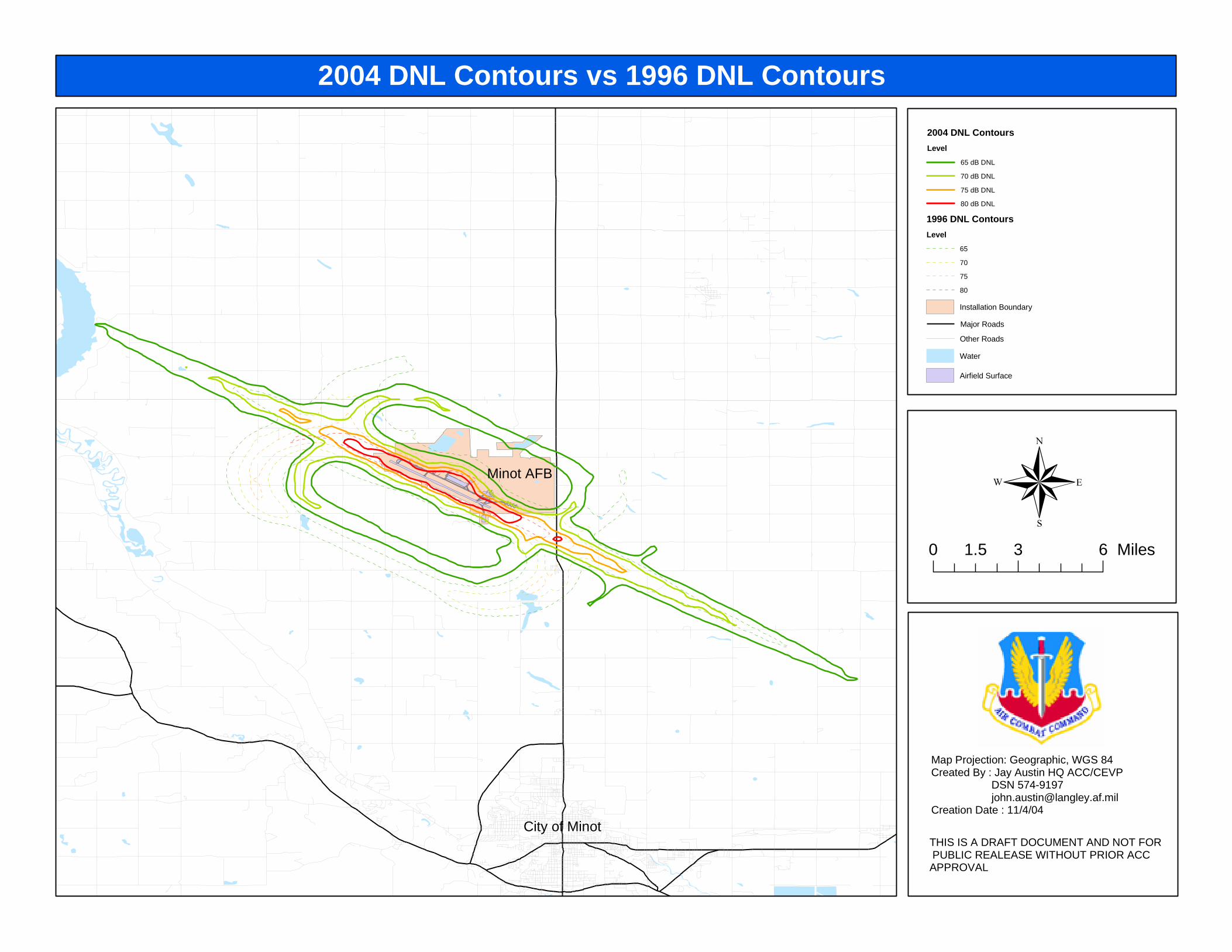
2004 DNL Contours vs 1996 DNL Contours
2004 DNL Contours
Level
65 dB DNL
70 dB DNL
75 dB DNL
80 dB DNL
1996 DNL Contours
Level
65
70
75
80
Installation Boundary
Major Roads
Other Roads
Water
Airfield Surface
THIS IS A DRAFT DOCUMENT AND NOT FOR PUBLIC REALEASE WITHOUT PRIOR ACCAPPROVAL
0 3 61.5 Miles
Map Projection: Geographic, WGS 84Created By : Jay Austin HQ ACC/CEVP DSN 574-9197 [email protected] Date : 11/4/04
Minot AFB
City of Minot
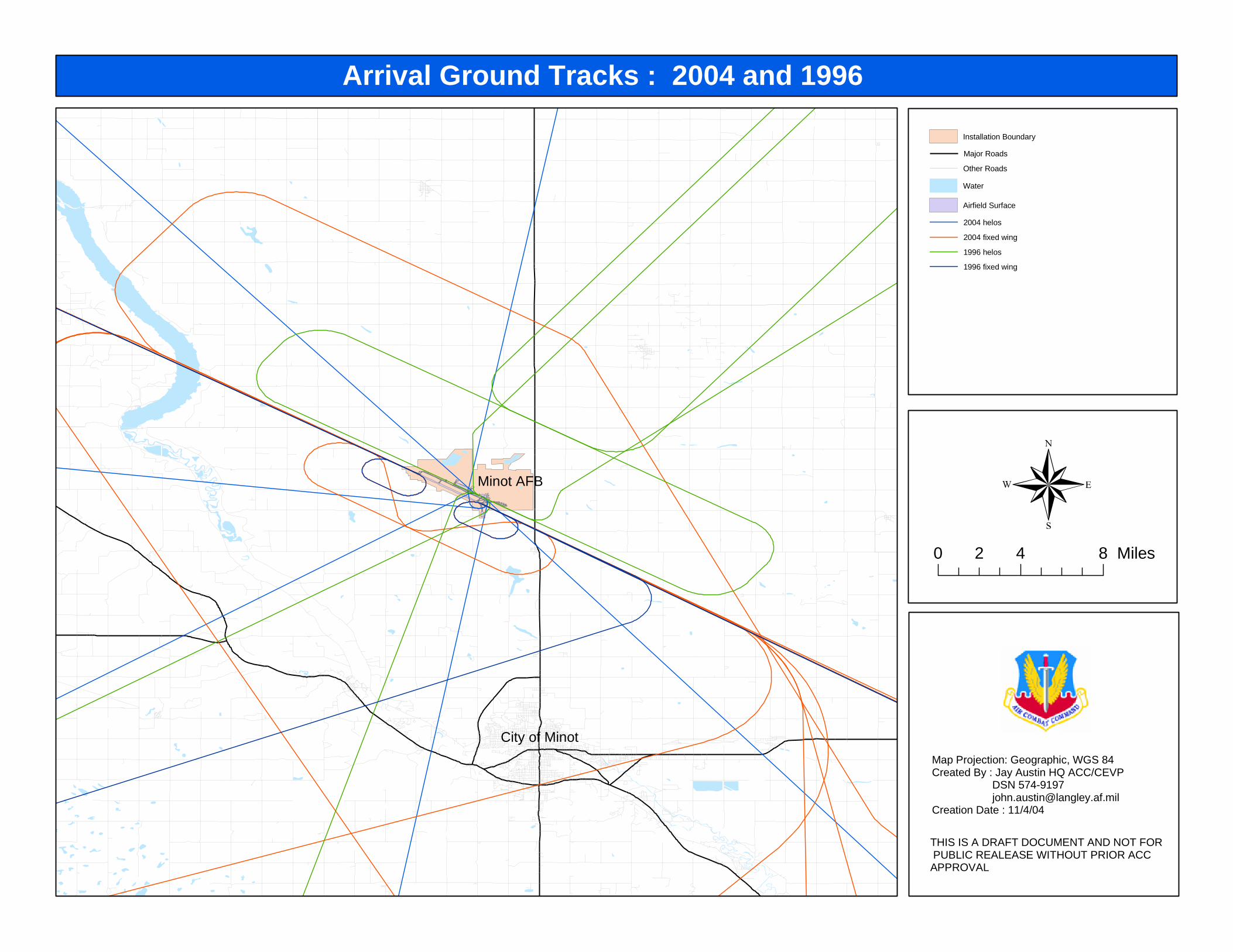
Arrival Ground Tracks : 2004 and 1996
Installation Boundary
Major Roads
Other Roads
Water
Airfield Surface
2004 helos
2004 fixed wing
1996 helos
1996 fixed wing
THIS IS A DRAFT DOCUMENT AND NOT FOR PUBLIC REALEASE WITHOUT PRIOR ACCAPPROVAL
0 4 82 Miles
Map Projection: Geographic, WGS 84Created By : Jay Austin HQ ACC/CEVP DSN 574-9197 [email protected] Date : 11/4/04
Minot AFB
City of Minot
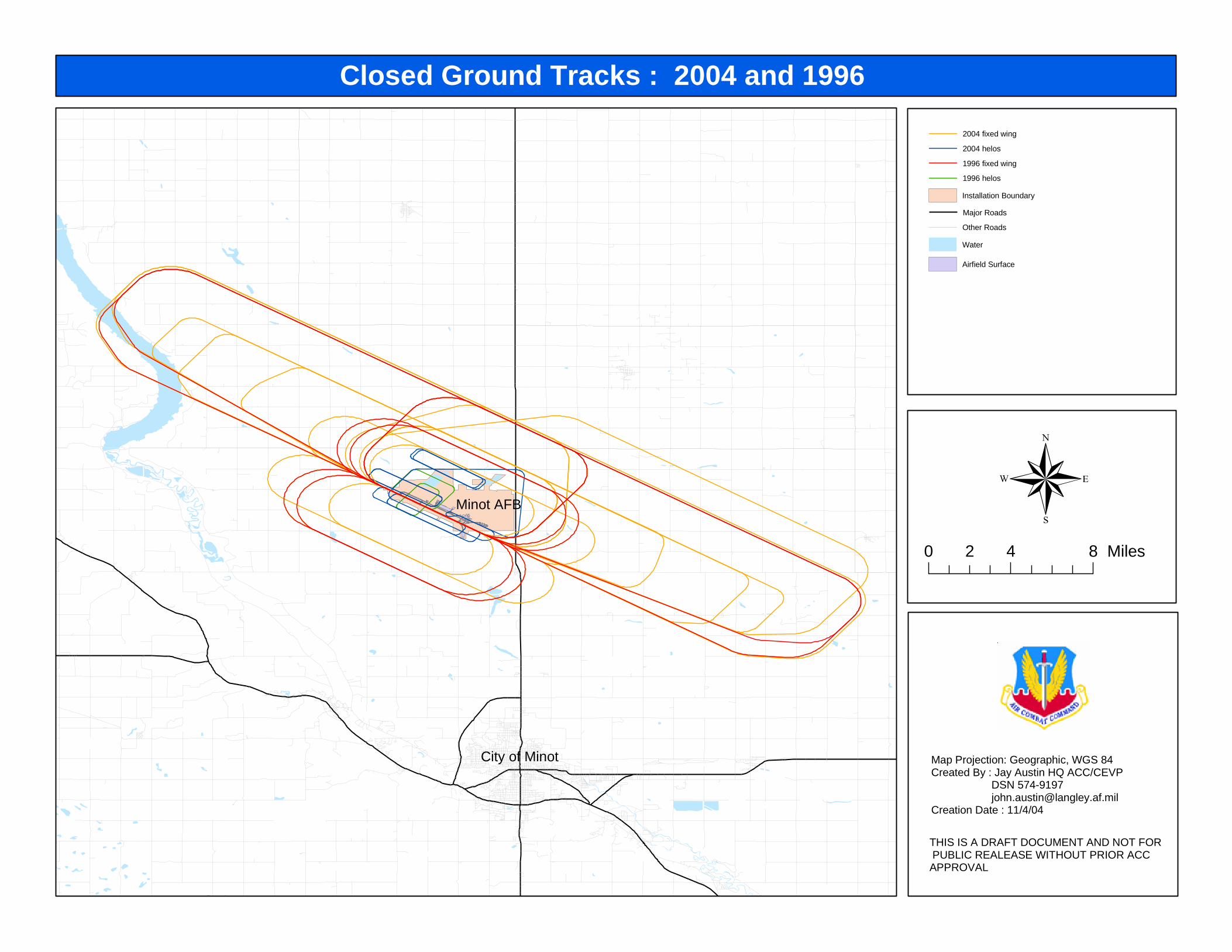
Closed Ground Tracks : 2004 and 1996
2004 fixed wing
2004 helos
1996 fixed wing
1996 helos
Installation Boundary
Major Roads
Other Roads
Water
Airfield Surface
THIS IS A DRAFT DOCUMENT AND NOT FOR PUBLIC REALEASE WITHOUT PRIOR ACCAPPROVAL
0 4 82 Miles
Map Projection: Geographic, WGS 84Created By : Jay Austin HQ ACC/CEVP DSN 574-9197 [email protected] Date : 11/4/04
Minot AFB
City of Minot
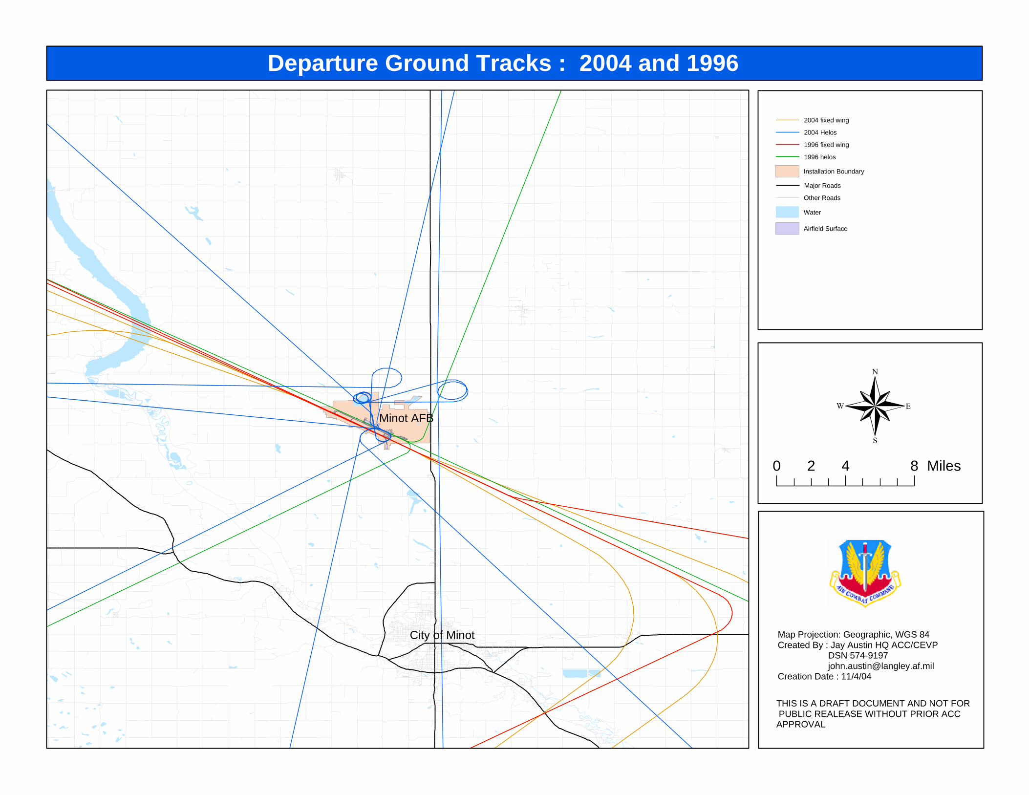
Departure Ground Tracks : 2004 and 1996
2004 fixed wing
2004 Helos
1996 fixed wing
1996 helos
Installation Boundary
Major Roads
Other Roads
Water
Airfield Surface
THIS IS A DRAFT DOCUMENT AND NOT FOR PUBLIC REALEASE WITHOUT PRIOR ACCAPPROVAL
0 4 82 Miles
Map Projection: Geographic, WGS 84Created By : Jay Austin HQ ACC/CEVP DSN 574-9197 [email protected] Date : 11/4/04
Minot AFB
City of Minot

![Japan Meteorological Agency | Earthquake Information · .dq]dnl vkl .dq]dnl .dudwvx vkl 1lvkl mrqdl.dudwvx vkl 7dnhnred.dudwvx vkl +dpdwdpd.dudwvx vkl 2fkl.dudwvx vkl .lwd kdwd.dudwvx](https://img.pdfslide.us/doc/110x75/5c01ea7e09d3f20f068d7a47/japan-meteorological-agency-earthquake-information-dqdnl-vkl-dqdnl-dudwvx.jpg)

![DNL – Geography – London: A Global City - Freeaubel.free.fr/DNL/1re/LESSON_London_A_Global_City/LESSON_Londo… · 1/13 DNL – Geography – London: A Global City [CA v1.5] Summary](https://img.pdfslide.us/doc/110x75/5aa1a4f77f8b9aa0108c2368/dnl-geography-london-a-global-city-113-dnl-geography-london.jpg)