Embed Size (px)
Citation preview

Climate Applications of ground-based Global
Navigation Satellite Systems (GNSS) measurements
Junhong (June) WangDept. of Atmospheric and Environmental
SciencesUniversity at Albany, SUNY, Albany, NY
Earth Observing Laboratory, NCAR, Boulder, CO

Outline
1. Motivation
2.GNSS precipitable water (PW) data
3.Climate applications:
• Validations of radiosonde and other data
• PW Variabilities: Diurnal cycle, annual anomaly, inter-annual variability, long-term trends and extremes
4. Other water cycle products from GNSS & other geodetic techniques
5. Summary
2

Gaffen et al. (1995)
Challenge: Large variability
3

How does GNSS estimate precipitable water?
4
Total delay = Ionosphere + dry + wet
Meteorological data (Ps, Ts) & estimated Tm
Dual-frequency GNSS mea.:GNSS EphemerisStation position
Timing
Atmospheric delay (ZTD = ZHD+ZWD)
Precipitable Water (PW)
ZWD = ZTD - ZHDZHD = f(Ps)
PW = * ZWD = f (Tm)
Forward modelGeodetic Noise to Meteorological signals
5
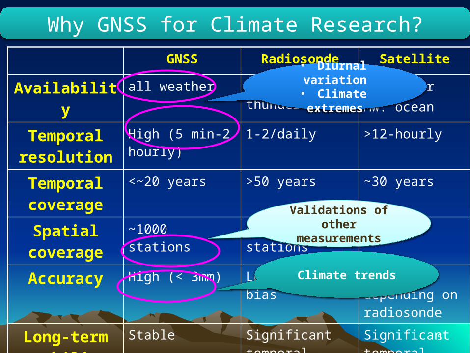
GNSS Radiosonde Satellite
Availability all weather Difficulty in thunderstorms
IR: clearMW: ocean
Temporal resolution
High (5 min-2 hourly)
1-2/daily >12-hourly
Temporal coverage
<~20 years >50 years ~30 years
Spatial coverage
~1000 stations ~1000 stations globe
Accuracy High (< 3mm) Low, various, bias Low, depending on radiosonde
Long-term stability
Stable Significant temporal inhomogeneity
Significant temporal inhomogeneity
Why GNSS for Climate Research?
• Diurnal variation• Climate extremes
Validations of other measurements
Climate trends
6
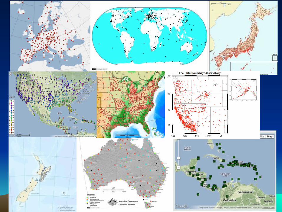
GNSS Networks
7
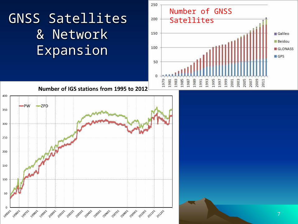
GNSS Satellites & Network Expansion
Number of GNSS Satellites
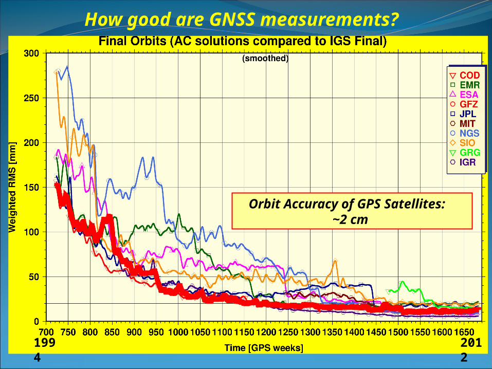
How good are GNSS measurements?
Orbit Accuracy of GPS Satellites: ~2 cm
1994
2012
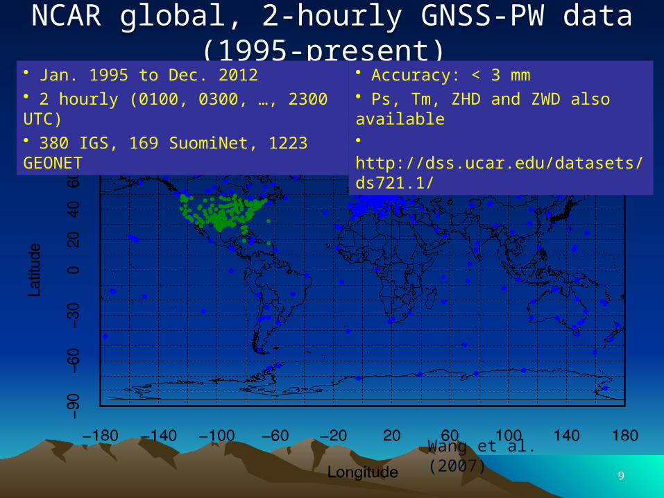
NCAR global, 2-hourly GNSS-PW data (1995-present) • Jan. 1995 to Dec. 2012• 2 hourly (0100, 0300, …, 2300 UTC)• 380 IGS, 169 SuomiNet, 1223 GEONET
• Accuracy: < 3 mm• Ps, Tm, ZHD and ZWD also available• http://dss.ucar.edu/datasets/ds721.1/
Wang et al. (2007)
9
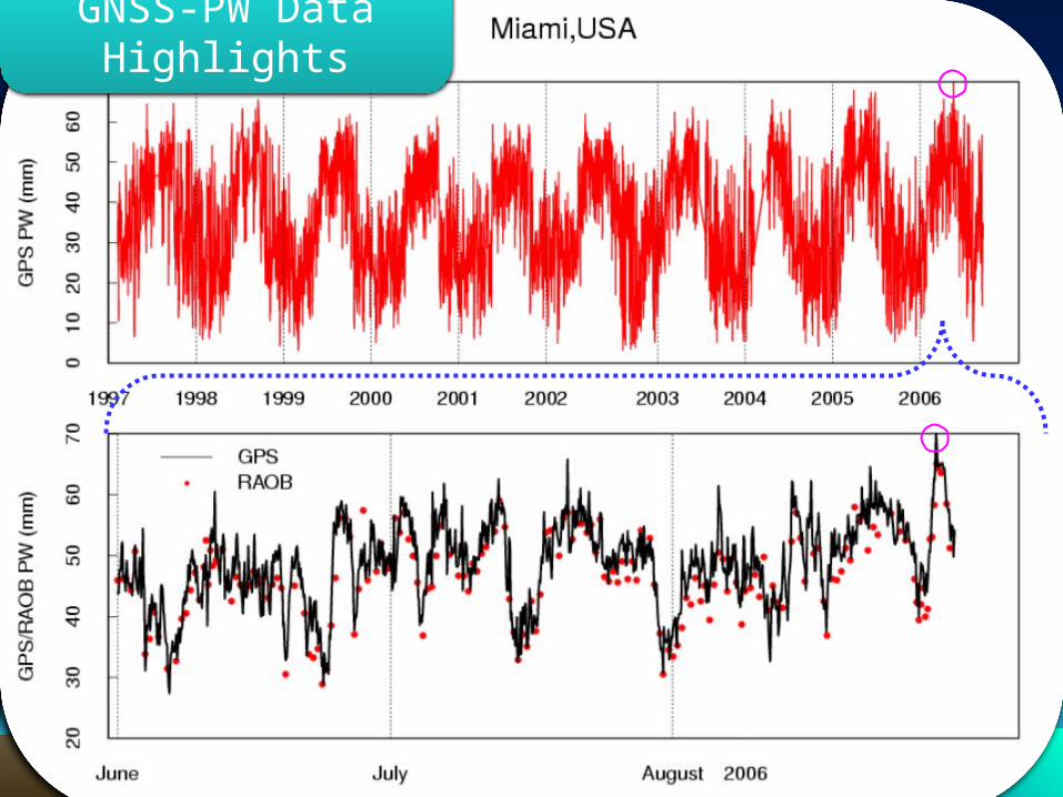
GNSS-PW Data Highlights
10

Hurricane Ernesto (Miami, 8/28-8/31/2006)
35
40
45
50
55
60
65
70
75
240 241 242 243 244
Julian days
PW
(m
m)
1005
1006
1007
1008
1009
1010
1011
1012
1013
1014
1015
Su
rfac
e p
ress
ure
(h
Pa)
PW
Ps
8/28 8/318/308/29
Hurricane Ernesto (24 Aug – 1 Sep. 2006)
11
12
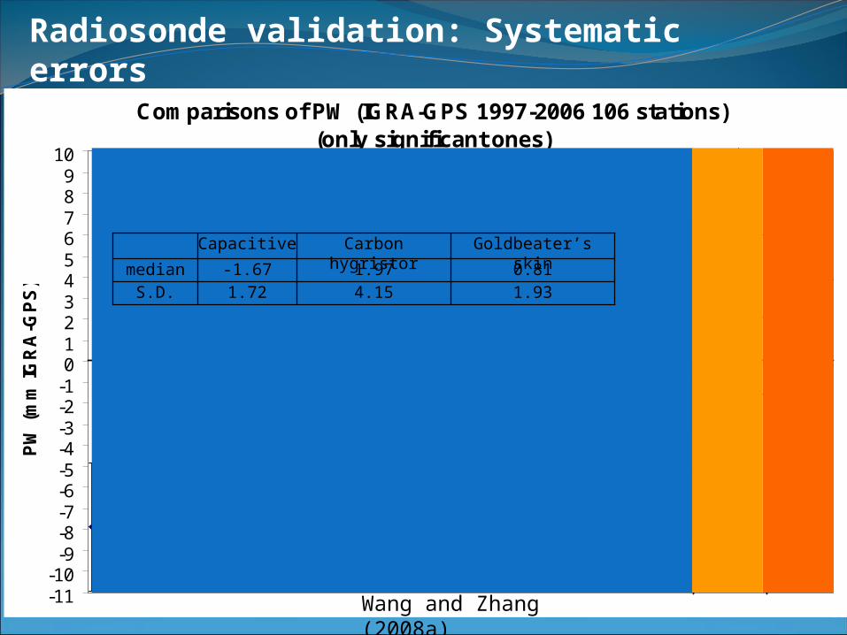
Radiosonde validation: Systematic errors
Comparisons of PW (IGRA-GPS 1997-2006 106 stations)(only significant ones)
-11-10
-9-8-7-6-5-4-3-2-10123456789
10
PW
(m
m IG
RA
-GP
S)
RS80A RS80H RS90 RS92Modem Meisei VIZ-type IM-MK3MSS Shang MRZ/Mars
CapacitiveCarbon Hygristor
Goldbeater's skin
1.934.151.72S.D.0.811.97-1.67median
Goldbeater’s skinCarbon hygristorCapacitive
Wang and Zhang (2008a)
13
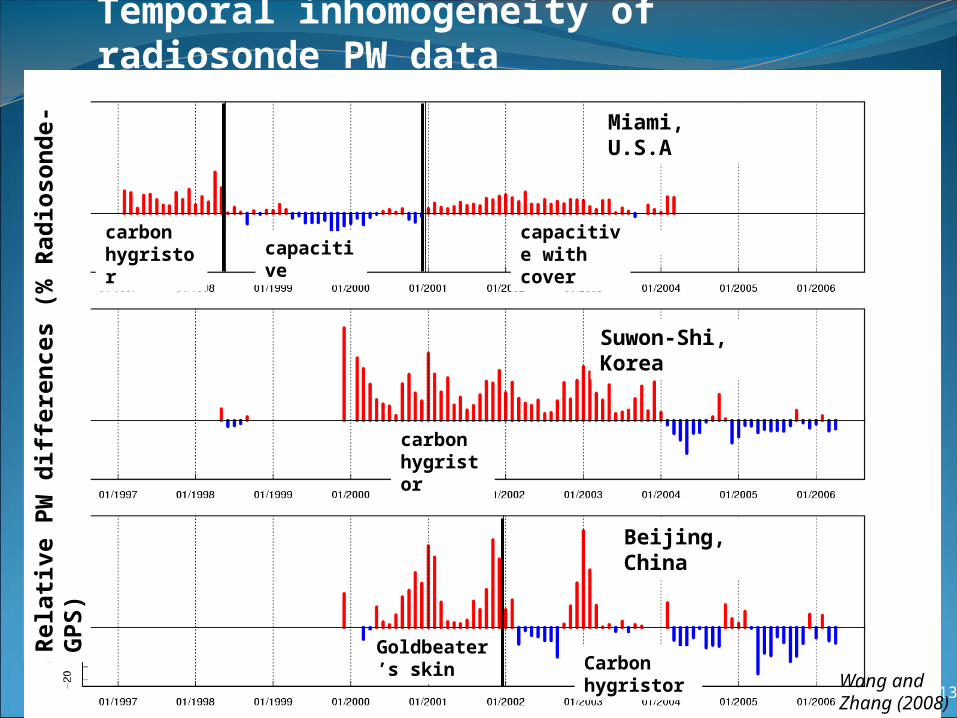
Temporal inhomogeneity of radiosonde PW data
Wang and Zhang (2008)
Miami, U.S.A
Suwon-Shi, Korea
Beijing, China
carbon hygristor
carbon hygristor
Goldbeater’s skin Carbon
hygristor
capacitive
capacitive with cover
Rela
tive
PW
diff
ere
nces
(% R
ad
ioso
nd
e-
GP
S)

Diurnal Variations (Lindenberg)
Radiosonde before corr.GNSS
Vaisala RS92
14
Radiosonde after corr.
ERA-Interim Japanese Reanalysis
Wang et al. (2013)

Global PW diurnal anomaly from GNSS
• The diurnal cycle is less than 5% of annual mean PW
• Larger magnitude in summer than in winter
• Peak around late afternoon to early evening
• An order of magnitude smaller than seasonal variation
GlobeS. H.N. H.
15
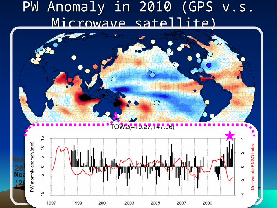
PW Anomaly in 2010 (GPS v.s. Microwave satellite)
Mears et al. (2010)Mears et al. (2011)
Mears et al. (2011)
16
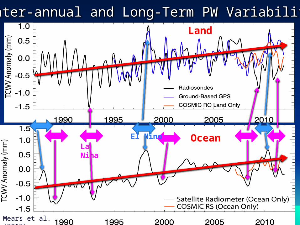
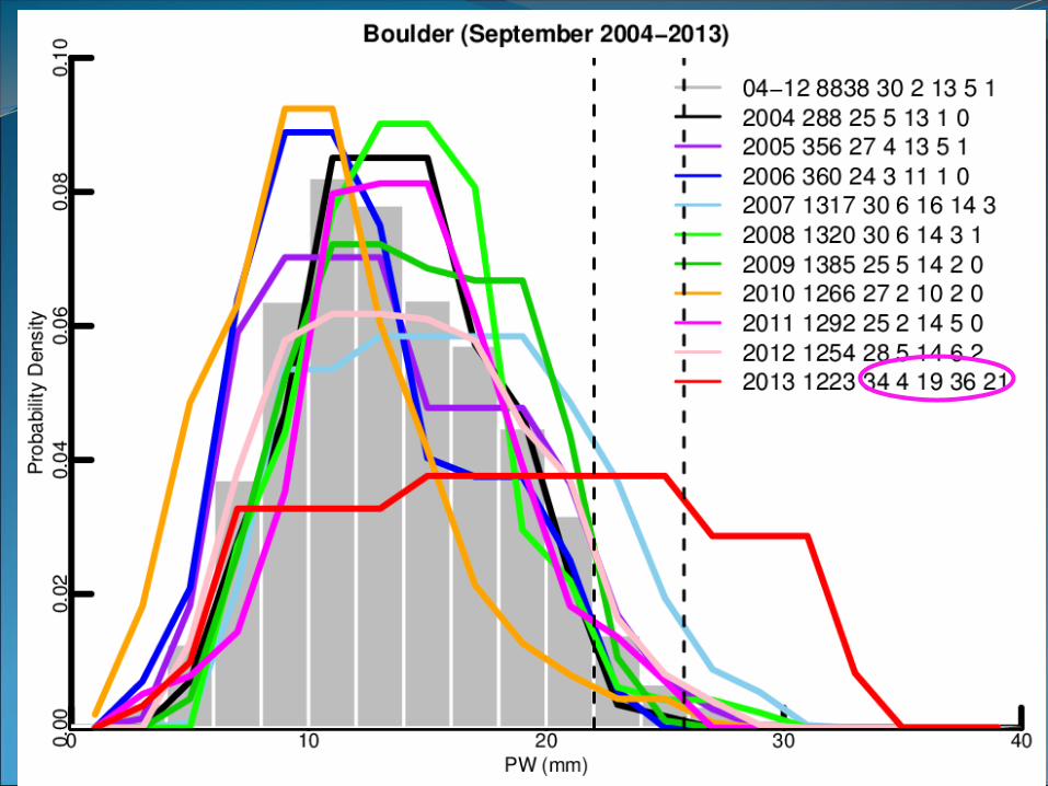
Inter-annual and Long-Term PW Variability
El NinoLa Nina
Land
Ocean
Mears et al. (2012) 17

18
Land: X Radiosonde; O GPS Ocean: MWR satellites
19
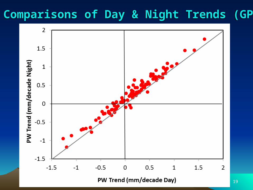
Comparisons of Day & Night Trends (GPS)
20
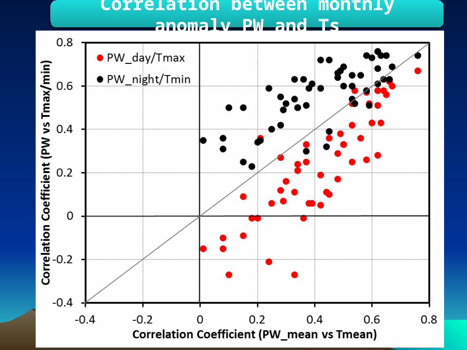
Correlation between monthly anomaly PW and Ts
21
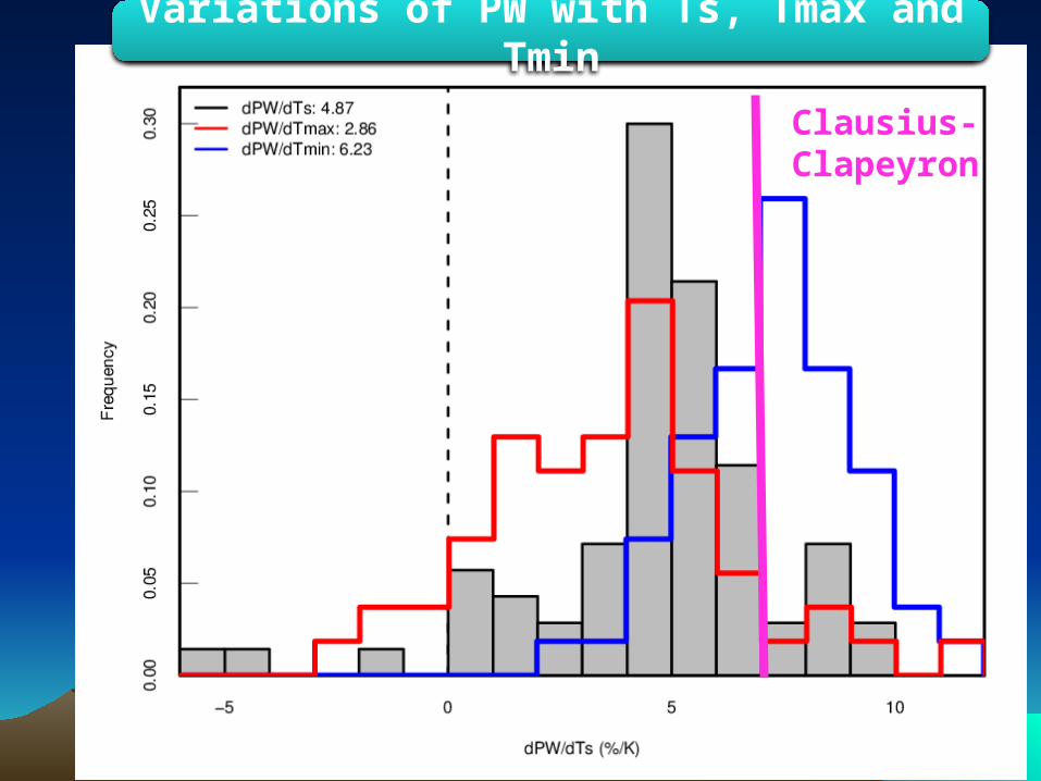
Variations of PW with Ts, Tmax and Tmin
Clausius-Clapeyron
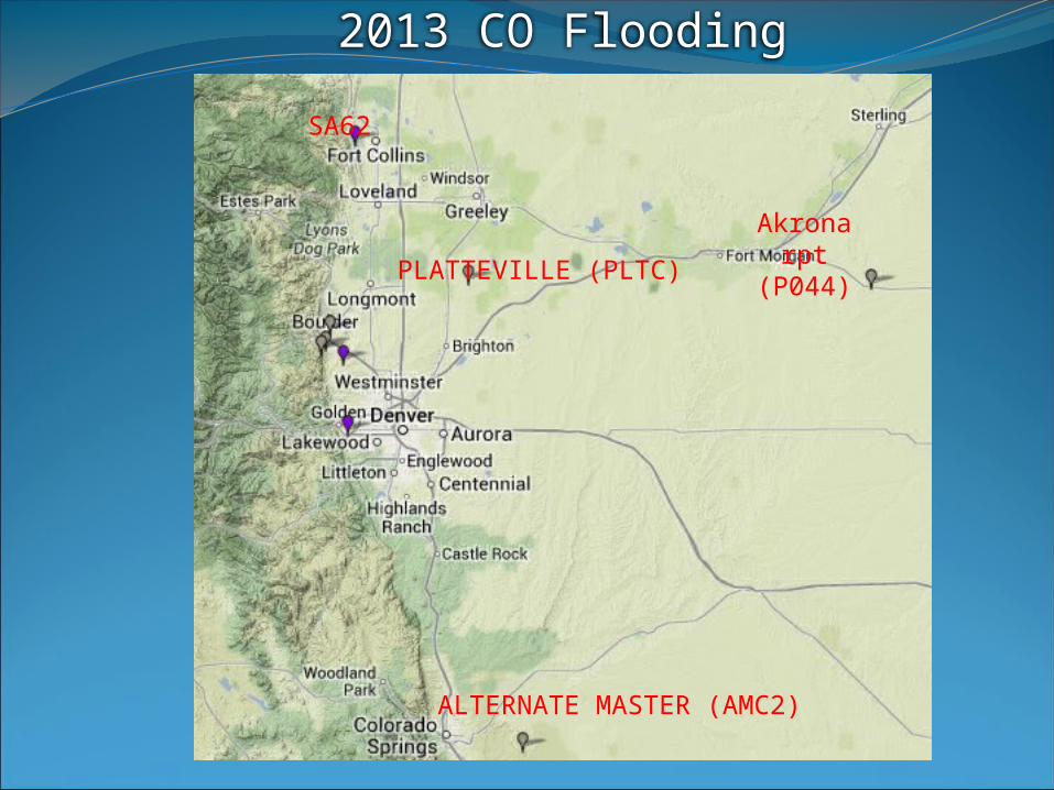
PLATTEVILLE (PLTC)
Akronarpt
(P044)
ALTERNATE MASTER (AMC2)
SA62
2013 CO Flooding


25
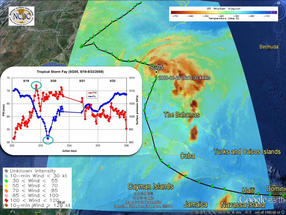
Tropical Strom Fay, Aug 17-29, 2008
• Fatalities: 13 dir./23 indirect• $560 million• Area affected: Puerto Rico, Dominican Republic, Haiti, Jamaica, Cuba, Bahamas, South Eastern USFay Dumps Record-Breaking Rain; Flood Victims Warned Of Alligator Swimming In Streets Homeowners Forced To Use Canoes POSTED: August 20, 2008

27
Tropical Strom Fay, Aug 17-29, 2008
http://xenon.colorado.edu/spotlight/index.php?product=spotlight&station=sg05
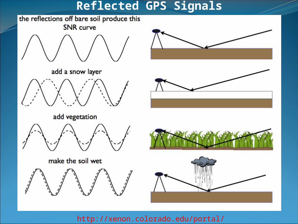
Reflected GPS Signals
http://xenon.colorado.edu/portal/
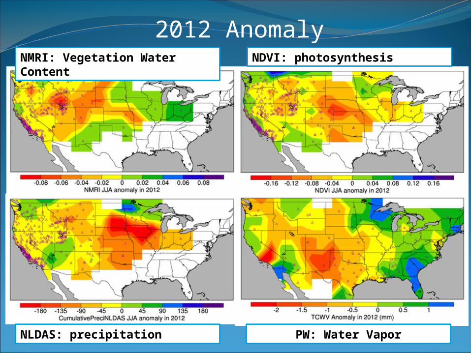
2012 AnomalyNMRI: Vegetation Water Content
NDVI: photosynthesis
NLDAS: precipitation PW: Water Vapor
http://xenon.colorado.edu/portal/index.php
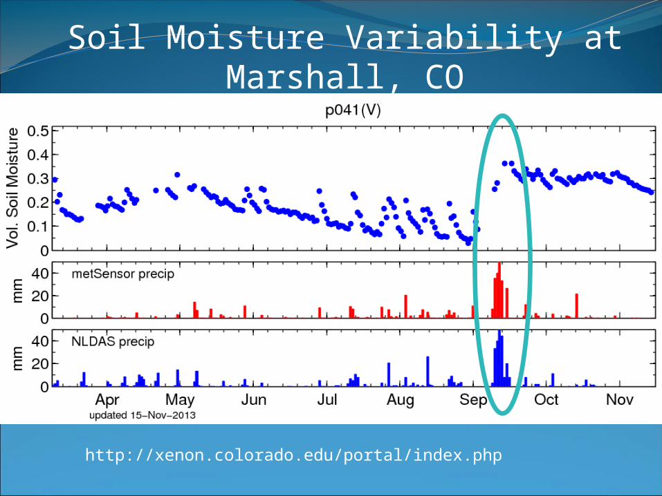
Soil Moisture Variability at Marshall, CO
31
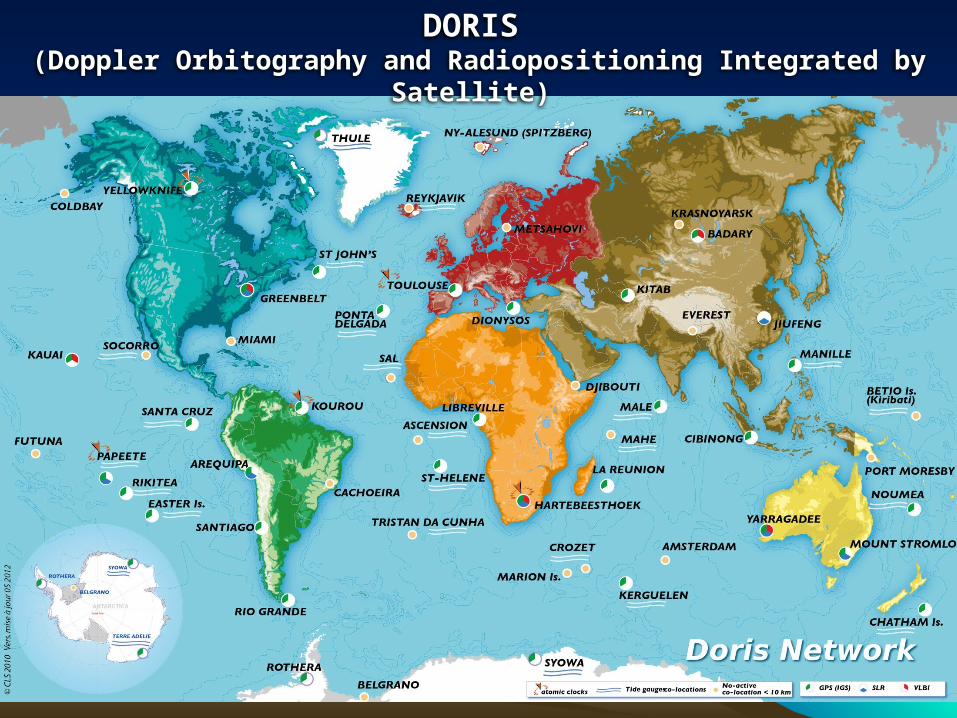
DORIS (Doppler Orbitography and Radiopositioning Integrated by Satellite)

32
Very Long Baseline Interferometry (VLBI)
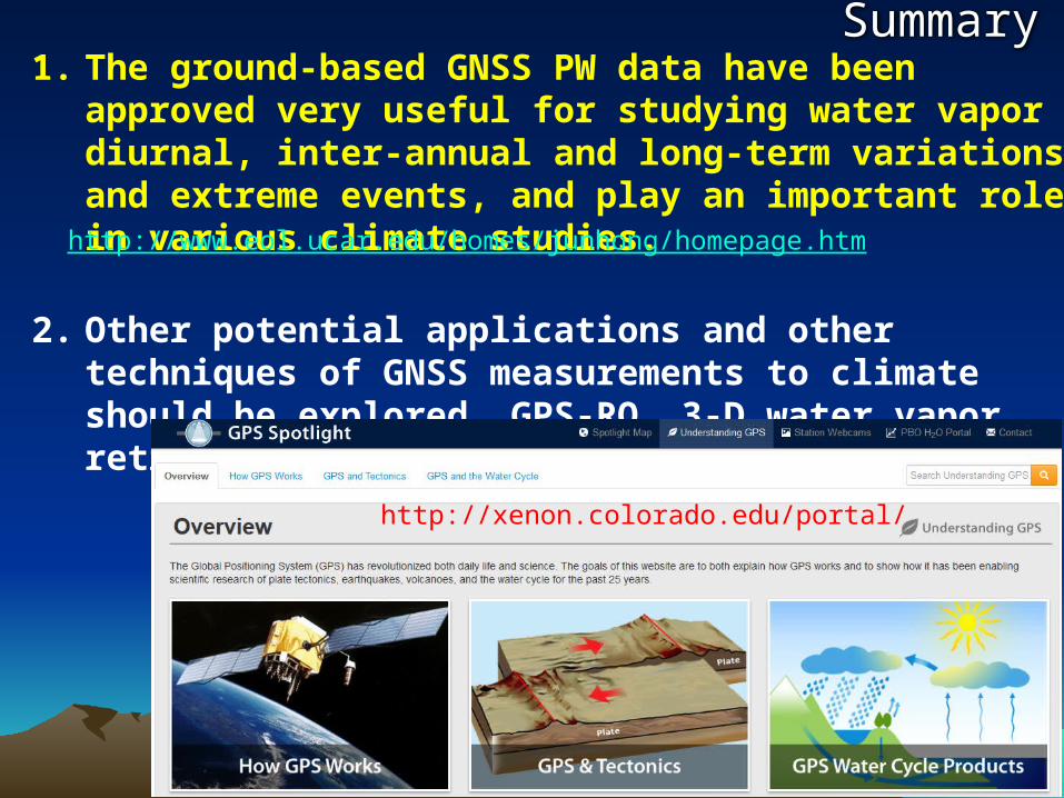
Summary1. The ground-based GNSS PW data have been approved very
useful for studying water vapor diurnal, inter-annual and long-term variations, and extreme events, and play an important role in various climate studies.
2. Other potential applications and other techniques of GNSS measurements to climate should be explored, GPS-RO, 3-D water vapor retrieval, other geodetic techniques.
33
http://www.eol.ucar.edu/homes/junhong/homepage.htm
http://xenon.colorado.edu/portal/

![Uputronics - MAX-8See the MAX-8 / MAX-M8 Hardware Integration Manual [1] for u-blox design recommendations. 1.6 Assisted GNSS (A-GNSS) Supply of aiding information, such as ephemeris,](https://img.pdfslide.us/doc/110x75/602642a81b8a480cd14511d5/uputronics-max-8-see-the-max-8-max-m8-hardware-integration-manual-1-for-u-blox.jpg)