Embed Size (px)
Citation preview
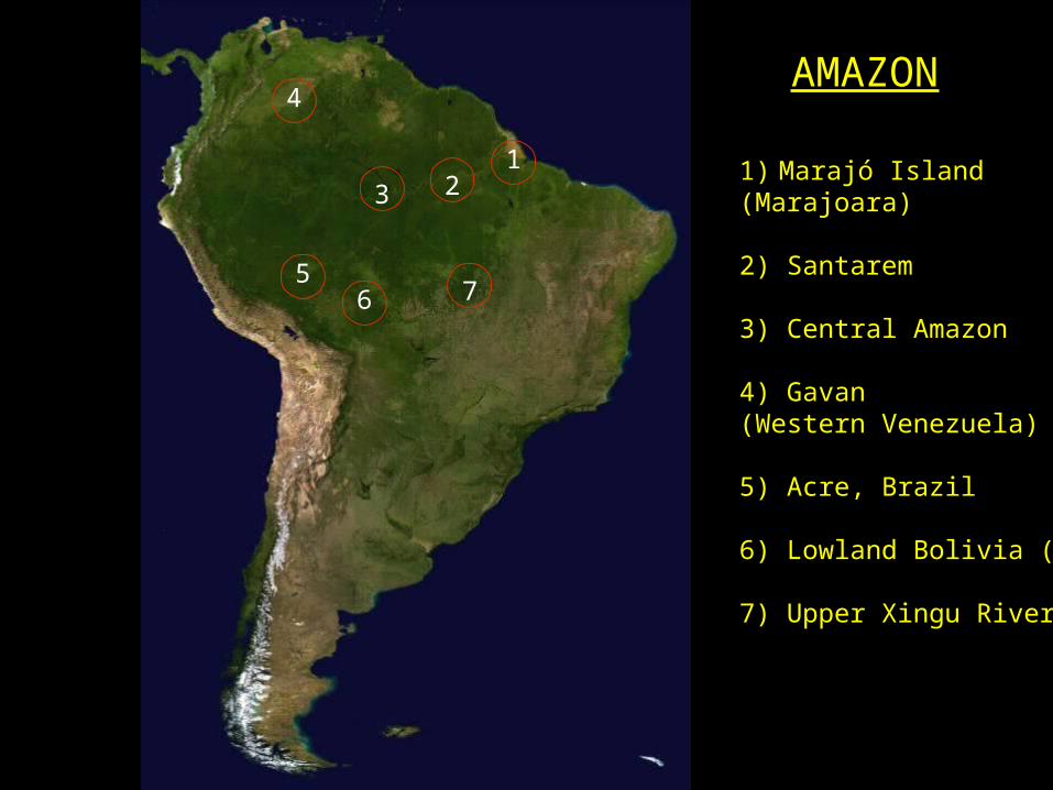
1) Marajó Island(Marajoara)
2) Santarem
3) Central Amazon
4) Gavan (Western Venezuela)
5) Acre, Brazil
6) Lowland Bolivia (Baure)
7) Upper Xingu River
1
765
3 2
4AMAZON

Rolling Stone, 10/17/07

The “Great Divide”
• Traditional view: complex societies emerged in the Andean area and any complex societies (chiefdoms) in Amazon must be the result of diffusion or migration from the Andes
Highlands(Andes)
Lowlands(Amazon)
The two major geographic blocks that cover the majority of South Americaare the Andes and Amazonia
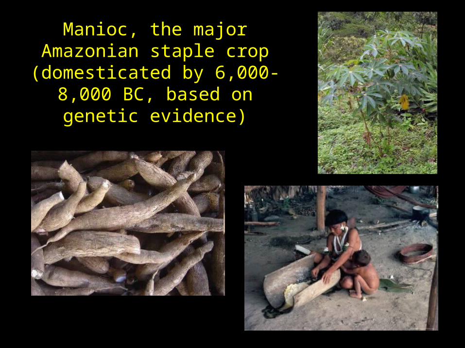
Manioc, the major Amazonian staple crop (domesticated by
6,000-8,000 BC, based on genetic evidence)

• At least 138 crops with some degree of domestication were being cultivated or managed by native Amazonians at the time of European conquest (83 crops native to Amazonia).
• 68% of these Amazonian crops are fruit or nut trees or woody perennials (not surprising in Amazon forest).
Peach Palm
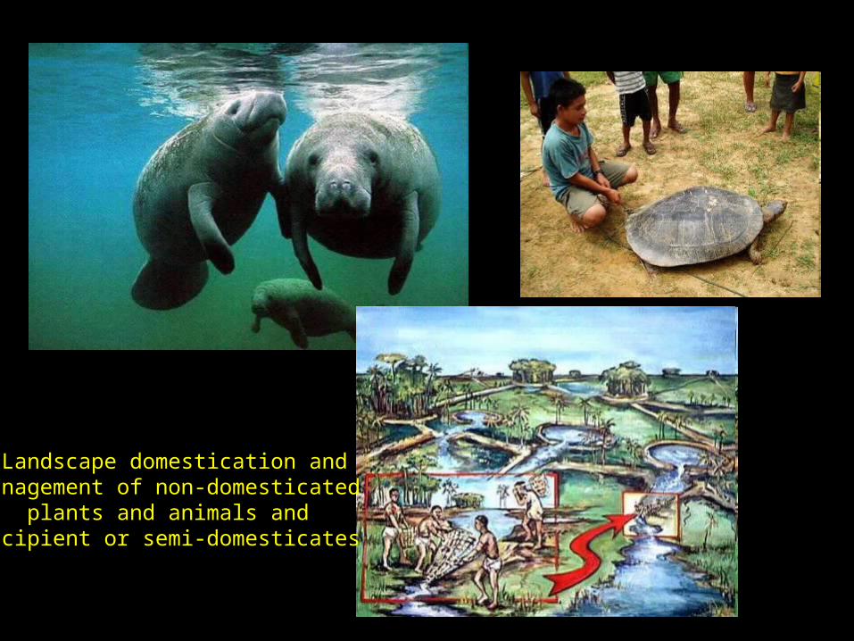
Landscape domestication andmanagement of non-domesticated
plants and animals and incipient or semi-domesticates
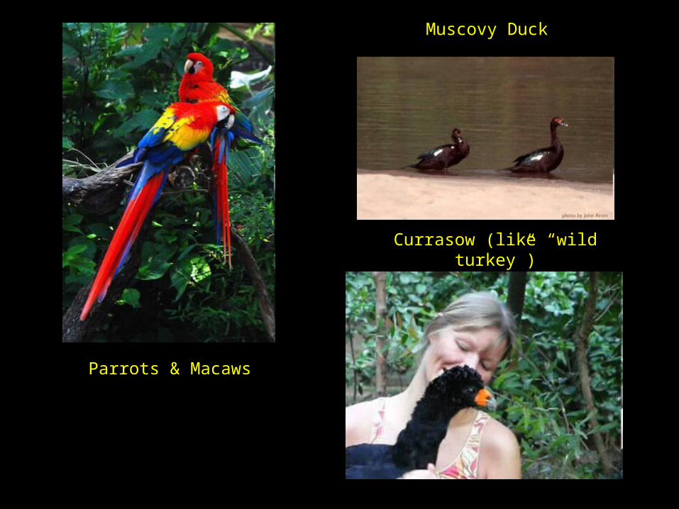
Parrots & Macaws
Currasow (like “wild turkey”)
Muscovy Duck

AustronesianArawak
Bantu
The Tropical Diaspora
Tupi-Guarani
Tupi languages originated in SW Amazonia by 3000-2000 BCProto-Arawak likely began to diverge c. 2000 BC

Distribution of Tupi-Guarani languages
Origin(homeland)
By AD 1
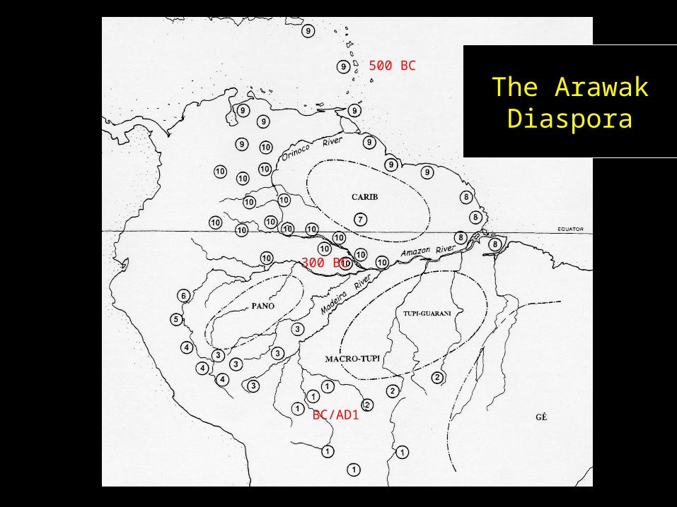
The ArawakDiaspora
500 BC
300 BC
BC/AD1

Amazonian Barrancoid
• Shared ceramic tradition across much of Amazonia, often associated with speakers of Arawak languages, generally dates to ca. 500 BC to AD 1000, but varies from region to region

Trants, Caribbeanc. 500 BC-AD 600
Gaván, Western Orinoquia, c. AD 600-1300
Northern Amazonia (Saladoid/Barrancoid)

Polychrome Tradition
• The Amazonian Polychrome Tradition represents a transformation, c. 1000 years ago, of the earlier Barrancoid Tradition ceramic industry by widespread trade of fine ceramics (“wealth” goods) between elites up and down the Amazon

Amazonian Polychrome Tradition
12
3
1. Marajoara2. Santarém
3. Central Amazon
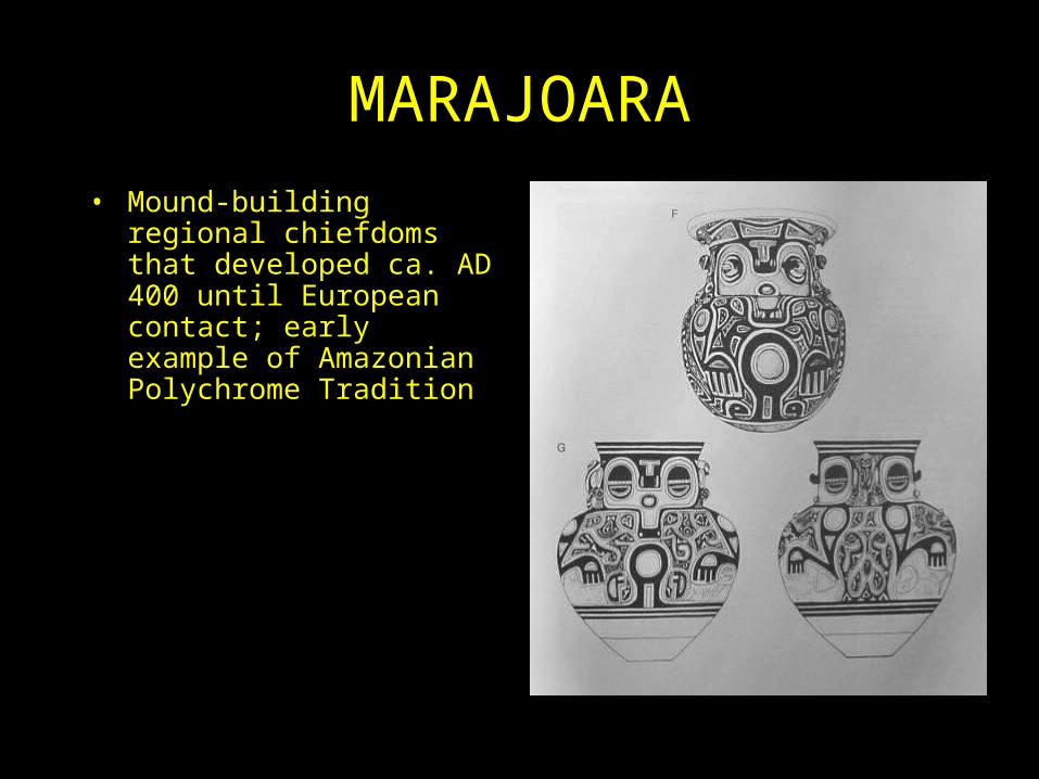
MARAJOARA• Mound-building regional
chiefdoms that developed ca. AD 400 until European contact; early example of Amazonian Polychrome Tradition

Caumtins (Marajoara) mound group
Elite mounds

Marajoaraburial urns

Domestic mounds

?
Elite Mounds (Camutins) Regional Ceramic Traditions

Amazonian Stonehenge (Amapa), ca. AD 1-500

Macapa burial urns, north of the mouth of the Amazon, ca. AD 1500-1600
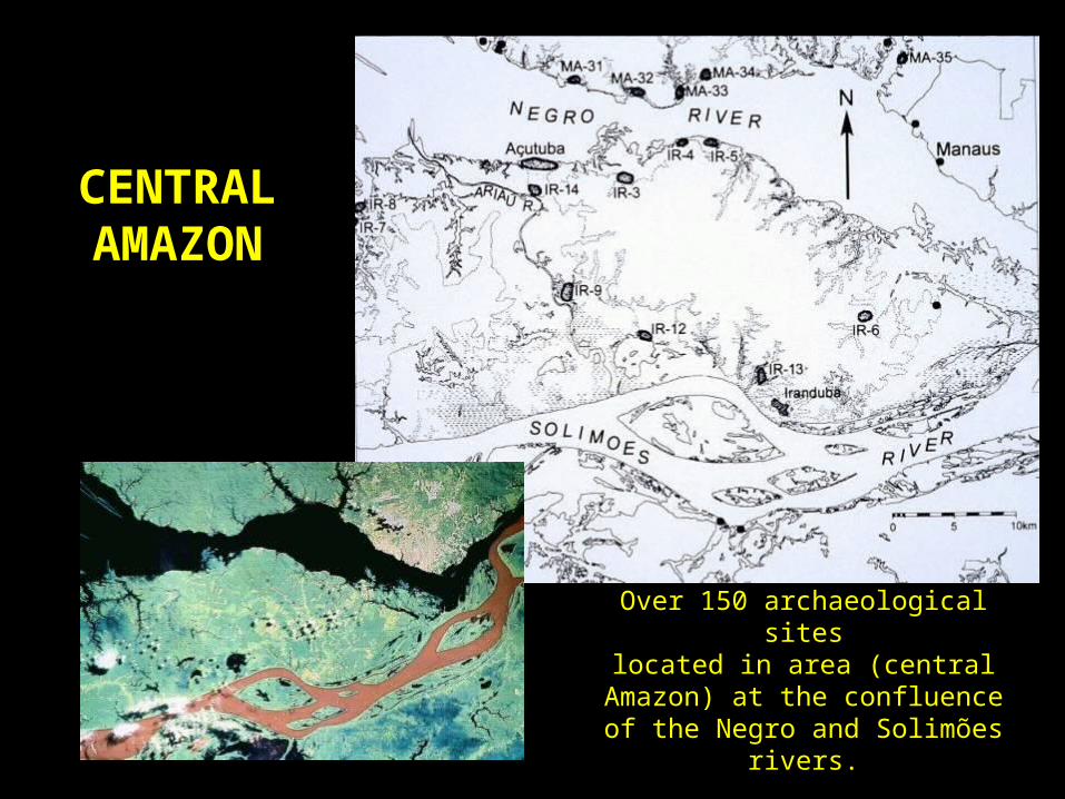
CENTRALAMAZON
Over 150 archaeological siteslocated in area (central Amazon) at
the confluence of the Negro and Solimões rivers.

Açutuba (“big Port”), central Amazon, ca. 300
BC-AD 1600
Major center with central plazathe size of 4 football fields

Ceramics from Açutuba (Central Amazon, Polychrome Tradition)

Amazonian “black earth” sites - “terra preta” (TP), after ca. AD 1000
Area adjacent to Açutuba plaza
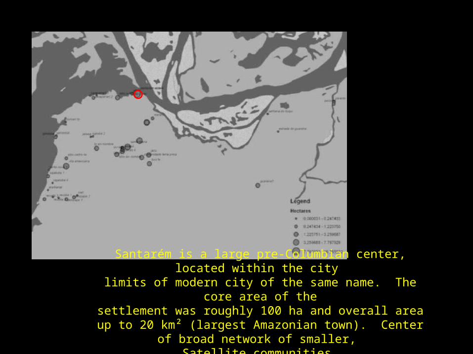
Santarém is a large pre-Columbian center, located within the city limits of modern city of the same name. The core area of thesettlement was roughly 100 ha and overall area up to 20 km²
(largest Amazonian town). Center of broad network of smaller, Satellite communities.

Santarém ceramics
“very great quantities of porcelain ware of various makes … the best that has ever been seen in the world” (Carvajal 1542)

1
3
2
1) Acre, Brazil; 2) lowland Bolivia; 3) Upper Xingu River
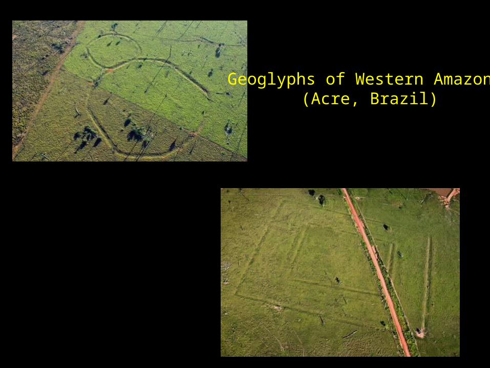
Geoglyphs of Western Amazonia(Acre, Brazil)
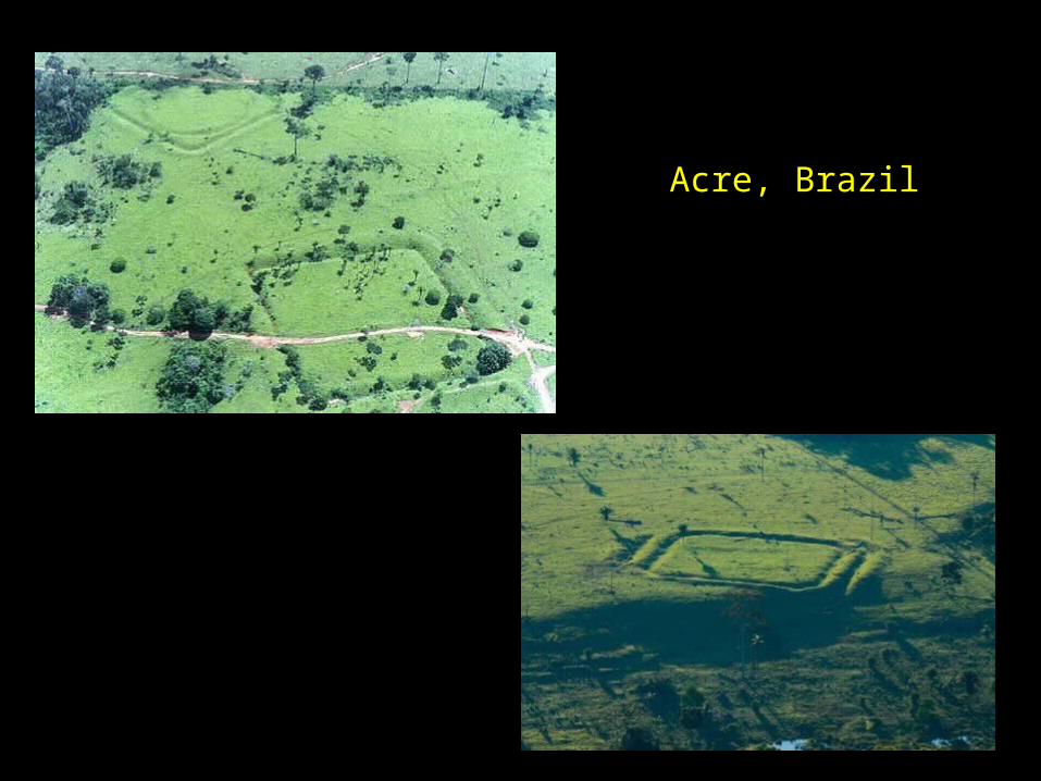
Acre, Brazil

Mound linked by causeways in domesticated landscapes of lowland Bolivia
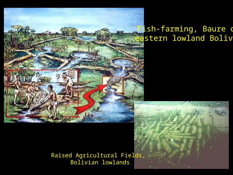
Raised Agricultural Fields, Bolivian lowlands
Fish-farming, Baure ofeastern lowland Bolivia

Areas of Arawak and related polities in AD
1500: 1) Upper Xingu; 2) Pareci; 3)
Baure (eastern Bolivia)

Regional distribution of
galactic clusters (polities) in a peer polity system, in other words each
polity was politically equal (not single capital center)
Note extent of anthropogenic
areas (denoted by large orange and red circles): no “pristine forest”
here


Galactic settlement clusters: central plaza
settlement, four primary plaza satellites
positioned according to cardinal directions, and other small peripheral
plaza settlements (about the size of
contemporary Upper Xingu villages)
These galactic clusterswere small, territorial
polities (complex societies) in AD 1500
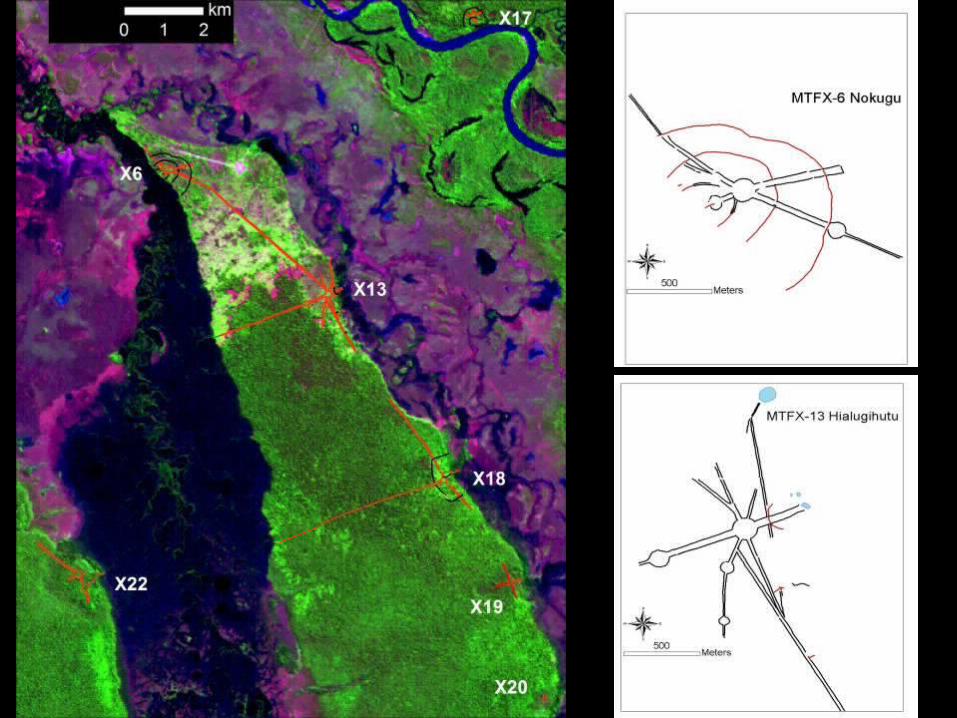
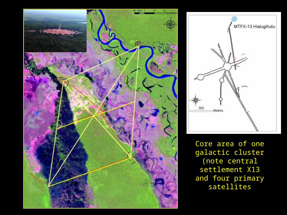
Core area of one galactic cluster (note
central settlement X13 and four primary
satellites

Ebenezer Howard’s “Garden cities of Tomorrow” (1902)
Garden Cities of Yesterday?
Galactic Urbanism or “Garden Cities”: precisely designed network of five core settlements and smaller peripheral settlements in territorial polities, with mosaic of occupation areas, agricultural countryside, and managed wetlands, interspersed by patches of forest and separated from other clusters by closed forest zones (green belts)

European Contact • Catastrophic effects of
European contact, notably depopulation from Old World diseases, decimated the complex societies of the Amazon floodplains, but also reached throughout the Amazon forest, even though European explorers themselves seldom ventured into many parts of the Amazon until recently


![Large- and Medium-Sized Land Mammals of Northeast Marajó ... · S. Siciliano et al. 41 Continued Cerdocyon Cerdocyon thous raposa C, R, O [34] MPEG 43004 Procyonidae Nasua Nasua](https://img.pdfslide.us/doc/110x75/5c36bbc509d3f288708bf98c/large-and-medium-sized-land-mammals-of-northeast-marajo-s-siciliano-et.jpg)