Embed Size (px)
Citation preview

Photogrammetric methods
of 3D-models generation
Victor Adrov Managing Director Racurs, Russia
16th International Scientific and Technical Conference
From Imagery to Map: Digital Photogrammetric Technologies
November, 2016. Agra, India.

We live in three dimensions
2-dimensional representation
3-dimensional representation
2.5-dimensional representation
3D topographic models:
Geometric quality and accuracy of data
Plausibility
Completeness
Up-to-date data
Accurate photorealism
Rich, real-time, comprehensive visibility
Advanced analysis

Better representation of the reality
From object geometric description to virtual reality
From 2D to 3D representation

3D model usage and creation challenges
• No strict definition and common understanding of the term "topographic 3D model“.
• No stated requirements for the model contents.
• No stated requirements for the mathematical description of the models.
• No stated numerical and quality requirements for the output products.
• No stated requirements for the model generalization.
• No standard output data formats …
The lack of standards and regulatory documents
• Nowadays fewer and fewer end-users can read conventional 2D maps.
• Common lack of understanding how and why to use topographic 3D models.
• User inflexibility and unwillingness to adopt new conventions of data representation.
• No user-friendly software to handle 3D data.
End-user problems
• Growing volumes of stored data.
• High performance requirements for the computational nodes.
• The lack of analytic and visualization mass-data tools.
Computational problems
Labor intensity

3D topographic models types
LOD 1 LOD 2 LOD 3
Buildings represented by
block models
Building models with
standard roof structures
Detailed (architectural)
building models
Levels of details

Technologies
2D to 3D Model Extrusion Laser Scanning
Photogrammetric technologies Architectural 3D modelling
3D topographic models
LOD 1 LOD 1-4
LOD 1-4 LOD 1-4

3D topographic models types
3D GIS + databases
city and road planning
Territory management
Municipal improvements and landscaping
Full automation Semi-automatic or manual, including vectorization of point clouds
Generation technology
Application areas
Telecommunication engineering
Natural disasters
Landscape visualization
Military operations planning
Education
Continuous surface models (point clouds, dDSM) Object-oriented (“separated”) models (DTM / DSM + vector objects)

3D topographic models
Textured and non-textured models
Non-textured
Color
Photorealistic textures
Textures set
Typical textures
Textures

Source remote sensing data for 3D topographic modeling
UAV images Aerial photos Satellite scanner images
Images to a 1:1 scale
Accuracy RMSE ~ 5 cm RMSE ~ 5-50 cm RMSE ~> 50 cm
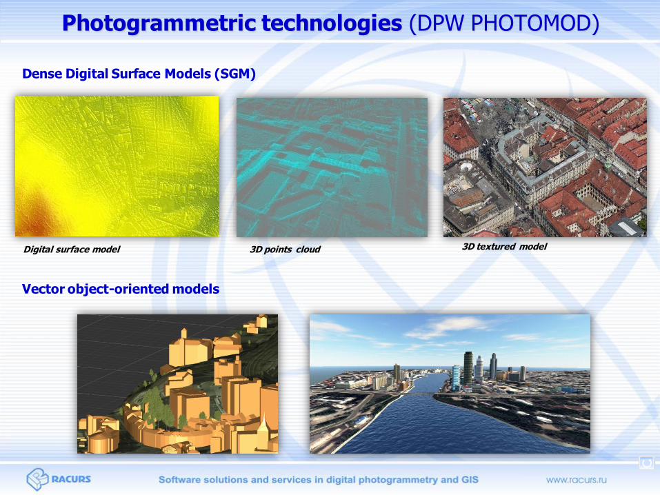
Photogrammetric technologies (DPW PHOTOMOD)
Dense Digital Surface Models (SGM)
3D points cloud 3D textured model
Vector object-oriented models
Digital surface model

3D model (SGM)
UAV. Camera Delairtech. Ground sample distance (GSD) and DEM cell size - 5 cm. Horizon, France
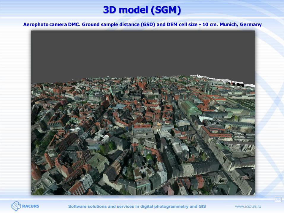
Aerophoto camera DMC. Ground sample distance (GSD) and DEM cell size - 10 cm. Munich, Germany
3D model (SGM)
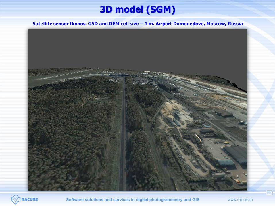
Satellite sensor Ikonos. GSD and DEM cell size – 1 m. Airport Domodedovo, Moscow, Russia
3D model (SGM)

Oblique aerial cameras systems data processing
Aerial camera UltraCam Osprey Prime II. Ground sample distance (GSD) and DEM cell size – 7,1 cm
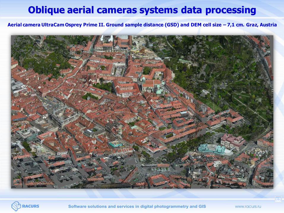
Aerial camera UltraCam Osprey Prime II. Ground sample distance (GSD) and DEM cell size – 7,1 cm. Graz, Austria
Oblique aerial cameras systems data processing

Automatic blocks of images orientation
Automatic DTM creation
Automatic orthophoto creation
Semi-automatic stereovectorization
Automatic buildings 3D-models
generation by closed polygons set
Manual and semi-automatic object
texturing
www.racurs.r
u
Vector 3D model creation

Vector 3D model Satellite sensor Pleiades, Ground sample distance (GSD) – 0.5 m at nadir, Ekaterinburg, Russia

Satellite sensor GeoEye, Ground sample distance (GSD) – 0.5 m at nadir, Novokuznetsk, Russia
Proc and cons of two types of 3D photogrammetric models

Pros and cons of two photogrammetric methods of 3D modeling
• High accuracy
• Ready for 3D GIS (ability to attach database to vector objects)
Pros
• A lot of manual work (vectorization and texturing)
• No automatic facade texturing Cons
• Full automation Pros
• Worse accuracy
• No way to attach database (no vector objects)
• More powerful hardware requirements
Cons
Vector model
Dense DSM
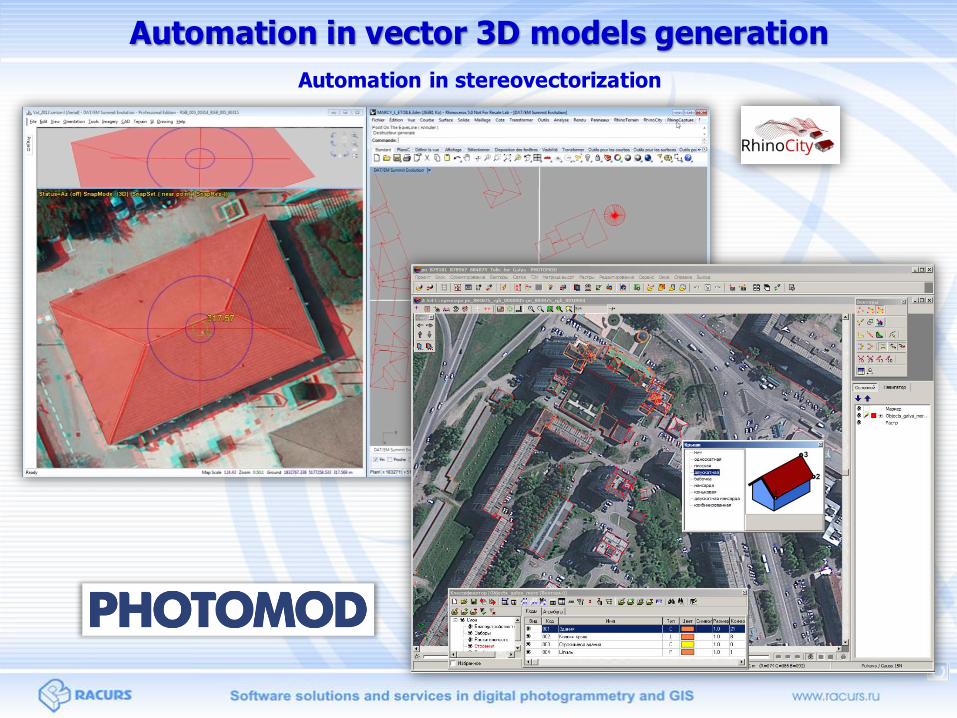
Automation in vector 3D models generation
Automation in stereovectorization

Automation in vector 3D models generation
Automation of point clouds vectorization
Automation of point clouds segmentation, building and line objects detecting.
Auto texturing

Integrated solutions: from remote sensing data processing till 3D-
models generation
Relevance and high geometry accuracy of 3D topographic models
High level of automation of 3D-models generation
Different types of models depending on customer requirements
Special program for 3D-models visualization and analyze (3D-mod)
Converting 3D data files to/from different formats
Advantages of 3D models generation using PHOTOMOD system
PHOTOMOD

Linking to a database
Attributes associated with 3D objects
Selecting objects with queries
Spatial analysis
Etc
3D-GIS creation
Opportunities of using 3D-GIS functions:

Height analysis
Flood monitoring and forecasting
Earthwork volume
calculations
Design of drainage systems
Application of 3D models

Sun and shadow studies
July 13, 2014. 8-00 a.m. July 13, 2014. 11-00 a.m. July 13, 2014. 2-00 p.m.
July 13, 2014. 5-00 p.m. July 13, 2014. 8-00 p.m.
Application of 3D models

Telecommunication
Application of 3D models

Emergency planning
Application of 3D models

Planning. Public consultation
Application of 3D models

Rapid prototype models
Application of 3D models

Thank you for the attention!