Embed Size (px)
Citation preview

• 1.64 Ma
• Only 38 seconds long!
The Quaternary Period
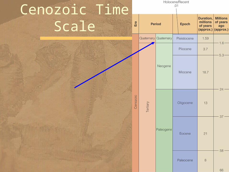
Cenozoic Time Scale

• Best known for glaciation – but also a time of volcanism and tectonic activity
• Continuing orogeny – Himalayas – Andes Mountains
• Deformation at convergent plate boundaries– Aleutian Islands– Japan– Philippines
Pleistocene—Holocene Tectonism and
Volcanism
• Interactions between – North American and Pacific plates – along the San Andreas transform plate boundary
– produced folding, faulting, and a number of basins and uplifts
• Marine terraces – covered with Pleistocene sediments – attest to periodic uplift in southern California
Uplift and Deformation

Marine Terraces– marine terraces on San Clemente Island, California
– each terrace represents a period when that area was at sea level
– highest terrace is now about 400 m above sea level

N Ca marine terraces
• Ongoing subduction of remnants of the Farallon plate – beneath Central America and the Pacific Northwest
– account for volcanism in these two areas• The Cascade Range
•of California, Oregon, Washington, and British Columbia
– has a history dating back to the Oligocene – but the large volcanoes now present formed during the last 1.6 million years
Cascade Range

• Lassen Peak, a large lava dome, – formed on the flank of an older, eroded composite volcano in California about 27,000 years ago
– It erupted most recently from 1914 to 1917
Lassen Peak—Lava Dome
• Began 1.6 Ma• Ended 10,000 years ago
•Pleistocene-Holocene (Recent) boundary
• Based on – climate change to warmer conditions concurrent with melting of most recent ice sheets•oxygen isotope ratios determined from shells of marine organisms
– changes in vegetation
Pleistocene Stratigraphy

Glaciers in North America
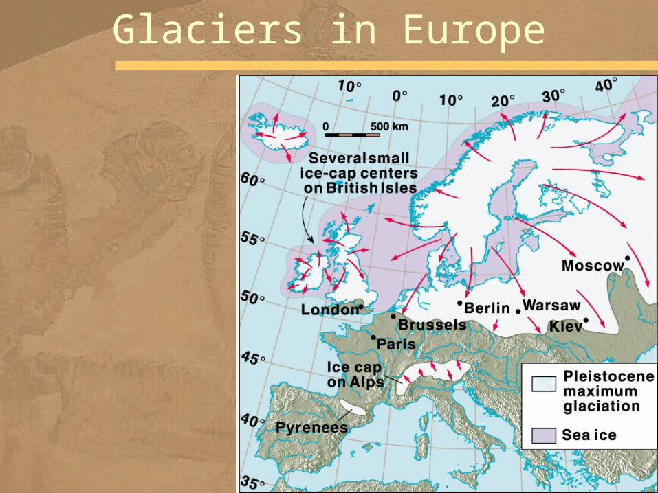
Glaciers in Europe

• Detailed mapping reveals several glacial advances and retreats
• North America had at least four major episodes of Pleistocene glaciation
• Each advance was followed by warmer climates
• The four glacial stages •Wisconsin •Illinoian •Kansan •Nebraskan
– named for the states of the southernmost advance
Four Glacial Stages
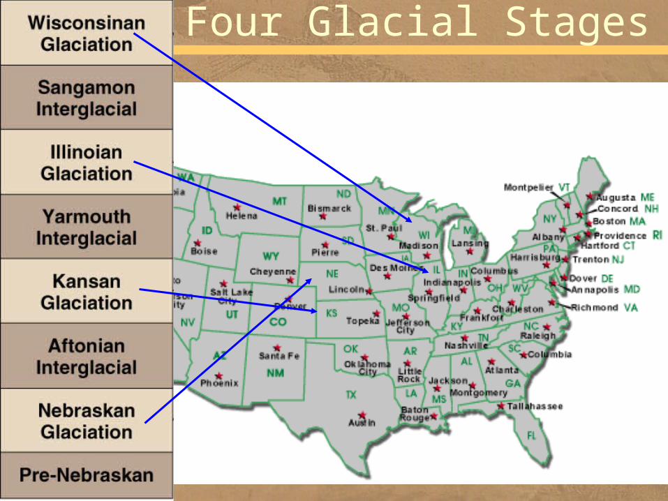
Four Glacial Stages

• Recent detailed studies of glacial deposits indicate – there were an as yet undetermined number of pre-Illinoian glacial events
– history of glacial advances and retreats in North America is more complex than previously thought
How Many Stages?

– six or seven major glacial advances and retreats are recognized in Europe
– at least 20 major warm–cold cycles can be detected in deep-sea cores
• Why isn't there better correlation among the different areas if glaciation was such a widespread event?
Correlation
•chaotic sediments difficult to correlate•minor fluctuations

• Changes in surface ocean temperature – recorded in the O18/O16 ratio in the shells of planktonic foraminifera
– provide data about climatic events
Evidence for Climatic Fluctuations

Oxygen Isotope Ratio
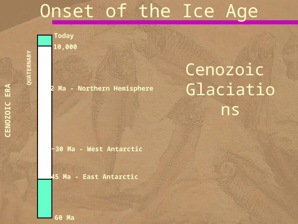
QUATERNARY
60 Ma
Today
~2 Ma - Northern Hemisphere
10,000
CENOZOIC ERA
~45 Ma - East Antarctic
~30 Ma - West Antarctic
Cenozoic Glaciatio
ns
Onset of the Ice Age

Why the Icehouse?
• Long-term climate drivers:– Plate tectonics
• Opening/closing of seaways– Ocean currents are our heat and AC
• Uplift and erosion of mountains– Weathering reduces atmospheric CO2
– Life: catastrophic evolution of new capabilities
– O2
– Astronomical drivers• Other bodies (moon, sun) pull on the Earth, changing its distance to the sun
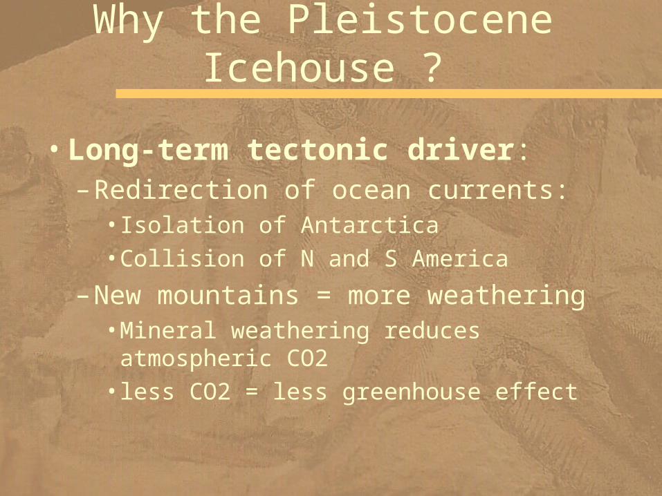
Why the Pleistocene Icehouse ?
•Long-term tectonic driver:–Redirection of ocean currents:
•Isolation of Antarctica•Collision of N and S America
–New mountains = more weathering •Mineral weathering reduces atmospheric CO2
•less CO2 = less greenhouse effect
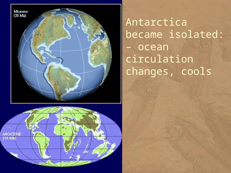
Antarctica became isolated:– ocean circulation changes, cools

•Shut off E/W global ocean flow
Isthmus of Panama: North & South American plates collided ~ 3.5 Ma
Why the Icehouse?
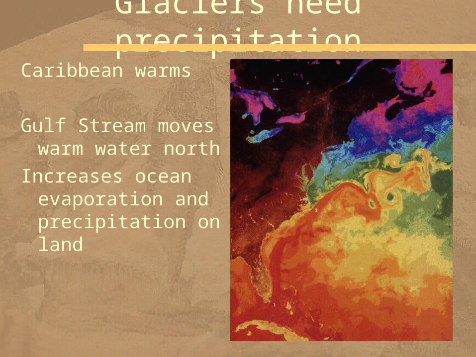
Caribbean warms
Gulf Stream moves warm water north
Increases ocean evaporation and precipitation on land
Glaciers need precipitation

• By Middle Miocene time – an Antarctic ice sheet had formed – accelerating the formation of very cold oceanic waters
• About 1.6 million years ago– continental glaciers began forming in the Northern Hemisphere
• The Pleistocene Ice Age was underway
Pleistocene Underway

You Are Here!
But we didn’t just get ONE ice age…

We got dozens of them.
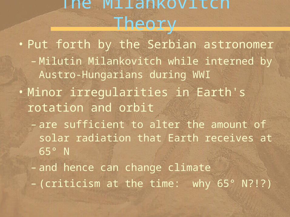
• Put forth by the Serbian astronomer – Milutin Milankovitch while interned by Austro-Hungarians during WWI
• Minor irregularities in Earth's rotation and orbit – are sufficient to alter the amount of solar radiation that Earth receives at 65° N
– and hence can change climate
– (criticism at the time: why 65° N?!?)
The Milankovitch Theory

Three Variables
• about 100,000 years
Ellipticity

• The angle between – Earth's axis
– and a line perpendicular to the plane of its orbit around the Sun
• This angle shifts about 1.5° – from its current value of 23.5°
– during a 41,000-year cycle
Axis Tilt
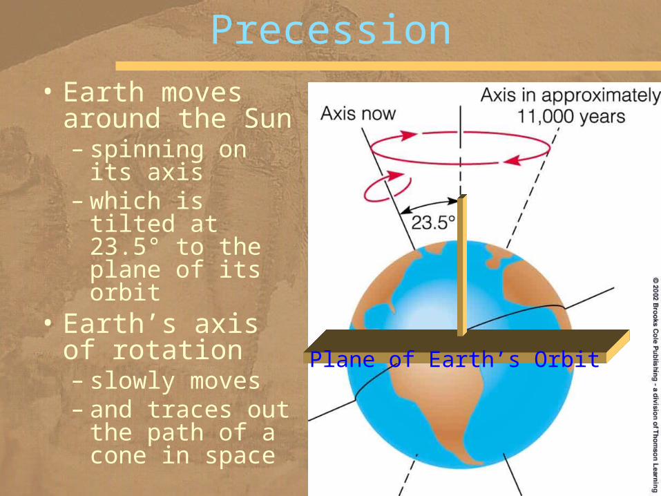
• Earth moves around the Sun– spinning on its axis
– which is tilted at 23.5° to the plane of its orbit
• Earth’s axis of rotation – slowly moves – and traces out the path of a cone in space
Precession
Plane of Earth’s Orbit

• At present, Earth is closer to the Sun in January
• In about 11,000 years, closer to the Sun in July
Effects of Precession

Makes a tippy system

Convolve 100,000 + 41,000 + 26,000 years…
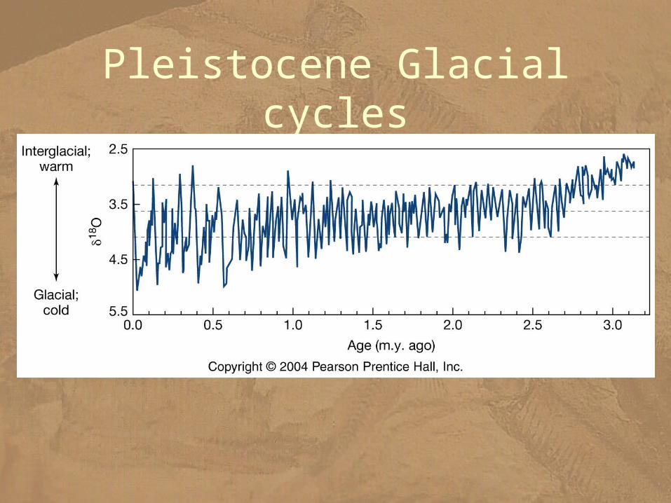
Pleistocene Glacial cycles

• 10,000-6,000 years ago, a warming trend– pollen– tree rings– ice advance/retreat
• Then the climate became cooler and moister – favoring the growth of valley glaciers on the Northern Hemisphere continents
• Three episodes of glacial expansion took place during this neoglaciation
Warming Trend

• The most recent glacial expansion – between 1500 and the mid- to late 1800s
– was a time of generally cooler temperatures
• It had a profound effect on – the social and economic fabric of human society
– accounting for several famines – migrations of many Europeans to the New World
– Local phenomenon
Little Ice Age
Pieter Bruegel the Elder (1525–1569)

• Geologists define a glacier – as a mass of ice on land that moves by plastic flow •internal deformation in response to pressure
– and by basal slip •sliding over its underlying surface
Glaciers—What Are They and How Do They Form?

• Any area receiving more snow in cold seasons– than melts in warm seasons– has a net accumulation over the years
• As accumulation takes place – snow at depth is converted to ice – when it reaches a critical thickness of about 40 m
– it begins to flow in response to pressure
How do glaciers form?
Marguerite Bay, 2002
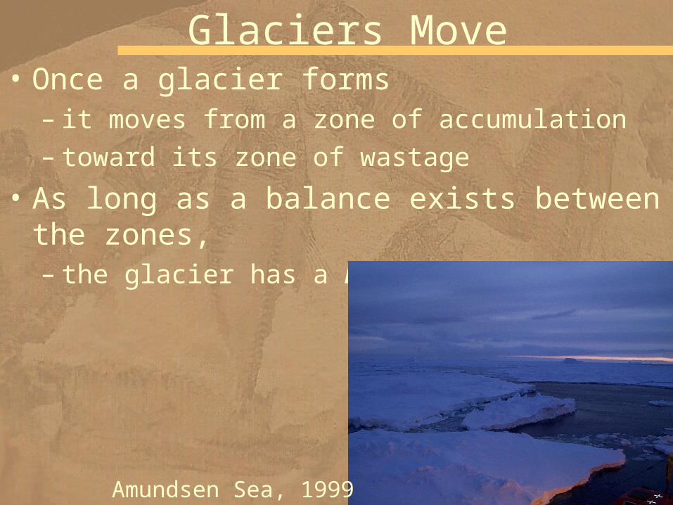
• Once a glacier forms – it moves from a zone of accumulation – toward its zone of wastage
• As long as a balance exists between the zones,– the glacier has a balanced budget
Glaciers Move
Amundsen Sea, 1999
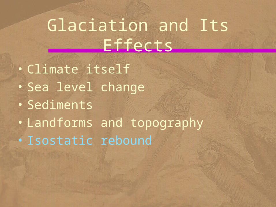
• Climate itself• Sea level change• Sediments• Landforms and topography• Isostatic rebound
Glaciation and Its Effects
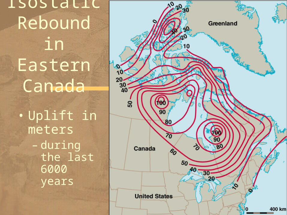
• Uplift in meters – during the last 6000 years
Isostatic Rebound
in Eastern Canada

• This U-shaped glacial trough in Montana – was eroded by a valley glacier
U-Shaped Glacial Trough

• Form where meltwater accumulates along a glacier's margin
• Deposits in proglacial lakes– vary considerably from gravel to mud – of special interest are the finely laminated mud deposits
– consisting of alternating dark and light layers
• Each dark–light couplet is a varve – representing an annual deposit
Proglacial Lakes
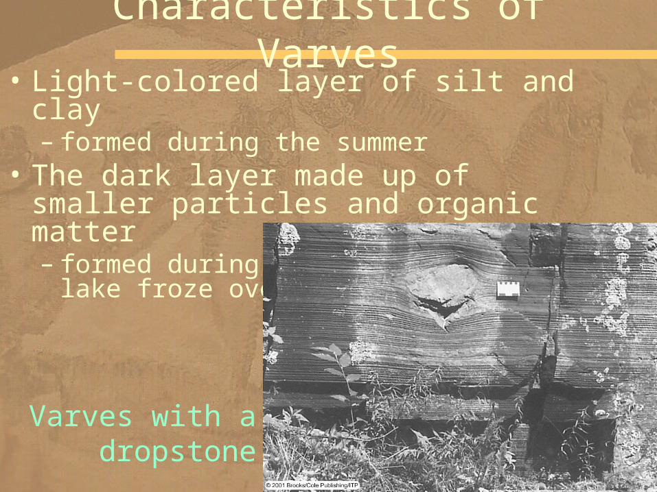
• Light-colored layer of silt and clay – formed during the summer
• The dark layer made up of smaller particles and organic matter – formed during the winter when the lake froze over
Characteristics of Varves
Varves with a dropstone

• Most important glacial deposits – chaotic mixtures of poorly sorted sediment deposited directly by glacial ice
– An end moraine is deposited– when a glacier’s terminus remains stationary for some time
Moraines
Mt. Cook, 1999
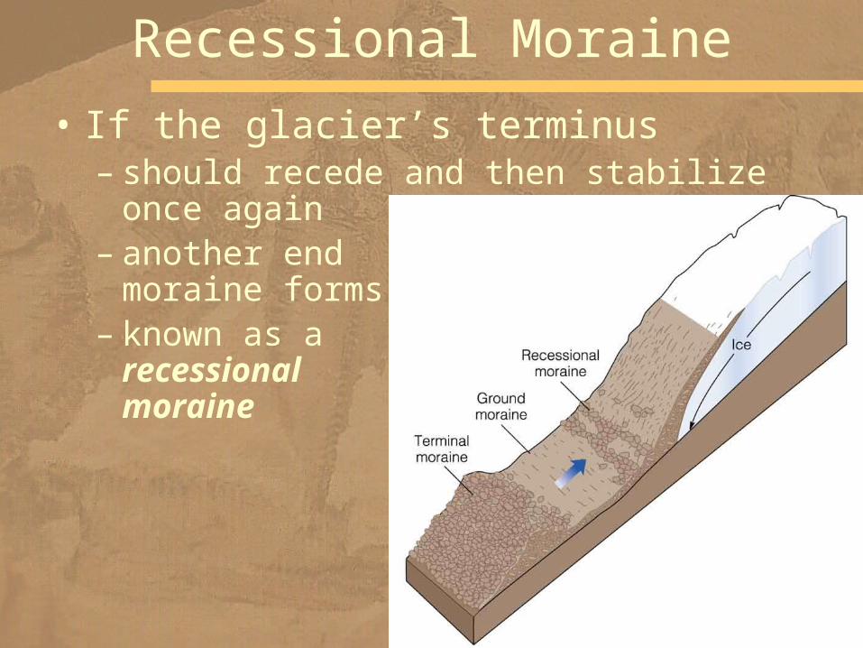
• If the glacier’s terminus – should recede and then stabilize once again
– another end moraine forms
– known as a recessional moraine
Recessional Moraine

• Features seen in areas once covered by glaciers
• glacial polish – the sheen
• striations– scratches?
Glacial Features
Devil’s Postpile National Monument, California

• Glaciers typically deposit poorly sorted nonstratified sediment
Glacial Sediment
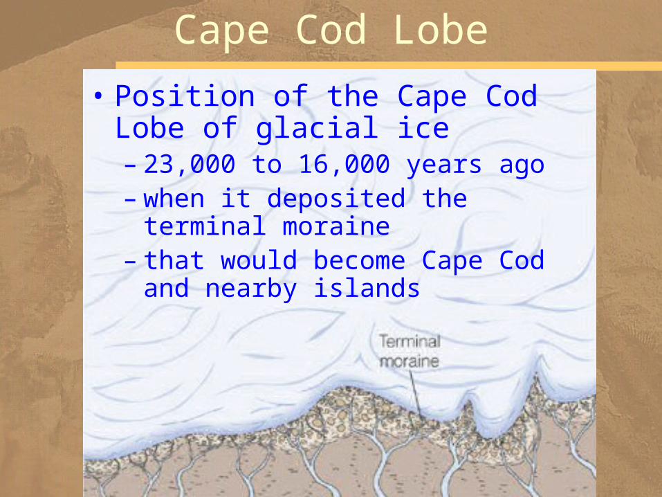
Cape Cod Lobe
• Position of the Cape Cod Lobe of glacial ice – 23,000 to 16,000 years ago – when it deposited the terminal moraine
– that would become Cape Cod and nearby islands

Recessional Moraine• Deposition of a recessional moraine – following a retreat of the ice front
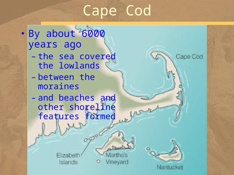
Cape Cod
• By about 6000 years ago– the sea covered the lowlands
– between the moraines
– and beaches and other shoreline features formed
• Today, between 28 and 35 million km3 of water – frozen in glaciers
• During the maximum extent of Pleistocene glaciers– more than 70 million km3 of ice
• These huge masses of ice contained enough frozen water – to lower sea level by 130 m
Changes in Sea Level

• Large areas of today's continental shelves were exposed
• The Bering Strait exposed– Alaska connected with Siberia via a broad land bridge
– Native Americans and various mammals, such as the bison, migrated
Land Bridge

• Sea level would rise about 70 m– many of the world's large population centers would be flooded
What would happen if all glaciers melted?

Where is all that ice?
66 m is in Antarctica

Isn't it stable?
We can watch it breaking up

Anderson et al., 2002
Change is ongoing

Difficult to Predict

![HARLINGEN CONSOLIDATED INDEPENDENT SCHOOL DISTRICT · PDF fileSchool Smart 086392 7 days [ALT1] Quill Corporation 1 EA $1.64 $1.64 Quill Brand 1‐1/2” Round Ring Binder; View, Black,](https://img.pdfslide.us/doc/110x75/5aafe14a7f8b9a07498de25f/harlingen-consolidated-independent-school-district-smart-086392-7-days-alt1.jpg)


![[Fe II ] 1.64 m m](https://img.pdfslide.us/doc/110x75/5681572e550346895dc4c93a/fe-ii-164-m-m.jpg)