Embed Size (px)
Citation preview
13 May 2009 CAWCR Fire Weather Research Workshop 1
Remote Sensing Opportunities for Fire Weather Research
Ian GrantSpace Based Observations Section
Bureau of Meteorology
13 May 2009 CAWCR Fire Weather Research Workshop 2
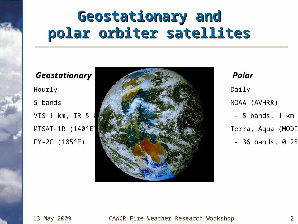
Geostationary andGeostationary andpolar orbiter satellitespolar orbiter satellites
• Geostationary
– Hourly
– 5 bands
– VIS 1 km, IR 5 km
– MTSAT-1R (140°E)
– FY-2C (105°E)
• Polar
– Daily
– NOAA (AVHRR)
– - 5 bands, 1 km
– Terra, Aqua (MODIS)
– - 36 bands, 0.25-1 km
Bureau's Crib Point Ground Station
13 May 2009 CAWCR Fire Weather Research Workshop 3
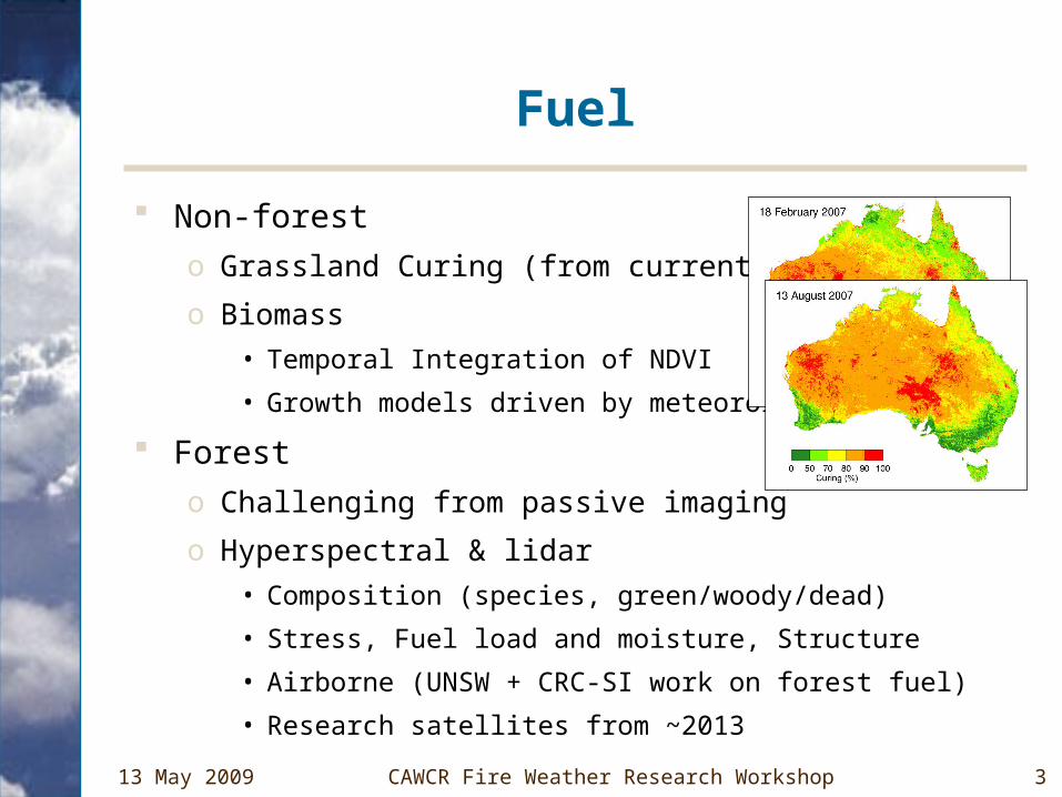
Fuel
Non-forest
o Grassland Curing (from current BCRC)
o Biomass
• Temporal Integration of NDVI
• Growth models driven by meteorology
Forest
o Challenging from passive imaging
o Hyperspectral & lidar
• Composition (species, green/woody/dead)
• Stress, Fuel load and moisture, Structure
• Airborne (UNSW + CRC-SI work on forest fuel)
• Research satellites from ~2013
13 May 2009 CAWCR Fire Weather Research Workshop 4
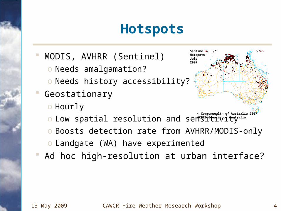
Hotspots
MODIS, AVHRR (Sentinel)o Needs amalgamation?
o Needs history accessibility?
Geostationaryo Hourly
o Low spatial resolution and sensitivity
o Boosts detection rate from AVHRR/MODIS-only
o Landgate (WA) have experimented
Ad hoc high-resolution at urban interface?
SentinelSentinelHotspotsHotspotsJuly 2007July 2007
© Commonwealth of Australia 2007ACRES Geoscience Australia
13 May 2009 CAWCR Fire Weather Research Workshop 5
Fire Intensity
Fire Radiative Power (During fire)
o Researched overseas – relation between FRP and emissions (NT plans: Stefan Maier, CDU)
o Standard MODIS product
Fire severity (Post-burn)
o NT spectral work (Andrew Edwards, CDU, BCRC)
CO from MOPITT, AIRS
Use in carbon emissions assessment?
13 May 2009 CAWCR Fire Weather Research Workshop 6
Smoke
Aerosol estimation over land Traditionally difficult (AVHRR, MODIS, GEO) … but recent progress with
o Multiple views (MISR, AATSR, POLDER)o Polarisation (POLDER)o Lidar (CALIPSO)Under development for Australia (Ross Mitchell)
Potential uses:o Initialisation/nudging and validation of smoke transport
modellingo Carbon emissions assessmento Air quality, including in connection with prescribed fire
13 May 2009 CAWCR Fire Weather Research Workshop 7
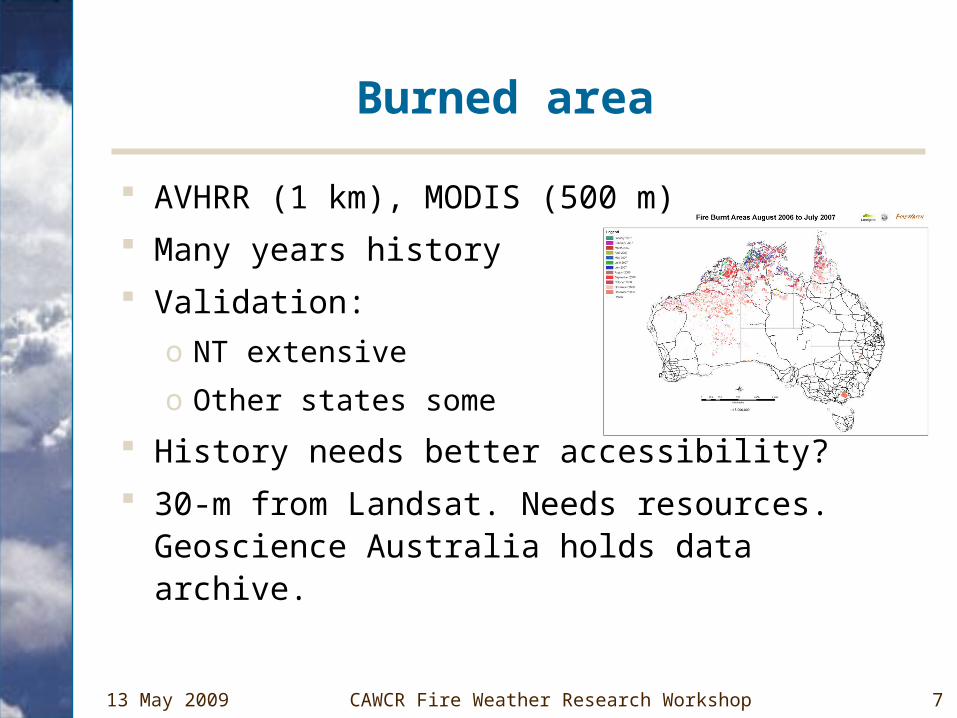
Burned area
AVHRR (1 km), MODIS (500 m)
Many years history
Validation:
o NT extensive
o Other states some
History needs better accessibility?
30-m from Landsat. Needs resources. Geoscience Australia holds data archive.
13 May 2009 CAWCR Fire Weather Research Workshop 8
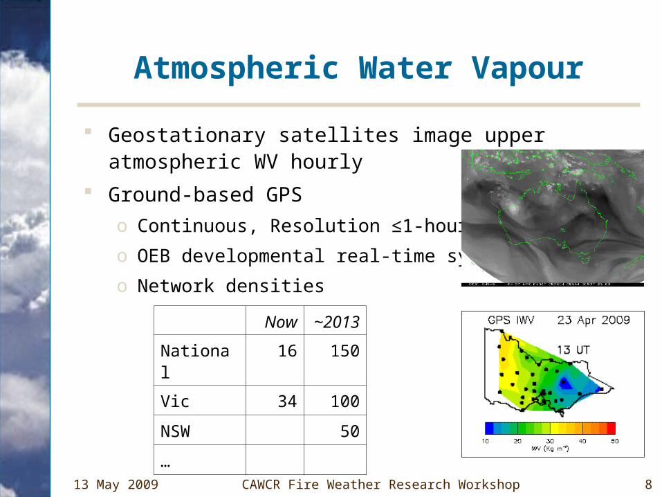
Atmospheric Water Vapour
Geostationary satellites image upper atmospheric WV hourly
Ground-based GPS
o Continuous, Resolution ≤1-hour
o OEB developmental real-time system
o Network densities
Now ~2013
National 16 150
Vic 34 100
NSW 50
…
13 May 2009 CAWCR Fire Weather Research Workshop 9
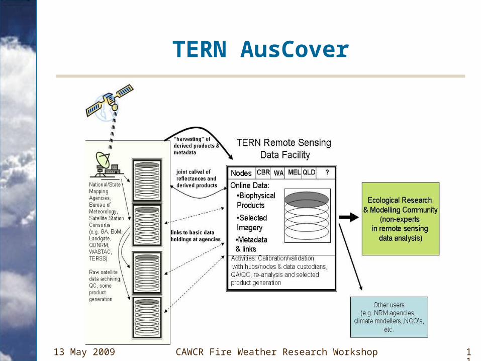
NCRIS/TERN AusCover
Terrestrial Ecosystem Research Network
AusCover
o Nationally consistent delivery and calibration of terrestrial satellite datasets for use in ecosystem science and NRM.
o Core set of standardised biophysical data products, calibrated for Australian conditions.
o A distributed data archive and access capability. Several regional nodes and calibration test sites.
Datasets likely to includeo Fire: Hotspots, Burned area
o MODIS: Land-cover types, LAI, fPAR, woody/herbaceous/grass/bare fractions
o Time-series of forest, non-forest cover
o NDVI
o …
13 May 2009 CAWCR Fire Weather Research Workshop 10
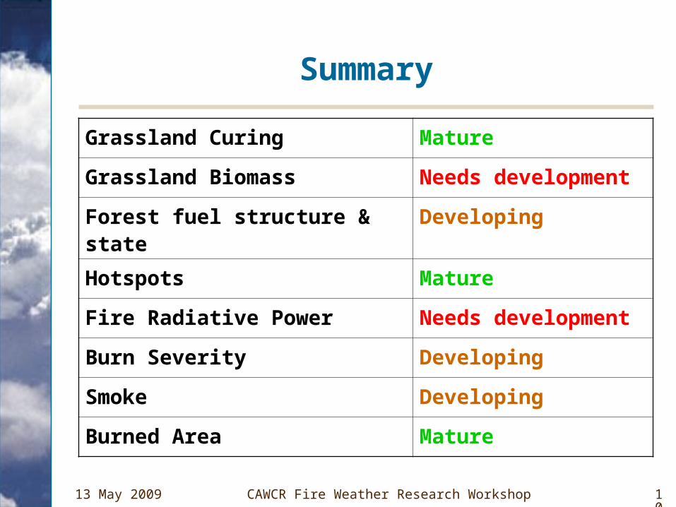
Summary
Grassland Curing Mature
Grassland Biomass Needs development
Forest fuel structure & state Developing
Hotspots Mature
Fire Radiative Power Needs development
Burn Severity Developing
Smoke Developing
Burned Area Mature
13 May 2009 CAWCR Fire Weather Research Workshop 11
TERN AusCover