Embed Size (px)
Citation preview
12.540 Principles of the Global Positioning System
Lecture 15
Prof. Thomas Herring
Room 54-820A; 253-5941
http://geoweb.mit.edu/~tah/12.540
04/07/2010 12.540 Lec 15 2
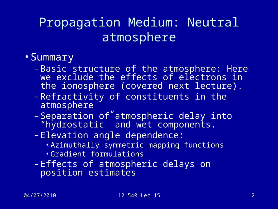
Propagation Medium: Neutral atmosphere
• Summary– Basic structure of the atmosphere: Here we exclude
the effects of electrons in the ionosphere (covered next lecture).
– Refractivity of constituents in the atmosphere– Separation of atmospheric delay into “hydrostatic”
and wet components.– Elevation angle dependence:
• Azimuthally symmetric mapping functions• Gradient formulations
– Effects of atmospheric delays on position estimates
04/07/2010 12.540 Lec 15 3
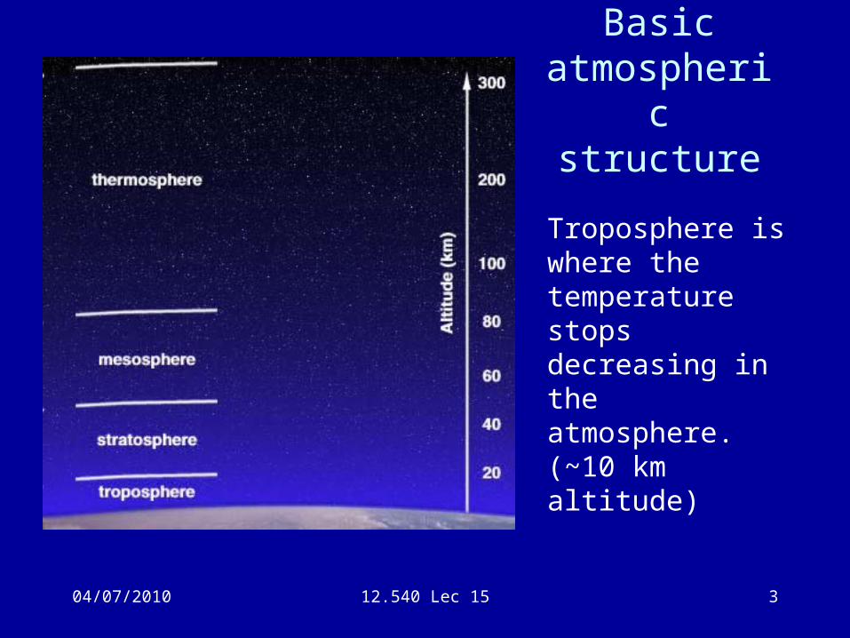
Basic atmospheric
structure
Troposphere is where the temperature stops decreasing in the atmosphere. (~10 km altitude)
04/07/2010 12.540 Lec 15 4
Troposphere
• Lots of examples of web-based documents about the atmosphere: See for example.
http://www-das.uwyo.edu/~geerts/cwx/notes/chap01/tropo.html
• Tropopause is where temperature stops decreasing. Generally at pressure levels of about 300 mbar but can be as low as 500 mbar.
• Sometimes term “tropospheric delay” used but this is only about 70% of delay.
• Generally by height of 50-100km all of atmospheric delay accounted for.
• Troposphere is where weather systems occur and aircraft fly on the tropopause.
04/07/2010 12.540 Lec 15 5
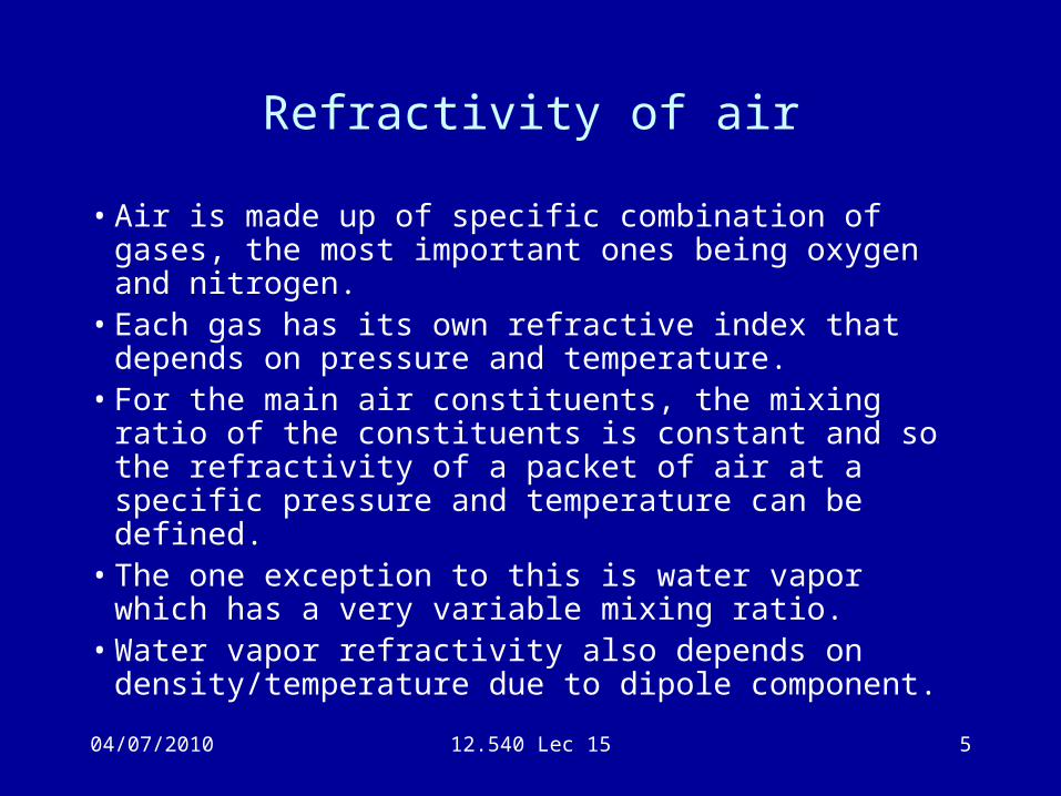
Refractivity of air
• Air is made up of specific combination of gases, the most important ones being oxygen and nitrogen.
• Each gas has its own refractive index that depends on pressure and temperature.
• For the main air constituents, the mixing ratio of the constituents is constant and so the refractivity of a packet of air at a specific pressure and temperature can be defined.
• The one exception to this is water vapor which has a very variable mixing ratio.
• Water vapor refractivity also depends on density/temperature due to dipole component.
04/07/2010 12.540 Lec 15 6
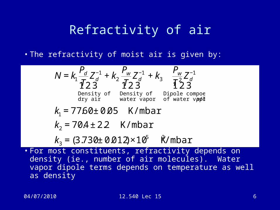
Refractivity of air
• The refractivity of moist air is given by:
• For most constituents, refractivity depends on density (ie., number of air molecules). Water vapor dipole terms depends on temperature as well as density
€
N = k1
PdTZd
−1
Density of dry air
1 2 3 + k2
PwTZd
−1
Density of water vapor
1 2 3 + k3
PwT 2Zd
−1
Dipole compoentof water vapor ρ/T
1 2 3
k1 = 77.60 ± 0.05 K/mbar
k2 = 70.4 ± 2.2 K/mbar
k3 = (3.730 ± 0.012) ×105 K2/mbar
04/07/2010 12.540 Lec 15 7
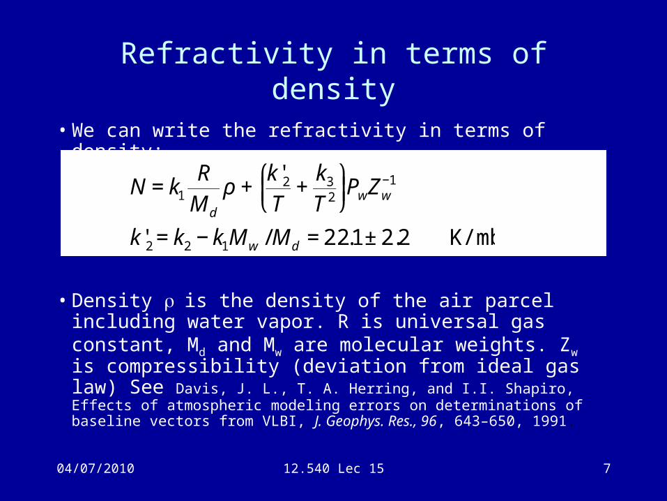
Refractivity in terms of density
• We can write the refractivity in terms of density:
• Density is the density of the air parcel including water vapor. R is universal gas constant, Md and Mw are molecular weights. Zw is compressibility (deviation from ideal gas law) See Davis, J. L., T. A. Herring, and I.I. Shapiro, Effects of atmospheric modeling errors on determinations of baseline vectors from VLBI, J. Geophys. Res., 96, 643–650, 1991.
€
N = k1
R
Md
ρ +k'2T
+k3
T 2
⎛ ⎝ ⎜
⎞ ⎠ ⎟PwZw
−1
k'2 = k2 − k1Mw /Md = 22.1± 2.2 K/mbar
04/07/2010 12.540 Lec 15 8
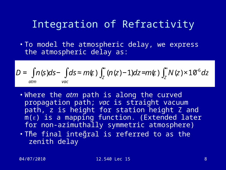
Integration of Refractivity
• To model the atmospheric delay, we express the atmospheric delay as:
• Where the atm path is along the curved propagation path; vac is straight vacuum path, z is height for station height Z and m() is a mapping function. (Extended later for non-azimuthally symmetric atmosphere)
• The final integral is referred to as the ”zenith delay”
€
D = n(s)ds− dsvac
∫atm
∫ ≈ m(ε) (n(z) −1)dz =Z
∞
∫ m(ε) N(z) ×10−6dzZ
∞
∫
04/07/2010 12.540 Lec 15 9
Zenith delay
• The zenith delay is determined by the integration of refractivity vertically.
• The atmospheric is very close to hydrostatic equilibrium meaning that surface pressure is given by the vertical integration of density. Since the first term in refractivity depends only on density, its vertical integration will depend only on surface pressure. This integral is called the “zenith hydrostatic delay (ZHD)”. (Often referred to as “dry delay” but this is incorrect because has water vapor contribution).
04/07/2010 12.540 Lec 15 10
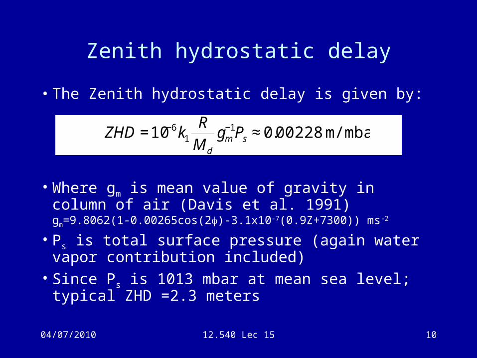
Zenith hydrostatic delay
• The Zenith hydrostatic delay is given by:
• Where gm is mean value of gravity in column of air (Davis et al. 1991)gm=9.8062(1-0.00265cos(2)-3.1x10⁻⁷(0.9Z+7300)) ms-2
• Ps is total surface pressure (again water vapor contribution included)
• Since Ps is 1013 mbar at mean sea level; typical ZHD =2.3 meters
€
ZHD =10−6k1
R
Md
gm−1Ps ≈ 0.00228 m/mbar
04/07/2010 12.540 Lec 15 11
Zenith wet delay
• The water vapor delay (second term in refractivity) is not so easily integrated because of distribution of water vapor with height.
• Surface measurements of water vapor pressure (deduced from relative humidity) are not very effective because it can be dry at surface and moist above and visa versa.
• Only effective method is to sense the whole column of water vapor. Can be done with water vapor radiometer (WVR) which infers water vapor delay from thermal emission from water vapor molecules and some laser profiling methods (LIDAR). Both methods are very expensive (200K$ per site)
04/07/2010 12.540 Lec 15 12
Zenith wet delay
• In meteorology, the term “Precipitable water” (PW) is used. This is the integral of water vapor density with height and equals the depth of water if all the water vapor precipitated as rain (amount measured on rain gauge).
• If the mean temperature of atmosphere is known, PW can be related to Zenith Wet Delay (ZWD) (See next page)
04/07/2010 12.540 Lec 15 13
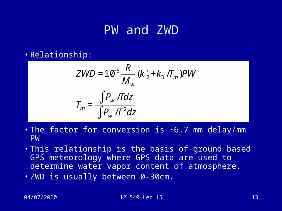
PW and ZWD
• Relationship:
• The factor for conversion is ~6.7 mm delay/mm PW• This relationship is the basis of ground based GPS
meteorology where GPS data are used to determine water vapor content of atmosphere.
• ZWD is usually between 0-30cm.
€
ZWD =10−6 R
Mw
(k'2 +k3 /Tm )PW
Tm =Pw /Tdz∫Pw /T 2dz∫
04/07/2010 12.540 Lec 15 14
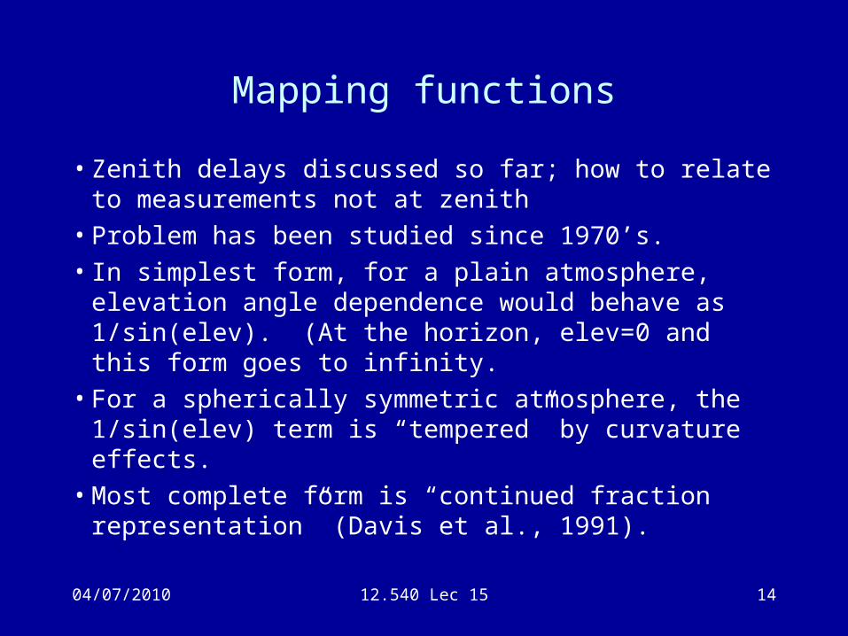
Mapping functions
• Zenith delays discussed so far; how to relate to measurements not at zenith
• Problem has been studied since 1970’s.• In simplest form, for a plain atmosphere, elevation
angle dependence would behave as 1/sin(elev). (At the horizon, elev=0 and this form goes to infinity.
• For a spherically symmetric atmosphere, the 1/sin(elev) term is “tempered” by curvature effects.
• Most complete form is “continued fraction representation” (Davis et al., 1991).
04/07/2010 12.540 Lec 15 15
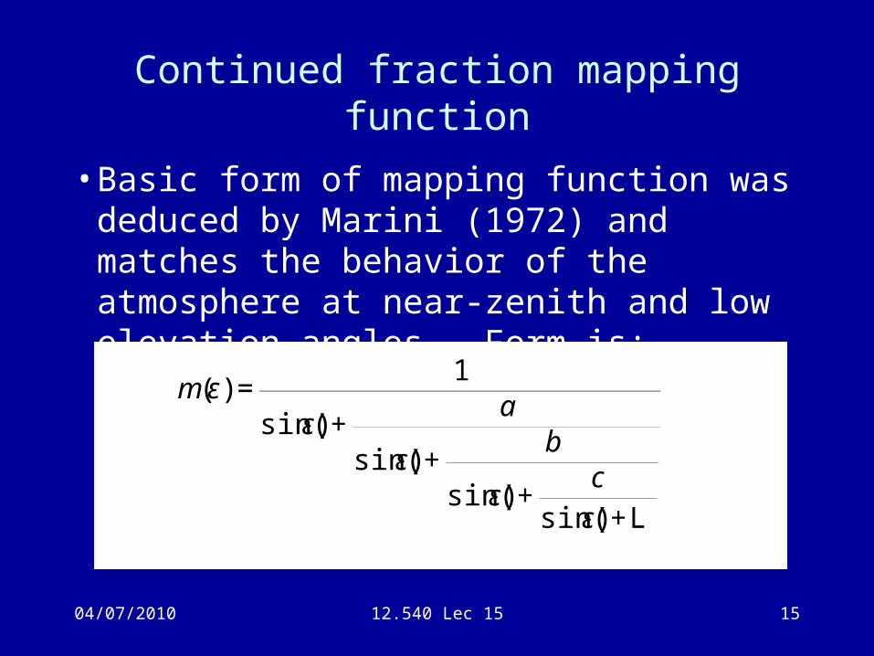
Continued fraction mapping function
• Basic form of mapping function was deduced by Marini (1972) and matches the behavior of the atmosphere at near-zenith and low elevation angles. Form is:
€
m(ε) =1
sin(ε) +a
sin(ε) +b
sin(ε) +c
sin(ε) +L
04/07/2010 12.540 Lec 15 16
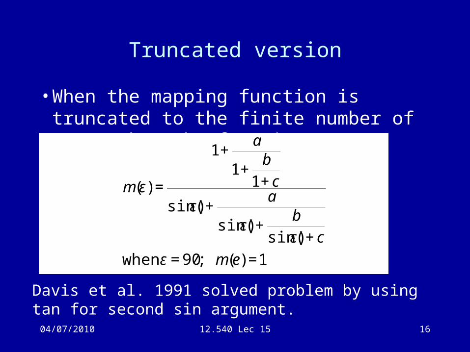
Truncated version
• When the mapping function is truncated to the finite number of terms then the form is:
€
m(ε) =
1+a
1+b
1+ c
sin(ε) +a
sin(ε) +b
sin(ε) + c
when ε = 90; m(e) =1
Davis et al. 1991 solved problem by using tan for second sin argument.
04/07/2010 12.540 Lec 15 17
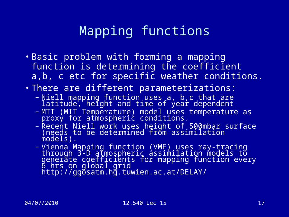
Mapping functions
• Basic problem with forming a mapping function is determining the coefficient a,b, c etc for specific weather conditions.
• There are different parameterizations:– Niell mapping function uses a, b,c that are latitude, height and
time of year dependent– MTT (MIT Temperature) model uses temperature as proxy for
atmospheric conditions.– Recent Niell work uses height of 500mbar surface (needs to
be determined from assimilation models).– Vienna Mapping function (VMF) uses ray-tracing through 3-D
atmospheric assimilation models to generate coefficients for mapping function every 6 hrs on global gridhttp://ggosatm.hg.tuwien.ac.at/DELAY/
04/07/2010 12.540 Lec 15 18
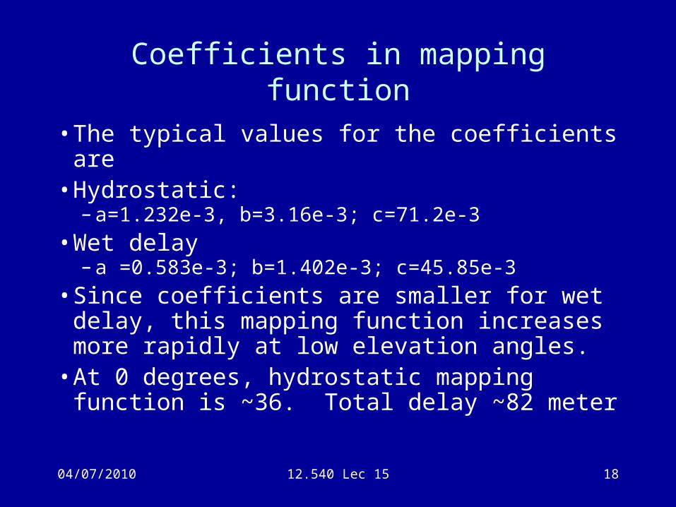
Coefficients in mapping function
• The typical values for the coefficients are• Hydrostatic:
– a=1.232e-3, b=3.16e-3; c=71.2e-3
• Wet delay– a =0.583e-3; b=1.402e-3; c=45.85e-3
• Since coefficients are smaller for wet delay, this mapping function increases more rapidly at low elevation angles.
• At 0 degrees, hydrostatic mapping function is ~36. Total delay ~82 meter
04/07/2010 12.540 Lec 15 19
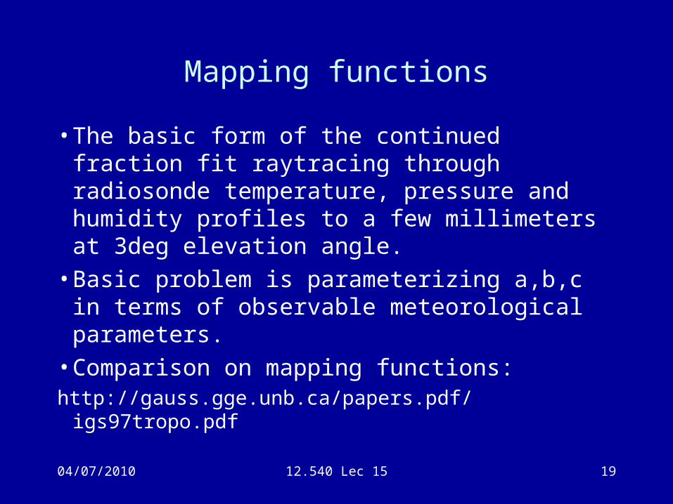
Mapping functions
• The basic form of the continued fraction fit raytracing through radiosonde temperature, pressure and humidity profiles to a few millimeters at 3deg elevation angle.
• Basic problem is parameterizing a,b,c in terms of observable meteorological parameters.
• Comparison on mapping functions:http://gauss.gge.unb.ca/papers.pdf/igs97tropo.pdf
04/07/2010 12.540 Lec 15 20
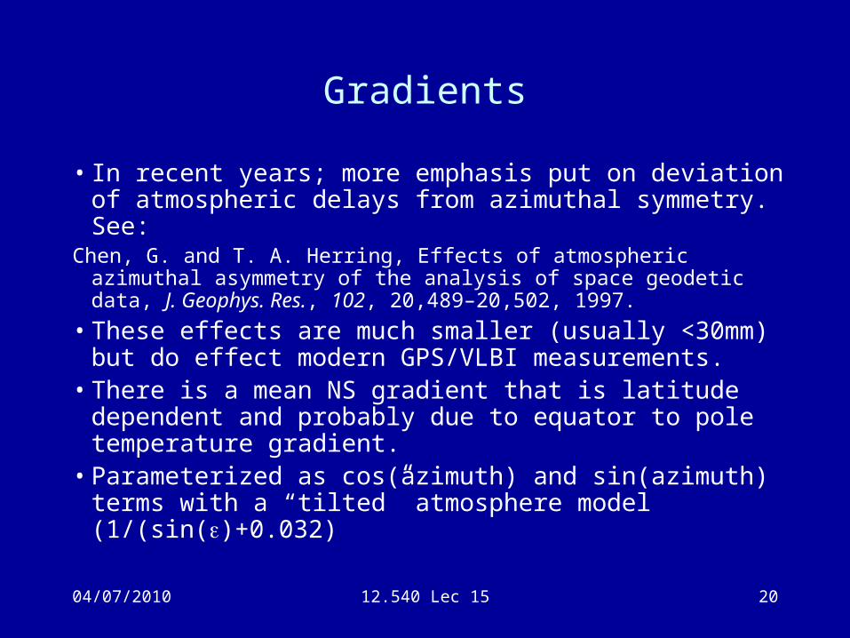
Gradients
• In recent years; more emphasis put on deviation of atmospheric delays from azimuthal symmetry. See:
Chen, G. and T. A. Herring, Effects of atmospheric azimuthal asymmetry of the analysis of space geodetic data, J. Geophys. Res., 102, 20,489–20,502, 1997.
• These effects are much smaller (usually <30mm) but do effect modern GPS/VLBI measurements.
• There is a mean NS gradient that is latitude dependent and probably due to equator to pole temperature gradient.
• Parameterized as cos(azimuth) and sin(azimuth) terms with a “tilted” atmosphere model (1/(sin()+0.032)
04/07/2010 12.540 Lec 15 21
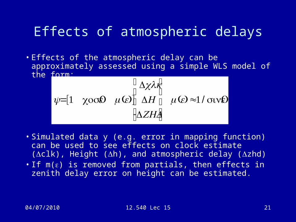
Effects of atmospheric delays
• Effects of the atmospheric delay can be approximately assessed using a simple WLS model of the form:
• Simulated data y (e.g. error in mapping function) can be used to see effects on clock estimate ( clk), Height ( h), and atmospheric delay ( zhd)
• If m() is removed from partials, then effects in zenith delay error on height can be estimated.
€
y=[1 (cosε) m(ε)]ΔclkΔH
ΔZHD
⎡
⎣
⎢ ⎢ ⎢
⎤
⎦
⎥ ⎥ ⎥
m(ε)≈1 / (sinε)
04/07/2010 12.540 Lec 15 22
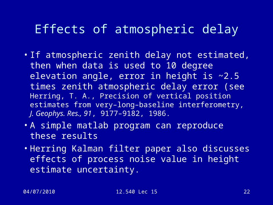
Effects of atmospheric delay
• If atmospheric zenith delay not estimated, then when data is used to 10 degree elevation angle, error in height is ~2.5 times zenith atmospheric delay error (see Herring, T. A., Precision of vertical position estimates from very–long–baseline interferometry, J. Geophys. Res., 91, 9177–9182, 1986.
• A simple matlab program can reproduce these results• Herring Kalman filter paper also discusses effects of
process noise value in height estimate uncertainty.
04/07/2010 12.540 Lec 15 23
Parameterization of atmospheric delay
• Given the sensitivity of GPS position estimates to atmospheric delay, and that external calibration of the delay is only good to a few centimeters; atmospheric zenith delays and often gradients are estimated high-precision GPS analyses.
• Parameterization is either Kalman filter or coefficients of piece-wise linear functions (GAMIT)
04/07/2010 12.540 Lec 15 24
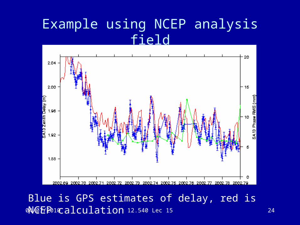
Example using NCEP analysis field
Blue is GPS estimates of delay, red is NCEP calculation
04/07/2010 12.540 Lec 15 25
Newer Mapping functions
• There has been recent work on mapping functions and zenith delay estimates.
• The Vienna Mapping Function and associated products developed at the Technical University of Vienna.
• Web site includes ECMWF derived values and the empirical global mapping function and global pressure temperature models (GMF and GPT). http://ggosatm.hg.tuwien.ac.at/DELAY/http://www.hg.tuwien.ac.at/~ecmwf1/ (old)
04/07/2010 12.540 Lec 15 26
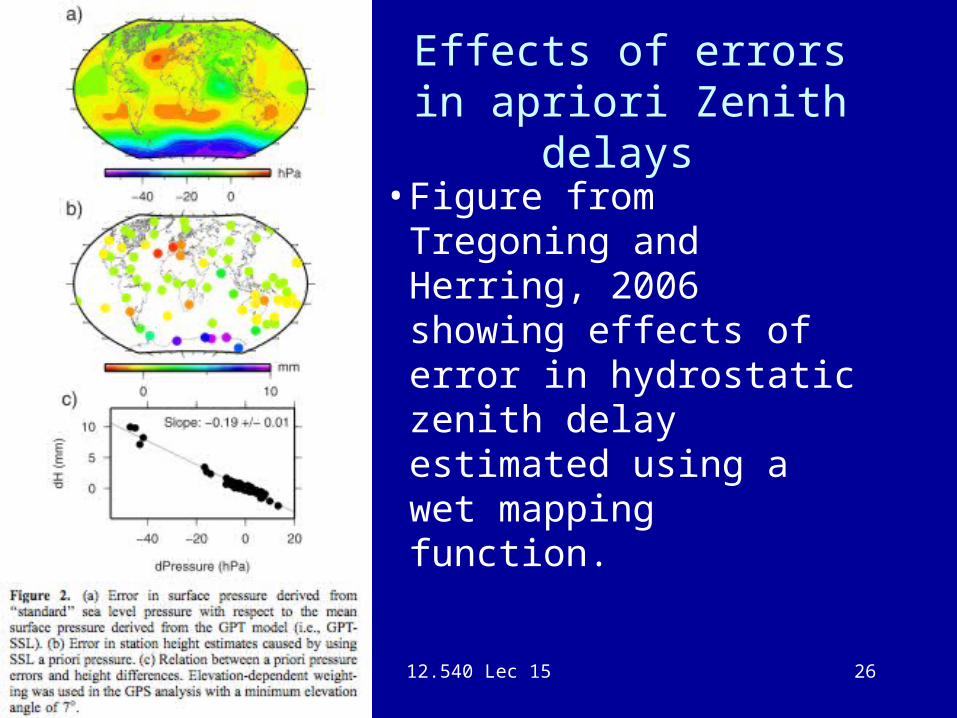
Effects of errors in apriori Zenith delays
• Figure from Tregoning and Herring, 2006 showing effects of error in hydrostatic zenith delay estimated using a wet mapping function.
04/07/2010 12.540 Lec 15 27
Summary• Atmospheric delays are one of the limiting error
sources in GPS• Delays are nearly always estimated:
– At low elevation angles there can be problems with mapping functions
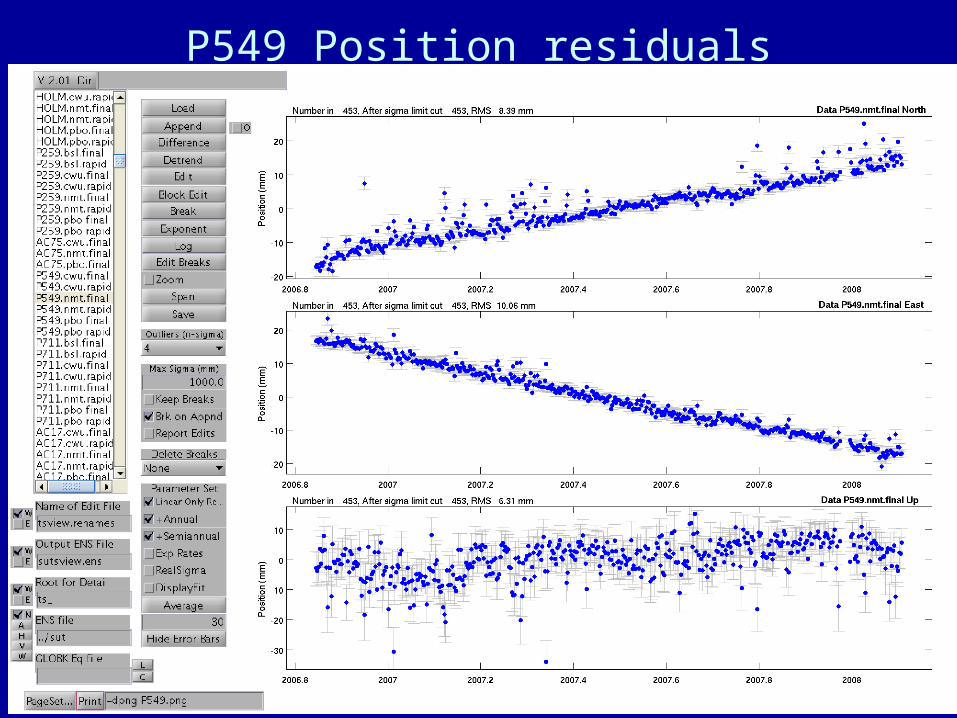
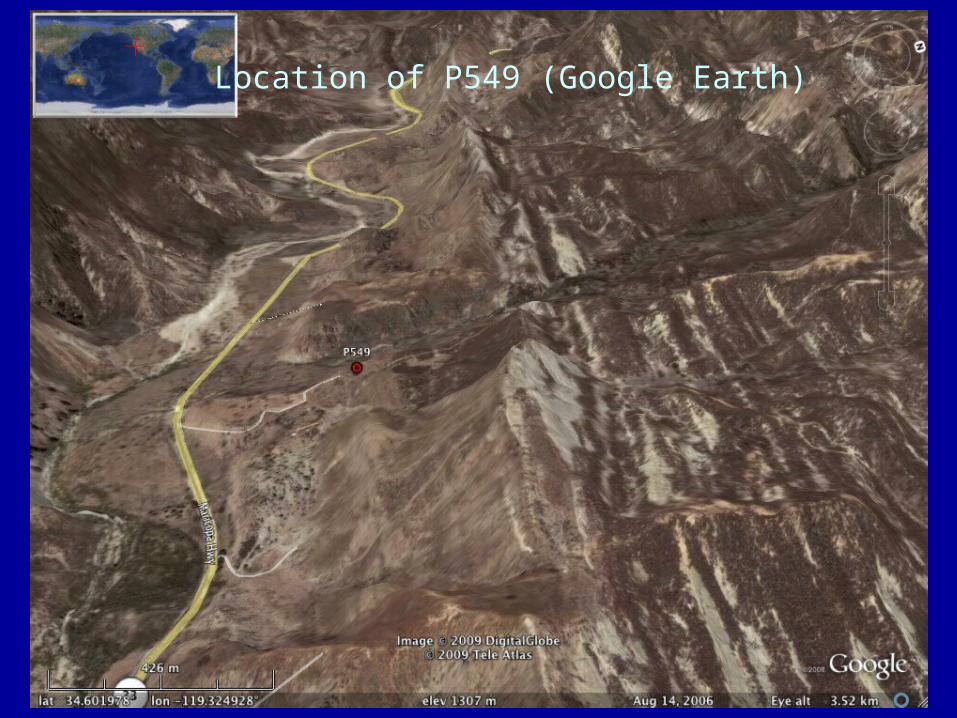
– Spatial inhomogeneity of atmospheric delay still unsolved problem even with gradient estimates. Some GPS stations (e.g., GRNX, P549) have asymmetric position estimate residuals.
– Estimated delays can be used for weather forecasting if latency <2 hrs.
• Class web page has links to some sites that deal with GPS atmospheric delay estimates.
• Example on next slide shows some unknown effects of atmospheric delays on GPS position estimates (“raining” (one-sided) position residuals)
04/07/2010 12.540 Lec 15 28
P549 Position residuals
04/07/2010 12.540 Lec 15 29
Location of P549 (Google Earth)