Embed Size (px)
Citation preview

12 AUGUST 2021
Copper porphyry intersected in first hole at
El Palmar copper-gold project, Ecuador
Key Points
• Drill hole EPDD001 at the El Palmar project in northern Ecuador is currently at ~350m and has intersected a copper mineralised porphyry system based on visual inspection
• The drill hole will continue to a depth of at least 600m
• Planning for follow-up drilling is underway Sunstone Metals Ltd (ASX: STM) is pleased to announce that the first drill hole at the El Palmar copper-gold porphyry target in northern Ecuador, EPDD001, is now at ~350m and has intersected a copper mineralised porphyry system from surface (Figures 1 & 2) with the upper 40m being highly weathered. The drill core comprises an altered diorite host rock with variable degrees of veining and chalcopyrite (copper sulphide). The presence of copper is supported by anomalous copper results from a handheld XRF instrument that is used to guide drill hole logging. The hole is now drilling the centre of the upper magnetic anomaly (Figure 3). This anomaly continues to at least 600m down hole and EPDD001 will be extended to at least this depth. The top 300m of drill core from EPDD001 will be logged in detail and cut and sampled for submission to the assay laboratory. It is expected that assay results will be available in the second half of September. Planning for follow up drilling is in progress. Additional holes will be drilled while waiting for the return of first assay results. El Palmar is located in northern Ecuador (Figures 1 & 4) in the vicinity of the one-billion-tonne Llurimagua copper-molybdenum porphyry deposit and in the same regional structural belt that hosts the 2.6Bt Alpala copper-gold deposit within the Cascabel project (Figure 4 and see ASX announcement dated 12 August 2020). Sunstone Managing Director Malcolm Norris said: “We have achieved the first objective in our strategy to discover a large copper-bearing porphyry system. We are encouraged by what we see in this first drill hole and we look forward to receiving the assays. “Drilling at the Bramaderos gold-copper project is ongoing and further results and plans for H2 2021 will be released shortly. “Our cash and equity investments remain strong at ~$23m, allowing us to significantly expand our exploration activities should results in the next couple of months justify”.

Figure 1: Location of the El Palmar project in northern Ecuador

Figure 2: RTP magnetics image showing the circular magnetic anomaly being targeted with drilling. Also shown are three historical drill holes, which drilled away from the target area, and the prepared drill collars to allow for future drilling (see ASX announcement dated 12th August 2020 for details of historical drilling results).

Figure 3: Slice through the El Palmar 3-D magnetic model showing the trace of drill hole EPDD001. Current depth is ~350m (see ASX announcements dated 13th July 2021, and 4th August 2021 for details of soil sampling results).

Figure 4: Location of the El Palmar project relative to the Llurimagua and Alpala (Cascabel) deposits, and the Toachi fault system.
For further information, please visit www.sunstonemetals.com.au Mr Malcolm Norris Managing Director Sunstone Metals Ltd Tel: 07 3368 9888 Email: [email protected]
Media: Paul Armstrong Read Corporate +61 8 9388 1474

About Sunstone Metals Sunstone has an advanced portfolio of exploration and development projects in Ecuador and Scandinavia. The
portfolio comprises:
1. The Bramaderos Gold-Copper Project where Sunstone owns an 87.5% interest with TSXV listed
Cornerstone Capital Resources holding 12.5% (see ASX announcement dated 10th April 2017, 28th August
2019, and 7 January 2020). The Bramaderos gold-copper project is located in Loja province, southern
Ecuador, and is highly prospective for the discovery of large porphyry gold-copper systems, and high-grade
epithermal gold systems. Historical exploration results from drilling at Bramaderos together with recent
exploration by Sunstone and joint venture partner Cornerstone Capital Resources (TSXV:CGP) indicate
multiple fertile mineralised systems with significant discovery potential.
2. The El Palmar Copper-Gold Project where the highly prospective 800ha El Palmar copper-gold porphyry
project in Ecuador will be acquired through a Staged Acquisition Agreement, which will ultimately deliver
100 per cent ownership to Sunstone.
3. Sunstone has a large equity interest in Stockholm listed Copperstone Resources (COPP-B.ST) following the
sale of the Viscaria Copper project to Copperstone in 2019.
4. The Finland Lithium Project includes the Kietyönmäki lithium prospect. Drilling by Sunstone has delivered
24.2m at 1.4% Li2O in a spodumene-bearing pegmatite. The project is a JV with Nortec Minerals. As
announced on 5 May 2021, a Letter of Intent has been signed to sell the Finland Lithium Project.
Competent Persons Statement
The information in this report that relates to exploration results is based upon information reviewed by Dr Bruce
Rohrlach who is a Member of the Australasian Institute of Mining and Metallurgy. Dr Rohrlach is a full-time employee
of Sunstone Metals Ltd and has sufficient experience which is relevant to the style of mineralisation and type of
deposit under consideration and to the activity which he is undertaking to qualify as a Competent Person as defined
in the 2012 Edition of the “Australasian Code for Reporting of Exploration Results, Mineral Resources and Ore
Reserves”. Dr Rohrlach consents to the inclusion in the report of the matters based on his information in the form
and context in which it appears.
Mr Malcolm Norris, Managing Director of Sunstone Metals Ltd., has authorised this announcement to be lodged
with the ASX.
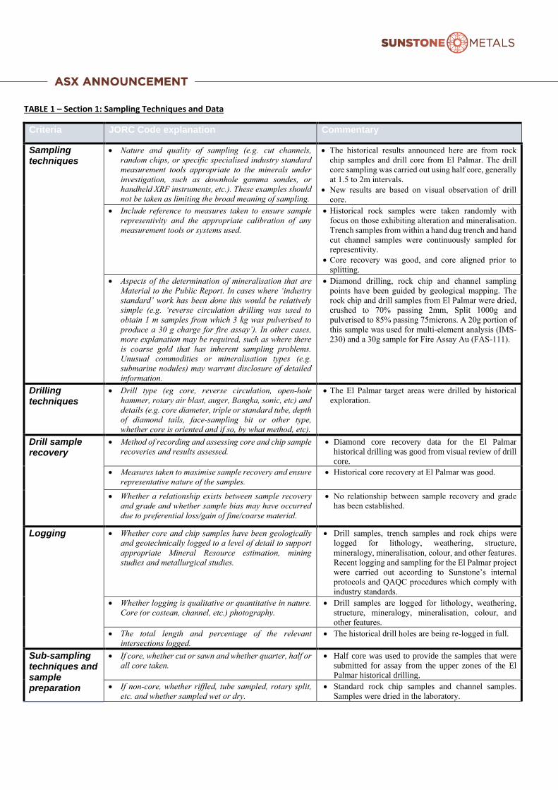
TABLE 1 – Section 1: Sampling Techniques and Data
Criteria JORC Code explanation Commentary
Sampling techniques
• Nature and quality of sampling (e.g. cut channels,
random chips, or specific specialised industry standard
measurement tools appropriate to the minerals under
investigation, such as downhole gamma sondes, or
handheld XRF instruments, etc.). These examples should
not be taken as limiting the broad meaning of sampling.
• The historical results announced here are from rock
chip samples and drill core from El Palmar. The drill
core sampling was carried out using half core, generally
at 1.5 to 2m intervals.
• New results are based on visual observation of drill
core.
• Include reference to measures taken to ensure sample
representivity and the appropriate calibration of any
measurement tools or systems used.
• Historical rock samples were taken randomly with
focus on those exhibiting alteration and mineralisation.
Trench samples from within a hand dug trench and hand
cut channel samples were continuously sampled for
representivity.
• Core recovery was good, and core aligned prior to
splitting.
• Aspects of the determination of mineralisation that are
Material to the Public Report. In cases where ‘industry
standard’ work has been done this would be relatively
simple (e.g. ‘reverse circulation drilling was used to
obtain 1 m samples from which 3 kg was pulverised to
produce a 30 g charge for fire assay’). In other cases,
more explanation may be required, such as where there
is coarse gold that has inherent sampling problems.
Unusual commodities or mineralisation types (e.g.
submarine nodules) may warrant disclosure of detailed
information.
• Diamond drilling, rock chip and channel sampling
points have been guided by geological mapping. The
rock chip and drill samples from El Palmar were dried,
crushed to 70% passing 2mm, Split 1000g and
pulverised to 85% passing 75microns. A 20g portion of
this sample was used for multi-element analysis (IMS-
230) and a 30g sample for Fire Assay Au (FAS-111).
Drilling techniques
• Drill type (eg core, reverse circulation, open-hole
hammer, rotary air blast, auger, Bangka, sonic, etc) and
details (e.g. core diameter, triple or standard tube, depth
of diamond tails, face-sampling bit or other type,
whether core is oriented and if so, by what method, etc).
• The El Palmar target areas were drilled by historical
exploration.
Drill sample recovery
• Method of recording and assessing core and chip sample
recoveries and results assessed.
• Diamond core recovery data for the El Palmar
historical drilling was good from visual review of drill
core.
• Measures taken to maximise sample recovery and ensure
representative nature of the samples.
• Historical core recovery at El Palmar was good.
• Whether a relationship exists between sample recovery
and grade and whether sample bias may have occurred
due to preferential loss/gain of fine/coarse material.
• No relationship between sample recovery and grade
has been established.
Logging • Whether core and chip samples have been geologically
and geotechnically logged to a level of detail to support
appropriate Mineral Resource estimation, mining
studies and metallurgical studies.
• Drill samples, trench samples and rock chips were
logged for lithology, weathering, structure,
mineralogy, mineralisation, colour, and other features.
Recent logging and sampling for the El Palmar project
were carried out according to Sunstone’s internal
protocols and QAQC procedures which comply with
industry standards.
• Whether logging is qualitative or quantitative in nature.
Core (or costean, channel, etc.) photography.
• Drill samples are logged for lithology, weathering,
structure, mineralogy, mineralisation, colour, and
other features.
• The total length and percentage of the relevant
intersections logged.
• The historical drill holes are being re-logged in full.
Sub-sampling techniques and sample preparation
• If core, whether cut or sawn and whether quarter, half or
all core taken.
• Half core was used to provide the samples that were
submitted for assay from the upper zones of the El
Palmar historical drilling.
• If non-core, whether riffled, tube sampled, rotary split,
etc. and whether sampled wet or dry.
• Standard rock chip samples and channel samples.
Samples were dried in the laboratory.

Criteria JORC Code explanation Commentary
• For all sample types, the nature, quality and
appropriateness of the sample preparation technique.
• Historical drill core samples from El Palmar (drilled by
Codelco) were analysed by ACME Labs in Vancouver.
Samples were crushed and split with 250 grams
pulverized to 200 mesh (Method - R200-250). Analysis
on drill core was undertaken on a sample split (Method
- VAN split pulp).
• Surface rocks at El Palmar are historical and were
collected by 3 different companies. GOEX S.A.
samples were analysed at Bureau Veritas Laboratories
in Peru. Lowell Mineral Exploration rocks were
analysed by ALS Minerals, with sample preparation
involving fine crushing 70% passing 2mm (Method
CRU-31), crushed sample split (Method SPL-21) and
pulverise 1000g to 85% passing 75um (Method PUL-
32). Codelco surface rock samples were analysed by
ACME Labs in Vancouver. Samples were crushed and
split with 250 grams pulverized to 200 mesh (Method -
R200-250)
• The sample preparation is carried out according to
industry standard practices using highly appropriate
sample preparation techniques.
• Quality control procedures adopted for all sub-sampling
stages to maximise representivity of samples.
• Sunstone used an industry standard QAQC
programme involving Certified Reference Materials
“standards” and blank samples, which were introduced
in the assay batches.
• Standards (Certified Reference Materials) or analytical
blanks were submitted at a rate of 1 in 28 samples.
Field duplicates were also taken at a rate of
approximately 1 in 28 samples.
• The check or duplicate assay results are reported along
with the sample assay values in the final analysis
report.
• Measures taken to ensure that the sampling is
representative of the in-situ material collected, including
for instance results for field duplicate/second-half
sampling.
• For diamond core, the routine sample procedure is to
always take the half/quarter core to the right of the
orientation line (looking down hole) or the cut line (in
cases where the orientation line was not reliable).
• Once assay results are received the results from
duplicate samples are compared with the
corresponding routine sample to ascertain whether the
sampling is representative.
• Whether sample sizes are appropriate to the grain size of
the material being sampled.
• Sample sizes are considered to be appropriate for the
style of sampling undertaken and the grainsize of the
material, and correctly represent the style and type of
mineralisation at the exploration stage.
Quality of assay data and laboratory tests
• The nature, quality and appropriateness of the assaying
and laboratory procedures used and whether the
technique is considered partial or total.
• Sunstone uses a fire assay gold technique for Au
assays (FAS-111) and a four acid multi element
technique (IMS-230) for a suite of 48 elements. FAS-
111 involves Au by Fire Assay on a 30-gram aliquot,
fusion and atomic absorption spectroscopy (AAS) at
trace levels. IMS-20 is considered a near total 4 acid
technique using a 20g aliquot followed by multi-
element analysis by ICP-AES/MS at ultra-trace
levels.
• This analysis technique is considered suitable for this
style of mineralisation.
• For geophysical tools, spectrometers, handheld XRF
instruments, etc., the parameters used in determining the
analysis including instrument make and model, reading
times, calibrations factors applied and their derivation,
• A handheld “Niton” XRF instrument is used on site
for verification of anomalous metal values and to assit
with the geological logging and mineral
identification. No specific data from this instrument
Criteria JORC Code explanation Commentary
etc. are referenced in this announcement.
• Nature of quality control procedures adopted (e.g.
standards, blanks, duplicates, external laboratory
checks) and whether acceptable levels of accuracy (i.e.
lack of bias) and precision have been established.
• Standards, blanks and duplicates are inserted ~1/28
samples. The values of the standards range from low
to high grade and are considered appropriate to
monitor performance of values near cut-off and near
the mean grade of the deposit.
• The check sampling results are monitored, and
performance issues are communicated to the
laboratory if necessary.
Verification of sampling and assaying
• The verification of significant intersections by either
independent or alternative company personnel.
• Procedure checks have been completed by the
Competent Person for exploration results for this
announcement.
• The use of twinned holes. • Twin holes have not been drilled in these areas.
• Documentation of primary data, data entry procedures,
data verification, data storage (physical and electronic)
protocols.
• Sunstone sampling data were imported and validated
using Excel.
• Discuss any adjustment to assay data. • Assay data were not adjusted. Core loss intervals are
assigned assay values of zero where present.
Location of data points
• Accuracy and quality of surveys used to locate drill holes
(collar and down-hole surveys), trenches, mine workings
and other locations used in Mineral Resource estimation.
• Sample co-ordinates are located by GPS and for trench
samples measured along the length of the trench.
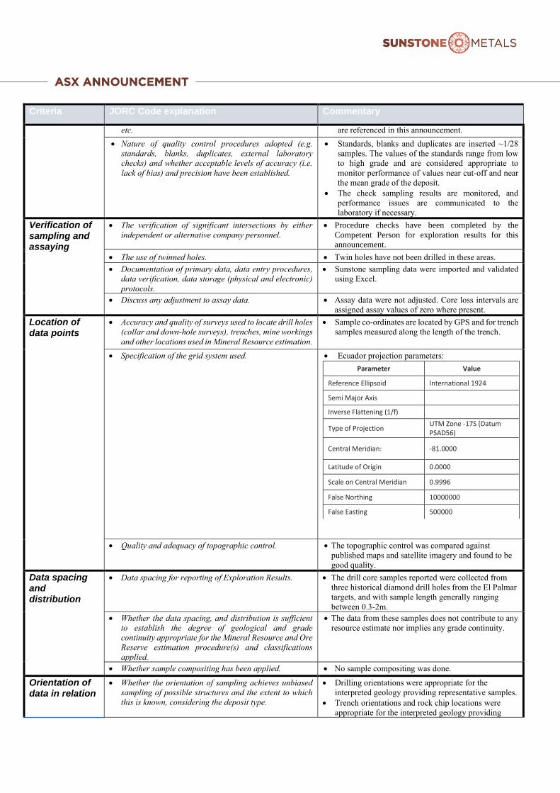
• Specification of the grid system used. • Ecuador projection parameters:
Parameter Value
Reference Ellipsoid International 1924
Semi Major Axis
Inverse Flattening (1/f)
Type of Projection UTM Zone -17S (Datum PSAD56)
Central Meridian: -81.0000
Latitude of Origin 0.0000
Scale on Central Meridian 0.9996
False Northing 10000000
False Easting 500000
• Quality and adequacy of topographic control. • The topographic control was compared against
published maps and satellite imagery and found to be
good quality.
Data spacing and distribution
• Data spacing for reporting of Exploration Results. • The drill core samples reported were collected from
three historical diamond drill holes from the El Palmar
targets, and with sample length generally ranging
between 0.3-2m.
• Whether the data spacing, and distribution is sufficient
to establish the degree of geological and grade
continuity appropriate for the Mineral Resource and Ore
Reserve estimation procedure(s) and classifications
applied.
• The data from these samples does not contribute to any
resource estimate nor implies any grade continuity.
• Whether sample compositing has been applied. • No sample compositing was done.
Orientation of data in relation
• Whether the orientation of sampling achieves unbiased
sampling of possible structures and the extent to which
this is known, considering the deposit type.
• Drilling orientations were appropriate for the
interpreted geology providing representative samples.
• Trench orientations and rock chip locations were
appropriate for the interpreted geology providing

Criteria JORC Code explanation Commentary
to geological structure
representative samples.
• If the relationship between the drilling orientation and
the orientation of key mineralised structures is
considered to have introduced a sampling bias, this
should be assessed and reported if material.
• No sampling bias is expected at this stage.
Sample security
• The measures taken to ensure sample security. • Sunstone sampling procedures indicate individual
samples were given due attention.
• Sample security was managed through sealed
individual samples and sealed bags of multiple
samples for secure delivery to the laboratory by
permanent staff of the joint venture.
• MS Analytical is an internationally accredited
laboratory that has all its internal procedures heavily
scrutinised in order to maintain their accreditation.
MS Analytical is accredited to ISO/IEC 17025 2005
Accredited Methods.
Audits or reviews
• The results of any audits or reviews of sampling
techniques and data.
• Sunstone’s sampling techniques and data have been
audited multiple times by independent mining
consultants during various project assessments.
These audits have concluded that the sampling
techniques and data management are to industry
standards.
• All historical data has been validated to the best
degree possible and migrated into a database.
TABLE 1 – Section 2: Exploration Results
Criteria JORC Code explanation Commentary
Mineral tenement and land tenure status
• Type, reference name/number, location and ownership
including agreements or material issues with third
parties such as joint ventures, partnerships, overriding
royalties, native title interests, historical sites,
wilderness or national park and environmental
settings.
• The El Palmar property is located in Imbabura province
and is held by an Ecuadorian registered company ‘Goex’.
Due diligence to date show that there are no wilderness
areas or national parks or areas of environmental
significance within or adjoining the concession area.
There are no native title interests.
• Sunstone and Goex have entered into a Staged
Acquisition Agreement where Sunstone may earn up to
100% based on defined milestones.
• The security of the tenure held at the time of reporting
along with any known impediments to obtaining a
licence to operate in the area.
• The El Palmar exploration concession was granted in
2003 and is held 100% by Goex.
Exploration done by other parties
• Acknowledgment and appraisal of exploration by other
parties.
• The historic exploration at El Palmar was completed by
various groups over the period 1990’s, 2007-2008, 2011-
2012 and GOEX (2012 to 2020). Most of the readily
available historic data has been acquired and compiled
into databases and a GIS project. Exploration by other
parties has included stream sediment surveys, geological
mapping, rock chip sampling, some local soil sampling,
channel sampling and limited diamond drilling (3 holes).

Criteria JORC Code explanation Commentary
Geology • Deposit type, geological setting and style of
mineralisation.
• The deposit style being explored for includes intrusion-
related and stockwork hosted porphyry Au-Cu systems
plus epithermal gold-silver-polymetallic veins. The
setting at El Palmar is a volcanic arc setting of Miocene
age intrusions.
Drill hole Information
• A summary of all information material to the
understanding of the exploration results including a
tabulation of the following information for all Material
drill holes:
a. easting and northing of the drill hole collar
b. elevation or RL (Reduced Level – elevation above
sea level in metres) of the drill hole collar
c. dip and azimuth of the hole
d. down hole length and interception depth
e. hole length.
• Details of the samples discussed in this announcement
are in the body of the text.
• See Figures 2&3 for the location of surface sampling,
drilling, and trenching activities at El Palmar.
• If the exclusion of this information is justified on the
basis that the information is not Material and this
exclusion does not detract from the understanding of
the report, the Competent Person should clearly
explain why this is the case.
• Information included in announcement.
Data aggregation methods
• In reporting Exploration Results, weighting averaging
techniques, maximum and/or minimum grade
truncations (e.g. cutting of high grades) and cut-off
grades are usually Material and should be stated.
• Weighted averages were calculated over reported
intervals according to sample length.
• No grade cut-offs were applied.
• Where aggregate intercepts incorporate short lengths
of high-grade results and longer lengths of low-grade
results, the procedure used for such aggregation
should be stated and some typical examples of such
aggregations should be shown in detail.
• No aggregating of intervals undertaken at this stage.
• The assumptions used for any reporting of metal
equivalent values should be clearly stated.
• Metal equivalents are not presented.
Relationship between mineralisation widths and intercept lengths
• If the geometry of the mineralisation with respect to the
drill-hole angle is known, its nature should be
reported.
• The geometry of the mineralisation relative to the drill
holes is not completely known at this stage of
exploration. .
• If it is not known and only the down hole lengths are
reported, there should be a clear statement to this
effect (e.g. ‘down hole length, true width not known’).
• True widths of mineralised lodes are not known at this
stage.
Diagrams • Appropriate maps and sections (with scales) and
tabulations of intercepts should be included for any
significant discovery being reported. These should
include, but not be limited to a plan view of drill hole
collar locations and appropriate sectional views.
• See Figures 2&3 for maps showing distribution of
samples.
Balanced reporting
• Where comprehensive reporting of all Exploration
Results is not practicable, representative reporting of
both low and high grades and/or widths should be
practiced to avoid misleading reporting of Exploration
Results.
• Figures 2&3 above show the current interpretations of
geology.
Other substantive exploration data
• Other exploration data, if meaningful and material,
should be reported) including (but not limited to):
geological observations; geophysical survey results;
geochemical survey results; bulk samples – size and
method of treatment; metallurgical test results; bulk
density, groundwater, geotechnical and rock
characteristics; potential deleterious or contaminating
substances.
• Figures 2&3 above show various datasets that are being
used to identify target areas and to guide current and
future drilling.

Criteria JORC Code explanation Commentary
Further work • The nature and scale of planned further work (e.g. tests
for lateral extensions or depth extensions or large-
scale step-out drilling).
• The planned exploration program is outlined in the
announcement.
• Diagrams clearly highlighting the areas of possible
extensions, including the main geological
interpretations and future drilling areas, provided this
information is not commercially sensitive.
• See Figures 2&3 which show areas for further
exploration.