Embed Size (px)
Citation preview
11/13/2019
1
Storing Waste Lab 11
Pre-Lab Questions:
1. What is nuclear waste?
2. How should we dispose of nuclear waste?
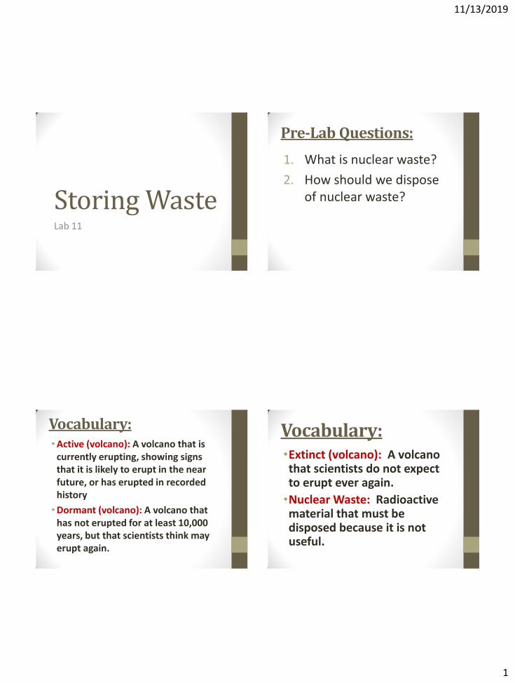
Vocabulary: •Active (volcano): A volcano that is
currently erupting, showing signs that it is likely to erupt in the near future, or has erupted in recorded history
•Dormant (volcano): A volcano that has not erupted for at least 10,000 years, but that scientists think may erupt again.
Vocabulary: •Extinct (volcano): A volcano that scientists do not expect to erupt ever again.
•Nuclear Waste: Radioactive material that must be disposed because it is not useful.
11/13/2019
2
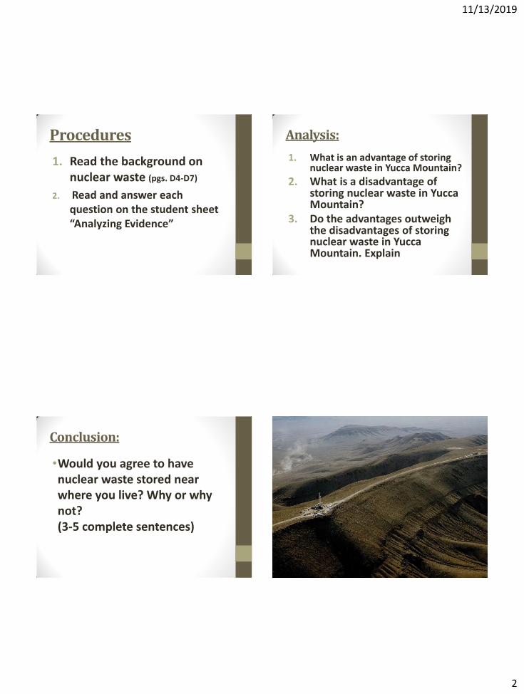
Procedures
1. Read the background on nuclear waste (pgs. D4-D7)
2. Read and answer each question on the student sheet “Analyzing Evidence”
Analysis:
1. What is an advantage of storing nuclear waste in Yucca Mountain?
2. What is a disadvantage of storing nuclear waste in Yucca Mountain?
3. Do the advantages outweigh the disadvantages of storing nuclear waste in Yucca Mountain. Explain
Conclusion:
•Would you agree to have nuclear waste stored near where you live? Why or why not? (3-5 complete sentences)
11/13/2019
3
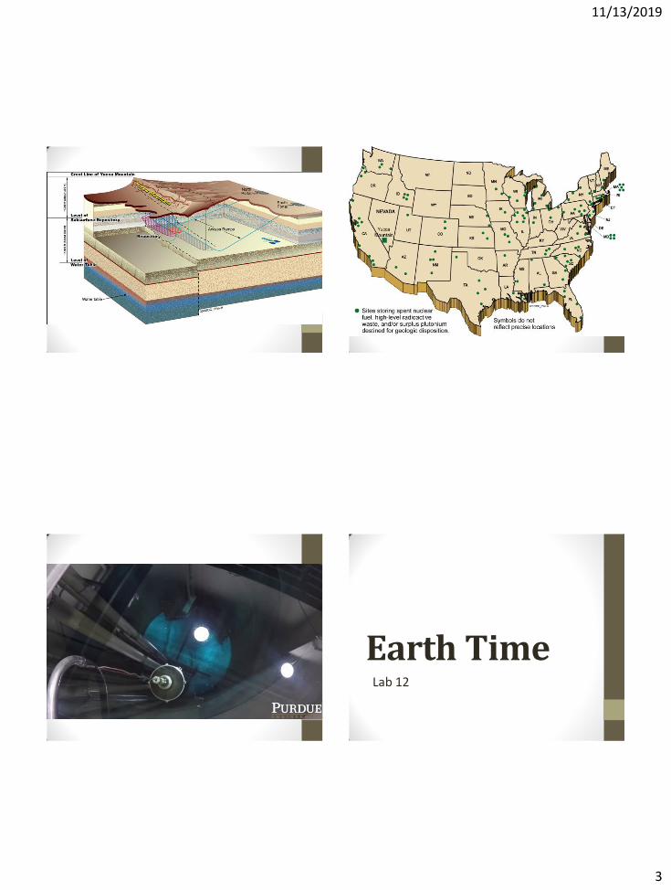
Earth Time Lab 12
11/13/2019
4
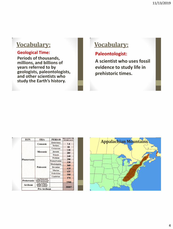
Vocabulary: Geological Time: Periods of thousands, millions, and billions of years referred to by geologists, paleontologists, and other scientists who study the Earth’s history.
Vocabulary:
Paleontologist:
A scientist who uses fossil evidence to study life in prehistoric times.
Appalachian Mountains
11/13/2019
5
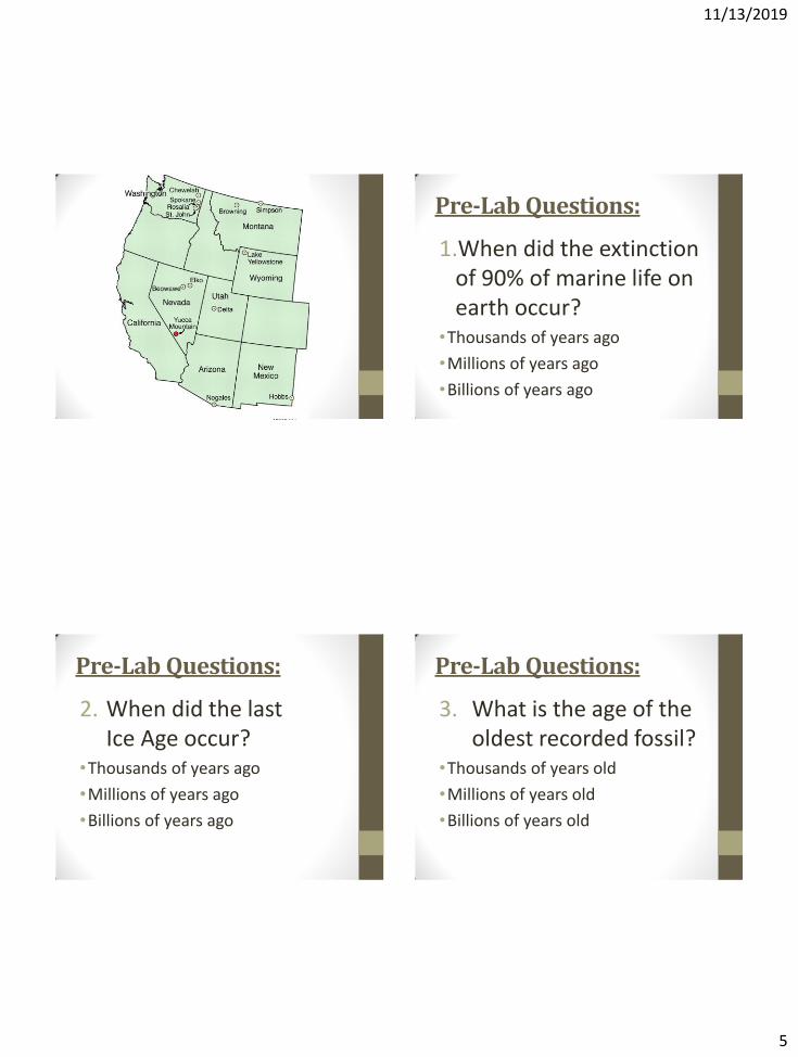
Pre-Lab Questions:
1.When did the extinction of 90% of marine life on earth occur?
•Thousands of years ago
•Millions of years ago
•Billions of years ago
Pre-Lab Questions:
2. When did the last Ice Age occur?
•Thousands of years ago
•Millions of years ago
•Billions of years ago
Pre-Lab Questions:
3. What is the age of the oldest recorded fossil?
•Thousands of years old
•Millions of years old
•Billions of years old
11/13/2019
6
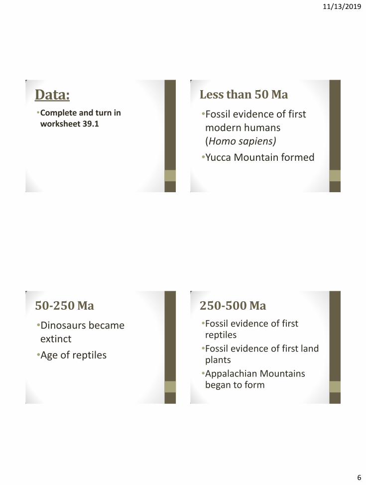
Data: •Complete and turn in worksheet 39.1
Less than 50 Ma
•Fossil evidence of first modern humans (Homo sapiens)
•Yucca Mountain formed
50-250 Ma
•Dinosaurs became extinct
•Age of reptiles
250-500 Ma
•Fossil evidence of first reptiles
•Fossil evidence of first land plants
•Appalachian Mountains began to form
11/13/2019
7
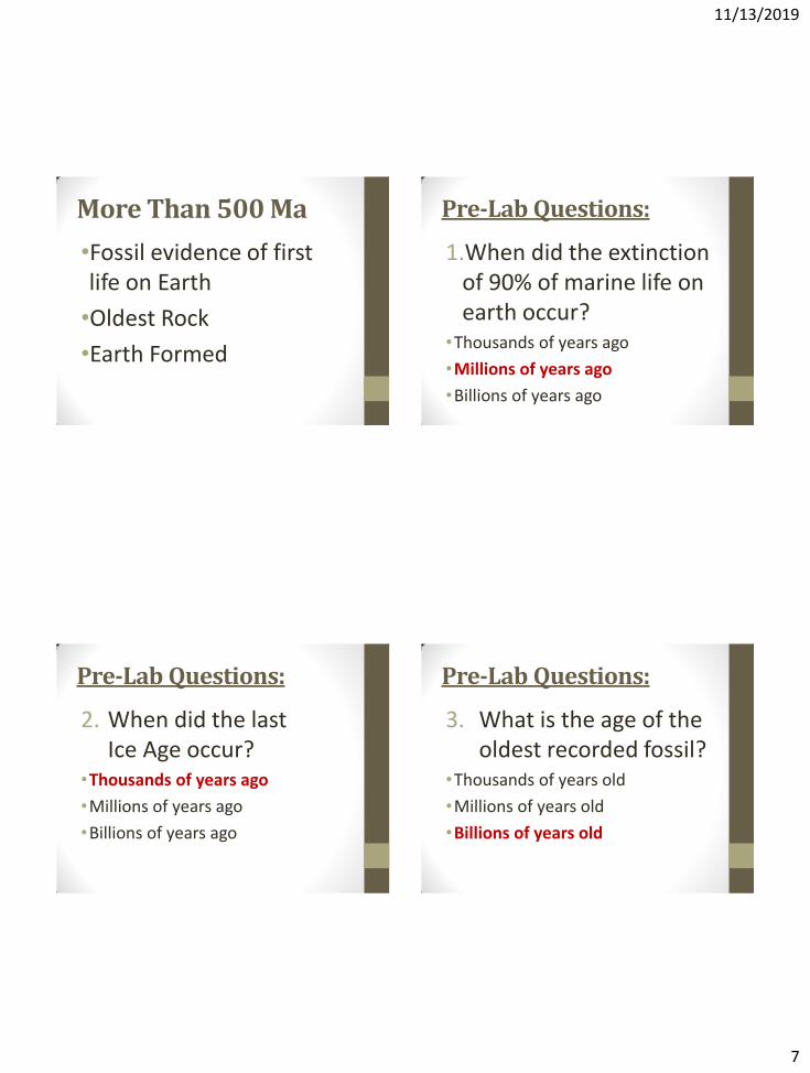
More Than 500 Ma
•Fossil evidence of first life on Earth
•Oldest Rock
•Earth Formed
Pre-Lab Questions:
1.When did the extinction of 90% of marine life on earth occur?
•Thousands of years ago
•Millions of years ago
•Billions of years ago
Pre-Lab Questions:
2. When did the last Ice Age occur?
•Thousands of years ago
•Millions of years ago
•Billions of years ago
Pre-Lab Questions:
3. What is the age of the oldest recorded fossil?
•Thousands of years old
•Millions of years old
•Billions of years old
11/13/2019
8
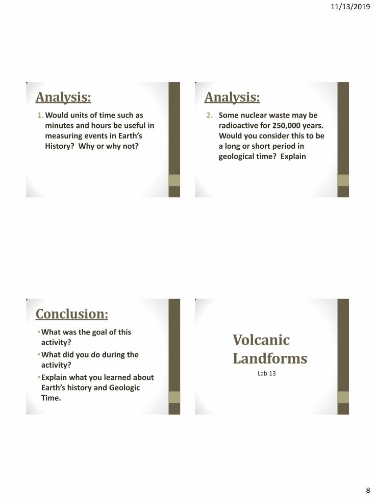
Analysis: 1. Would units of time such as
minutes and hours be useful in measuring events in Earth’s History? Why or why not?
Analysis: 2. Some nuclear waste may be
radioactive for 250,000 years. Would you consider this to be a long or short period in geological time? Explain
Conclusion: •What was the goal of this activity?
•What did you do during the activity?
•Explain what you learned about Earth’s history and Geologic Time.
Volcanic Landforms
Lab 13
11/13/2019
9
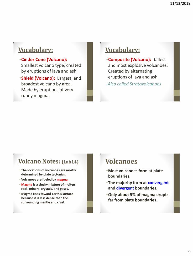
Vocabulary:
•Cinder Cone (Volcano): Smallest volcano type, created by eruptions of lava and ash.
•Shield (Volcano): Largest, and broadest volcano by area. Made by eruptions of very runny magma.
Vocabulary:
•Composite (Volcano): Tallest and most explosive volcanoes. Created by alternating eruptions of lava and ash.
-Also called Stratovolcanoes
Volcano Notes: (Lab14)
• The locations of volcanoes are mostly determined by plate tectonics.
• Volcanoes are fueled by magma.
• Magma is a slushy mixture of molten rock, mineral crystals, and gases.
• Magma rises toward Earth’s surface because it is less dense than the surrounding mantle and crust.
Volcanoes •Most volcanoes form at plate boundaries.
•The majority form at convergent and divergent boundaries.
•Only about 5% of magma erupts far from plate boundaries.
11/13/2019
10
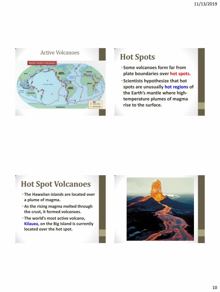
Active Volcanoes Hot Spots •Some volcanoes form far from plate boundaries over hot spots.
•Scientists hypothesize that hot spots are unusually hot regions of the Earth’s mantle where high-temperature plumes of magma rise to the surface.
Hot Spot Volcanoes •The Hawaiian islands are located over
a plume of magma.
•As the rising magma melted through the crust, it formed volcanoes.
•The world’s most active volcano, Kilauea, on the Big Island is currently located over the hot spot.
11/13/2019
11
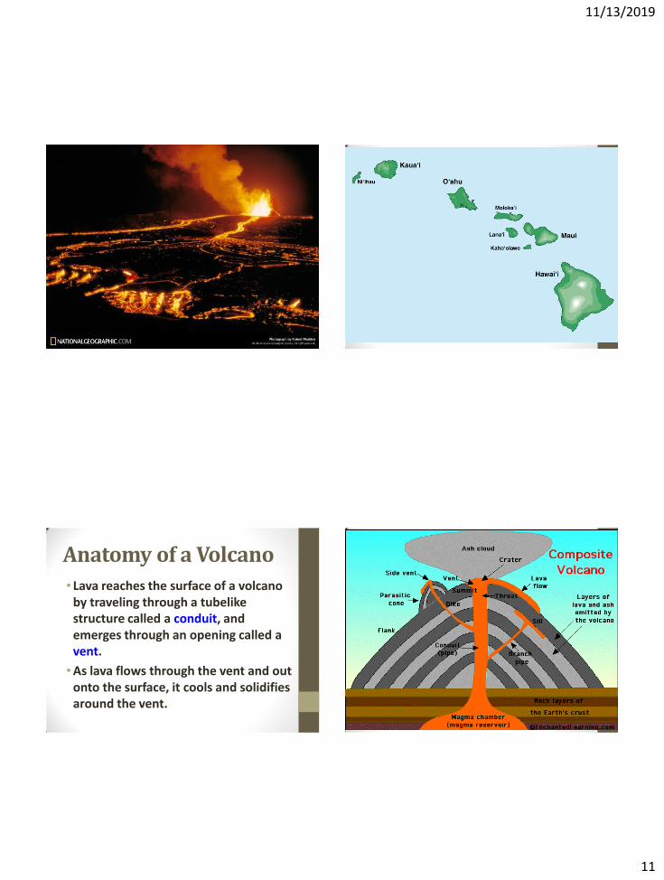
Anatomy of a Volcano
• Lava reaches the surface of a volcano by traveling through a tubelike structure called a conduit, and emerges through an opening called a vent.
•As lava flows through the vent and out onto the surface, it cools and solidifies around the vent.
11/13/2019
12
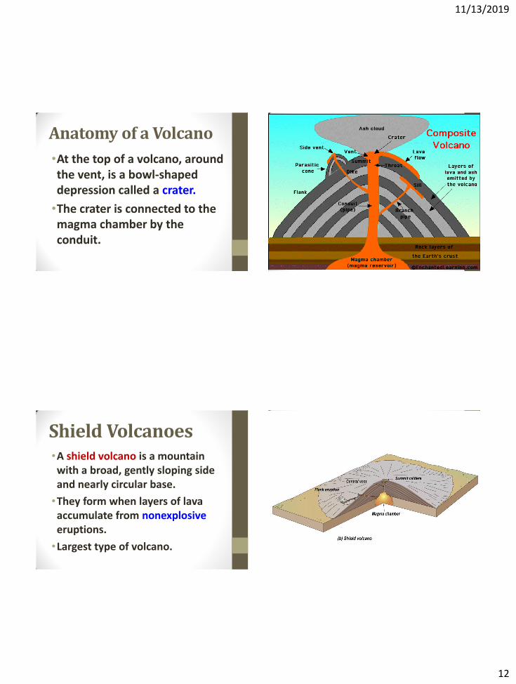
Anatomy of a Volcano
•At the top of a volcano, around the vent, is a bowl-shaped depression called a crater.
•The crater is connected to the magma chamber by the conduit.
Shield Volcanoes •A shield volcano is a mountain with a broad, gently sloping side and nearly circular base.
•They form when layers of lava accumulate from nonexplosive eruptions.
•Largest type of volcano.
11/13/2019
13
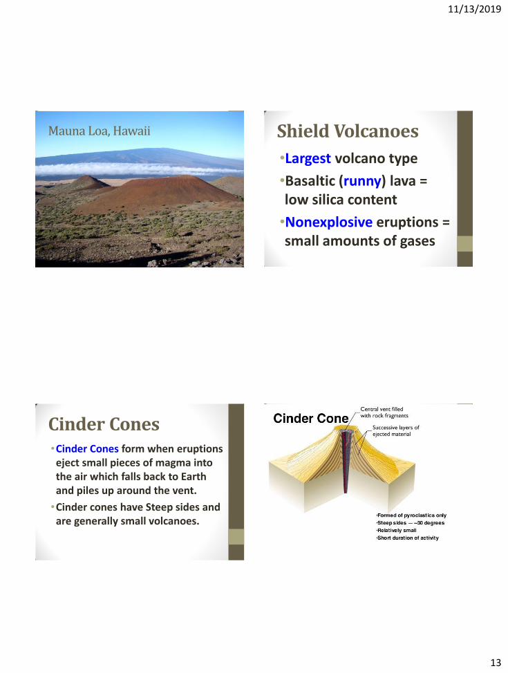
Mauna Loa, Hawaii Shield Volcanoes
•Largest volcano type
•Basaltic (runny) lava = low silica content
•Nonexplosive eruptions = small amounts of gases
Cinder Cones •Cinder Cones form when eruptions eject small pieces of magma into the air which falls back to Earth and piles up around the vent.
•Cinder cones have Steep sides and are generally small volcanoes.
11/13/2019
14
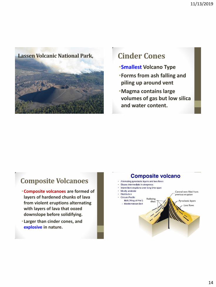
Lassen Volcanic National Park, CA Cinder Cones
•Smallest Volcano Type
•Forms from ash falling and piling up around vent
•Magma contains large volumes of gas but low silica and water content.
Composite Volcanoes
•Composite volcanoes are formed of layers of hardened chunks of lava from violent eruptions alternating with layers of lava that oozed downslope before solidifying.
•Larger than cinder cones, and explosive in nature.
11/13/2019
15
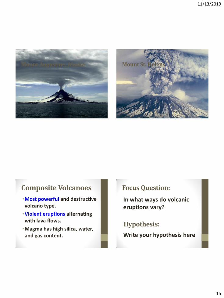
Mount Augustine, Alaska Mount St. Helens
Composite Volcanoes
•Most powerful and destructive volcano type.
•Violent eruptions alternating with lava flows.
•Magma has high silica, water, and gas content.
Focus Question:
In what ways do volcanic eruptions vary?
Write your hypothesis here
Hypothesis:
11/13/2019
16
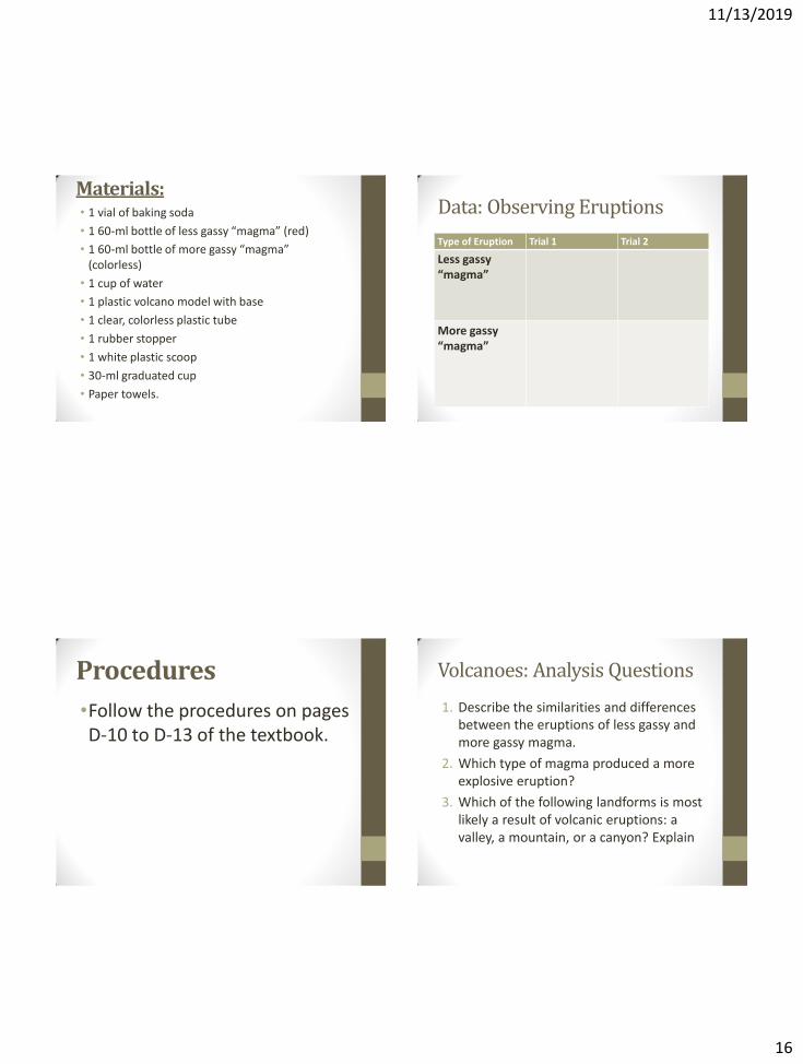
Materials: • 1 vial of baking soda
• 1 60-ml bottle of less gassy “magma” (red)
• 1 60-ml bottle of more gassy “magma” (colorless)
• 1 cup of water
• 1 plastic volcano model with base
• 1 clear, colorless plastic tube
• 1 rubber stopper
• 1 white plastic scoop
• 30-ml graduated cup
• Paper towels.
Data: Observing Eruptions
Type of Eruption Trial 1 Trial 2
Less gassy “magma”
More gassy “magma”
Procedures
•Follow the procedures on pages D-10 to D-13 of the textbook.
Volcanoes: Analysis Questions
1. Describe the similarities and differences between the eruptions of less gassy and more gassy magma.
2. Which type of magma produced a more explosive eruption?
3. Which of the following landforms is most likely a result of volcanic eruptions: a valley, a mountain, or a canyon? Explain
11/13/2019
17
Conclusion •Describe what we did during this
investigation
•What did you learn about volcanic eruptions?
•What did you like/dislike about this lab?
•Did this lab remind you of anything?
Continental Drift
Lab 15
Focus Question:
•What evidence do we have that the continents have moved?
Hypothesis:
“Answer the focus question here”
11/13/2019
18
Vocabulary:
Continental Drift:
A theory that the continents were attached together in the past, and have been drifting apart ever since.
Vocabulary:
Evidence:
Information gained by direct observation.
Introduction: • The Idea of continental drift was first
proposed by German meteorologist, Alfred Wegener.
• In 1912, Wegener presented his ideas about continental movement to the scientific community.
• In 1915, he published a book which outlined his theory, titled “The Origin of Continents and Oceans”
Introduction: • In 1915, Wegener published The Origin of Continents and Oceans in which he outlined his theory of continental drift.
•Wegener’s ideas about continental drift were not widely accepted.
11/13/2019
19
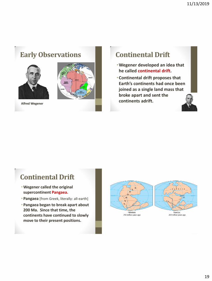
Early Observations
Alfred Wegener
Continental Drift
•Wegener developed an idea that he called continental drift.
•Continental drift proposes that Earth’s continents had once been joined as a single land mass that broke apart and sent the continents adrift.
Continental Drift •Wegener called the original
supercontinent Pangaea.
•Pangaea [from Greek, literally: all-earth]
•Pangaea began to break apart about 200 Ma. Since that time, the continents have continued to slowly move to their present positions.
11/13/2019
20
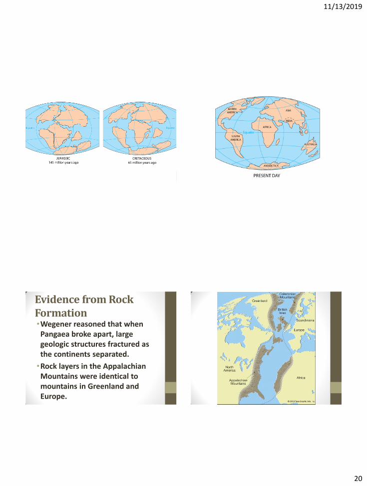
Evidence from Rock Formation •Wegener reasoned that when Pangaea broke apart, large geologic structures fractured as the continents separated.
•Rock layers in the Appalachian Mountains were identical to mountains in Greenland and Europe.
11/13/2019
21
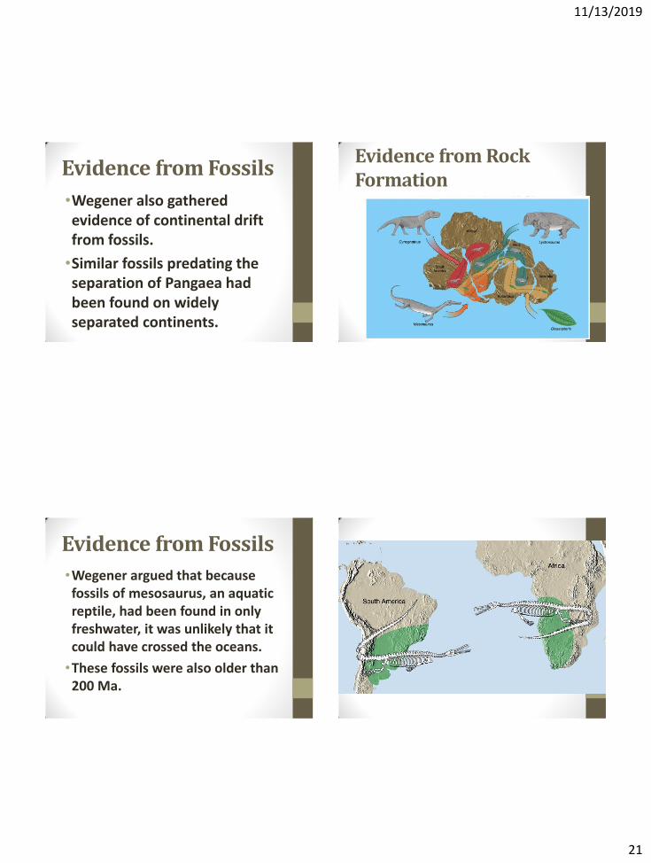
Evidence from Fossils
•Wegener also gathered evidence of continental drift from fossils.
•Similar fossils predating the separation of Pangaea had been found on widely separated continents.
Evidence from Rock Formation
Evidence from Fossils
•Wegener argued that because fossils of mesosaurus, an aquatic reptile, had been found in only freshwater, it was unlikely that it could have crossed the oceans.
•These fossils were also older than 200 Ma.
11/13/2019
22
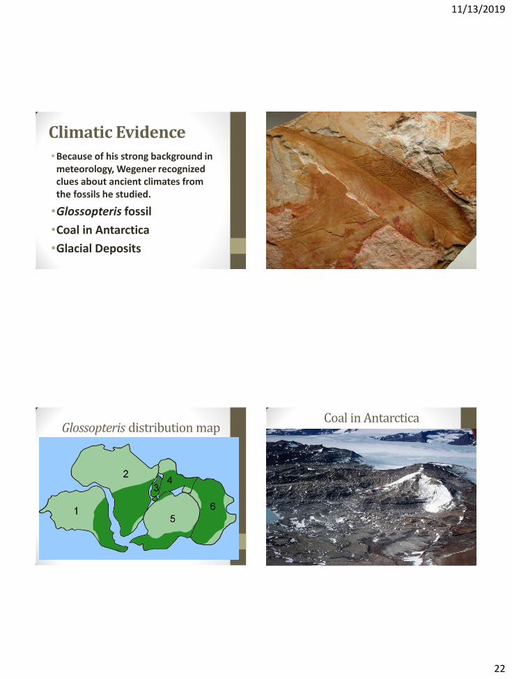
Climatic Evidence •Because of his strong background in
meteorology, Wegener recognized clues about ancient climates from the fossils he studied.
•Glossopteris fossil
•Coal in Antarctica
•Glacial Deposits
Glossopteris distribution map Coal in Antarctica
11/13/2019
23
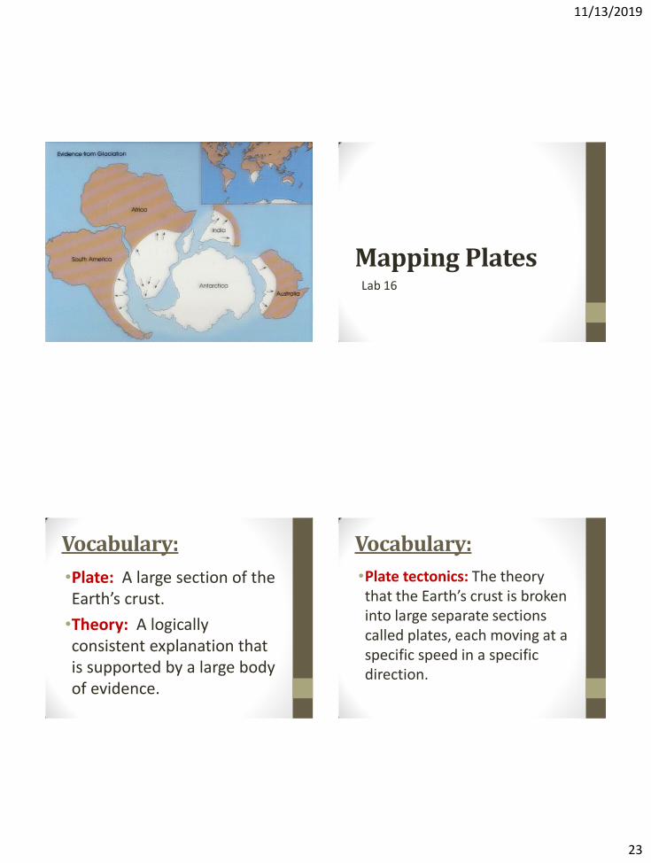
Mapping Plates Lab 16
Vocabulary:
•Plate: A large section of the Earth’s crust.
•Theory: A logically consistent explanation that is supported by a large body of evidence.
Vocabulary:
•Plate tectonics: The theory that the Earth’s crust is broken into large separate sections called plates, each moving at a specific speed in a specific direction.
11/13/2019
24
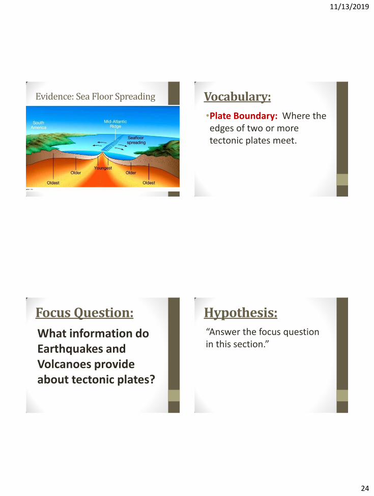
Evidence: Sea Floor Spreading Vocabulary:
•Plate Boundary: Where the edges of two or more tectonic plates meet.
Focus Question:
What information do Earthquakes and Volcanoes provide about tectonic plates?
Hypothesis:
“Answer the focus question in this section.”
11/13/2019
25
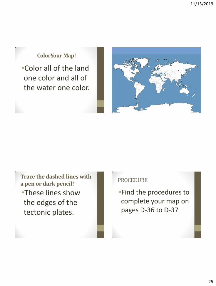
ColorYour Map!
•Color all of the land one color and all of the water one color.
Trace the dashed lines with a pen or dark pencil!
•These lines show the edges of the tectonic plates.
PROCEDURE
•Find the procedures to complete your map on pages D-36 to D-37
11/13/2019
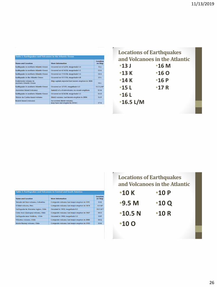
26
Locations of Earthquakes and Volcanoes in the Atlantic •13 J •13 K •14 K •15 L •16 L •16.5 L/M
•16 M •16 O •16 P •17 R
Locations of Earthquakes and Volcanoes in the Atlantic
•10 K
•9.5 M
•10.5 N
•10 O
•10 P
•10 Q
•10 R
11/13/2019
27
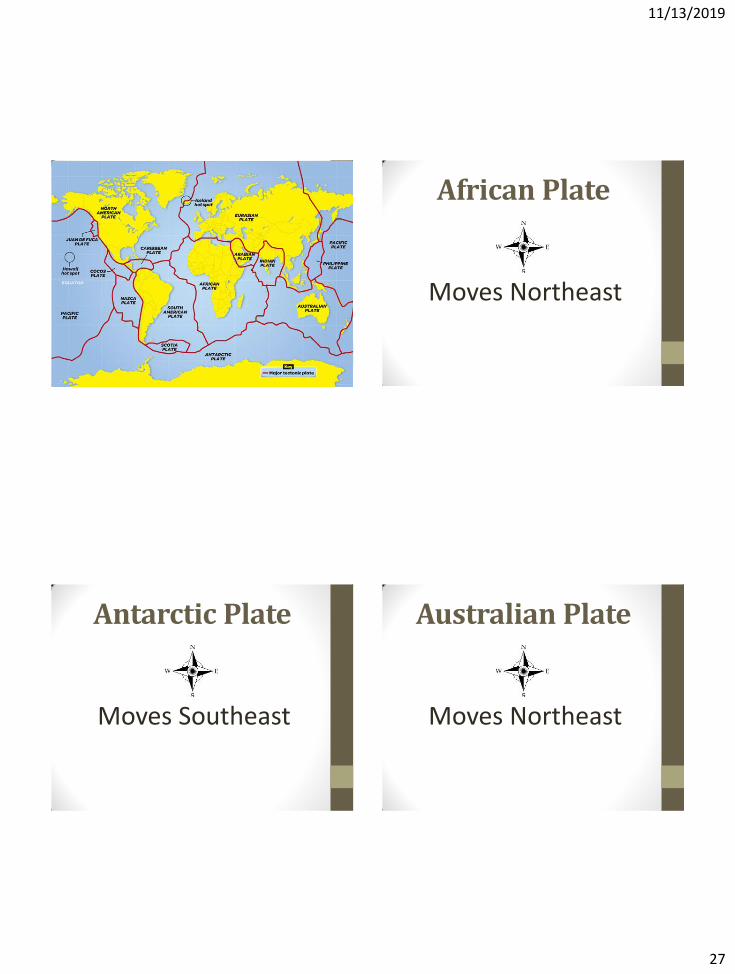
African Plate
Moves Northeast
Antarctic Plate
Moves Southeast
Australian Plate
Moves Northeast
11/13/2019
28
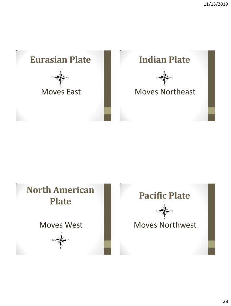
Eurasian Plate
Moves East
Indian Plate
Moves Northeast
North American Plate
Moves West
Pacific Plate
Moves Northwest
11/13/2019
29
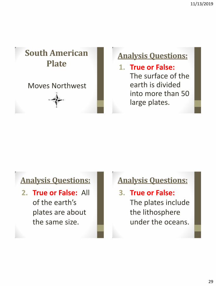
South American Plate
Moves Northwest
Analysis Questions:
1. True or False: The surface of the earth is divided into more than 50 large plates.
Analysis Questions:
2. True or False: All of the earth’s plates are about the same size.
Analysis Questions:
3. True or False: The plates include the lithosphere under the oceans.
11/13/2019
30
Analysis Questions:
4. True or False: All of the earth’s plates are moving in the same direction.
Analysis Questions: 5. True or False: The
edges of the continents are the same as the boundaries of the plates.
Analysis Questions: 6. The data used to create the
missing plate boundaries was collected between 1834-2005. In terms of geological time, would you consider these volcanoes and earthquakes to have occurred recently or a long time ago? Explain
Analysis Questions:
7. What is the relationship between earthquakes, volcanoes, and plate boundaries?
11/13/2019
31
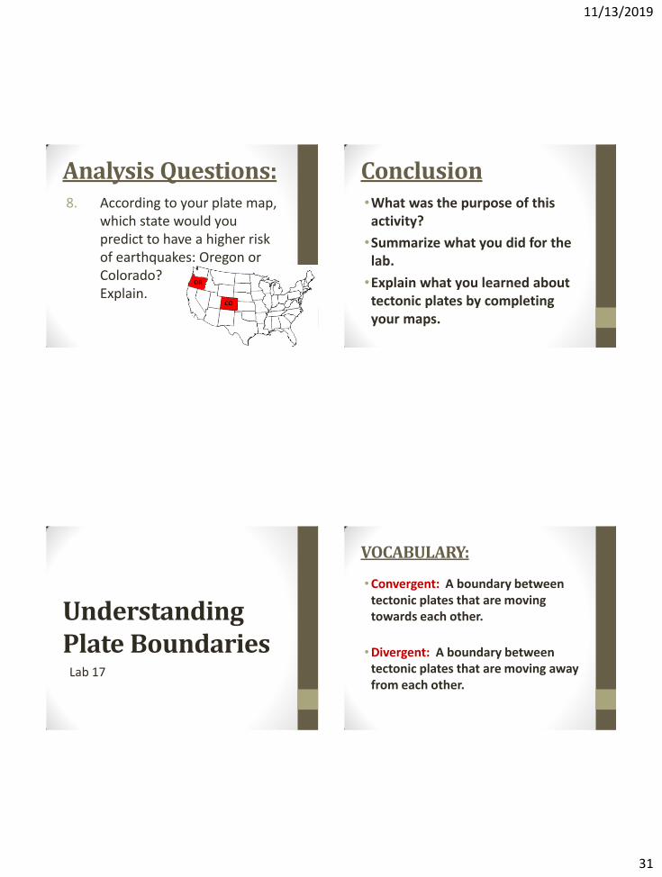
Analysis Questions: 8. According to your plate map,
which state would you predict to have a higher risk of earthquakes: Oregon or Colorado? Explain.
Conclusion •What was the purpose of this activity?
•Summarize what you did for the lab.
•Explain what you learned about tectonic plates by completing your maps.
Understanding Plate Boundaries
Lab 17
VOCABULARY:
•Convergent: A boundary between tectonic plates that are moving towards each other.
•Divergent: A boundary between tectonic plates that are moving away from each other.
11/13/2019
32
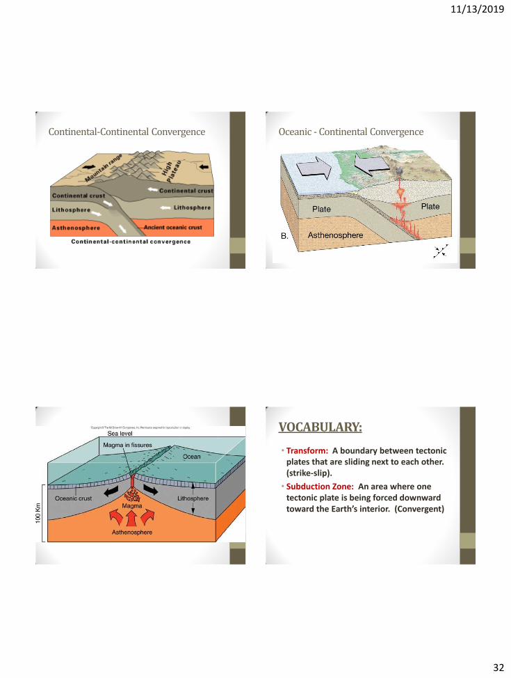
Continental-Continental Convergence Oceanic - Continental Convergence
VOCABULARY:
• Transform: A boundary between tectonic plates that are sliding next to each other. (strike-slip).
• Subduction Zone: An area where one tectonic plate is being forced downward toward the Earth’s interior. (Convergent)
11/13/2019
33
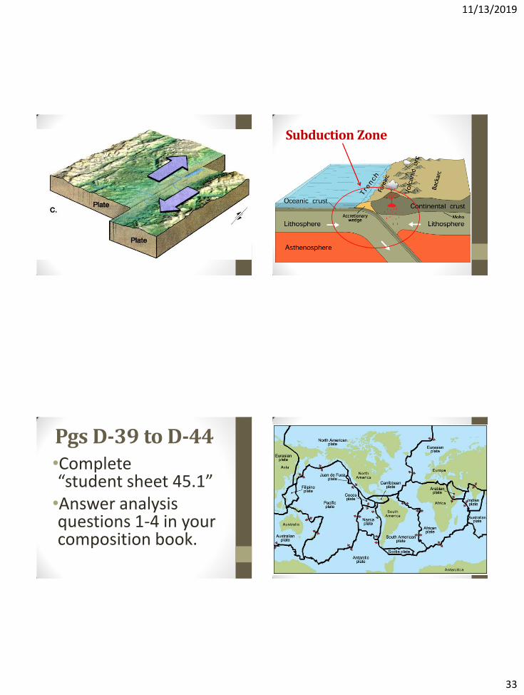
Subduction Zone
Pgs D-39 to D-44 •Complete “student sheet 45.1” •Answer analysis questions 1-4 in your composition book.
11/13/2019
34
Analysis:
1. Describe one way in which the movement of plates can result in the formation of mountains.
Analysis: 2. On your tectonic plate
map, find and label the following:
•A convergent boundary
•A divergent boundary
•A transform boundary
Analysis: 3. Yucca Mountain is located
close to H6 on your map. Which type of boundary is it closest to?
4. Which type of rock would you expect to find at a divergent plate boundary? Explain
CONCLUSION:
•Describe the differences between convergent, divergent, and transform boundaries.
•What do these types of boundaries create?
•What happens at subduction zones?
11/13/2019
35
11/13/2019
36
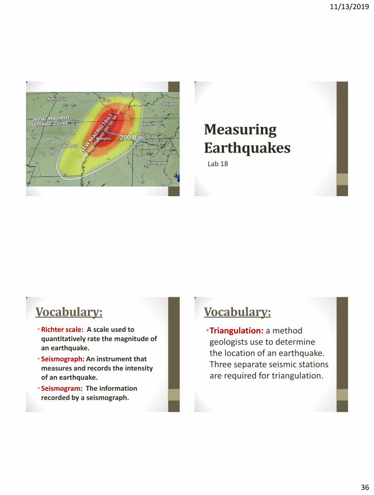
Measuring Earthquakes
Lab 18
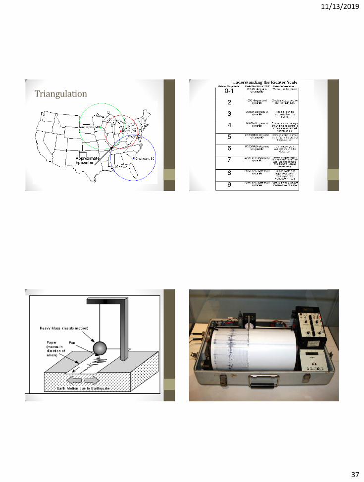
Vocabulary: •Richter scale: A scale used to
quantitatively rate the magnitude of an earthquake.
• Seismograph: An instrument that measures and records the intensity of an earthquake.
• Seismogram: The information recorded by a seismograph.
Vocabulary:
•Triangulation: a method geologists use to determine the location of an earthquake. Three separate seismic stations are required for triangulation.
11/13/2019
37
Triangulation
11/13/2019
38
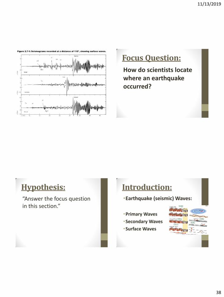
Focus Question:
How do scientists locate where an earthquake occurred?
Hypothesis:
“Answer the focus question in this section.”
•Earthquake (seismic) Waves:
•Primary Waves
•Secondary Waves
•Surface Waves
Introduction:
11/13/2019
39
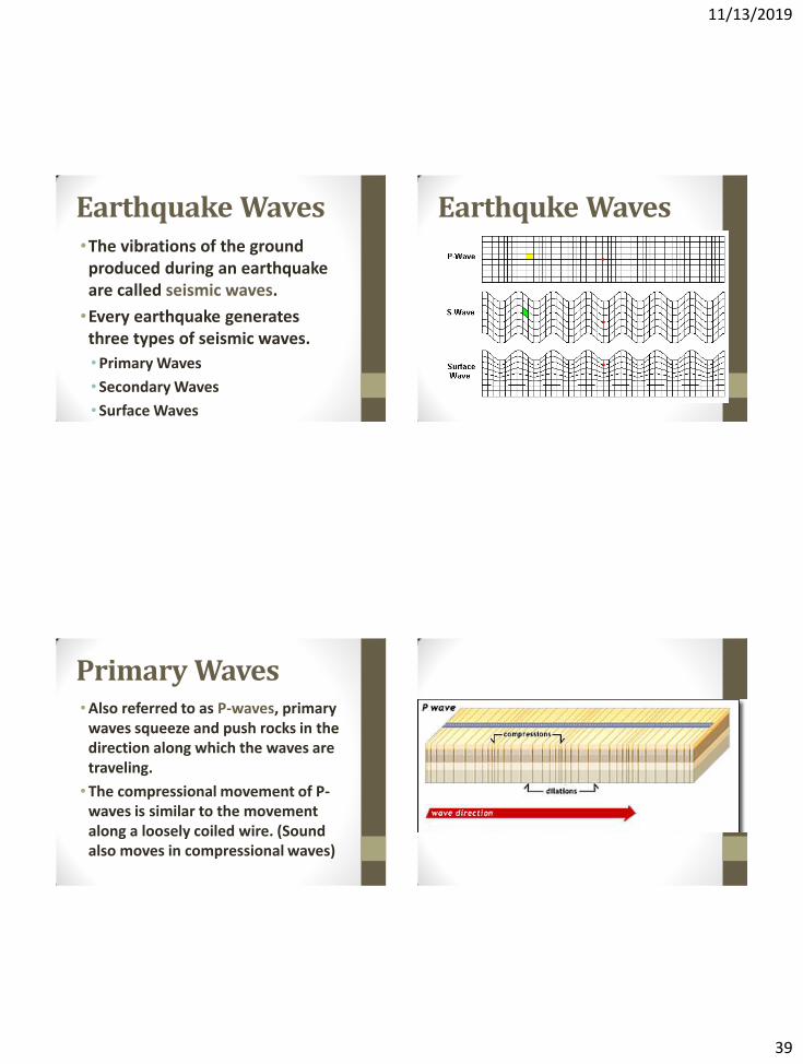
•The vibrations of the ground produced during an earthquake are called seismic waves.
•Every earthquake generates three types of seismic waves.
•Primary Waves
• Secondary Waves
• Surface Waves
Earthquake Waves Earthquke Waves
•Also referred to as P-waves, primary waves squeeze and push rocks in the direction along which the waves are traveling.
•The compressional movement of P-waves is similar to the movement along a loosely coiled wire. (Sound also moves in compressional waves)
Primary Waves
11/13/2019
40
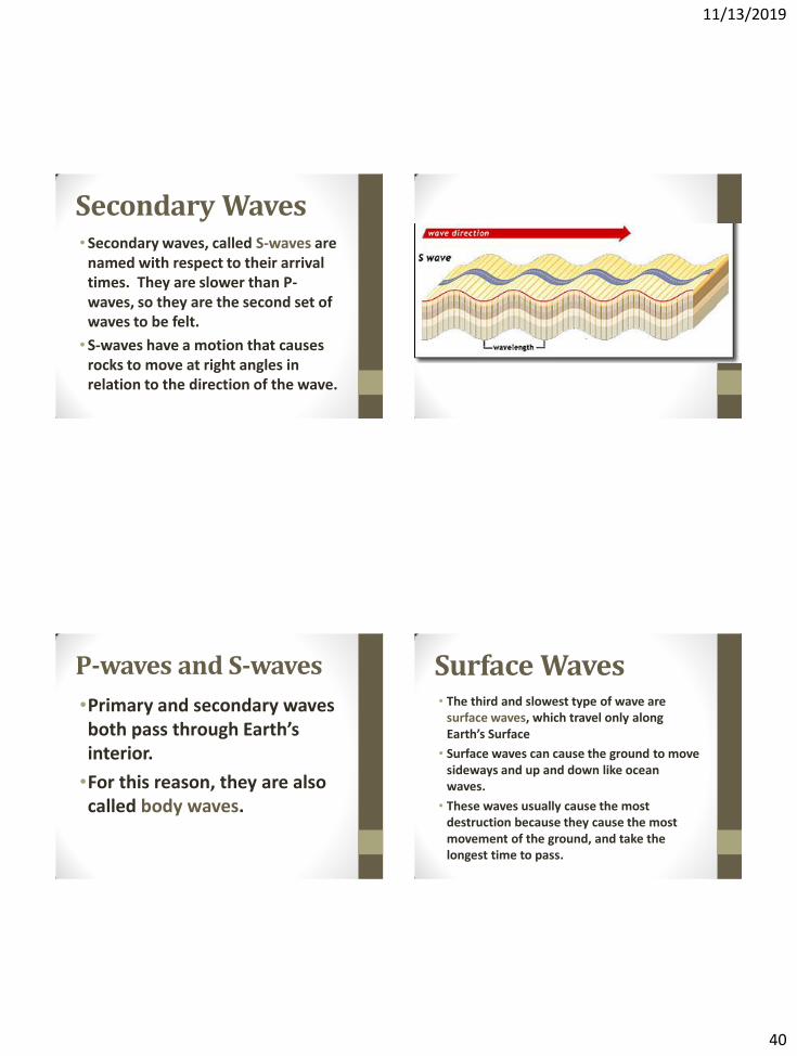
• Secondary waves, called S-waves are named with respect to their arrival times. They are slower than P-waves, so they are the second set of waves to be felt.
• S-waves have a motion that causes rocks to move at right angles in relation to the direction of the wave.
Secondary Waves
•Primary and secondary waves both pass through Earth’s interior.
•For this reason, they are also called body waves.
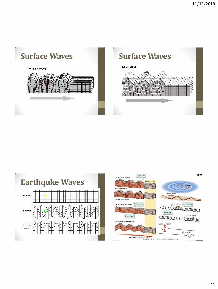
P-waves and S-waves • The third and slowest type of wave are
surface waves, which travel only along Earth’s Surface
• Surface waves can cause the ground to move sideways and up and down like ocean waves.
• These waves usually cause the most destruction because they cause the most movement of the ground, and take the longest time to pass.
Surface Waves
11/13/2019
41
Surface Waves Surface Waves
Earthquke Waves
11/13/2019
42
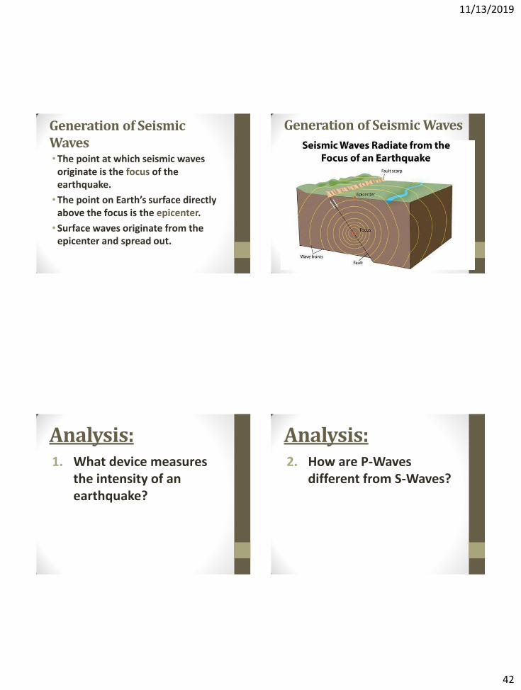
•The point at which seismic waves originate is the focus of the earthquake.
•The point on Earth’s surface directly above the focus is the epicenter.
• Surface waves originate from the epicenter and spread out.
Generation of Seismic Waves
Generation of Seismic Waves
Analysis: 1. What device measures
the intensity of an earthquake?
Analysis: 2. How are P-Waves
different from S-Waves?
11/13/2019
43
Analysis: 3. Explain how the focus of
an earthquake is different from the epicenter.
Observations: Observations of earthquake simulation
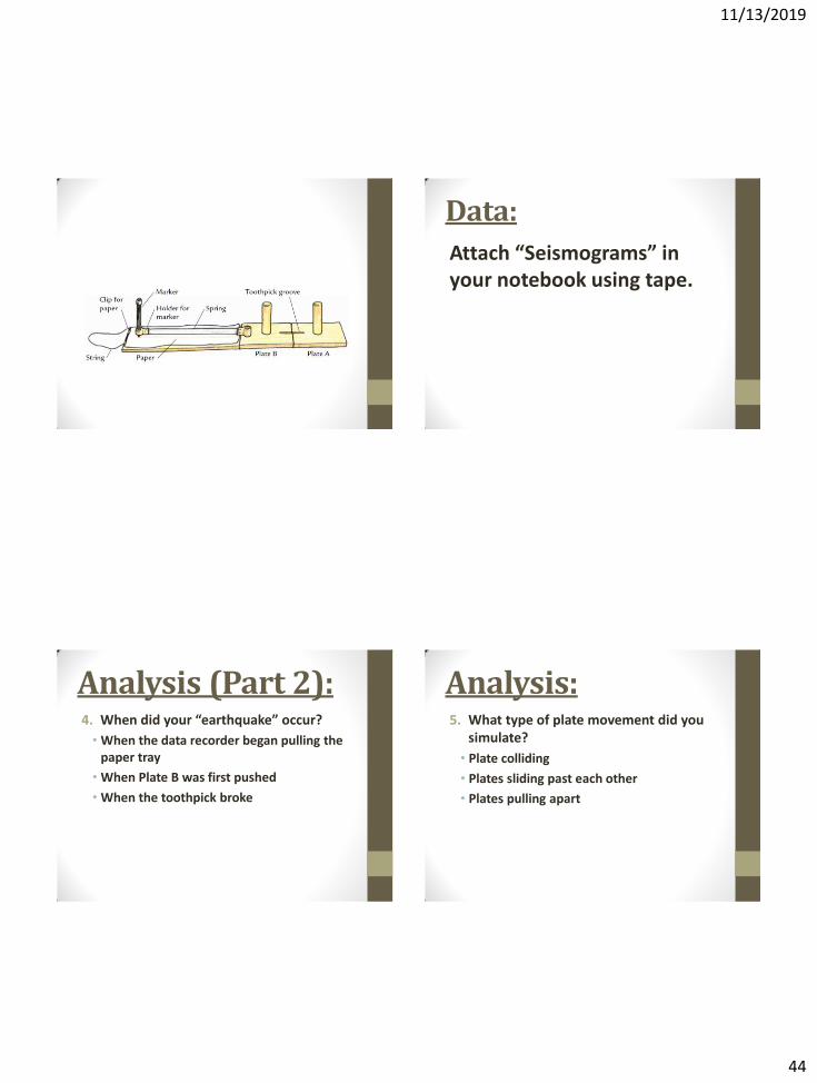
Procedures: • Set up the seismographs.
• We will run the seismographs 8 times on 4 separate sheets of paper (front and back).
• Your group will receive 4 sheets of paper and 8 toothpicks.
• Make sure to remove the marker from the seismograph before removing the sheet of paper. (Keep the seismograms)
• Once you are finished, throw away any toothpicks, return the seismograph to the back table, and return to your seat.
Procedures:
•Make sure each person in your group gets a chance performing each role.
• Plate A holder
• Plate B pusher
• Data Recorder
• Observer
11/13/2019
44
Data:
Attach “Seismograms” in your notebook using tape.
Analysis (Part 2): 4. When did your “earthquake” occur?
• When the data recorder began pulling the paper tray
• When Plate B was first pushed
• When the toothpick broke
Analysis: 5. What type of plate movement did you
simulate?
• Plate colliding
• Plates sliding past each other
• Plates pulling apart
11/13/2019
45
Analysis: 6. Describe what the
seismogram looked like.
Conclusion: •Summarize what the activity was about.
•What did you learn about measuring earthquakes by completing the activity?
•How are earthquakes related to plate tectonics?
Beneath the Earth’s Surface
Lab 19
Focus Question
•What would you see if you could cut Earth in half?
11/13/2019
46
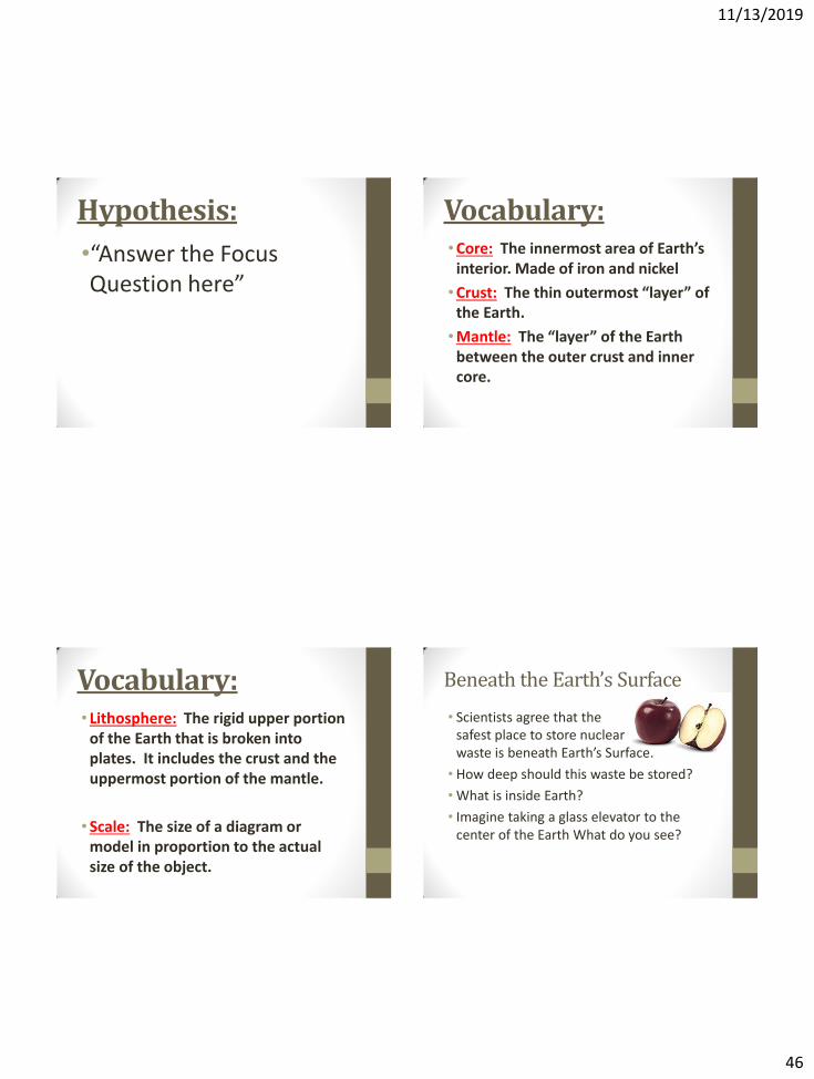
Hypothesis:
•“Answer the Focus Question here”
Vocabulary: •Core: The innermost area of Earth’s
interior. Made of iron and nickel
•Crust: The thin outermost “layer” of the Earth.
•Mantle: The “layer” of the Earth between the outer crust and inner core.
Vocabulary: • Lithosphere: The rigid upper portion
of the Earth that is broken into plates. It includes the crust and the uppermost portion of the mantle.
• Scale: The size of a diagram or model in proportion to the actual size of the object.
Beneath the Earth’s Surface
• Scientists agree that the safest place to store nuclear waste is beneath Earth’s Surface.
• How deep should this waste be stored?
• What is inside Earth?
• Imagine taking a glass elevator to the center of the Earth What do you see?
11/13/2019
47
Talking Drawing #1:
•If you sliced the Earth in half, what would it look like?
•Draw and label anything you would expect to find.
•Think about the thicknesses of different layers.
Reading:
Read pages D-15 to D-18
Analysis: 1. Which layer(s) of the Earth is/are:
a) the hottest? b) at the Earth’s center? c) completely solid?
2. Copy the five terms shown below: outer core upper mantle lithosphere solid crust
Conclusion:
•Explain what you understand about earths interior by looking at your diagram.
•How do scientists know what the inside of earth is like if we’ve never dug below the crust?
•Explain what you learned by completing the activity.
11/13/2019
48
Convection Currents
Lab 20
Focus Question:
•What will happen to the red food coloring when the beaker is placed on the hotplate?
Hypothesis:
Observation:
Vocabulary: •Convection: the circular motion that
happens when warm air or liquid rises, and cool air or liquid sinks.
11/13/2019
49
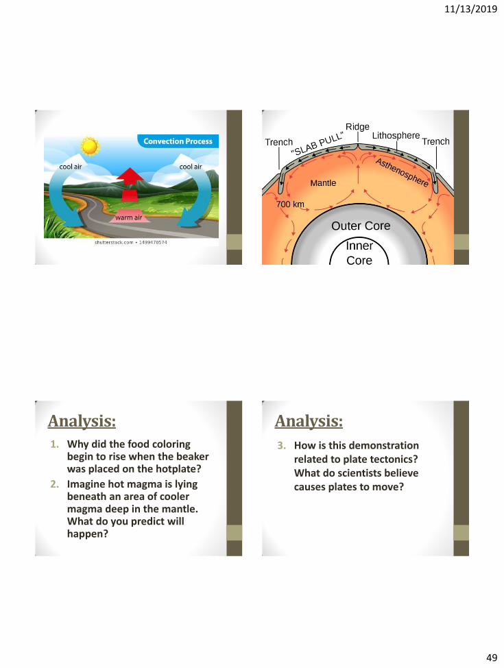
Analysis: 1. Why did the food coloring
begin to rise when the beaker was placed on the hotplate?
2. Imagine hot magma is lying beneath an area of cooler magma deep in the mantle. What do you predict will happen?
Analysis:
3. How is this demonstration related to plate tectonics? What do scientists believe causes plates to move?
11/13/2019
50
Vocabulary Review
Vocabulary: Active (volcano):
A volcano that is currently erupting, showing signs that it is likely to erupt in the near future, or has erupted in recorded history
Dormant (volcano):
A volcano that has not erupted for at least 10,000 years, but that scientists think may erupt again.
Vocabulary: Extinct (volcano):
A volcano that scientists do not expect to erupt ever again.
Nuclear Waste:
Radioactive material that must be disposed because it is not useful.
Vocabulary: Lithosphere:
The rigid upper portion of the Earth that is broken into plates. It includes the crust and the uppermost portion of the mantle.
11/13/2019
51
Vocabulary:
Mantle:
The “layer” of the Earth between the outer crust and inner core.
Vocabulary: Core:
The innermost area of Earth’s interior.
Crust:
The thin outermost “layer” of the Earth.
Scale:
The size of a diagram or model in proportion to the actual size of the object.
Vocabulary: Geological Time: Periods of thousands, millions, and billions of years referred to by geologists, paleontologists, and other scientists who study the Earth’s history.
Vocabulary:
Paleontologist:
A scientist who uses fossil evidence to study life in prehistoric times.

11/13/2019
52
Vocabulary:
Continental Drift:
A theory that the continents were attached together in the past, and have been drifting apart ever since.
VOCABULARY:
Convergent:
A boundary between tectonic plates that are moving towards each other.
Divergent:
A boundary between tectonic plates that are moving away from each other.
VOCABULARY:
Subduction Zone:
An area where one tectonic plate is being forced downward toward the Earth’s interior. This process causes the solid portions of the subducted plate to melt.
Transform:
A boundary between tectonic plates that are sliding next to each other. Also called a strike-slip boundary.
Vocabulary:
Plate:
A large section of the Earth’s surface.
Plate Boundary:
Where the edges of two or more tectonic plates meet.
11/13/2019
53
Vocabulary:
Plate tectonics:
The theory that the rigid outer portion of the Earth is broken into large separate sections called plates, each moving at a specific speed in a specific direction.
Vocabulary:
Theory:
A logically consistent explanation that is supported by a large body of evidence.
Vocabulary: Richter scale:
A scale used to quantitatively rate the magnitude of an earthquake.
Seismograph:
An instrument that measures and records the intensity of an earthquake.
Seismogram:
The information recorded by a seismograph.
Test Review Questions
11/13/2019
54
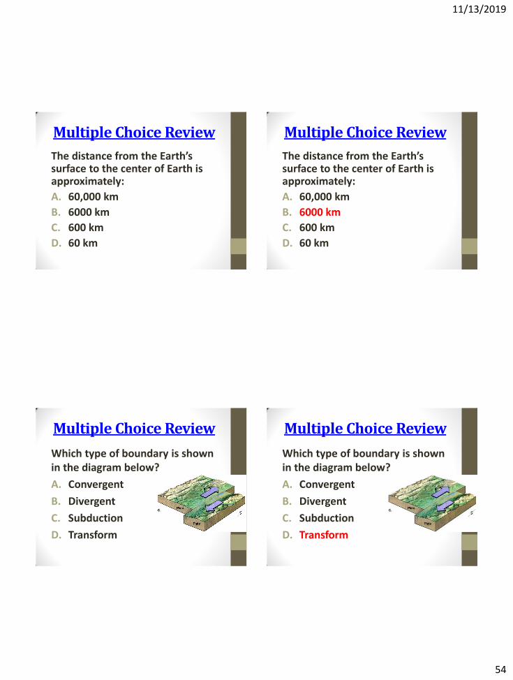
Multiple Choice Review
The distance from the Earth’s surface to the center of Earth is approximately:
A. 60,000 km
B. 6000 km
C. 600 km
D. 60 km
Multiple Choice Review
The distance from the Earth’s surface to the center of Earth is approximately:
A. 60,000 km
B. 6000 km
C. 600 km
D. 60 km
Multiple Choice Review
Which type of boundary is shown in the diagram below?
A. Convergent
B. Divergent
C. Subduction
D. Transform
Multiple Choice Review
Which type of boundary is shown in the diagram below?
A. Convergent
B. Divergent
C. Subduction
D. Transform
11/13/2019
55
Multiple Choice Review
A dormant volcano is one that:
A. Is currently erupting
B. Has erupted in recent geological time
C. Will never erupt again
D. Has never erupted
Multiple Choice Review
A dormant volcano is one that:
A. Is currently erupting
B. Has erupted in recent geological time
C. Will never erupt again
D. Has never erupted
Multiple Choice Review
Nuclear waste:
A. Is harmful to living things
B. Is radioactive
C. Comes in the form of glass, metals, and ceramics
D. All of the above
Multiple Choice Review
Nuclear waste:
A. Is harmful to living things
B. Is radioactive
C. Comes in the form of glass, metals, and ceramics
D. All of the above
11/13/2019
56
Multiple Choice Review
Which is the most likely to occur at a transform boundary?
A. Earthquakes
B. Volcanoes
C. Mountain Formation
D. All of the above
Multiple Choice Review
Which is the most likely to occur at a transform boundary?
A. Earthquakes
B. Volcanoes
C. Mountain Formation
D. All of the above
Multiple Choice Review
Scientific evidence suggest the Earth is:
A. Hundreds of years old
B. Thousands of years old
C. Millions of years old
D. Billions of years old
Multiple Choice Review
Scientific evidence suggest the Earth is:
A. Hundreds of years old
B. Thousands of years old
C. Millions of years old
D. Billions of years old
11/13/2019
57
Multiple Choice Review
Which of the following occurs at a convergent boundary? A. New crust is formed
B. Crust is destroyed
C. Plates move away from one another
D. Hurricanes are created
Multiple Choice Review
Which of the following occurs at a convergent boundary? A. New crust is formed
B. Crust is destroyed
C. Plates move away from one another
D. Hurricanes are created
Multiple Choice Review
The Lithosphere is made up of:
A. The crust and the core
B. The core and the mantle
C. The inner and outer core
D. The crust and the upper mantle
Multiple Choice Review
The Lithosphere is made up of:
A. The crust and the core
B. The core and the mantle
C. The inner and outer core
D. The crust and the upper mantle
11/13/2019
58
Multiple Choice Review
What is the following picture showing?
A. A Richter scale
B. A seismogram
C. A seismograph
D. The geological time scale
Multiple Choice Review
What is the following picture showing?
A. A Richter scale
B. A seismogram
C. A seismograph
D. The geological time scale
Multiple Choice Review
Where is new lithosphere created?
A. At convergent boundaries
B. At divergent boundaries
C. At transform boundaries
D. At all of the above
Multiple Choice Review
Where is new lithosphere created?
A. At convergent boundaries
B. At divergent boundaries
C. At transform boundaries
D. At all of the above
11/13/2019
59
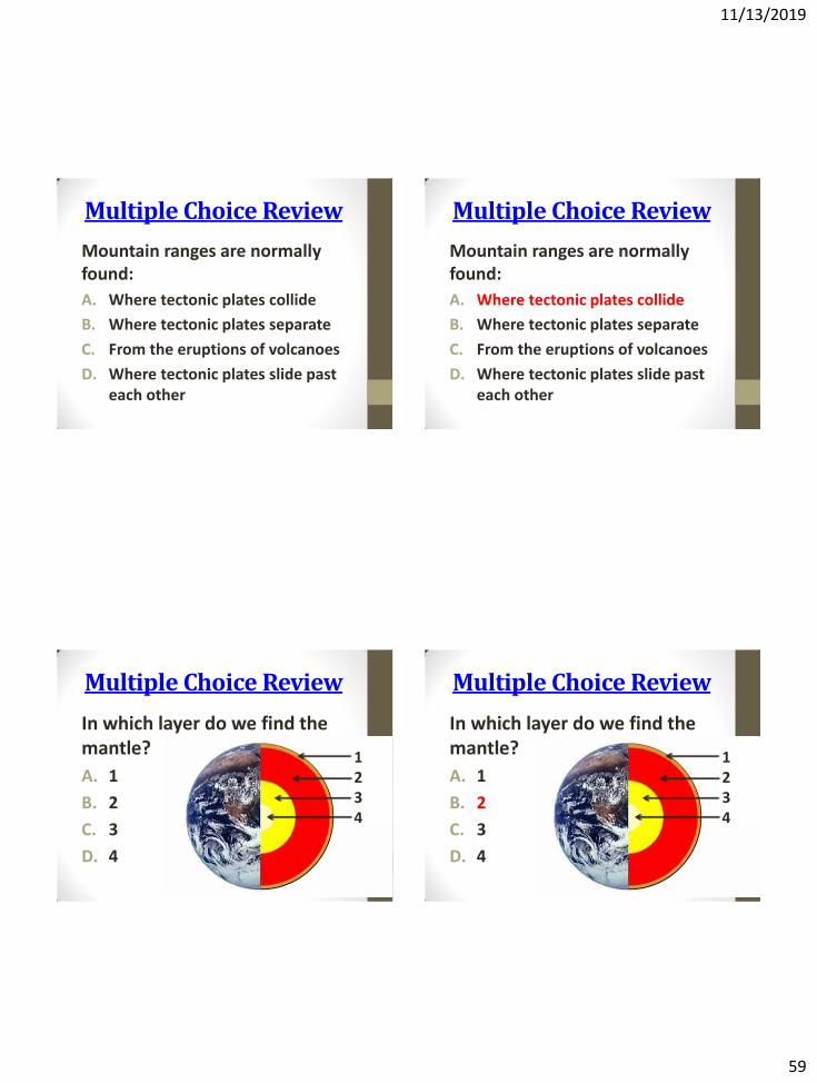
Multiple Choice Review
Mountain ranges are normally found:
A. Where tectonic plates collide
B. Where tectonic plates separate
C. From the eruptions of volcanoes
D. Where tectonic plates slide past each other
Multiple Choice Review
Mountain ranges are normally found:
A. Where tectonic plates collide
B. Where tectonic plates separate
C. From the eruptions of volcanoes
D. Where tectonic plates slide past each other
Multiple Choice Review
In which layer do we find the mantle?
A. 1
B. 2
C. 3
D. 4
1 2 3 4
Multiple Choice Review
In which layer do we find the mantle?
A. 1
B. 2
C. 3
D. 4
1 2 3 4