Embed Size (px)
Citation preview
1
Practicum Session 4Pre-Planning With Digital Charts
2
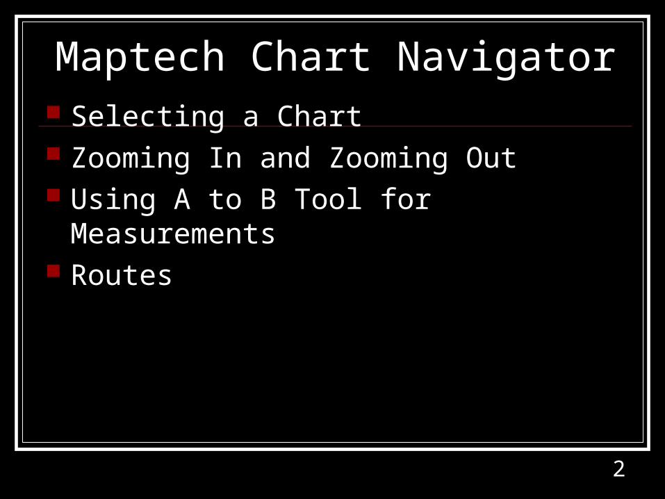
Maptech Chart Navigator Selecting a Chart Zooming In and Zooming Out Using A to B Tool for Measurements Routes
3
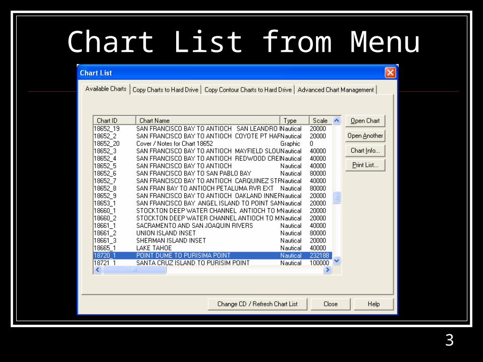
Chart List from Menu
4
5
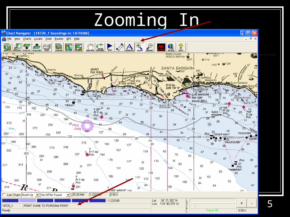
Zooming In
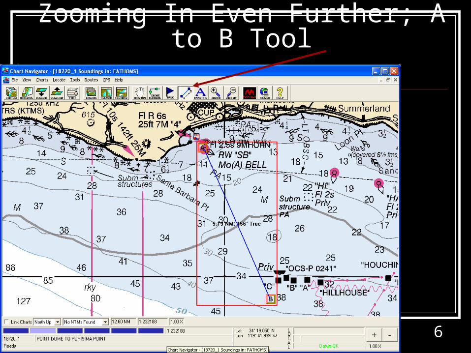
6
Zooming In Even Further; A to B Tool
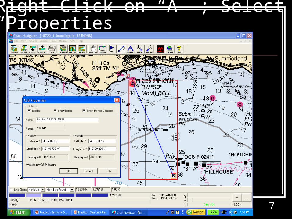
7
Right-Click on “A” ; Select “Properties”
8
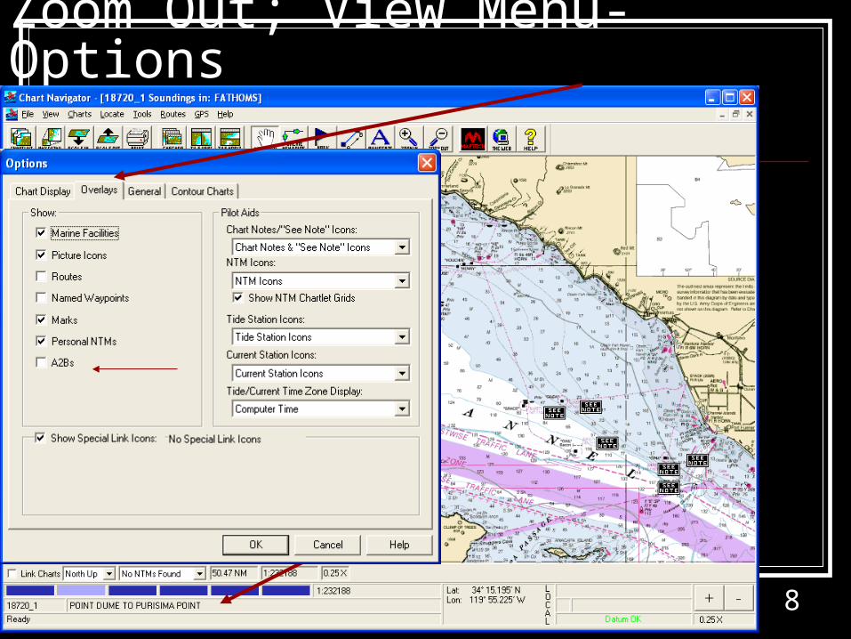
Zoom Out; View Menu-Options
9
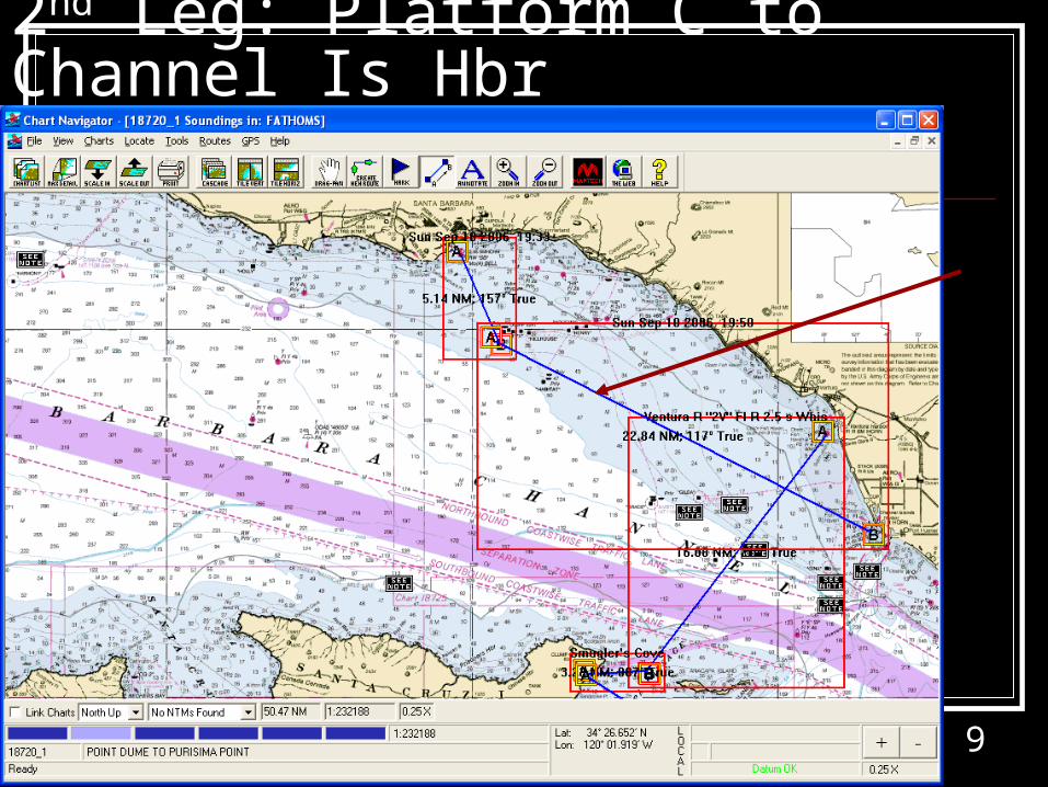
2nd Leg: Platform C to Channel Is Hbr
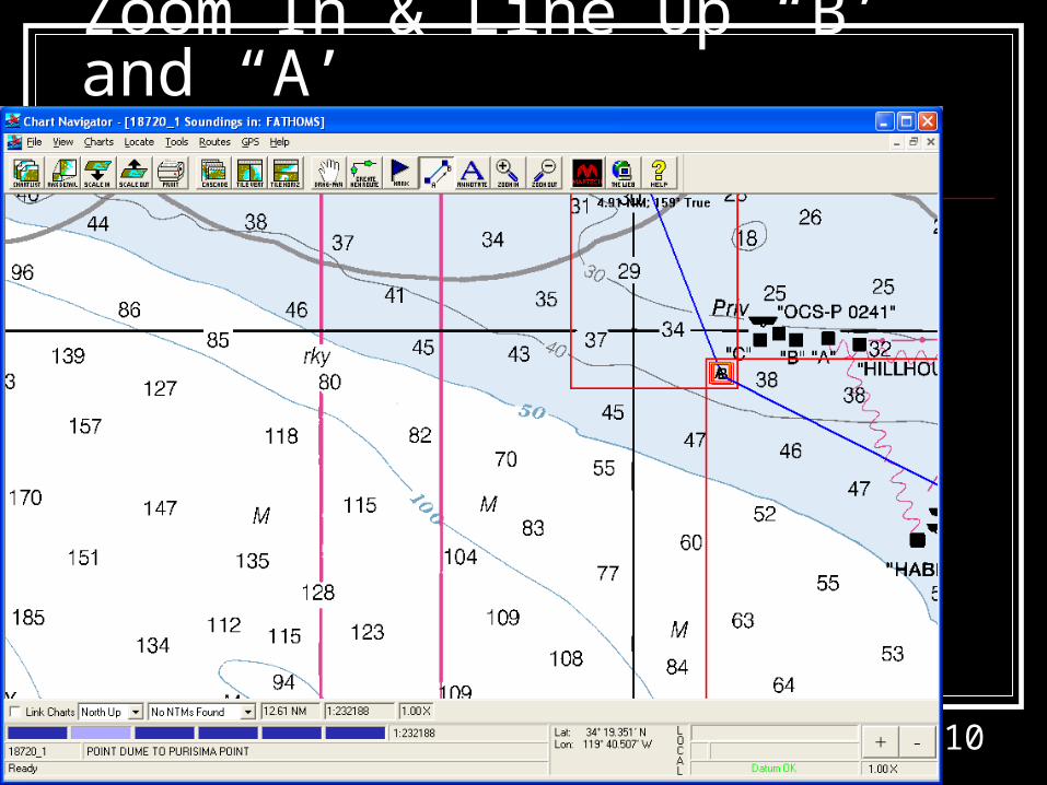
10
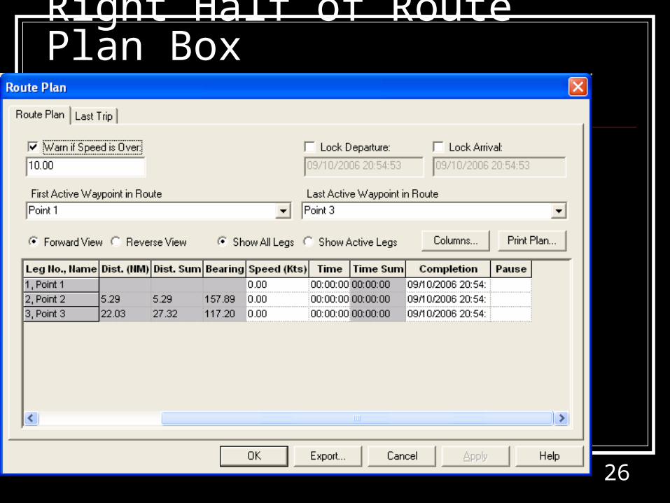
Zoom In & Line Up “B’ and “A’
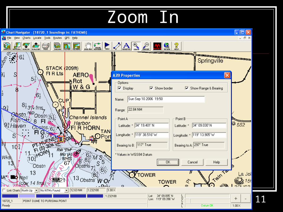
11
Zoom In
12
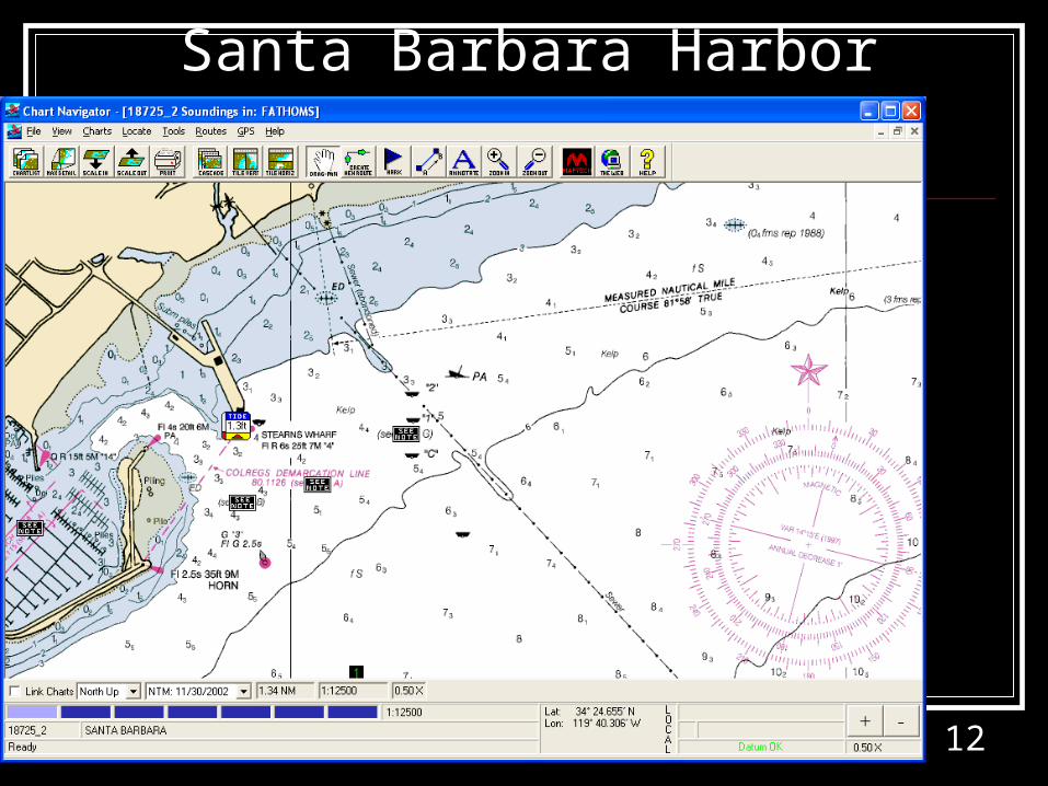
Santa Barbara Harbor
13
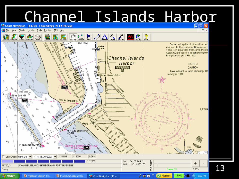
Channel Islands Harbor
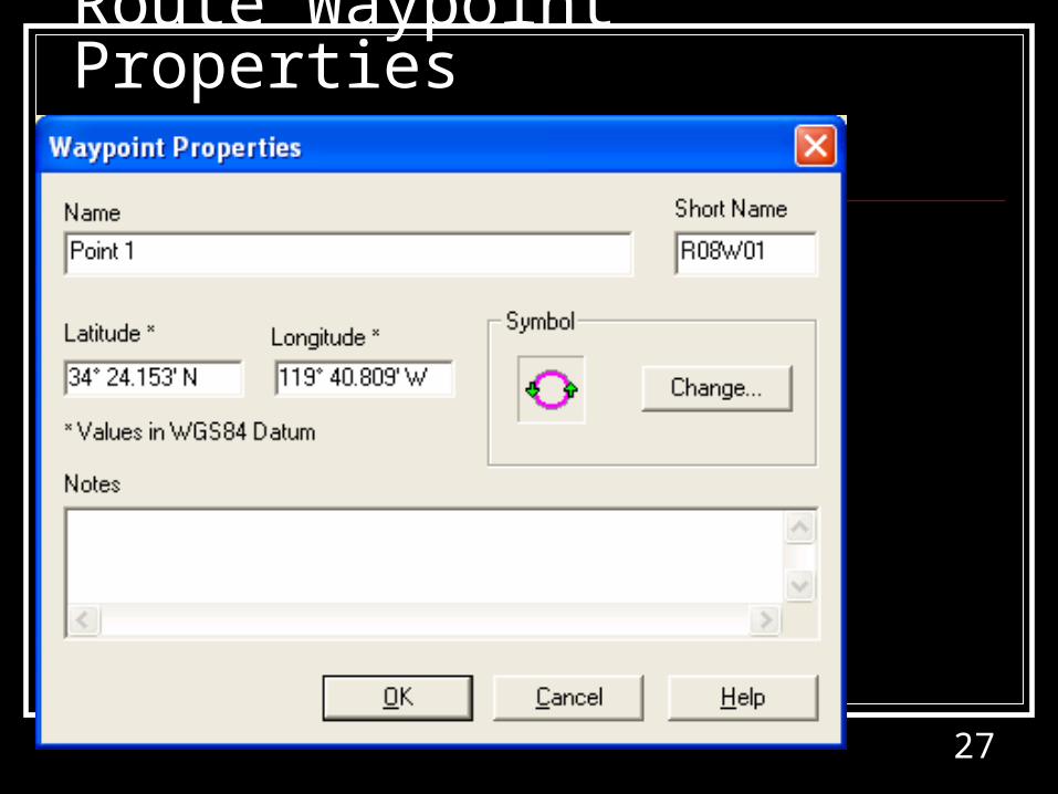
14
Using the Route Tool
15
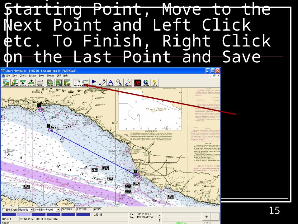
Creating a Route; Use Route Tool, Left Click on a Starting Point, Move to the Next Point and Left Click etc. To Finish, Right Click on the Last Point and Save
16
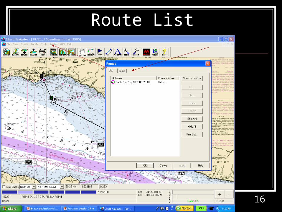
Route List
17
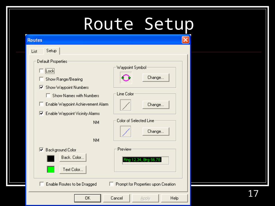
Route Setup
18
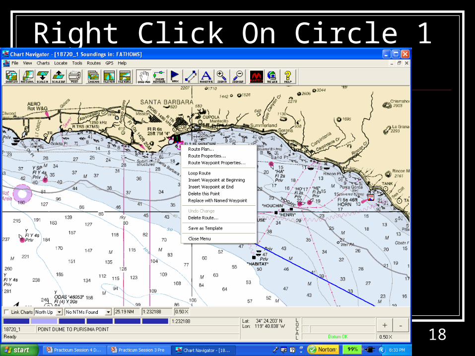
Right Click On Circle 1
19
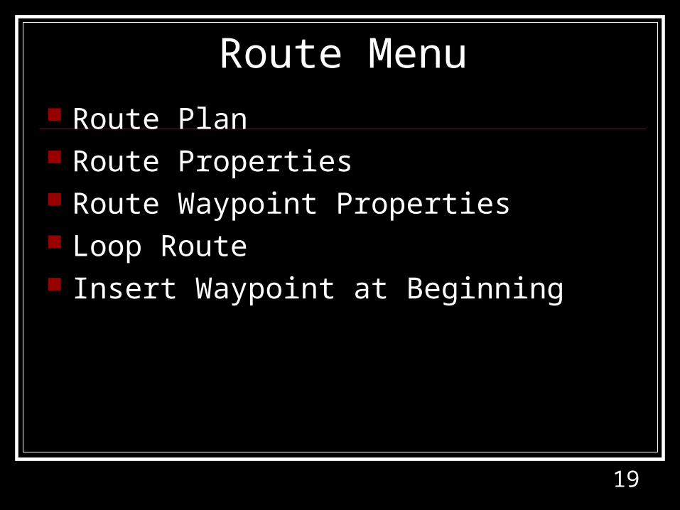
Route Menu Route Plan Route Properties Route Waypoint Properties Loop Route Insert Waypoint at Beginning
20
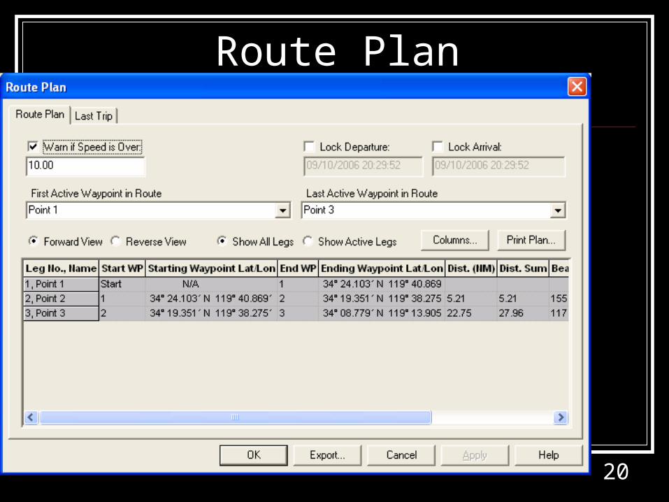
Route Plan
21
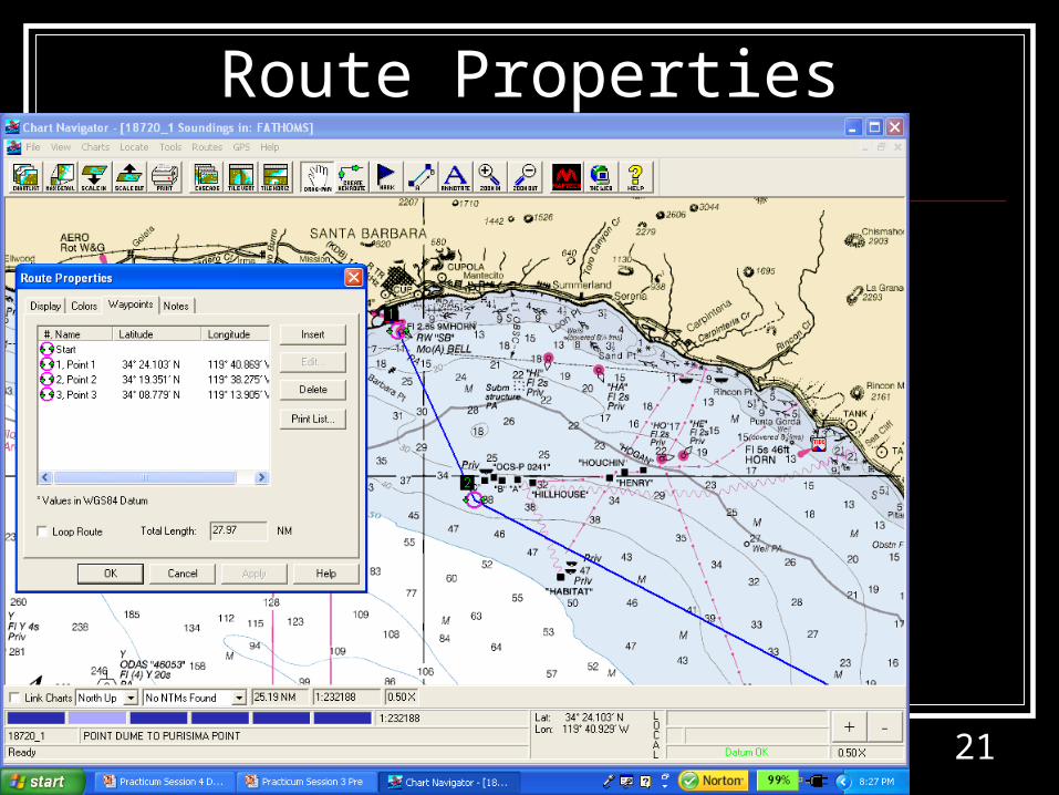
Route Properties
22
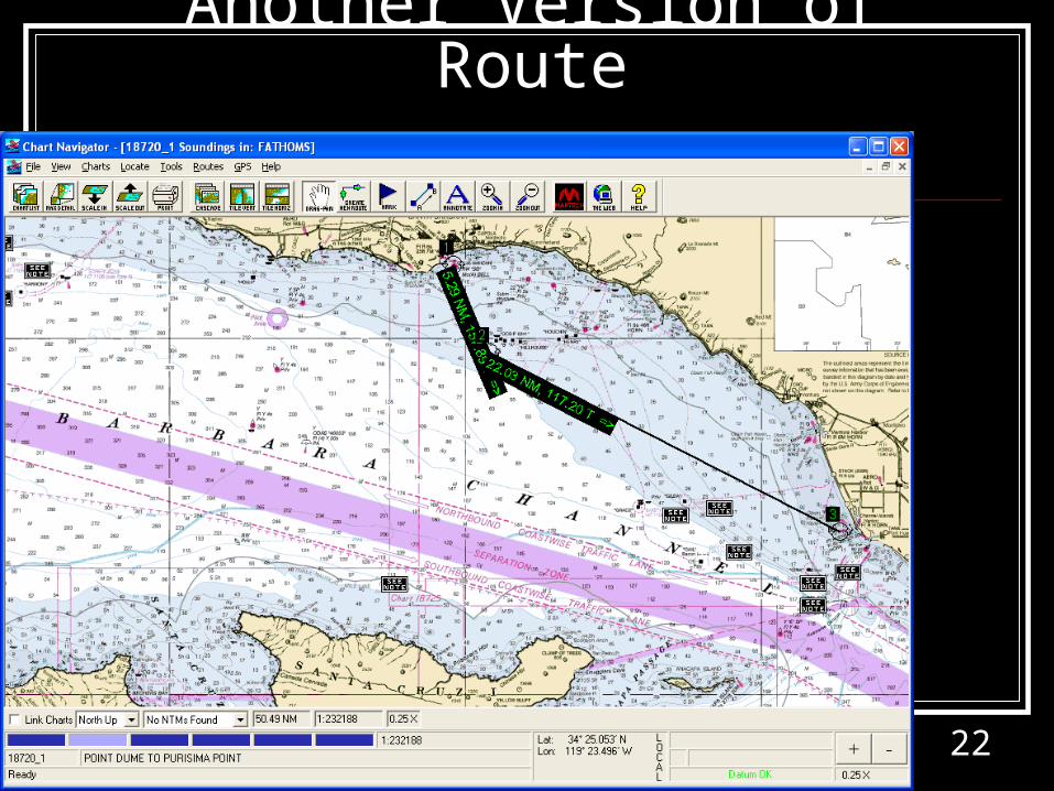
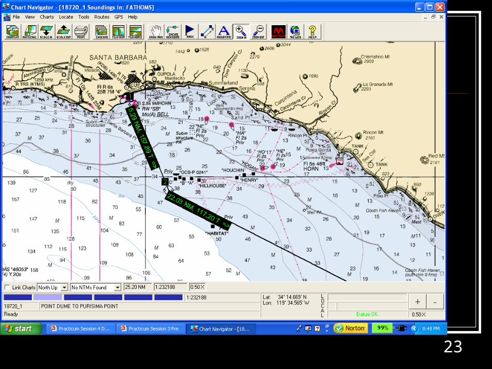
Another Version of Route
23
24
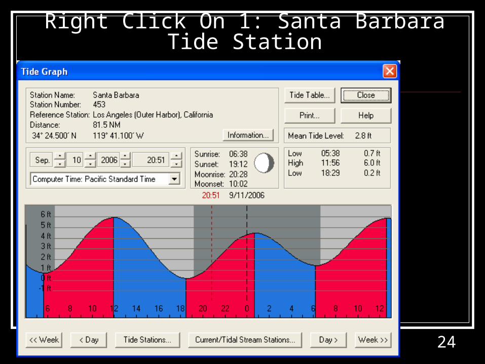
Right Click On 1: Santa Barbara Tide Station
25
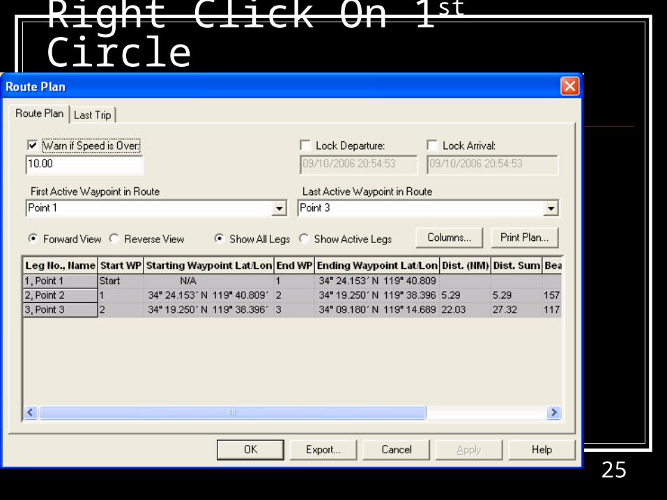
Right Click On 1st Circle
26
Right Half of Route Plan Box
27
Route Waypoint Properties