Embed Size (px)
Citation preview

1
Namaste!!!Namaste!!!Naba Raj Adhikari
NEPAL
2
HydroMeteorological Activities in Nepal
HydroMeteorological Activities in Nepal
Dept. of Hydrology Meteorology
NEPAL
3
0 200 400100 Kilometers
India
China
IranPakistan
Myanmar
Thailand
Afghanistan
Laos
Nepal
Cambodia
Bangladesh
Oman
Bhutan
Sri Lanka
Turkmenistan
Malaysia
¶0 130 26065 Kilometers
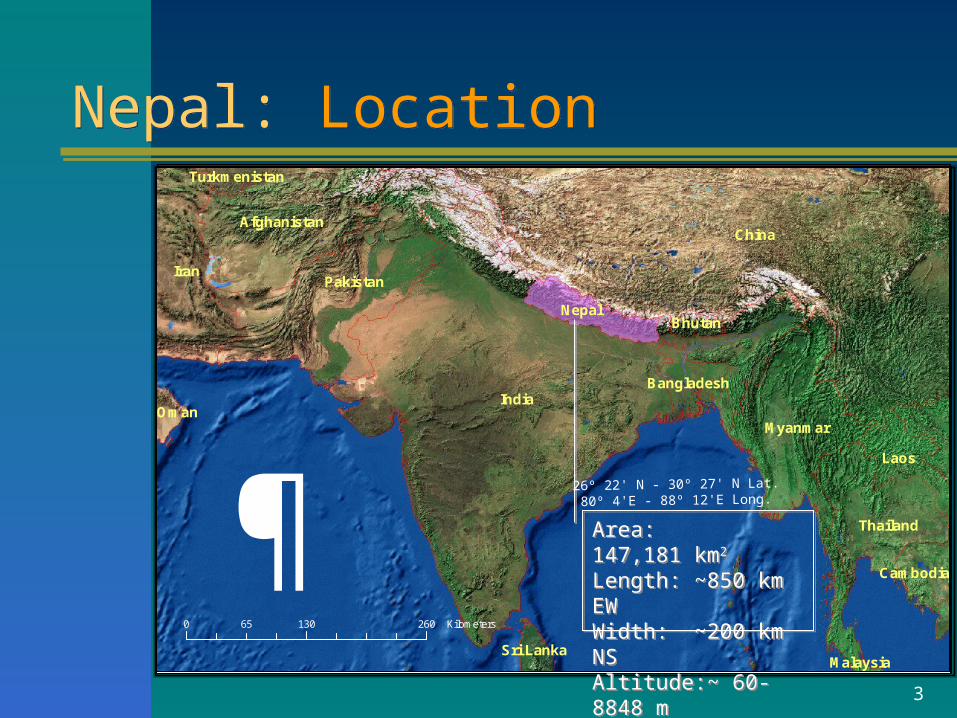
Nepal: LocationNepal: Location
Area: 147,181 km2 Length: ~850 km EWWidth: ~200 km NSAltitude:~ 60-8848 m
Area: 147,181 km2 Length: ~850 km EWWidth: ~200 km NSAltitude:~ 60-8848 m
26º 22' N - 30º 27' N Lat. 80º 4'E - 88º 12'E Long.
4
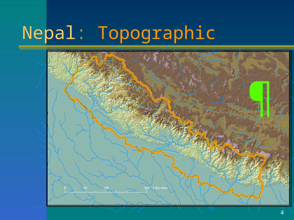
Nepal: TopographicNepal: TopographicTITLE HERE
0 190 38095 Kilometers
5
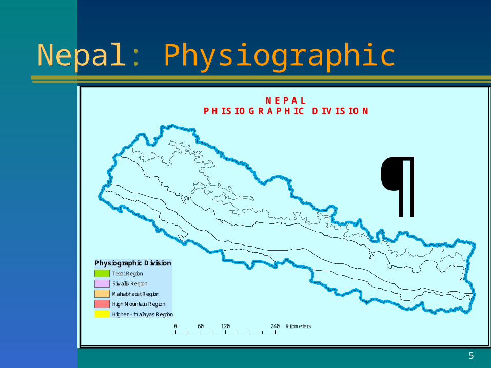
Nepal: PhysiographicNepal: Physiographic
¶Physiographic Division
Terai Region
Siwalik Region
Mahabharat Region
High Mountain Region
Higher Himalayas Region
0 120 24060 Kilometers
N E P A LN E P A LP H I S I O G R A P H I C D I V I S I O NP H I S I O G R A P H I C D I V I S I O N
6
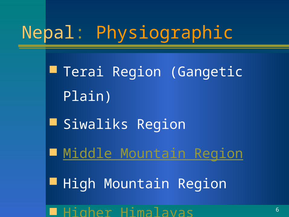
Nepal: PhysiographicNepal: Physiographic
Terai Region (Gangetic Plain)
Siwaliks Region
Middle Mountain Region
High Mountain Region
Higher Himalayas
7
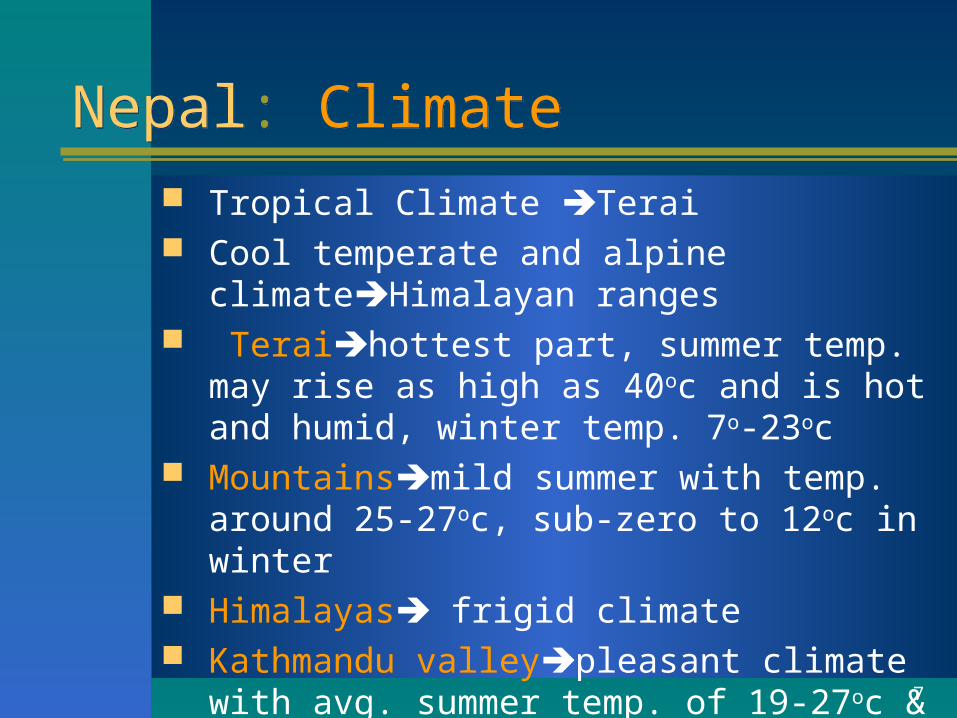
Nepal: ClimateNepal: Climate Tropical Climate Terai Cool temperate and alpine climateHimalayan
ranges Teraihottest part, summer temp. may rise as
high as 40oc and is hot and humid, winter temp. 7o-23oc
Mountainsmild summer with temp. around 25-27oc, sub-zero to 12oc in winter
Himalayas frigid climate Kathmandu valleypleasant climate with avg.
summer temp. of 19-27oc & 2-12oc winter temp.
8
Nepal: Climate (contd.)Nepal: Climate (contd.)
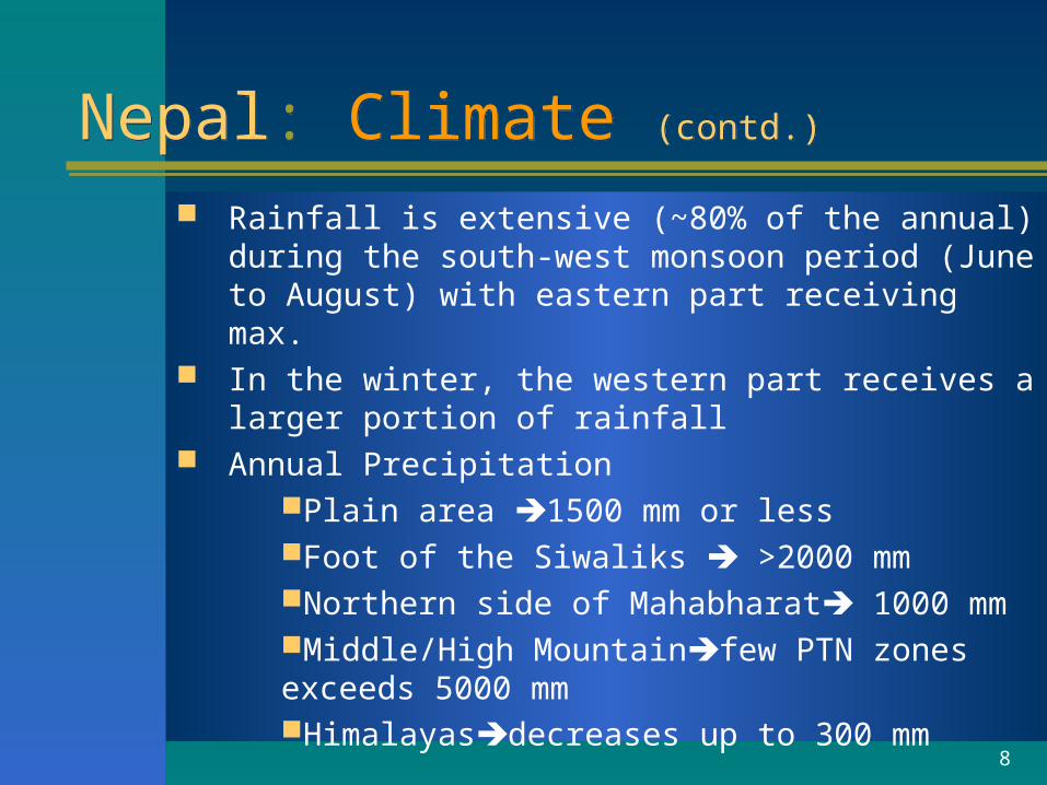
Rainfall is extensive (~80% of the annual) during the south-west monsoon period (June to August) with eastern part receiving max.
In the winter, the western part receives a larger portion of rainfall
Annual PrecipitationPlain area 1500 mm or lessFoot of the Siwaliks >2000 mmNorthern side of Mahabharat 1000 mmMiddle/High Mountainfew PTN zones exceeds 5000 mmHimalayasdecreases up to 300 mm
9
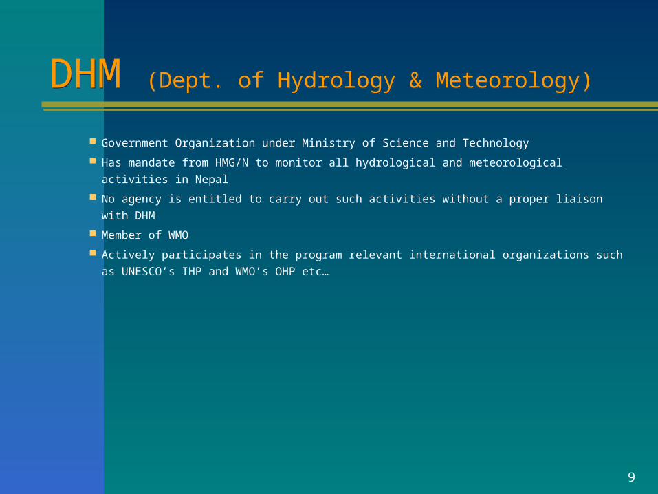
DHM (Dept. of Hydrology & Meteorology)DHM (Dept. of Hydrology & Meteorology)
Government Organization under Ministry of Science and Technology
Has mandate from HMG/N to monitor all hydrological and meteorological activities in Nepal
No agency is entitled to carry out such activities without a proper liaison with DHM
Member of WMO
Actively participates in the program relevant international organizations such as
UNESCO’s IHP and WMO’s OHP etc…
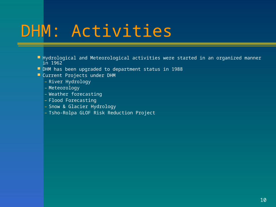
10
DHM: ActivitiesDHM: Activities Hydrological and Meteorological activities were started in an organized manner in 1962 DHM has been upgraded to department status in 1988 Current Projects under DHM
– River Hydrology– Meteorology– Weather forecasting– Flood Forecasting– Snow & Glacier Hydrology– Tsho-Rolpa GLOF Risk Reduction Project
11
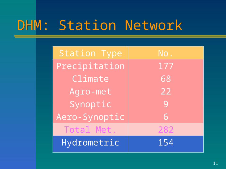
DHM: Station NetworkDHM: Station Network
Station Type No.
Precipitation
Climate
Agro-met
Synoptic
Aero-Synoptic
177
68
22
9
6
Total Met. 282
Hydrometric 154
12
!(!(
!(
!(
!(
!(
!(
!( !(
!(!(
!(!(
!(
!(
!(
!(
!(
!(
!(
!(!(
!(
!( !( !(
!(
!(!(
!(!( !(
!(
!(
!(
!( !(!(
!(!(!(
!(
!(!(
!(
!(
!(!(
!(
!(
!(
!(
!(
!(!(
!(
!( !(
!(
!(!(!(
!(
!(!(
!( !(
!(
!(!(
!(
!(
!(
!(
!(
!(
!(
!(
!(
!(!(
!(
!(
!(
!(
!(
!(
!(
!(!(
!(!(
!(!(
!(
!(!(
!( !(
!(
!(
!( !(!(
!(
!(
!(
!(
!(
!(
!(
!(!(
!(!(
!(!(
!(
!(
!(!(
!(
!(!(!(
!(
!(
!(
!(
!(
!(
!(
!(
!(
!(
!(!(
!(
!( !( !(!(
!(
!(
!( !(
!(!(
!(
!(
!(
!(
!(
!(
!( !(
!(
!(
!(
!(!( !(
!( !( !(!(
!(!(!(
!(
!(!(!(
!(
!(
!(!(!(
!(!(!( !( !(
!(
!(
!(!(
!( !(
!(!(
!( !(!(
!(
!(
!(!(!( !(
!(
!(!(
!(!(
!(
!(
!(
!(
!( !(!(
!(
!(
!(
!(
!(!(!(
!(
!(!(
!(
!(
!(!(
!(!(
!(
!(
!(
!(
!(
!(
!(!(
!( !(!(!(
!(
!(
!(
!(
!(
!(
!(
!(
!(
!(
!(
!(
!(!(
!(
!(
!(
!(!(
!(!(
!(!(
!(
!(
!(
!(
#*
#*
#*#*
#*#*#*#*
#*#*
#*
#*
#*#*#*
#*#*
#*
#*
#*
#*#*#*
#*
#*#*
#*
#*
#*#*
#* #*#*#*
#*
#*
#*#*
#*#*#*
#*
#*
#*#*#*#*
#*#*#*#*#*
#*#*
#*
#*#*
#*
#*#*
#*
#*#*#* #*
#* #*
#*
#*
#*
#*
#*#* #*
#*
#*#*
0 120 24060 Kilometers
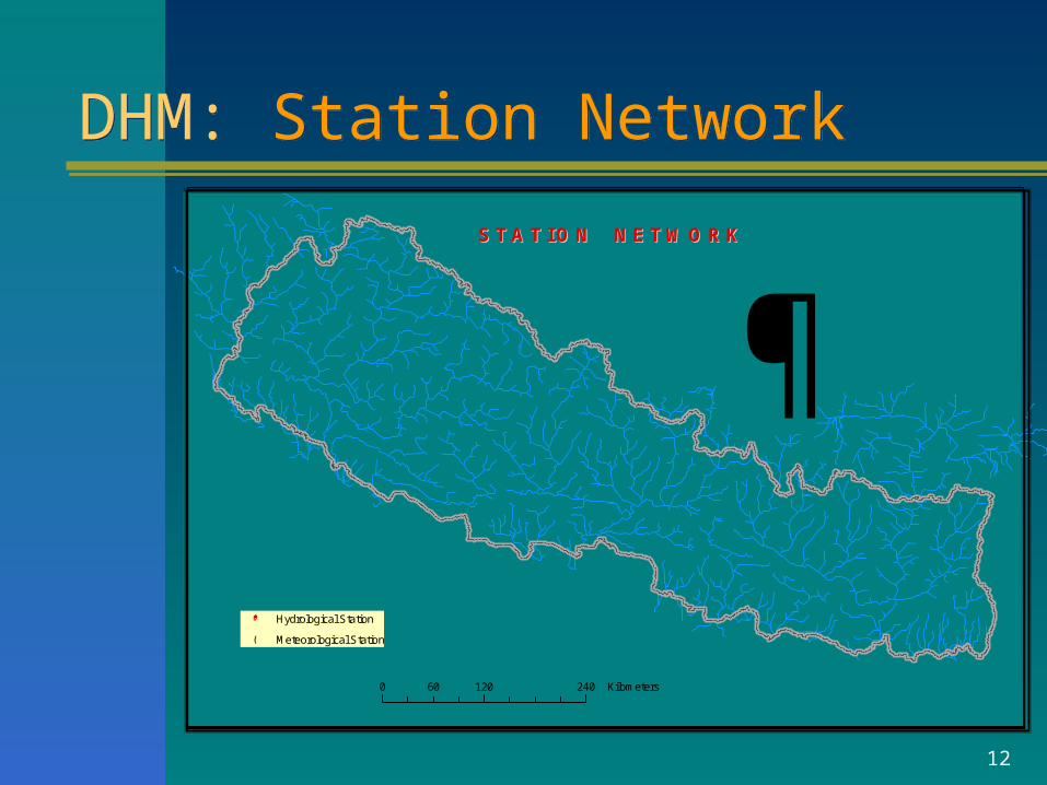
S T A T I O N N E T W O R KS T A T I O N N E T W O R K
#* Hydrological Station
!( Meteorological Station
DHM: Station NetworkDHM: Station Network
13
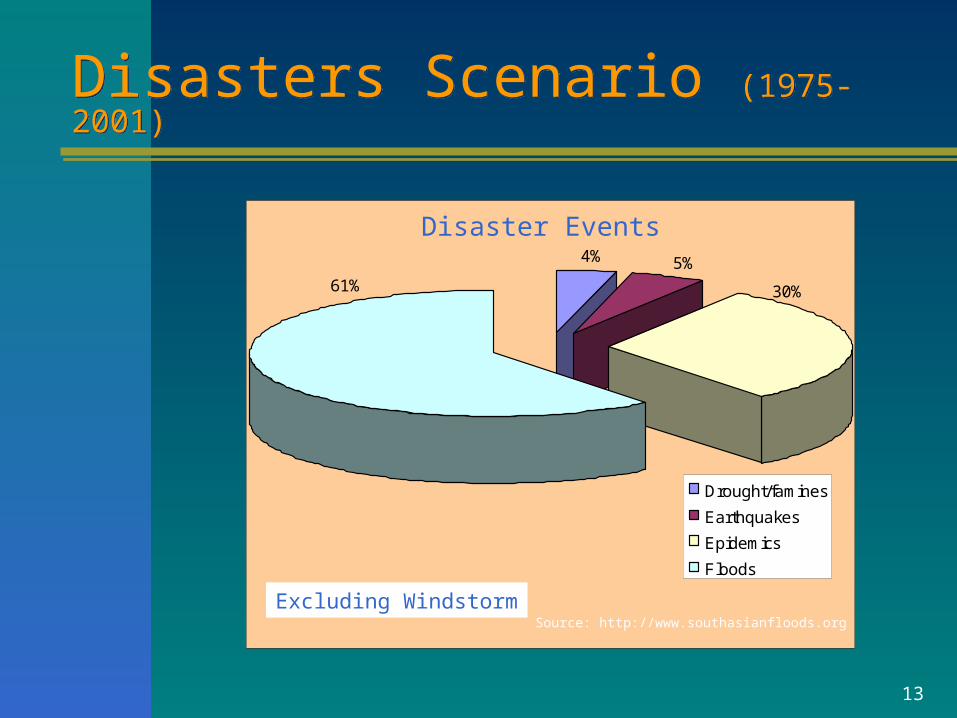
Disasters Scenario (1975-2001)Disasters Scenario (1975-2001)
4% 5%61% 30%
Drought/famines
Earthquakes
Epidemics
Floods
Source: http://www.southasianfloods.org
Disaster Events
Excluding Windstorm
14
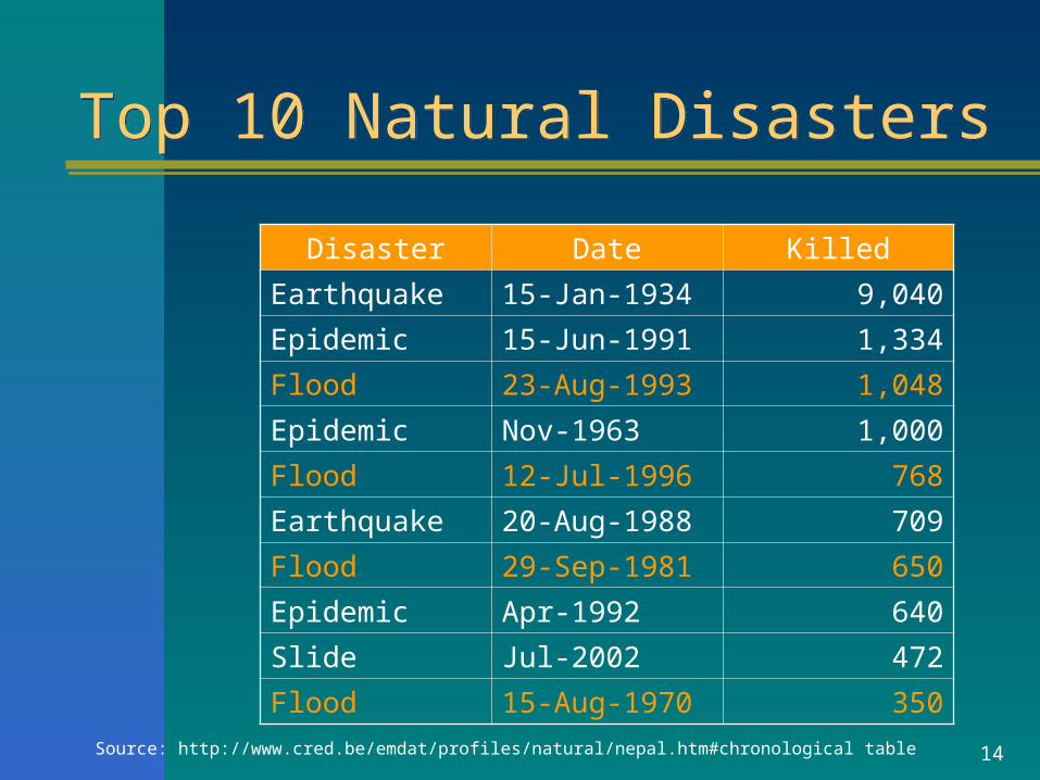
Top 10 Natural DisastersTop 10 Natural Disasters
Disaster Date Killed
Earthquake 15-Jan-1934 9,040Epidemic 15-Jun-1991 1,334Flood 23-Aug-1993 1,048Epidemic Nov-1963 1,000Flood 12-Jul-1996 768Earthquake 20-Aug-1988 709Flood 29-Sep-1981 650Epidemic Apr-1992 640Slide Jul-2002 472Flood 15-Aug-1970 350
Source: http://www.cred.be/emdat/profiles/natural/nepal.htm#chronological table
15
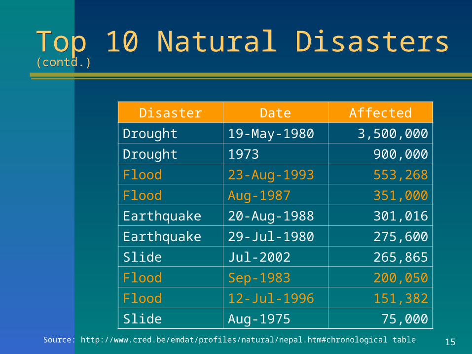
Top 10 Natural Disasters (contd.)Top 10 Natural Disasters (contd.)
Disaster Date Affected
Drought 19-May-1980 3,500,000Drought 1973 900,000Flood 23-Aug-1993 553,268Flood Aug-1987 351,000Earthquake 20-Aug-1988 301,016Earthquake 29-Jul-1980 275,600Slide Jul-2002 265,865Flood Sep-1983 200,050Flood 12-Jul-1996 151,382Slide Aug-1975 75,000
Source: http://www.cred.be/emdat/profiles/natural/nepal.htm#chronological table
16
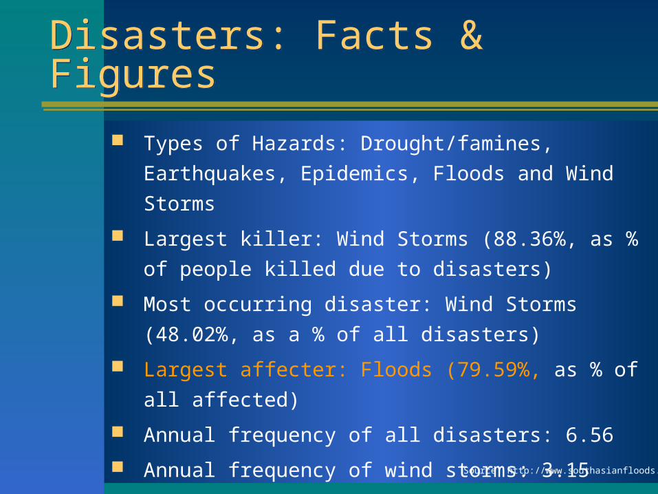
Disasters: Facts & FiguresDisasters: Facts & Figures
Types of Hazards: Drought/famines, Earthquakes,
Epidemics, Floods and Wind Storms
Largest killer: Wind Storms (88.36%, as % of
people killed due to disasters)
Most occurring disaster: Wind Storms (48.02%, as
a % of all disasters)
Largest affecter: Floods (79.59%, as % of all
affected)
Annual frequency of all disasters: 6.56
Annual frequency of wind storms: 3.15
Annual frequency of floods: 1.78 Source: http://www.southasianfloods.org
17
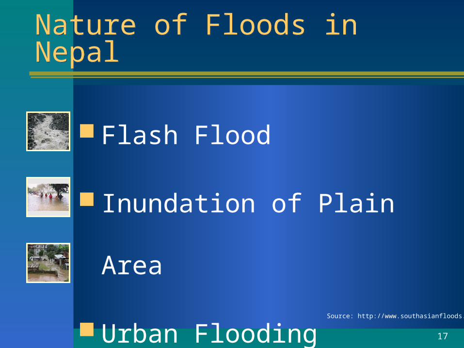
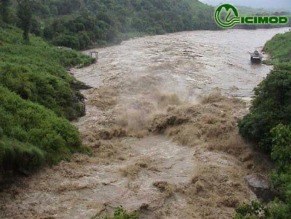
Nature of Floods in NepalNature of Floods in Nepal
Flash Flood
Inundation of Plain Area
Urban Flooding
Source: http://www.southasianfloods.org
18
DHM towards Flood ForecastingDHM towards Flood Forecasting
Wireless Data Transmission
Data Sharing with neighboring countries-India &
Bangladesh
Tsho Rolpa Risk Reduction and Early Warning
System
Initiated to calibrate easily available R-R models
HFAM
TOP, Tank, Xinanjinag, ANN, ADM etc.
Results are not encouraging for flood peaks
19
ProblemsProblems
No real time data transmission
system
Flood with landslides:
Difficult to predict landslide
Scouring and siltation of river beds:
difficult to operate automatic recorder
20
Flood Forecasting SystemFlood Forecasting System
Long way to go !!!

21
Thank You !!!Thank You !!!
Dhanyabad !!!

22
23
24
25
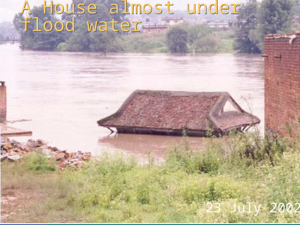
A House almost under flood waterA House almost under flood water
23 July 2002
26
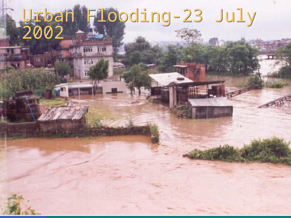
Urban Flooding-23 July 2002Urban Flooding-23 July 2002
27
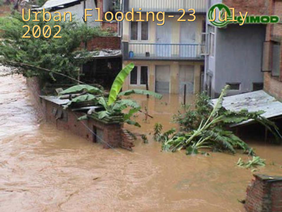
Urban Flooding-23 July 2002Urban Flooding-23 July 2002
28
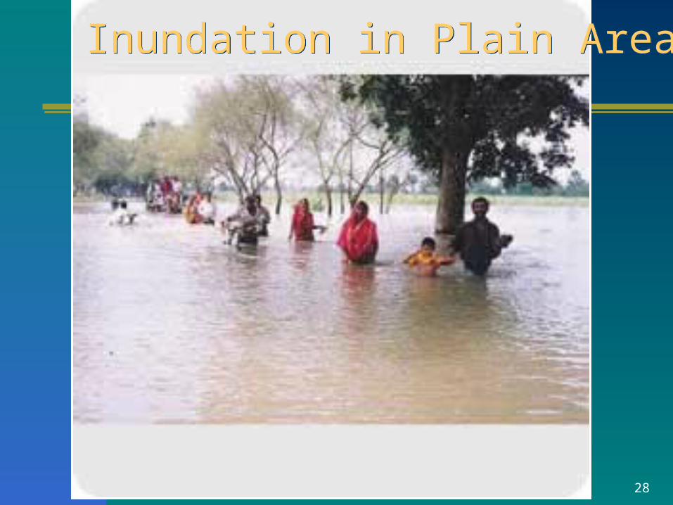
Inundation in Plain AreaInundation in Plain Area
29
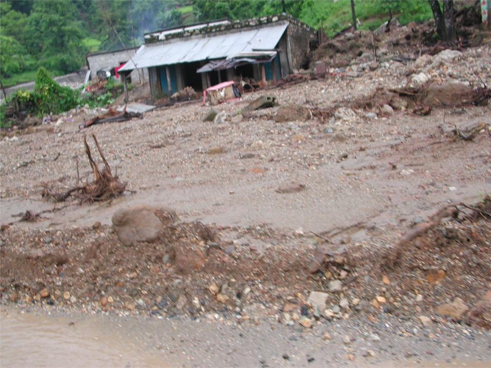
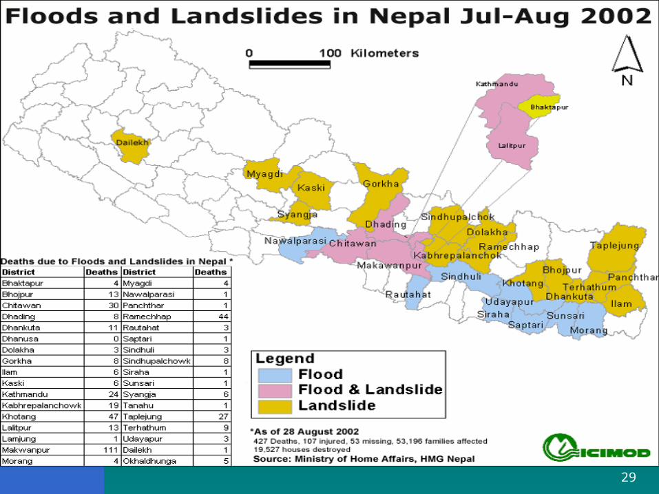
Floods & Landslides-2002Floods & Landslides-2002
30
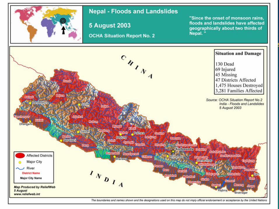
Floods & Landslides-2003Floods & Landslides-2003
31
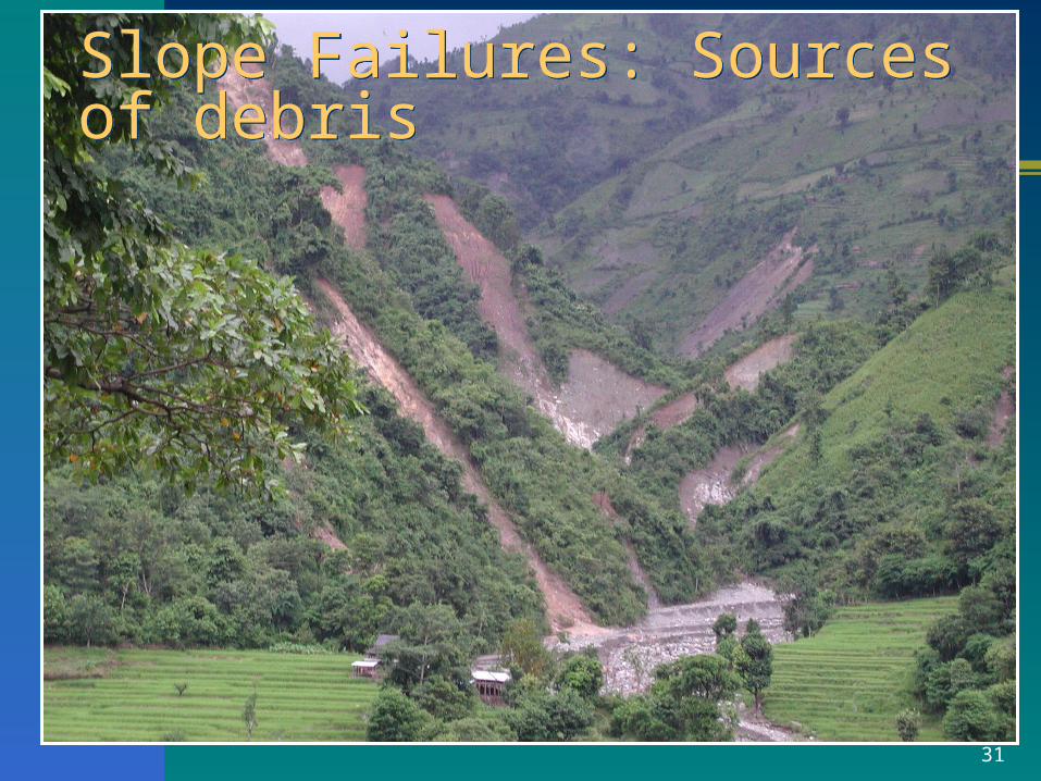
Slope Failures: Sources of debrisSlope Failures: Sources of debris
32
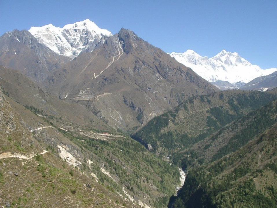
Landscape:High HimalayasLandscape:High Himalayas
33
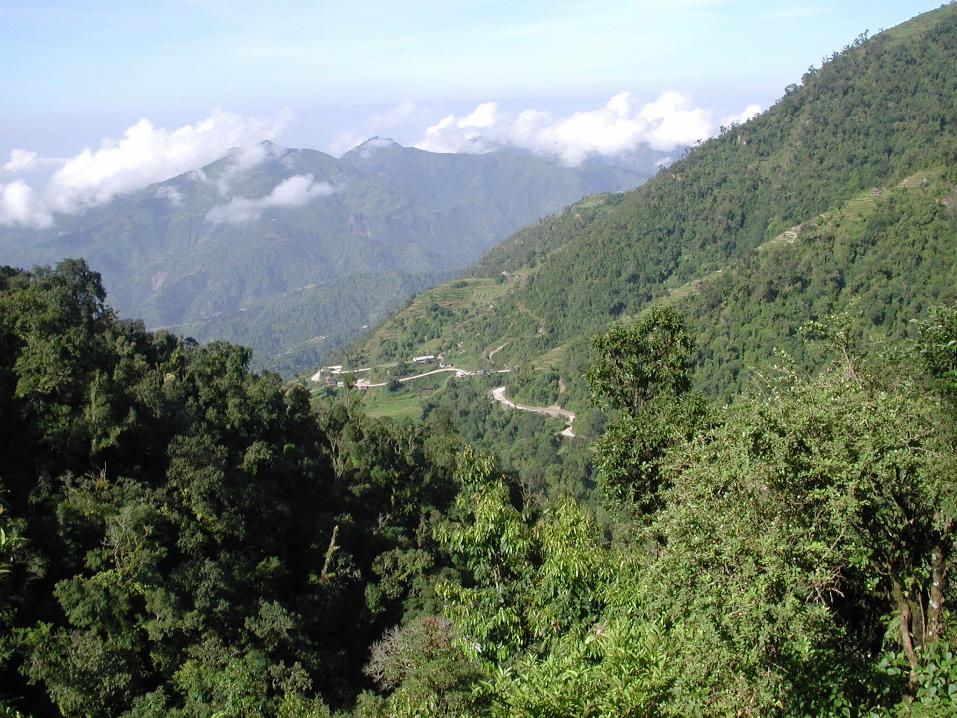
Landscape: High MountainsLandscape: High Mountains

34
35
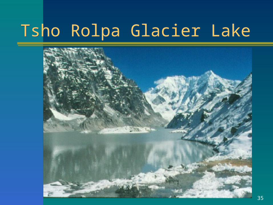
Tsho Rolpa Glacier LakeTsho Rolpa Glacier Lake

36
Tsho Rolpa Glacier LakeTsho Rolpa Glacier Lake
Length: 3.3 kmWidth: 0.5 kmMax. Depth: 122 mAvg. Depth: 55mArea: 1.65 sqkmDam Height: 150 mVolume: 90-100 million cum
37
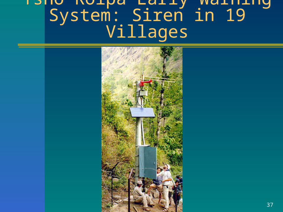
Tsho Rolpa Early Warning System: Siren in 19 VillagesTsho Rolpa Early Warning
System: Siren in 19 Villages
38
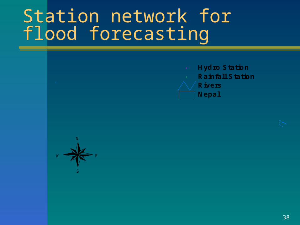
Station network for flood forecastingStation network for flood forecasting
#
#
#
##
#
#
# ##
#
# #
#
#
#
#
#
#
#
#
#
#
#
##
#
## #
#
#
#
#
#
##
#
#
#
NepalRivers
# Rainfall Station# Hydro Station
N
EW
S
![THE THIRTIETH PART JUZ’UN-NABA’ - Riad Nachefriadnachef.org/s/Juzu'n-Naba'_ArabicEnglishNew_Full[1].pdf · JUZ’UN-NABA’ Preface Praise and ... We present to you the 30th Juz’](https://img.pdfslide.us/doc/110x75/5a793d5e7f8b9ae93a8c2c9e/the-thirtieth-part-juzun-naba-riad-n-nabaarabicenglishnewfull1pdfjuzun-naba.jpg)


![Juzu'n-Naba' ArabicEnglishNew Full[1]](https://img.pdfslide.us/doc/110x75/54a0c7c9ac7959737b8b458d/juzun-naba-arabicenglishnew-full1.jpg)