Embed Size (px)
Citation preview
1
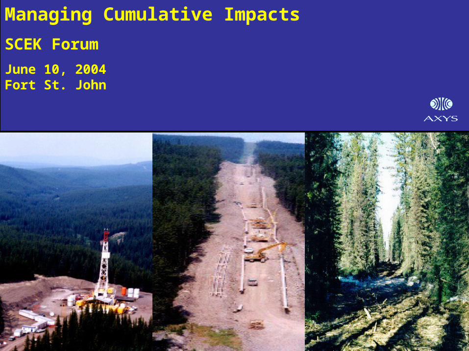
Managing Cumulative Impacts
SCEK Forum
June 10, 2004Fort St. John
2
Project Phases
Phase 1 (2002-03): Establish a Framework to Assess and Manage Cumulative Effects in Northeast BCIncluded:
– Dual Track Approach to Cumulative Impact Management (CIM)
– Identification of Potential Thresholds
– Regional Assessment, Hotspot Mapping, Effects Management Options
– Development of CIM Screener (CIMS) Concept
Phase 2 (2004): Implementation of CIMS
3
Background
• What are cumulative impacts?
– Occur when the impacts of two or more actions overlap
• What’s happening in NE BC?
– High concentration of resource-based industries
– Relatively rapid growth and expansion
– High non-industry values (e.g., wilderness, traditional use)
• Why did this study come about?
– Concerns about proactively managing the impacts of multiple land uses on a finite land base
4
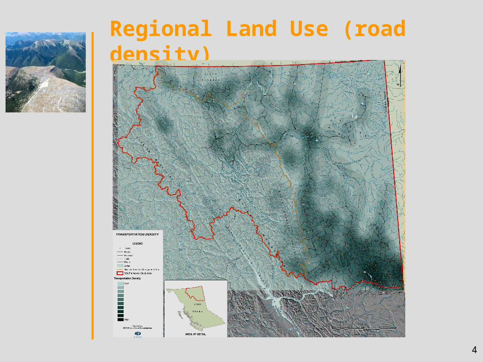
Regional Land Use (road density)
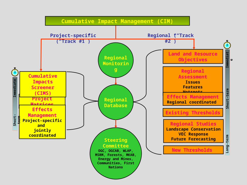
Project Matrices
Effects Management
Project-specific and jointly coordinated
Cumulative Impacts Screener
(CIMS)
Project-specific (“Track #1”) Regional (“Track #2”)
Imm
edia
te
Cumulative Impact Management (CIM)
Regional Database
Steering Committee
OGC, OGCAB, WLAP, MSRM, Forests, MKAB,
Energy and Mines, Communities, First
Nations
Regional AssessmentIssues
FeaturesHotspots
Effects Management Regional coordinated
Regional StudiesLandscape Conservation
VEC ResponseFuture Forecasting
Land and Resource
Objectives
New Thresholds
Imm
edia
teL
on
g-t
erm
Sh
ort
-ter
m
Sh
ort
-ter
m
Regional Monitoring
Existing Thresholds
6
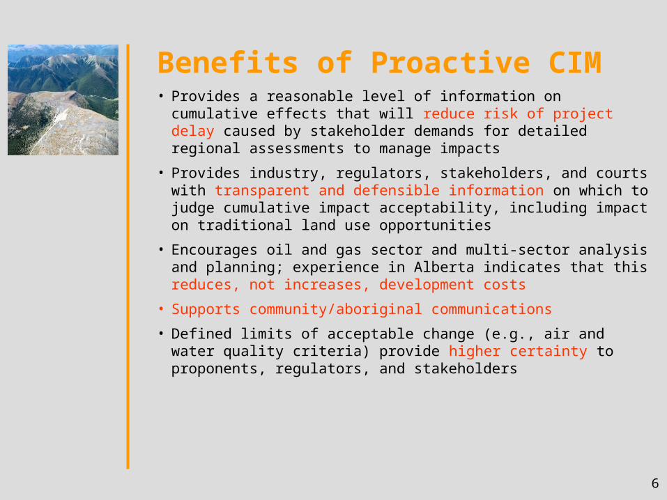
Benefits of Proactive CIM• Provides a reasonable level of information on cumulative effects
that will reduce risk of project delay caused by stakeholder demands for detailed regional assessments to manage impacts
• Provides industry, regulators, stakeholders, and courts with transparent and defensible information on which to judge cumulative impact acceptability, including impact on traditional land use opportunities
• Encourages oil and gas sector and multi-sector analysis and planning; experience in Alberta indicates that this reduces, not increases, development costs
• Supports community/aboriginal communications
• Defined limits of acceptable change (e.g., air and water quality criteria) provide higher certainty to proponents, regulators, and stakeholders
7
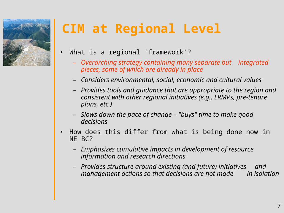
CIM at Regional Level
• What is a regional ‘framework’?
– Overarching strategy containing many separate but integrated pieces, some of which are already in place
– Considers environmental, social, economic and cultural values
– Provides tools and guidance that are appropriate to the region and consistent with other regional initiatives (e.g., LRMPs, pre-tenure plans, etc.)
– Slows down the pace of change – "buys" time to make good decisions
• How does this differ from what is being done now in NE BC?
– Emphasizes cumulative impacts in development of resource information and research directions
– Provides structure around existing (and future) initiatives and management actions so that decisions are not made in isolation
8
CIM at Regional Level (cont'd)
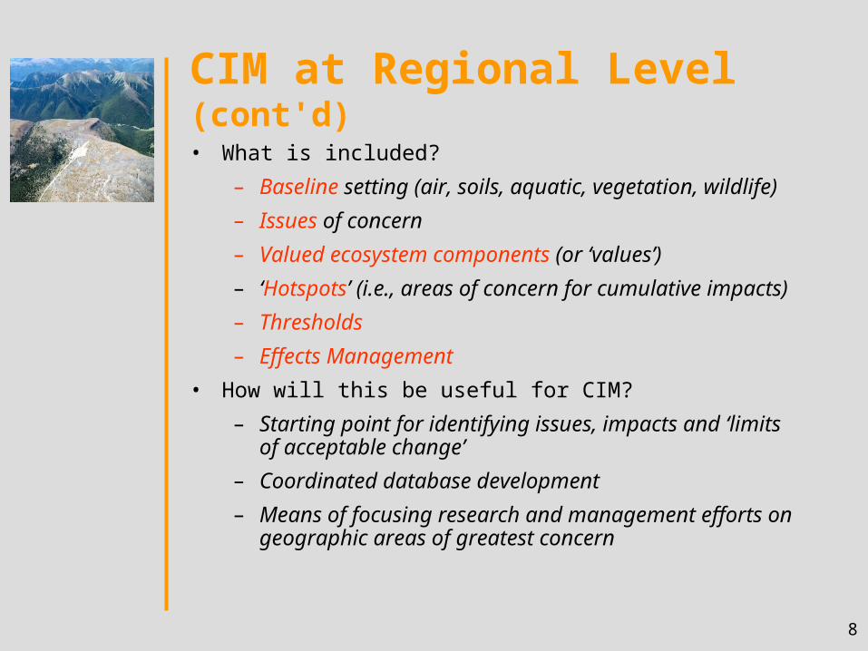
• What is included?
– Baseline setting (air, soils, aquatic, vegetation, wildlife)
– Issues of concern
– Valued ecosystem components (or ‘values’)
– ‘Hotspots’ (i.e., areas of concern for cumulative impacts)
– Thresholds
– Effects Management
• How will this be useful for CIM?
– Starting point for identifying issues, impacts and ‘limits of acceptable change’
– Coordinated database development
– Means of focusing research and management efforts on geographic areas of greatest concern
9
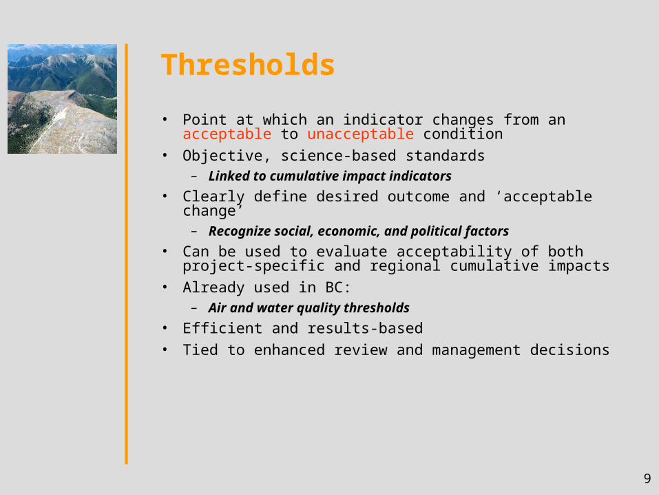
Thresholds
• Point at which an indicator changes from an acceptable to unacceptable condition
• Objective, science-based standards – Linked to cumulative impact indicators
• Clearly define desired outcome and ‘acceptable change’– Recognize social, economic, and political factors
• Can be used to evaluate acceptability of both project-specific and regional cumulative impacts
• Already used in BC: – Air and water quality thresholds
• Efficient and results-based
• Tied to enhanced review and management decisions
10
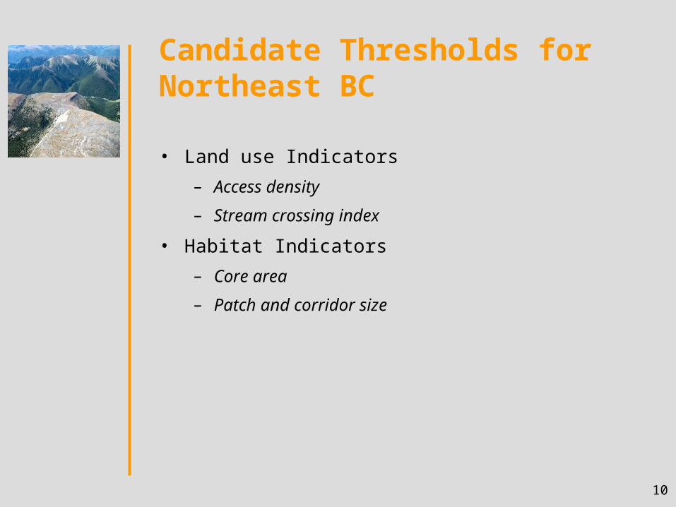
Candidate Thresholds for Northeast BC
• Land use Indicators
– Access density
– Stream crossing index
• Habitat Indicators
– Core area
– Patch and corridor size
11
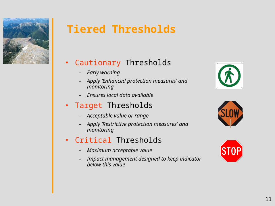
Tiered Thresholds
• Cautionary Thresholds
– Early warning
– Apply ‘Enhanced protection measures’ and monitoring
– Ensures local data available
• Target Thresholds– Acceptable value or range
– Apply ‘Restrictive protection measures’ and monitoring
• Critical Thresholds– Maximum acceptable value
– Impact management designed to keep indicator below this value
12
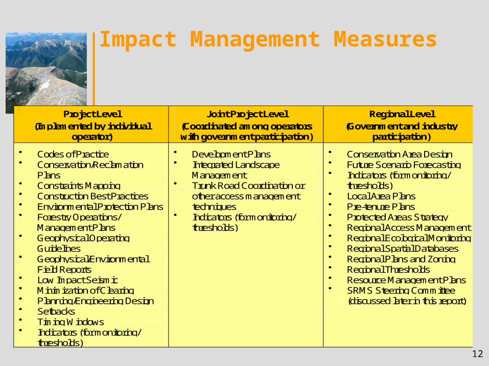
Impact Management Measures
Project Level (Implemented by individual
operator)
Joint Project Level (Coordinated among operators with government participation)
Regional Level (Government and industry
participation)
Codes of Practice Conservation/Reclamation
Plans Constraints Mapping Construction Best Practices Environmental Protection Plans Forestry Operations/
Management Plans Geophysical Operating
Guidelines Geophysical/Environmental
Field Reports Low Impact Seismic Minimization of Clearing Planning/Engineering Design Setbacks Timing Windows Indicators (for monitoring/
thresholds)
Development Plans Integrated Landscape
Management Trunk Road Coordination or
other access management techniques
Indicators (for monitoring/ thresholds)
Conservation Area Design Future Scenario Forecasting Indicators (for monitoring/
thresholds) Local Area Plans Pre-tenure Plans Protected Areas Strategy Regional Access Management Regional Ecological Monitoring Regional Spatial Databases Regional Plans and Zoning Regional Thresholds Resource Management Plans SRMS Steering Committee
(discussed later in this report)
13
CIM at Project Level
• How does looking at one application help manage regional cumulative impacts?
– Checking and tracking applications as they arise
– Slowing down the pace of change
• What are the challenges to implementing CIM at this level
– High volume of applications
– OGC commitment to relatively quick reviews
– Present lack of thresholds as basis for measuring change
• What is a Project Screener?
– Tool to check for cumulative impacts at application stage
– Checklist based
– Adaptable for use with thresholds, but useable in interim
14
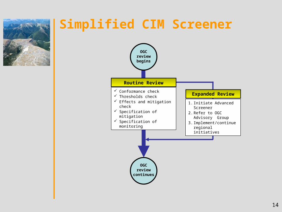
Simplified CIM Screener
Routine Review
OGC review begins
OGC review continues
Expanded Review Conformance check Thresholds check Effects and mitigation check Specification of mitigation Specification of monitoring
1. Initiate Advanced Screener
2. Refer to OGC Advisory Group
3. Implement/continue regional initiatives
15
• Implement CIMS as a dual track approach• Form a central CIMS Steering Committee• Refine and implement thresholds• Implement CIM Screener for addressing cumulative
impacts at the project review stage by OGC• Maintain a regional database• Implement various levels of impact management
measures – locally and regionally• Encourage applied research, especially that which will
advance the development and implementation of thresholds
• Implement monitoring in an adaptive management fashion
Phase 1 Recommendations
16
Phase 2: CIM Screener (CIMS) Implementation• Make explicit and enhance what the OGC is already doing
to address cumulative effects
• Provide a defensible, consistent and documented (i.e., transparent) process to address cumulative effects
• Assist OGC Resource Officers in identifying situations that possibly may be of concern
• Provide a meaningful response to cumulative effects by optimizing selection and reasonable application of effects management options
• Pilot test summer '04; full implementation anticipated Fall '04
17
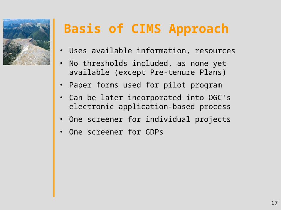
Basis of CIMS Approach
• Uses available information, resources
• No thresholds included, as none yet available (except Pre-tenure Plans)
• Paper forms used for pilot program
• Can be later incorporated into OGC's electronic application-based process
• One screener for individual projects
• One screener for GDPs
18
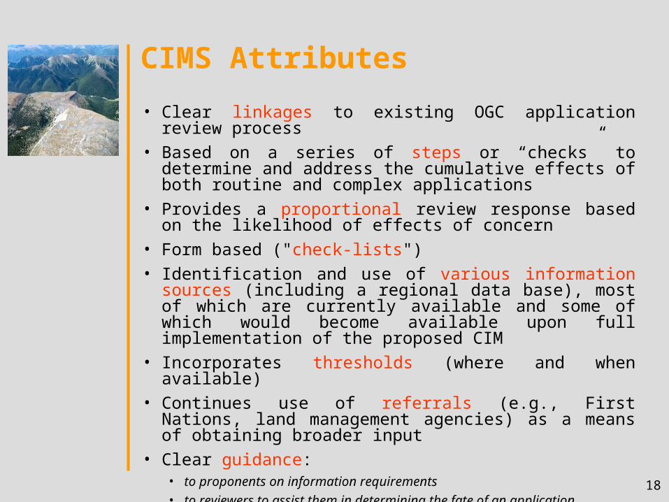
CIMS Attributes
• Clear linkages to existing OGC application review process
• Based on a series of steps or “checks” to determine and address the cumulative effects of both routine and complex applications
• Provides a proportional review response based on the likelihood of effects of concern
• Form based ("check-lists")
• Identification and use of various information sources (including a regional data base), most of which are currently available and some of which would become available upon full implementation of the proposed CIM
• Incorporates thresholds (where and when available)
• Continues use of referrals (e.g., First Nations, land management agencies) as a means of obtaining broader input
• Clear guidance:• to proponents on information requirements
• to reviewers to assist them in determining the fate of an application
19