Embed Size (px)
Citation preview
1
1. Click the black box labeled
App State to return to
your previous map zoom
area
Utilize the tabs to navigate to area of interest
2
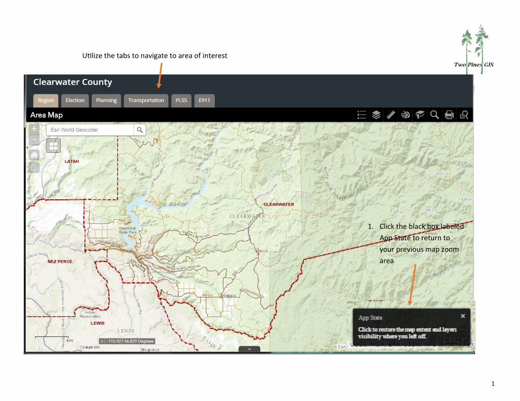
Legend
Layer List
Measure
Draw
Bookmark
Search
Query
Each map has a set of widgets. The widgets contain tools.
3
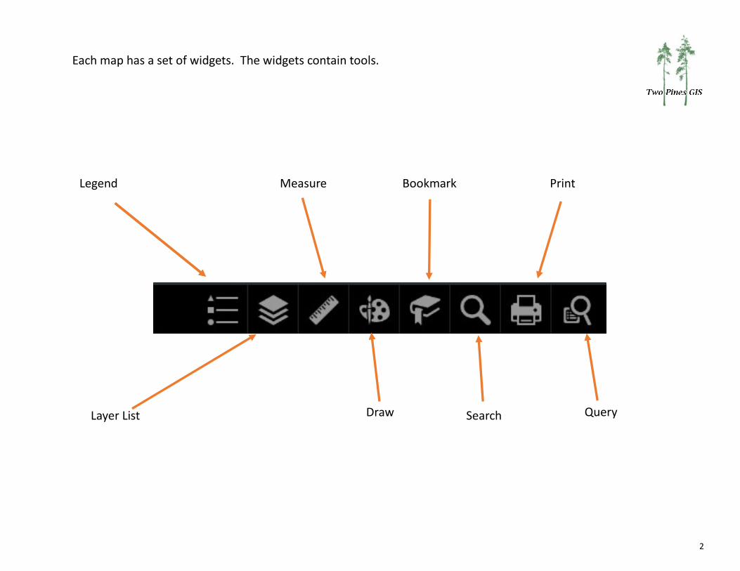
Basemap Gallery
To change the background map
1. Click basemap icon
2. Select basemap
4
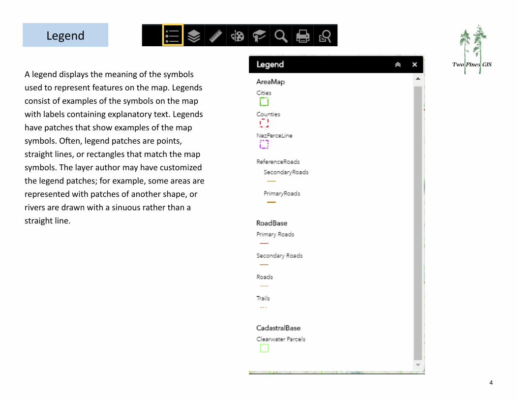
A legend displays the meaning of the symbols
used to represent features on the map. Legends
consist of examples of the symbols on the map
with labels containing explanatory text. Legends
have patches that show examples of the map
symbols. Often, legend patches are points,
straight lines, or rectangles that match the map
symbols. The layer author may have customized
the legend patches; for example, some areas are
represented with patches of another shape, or
rivers are drawn with a sinuous rather than a
straight line.
Legend
5
1
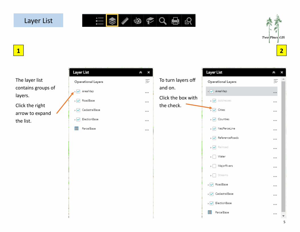
Layer List
2
The layer list
contains groups of
layers.
Click the right
arrow to expand
the list.
To turn layers off
and on.
Click the box with
the check.
6
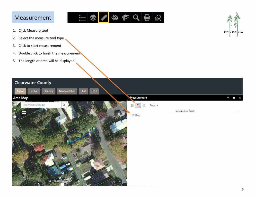
Measurement
1. Click Measure tool
2. Select the measure tool type
3. Click to start measurement
4. Double click to finish the measurement
5. The length or area will be displayed
7
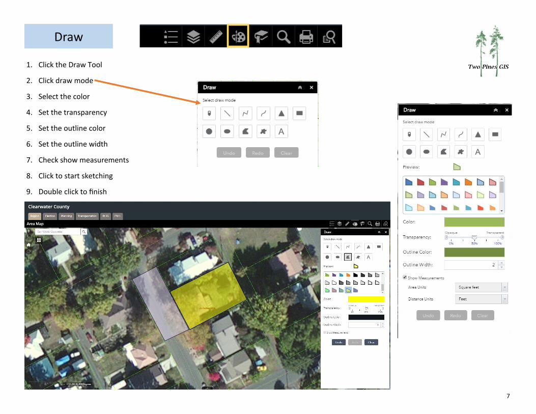
Draw
1. Click the Draw Tool
2. Click draw mode
3. Select the color
4. Set the transparency
5. Set the outline color
6. Set the outline width
7. Check show measurements
8. Click to start sketching
9. Double click to finish
8
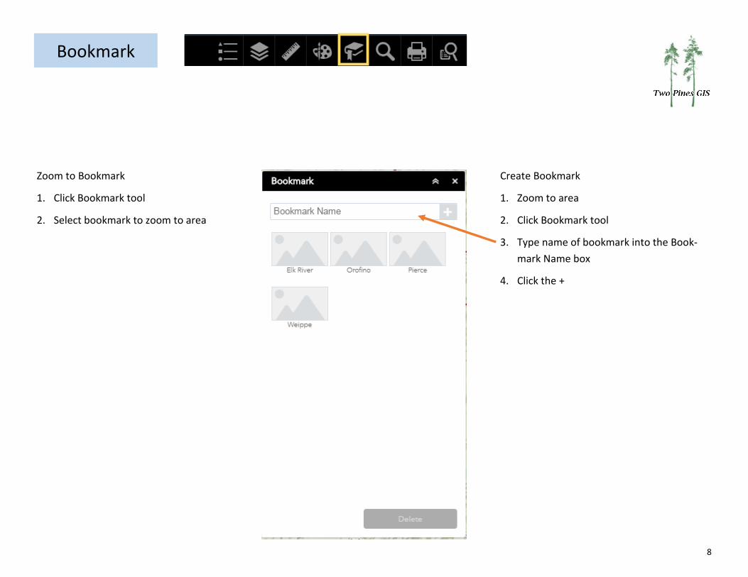
Bookmark
Zoom to Bookmark
1. Click Bookmark tool
2. Select bookmark to zoom to area
Create Bookmark
1. Zoom to area
2. Click Bookmark tool
3. Type name of bookmark into the Book-
mark Name box
4. Click the +
9
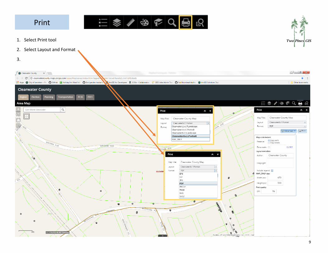
1. Select Print tool
2. Select Layout and Format
3.
10
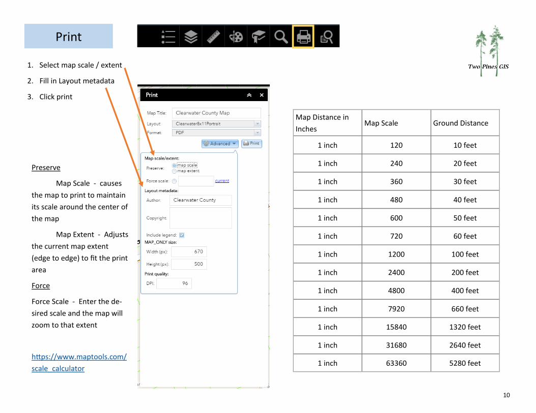
1. Select map scale / extent
2. Fill in Layout metadata
3. Click print
Preserve
Map Scale - causes
the map to print to maintain
its scale around the center of
the map
Map Extent - Adjusts
the current map extent
(edge to edge) to fit the print
area
Force
Force Scale - Enter the de-
sired scale and the map will
zoom to that extent
https://www.maptools.com/
scale_calculator
Map Distance in
Inches Map Scale Ground Distance
1 inch 120 10 feet
1 inch 240 20 feet
1 inch 360 30 feet
1 inch 480 40 feet
1 inch 600 50 feet
1 inch 720 60 feet
1 inch 1200 100 feet
1 inch 2400 200 feet
1 inch 4800 400 feet
1 inch 7920 660 feet
1 inch 15840 1320 feet
1 inch 31680 2640 feet
1 inch 63360 5280 feet