Embed Size (px)
Citation preview
Tectonic Landforms and Hazards
1. Introduction
2. Folding and faulting
3. Reverse faults
4. Normal faults
5. Transform (strike-slip) faults
6. Tectonic hazards
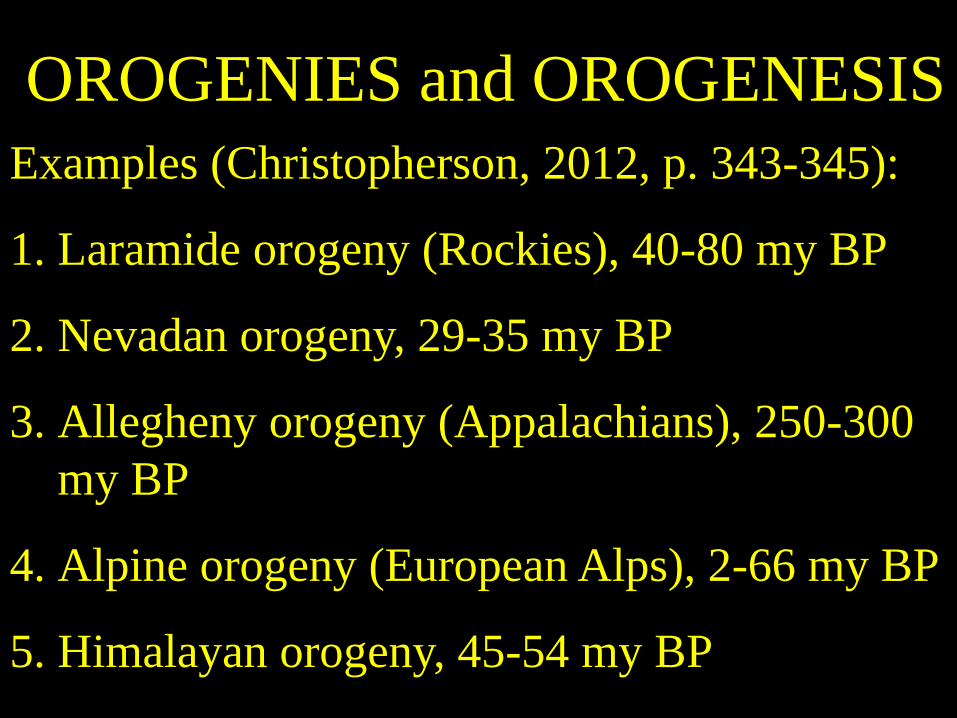
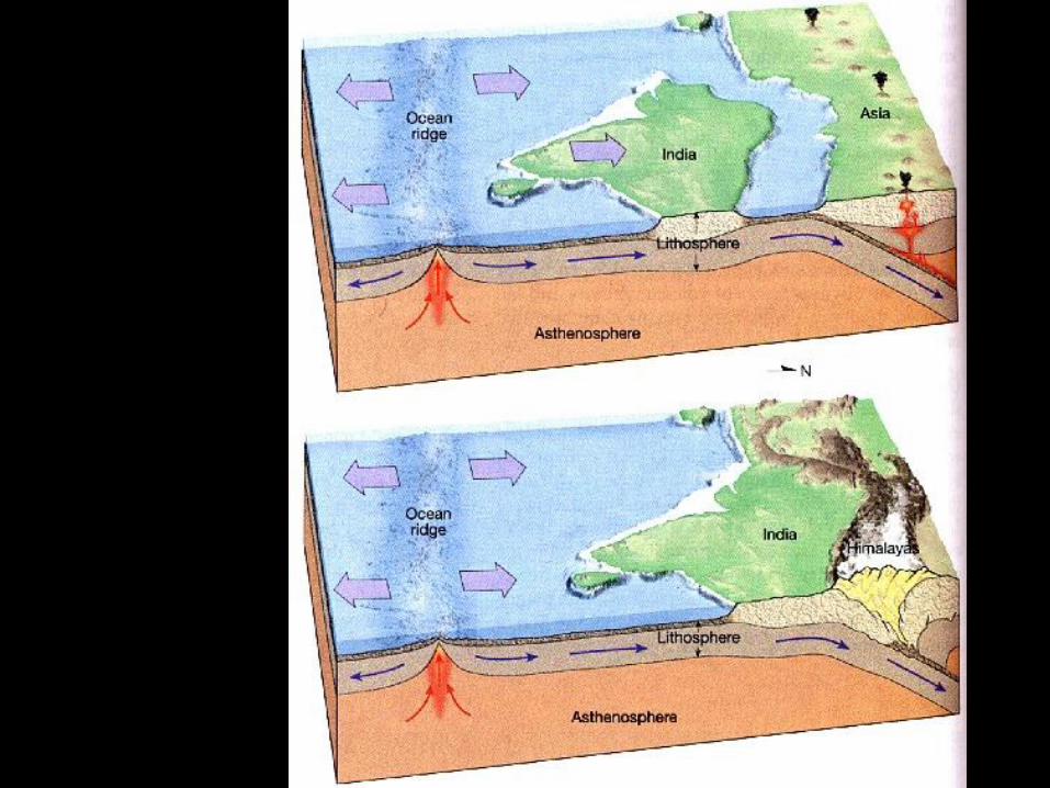
OROGENIES and OROGENESIS
Examples (Christopherson, 2012, p. 343-345):
1. Laramide orogeny (Rockies), 40-80 my BP
2. Nevadan orogeny, 29-35 my BP
3. Allegheny orogeny (Appalachians), 250-300
my BP
4. Alpine orogeny (European Alps), 2-66 my BP
5. Himalayan orogeny, 45-54 my BP
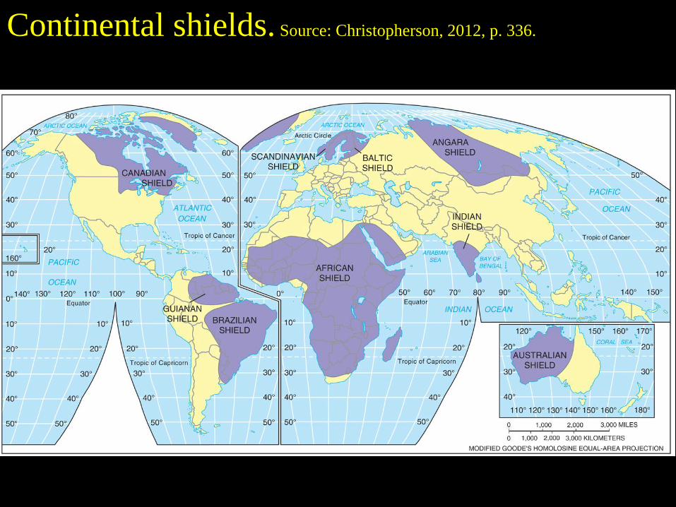
Continental shields. Source: Christopherson, 2012, p. 336.
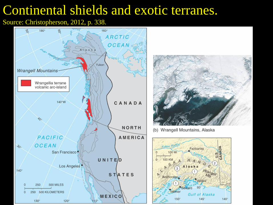
Continental shields and exotic terranes.
Source: Christopherson, 2012, p. 338.
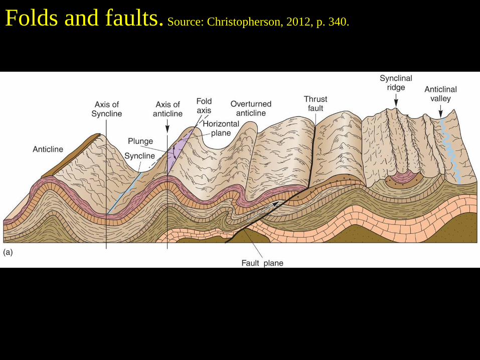
Folds and faults. Source: Christopherson, 2012, p. 340.
Compressional force
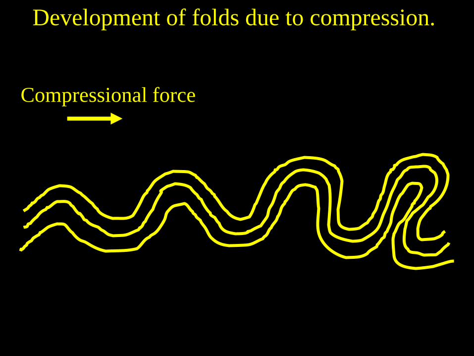
Development of folds due to compression.
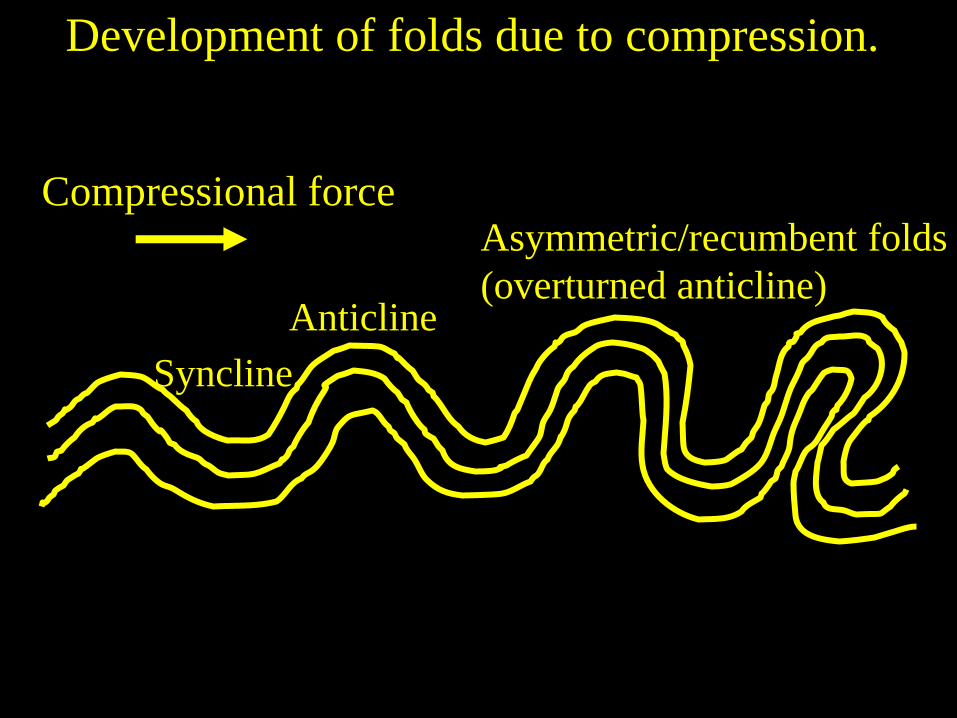
Compressional force
Anticline
Syncline
Asymmetric/recumbent folds
(overturned anticline)
Development of folds due to compression.
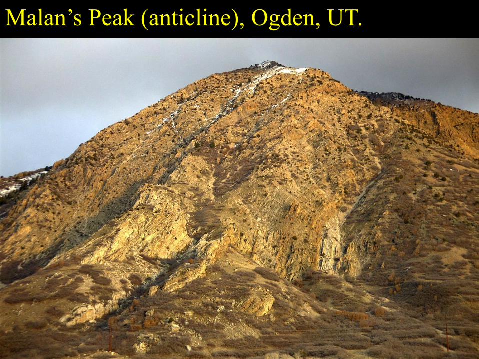
Malan’s Peak (anticline), Ogden, UT.
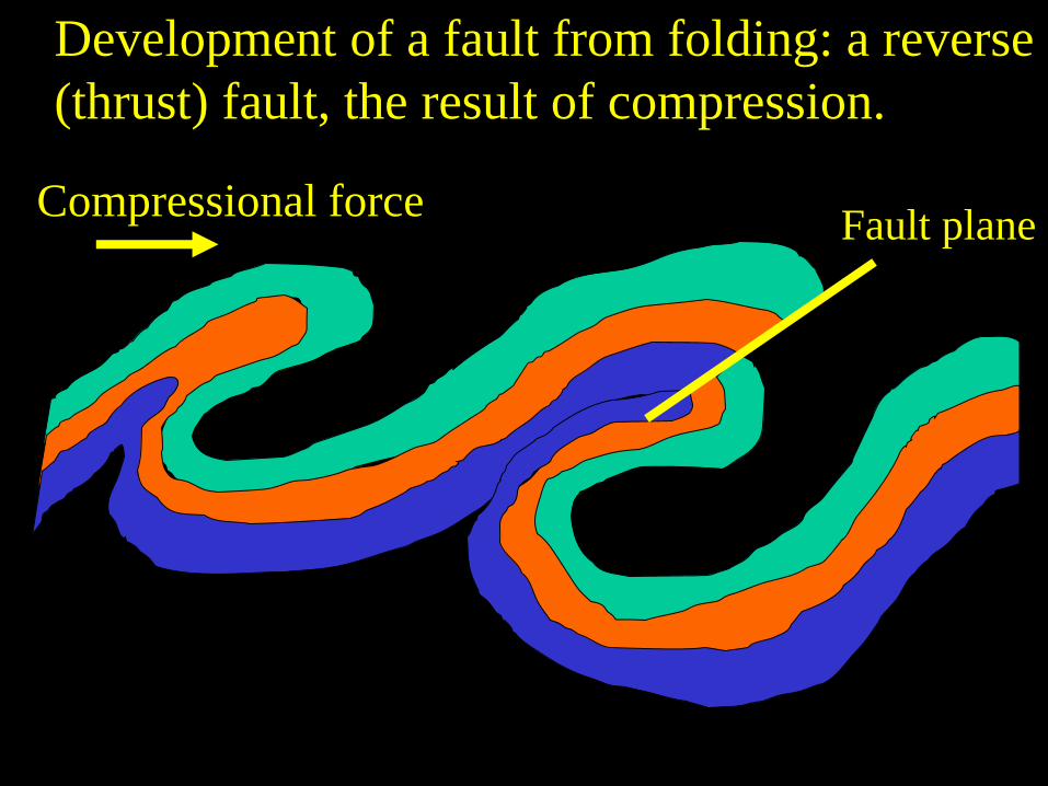
Compressional force Fault plane
Development of a fault from folding: a reverse
(thrust) fault, the result of compression.

Fault plane
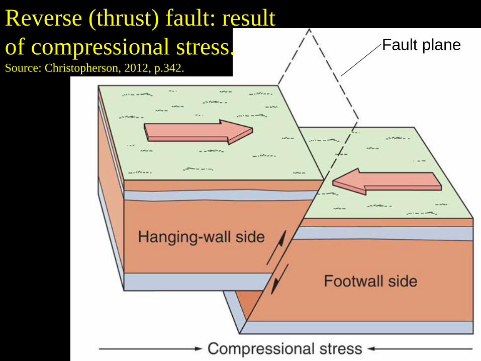
Reverse (thrust) fault: result
of compressional stress. Source: Christopherson, 2012, p.342.
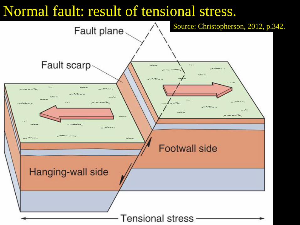
Normal fault: result of tensional stress. Source: Christopherson, 2012, p.342.

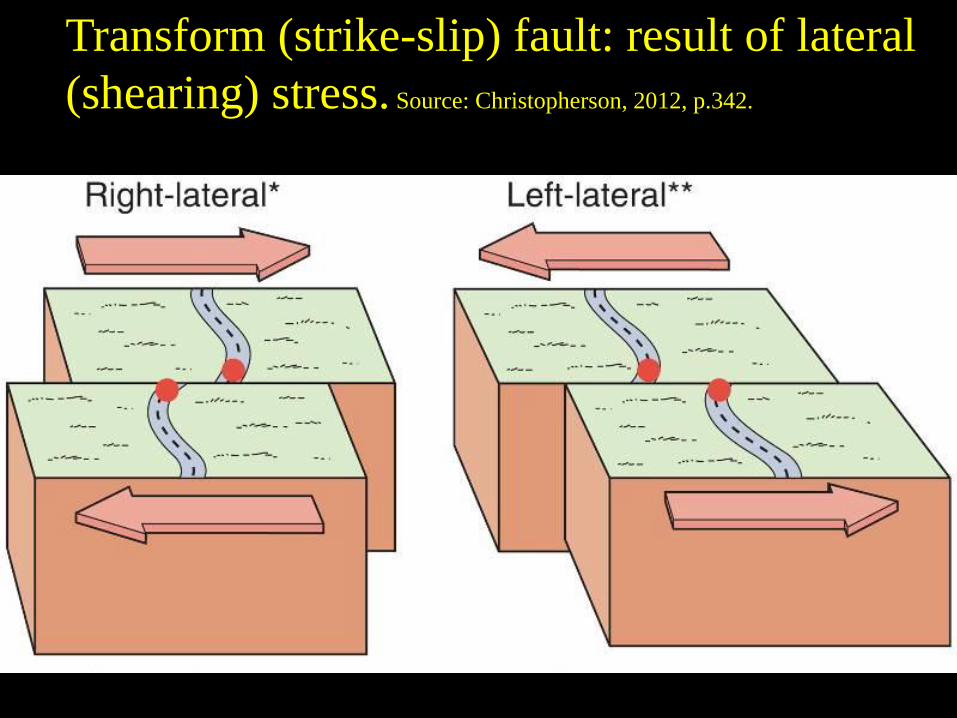
Transform (strike-slip) fault: result of lateral
(shearing) stress. Source: Christopherson, 2012, p.342.
Fault plane
Reverse (thrust) fault: result
of compressional stress. Source: Christopherson, 2012, p.342.
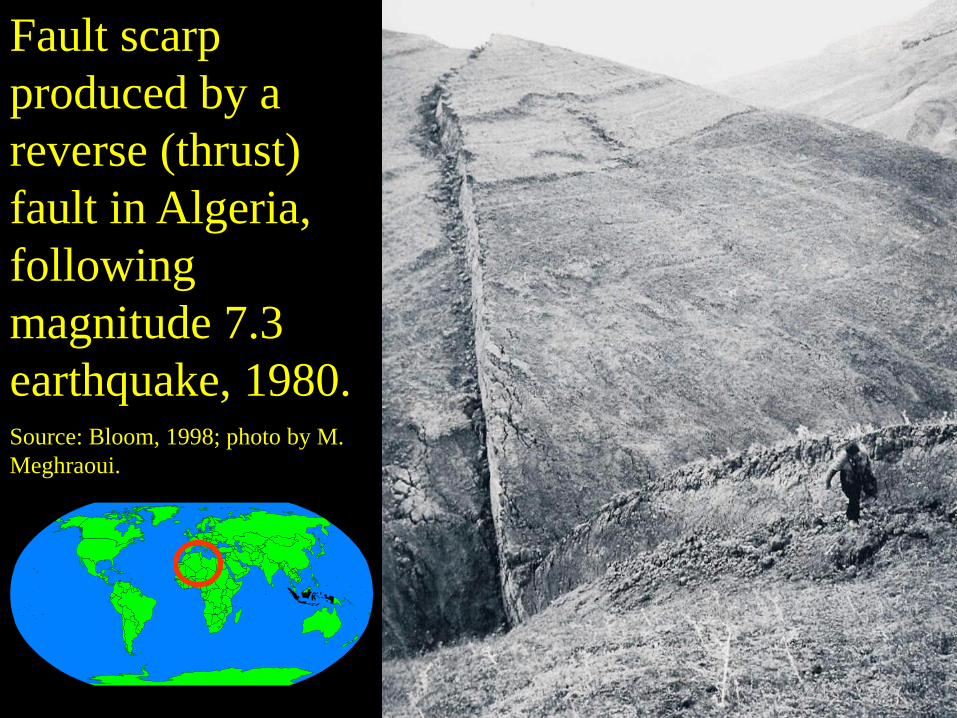
Fault scarp
produced by a
reverse (thrust)
fault in Algeria,
following
magnitude 7.3
earthquake, 1980. Source: Bloom, 1998; photo by M.
Meghraoui.

Normal fault: result of tensional stress. Source: Christopherson, 2012, p.342.
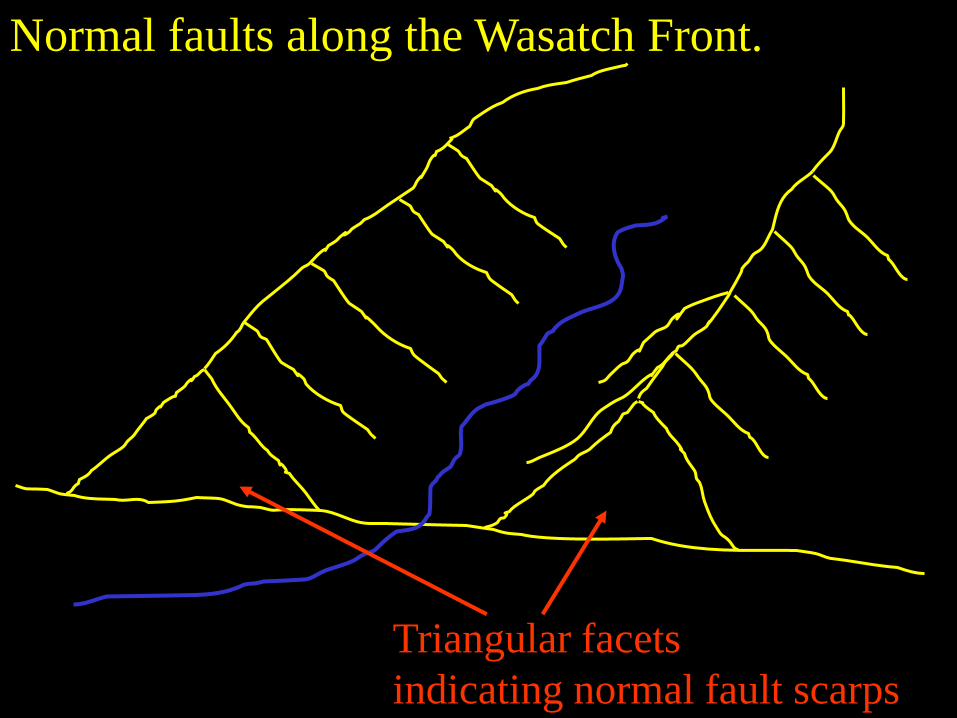
Triangular facets
indicating normal fault scarps
Normal faults along the Wasatch Front.
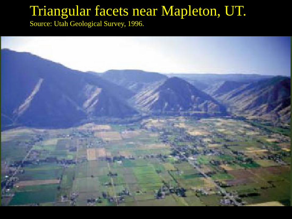
Triangular facets near Mapleton, UT.
Source: Utah Geological Survey, 1996.
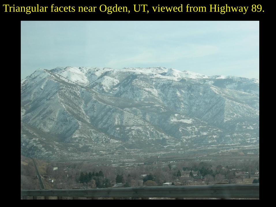
Triangular facets near Ogden, UT, viewed from Highway 89.
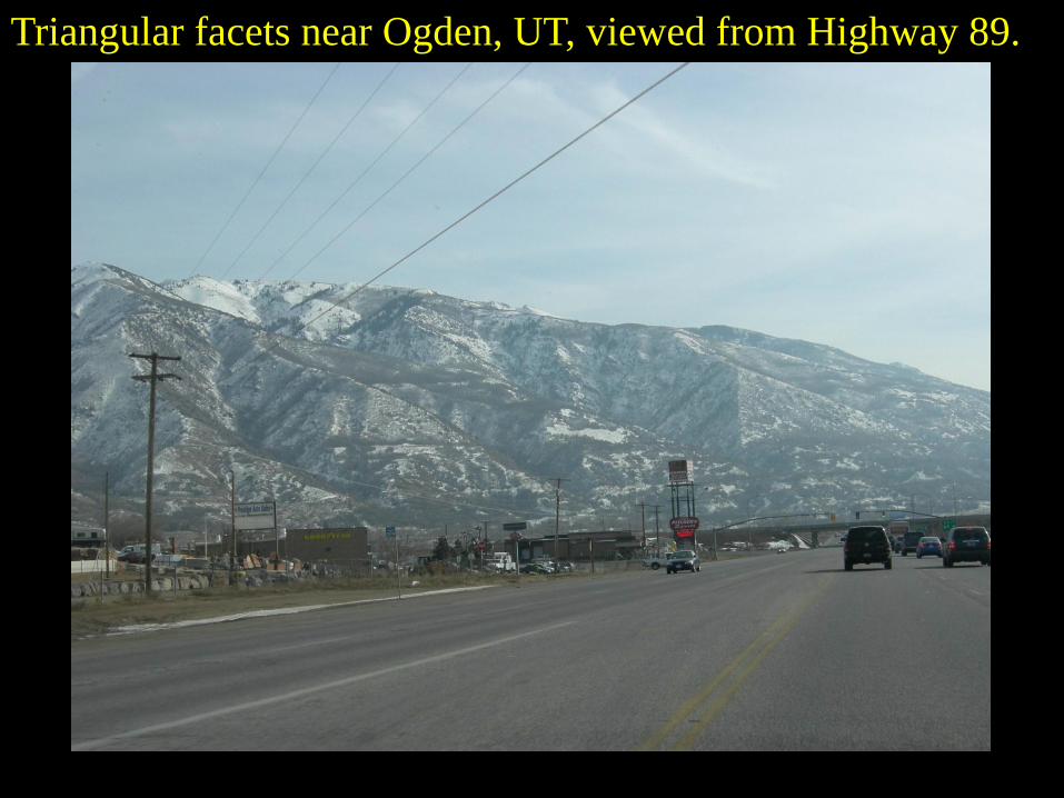
Triangular facets near Ogden, UT, viewed from Highway 89.
Source: David Schultz, Pictures from 2002 Winter Olympic Weather Forecaster Training
http://www.cimms.ou.edu/~schultz/olympics/images/img20.gif
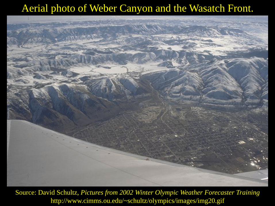
Aerial photo of Weber Canyon and the Wasatch Front.
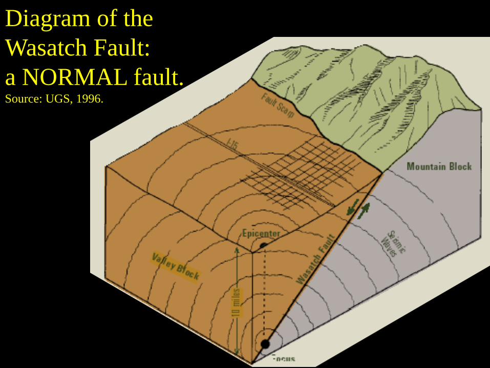
Diagram of the
Wasatch Fault:
a NORMAL fault.
Source: UGS, 1996.
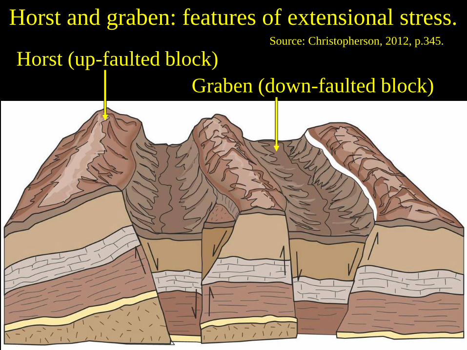
Graben (down-faulted block)
Horst (up-faulted block)
Horst and graben: features of extensional stress. Source: Christopherson, 2012, p.345.
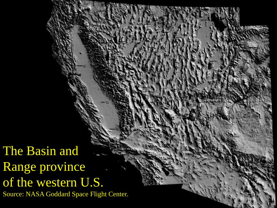
The Basin and
Range province
of the western U.S. Source: NASA Goddard Space Flight Center.
Transform (strike-slip) fault: result of lateral
(shearing) stress. Source: Christopherson, 2012, p.342.
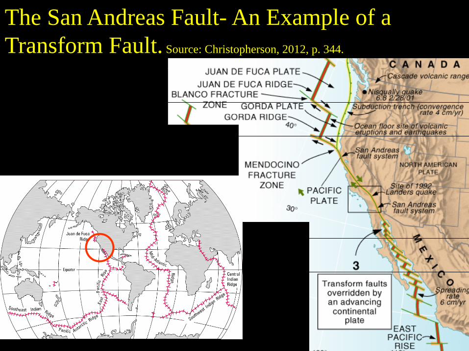
The San Andreas Fault- An Example of a
Transform Fault. Source: Christopherson, 2012, p. 344.
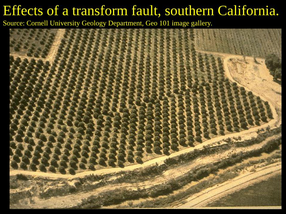
Effects of a transform fault, southern California.
Source: Cornell University Geology Department, Geo 101 image gallery.
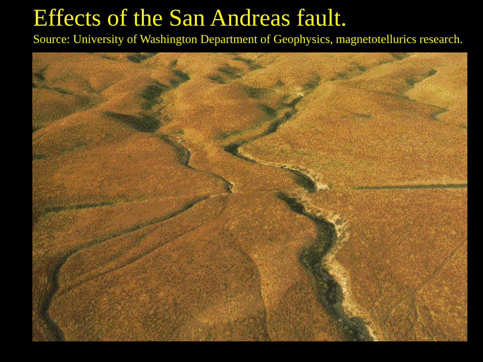
Effects of the San Andreas fault.
Source: University of Washington Department of Geophysics, magnetotellurics research.
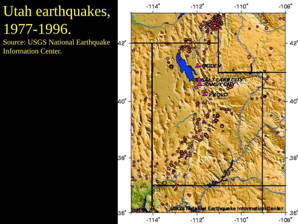
Utah earthquakes,
1977-1996. Source: USGS National Earthquake
Information Center.
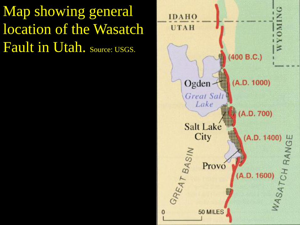
Map showing general
location of the Wasatch
Fault in Utah. Source: USGS.
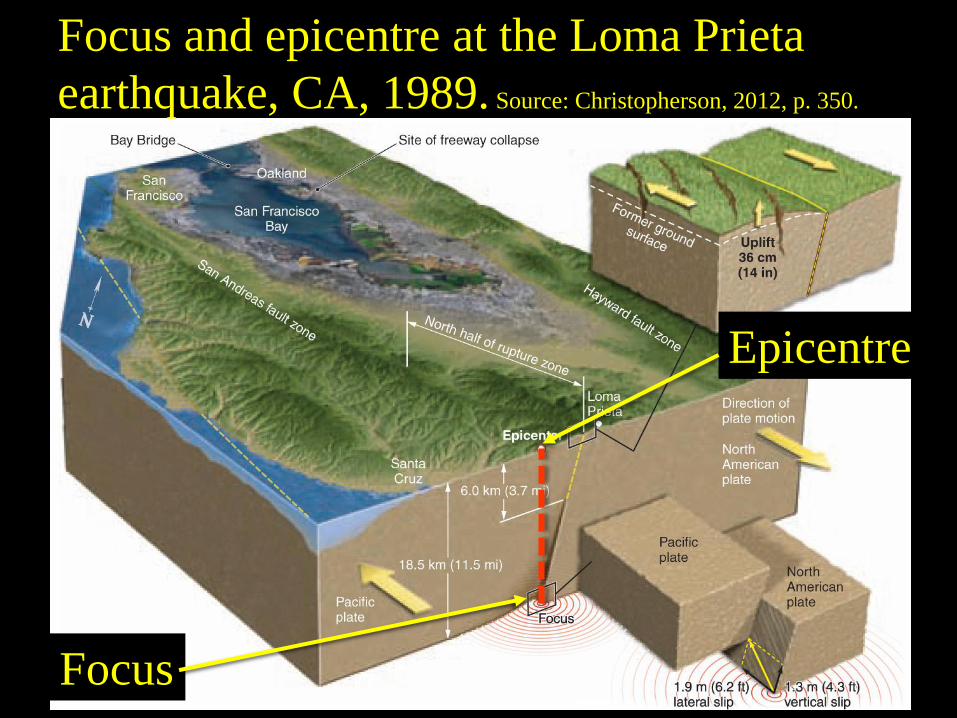
Focus
Epicentre
Focus and epicentre at the Loma Prieta
earthquake, CA, 1989. Source: Christopherson, 2012, p. 350.

Diagram of the
Wasatch Fault:
a NORMAL fault.
Source: UGS, 1996.
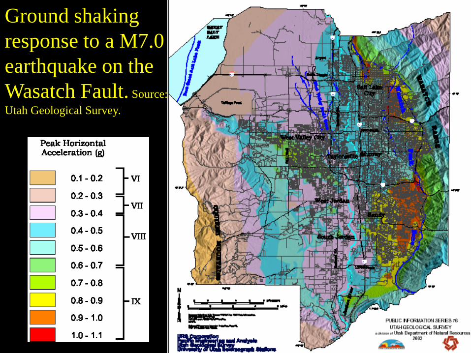
Ground shaking
response to a M7.0
earthquake on the
Wasatch Fault. Source:
Utah Geological Survey.
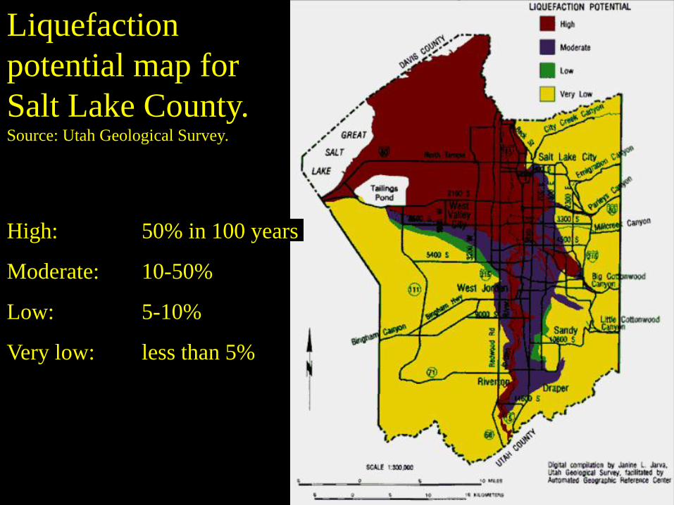
Liquefaction
potential map for
Salt Lake County.
Source: Utah Geological Survey.
High: 50% in 100 years
Moderate: 10-50%
Low: 5-10%
Very low: less than 5%
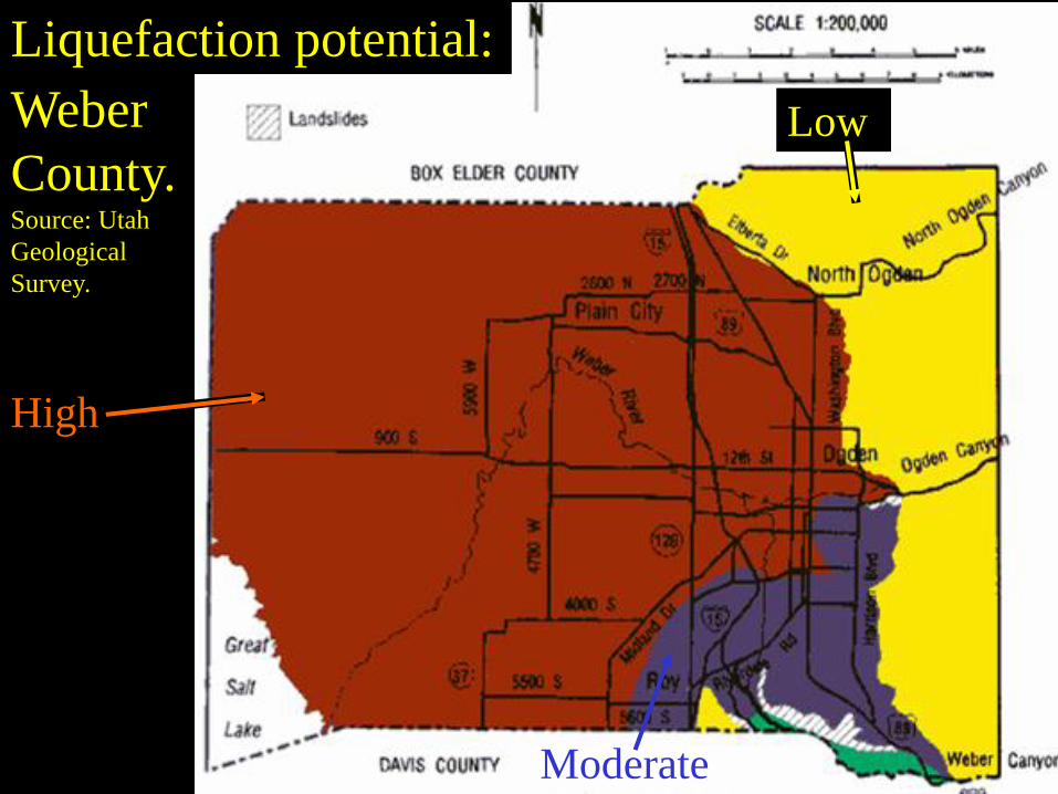
Liquefaction potential:
Weber
County.Source: Utah
Geological
Survey.
High
Moderate
Low