Embed Size (px)
Citation preview
1
Map Projections Map Projection
• Scientific method of transferring locations on Earth’s surface to a flat map
• 3 major families of projection– Cylindrical
• Mercator Projection
– Conic Projections• Well suited for mid-latitudes
– Planar Projections
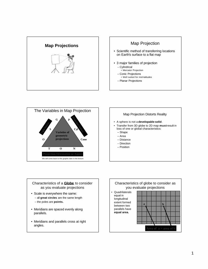
The Variables in Map Projection
Ligh
t Sou
rce
Projection Surface
Projection Orientation or Aspect
G
S
O
T O N
P
Cyl
Cone
Varieties ofgeometric projections
We will come back to this graphic later in the lecture
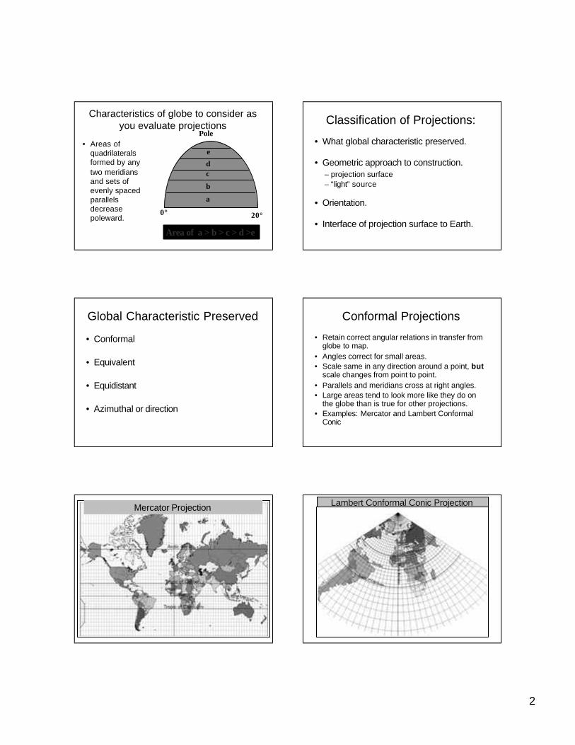
Map Projection Distorts Reality
• A sphere is not a developable solid .• Transfer from 3D globe to 2D map must result in
loss of one or global characteristics:– Shape– Area– Distance– Direction– Position
Characteristics of a Globe to consider as you evaluate projections
• Scale is everywhere the same:– all great circles are the same length– the poles are points.
• Meridians are spaced evenly along parallels.
• Meridians and parallels cross at right angles.
Characteristics of globe to consider as you evaluate projections
• Quadrilaterals equal in longitudinal extent formed between two parallels have equal area.
Area of a = area of b
a b
2
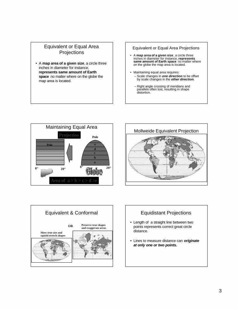
Characteristics of globe to consider as you evaluate projections
• Areas of quadrilaterals formed by any two meridians and sets of evenly spaced parallels decrease poleward.
Area of a > b > c > d >e
0° 20°
a
b
cd
e
Pole
Classification of Projections:
• What global characteristic preserved.
• Geometric approach to construction.– projection surface– “light” source
• Orientation.
• Interface of projection surface to Earth.
Global Characteristic Preserved
• Conformal
• Equivalent
• Equidistant
• Azimuthal or direction
Conformal Projections
• Retain correct angular relations in transfer from globe to map.
• Angles correct for small areas.• Scale same in any direction around a point, but
scale changes from point to point.• Parallels and meridians cross at right angles.• Large areas tend to look more like they do on
the globe than is true for other projections.• Examples: Mercator and Lambert Conformal
Conic
Mercator Projection Lambert Conformal Conic ProjectionLambert Conformal Conic Projection
3
Equivalent or Equal Area Projections
• A map area of a given size, a circle three inches in diameter for instance, represents same amount of Earth space no matter where on the globe the map area is located.
Equivalent or Equal Area Projections
• A map area of a given size , a circle three inches in diameter for instance, represents same amount of Earth space no matter where on the globe the map area is located.
• Maintaining equal area requires:– Scale changes in one direction to be offset
by scale changes in the other direction.
– Right angle crossing of meridians and parallels often lost, resulting in shape distortion.
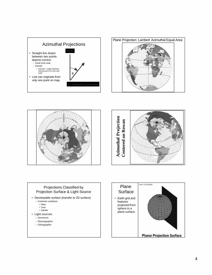
Maintaining Equal Area
Projection
Area of a > b > c > d >e
0° 20°
abcde
Pole
0° 20°
Pole
Mollweide Equivalent Projection
Equivalent & Conformal
Preserve true shapes and exaggerate areas
Show true size and squish/stretch shapes
OR
Equidistant Projections
• Length of a straight line between two points represents correct great circle distance.
• Lines to measure distance can originateat only one or two points.
4
Azimuthal Projections
• Straight line drawn between two points depicts correct:– Great circle route– Azimuth
• Azimuth = angle between starting point of a line and north
• Line can originate from only one point on map.
θ
θ = Azimuth of green line
North
Plane Projection: Lambert Azimuthal Equal Area
Azi
mut
hal
Pro
ject
ion
Cen
tere
d on
Row
an
Projections Classified byProjection Surface & Light Source
• Developable surface (transfer to 2D surface)– Common surfaces:
• Plane• Cone• Cylinder
• Light sources:– Gnomonic
– Stereographic– Orthographic
Plane Surface
• Earth grid and features projected from sphere to a plane surface.
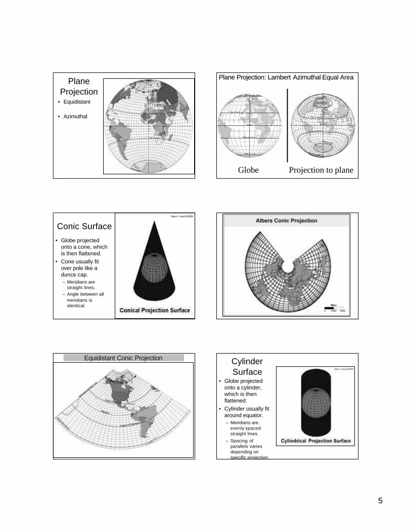
5
Plane Projection
• Equidistant
• Azimuthal
Plane Projection: Lambert Plane Projection: Lambert AzimuthalAzimuthal Equal AreaEqual Area
Globe Projection to plane
Conic Surface
• Globe projected onto a cone, which is then flattened.
• Cone usually fit over pole like a dunce cap.– Meridians are
straight lines.– Angle between all
meridians is identical.
Equidistant Conic ProjectionEquidistant Conic Projection Cylinder Surface
• Globe projected onto a cylinder, which is then flattened.
• Cylinder usually fit around equator.– Meridians are
evenly spaced straight lines.
– Spacing of parallels varies depending on specific projection.
6
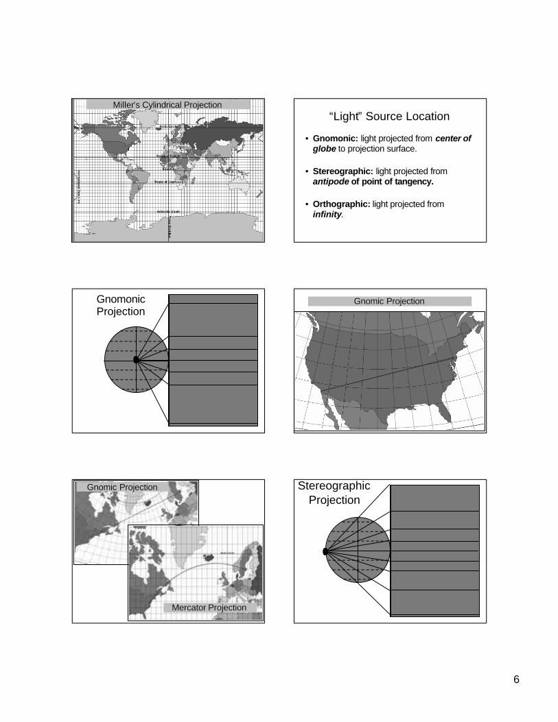
MillerMiller’’s Cylindrical Projections Cylindrical Projection“Light” Source Location
• Gnomonic: light projected from center of globe to projection surface.
• Stereographic: light projected from antipode of point of tangency.
• Orthographic: light projected from infinity.
Gnomonic Projection
Gnomic ProjectionGnomic Projection
Gnomic ProjectionGnomic Projection
MercatorMercator ProjectionProjection
Stereographic Projection
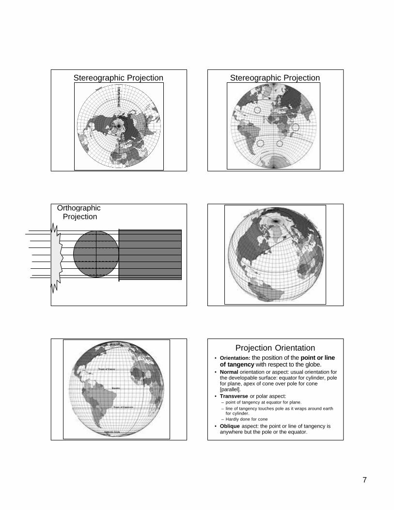
7
Stereographic Projection Stereographic Projection
OrthographicProjection
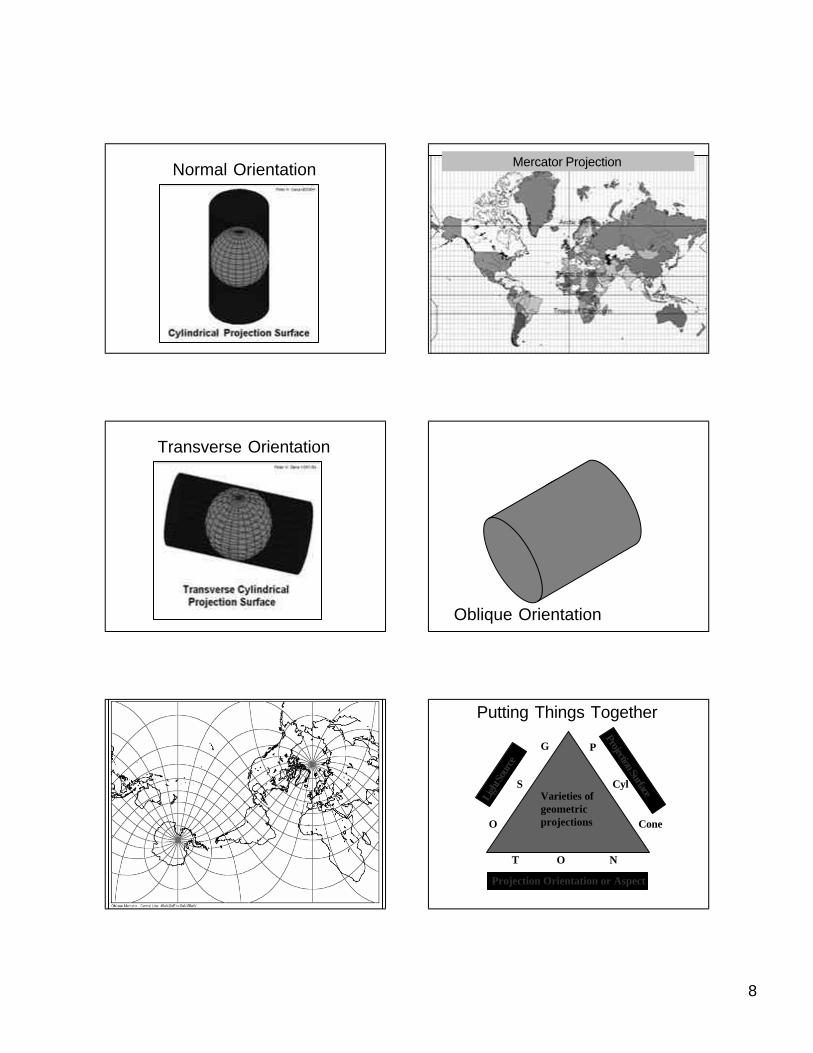
Projection Orientation• Orientation: the position of the point or line
of tangency with respect to the globe.• Normal orientation or aspect: usual orientation for
the developable surface: equator for cylinder, pole for plane, apex of cone over pole for cone [parallel].
• Transverse or polar aspect: – point of tangency at equator for plane.– line of tangency touches pole as it wraps around earth
for cylinder.– Hardly done for cone
• Oblique aspect: the point or line of tangency is anywhere but the pole or the equator.
8
Normal Orientation Mercator Projection
Transverse Orientation
Oblique Orientation
Putting Things Together
Ligh
t Sou
rce
Projection Surface
Projection Orientation or Aspect
G
S
O
T O N
P
Cyl
Cone
Varieties ofgeometric projections
9
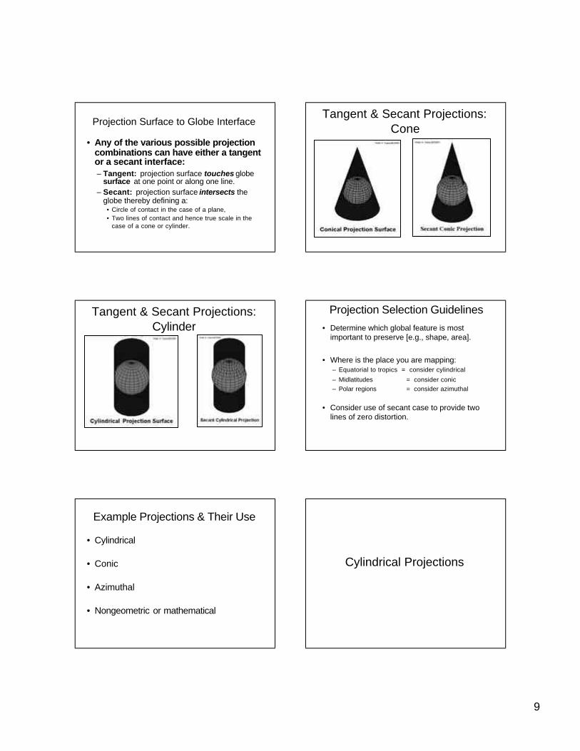
Projection Surface to Globe Interface
• Any of the various possible projection combinations can have either a tangent or a secant interface:– Tangent: projection surface touches globe
surface at one point or along one line.– Secant: projection surface intersects the
globe thereby defining a:• Circle of contact in the case of a plane,• Two lines of contact and hence true scale in the
case of a cone or cylinder.
Tangent & Secant Projections: Cone
Tangent & Secant Projections: Cylinder
Projection Selection Guidelines• Determine which global feature is most
important to preserve [e.g., shape, area].
• Where is the place you are mapping:– Equatorial to tropics = consider cylindrical
– Midlatitudes = consider conic– Polar regions = consider azimuthal
• Consider use of secant case to provide two lines of zero distortion.
Example Projections & Their Use
• Cylindrical
• Conic
• Azimuthal
• Nongeometric or mathematical
Cylindrical Projections
10
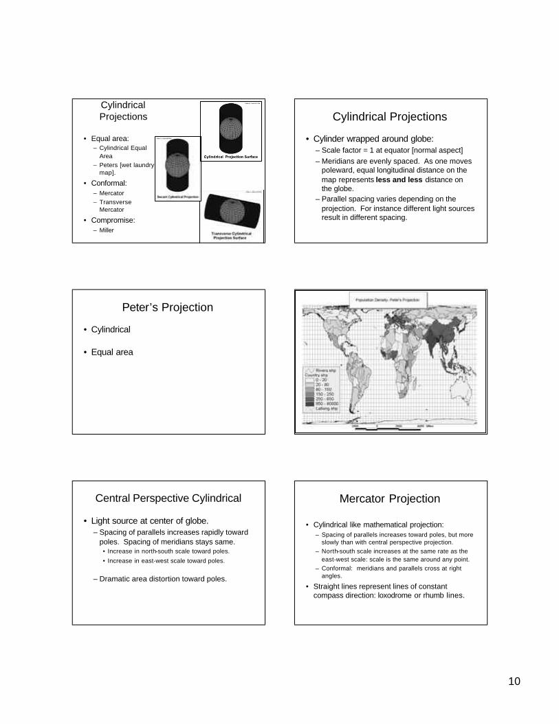
Cylindrical Projections
• Equal area:– Cylindrical Equal
Area– Peters [wet laundry
map].
• Conformal:– Mercator– Transverse
Mercator
• Compromise:– Miller
Cylindrical Projections
• Cylinder wrapped around globe:– Scale factor = 1 at equator [normal aspect]– Meridians are evenly spaced. As one moves
poleward, equal longitudinal distance on the map represents less and less distance on the globe.
– Parallel spacing varies depending on the projection. For instance different light sources result in different spacing.
Peter’s Projection
• Cylindrical
• Equal area
Central Perspective Cylindrical
• Light source at center of globe.– Spacing of parallels increases rapidly toward
poles. Spacing of meridians stays same.• Increase in north-south scale toward poles.
• Increase in east-west scale toward poles.
– Dramatic area distortion toward poles.
Mercator Projection
• Cylindrical like mathematical projection:– Spacing of parallels increases toward poles, but more
slowly than with central perspective projection.– North-south scale increases at the same rate as the
east-west scale: scale is the same around any point.– Conformal: meridians and parallels cross at right
angles.
• Straight lines represent lines of constant compass direction: loxodrome or rhumb lines.
11
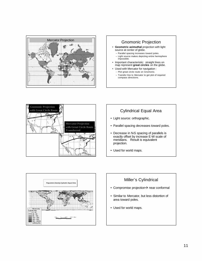
Mercator Projection Gnomonic Projection• Geometric azimuthal projection with light
source at center of globe.– Parallel spacing increases toward poles.– Light source makes depicting entire hemisphere
impossible.
• Important characteristic: straight lines on map represent great circles on the globe.
• Used with Mercator for navigation :– Plot great circle route on Gnomonic.– Transfer line to Mercator to get plot of required
compass directions.
Gnomonic Projection with Great Circle Route
Mercator Projectionwith Great Circle RouteTransferred
Cylindrical Equal Area
• Light source: orthographic.
• Parallel spacing decreases toward poles.
• Decrease in N-S spacing of parallels is exactly offset by increase E-W scale of meridians. Result is equivalent projection.
• Used for world maps.
Miller’s Cylindrical
• Compromise projectionà near conformal
• Similar to Mercator, but less distortion of area toward poles.
• Used for world maps.
12
MillerMiller’’s Cylindrical Projections Cylindrical Projection
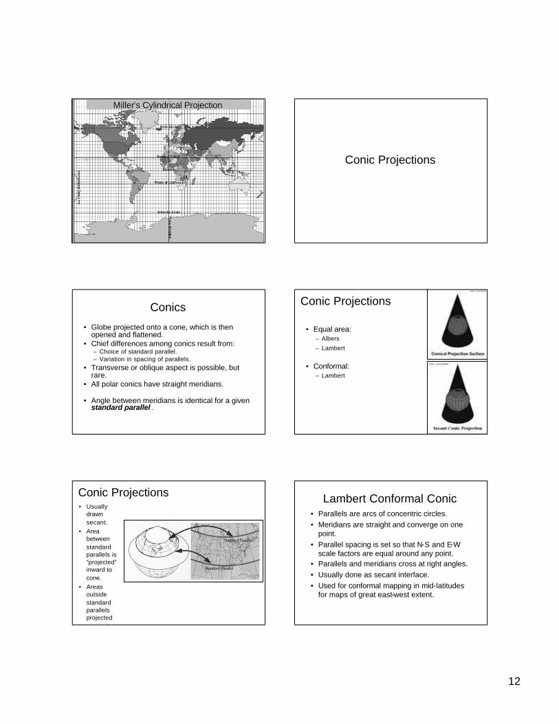
Conic Projections
Conics
• Globe projected onto a cone, which is then opened and flattened.
• Chief differences among conics result from:– Choice of standard parallel.– Variation in spacing of parallels.
• Transverse or oblique aspect is possible, but rare.
• All polar conics have straight meridians.
• Angle between meridians is identical for a given standard parallel .
Conic Projections
• Equal area:– Albers
– Lambert
• Conformal:– Lambert
Conic Projections• Usually
drawn secant.
• Area between standard parallels is “projected”inward to cone.
• Areas outside standard parallels projected outward.
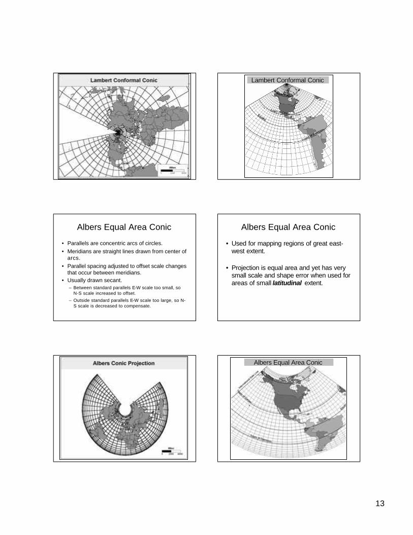
Lambert Conformal Conic• Parallels are arcs of concentric circles.• Meridians are straight and converge on one
point.• Parallel spacing is set so that N-S and E-W
scale factors are equal around any point.• Parallels and meridians cross at right angles.• Usually done as secant interface.• Used for conformal mapping in mid-latitudes
for maps of great east-west extent.
13
Lambert Conformal ConicLambert Conformal Conic
Albers Equal Area Conic
• Parallels are concentric arcs of circles.• Meridians are straight lines drawn from center of
arcs.• Parallel spacing adjusted to offset scale changes
that occur between meridians.• Usually drawn secant.
– Between standard parallels E-W scale too small, so N-S scale increased to offset.
– Outside standard parallels E-W scale too large, so N-S scale is decreased to compensate.
Albers Equal Area Conic
• Used for mapping regions of great east-west extent.
• Projection is equal area and yet has very small scale and shape error when used for areas of small latitudinal extent.
Albers Equal Area ConicAlbers Equal Area Conic
14
Albers Equal Area ConicAlbers Equal Area Conic
Lambert Conformal ConicLambert Conformal Conic
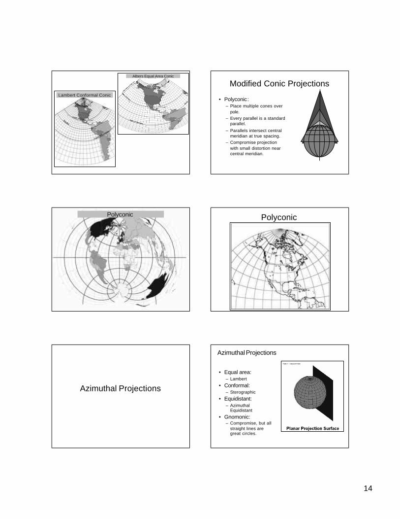
Modified Conic Projections
• Polyconic:– Place multiple cones over
pole.– Every parallel is a standard
parallel.
– Parallels intersect central meridian at true spacing.
– Compromise projection with small distortion near central meridian.
7PolyconicPolyconic Polyconic
Azimuthal Projections
Azimuthal Projections
• Equal area:– Lambert
• Conformal:– Sterographic
• Equidistant:– Azimuthal
Equidistant
• Gnomonic:– Compromise, but all
straight lines are great circles.
15
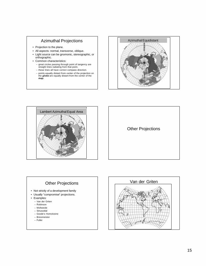
Azimuthal Projections• Projection to the plane.• All aspects: normal, transverse, oblique.• Light source can be gnomonic, stereographic, or
orthographic.• Common characteristics:
– great circles passing through point of tangency are straight lines radiating from that point.
– these lines all have correct compass direction. – points equally distant from center of the projection on
the globe are equally distant from the center of the map.
AzimuthalAzimuthal Equidistant Equidistant
Lambert Azimuthal Equal Area
Other Projections
Other Projections
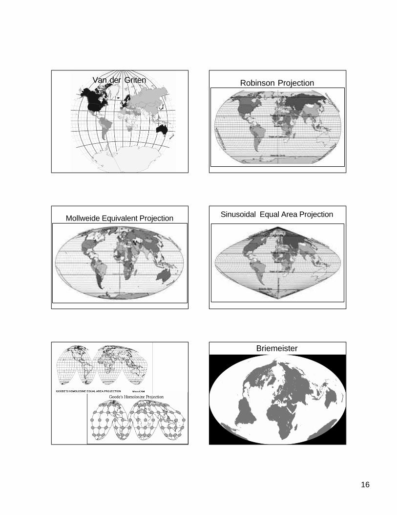
• Not strictly of a development family• Usually “compromise” projections.• Examples:
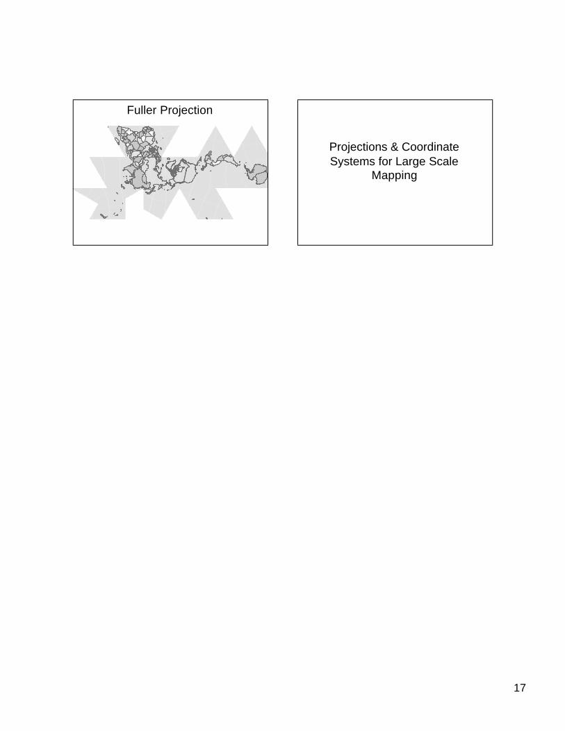
– Van der Griten– Robinson– Mollweide– Sinusodial– Goode’s Homolosine– Briesmeister– Fuller
Van der Griten
16
Van der Griten Robinson Projection
Mollweide Equivalent Projection Sinusoidal Equal Area Projection
Briemeister
17
Fuller Projection
Projections & Coordinate Systems for Large Scale
Mapping