Embed Size (px)
Citation preview
SCAG Scenario Planning Model (SPM):Status Overview and Demo
01/28/2015
Modeling and ForecastingJungA Uhm

Outline
� What is SPM?
� What has been done to date and Why?
� SPM Functionalities : feature highlights
� …how? : sites walk-through
� What’s next?

What is SPM?
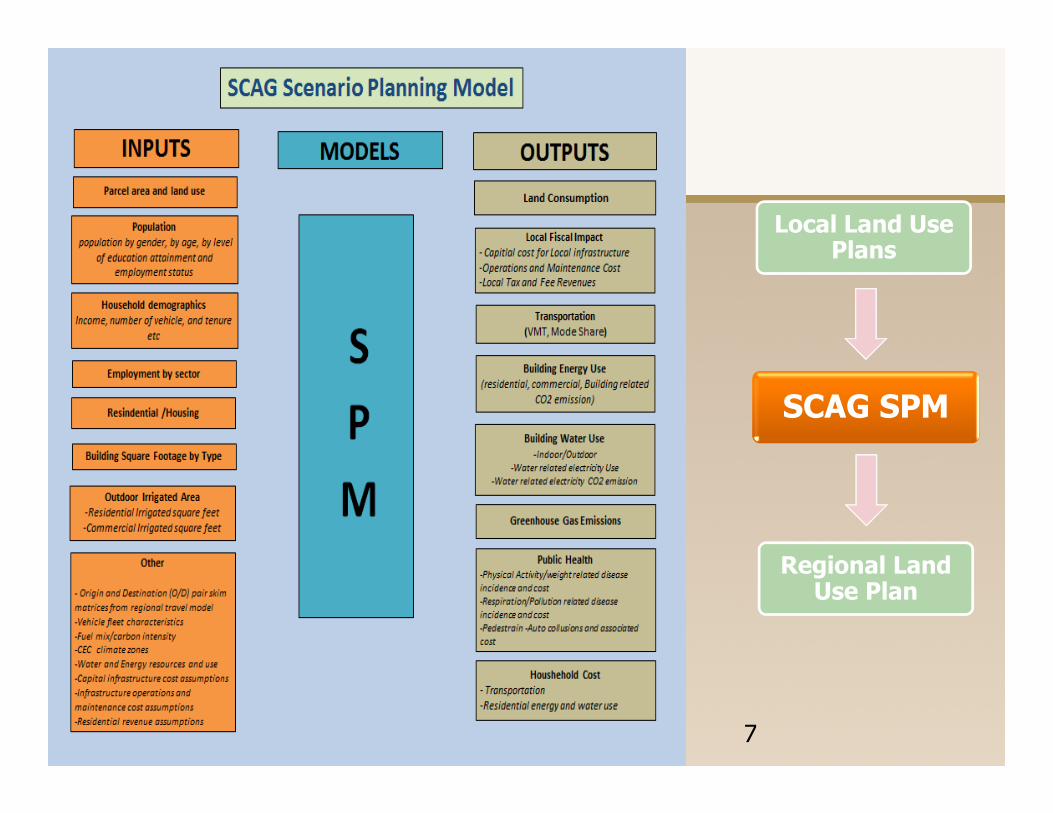
� A comprehensive web-based land use sketch planning tool for scenario development, modeling, and data management
� Built on ‘UrbanFootprint (UF)’ modeling platform developed by Calthorpe Associates
� Currently being customized and enhanced for use by major MPOs in CA

What has been done and Why?
� Started from a ground-up, working with SPM Working Group and developed two major functionalities:
1. Sophisticated Data Management site through 3 rounds of pilot testing
– Provide a common platform to share/review/update local data, enabling seamless integration with regional data
– Reduce effort on a local input process for the next RTP/SCS cycle while maintaining the integrity of local input
What has been done and Why? (cont.)
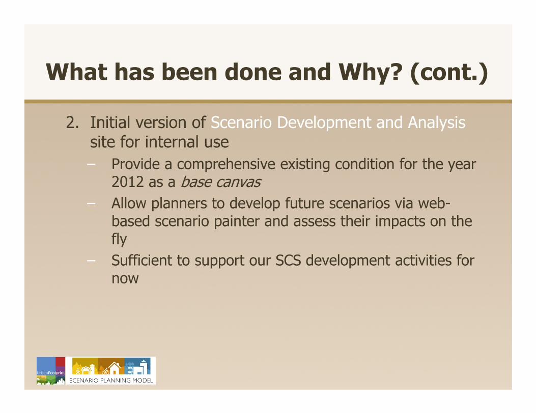
2. Initial version of Scenario Development and Analysissite for internal use
– Provide a comprehensive existing condition for the year 2012 as a base canvas
– Allow planners to develop future scenarios via web-based scenario painter and assess their impacts on the fly
– Sufficient to support our SCS development activities for now
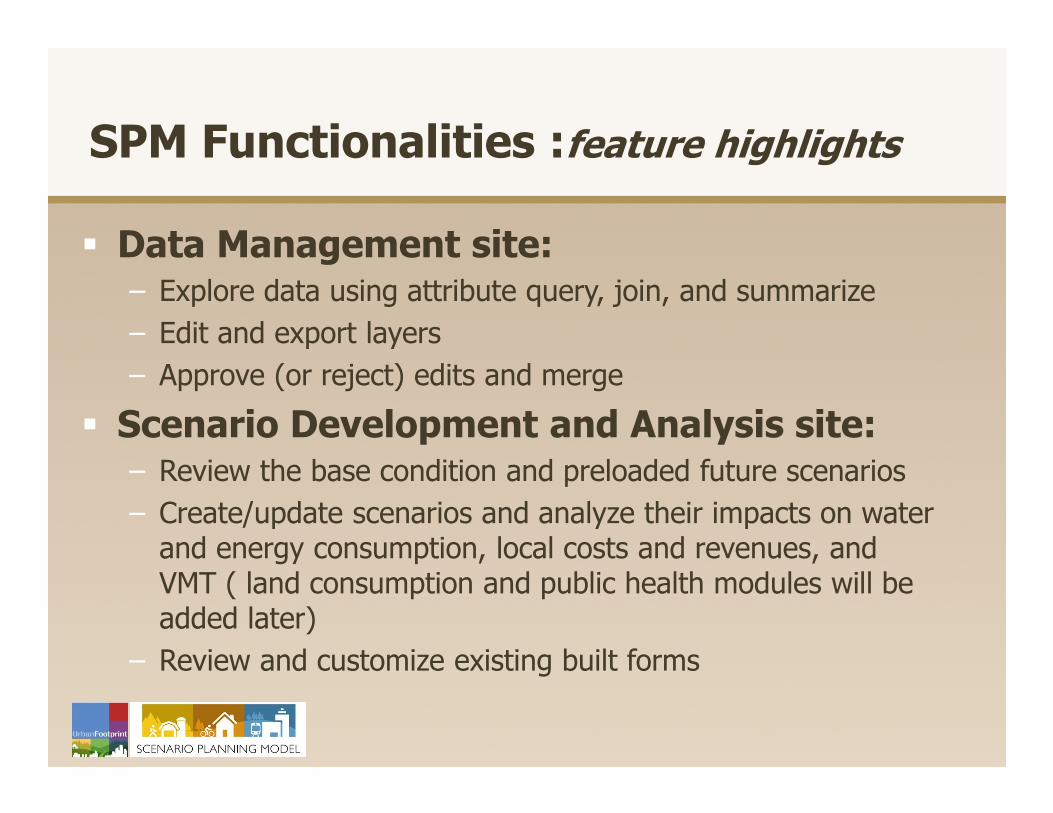
SPM Functionalities :feature highlights
� Data Management site:– Explore data using attribute query, join, and summarize
– Edit and export layers
– Approve (or reject) edits and merge
� Scenario Development and Analysis site:– Review the base condition and preloaded future scenarios
– Create/update scenarios and analyze their impacts on water and energy consumption, local costs and revenues, and VMT ( land consumption and public health modules will be added later)
– Review and customize existing built forms
7
Regional Land Use Plan
Local Land Use Plans
SCAG SPM
How ? – sites walk-through (DM site)
3
1: Layer Management Window
2: Map Toolbar
3: Explore Window
4: Edit Window
5: Map Area
1
5
4
2

How ? – sites walk-through (SD site)
1: Layer Management Window
2: Map Toolbar
3: Explore Window
4: Analysis/Editor Window
5: Map Area
1
5
4
3
2
What’s next?
� Roll-out of the Data Management site to all local jurisdictions and provide training
� Work closely with the SPM Working Group to further develop the Scenario site for local application
� Integrate the two sites and continue to enhance

Thank You