Embed Size (px)
Citation preview
500000
500000
510000
510000
520000
520000
530000
530000
540000
540000
550000
550000
560000
560000
570000
570000
580000
580000
590000
590000
600000
600000 10
0000
10
0000
11
0000
11
0000
12
0000
12
0000
13
0000
13
0000
14
0000
14
0000
15
0000
15
0000
16
0000
16
0000
17
0000
17
0000
18
0000
18
0000
19
0000
19
0000
20
0000
20
0000
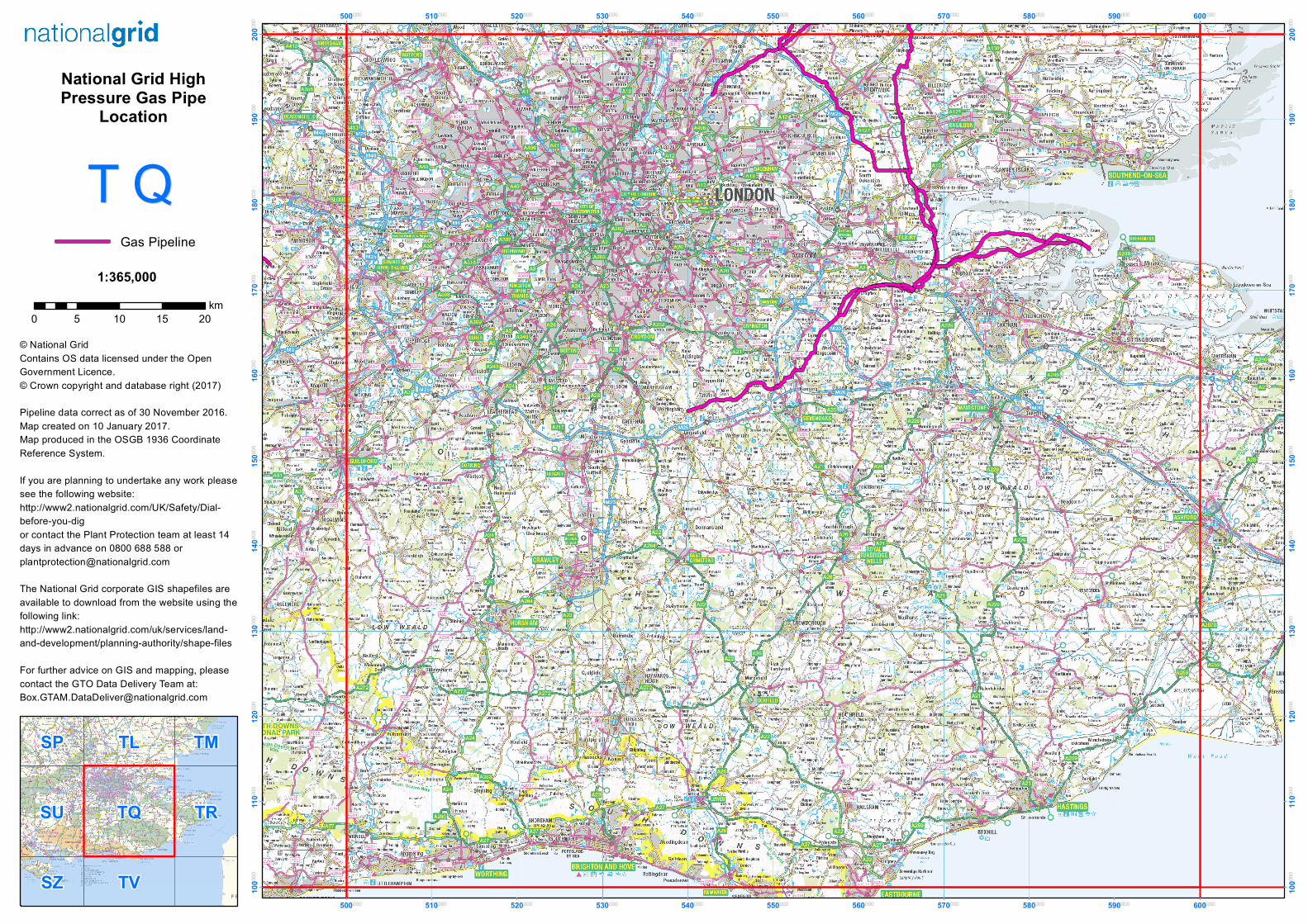
1:365,000
TQ TRSU
TL
TVSZ
SP TM
© National GridContains OS data licensed under the OpenGovernment Licence.© Crown copyright and database right (2017)
Pipeline data correct as of 30 November 2016.Map created on 10 January 2017.Map produced in the OSGB 1936 CoordinateReference System.
If you are planning to undertake any work pleasesee the following website:http://www2.nationalgrid.com/UK/Safety/Dial-before-you-digor contact the Plant Protection team at least 14days in advance on 0800 688 588 [email protected]
The National Grid corporate GIS shapefiles areavailable to download from the website using thefollowing link:http://www2.nationalgrid.com/uk/services/land-and-development/planning-authority/shape-files
For further advice on GIS and mapping, pleasecontact the GTO Data Delivery Team at:[email protected]
Gas Pipeline
0 5 10 15 20km
T QT QNational Grid HighPressure Gas Pipe
Location