Embed Size (px)
Citation preview

{to'ntt',q,=o-
3!6-3o:l
-rso!t -O
rtrF.J ltr
n+tr +E
- gv1 €{ \oit tr -r ;= a o firi-'mjz g s * = -t=q,\-rJ:X-ro P i * I rr zN;m.' P.P N FFrHr-q,
6= s =mt6rtf
+{=o63
zg,!Lo9Lvooo-E
oon
$T)
cF>-
/
hsR*l
r-sPFt
L(n0
iN)\F!t
t
Fo',./\t*
;- r
I
s
u
7" --(
I(.__
t,(
brly)T
s*/,5r')
"^9)-
F'
(>
-
=)t
--5
l=
l
$q2h
F
e
Pqet
\<
:--
-7
trit,t
\ts
$frN..+(qe.r
7'l]
I
A
:,
t>
.1'\
-<Ct
N\. rl
-f:7--l./
{(,r '
:
o
>
Yt(\so
n'
+NLs
z, A,3o
rnP\?n
J\
F
ttf, +N(
r*-n
\
({,
pl
IIi
>-ty
\.
)'
r'
T\.,.\l
:'
\!.1
$?+I-.:-\
fl-,5=
fsr Itt
P=r
r
\f:
Tn)
1'
X
6af
<i
IVI
J1-
c' ()<)
sstT-(
(fov)to3s,o=
\':
oI
\lf,
\)
s(*
+
\T*(-+. .1Jr..'
ti
'$
5
tr'\
h
-l(r.- ,ei\(
i*
C,
(-rF
sIf\a-E*_
:-|-!<-.(-'
<4*
-t>
F{'l
.T;L4
\.*
!a-/ {v
i(I
:='r-.
,<. *f'
rj
tr)\I
4
1l Ip
-\
v) 4
(
--,
1'
t(
c\t_J-
\t
tJ
s<il.
<$F
UOo=n
{'\
f7t\
(As-J
I
\
->1t\JG
I
ant
e<t|.t
-iv
Io,r,A\
-c.
!>.\*.
c
N
n\
7i'
L-
1:-{
i
s-{t
I
a\
1)-1
(,F)
I
-$\.J\a'fiG{
i
{9.o
E
ofo:8t
(*\'lrrrt\l\ --t*
s
t\
Pt.G)
(-
I,\i.
..\.1+v
i's\(
\\-+
I
c\-r'
\.\s
FkNtb
$(\,x.
-'-.\;){)'
\
IhNI'
\*-7I\$+,\\.
\9
:$9J
A,c-to
N
235
-{
o.|1V'o:lo.
5E63o5
Ttso!t t-O
mn -J|'./rn+c ;.E '!
ttr !
i 3qn 3 -, ;1^ o rrr iiz E g = fr9 AP P il= q P b .' zDJ;rnora P-o n FFl Ur-v!
fi= s =Flti'Flf -r{
=o6S
zg,g,oE7oq,o-Eoan
--
f,
t7
€I
F?esE3
Igs
Rrt
'17
of
O) p+
t
v, +
(ADIs?D
a
)
\v
--i
-
Pq")
z, q,
3o
eoe(nq"Tl
T!
It
Ft$
Vut
ac:
b/Cs0
o5
$+t
-1
>tr*ld
'v:'
in,
("t
ul-
(f
0qaA,
of
T<
FIp
!'rTf,
4^v$$Ct-lpI ><)
IPI
\5>c.+tI
:=io
F
)
uqo=n
dl
Tffs
O{--0
s\)v
sA
s\C)\tlJs\.\
-,\Jo
IA
vl
:j
q)\\ha.lot4)
lri=
(,il
(s--J
ooE
ofo+t
h
\
\w4I :t
k\I
-<
9gaJq,t+tro
236

2
7
Framework on Preparation of the Optimum Project Plan
Data Collection Analysis and Evaluation Planning and Recommendation Stakeholders
And Survey Consultation & Seminar
Formulation of Alternative Plans
1 Setting of alternative project plans
2 Collection & measurement of each
indicators of the alternative project
plan
Evaluation of traffic improvement
Impact by the project
Support of Environmental
Impact Assessment
Examination and preparation
of TOR for environmental &
social consideration
Implementing support to the
environmental & social
consideration survey
Support in EIA procedures,
such as taggingSelection of Optimum Project Plan
Support of stakeholders’ meetings
Correction / modification
3rd Stakeholders’ Meeting
4th Stakeholders’ Meeting
8
On-going Works on the ESC Study
• Environmental Baseline Study
– Field measurement surveys: air, noise/vibration,
water
– Secondary data collection
9
On-going Works on the ESC Study
CALA Expressway
Alt 1
Alt 2
Alt 2A
Alt 2
Alt 2
Alt 1
Alt 3
N/S 3 (Bacoor-Dasmarinas)
E/W 1 (Daang Hari)
Alt 1
Alt 2
Legend●Station for Residential
Area●Station for Road Area
Field Measurement SurveysEnvironmental Baseline Study
(Air, Noise/Vibration)
10
On-going Works on the ESC Study
Field Measurement SurveysEnvironmental Baseline Study
(Water)
Legend●Station for ImusRiver●Station for Ylang YlangRiver●Station for Rio Grande River●Station for Canas River
Water Quality Parameters :
pH (acidity)
Temperature
Total Suspended Solids
River Flow
11
On-going Works on the ESC Study
• Environmental Baseline Study
– Field measurement surveys: air, noise/vibration, water
– Secondary data collection
• Social Survey
– Focus group discussion (Barangay consultation)
– Perception survey
– Household inventory survey for resettlement (100% survey for potential households to be resettled for ROW acquisition)
12
Consensus Building Process
for Implementation of the Proposed Projects
• Focus Group Discussion (Barangay Consultation)� Agenda: Outline of the
proposed projects, Proposed alternative road alignments, Coordination on social surveys, Q&A (discussion)
� Participants: Barangaycaptains and councilors, Project-affected persons, Residents, Peoples organizations (PO), Non-governmental organizations (NGO)
� Acceptance of the project by Barangay=>Endorsement of the Acceptance of the Project by Municipalities and Provinces
238

3
13
Consensus Building Process
for Implementation of the Proposed Projects
• Focus Group Discussion (Barangay Consultation)
Issues & Concern
• Is the alignment final?
• Will there be compensation for
affected assets? When?
• Is there a ready relocation site?
• How will existing business
establishment be compensated?
• Will there be alternative income
source in the relocation site?
• What documents are needed as
proof of ownership?
14
Consensus Building Process
for Implementation of the Proposed Projects
• Perception
Survey� Sampled households
from project-affected
barangays
15
Consensus Building Process
for Implementation of the Proposed Projects
• Household Interview
Survey for
Resettlement
� All potential households
to be resettled
� Incl. questions on
perception of the project
16
Consensus Building Process
for Implementation of the Proposed Projects
5th Stakeholder Meeting�Conclusion of the consensus building results
Focus Group Discussion (Barangay Consultation)�Agenda: Outline of the proposed projects, Proposed alternative road alignments,
Coordination on social surveys, Q&A (discussion)
�Participants: Barangay captains and councilors, Project-affected persons, Residents,
Peoples organizations (PO), Non-governmental organizations (NGO)
�Acceptance of the project by Barangay
=>Endorsement of the Acceptance of the Project by Municipalities and Provinces
Perception Survey�Sampled households from project-affected barangays
Household Interview Survey for Resettlement�All households to potentially be resettled
�Incl. questions on perception of the project
17
Consensus Building Process
for Implementation of the Proposed Projects
(Barangay Consultation)
Barangay Consultation for each BarangayAgenda:
- Outline of the proposed projects
- Proposed alternative road alignments
- Coordination of social surveys
- Q&A (discussion)
BarangayAcceptance of the project
by Barangay
Endorsement of the project by
Municipality
Barangay
Barangay
Barangay
Barangay
Barangay
Endorsement of the project by
Province
Acceptance of the project
by BarangayAcceptance of the project
by Barangay
Municipality
DPWH
Province
Participants: - Barangay captains and councilors
- Project-affected persons
- Residents
- Peoples organizations (PO)
- Non-governmental organizations (NGO)
Municipality
Barangay
Barangay
Barangay
Municipality
Province
18
Overall Framework of Environmental & Social Considerations for the CALA East-West National Road Project
Preparation of Alternative Scenarios
Social & Environmental Constraints
- socially vulnerable facilities/areas
- protection and constrained areas
Assessment of Alternative Scenarios-IEE Study for alternatives
-Social Assessment
Formulation of Optimum Project Plan
Feasibility Study
Resettlement Framework EIA Study
-Air
-Noise
etc. Preliminary RAP
Complete RAP
Parcellary survey
-set of cut-off date
Detailed Design
-Finalization of ROW
JIC
A C
AL
A E
-W S
tud
y
Main Project FlowTasks on
Environmental and Social Considerations
Submission of
EIS document
ECC acquisition
Detailed EMMP
Implementation
of EMMP
Preparation of
EIS document
Letter of intent
Scoping session
EIS ProcessStakeholder
Meeting
∆: 1st STM
∆: 3rd STM
Construction
Operation & Maintenance
∆: 8th STM
Land acquisition & resettlement
Preparation of resettlement
Monitoring & evaluation
∆: 2nd STM
Agreed?
End
YES
NO
1st level scoping
∆: 5th STM
239

1
DEPARTMENT OF PUBLIC WORKS AND HIGHWAYS (DPWH) JAPAN INTERNATIONAL COOPERATION AGENCY (JICA)
THE FEASIBILITY STUDY AND IMPLEMENTATION SUPPORT ON THE CALA EAST-WEST NATIONAL ROAD
PROJECT (CALA East-West)
4th Stakeholder Meeting
Session 2: Evaluation of Road Alternative Alignments
7 December 2005
2
Topics
1. Background
1.1 Selected Priority Projects
1.2 Alternative Alignments
2. Criteria for Evaluation of Alternative
Alignments
3. Implementation Support
4. Workshop Guidelines
3
Selected Priority Projects
1.1 Selected Priority Projects
Legend
Daang Hari (DH) Proposed
Daang Hari (DH) PNCC Project
Daang Hari (DH) Existing
North-South Road (NS) Proposed
North-South Road (NS) Exiting
CALA Expressway (CE) Proposed
CALA Expressway (CE) Future
Governor’s
Drive
Aguinaldo
Hway
SLEX
Molino
Blvd
4
Daang Hari Road Extension (DH)
1.2 Alternative Alignments
Legend
Daang Hari (DH) Proposed
Daang Hari (DH) PNCC Project
Daang Hari (DH) Existing
North-South Road (NS) Proposed
North-South Road (NS) Exiting
CALA Expressway (CE) Proposed
CALA Expressway (CE) Future
DH-1
DH-2
DH-3
DH-4
DH-5
DH-6
National Highway
(30m-ROW, 6 lanes)
Alternative 1
DH-1~3+DH-4 = 27.6km
Alternative 2
DH-1~3+DH-5 = 29.0km
Alternative 3
DH-1~3+DH-6 = 30.5km
5
DH Road Description: Common Alignment
Road Segment Alignment Description
DH
1:
SL
EX
to
Old
Natio
nal R
oad
The alignment lies within the heavily built up area in Poblacion Muntinlupa traversing a generally flat to gently rolling terrain adjacent to residential area beginning from the Old National Road and intersecting Muntinlupa. The segment
spans approximately 1.68 km.
DH
2:
Mu
nti
nlu
pa t
o
Baco
or
Bo
un
dary
The alignment runs along the open area near the Muntinlupa Bilibid Prison,
crossing over the South Luzon Tollway until it joins the existing Daang Hari Road at the boundary of Bacoor and Muntinlupa. This alignment has a length of 3.17 km and traverses a gentle rolling terrain.
DH
3:
Bac
oo
r B
ou
nd
ary
to Im
us
The alignment uses the existing Daang Hari Road, with a length of 10.40 km. The
line runs along residential areas in Bacoor and Imus, Cavite. The existing pavement of Daang Hari Road ends at the intersection of Aguinaldo Highway while the line runs continuously towards the western side of Imus using the
existing Subdivision Road near Salitran.
6
DH Road Description: Alternative Alignment
Road Segment
Alignment Description
DH
4:
Imu
s to
Ge
n.
Tri
as/R
osa
r The alternative lines traverse the open raw land between Imus (starting from Aguinaldo Highway) and Gen. Trias. DH – 4 spans 9.00 km and initially runs in a
westerly direction then veers northwest toward the Export Processing Zone Area in Rosario as it intersects the Rosario – Noveleta Diversion Road.
DH
5:
Imu
s t
o
Ta
nza
1
This alignment shares the same starting point as DH4. It has a length of 8.75 kms.
and traverses westerly along open raw land of the same Imus and Gen. Trias
municipalities. In Tanza, it slightly veers in a northwesterly direction for a short distance and then interfaces with the existing Tanza – Gen. Trias Road.
DH
6:
Imu
s t
o
Ta
nza
2
DH 6, is a variation of DH – 5 but extends farther to the west toward the Tanza area
and connects with the Tanza – Naic – Caylabne Road. This proposed road alignment
alternative measures approximately 10.40 km in length and likewise passes through an open area with relatively flat to gently rolling terrain.
241

2
7
Daang Hari Road Extension
1.2 Alternative Alignments
• Requires improvement and widening of the short
section of the existing Tanza – Gen. Trias Road to
maintain traffic convenience and smooth traffic flow
along the intersection.
• Offers more efficient linkage to the other road
networks such as the Tanza – Gen. Trias Road and
Tanza – Naic – Caylabne Road, which lead to
various ongoing residential developments, tourist
destinations, leisure parks and resorts. Located
midway between Bacoor and Naic, the alternative
line serves more traffic generators even those
coming from the Export Processing Zone in Rosario.
• The alternative line has the shortest route length
among other alternatives.
• Requires the least project capital requirements due
to its advantageous location in terms of waterway
crossings, road intersections and fewer
disturbances to existing roadside developments.
DH-5 :
Imus to Tanza
(Tanza – Gen.
Trias Road)
• Will disturb more roadside structures during
construction.
• Requires longer pipe network as the locations of
outfall for surface runoff discharge are far from each
other.
• Though desirable geometric design conditions
could be satisfied as the segment traverses open
area, the alignment has more bends than the other
alternative lines requiring more road traffic safety
devices than the ordinary condition when the
alignment is almost straight.
• Total project capital requirement is higher than DH-
5.
• Provides direct access to the Export Processing
Zone in Rosario and alternative route to the heavily
congested section of Aguinaldo Highway from
Rosario and Bacoor to Imus.
• Comparatively shorter route length than that of DH-
6 but a little longer than that of DH-5.
DH-4 :
Imus to Rosario
(EPZA)
DisadvantageAdvantage
8
Daang Hari Road Extension
1.2 Alternative Alignments
• Has the longest route length among the other
alternatives and consequently has the highest total
project capital requirement.
• The alignment entails sharp bends as it approaches
the intersection of Tanza – Naic – Caylabne Road.
• Likewise with DH-5, this segment offers more
efficient linkage to the other road networks such
as the Tanza – Gen. Trias Road and Tanza –
Naic – Caylabne Road, which lead to various
ongoing residential developments, tourist
destinations, leisure parks and resorts. Located
midway between Bacoor and Naic, the alternative
line serves more traffic generators even those
coming from the Export Processing Zone in
Rosario.
DH-6 :
Imus to Tanza
(Tanza – Naic –
Caylabne Road)
DisadvantageAdvantage
9
North-South Road
1.2 Alternative Alignments
Legend
Daang Hari (DH) Proposed
Daang Hari (DH) PNCC Project
Daang Hari (DH) Existing
North-South Road (NS) Proposed
North-South Road (NS) Exiting
CALA Expressway (CE) Proposed
CALA Expressway (CE) Future
NS-1
NS-2
NS-3
NS-4
NS-5
NS-6
National Highway
(30m-ROW, 6 lanes)
Alternative 1
NS-1~4+NS-5 = 28.3km
Alternative 2
NS-1~4+NS-6 = 26.7km
10
North-South Road: Common Alignment
NS 1
:
R1 to B
acoor
This road segment starts as it interfaces with the existing R-1 Expressway (previously
Manila Cavite Coastal Road) at a bend as the latter connects with McDonald Jct.-
Aguinaldo Highway. From this junction, the alignment runs through the shoreline and
across salt ponds for about 1.0 km while it bends and connects with McDonald Jct. –
Aguinaldo Highway. Then, the proposed road alignment uses the same existing road
(McDonald Jct. – Aguinaldo Highway) for about 440 meters and terminates as it
intersects the main Aguinaldo Highway. The road segment has a length of 1.39 km.
NS 2
:
Bacoor to
Molino
Boule
vard The segment commences at the terminus of Segment. From the junction of Aguinaldo
Highway, the segment runs along the Molino Boulevard alignment for about 4.61 km.
This line traverses subdivision areas and the construction of the remaining section of
Molino Boulevard along this area has yet to be completed. The terrain is generally flat
and the surrounding area has been well developed.
NS 3
:
Molin
o B
lvd.
to D
aan
g H
ari The alignment veers away from the existing Molino Boulevard alignment along the
south west direction cutting across the existing subdivision areas for about 2 km after
which, it runs through an open raw land area until it bends near Aguinaldo Highway
and continuously runs alongside until it reaches and connects with existing Daang Hari
Road. The road segment measures about 5.1 km in length.
NS 4
:
Daa
ng H
ari t
o G
ov
Drive
From Daang Hari intersection, the road alignment creeps through the open area
alongside Aguinaldo Highway until it cuts across roadside residential and commercial
development along Salitran Road. The alignment continues to move southerly almost
parallel to the Aguinaldo Highway and along the still vacant areas east of the existing
highway towards Palapala in Dasmarinas. The road alignment intersects again with
Aguinaldo Highway as this segment terminates and changes direction west of the
same highway. From the intersection with Daang Hari, the segment runs
approximately 7.52 km along gently rolling terrain in Dasmarinas.
11
North-South Road: Alternative Alignment
NS
5:
Ag
uin
ald
o H
igh
way
(exp
ansi
on
)
NS – 5 uses the existing Aguinaldo Highway alignment starting from about 2 km
before Governor’s Drive and terminates at the junction of Silang Municipal Road and the said highway. It spans about 9.24 km and has wide 4 to 5 lanes up to the
Robinson’s Mall area and tapers to two (2) lanes within about 500 meters until it reaches Silang. The existing horizontal and vertical alignments are generally good
along relatively flat to gently rolling terrain. .
NS
6:
New
ro
ad
west
of
Ag
uin
ald
o NS – 6 is an alternative alignment, which starts from the intersection of Aguinaldo
Highway and traverses slightly in a southwesterly direction almost parallel to and west of Aguinaldo Highway. Since the alternative alignment would supposedly connect with
the proposed CALA Expressway, it should terminate as it intersects the expressway alignment located about 7.85 km from the segment’s northern terminal at the
intersection of Aguinaldo Highway. The segment cuts across the commercial strip near the junction of Governor’s Drive and through the open raw land adjacent to the
existing riverbank located west of Aguinaldo Highway. The alignment traverses a rolling terrain at the initial stretch and changes gradually to gently rolling and relatively
flat as it approaches the Silang Area.
12
North South Road
1.2 Alternative Alignments
• Expensive right of way acquisition along the
commercial areas in Palapala. However, previous
coordination with the landowner indicates that
mutual beneficial arrangement could be secured.
• The alignment requires spur connection with
Aguinaldo Highway for alignment continuity.
• Requires mitigation of adverse impacts to existing
adjacent waterway during construction.
• Requires higher total project requirement due to
new construction and acquisition of right of way.
• Provides alternative route to the existing Aguinaldo
Highway, which is now experiencing congestion
due to heavy roadside developments.
• Provides opportunity for untouched areas and raw
land along its route to be developed.
• Fewer disturbances to existing developments as
well as fewer project affected persons.
• Easy to construct as the alignment rests on open
area.
NS-6 :
Governor’s
Drive to Silang
(via Aguinaldo
Highway)
• The proposed widening or improvement of the
existing road section will affect significantly large
number of roadside developments aside from the
necessity to relocate existing utilities installed within
the road right of way.
• Requires provision for project affected persons and
properties.
• Difficulty in right of way acquisition since many lot
owners would be involved.
• Requires efficient traffic management and control
during construction.
• Minimum requirements for project implementation
such as compliance with environmental
requirements, etc. since the existing alignment will
be utilized.
• Still, the alignment has the shortest route length.
• Utilization of the existing pavement structure could
be optimized resulting in less project capital
requirements.
NS-5 :
Governor’s
Drive to Silang
(via Aguinaldo
Highway)
DisadvantageAdvantage
242

3
13
CALA Expressway
1.2 Alternative Alignments
Legend
Daang Hari (DH) Proposed
Daang Hari (DH) PNCC Project
Daang Hari (DH) Existing
North-South Road (NS) Proposed
North-South Road (NS) Exiting
CALA Expressway (CE) Proposed
CALA Expressway (CE) Future
CE-3
CE-1
CE-2
CE-4
CE-5
CE-6 CE-7
Expressway(50m-ROW, 6 lanes)
Alternative 1
CE-1~2+CE-3 = 18.5km
Alternative 2
CE-1~2+CE-4 = 19.6km
Alternative 3
CE-5~7 = 22.8km
14
CALA Expressway
CE
1 ,2,3
CE1 runs from Governors’ Drive to NS6. CE2 is the segment that continues on from NS6 to Aguinaldo Highway (at Silang). CE3 alignment veers away toward the northwest direction as
it enters the Sta. Rosa industrial complex and uses the existing link road to Mamplasan Interchange of the South Luzon Tollway in Binan, Laguna. The alternative line traverses rolling terrain between Silang and Sta. Rosa Industrial Complex and relatively flat area within the industrial park area for a total length of 15.65 km.
CE
1,2
an
d 4
This uses the same alignment of CE1 and CE2 but continues on an easterly direction toward subdivision areas at the back of the Sta. Rosa industrial complex and runs parallel to an existing waterway until it reaches and eventually connects with the existing Sta. Rosa Interchange of the South Luzon Tollway. Likewise, the alternative line passes through the same terrain and spans approximately 14.53 km. As it enters the Sta. Rosa Industrial Complex, the line cuts through some developed residential and industrial subdivision areas and crosses over the existing major waterway twice.
CE
5 –
CE
7
This line runs parallel to the alternative CE 1 – CE4 at a distance of about 2.5 km and begins its alignment 4.5 km west of Governor’s Drive – Aguinaldo Highway Junction and ends at the existing ABB – Greenfield Interchange of the South Luzon Tollway. The alternative alignment has three (3) segments with aggregate length of 22.82 km. The expressway alignment traverses a rolling terrain from Governor’s Drive and gently rolling to relatively flat along residential and industrial subdivisions along Sta. Rosa and Cabuyao.
15
CALA Expressway
1.2 Alternative Alignments
• The alternative line will affect significantly large
magnitude of existing developments, properties and
persons.
• Interfacing with Sta. Rosa Interchange may on the
contrary aggravate the present traffic condition at
the said facility unless independent interfacing
scheme with the South Luzon Expressway would
be developed to accommodate additional traffic that
will be generated by the connection.
• The alternative line though will avoid hitting some
residential structures as the subdivision areas are
not fully occupied, yet disturbance to the existing
completely developed lands will be great since it is
inevitable that the utilities already installed would be
affected.
• Will require higher capital requirement in spite of the
alternative line’s shorter route length due to high
cost of road development consisting of longer
waterway structures and the high cost of right of
way acquisition and compensation.
• The alignment will create adverse environmental
impacts as it cross over and runs parallel and
adjacent to the existing major waterway.
• Ayala Land owns some properties on this area and
it might be a conflict.
• The alternative line has the shortest route length
generated and provides direct connection with Sta.
Rosa Interchange. May serve as diversion road or
alternative road to Sta. Rosa – Tagaytay Road,
which is presently experiencing traffic congestion
especially during peak hours.
CE-1~2+CE-3:
Aguinaldo
Highway to
South Luzon
Tollway via Sta.
Rosa
Interchange
DisadvantageAdvantage
16
CALA Expressway
1.2 Alternative Alignments
• Has longer route length and requires several bends
as it uses the link road and approaches the
proposed terminal at Mamplasan Interchange.
• Will require higher capital requirement in spite of
potential savings to be generated from the
utilization of the existing link road right of way and
road structure due to its longer route as compared
to the other alternative line.
• Ayala Land owns some properties on this area and
it might be a conflict.
• Fewer disturbances to existing developments. Will
affect less number of structures.
• Utilization of the right of way and roadway structure
of the existing link road to Mamplasan Interchange
could be optimized resulting in reduced project
capital requirement.
• Minimum adverse environmental impacts as the
segment will use the existing link road alignment.
• Offers more efficient road network interfacing since
the Mamplasan Interchange has not reached its
capacity even during peak hours and at the same
time serves as a diversion route to Sta. Rosa –
Tagaytay Road, which is presently experiencing
traffic congestion.
CE-1~2+CE-4:
Aguinaldo
Highway to
South Luzon
Tollway via
Mamplasan
Interchange.
DisadvantageAdvantage
17
CALA Expressway
1.2 Alternative Alignments
• Farther location when other nearer sites with large
tracts of land still left untouched and undeveloped
due to lack of adequate transportation network.
• For efficient utilization of right of way along the last
stretch of the alignment near the SLT, several
turning curves should be provided.
• The location lacks adequate local road network
system such that traffic from the adjoining service
road will have to blend with expressway traffic at the
Interchange.
• Magnitude of disturbance to existing developments
is very small as compared to the other alternative
lines.
• The cost of development for the alternative line is
the lowest among the other expressway line options
since it has the shortest route length and less
number of roadway structures to be installed.
• This line offers opportunity to develop untouched
and open raw land along its route and increase the
land development potentials with the new alignment
opening.
• The line will not create adverse social and
environmental impacts as it traverses generally
open land.
• The line provides more efficient transportation
network linkage with the South Luzon Tollway since
the newly constructed ABB-Greenfield Interchange
has sufficient space for future expansion and
improvement.
CE-5~7:
Aguinaldo
Highway (Silang)
to ABB-
Greenfield
Interchange.
DisadvantageAdvantage
18
Evaluation of Alternative Alignments
2. Criteria for Evaluation of Alternative Alignments
Easiness of
Construction
Adequacy of
the Alignment
Low Capital
Requirement
Network
Efficiency
Support
Growth
Corridors /
Industrial
Areas
Tourism
Devmt.
Magnitude of
Disturbance
Easiness in
ROWA
Low Impact on
Agricultural
Sector
5 5 15 15 15 10 10 20 5
Alt.-1 DH-4 Imus to Rosario (EPZA)
Alt.-2 DH-5 Imus to Tanza (Gen. Trias Road)
Alt.-3 DH-6 Imus to Tanza (Tanza-Naic Road)
10 15 20 10 5 5 15 15 5
Alt.-1 NS-5Governors' Drive to Silang
(on Aguinaldo Highway)
Alt.-2 NS-6Governors' Drive to Silang
(new alignment)
5 10 15 15 15 10 10 15 5
CE-1 Governors' Drive to NS-6
CE-2 North South Road to NS-6
CE-3Aguinaldo Highway to SLEX via Sta.
Rosa Interchange
CE-1 Governors' Drive to NS-6
CE-2 North South Road to NS-6
CE-4Aguinaldo Highway to SLEX via
Mamplasan Interchange
CE-5Governors' Drive to North-South Road
NS-6
CE-6North South Road to Aguinaldo
Highway (Silang)
CE-7Aguinaldo Highway (Silang) to ABB
Greenfield Interchange
Alt.-2
Alt.-3
Alt.-1
45%
CALA EXPRESSWAY
NORTH-SOUTH ROAD
35%
35%
Alternative Alignment
20%
Traffic / Technical Regional Development
25% 40%DAANG HARI
Alte
rna
tiv
e N
o.
Total
Score
Environment
30% 40% 30%
243

4
19
3. Implementation Support
1. LGUs initiatives
a. Board Resolutions endorsing/accepting the project
b. Land Use preservation/protection of alignment
c. Development control along alignment
d. Cost sharing scheme
2. Contribution/participation by private sector
20
4. Workshop Guidelines
Groupings Scope of Evaluation
(Alternative Alignments) Facilitator
(1) Provincial Stakeholders Entire Alternative
Alignments Takagi / Lynn Sison
(2) Bacoor Stakeholders North South Mamet Tizon
(3) Dasmarinas Stakeholders North South Freddie Galano
(4) Gen. Trias Stakeholders East West Rene Santiago
(5) Imus Stakeholders East West Alvin Madrid
(6) Silang Stakeholders CALA Expressway Bing Pallana
(7) Tanza Stakeholders East West Nanette Abilay
21
Output of Workshop
Output of the exercise is a weighted scoring
of each road alternative based on the
following parameters:
– Traffic and Technical: Easiness of Construction, Adequacy of Alignment, and Magnitude of Capital
Requirement
– Regional Development: Network Efficiency, Support Growth Corridors/Industrial Areas, and Tourism
Development
– Environment: Magnitude of Disturbance, Easiness in ROWA, and Low Impact on Agriculture.
22
Evaluation Criteria for Alternative
Alignments
(1) (2) (3)
Traffic/Technical Regional
Development Environment
Total
East-West Road 25% 40% 35% 100%
North-South Road 45% 20% 35% 100%
CALA Expressway
30% 40% 30% 100%
Source: TWG and Study Team
23
Sub Criteria for Traffic Evaluation
(1) Traffic/Technical
(1-1)
Easiness of construction
(1-2) Adequacy of
alignment
(1-3) Magnitude (less)
of capital requirement
Total
East-West Road 5% 5% 15% 25%
North-South Road 10% 15% 20% 45%
CALA Expressway
5% 10% 15% 30%
24
Sub Criteria for Regional Development
(2) Regional Development
(2-1) (2-2) (2-3)
Network efficiency Support growth
corridors/ industrial areas
Tourism development
Total
East-West Road 15% 15% 10% 40%
North-South Road 10% 5% 5% 20%
CALA Expressway
15% 15% 10% 40%
244

5
25
Sub Criteria for Environment
(3) Environment
(3-1) (3-2) (3-3)
Magnitude of disturbance
Easiness of ROWA
Low impact on agricultural sector
Total
East-West Road 10% 20% 5% 35% North-South Road 15% 15% 5% 35% CALA Expressway
10% 15% 5% 30%
26
General Mechanics
• Chairperson per group will be selected.
• Facilitator will prepare the output evaluation sheet for the group
• Reference materials will be distributed for each evaluation criteria
• Output of the groups will be summarized and presented in Session 3.
27
THANK YOU
245
1
1
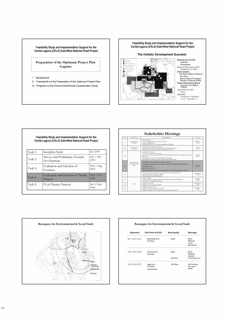
Preparation of the Optimum Project Plan
-Laguna-
Feasibility Study and Implementation Support for the Cavite-Laguna (CALA) East-West National Road Project
I Background
II Framework on the Preparation of the Optimum Project Plan
III Progress on the Environment/Social Consideration Study
2
Feasibility Study and Implementation Support for the Cavite-Laguna (CALA) East-West National Road Project
Regional Growth Pole
Calamba
Dasmarinas
Dispersed Sub-Center of MM
Muntinlupa/Las Piñas
Urban Centers
San Pedro/Binan/Cabuyao/
Sta. Rosa
Bacoor/Kawit/Noveleta/ Rosario/Carmona/GMA
Nature Preservation/Resort
Tagaytay/Los Baños / Ternate
Agro-business Center
Silang
Agriculture
Maragondon, Magallanes,
Gen. E. Aguinaldo, etc.
Legend
Regional Growth Pole
Administration Center
Disposed Sub-Center for Metro Manila
Urban Center for South Super Dev’t Axis
Mainly Residential Development
Agriculture Agri-Business Center
Nature Preservation and Resort Area
Industrial Development
Agriculture
Urban Development
Nature Preservation / Resort
The Holistic Development Scenario
3
Feasibility Study and Implementation Support for the Cavite-Laguna (CALA) East-West National Road Project
Jan. – Sept.
2006FS of Priority ProjectsTask 5:
Sept. – Dec.
2005Evaluation and Selection of Priority
ProjectsTask 4:
May – Aug.
2005Evaluation and Selection of
ScenariosTask 3:
Jan. – Mar
2005Surveys and Preliminary Scenario
DevelopmentTask 2:
Jan. 2005Inception StudyTask 1:
4
Stakeholder Meetings
Early Sept.,2006
- Outline of results of F/S- Mutual consent on framework of RAP- Further arrangement and requirement for the implementation
8th
Early July,2006
- Progress of the F/S- Explanation of framework of RAP
7th
Mid-May,2006
- Outline of F/S- Follow-up of Environmental and social considerations study (EIA level)- Explanation of resettlement policy
F/S
6th
Mid-March,2006
- Results of Environmental and social considerations study (EIA level)- Overall evaluation on project validity- Mutual consent on optimum project
5th
Early Dec.,2005
- Results of evaluation on alternatives- Progress and interim results of Environmental and social considerations study (EIA level)- Study framework on preparation of optimum project plan
4th
Sept. 23,2005
- Outline of alternatives- Alternative measure in zero option- Scope and evaluation methodologies for Environmental and social considerations study (EIA level)- Obtain opinion on concerned environmental impacts(This STM is the Official Scoping Session under EIS Process)
Preparation of Optimum Project
Plan
3rd
June 16,2005
- Alternative Development Scenarios- Environmental Framework-Social and Natural Environment- Alternative Scenarios for Regional Transport Network
Evaluation of Scenarios
2nd
March 17,2005
- Study Outline- Past, Ongoing & Future Transport Projects- Scope of Stakeholders, - Schedule & Objectives of Future Stakeholder Meetings
Preparation of Scenarios
1st
PeriodMain SubjectsStudy PhaseNo.
5
Barangays for Environmental & Social Study
Governor’s
Drive
Aguinaldo
Hway
SLEX
Molino
Blvd
Muntinlupa City
Silang
Binan
Sta Rosa
Mamplasan
Sta Rosa
Interchange
ABB-Greenfield
6
Barangays for Environmental & Social Study
Alignment Exit Point at SLEX Municipality Barangay
CE-1, CE-2, CE-3
CE-1, CE-2, CE-4
CE-5, CE-6, CE-7
Mamplasan Exit Binan Binan
Sta Rosa Exit Binan Binan
Asia Brewery
Sta Rosa Sto Domingo
(Existing)
(Existing)
(Exixting)
Malamig
Loma
Malamig
Ganado
Pulong Sta Cruz
Don Jose
Malilit
Mamplasan
Sta Rosa
Malilit Exit
247
2
7
Framework on Preparation of the Optimum Project Plan
Data Collection Analysis and Evaluation Planning and Recommendation Stakeholders
And Survey Consultation & Seminar
Formulation of Alternative Plans
1 Setting of alternative project plans
2 Collection & measurement of each
indicators of the alternative project
plan
Evaluation of traffic improvement
Impact by the project
Support of Environmental
Impact Assessment
Examination and preparation
of TOR for environmental &
social consideration
Implementing support to the
environmental & social
consideration survey
Support in EIA procedures,
such as taggingSelection of Optimum Project Plan
Support of stakeholders’ meetings
Correction / modification
3rd Stakeholders’ Meeting
4th Stakeholders’ Meeting
8
On-going Works on the ESC Study
• Environmental Baseline Study
– Field measurement surveys: air, noise/vibration,
water
– Secondary data collection
9
On-going Works on the ESC Study
CALA Expressway
Alt 1
Alt 2
Alt 2A
Alt 2
Alt 2
Alt 1
Alt 3
N/S 3 (Bacoor-Dasmarinas)
E/W 1 (Daang Hari)
Alt 1
Alt 2
Legend●Station for Residential
Area●Station for Road Area
Field Measurement SurveysEnvironmental Baseline Study
(Air, Noise/Vibration)
10
On-going Works on the ESC Study
Field Measurement SurveysEnvironmental Baseline Study
(Water)
Legend●Station for ImusRiver●Station for Ylang YlangRiver●Station for Rio Grande River●Station for Canas River
Water Quality Parameters :
pH (acidity)
Temperature
Total Suspended Solids
River Flow
11
On-going Works on the ESC Study
• Environmental Baseline Study
– Field measurement surveys: air, noise/vibration, water
– Secondary data collection
• Social Survey
– Focus group discussion (Barangay consultation)
– Perception survey
– Household inventory survey for resettlement (100% survey for potential households to be resettled for ROW acquisition)
12
Consensus Building Process
for Implementation of the Proposed Projects
• Focus Group Discussion (Barangay Consultation)
� Agenda: Outline of the proposed projects, Proposed alternative road alignments, Coordination on social surveys, Q&A (discussion)
� Participants: Barangaycaptains and councilors, Project-affected persons, Residents, Peoples organizations (PO), Non-governmental organizations (NGO)
� Acceptance of the project by Barangay =>Endorsement of the Acceptance of the Project by Municipalities and Provinces
248
3
13
Consensus Building Process
for Implementation of the Proposed Projects
• Focus Group Discussion (Barangay Consultation)
Issues & Concern
• Is the alignment final?
• Will there be compensation for
affected assets? When?
• Is there a ready relocation site?
• How will existing business
establishment be compensated?
• Will there be alternative income
source in the relocation site?
• What documents are needed as
proof of ownership?
14
Consensus Building Process
for Implementation of the Proposed Projects
• Perception Survey
� Sampled households from
project-affected barangays
15
Consensus Building Process
for Implementation of the Proposed Projects
• Household Interview
Survey for
Resettlement
� All potential
households to be
resettled
� Incl. questions on
perception of the project
16
Consensus Building Process
for Implementation of the Proposed Projects
5th Stakeholder Meeting�Conclusion of the consensus building
results
Focus Group Discussion (Barangay Consultation)�Acceptance of the project by Barangay
=>Endorsement of the Acceptance of the Project by Municipalities
and Provinces
Perception Survey�Sampled households from project-affected
barangays
Household Interview Survey for
Resettlement�All households to potentially be resettled
�Incl. questions on perception of the project
17
Consensus Building Process
for Implementation of the Proposed Projects
(Barangay Consultation)
Barangay Consultation for each BarangayAgenda:
- Outline of the proposed projects
- Proposed alternative road alignments
- Coordination of social surveys
- Q&A (discussion)
BarangayAcceptance of the project
by Barangay
Endorsement of the project by
Municipality
Barangay
Barangay
Barangay
Barangay
Barangay
Endorsement of the project by
Province
Acceptance of the project
by BarangayAcceptance of the project
by Barangay
Municipality
DPWH
Province
Participants: - Barangay captains and councilors
- Project-affected persons
- Residents
- Peoples organizations (PO)
- Non-governmental organizations (NGO)
Municipality
Barangay
Barangay
Barangay
Municipality
Province
18
Overall Framework of Environmental & Social Considerations for the CALA East-West National Road Project
Preparation of Alternative Scenarios
Social & Environmental Constraints
- socially vulnerable facilities/areas
- protection and constrained areas
Assessment of Alternative Scenarios-IEE Study for alternatives
-Social Assessment
Formulation of Optimum Project Plan
Feasibility Study
Resettlement Framework EIA Study
-Air
-Noise
etc. Preliminary RAP
Complete RAP
Parcellary survey
-set of cut-off date
Detailed Design
-Finalization of ROW
JIC
A C
AL
A E
-W S
tud
y
Main Project FlowTasks on
Environmental and Social Considerations
Submission of
EIS document
ECC acquisition
Detailed EMMP
Implementation
of EMMP
Preparation of
EIS document
Letter of intent
Scoping session
EIS ProcessStakeholder
Meeting
∆: 1st STM
∆: 3rd STM
Construction
Operation & Maintenance
∆: 8th STM
Land acquisition & resettlement
Preparation of resettlement
Monitoring & evaluation
∆: 2nd STM
Agreed?
End
YES
NO
1st level scoping
∆: 5th STM
249
4
19
THANK YOU
Feasibility Study and Implementation Support for the Cavite-Laguna (CALA) East-West National Road Project
250

1
DEPARTMENT OF PUBLIC WORKS AND HIGHWAYS (DPWH) JAPAN INTERNATIONAL COOPERATION AGENCY (JICA)
THE FEASIBILITY STUDY AND IMPLEMENTATION SUPPORT ON THE CALA EAST-WEST NATIONAL ROAD
PROJECT (CALA East-West)
4th Stakeholder Meeting
Session 2: Evaluation of Road Alternative Alignments
9 December 2005
2
Topics
1. Background
1.1 Selected Priority Projects
1.2 Alternative Alignments
2. Criteria for Evaluation of Alternative
Alignments
3. Implementation Support
4. Workshop Guidelines
3
Selected Priority Projects
1.1 Selected Priority Projects
Legend
Daang Hari (DH) Proposed
Daang Hari (DH) PNCC Project
Daang Hari (DH) Existing
North-South Road (NS) Proposed
North-South Road (NS) Exiting
CALA Expressway (CE) Proposed
CALA Expressway (CE) Future
Governor’s
Drive
Aguinaldo
Hway
SLEX
4
CALA Expressway
1.2 Alternative Alignments
Legend
Daang Hari (DH) Proposed
Daang Hari (DH) PNCC Project
Daang Hari (DH) Existing
North-South Road (NS) Proposed
North-South Road (NS) Exiting
CALA Expressway (CE) Proposed
CALA Expressway (CE) Future
CE-3
CE-1
CE-2
CE-4
CE-5
CE-6 CE-7
Expressway(50m-ROW, 6 lanes)
Alternative 1
CE-1~2+CE-3 = 18.5km
Alternative 2
CE-1~2+CE-4 = 19.6km
Alternative 3
CE-5~7 = 22.8km
5
CALA Expressway
CE
1 ,2,3
CE1 runs from Governors’ Drive to NS6. CE2 is the segment that continues on from NS6 to Aguinaldo Highway (at Silang). CE3 alignment veers away toward the northwest direction as
it enters the Sta. Rosa industrial complex and uses the existing link road to Mamplasan Interchange of the South Luzon Tollway in Binan, Laguna. The alternative line traverses rolling terrain between Silang and Sta. Rosa Industrial Complex and relatively flat area within the industrial park area for a total length of 15.65 km.
CE
1,2
an
d 4
This uses the same alignment of CE1 and CE2 but continues on an easterly direction toward subdivision areas at the back of the Sta. Rosa industrial complex and runs parallel to an existing waterway until it reaches and eventually connects with the existing Sta. Rosa Interchange of the South Luzon Tollway. Likewise, the alternative line passes through the same terrain and spans approximately 14.53 km. As it enters the Sta. Rosa Industrial Complex, the line cuts through some developed residential and industrial subdivision areas and crosses over the existing major waterway twice.
CE
5 –
CE
7
This line runs parallel to the alternative CE 1 – CE4 at a distance of about 2.5 km and begins its alignment 4.5 km west of Governor’s Drive – Aguinaldo Highway Junction and ends at the existing ABB – Greenfield Interchange of the South Luzon Tollway. The alternative alignment has three (3) segments with aggregate length of 22.82 km. The expressway alignment traverses a rolling terrain from Governor’s Drive and gently rolling to relatively flat along residential and industrial subdivisions along Sta. Rosa and Cabuyao.
6
CALA Expressway
1.2 Alternative Alignments
•Has longer route length and
requires several bends as it uses
the link road and approaches the
proposed terminal at Mamplasan
Interchange.
•Will require higher capital
requirement in spite of potential
savings to be generated from the
utilization of the existing link
road right of way and road
structure due to its longer route
as compared to the other
alternative line.
•Ayala Land owns some
properties on this area and it
might be a conflict.
•Fewer disturbances to existing
developments. Will affect less
number of structures.
•Utilization of the right of way and
roadway structure of the existing
link road to Mamplasan Interchange
could be optimized resulting in
reduced project capital requirement.
•Minimum adverse environmental
impacts as the segment will use the
existing link road alignment.
•Offers more efficient road network
interfacing since the Mamplasan
Interchange has not reached its
capacity even during peak hours
and at the same time serves as a
diversion route to Sta. Rosa –
Tagaytay Road, which is presently
experiencing traffic congestion.
CE-1~2+
CE-3:
South
Luzon
Tollway via
Mamplasan
Interchange.
DisadvantageAdvantage
251

2
7
CALA Expressway
1.2 Alternative Alignments
• The alternative line will affect significantly large magnitude
of existing developments, properties and persons.
• Interfacing with Sta. Rosa Interchange may on the contrary
aggravate the present traffic condition at the said facility
unless independent interfacing scheme with the South
Luzon Expressway would be developed to accommodate
additional traffic that will be generated by the connection.
• The alternative line though will avoid hitting some
residential structures as the subdivision areas are not fully
occupied, yet disturbance to the existing completely
developed lands will be great since it is inevitable that the
utilities already installed would be affected.
• Will require higher capital requirement in spite of the
alternative line’s shorter route length due to high cost of
road development consisting of longer waterway structures
and the high cost of right of way acquisition and
compensation.
• The alignment will create adverse environmental impacts as
it cross over and runs parallel and adjacent to the existing
major waterway.
• Ayala Land owns some properties on this area and it might
be a conflict.
•The alternative line is the
shortest route and
provides direct
connection with Sta. Rosa
Interchange. May serve as
diversion road or
alternative road to Sta.
Rosa – Tagaytay Road,
which is presently
experiencing traffic
congestion especially
during peak hours.
CE-1~2+
CE-4:
South Luzon
Tollway via Sta.
Rosa
Interchange
DisadvantageAdvantage
8
CALA Expressway
1.2 Alternative Alignments
• Farther location when other nearer sites with
large tracts of land still left untouched and
undeveloped due to lack of adequate
transportation network.
• For efficient utilization of right of way along
the last stretch of the alignment near the SLT,
several turning curves should be provided.
• The location lacks adequate local road
network system such that traffic from the
adjoining service road will have to blend with
expressway traffic at the Interchange.
• Magnitude of disturbance to existing
developments is very small as compared to
the other alternative lines.
• The cost of development for the alternative
line is the lowest among the other
expressway line options since it has the
shortest route length and less number of
roadway structures to be installed.
• This line offers opportunity to develop
untouched and open raw land along its route
and increase the land development potentials
with the new alignment opening.
• The line will not create adverse social and
environmental impacts as it traverses
generally open land.
• The line provides more efficient
transportation network linkage with the South
Luzon Tollway since the newly constructed
ABB-Greenfield Interchange has sufficient
space for future expansion and improvement.
CE-5~7:
ABB-
Greenfield
Interchange.
DisadvantageAdvantage
9
Evaluation of Alternative Alignments
2. Criteria for Evaluation of Alternative Alignments
Traffic and Technical : Easiness of Construction,
Adequacy of Alignment, and Magnitude of Capital
Requirement .Regional Development: Network Efficiency,
Support Growth Corridors/ Industrial Areas, and
Tourism Development Environment : Magnitude of Disturbance,
Easiness in ROWA, and
Impact on Agriculture.
10
3. Implementation Support
1. LGUs initiatives
a. Board Resolutions endorsing/accepting the project
b. Land Use preservation/protection of alignment
c. Development control along alignment
d. Cost sharing scheme
2. Contribution/participation by private sector
11
4. Workshop Guidelines
Groupings
Scope of Evaluation
Facilitator
(1) Provincial Stakeholders All alternatives Takagi / Mamet Tizon
(2) Sta. Rosa Stakeholders All alternatives Rene Santiago / Alvin Madrid
(3) Binan Stakeholders All alternatives Freddie Galano / Bing Pallana
12
Evaluation Rating for Alternative
Alignments
(1) (2) (3) Traffic/
Technical Regional
Development Environment
Total
CALA Expressway
30% 40% 30% 100%
252

3
13
Sub Criteria for Traffic Evaluation
(1) Traffic/Technical
(1-1)
Easiness of construction
(1-2) Adequacy of
alignment
(1-3) Magnitude
(less) of capital requirement
Total
CALA Expressway
5% 10% 15% 30%
14
Sub Criteria for Regional Development
(2) Regional Development
(2-1) (2-2) (2-3)
Network
efficiency
Support growth
corridors/industrial areas
Tourism development
Total
CALA Expressway
15% 15% 10% 40%
15
Sub Criteria for Environment
(3) Environment (3-1) (3-2) (3-3)
Magnitude of disturbance
Easiness of ROWA
Impact on agricultural
sector
Total
CALA Expressway
10% 15% 5% 30%
16
General Workshop Mechanics
• Chairperson per group will be selected.
• Facilitator will prepare the output evaluation sheet for the group
• Reference materials will be distributed for each evaluation criteria
• Output of the groups will be summarized and presented in Session 3.
17
THANK YOU
253

1
DEPARTMENT OF PUBLIC WORKS AND HIGHWAYS (DPWH) JAPAN INTERNATIONAL COOPERATION AGENCY (JICA)
THE FEASIBILITY STUDY AND IMPLEMENTATION SUPPORT ON THE CALA EAST-WEST NATIONAL ROAD
PROJECT (CALA East-West)
4th Stakeholder Meeting
Session 3: Results of the Evaluation of Road
Alternative Alignments
9 December 2005
2
Results of the Evaluation by Group
3
Next Steps
• Consultation with Affected Barangays
• Consultation with Large Property Owners
• Environmental and Social Study
• 5th Stakeholders’ Meeting for Environmental
and Social Study Results (March 2006)
4
THANK YOU
255

1
Coordination Meeting with HUDCC/TWG-DH26th Flr. Atrium Bldg., Makati City
The Feasibility Study and Implementation Support on the CALA East-West National
Road Project
(CALA East-West)
December 12, 2005
Department of Public Works and Highways o Japan International Cooperation Agency
Study Objectives and Background
i. Review of CALA regional transport network development scenario.
ii. Examination of the feasibility of CALA East-West road and related projects and preparation of project implementation plan.
STUDY AREA
0 5 10Km
Manila Bay
Cavite
Lagunade Bay
Metro Manila
Laguna
Binan
KawitLas Pinas
MuntinlupaRosario
Tanza
General Trias
Trece Martires
Silang
Naic
Dasmarinas
GMACarmona
Neveleta
Cavite City
Bacoor
Imus
San Pedro
Person Trip Dependency in Metro Manila by CALA
Total Trips
Includes
Intra Zone Trips
By Public Mode & Private Mode
(1996 & 2005)
Traffic Volumes on Present Network
Year 2020
Trend Case on
Present Network
Year 2005
Note: Congested sections are shown in red.
Development Scenario for 2005-2008
21.3% of heavily congested road
15,504Annual savings (in Million Pesos)
21.4 km/hAve. Travel Speed
Heavily Congested
Forced Flow
Saturated Flow
Free-flow
Sta Rosa Interchange
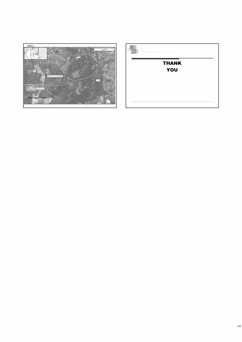
• R1 Extension to Kawit(PEA)
• CALA North-South Toll Road from Bacoor to Daang Hari(PIC/NDC/DPWH)
• Daang Hari Road
- Extension to SLEX (DOJ/PNCC)
- Extension to Rosario (DPWH thru JBIC/NDC/LGU)
Alabang Interchange
Susana Heights
Carmona Interchange
Bicutan Interchange
Sucat Interchange
257
2
THANK
YOU
258