Embed Size (px)
Citation preview
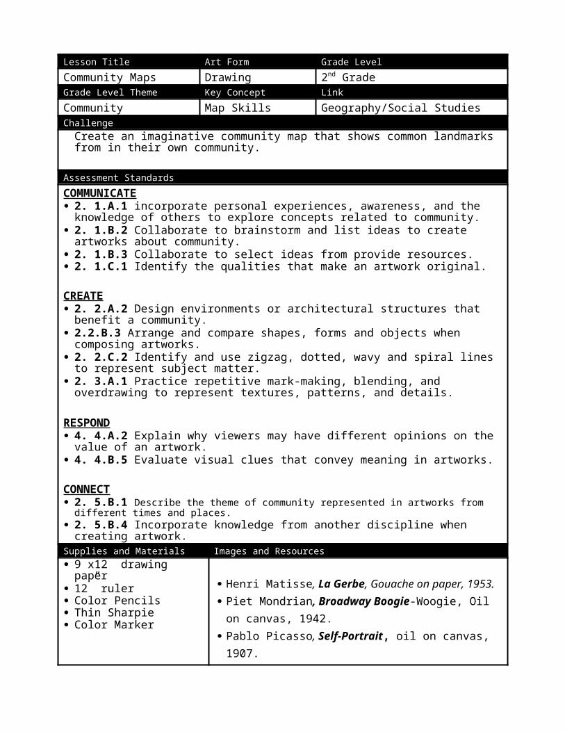
Lesson Title Art Form Grade LevelCommunity Maps Drawing 2nd GradeGrade Level Theme Key Concept LinkCommunity Map Skills Geography/Social StudiesChallenge
Create an imaginative community map that shows common landmarks from in their own community.
Assessment StandardsCOMMUNICATE 2. 1.A.1 incorporate personal experiences, awareness, and the knowledge of others to explore
concepts related to community. 2. 1.B.2 Collaborate to brainstorm and list ideas to create artworks about community. 2. 1.B.3 Collaborate to select ideas from provide resources. 2. 1.C.1 Identify the qualities that make an artwork original.CREATE 2. 2.A.2 Design environments or architectural structures that benefit a community. 2.2.B.3 Arrange and compare shapes, forms and objects when composing artworks. 2. 2.C.2 Identify and use zigzag, dotted, wavy and spiral lines to represent subject matter. 2. 3.A.1 Practice repetitive mark-making, blending, and overdrawing to represent textures,
patterns, and details.
RESPOND 4. 4.A.2 Explain why viewers may have different opinions on the value of an artwork. 4. 4.B.5 Evaluate visual clues that convey meaning in artworks.CONNECT 2. 5.B.1 Describe the theme of community represented in artworks from different times and places. 2. 5.B.4 Incorporate knowledge from another discipline when creating artwork.Supplies and Materials Images and Resources 9”x12” drawing paper 12” ruler Color Pencils Thin Sharpie Color Marker
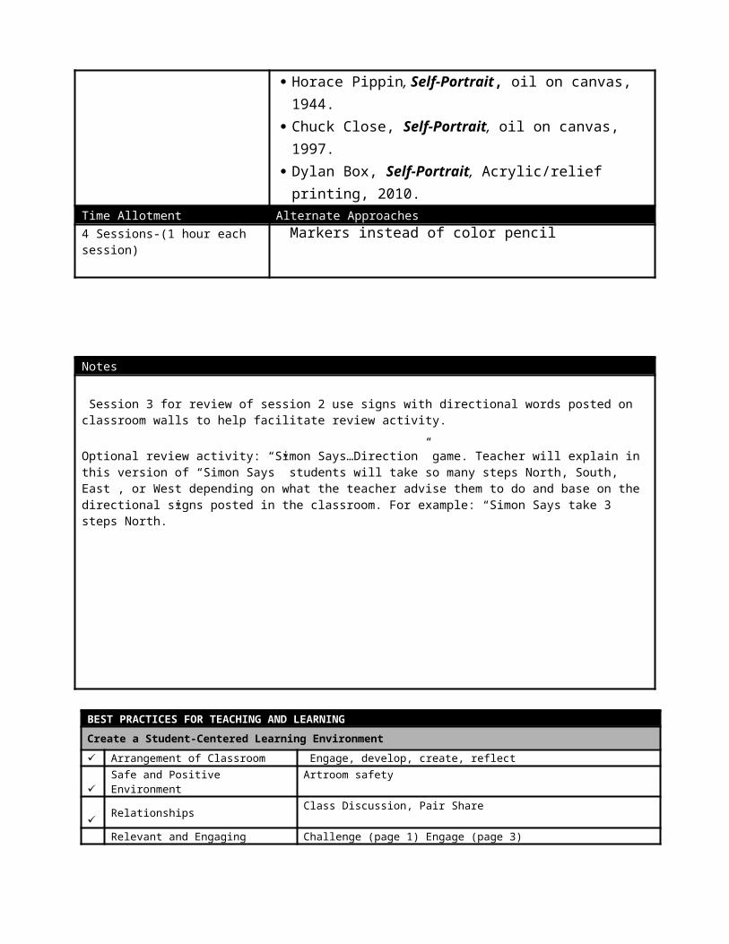
Henri Matisse, La Gerbe, Gouache on paper, 1953. Piet Mondrian, Broadway Boogie-Woogie, Oil on canvas,
1942. Pablo Picasso, Self-Portrait, oil on canvas, 1907. Horace Pippin, Self-Portrait, oil on canvas, 1944. Chuck Close, Self-Portrait, oil on canvas, 1997. Dylan Box, Self-Portrait, Acrylic/relief printing, 2010.
Time Allotment Alternate Approaches4 Sessions-(1 hour each session) Markers instead of color pencil
Notes
Session 3 for review of session 2 use signs with directional words posted on classroom walls to help facilitate review activity.
Optional review activity: “Simon Says…Direction” game. Teacher will explain in this version of “Simon Says” students will take so many steps North, South, East , or West depending on what the teacher advise them to do and base on the directional signs posted in the classroom. For example: “Simon Says take 3 steps North.”
BEST PRACTICES FOR TEACHING AND LEARNING
Create a Student-Centered Learning Environment
✓ Arrangement of Classroom Engage, develop, create, reflect ✓ Safe and Positive Environment Artroom safety
✓ Relationships Class Discussion, Pair Share
✓ Relevant and Engaging Learning Task Challenge (page 1) Engage (page 3)
✓ Student Communication Questioning
Plan and Teach for Student Learning
✓
Lessons Aligned with POS/Pacing Guides
POS indicators (page 1)
✓ Content Knowledge Geographical representation and Understanding of direction
✓ Engagement Engage (page 3)
✓ High-Yield Instructional Strategies Non-linguistic representation✓ Teacher Collaboration Cooperate in Instruction, Class Brainstorm✓ Integrated Technology Use of Google Maps
Assess Student Learning
✓ Goal Setting and Reflection I can statement (page 2), Reflection (page 4)
✓ Checking for Understanding Self-Reflection, Exit Ticket, Hand Signal (page 4)
✓ Assessments Informal assessment
Lesson SessionYour Community Map 1Engage
Read There’s a Map on My Lap! access students prior knowledge and listen to the story, students will fill out a KWL chart about maps as a class.
Present PowerPoint on Community maps:Essential Questions:
What are maps? What are their uses?How do we use a map? What tools on a map do we use?How do we know the names of things on a map?Have you use a map before? Or your parents use a map before?When and where had you or your parents use maps before?
Introduce art challenge: Create an imaginative community map using common landmarks from your own community.Introduce vocabulary—Map, Location, Community, Landmark, Symbol,Introduce artist exemplars:
David Ryan Robinson, ZSL London Zoo, silkscreen illustration (promote the Worldwide Conservation of animals, 2012.
Essential Questions:Where is this map located? How do you know this?What visual “clues” do you see that make you tell it’s from London?
Captayn John Smith, Cartogram of Virginia, 1612.Essential Questions:
Where is this map located? How do you know this?What visual “clues” do you see that make you tell it’s from London?
Engagement activity: Students in their table group write a list of landmarks in their community.Develop1) Model how to fill out Community Map Symbol Planning Sheet.2) Share teacher’s prototype.
Show teacher example of planning sheet. Direct student to: Title for your community map Include at least 5 natural feature symbols (non-man made)
o Biomes (Mountains, Forest, Desert, etc)o Body of water (River, Lake, Sea, Ocean)
Include 5 manmade landmarks as symbols (library, hospital, school, church, grocery store, police station, fire station, airport, train station, etc.)
Include transportation (stop sign, traffic light, car, taxi, train, airplane) Show the season (draw raindrops, snowflake, heat waves)
3) Demonstrate first step after filling planning sheet is for students to make a bubble letter of their first name and use the space inside to draw a community map.
4) Explain students color pencil technique and what good craftsmanship looks like.Create
Direct students to fill out planning sheet.Reflect
“Snowstorm”-Class Reflection/Closure ActivityStudents write down (or draw if they have trouble writing) what they learned about community or maps on a scrap paper teacher provide which they will wad up and throw into the air. Then each learner will pick up a nearby piece of paper response to read out loud. (Students do not have to write their name on their paper for anonymity.)
Lesson SessionYour Community Map 2Engage
Review session 1: We learned what is a map and why are map useful. We learn what is a community and what a landmark is.
Engagement activity/Review: Activate prior knowledge about maps by providing 3 different maps for students to compare & contrast. David Ryan Robinson, ZSL London Zoo, silkscreen illustration (promote the Worldwide
Conservation of animals, 2012. Captayn John Smith, Cartogram of Virginia, 1612. Richard Scarry, Busy, Busy Town, Book Illustration, 1997.
Essential Questions: What are the similarities between the maps? Do they have similar map things? What are the differences between the maps? Where are the maps located? How can you tell?
Present PowerPoint on Community maps:Go over what is a compass rose and different example from maps.Why are compass roses important?
Introduce vocabulary—Title, Compass Rose, Label, SymbolExplain the cardinal directions: North is upward, South is downward, West is toward the left, and East is toward the right
Develop Remind this is their imaginative community map so students get to be city planners and place
where your roads, houses, and landmarks will be. Review color pencil technique poster and model students how to color appropriately.
Create Direct students to first draw their imaginative community map on draft paper before
beginning on final drawing paper. Students can then draw a big bubble letter of their first letter of their first name. (Letter need
to be as big as the 9”x11” paper.)Remind students to:
o Include at least 5 symbols that describe their Remind students you should finish your drawing of your maps today in pencil.
ReflectBack It Up & Re-Map— Class Discussion Checking students understanding of use of compass rose and directions students will point out where certain location are on the map.
Lesson SessionCommunity Maps 3Engage
Review session 2: We learned how to compare maps and learn what a compass rose is use for. Teacher will ask students to raise their hands to review directional words.
Engagement activity: Integration of technology and relevancy of maps through demonstrate the use of Google Earth and Goggle Maps. Zoom in and out of school community area using an interactive map on Google Maps.
Essential Questions: Where are the buildings? What are the roads? Where do you notice the roads compare to the buildings? Do you see any stores nearby? How about any parks?Explain how we can zoom in and out as if we’re seeing the community from a bird-eye perspective
Introduce vocabulary— Map Legend, Shading, Contour/Outline
Essential Questions:Have you use a map legend before? Explain map legends help us understand a map icons/symbols.
Explain that a map legend is like a lock and key. To understand a map legend its not some secret code but the information is provided to explain what these symbols mean.
DevelopDemonstrate how to draw an example compass rose. Start with a vertical line then a horizontal line to make a “cross”. Make sure you name the cardinal directions—North, West, East, and South.
Demonstrate how to correctly color using color pencil by coloring the outline/contour of a shape then filling in shape area.
Demonstrate the use of shading is from light to dark by applying pressure to your pencil.Create
Ask students who job is supply distributor to hand out table supplies—erasers, color pencils and thin sharpie (if students are finished with their pencil drawing).
Ask students who are artwork distributors to hand out table artwork.
Students should work on tracing neatly their pencil drawing with thin sharpie before coloring and to erase their pencil marks.
Then students can color in their maps using color pencils practicing the coloring technique I demonstrated.
Reflect
Vocabulary Check—Class Discussion o Review words we already learned in class (Map, Landmark, Community, Symbol,
Label, Compass Rose, Map Legend) using picture flashcards and students match with each flashcard picture and in their own words explain what each vocabulary definition is.
Lesson SessionYour Community Maps 4EngageReview session 3: We learned how to make a compass rose and learn what are map legends.
Engagement Activity: Present a video on the use of signs in maps “2nd Grade Understanding and Maps Symbols” https://youtu.be/v9nOie2mmr0Present PowerPoint on Community Maps:
Review vocabulary— Symbol, Map Legend, Compass Rose
Historical map exemplar: Walter Bigges, City of S. Domingo located in Hispaniola, illustration, 1588.
Essential Questions: Although the map is in Spanish in a language some of us may not speak, can you tell what’s on the map? Do you still see a title? Do you still see a legend? Do you still see symbols?
Develop Remind students to look at map and see if it has the following on their checklist.
Title for your community map Include at least 5 natural feature symbols (non-manmade)
o Biomes (Mountains, Forest, Desert, etc)o Body of water (River, Lake, Sea, Ocean)
Include 5 manmade landmarks as symbols (library, hospital, school, church, grocery store, police station, fire station, airport, train station, etc.)
Include transportation (stop sign, traffic light, car, taxi, train, airplane) Show the climate (draw raindrops, windy, snowflake, heat waves)
Create Ask students who job is supply distributor to hand out table supplies—color pencils.
Ask students who are artwork distributors to hand out table artwork.
Students should finish coloring their maps.
Reflect “Artwalk”—Class Critique
Instruct every student to stand up behind stood reciting and performing in action “1 finger on your lip & other hand on your hip”. Then direct students to follow the teacher as the leader around all the different tables until everyone saw everyone self-portrait.
Turn to your table partner to perform “The Art Sandwich” verbally:o Compliment—“Something I like about your art is…”o Suggestion—“Something I would add if I was making your map is…”
o Compliment—“Something else I like about your art is…”
Lesson #4 Updated At-A-Glance
Grade Level: 2nd Grade
Theme: Community
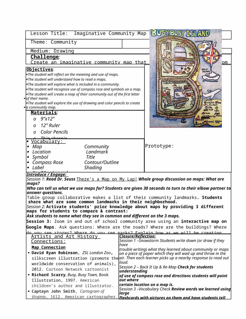
Medium: DrawingChallenge:Create an imaginative community map that shows common landmarks from in their own community.
Objectives: The student will reflect on the meaning and use of maps.The student will understand how to read a maps.The student will explore what is included in a community. The student will recognize use of compass rose and symbols on a map. The student will create a map of their community out of the first letter
of their name.The student will explore the use of drawing and color pencils to create
a community map.
Materials: o 9”x12”o 12” Rulero Color Pencilso Thin sharpieo Colored Markers
Prototype:
Introduce / Engage: Session 1: Read Dr. Seuss There’s a Map on My Lap! Whole group discussion on maps: What are maps? Who can tell us what we use maps for? Students are given 30 seconds to turn to their elbow partner to answer questions. Table group collaborative makes a list of their community landmarks. Students share what are some common landmarks in their neighborhood.
Session 2: Activate students’ prior knowledge about maps by providing 3 different maps for students to compare & contrast: Ask students to name what they see in common and different on the 3 maps. Session 3: Zoom in and out of school community area using an interactive map on Google Maps. Ask questions: Where are the roads? Where are the buildings? Where do you see stores? Where do you see parks? Explain how as we will be creating bird’s eye view maps just like in google maps. Session 4: Present a video https://youtu.be/v9nOie2mmr0 (2:58 min) “2nd Grade Understanding and Making Maps Symbols” to understand use of signs in maps in the real world. Closure/Reflection:
Session 1 –Snowstorm Students write down (or draw if they have trouble writing) what they learned about community or maps on a piece of paper which they will wad up and throw in the air. Then each learner picks up a nearby response to read out loud. Session 2 – Back It Up & Re-Map Check for students understandingof use of compass rose and directions students will point out where certain location on a map is. Session 3 –Vocabulary Check Review words we learned using large flashcards with pictures on them and have students tell me in their own what each vocabulary words means. Session 4 – Artwalk to observe what others had done.Students also fill out a “Community Map Quiz” to check for students’ understanding of lesson objective and content. True/false and matching vocabulary words with pictures.
Artists and Art History Connections:Map Connection
David Ryan Robinson, ZSL London Zoo, silkscreen illustration (promote the worldwide conservation of animals), 2012. Cartoon Network cartoonist
Richard Scarry, Busy, Busy Town, Book Illustration, 1997. American children’s author and illustrator.
Captayn John Smith, Cartogram of Virginia, 1612. American cartographer.
Walter Bigges, City of S. Domingo located in Hispaniola, illustration, 1588. Spaniard cartographer.
Lesson Title: Imaginative Community Map
Vocabulary: Map Community Location Landmark Symbol Title Compass Rose Contour/Outline Label Shading Key/Map Legend
George Mason University5th Grade—“Where I live?”—Community Map
POS “THOUGHT JOT”
The following worksheet is designed for the student teacher to use the Program of Studies (POS) developed by Fairfax County Public Schools to create lesson plans. Each Standard should be addressed in each lesson. Shoot for at least 2 relevant Benchmarks per Standard. An SBI is an acronym for Standards, Benchmarks, and Indicators.STANDARD 1 - COMMUNICATE
The student will understand and apply the creative process to develop and communicate relevant and original ideas.
2. 1.A.1 The student will incorporate personal experience, awareness, and the knowledge of others to explore concepts related to community.The student will incorporate what they know about their community to share their knowledge of aspect of their community through designing a community map. 2. 1.B.2 The student will collaborate to brainstorm and list ideas to create artworks about community.The students will as a table group brainstorm together to create a mind map of the things are incorporated in their neighborhood and find common landmarks.2. 1.B.3 The student will collaborate to select ideas from provided resources. The students amongst their collaborative group will use ideas from mindmap about common landmarks into their own personal community maps. 2. 1.C.1 The student will identify the qualities that make an artwork original. The students will plan their own key, symbols and titles to make their maps original.
STANDARD 2 - FORMS, METHODS & FUNDAMENTALS The student will understand how artists make purposeful decisions to follow or break tradition when selecting art forms, choosing methods of representation, and applying art fundamentals in artworks.
2.2.A.2 The student will design environments or architectural structures that benefit a community
The students will city planners drawing element of their preexisting community and adding imaginative elements they wish their neighborhood would have for the benefit of their community.
2. 2.B.3 The student will arrange and compare shapes, forms, and objects when composing artworks.
The student will assess how big they should make their symbols in their map compare to other structures.
2. 2.C.2 The student will identify and use zigzag, dotted, wavy and spiral lines to represent subject matter.
The student will use variety of lines to express roads with dotted lines, wavy lines for expressing water areas, zigzag lines to express grassy areas for parks in maps.
STANDARD 3 - ART MEDIA TECHNIQUES & PROCESSES The student will understand how artists experiment with materials, develop excellence through practice, and apply art media techniques and processes to create meaning in artworks.
2.3.A.1 The student will practice repetitive mark-making, blending, and overdrawing to represent textures, patterns, and details.The student will be practicing repetitive mark-making, blending, and overdrawing to represent textures, patterns, and details. STANDARD 4 - RESPOND
The student will gain insight into art and artmaking by reflecting on and responding to artworks through critical and aesthetic discussions.
2. 4.A.2 The student will explain why viewers may have different opinions on the value of an artwork. The students share with how one may view a map as being a functional piece as well possible artwork. 2. 4.B.5 The student will evaluate visual clues that convey meaning in artworks.The student will evaluate how visual clues in form of symbols on a map represent meaning.
STANDARD 5 - CONNECT The student will understand the connections among art, artists, history, and culture.2. 5.A.1 The student will describe the theme of community represented in artworks from different times and places. The student will use study different maps from different time and places from London Zoo map, to 1600’s Virginia map, and fictional map of Richard Scarry’s world of Busytown. 2. 5.B.1 The student will incorporate knowledge from another discipline when creating artwork.The student will incorporate knowledge of geography into their map making.
Your Community MapLesson # 4 ScriptSESSION 1:
1.) Before the students arrive in the classroom, have the PowerPoint displayed and prototypes prepared.
2.) All of the students walk into the classroom and sit on the classroom carpet rug in rows.
3.) Once the class officially begins, start out by discussing the PowerPoint. Today we will be discussing the challenge: Students will create an imaginative community map
that shows common landmarks from their own community.
4.) Ask the following questions to define new vocabulary: What are maps? What are maps use for?What is a location? Where are we located right now?What is a community? Who makes up a community? What is a landmark? Can you name some landmarks you know? How about landmarks in your community?What is a symbol? Had you heard of this word before? Can you give me an example of a symbol?Use symbols on posters around art room as example.
5.) Read Dr. Seuss There’s a Map on My Lap!
6.) Talk about how Dr. Seuss use maps in his book. Turn to your elbow bubby and tell him/her one thing you learn about maps while you listen to There’s a Map on My Lap!
7.) Showcase artists’ figures to help students visualize what they will be making: o David Ryan Robinson “LSZ London”, illustration, 2012
Questions to ask students:• Can you guess this map location?• What visual “clues” can you see that make you know it’s location?
o Richard Scarry “Busy, Busy Town”, book illustration,1997Questions to ask students:
• Can you guess this map location?Tell students the location is fictional. But how do the kids know its not a real location?
• What visual “clues” can you see that make you know its an elk?
o Captayn John Smith “Cartogram of Virginia”, historical cartogram, 1612Questions to ask students:
• Can you guess this map location?• What visual “clues” can you see that tell us it's a house?
o Walter Bigges “City of S. Domingo located in Hispaniola”, cartogram, 1588Questions to ask students:
• Can you guess this map location?Tell students although it is in a language some of us cannot understand we call still make out some clues about things on the map.
• What visual “clues” can you see that tell us it's a great owl?
Questions: What are similarities/common about these 3 maps? What are the differences you see?
9.) Instruct students to get into their table group to come up of a list of community landmarks. Then discuss a few examples from each list.
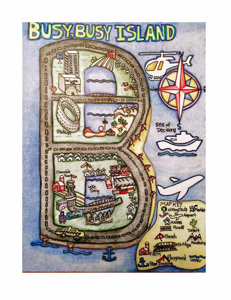
Share Teacher prototype: Discuss with students what they will be learning in this lesson. Bring out the teacher prototype and discuss what the students will be learning. “I can … make a
community map that has landmarks by coming up with symbols that represent the landmarks.” statement.
I can reflect on the meaning and use of maps. I can understand how to read a map. I can explore what is included in a community. I can create a map with a compass rose and symbols on it. I can draw a map and color it by using color pencil techniques.
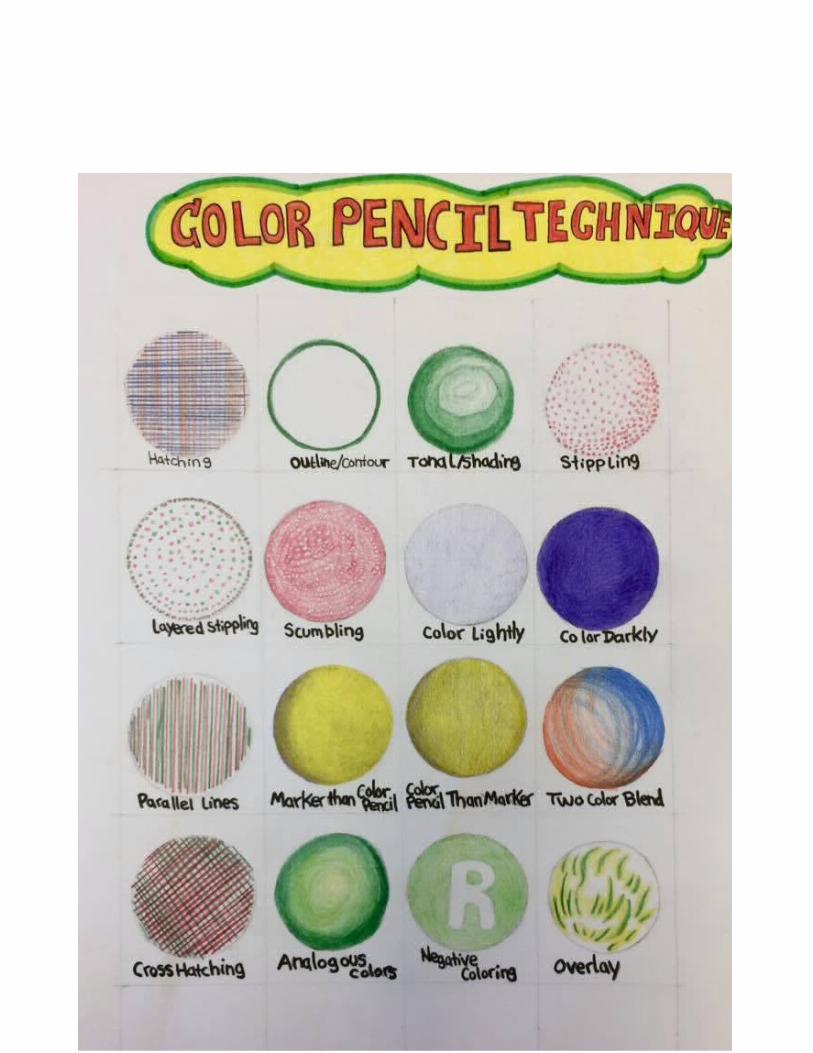
8.) Show the color pencil technique poster. Ask questions: What color pencil techniques did you see Mr. Dang use in his example? Demonstrate how to fill out Your Community Map Planning Sheets
9.) Distribute Your Community Map Planning Sheets for students to brainstorm and plan out their imaginative community map design. Remind students they are city planners and need to think about what the people in their community need: transportation like roads, airplane, cars to move around, at least 5 different landmarks for people to go to like school, church, supermarket. Their map needs a title just like Mr. Dang’s map.
10.) 15 minutes before the end of class, direct students to stop what they are doing and put their names on their planning sheet to collect.
11.) Introduce the reflection activity: “Snowstorm” Student write down (or draw if they have trouble writing) what they learned about community or maps on a piece of paper which they will wad up and throw into the air. Then each learner picks up a nearby response to read out loud.
12.) Direct students into clean-up procedures. Turn off lights and remind students to do their art jobs putting
away materials and artwork.
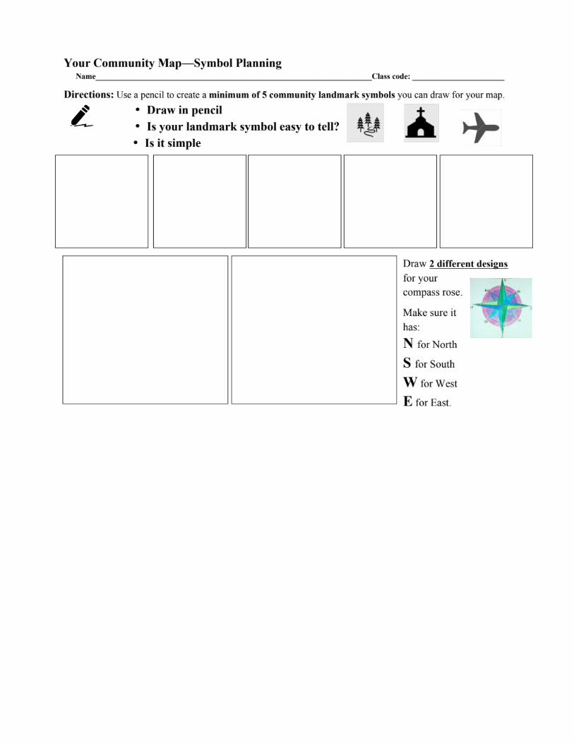
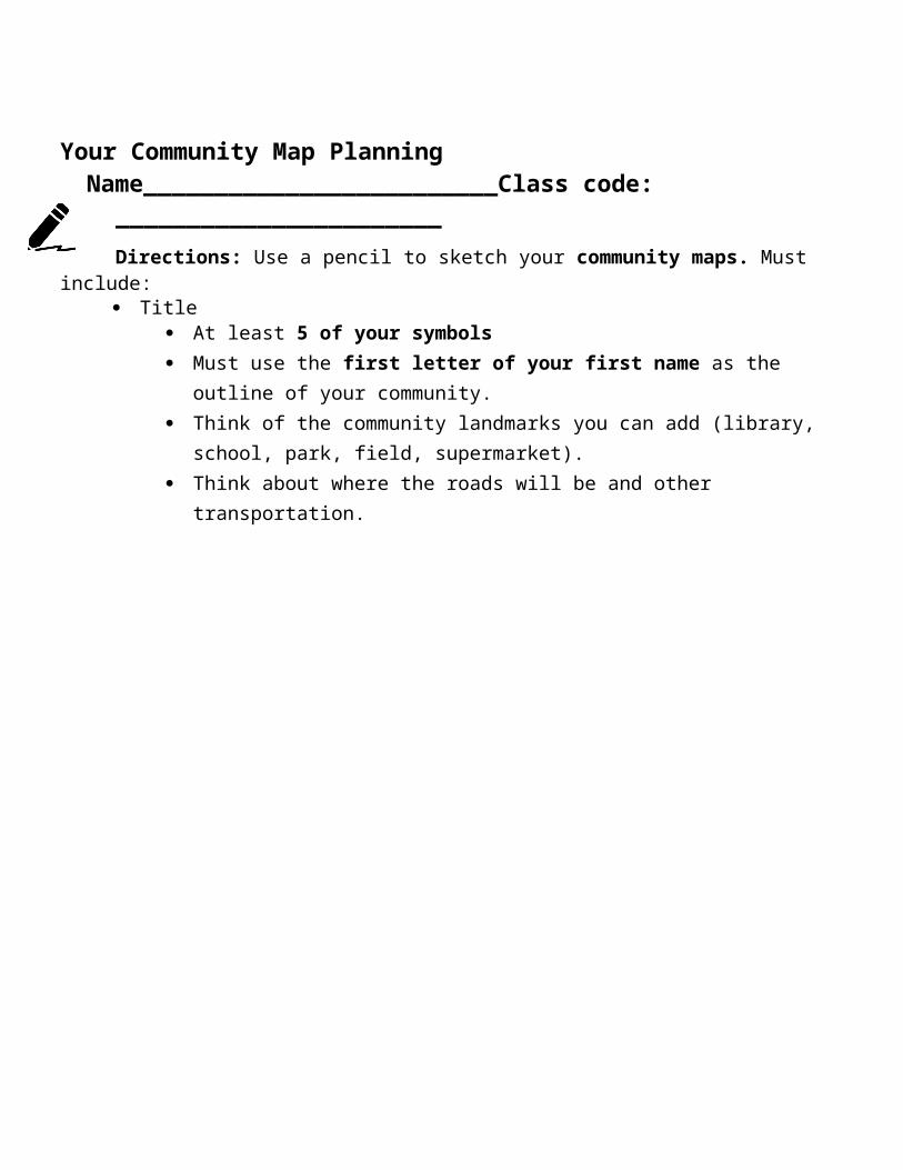
Your Community Map PlanningName_________________________Class code: _______________________
Directions: Use a pencil to sketch your community maps. Must include: Title
At least 5 of your symbols Must use the first letter of your first name as the outline of your community. Think of the community landmarks you can add (library, school, park, field,
supermarket). Think about where the roads will be and other transportation.
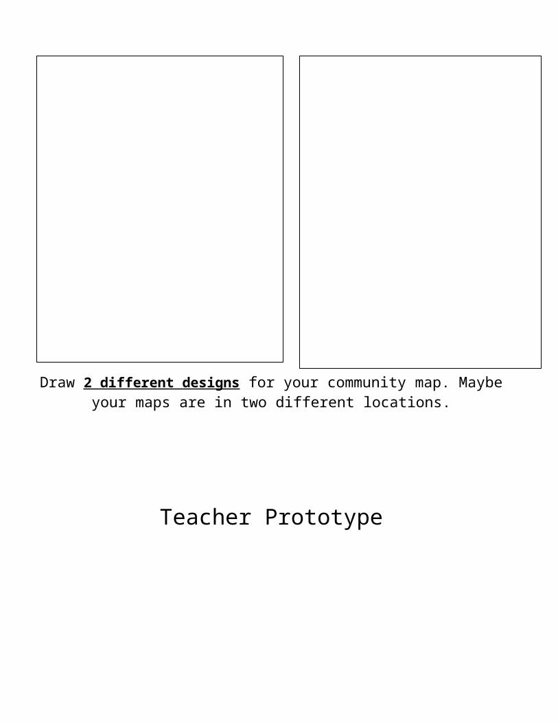
Draw 2 different designs for your community map. Maybe your maps are in two different locations.
Teacher Prototype
2nd grade Community Quiz
Name:________________________________________ Class code:____________________
1. A community is a ___________________________________________________________________.
2. Label N, S, E, and W on the compass rose. 6. The school is ____________ of Ruth’s House
Write north, south, east, or west Circle True or False for to complete each sentence. these questions
3. The school is _______________ of the supermarket. 7. Contour is the same as outline. True/ False
4. The park is _______________ of the super market. 8. Shading happens when you apply pressure to your pencil for different darkness.
True/ False5. David’s house is ____________ of the park. 9. Is a globe a map. True/ False
10. North, East, West, and Smith are direction on a compass rose. True False
NAME: Brian Dang Grade Level: 2nd Grade_ Art form: DrawingAVT 691 Self-evaluation:Elementary Lesson Packet for Lesson # 4 Title: Your Community MapWrite your category grades (A, B, C, D, or F in the space provided). The second line is for the teacher. Place an “x” in boxes are simply done, “+” in boxes that are done well, and a “-“ in boxes are missing or poorly done.
Designed a STARS lesson (Glance and Template) appropriate for elementary students at your specified grade level. A
X S tandards-Based : The lesson is based on the POS for this grade level.
X R elevant : The lesson is engaging and clear. It can be understood by a student at this grade. Students have some choice in the process.
+ T hematic : The lesson is inspired by a theme assigned to this grade level (Big Idea).
+ S kill-building : The lesson plan will help students with increasing the technical abilities (Sequence by Media).
+ A ge-appropriate : The lesson is age appropriate. Nurtures and develops critical & creative skills.
+ I included diverse, meaningful, and specific artists work in my lesson.
Communicated your expectations for the assignment. A
x I stated the art challenge in grade level appropriate way (media-specific action).
+ I described my materials technique demonstration steps in my lesson plan.
+ I offered meaningful adaptations or modifications for students who struggle as well as students who exceed in my lesson plan.
x I developed a student self-scoring document (student rubric, student self-assessment, or student self-evaluation as an additional document for my Final Packet [based on the objectives]).
+ I explained objectives aligned to the POS in a grade-level appropriate way.
+ I designed and included student planning and reflection sheets for my lesson.
Created a sample or prototype of the finished work or art. A
+ I included an example of what the students are to create in 2 ways: I inserted a thumbnail image in my At-a-Glance and I provided a large, high quality version.
+ My prototype is R elevant : The lesson is engaging and clear. It can be understood by a student at this grade as personal way that I (the teacher) solved the art challenge.
+ My prototype is S tandards-Based : The lesson is based on the POS for this grade level.My prototype is T hematic : The lesson is inspired by a theme assigned to this grade level (Big Idea).My prototype is A ge-appropriate : The lesson is age appropriate.
+ My prototype is neat and complete. My work of art demonstrates excellent craftsmanship and skill. It nurtures grade-appropriate abilities while challenges students to slightly increase rigor.
Used digital technology in your lesson presentation. B
+ I used technology (PWPT, Prezi, etc.) and a summary of its use is included in my lesson plan.
X I provided an agenda for the digital presentation (grade level friendly).
+ I used technology in a clear and informative way (grade level) by effectively using visual cues to support independent reading (images, font size or style, underlining or highlighting).
- I provided a class session checklist that students can independently understand.
+ My challenge and objectives are presented in a student friendly way.
Submitted items by due date; labeled appropriately and formatted correctly (FINAL + Self-Evaluation). A
x At-a-Glance completed and formatted correctly. x Completed artwork example (Prototype)x POS Thought Jot completed and formatted
correctly.+ Digital Technology Presentation that is complete and
formatted correctly.x FCPS Template Lesson Plan (including Template
[formatted correctly], Planning, Reflection, and Scoring sheets)
+ A Script of at least the 1st session that details how I will teach my students. Asking meaningful questions. Providing strong, grade-level appropriate descriptions. Considering grade level misconceptions and skills.