Embed Size (px)
Citation preview
Topographic Maps
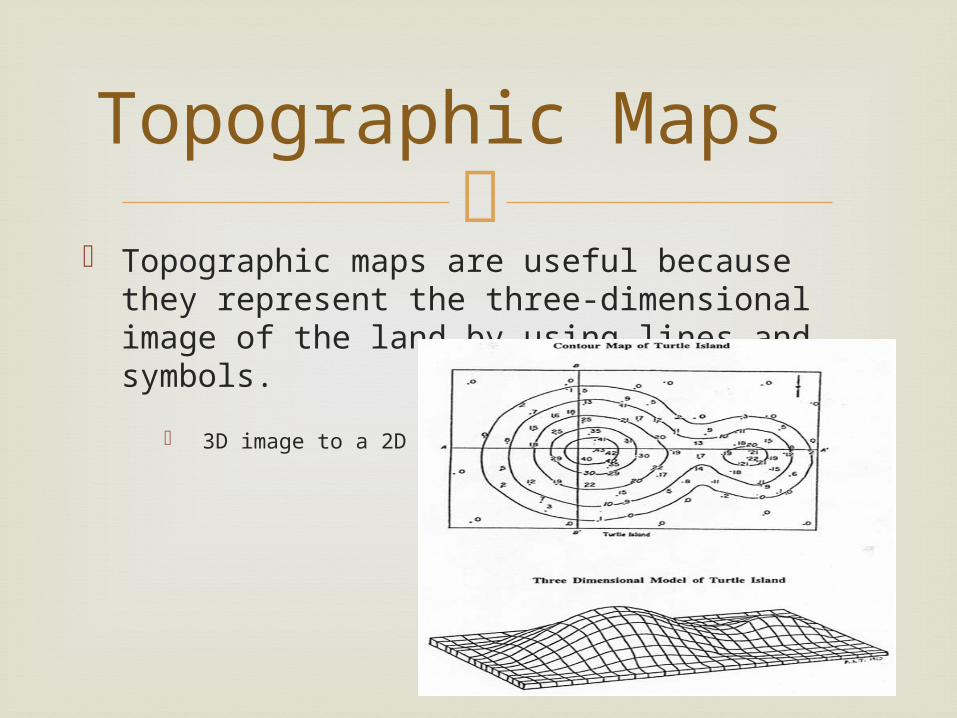
Topographic maps are useful because they
represent the three-dimensional image of the land by using lines and symbols.
3D image to a 2D map
Topographic Maps
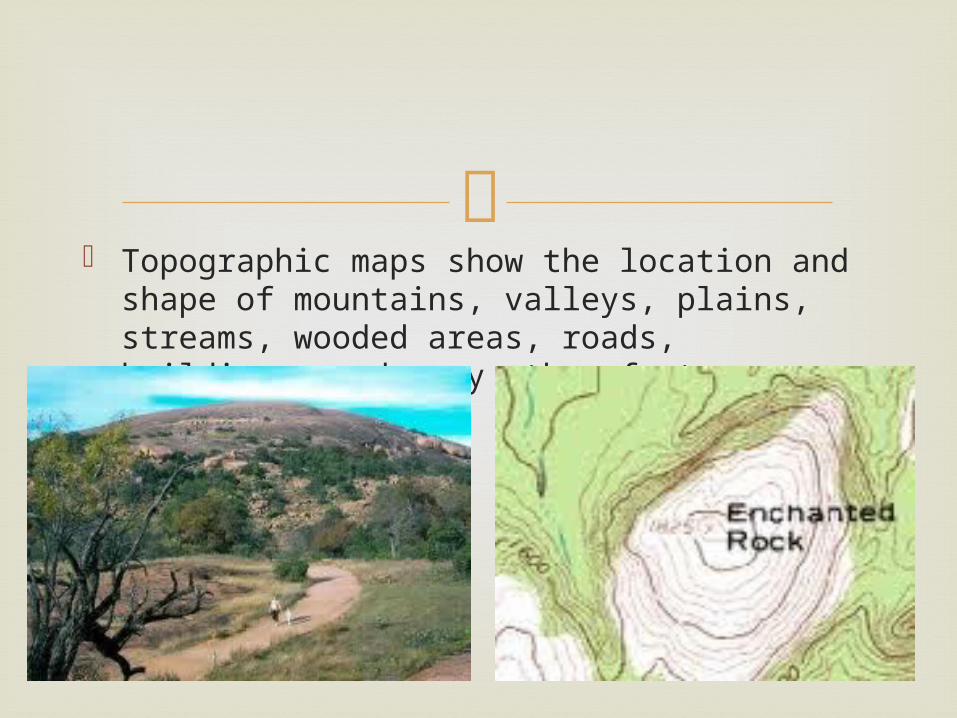
Topographic maps show the location and
shape of mountains, valleys, plains, streams, wooded areas, roads, buildings, and many other features.
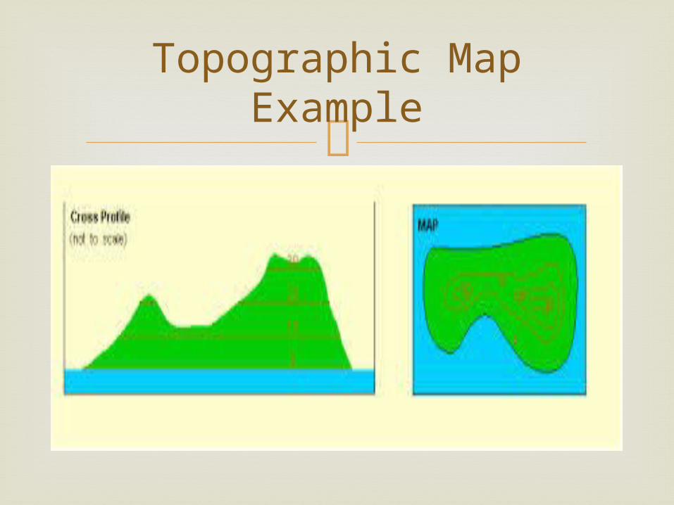
Topographic Map Example
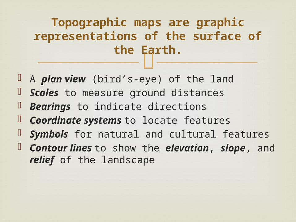
A plan view (bird’s-eye) of the land Scales to measure ground distances Bearings to indicate directions Coordinate systems to locate features Symbols for natural and cultural features Contour lines to show the elevation, slope,
and relief of the landscape
Topographic maps are graphic representations of the surface of the
Earth.
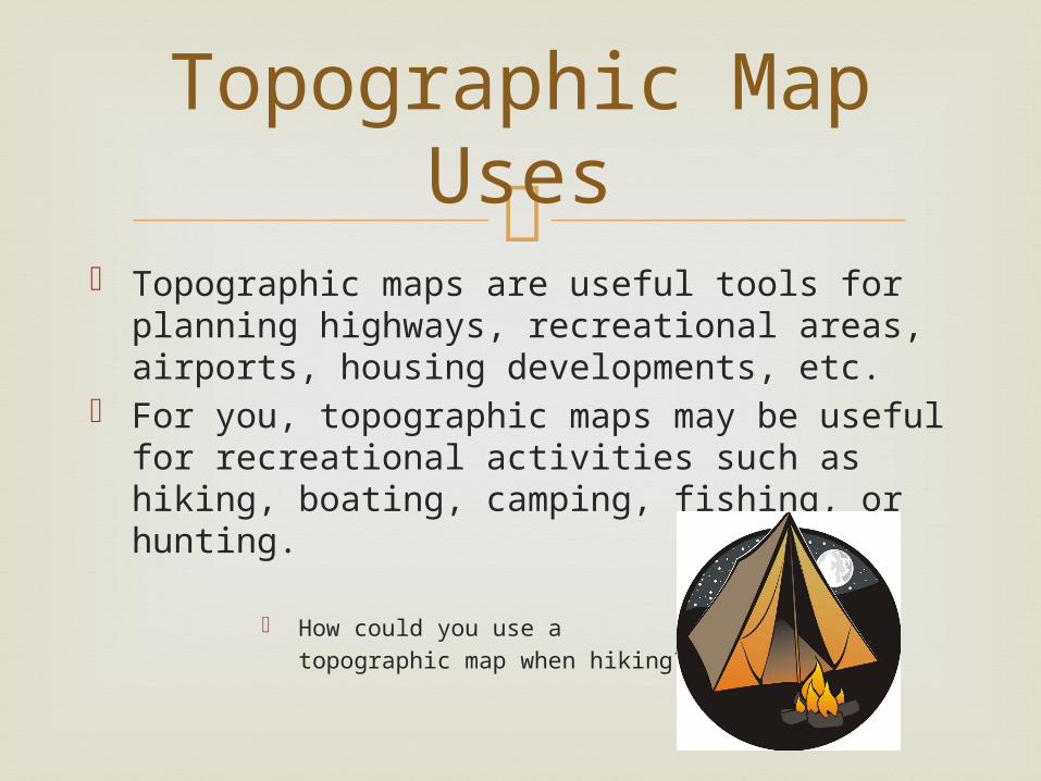
Topographic maps are useful tools for planning
highways, recreational areas, airports, housing developments, etc.
For you, topographic maps may be useful for recreational activities such as hiking, boating, camping, fishing, or hunting.
How could you use a topographic map when hiking?
Topographic Map Uses
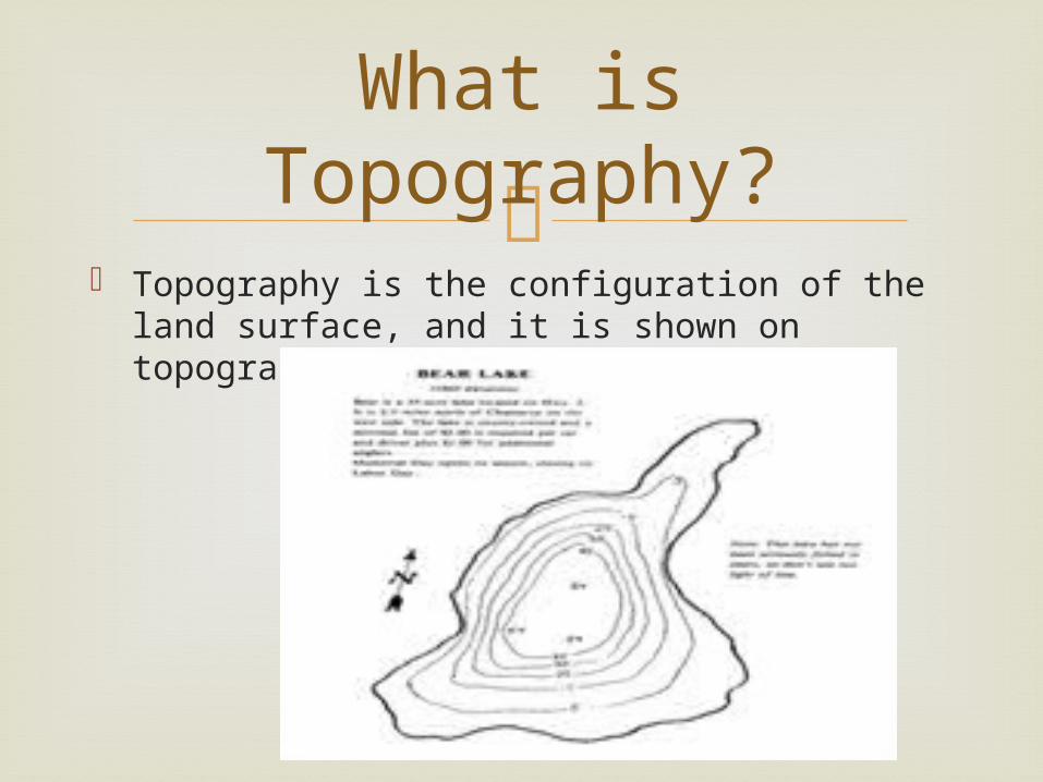
Topography is the configuration of the land
surface, and it is shown on topographic maps with contour lines.
What is Topography?
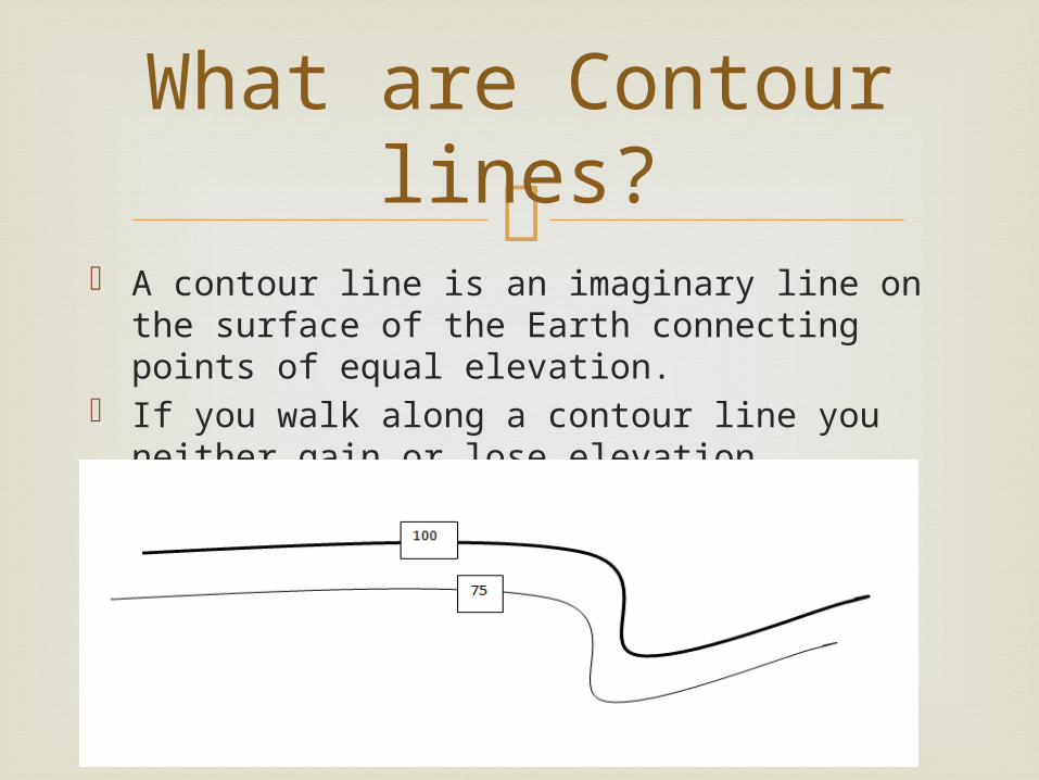
A contour line is an imaginary line on the
surface of the Earth connecting points of equal elevation.
If you walk along a contour line you neither gain or lose elevation.
What are Contour lines?
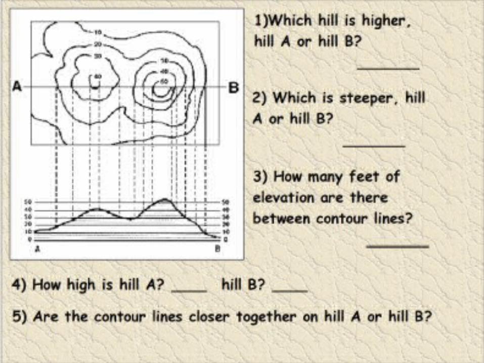
Each contour line represents one elevation. Contour lines never cross!!! The vertical spacing (difference in elevation)
between contour lines is known as the contour interval.
Typical contour intervals are 10, 20, 50, and 100 feet.
The contour interval is generally given in the legend of the map.
Contour Line Rules
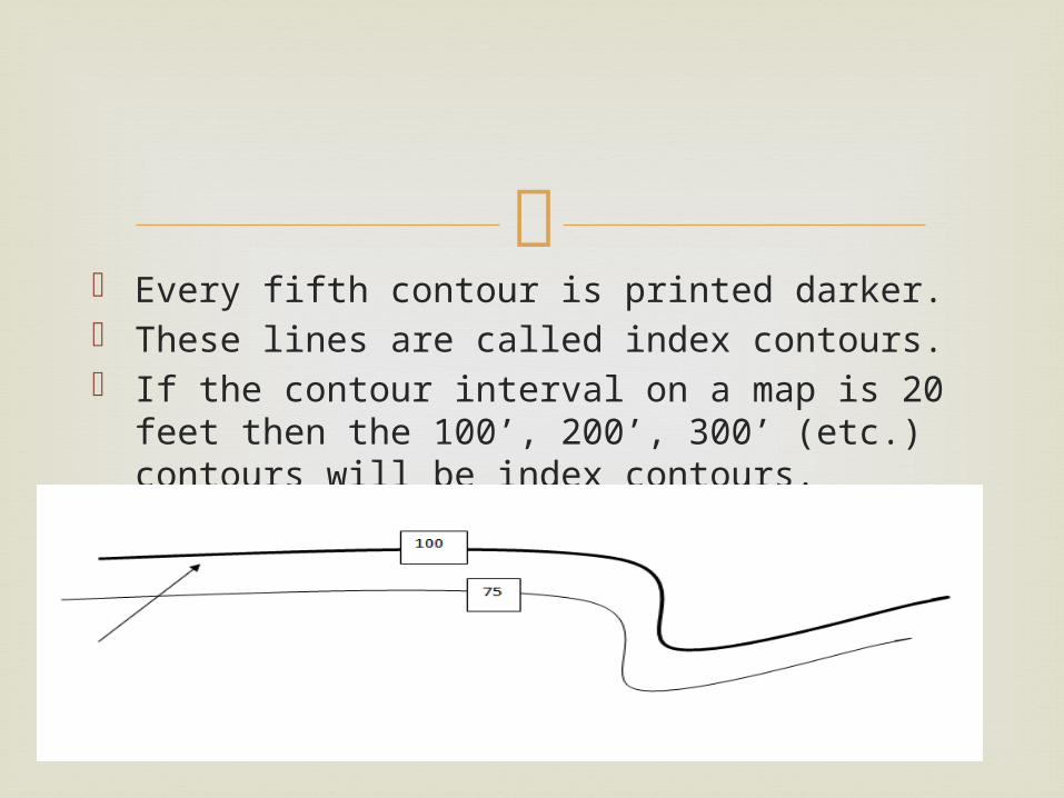
Every fifth contour is printed darker. These lines are called index contours. If the contour interval on a map is 20 feet then
the 100’, 200’, 300’ (etc.) contours will be index contours.
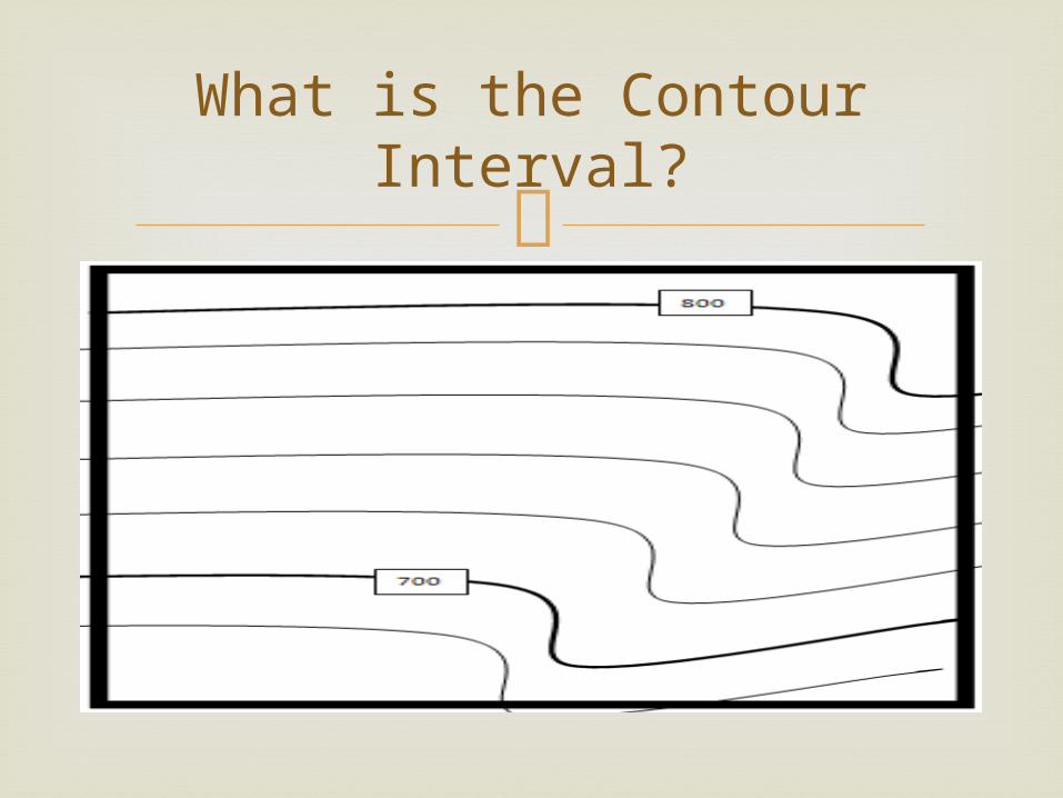
What is the Contour Interval?
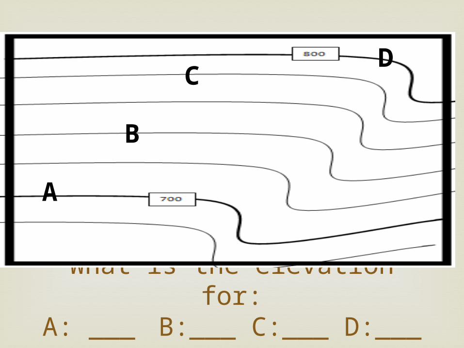
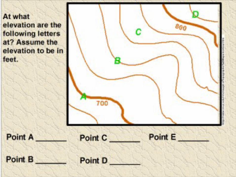
What is the elevation for:A: ___ B:___ C:___ D:___
A
B
CD
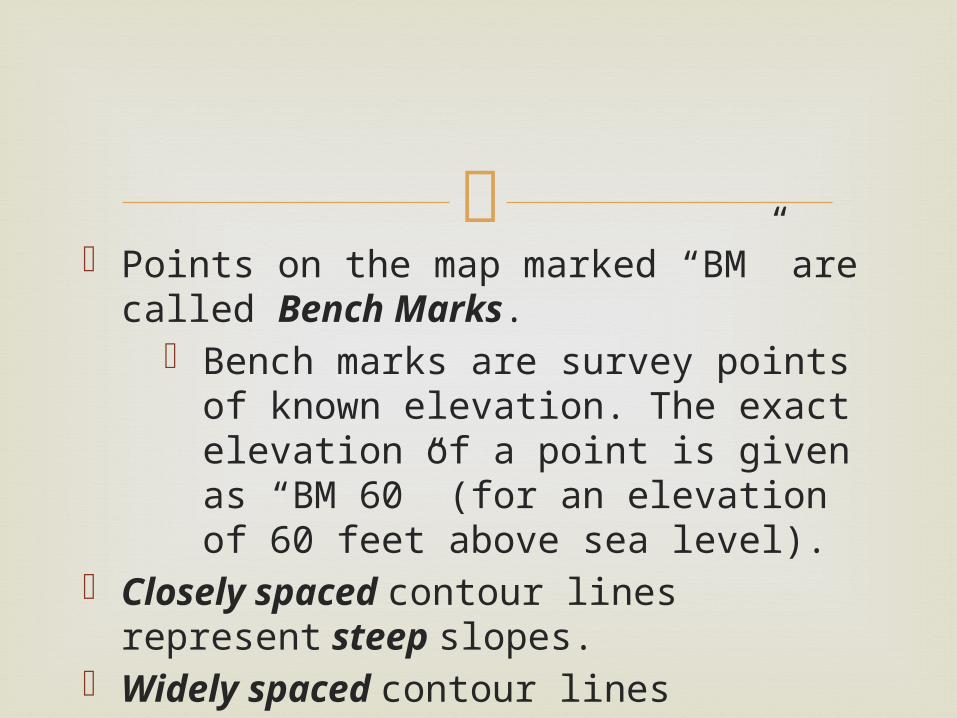
Points on the map marked “BM” are
called Bench Marks. Bench marks are survey points of
known elevation. The exact elevation of a point is given as “BM 60” (for an elevation of 60 feet above sea level).
Closely spaced contour lines represent steep slopes.
Widely spaced contour lines represent gentle slopes.
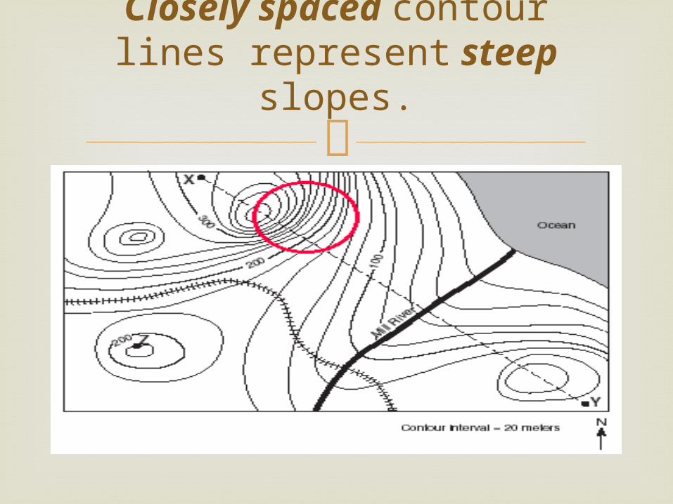
Closely spaced contour lines represent steep slopes.
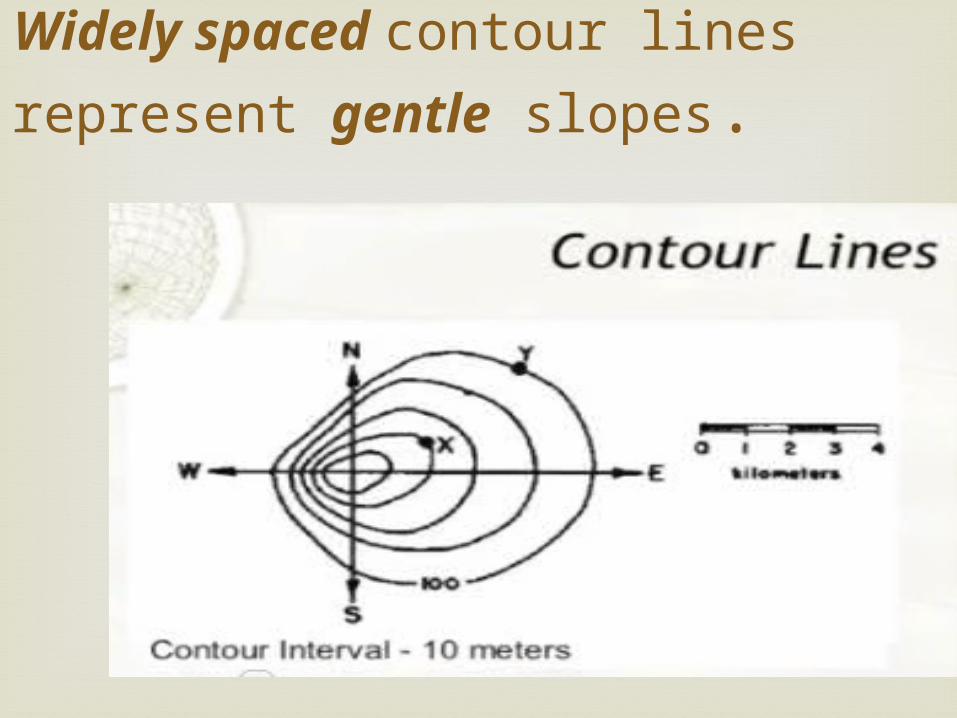
Widely spaced contour lines represent gentle
slopes.

Remember that streams and rivers flow downhill (from higher elevation to lower elevations).
The point of the “V” points uphill or upstream. (Look at the map and think about this for a minute).
Note that where a contour line crosses a stream or river (of even a dry gully or valley), the contour lines are bent sharply, forming a “V”.
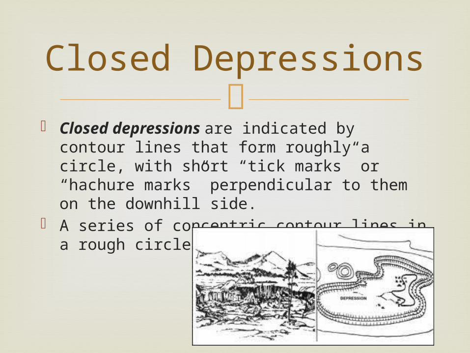
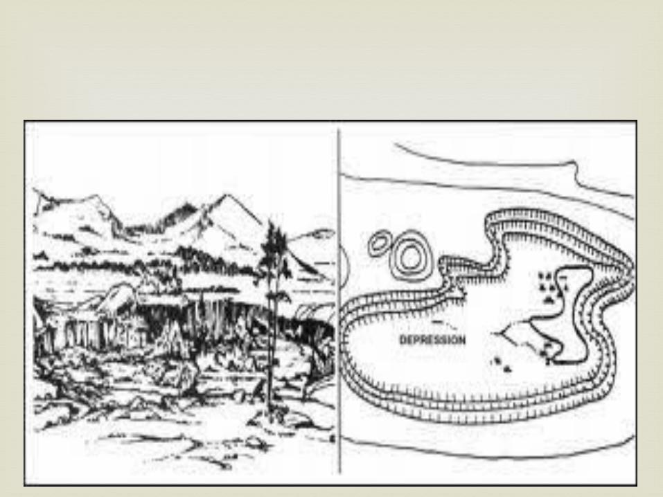
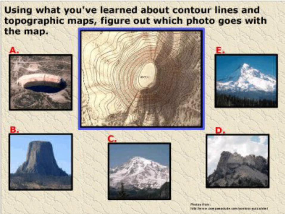
Closed depressions are indicated by contour
lines that form roughly a circle, with short “tick marks” or “hachure marks” perpendicular to them on the downhill side.
A series of concentric contour lines in a rough circle represents a hill.
Closed Depressions
Complete the vocabulary and
questions for a daily grade. You may use your notes.
Glue your notes onto p.91 of your ISN.