Embed Size (px)
Citation preview
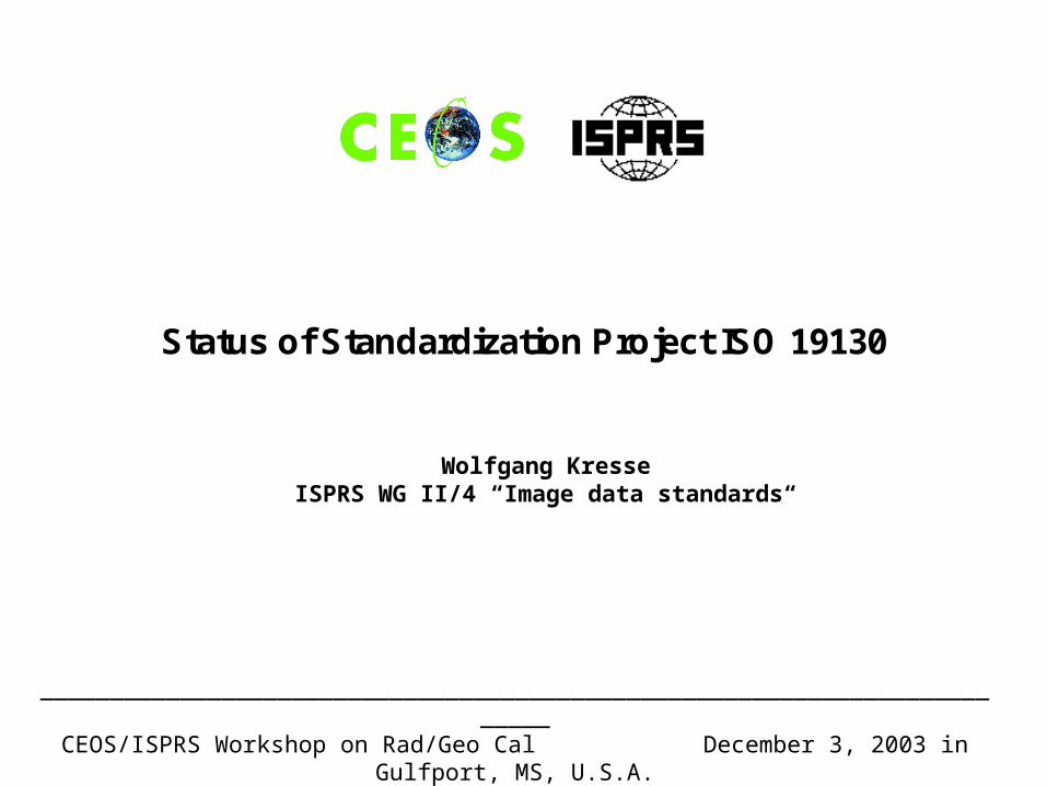
_________________________________________________________________________CEOS/ISPRS Workshop on Rad/Geo Cal December 3, 2003 in Gulfport, MS, U.S.A.
Status of Standardization Project ISO 19130
Wolfgang KresseISPRS WG II/4 “Image data standards“
_________________________________________________________________________CEOS/ISPRS Workshop on Rad/Geo Cal December 3, 2003 in Gulfport, MS, U.S.A.
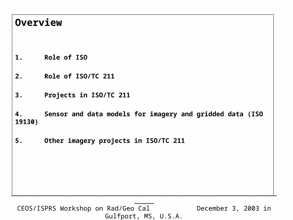
Overview
1. Role of ISO
2. Role of ISO/TC 211
3. Projects in ISO/TC 211
4. Sensor and data models for imagery and gridded data (ISO 19130)
5. Other imagery projects in ISO/TC 211

_________________________________________________________________________CEOS/ISPRS Workshop on Rad/Geo Cal December 3, 2003 in Gulfport, MS, U.S.A.
1. Role of ISO (1/2)
3 international standards developing organizations
ISO International Organization for Standardization (isos = equal)
IEC International Electrotechnical Commission
ITU International Telecommunication Union
Joint Technical Committee: ISO/IEC JTC1: computer sciences
_________________________________________________________________________CEOS/ISPRS Workshop on Rad/Geo Cal December 3, 2003 in Gulfport, MS, U.S.A.
1. Role of ISO (2/2)
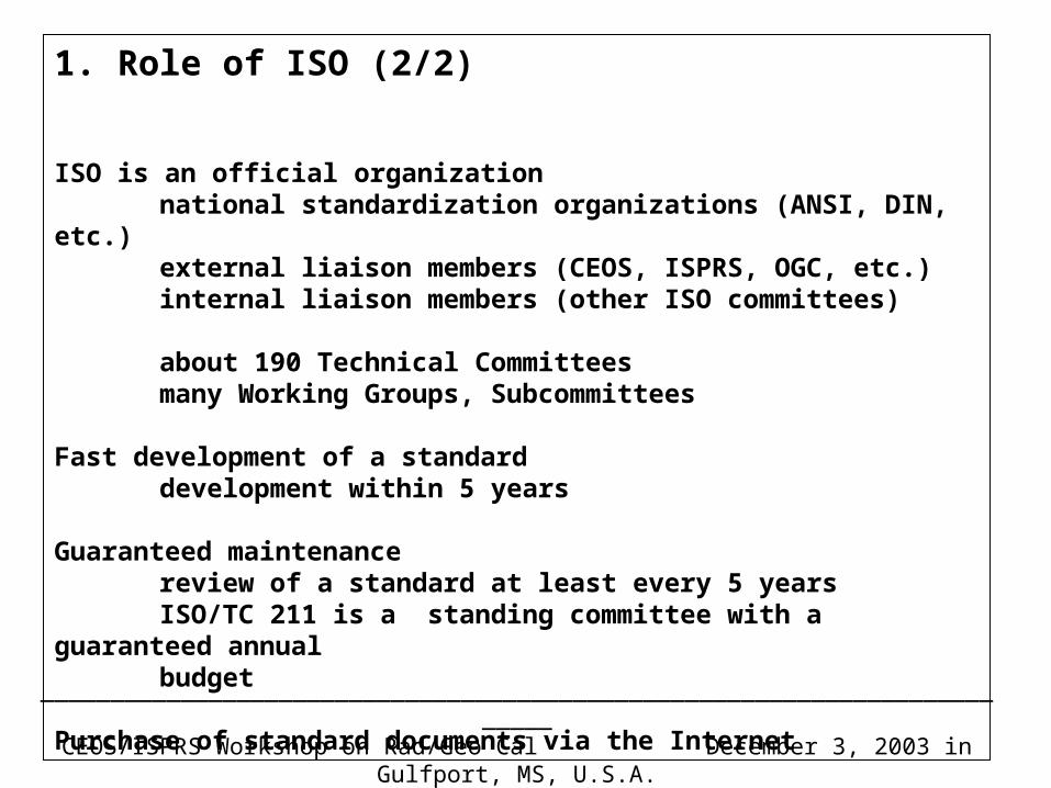
ISO is an official organizationnational standardization organizations (ANSI, DIN, etc.)
external liaison members (CEOS, ISPRS, OGC, etc.)internal liaison members (other ISO committees)
about 190 Technical Committeesmany Working Groups, Subcommittees
Fast development of a standarddevelopment within 5 years
Guaranteed maintenancereview of a standard at least every 5 yearsISO/TC 211 is a standing committee with a guaranteed annualbudget
Purchase of standard documents via the Internet
_________________________________________________________________________CEOS/ISPRS Workshop on Rad/Geo Cal December 3, 2003 in Gulfport, MS, U.S.A.
2. Role of ISO/TC 211 (1/2)
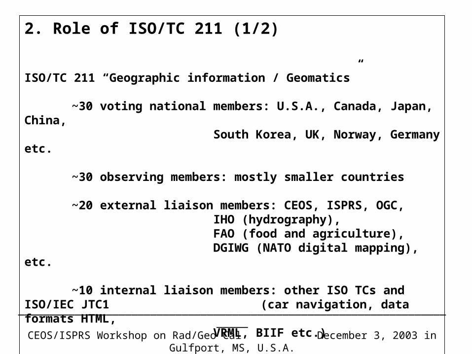
ISO/TC 211 “Geographic information / Geomatics”
~30 voting national members: U.S.A., Canada, Japan, China,South Korea, UK, Norway, Germany etc.
~30 observing members: mostly smaller countries
~20 external liaison members: CEOS, ISPRS, OGC,IHO (hydrography),FAO (food and agriculture),DGIWG (NATO digital mapping), etc.
~10 internal liaison members: other ISO TCs and ISO/IEC JTC1 (car navigation, data formats HTML, VRML, BIIF etc.)
_________________________________________________________________________CEOS/ISPRS Workshop on Rad/Geo Cal December 3, 2003 in Gulfport, MS, U.S.A.
2. Role of ISO/TC 211 (2/2)
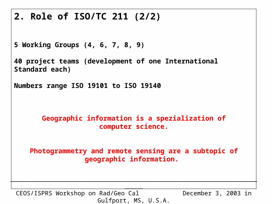
5 Working Groups (4, 6, 7, 8, 9)
40 project teams (development of one International Standard each)
Numbers range ISO 19101 to ISO 19140
Geographic information is a spezialization ofcomputer science.
Photogrammetry and remote sensing are a subtopic ofgeographic information.
_________________________________________________________________________CEOS/ISPRS Workshop on Rad/Geo Cal December 3, 2003 in Gulfport, MS, U.S.A.
3. Projects in ISO/TC 211 (1/1)
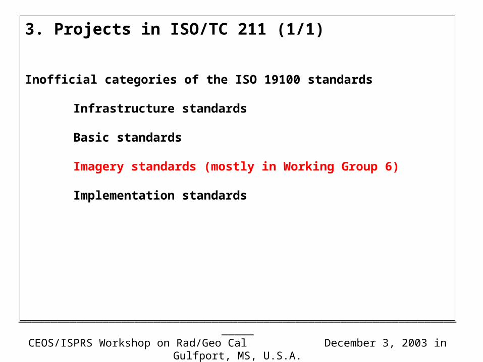
Inofficial categories of the ISO 19100 standards
Infrastructure standards
Basic standards
Imagery standards (mostly in Working Group 6)
Implementation standards
_________________________________________________________________________CEOS/ISPRS Workshop on Rad/Geo Cal December 3, 2003 in Gulfport, MS, U.S.A.
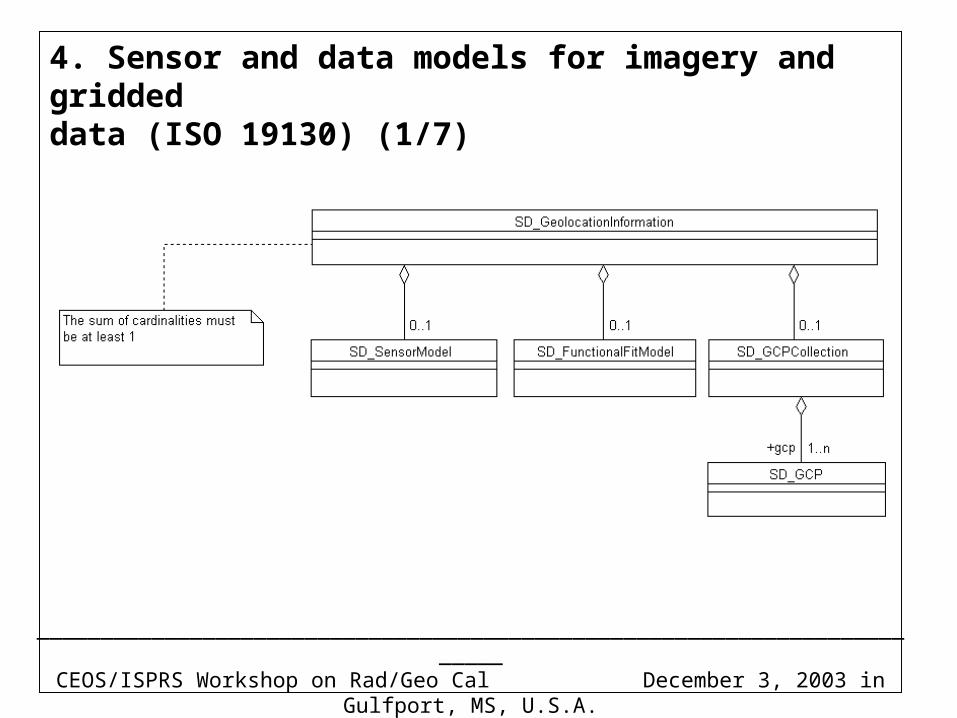
4. Sensor and data models for imagery and griddeddata (ISO 19130) (1/7)
_________________________________________________________________________CEOS/ISPRS Workshop on Rad/Geo Cal December 3, 2003 in Gulfport, MS, U.S.A.
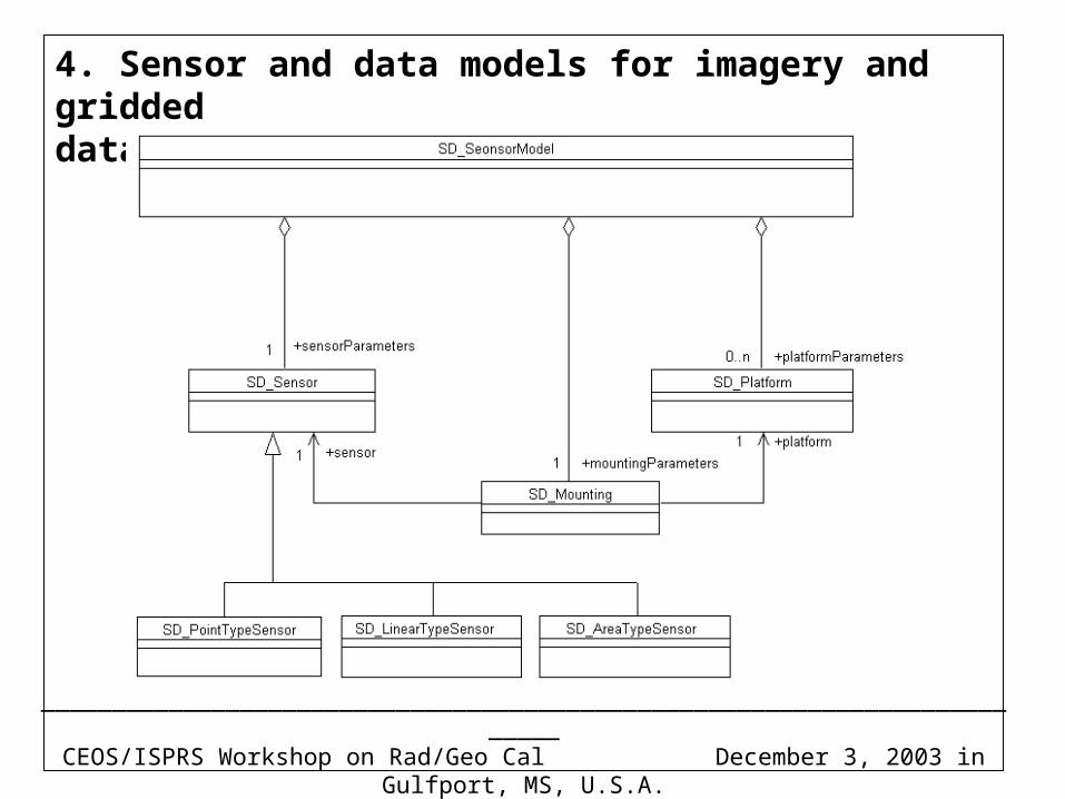
4. Sensor and data models for imagery and griddeddata (ISO 19130) (2/7)
_________________________________________________________________________CEOS/ISPRS Workshop on Rad/Geo Cal December 3, 2003 in Gulfport, MS, U.S.A.
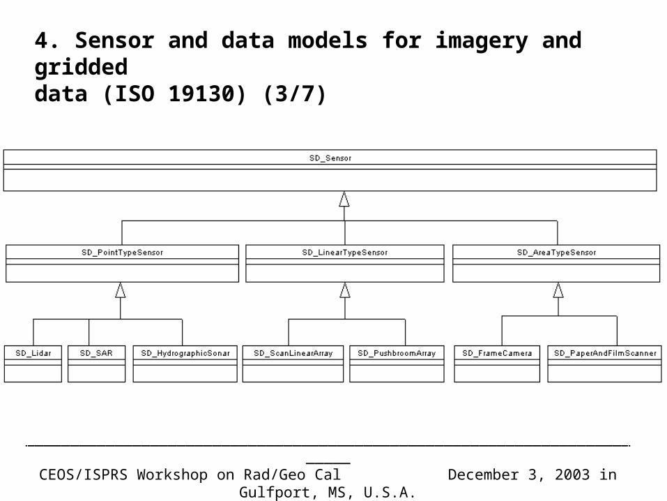
4. Sensor and data models for imagery and griddeddata (ISO 19130) (3/7)
_________________________________________________________________________CEOS/ISPRS Workshop on Rad/Geo Cal December 3, 2003 in Gulfport, MS, U.S.A.
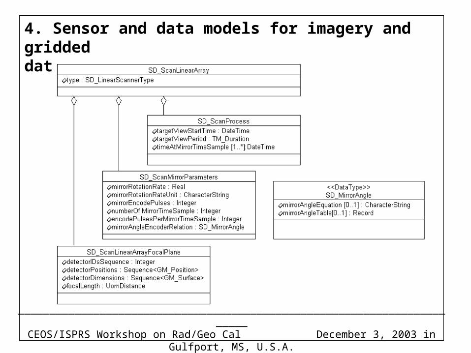
4. Sensor and data models for imagery and griddeddata (ISO 19130) (4/7)
_________________________________________________________________________CEOS/ISPRS Workshop on Rad/Geo Cal December 3, 2003 in Gulfport, MS, U.S.A.
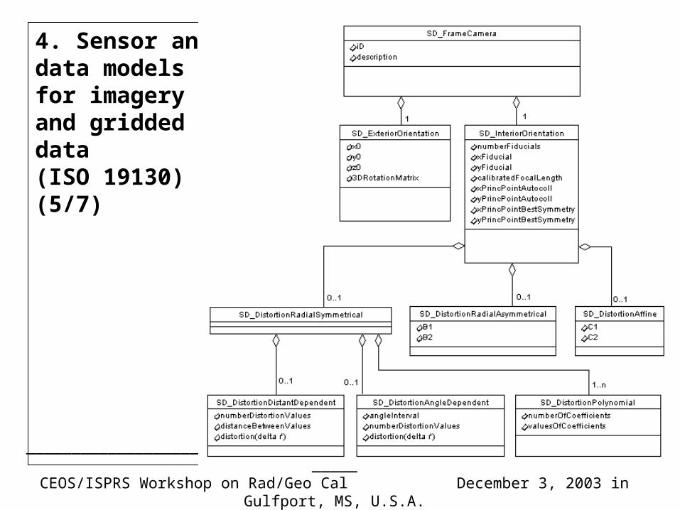
4. Sensor anddata modelsfor imageryand griddeddata(ISO 19130)(5/7)
_________________________________________________________________________CEOS/ISPRS Workshop on Rad/Geo Cal December 3, 2003 in Gulfport, MS, U.S.A.
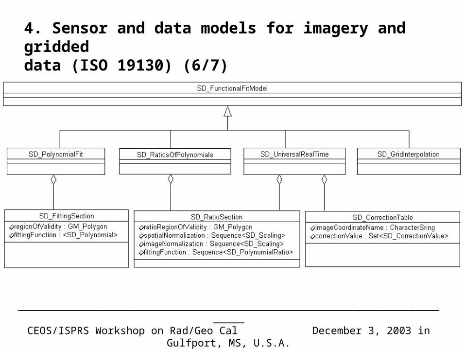
4. Sensor and data models for imagery and griddeddata (ISO 19130) (6/7)
_________________________________________________________________________CEOS/ISPRS Workshop on Rad/Geo Cal December 3, 2003 in Gulfport, MS, U.S.A.
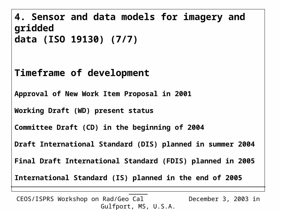
4. Sensor and data models for imagery and griddeddata (ISO 19130) (7/7)
Timeframe of development
Approval of New Work Item Proposal in 2001
Working Draft (WD) present status
Committee Draft (CD) in the beginning of 2004
Draft International Standard (DIS) planned in summer 2004
Final Draft International Standard (FDIS) planned in 2005
International Standard (IS) planned in the end of 2005
_________________________________________________________________________CEOS/ISPRS Workshop on Rad/Geo Cal December 3, 2003 in Gulfport, MS, U.S.A.
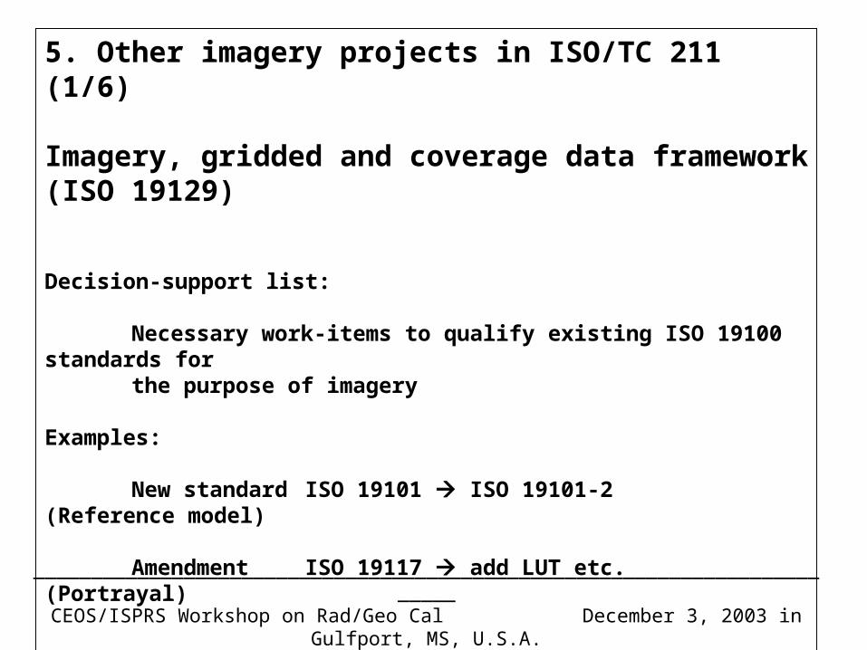
5. Other imagery projects in ISO/TC 211 (1/6)
Imagery, gridded and coverage data framework(ISO 19129)
Decision-support list:
Necessary work-items to qualify existing ISO 19100 standards forthe purpose of imagery
Examples:
New standard ISO 19101 ISO 19101-2 (Reference model)
Amendment ISO 19117 add LUT etc. (Portrayal)
_________________________________________________________________________CEOS/ISPRS Workshop on Rad/Geo Cal December 3, 2003 in Gulfport, MS, U.S.A.
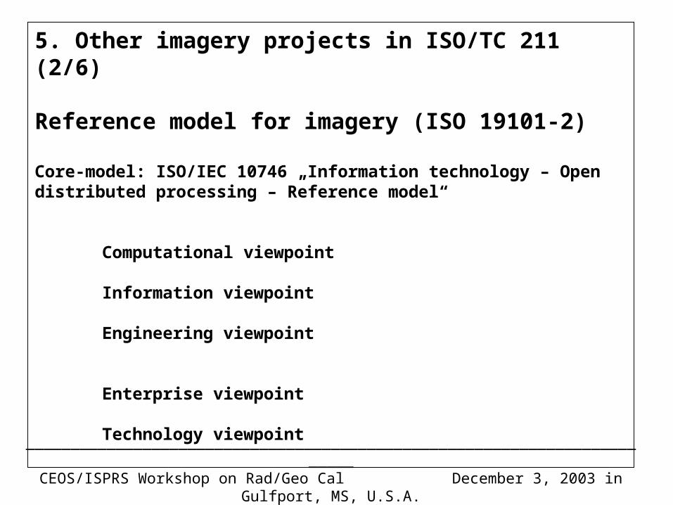
5. Other imagery projects in ISO/TC 211 (2/6)
Reference model for imagery (ISO 19101-2)
Core-model: ISO/IEC 10746 „Information technology – Open distributed processing – Reference model“
Computational viewpoint
Information viewpoint
Engineering viewpoint
Enterprise viewpoint
Technology viewpoint
_________________________________________________________________________CEOS/ISPRS Workshop on Rad/Geo Cal December 3, 2003 in Gulfport, MS, U.S.A.
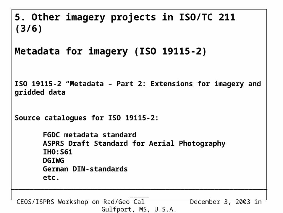
5. Other imagery projects in ISO/TC 211 (3/6)
Metadata for imagery (ISO 19115-2)
ISO 19115-2 “Metadata – Part 2: Extensions for imagery and gridded data”
Source catalogues for ISO 19115-2:
FGDC metadata standardASPRS Draft Standard for Aerial PhotographyIHO:S61DGIWGGerman DIN-standardsetc.
_________________________________________________________________________CEOS/ISPRS Workshop on Rad/Geo Cal December 3, 2003 in Gulfport, MS, U.S.A.
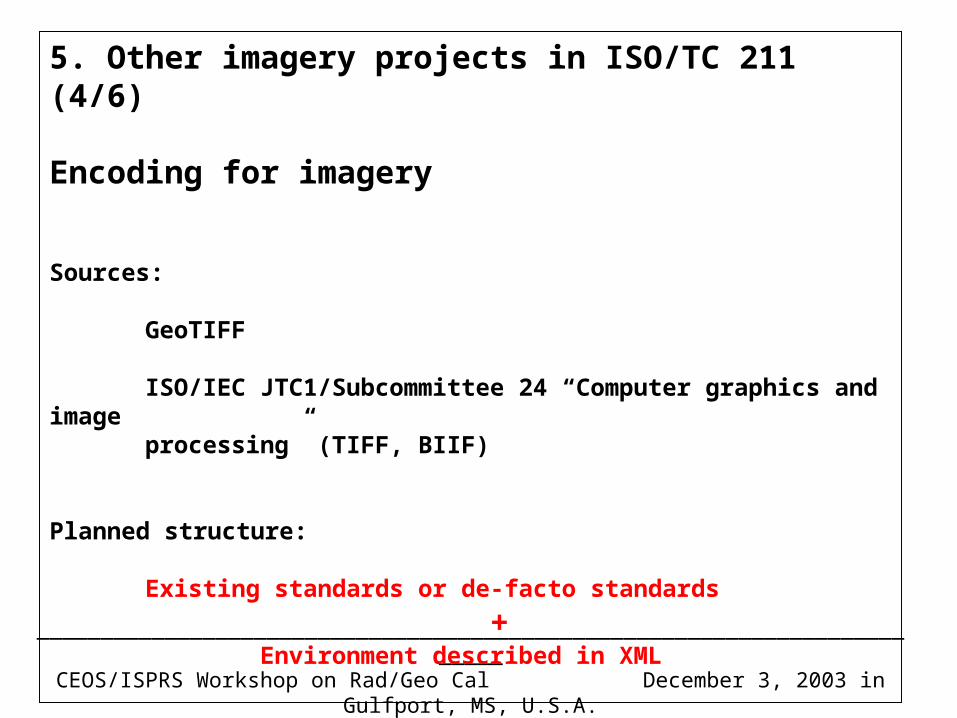
5. Other imagery projects in ISO/TC 211 (4/6)
Encoding for imagery
Sources:
GeoTIFF
ISO/IEC JTC1/Subcommittee 24 “Computer graphics and imageprocessing” (TIFF, BIIF)
Planned structure:
Existing standards or de-facto standards
+ Environment described in XML
_________________________________________________________________________CEOS/ISPRS Workshop on Rad/Geo Cal December 3, 2003 in Gulfport, MS, U.S.A.
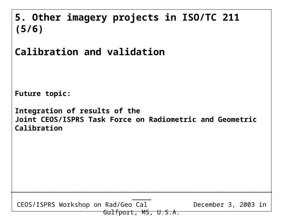
5. Other imagery projects in ISO/TC 211 (5/6)
Calibration and validation
Future topic:
Integration of results of theJoint CEOS/ISPRS Task Force on Radiometric and Geometric Calibration
_________________________________________________________________________CEOS/ISPRS Workshop on Rad/Geo Cal December 3, 2003 in Gulfport, MS, U.S.A.
5. Other imagery projects in ISO/TC 211 (6/6)
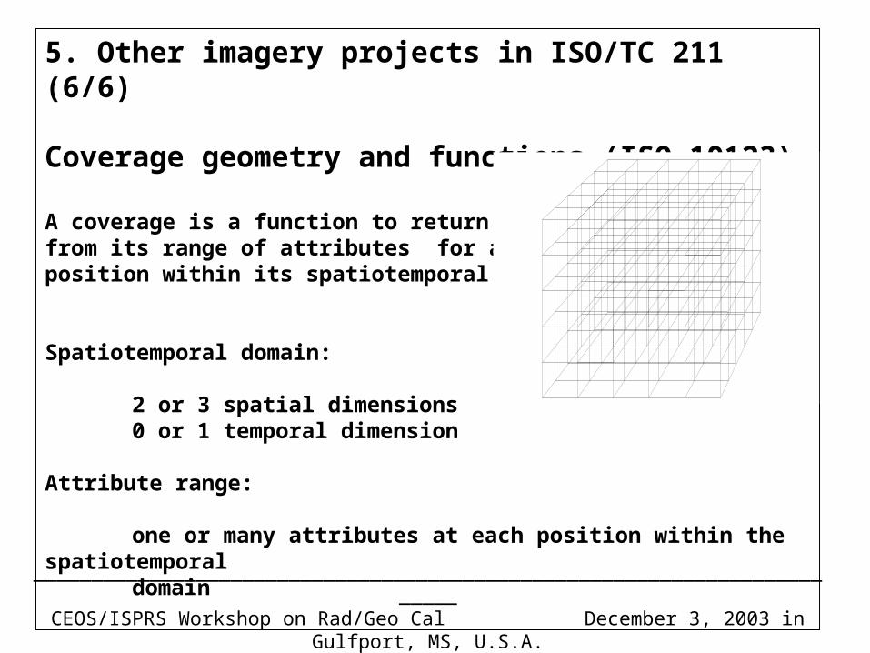
Coverage geometry and functions (ISO 19123)
A coverage is a function to return valuesfrom its range of attributes for anyposition within its spatiotemporal domain.
Spatiotemporal domain:
2 or 3 spatial dimensions0 or 1 temporal dimension
Attribute range:
one or many attributes at each position within the spatiotemporal domain
_________________________________________________________________________CEOS/ISPRS Workshop on Rad/Geo Cal December 3, 2003 in Gulfport, MS, U.S.A.
The end