Embed Size (px)
Citation preview
V I R G I NI A: VIRGINIA
BEFORE THE VIRGINIA GAS AND OIL BOARD
POCAHONTAS GAS PARTNERSHIP )))
MODIFICATION OF A PRODUCTION UNIT )KNOWN AS BUNE1 (herein "Subject Drilling Unit" ) )CREATED FOR THE PRODUCTION OF )OCCLUDED NATURAL GAS PRODUCED FROM )COALBEDS AND ROCK STRATA ASSOCIATED )THEREWITH FROM WITHIN THE SEALED GOB )CONSOLIDATION COAL COMPANY'S )BUCHANAN NO. 1 MINE )(herein "Sealed Coalbed Methane Gob )Gas" or "Gas") )
)))))))))
APPLICANT
RELIEFSOUGHT:
LEGALDESCRIPTION: HURRICANE MAGISTERIAL DISTRICT OF
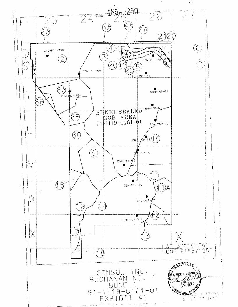
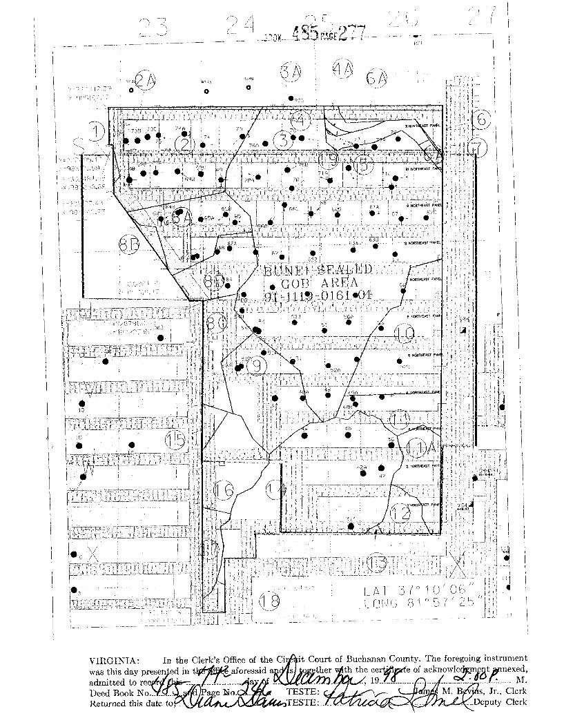
BUCHANAN COUNTY, VIRGINIA AS MOREPARTICULARLY DESCRIBED INSUBPARAGRAPH 8.a. BELOW ANDDEPICTED ON EXHIBIT A-1ATTACHED HERETO AND MADE A PARTHEREOF (herein "Subject Lands" )
VIRGINIA GAS ANDOIL BOARD
DOCKET NO.91-1119-0161%1(Modification of BoardOrder in VGOB 91-1119-0161 executed April 30,1992, and made effectiveNovember 19, 1991)
REPORT OF THE BOARD
FINDINGS AND ORDER
1. Hearinit Date and Place: This cause came on for hearing before the Virginia Gas and OilBoard (herein "Board") at 9:00 a.m. on September 15, 1998 at the Dickenson ConferenceRoom, Southwest Virginia Education 4-H Building, Abingdon, Virginia.
2. Annearances: Mark A. Swartz of the firm Swartz and Stump, I.c. appeared for theApplicant; Sandra B.Riggs, Assistant Attorney General, was present to advise the Board.
3. Notice and Jurisdiction: Pursuant to Va. Code $ 45.1-361.1 et seq. , and more particularly Va.Code g 45.1-361.20, the Board finds that it has jurisdiction over the subject matter. Basedupon the evidence presented by Applicant, the Board also finds that the Applicant has (1)exercised due diligence in conducting a meaningful search of reasonably available sources todetermine the identity and whereabouts of each gas and oil owner, coal owner, or mineralowner and/or potential owner, i.e., persons identified by Applicant as having ("Owner" ) orclaiming ("Claimant" ) the rights to Gas in the formations more particularly described inSubparagraph 7.d. below (herein "Subject Formations" ), in the Subject Drilling Unitunderlying and comprised of Subject Lands and (2) has given notice to those parties identified(herein sometimes "person(s)" whether referring to individuals, corporations, partnerships,associations, companies, businesses, trusts, joint ventures or other legal entities) entitled byVa. Code gg 45.1-361.19 and 45.1-361.20 to notice of the application filed herein; and (3)that the persons set forth in Exhibit B to the application filed herein were identified byApplicant as the persons who may be Owners or Claimants of Gas interests in subjectFormations in the Subject Drilling Unit, underlying and comprised of Subject Lands to whomnotice was given. Further, the Board has caused notice of this hearing to be published asrequired by Va. Code g 45.1-361.19.B. Whereupon the Board hereby finds that the notices
given herein satisfy all statutory requirements, Board rule requirements and the minimumstandards of state due process.
4. Amendments: Exhibit Al; Exhibit A, page 2; Tract Identification; Exhibit B; Exhibit B-3;Exhibit D; and Exhibit E.
5. Dismissals: None
6. Relief Reauested: Applicant requests that the Board modify its Order in VGOB Docket No.91-1119-0161entered effective as of November 19, 1991, executed April 30, 1992 (herein"Original Order" ) by modifying the boundaries of Subject Drilling Unit f'rom that described inSubparagraph 7.b. of the Original Order and depicted in Exhibit B to the Original Order tothat described in Paragraph 8.a. below and depicted on Exhibit A-1 hereto.
7. Soecial Findings: The Board specifically finds:
a. Applicant is a Virginia general partnership composed of Consolidation Coal Company, aDelaware corporation, and CONOCO Inc. , a Delaware corporation.
b. Pocahontas Gas Partnership is duly authorized to transact business in the Commonwealthof Virginia, is an operator in the Commonwealth of Virginia, and has satisfied theBoard's requirements for operations in Virginia.
c. Applicant claims ownership of gas leases, coalbed methane gas leases, and/or coal leasesrepresenting 100 percent of the coal interests and 99.34082 percent of the oil and gasinterests within Subject Drilling Unit.
d. The Original Order established and created the BUNE1 Drilling Unit for the productionof Sealed Coalbed Methane Gob Gas from the de-stressed zones underlying SubjectLands which are associated with the rubble area remaining after full seam mining of coaland extending above and below into areas in communication with the gob rubbleresulting from fracturing associated with full seam extraction mining methods from thebase of the Pocahontas No. 2 seam of coal upward to and in common communicationwith all seams and areas below the Tiller seam of coal (herein "Subject Formation" ).
e. Pursuant to the Original Order, the Board determined that to avoid drilling of unnecessarywells, prevent the various types of waste and protect the correlative rights of all Ownersand Claimants of Gas below the Tiller seam of coal with respect to the Subject DrillingUnit, the most effective and economical method to recover and produce Sealed CoalbedMethane Gob Gas was to create the boundaries of the BUNE 1 Drilling Unit inconformance with the existing mine plans.
f. It is necessary to modify the Original Order to change the boundaries of the SubjectDrilling Unit to make them conform to the now existing extent of mining as depicted onExhibit AA1; a copy of which is annexed hereto.
g. The seals which isolated the sealed gob area in question were completed on June 30,1998.
8. Relief Granted: The Original Order is modified in the following respects:
a. Effective midnight June 30, 1998, the BUNE 1 Drilling Unit, i.e., Subject Drilling Unit,shall consist of 1,483.67 acres for the drilling development and production of coalbedmethane gas from Subject Formation underlying Subject Lands which are depicted onExhibit "Al" annexed hereto and described as: Beginning at Virginia South State Planecoordinates N 333376.95 E 985182.91 thence S 88'30'21'*E 7749.21, thence S
1'57'38"W 10026.23, thence N 88'10'59"W 4310.88, thence S 0'34'01"W 551.74,thence N 89'08'38"W 731.54, thence S 0'58'57"W 1272,95, thence N 89'27'31"W596.95, thence N 1'37'17"E 7329.99, thence N 87'26'30"W 222.46, thence N33'40'31"W 3034.66, thence N 1'27'48"E 1139.20, thence N 82'24'13"W 82.61, thenceN 0'43'20"E 881.55 to the point of beginning (herein "Subject Lands" ).
b. The Original Order shall remain in full force and effect, subject only to the modificationcontained in Paragraph 8.a. above, which modification shall become effective as ofmidnight June 30, 1998.
b. The Board grants the relief set forth in subparagmphs 8.a. and 8.b. above in order toconform the boundaries of the BUNE 1 Sealed Gob Unit to the Mine Plans, to providemine safety while also preventing the waste of the Gas, to avoid the drilling ofunnecessary wells and to protect correlative rights.
9. Effective Date: This order shall be effective as of June 30, 1998.
~. ~ ~ ~;~&~,. W~Virginia Gas and Oil Board.
Chairman, Benny g Wampler /
DONE AND PERFORMED this 7 day ofBoard.
Byfon mas FulmerPrincip xecutive to the StaffVirg' Gas and Oil Board
Commonwealth of VirginiaCounty of Wise
))
Acknowledged on thi~ day of &f , 1998, personally before me a notarypublic in and for the Commonwealth of Vugima, appeared Benny R. Wampler, being duly sworn diddepose and say that he is Chairman of the Virginia Gas and Oil Board, that he executed the same asChairman of the Virginia Gas and Oil Board, and that he was authorized to do so.
My Commission expires: July 31, 2002
Susan G. GarrettNotary Public
Commonwealth of VirginiaCounty of Washington )
Acknowledged on this day of +~, 1998, personally before me anotary public in and for the Commonwealth of Virginia, appeared Byron Thomas Fulmer, being duly sworndid depose and say that he is Principal Executive to the Staff of the Virginia Gas and Oil Board, that heexecuted the same as Principal Executive to the Staff of said B d, t he was authorized to do so.
2mBDiane J. Davis gr
Notary Public
My commission expires: September 30, 2001
I
J L
~ i
0 Q
4 5 ~ ~ ~
I ~
iIS
$ ~ J
~ ~
0 ~
0 ~ e
I Ik
00 ~ e
0 L
I I
~i
J
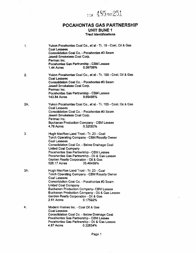
POCAHONTAS GAS PARTNERSHlPUNIT BUNE I
Tract IdentiTications
Yukon Pocahontas Coal Co., et al - Tr. 19-Coal, Oil & GasCoal LesseesConsolidation Coal Co. - Pocahontas ¹3SeamJewell Smokeless Coal Corp.Permac Inc.Pocahontas Gas Partnership - CBM Lessee1.44 Acres 0.09706%
Yukon Pocahontas Coal Co. , et al - Tr. 100- Coal, Oil & GasCoal LesseesConsolidation Coal Co. - Pocahontas ¹3SeamJewell Smokeless Coal Corp.Permac Inc.Pocahontas Gas Partnership - CBM Lessee143.84 Acres 9.69488%
Yukon Pocahontas Coal Co., et al - Tr. 100 —Coal, Oil & GasCoal LesseesConsolidation Coal Co. - Pocahontas ¹3SeamJewell Smokeless Coal Corp.Permac Inc.Buchanan Production Company - CBM Lessee4.76 Acres 0.32083%
Hugh MacRae Land Trust - Tr. 23 - CoalTorch Operating Company - CBM Royalty OwnerCoal LesseesConsolidation Coal Co. —Below Drainage CoalUnited Coal CompanyPocahontas Gas Partnership - CBM LesseePocahontas Gas Partnership - Oil & Gas LesseeGarden Realty Corporation - Oil & Gas526.17 Acres 35.46409%
3A. Hugh MacRae Land Trust - Tr. 23 - CoaiTorch Operating Company - CBM Royalty OwnerCoal LesseesConsolidation Coal Co. - Pocahontas ¹3SeamUnited Coal CompanyBuchanan Production Company- CBM LesseeBuchanan Production Company - Oil & Gas LesseeGarden Realty Corporation - Oil & Gas2.61 Acres 0.17592%
Modern Homes inc. - Coal Oii 8 GasCoal LesseesConsolidation Coal Co. - Below Drainage CoalPocahontas Gas Partnership —CBM LesseePocahontas Gas Partnership - Oil & Gas Lessee4.87 Acres 0 32834%
Page 1
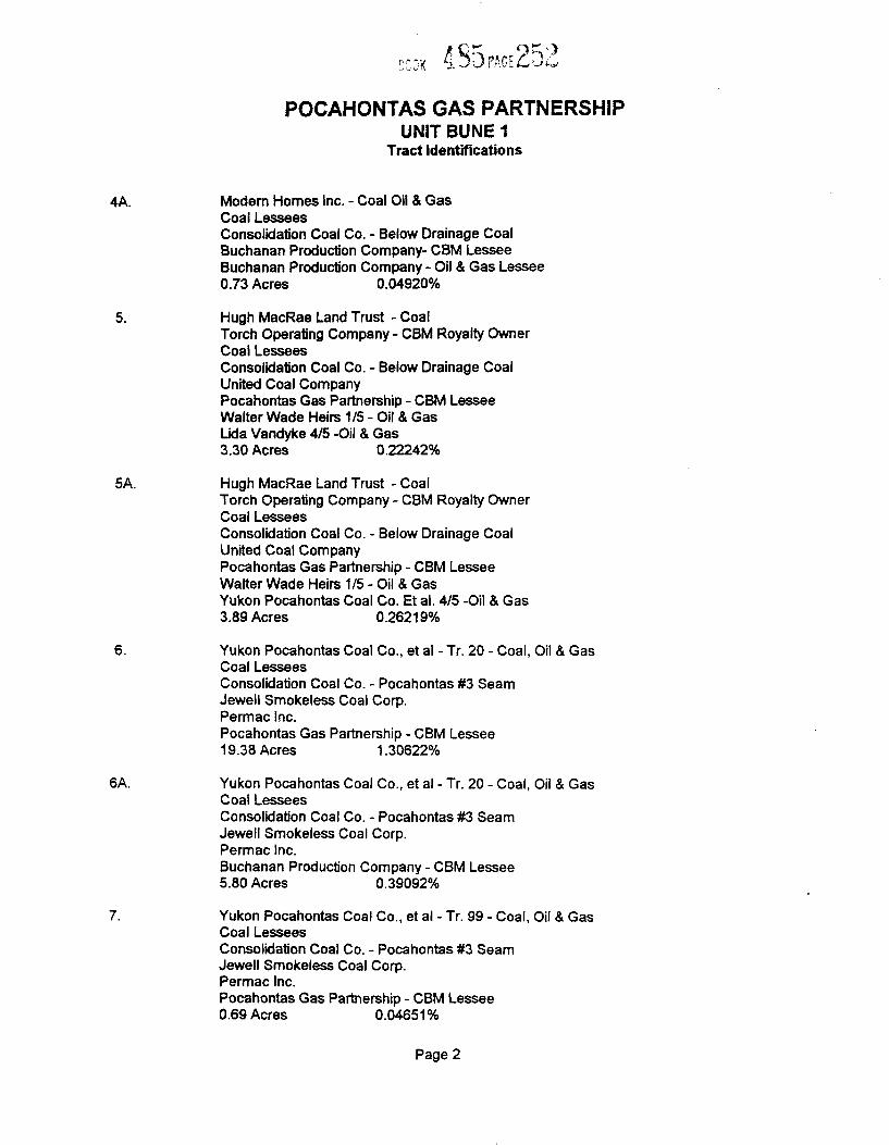
POCAHONTAS GAS PARTNERSHIPUNIT BUNE 1
Tract identifications
4A. Modern Homes Inc. - Coal Oil & GasCoal LesseesConsolidation Coal Co. - Below Drainage CoalBuchanan Production Company- CBM I esseeBuchanan Production Company - Oil & Gas Lessee0.73 Acres 0 04920'/o
Hugh MacRae Land Trust - CoalTorch Operating Company - CBM Royalty OwnerCoal LesseesConsolidation Coal Co. - Below Drainage CoalUnited Coal CompanyPocahontas Gas Partnership - CBM LesseeWalter Wade Heirs 1/5 - Oil & GasLida Vandyke 4/5 -Oil & Gas3.30 Acres 0.22242%
5A. Hugh MacRae Land Trust - CoalTorch Operating Company - CBM Royalty OwnerCoal LesseesConsolidation Coal Co. - Below Drainage CoalUnited Coal CompanyPocahontas Gas Partnership - CBM LesseeWalter Wade Heirs 1/5 - Oil & GasYukon Pocahontas Coal Co. Et al. 4/5 -Oil & Gas3.89 Acres 0.26219'/o
Yukon Pocahontas Coal Co., et ai - Tr. 20- Coal, Oil & GasCoal LesseesConsolidation Coal Co. - Pocahontas ¹3SeamJewell Smokeiess Coal Corp.Permac Inc.Pocahontas Gas Partnership - CBM Lessee19.38 Acres 1.30622'/o
6A. Yukon Pocahontas Coal Co., et al - Tr. 20 —Coal, Oil & GasCoai LesseesConsolidation Coal Co. - Pocahontas ¹3SeamJeweil Smokeless Coal Corp.Permac Inc.Buchanan Production Company —CBM Lessee5.80 Acres 0.39092%
Yukon Pocahontas Coal Co. , et al - Tr. 99- Coal, Oil & GasCoal LesseesConsolidation Coal Co. - Pocahontas ¹3SeamJewell Smokeless Coal Corp.Permac Inc.Pocahontas Gas Partnership - CBM l essee0.69 Acres 0 04651%
Page 2
POCAHONTAS GAS PARTNERSHIPUNIT BUNE 1
Tract IdentiTications
8A. Hugh MacRae Land Trust - Tr. 11 - CoalTorch Operating Company - CBM Royaity OwnerCoal LesseesConsolidation Coal Co. - Below Drainage CoaiUnited Coal CompanyPocahontas Gas Partnership - Oil & Gas65.64 Acres 4.42416%
8B. Hugh MacRae Land Trust - Tr. 11 - CoalTorch Operating Company - CBM Royalty OwnerCoal LesseesConsolidation Coal Co. - Below Drainage CoalUnited Coal CompanyPocahontas Gas Partnership - Oil & GasJanet Weatherford - 1/8 Gas Royalty Interest48.01 Acres 3 23589%
8C. Hugh MacRae Land Trust- Tr. 11-CoalTorch Operating Company - CBM Royalty OwnerCoal LesseesConsolidation Coal Co. - Below Drainage CoalUnited Coal CompanyPocahontas Gas Partnership - Oil & GasClinton Don Wood - 1/8 Gas Royalty Interest48.22 Acres 3.25005%
Hugh MacRae Land Trust - Tr. 11 - CoalTorch Operating Company - CBM Royalty OwnerCoal LesseesConsolidation Coal Co. - Below Drainage CoalUnited Coal CompanyPocahontas Gas Partnership - CBM LesseePocahontas Gas Partnership - Oil & Gas LesseeS.J. Mullins Heirs-Oil 8 Gas83.27 Acres 5.61243%
10. Hugh MacRae Land Trust- Tr. 6 —CoaiTorch Operating Company - CBM Royalty OwnerCoal LesseesConsolidation Coal Co. - Below Drainage CoalUnited Coal CompanyPocahontas Gas Partnership - Oil & Gas103.33 Acres 6.96449%
Page 3
POCAHONTAS GAS PARTNERSHlPUNIT BUNE 1
Tract Identifications
Hugh MacRae Land Trust - Tr. 17 - CoalTorch Operating Company - CBM Royalty OwnerCoal LesseesConsolidation Coal Co. - Below Drainage CoalUnited Coal CompanyPocahontas Gas Partnership - Oil & Gas37.98 Acres 2.55S87%
Hugh MacRae Land Trust - Tr. 17- CoalTorch Operating Company - CBM Royalty OwnerCoal l esseesConsolidation Coal Co. - Below Drainage CoalUnited Coal Company'/~ Pocahontas Gas Partnership - Oil & Gas'l~ William Tickle - Oil & Gas42.51 Acres 2.86519%
Hugh MacRae Land Trust - Tr. 17 - CoalTorch Operating Company - CBM Royalty OwnerCoal LesseesConsolidation Coal Co. - Below Drainage CoalUnited Coai CompanyPocahontas Gas Partnership - Oil & Gas LesseePocahontas Gas Partnership - CBM LesseeL. Mutter Heirs - Oil & Gas20.44 Acres 1.37?66%
Hugh MacRae Land Trust - Tr. 10 - CoalTorch Operating Company - CBM Royaity OwnerCoal LesseesConsolidation Coal Co. - Below Drainage CoalUnited Coal CompanyPocahontas Gas Partnership - Oil & Gas i esseePocahontas Gas Partnership - CBM LesseeR. C. Mutter Heirs - Oil & Gas1.32 Acres 0.088S7%
Hugh MacRae Land Trust - Tr. 24- CoalTorch Operating Company - CBM Royalty OwnerCoal LesseesConsolidation Coal Co. - Below Drainage CoalUnited Coal CompanyPocahontas Gas Partnership —Oil & Gas201.08 Acres 13.55288%
Page 4
/i Pgp!~! P «J
POCAHONTAS GAS PARTNERSHIPUNIT BUNE 1
Tract Identifications
15. Hugh MacRae Land Trust- Tr. 13- CoalTorch Operating Company - CBM Royalty OwnerCoai LesseesConsolidation Coal Co. - Below Drainage CoalUnited Coal CompanyPocahontas Gas Partnership - Oil & Gas9.35 Acres 0.63019%
16. Hugh MacRae Land Trust- Tr. 13-CoalTorch Operating Company - CBM Royalty OwnerCoal LesseesConsolidation Coal Co. - Below Drainage CoalUnited Coal CompanyPocahontas Gas Partnership - Oil & Gas56.90 Acres 3.83508%
17. Hugh MacRae Land Trust - Tr. 13 - CoalTorch Operating Company - CBM Royalty OwnerCoal LesseesConsolidation Coal Co. - Below Drainage CoalUnited Coal CompanyPocahontas Gas Partnership - Oil & Gas23.22 Acres 1 56504%
Hugh MacRae Land Trust - Tr. 10 - CoalTorch Operating Company - CBM Royalty OwnerCoal LesseesConsolidation Coal Co. - Below Drainage CoalUnited Coal CompanyPocahontas Gas Partnership - Oil & Gas6.98 Acres P 47P46
19. Virginia Department of Transportation - Coal (except P-3 seam), Oil & GasConsolidation Coal Company - Pocahontas ¹3SeamPocahontas Gas Partnership - Oil & Gas Lessee2.14 Acres 0.14424%
20. Hugh MacRae Land Trust - CoalTorch Operating Company - CBM Royalty OwnerCoal LesseesConsolidation Coal Co. - Below Drainage CoalUnited Coal CompanyPocahontas Gas Partnership - CBM LesseeWalter Wade Heirs 1/5 - Oil & GasModem Homes inc. 4/5 -Oil & Gas10.00 Acres 0.67400%
Page 5
POCAHONTAS GAS PARTNERSHIPUNlT BUNE 1
Tract IdentiTications
21. Hugh MacRae Land Trust - CoalTorch Operating Company - CBM Royalty OwnerCoal LesseesConsolidation Coal Co. - Below Drainage CoalUnited Coal CompanyPocahontas Gas Partnership - CBM LesseeWaiter Wade Heirs 1/5 - Oil & GasPepsico of Norton Inc. 4/5 -Oil & Gas0.80 Acres 0.05392'/0
22. Hugh MacRae Land Trust - CoalTorch Operating Company - CBM Royalty OwnerCoal LesseesConsolidation Coal Co. - Below Drainage CoalUnited Coal CompanyPocahontas Gas Partnership - CBM LesseeVirginia Department of Transportation - Oil & Gas5.00 Acres 0 33700'/0
Page 6
Docket ¹VGOB41-1119-16141 ~",'3)( ~U9 PI)v~r Q~~ &
Exhibit BUst of aN Owners/Claimants
Net AcresIn Unit
InterestIn Unit
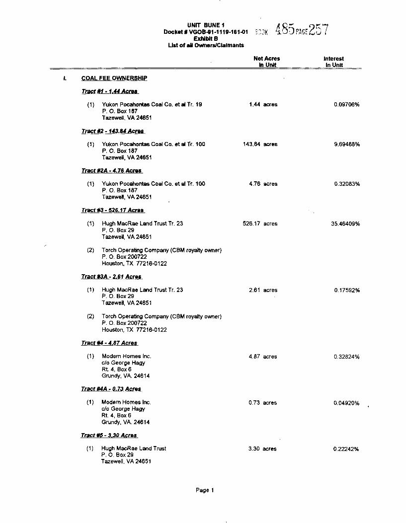
COAL FEE OWNERSHIP
Tract ¹1- 1 44 Acres
(1) Yukon Pocahontas Coal Co. et al Tr. 19P. O. Box 187Tazewell, VA 24651
Tract ¹2-143.84 Acres
1.44 acres 0.09706%
(1) Yukon Pocahontas Coal Co. et al Tr. 100P. O. Box 187Tazewell, VA 24651
Tract ¹2A- 4.76 Acres
(1) Yukon Pocahontas Coal Co. et al Tr. 100P. O. Box 187Tazewell, VA 24651
143.84 acres
4.76 acres
9 69488%
0.32083%
Tract ¹3- 526.17Acres
(1) Hugh MacRae Land Trust Tr. 23P. O. Box 29Tazewell, VA 24651
526.17 acres 35.46409%
(2) Torch Operating Company (CBM royalty owner)P. O. Box 200722Houston, TX 77216-0122
Tract ¹3A- 2.61 Acres
(1) Hugh MacRae Land Trust Tr. 23P. O. Box 29Tazewell, VA 24651
(2) Torch Operating Company (CBM royalty owner)P. O. Box 200722Houston, TX 77216-0122
2.61 acres 0.17592%
Tract ¹4- 4.87 Acres
(1) Modem Homes Inc.c/o George HagyRt. 4, Box 6Grundy, VA. 24614
Tract ¹4A- 0.73 Acres
4.87 acres 0.32824%
(1) Modem Homes Inc.c/o George HagyRt. 4, Box 6Grundy, VA. 24614
Tract ¹5- 3.30 Acres
0.73 acres 0.04920%
(1) Hugh MacRae Land TrustP. O. Box 29Tazewell, VA 24651
3.30 acres 0.22242%
Page 1
UNIT BUNE1Docket ¹ VGOB4I1-1119-16141
Exhibit BList of aN OwnerslClaimants
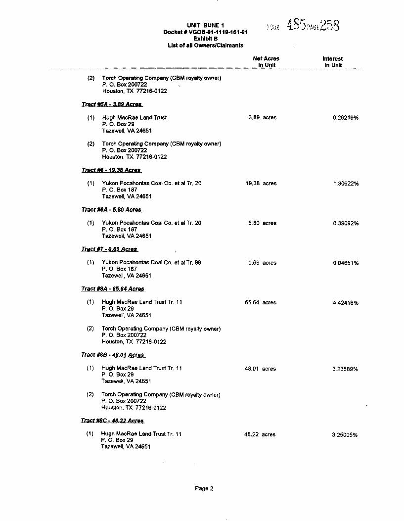
(2) Torch Operaling Company (CBM royalty owner)P. O. Box 200722Houston, TX 77216-0122
Tract ¹5A- 3.89 Acres
Net AcresIn Unit
InterestIn Unit
(1) Hugh MacRae Land TrustP. 0, Box29Tazewell, VA 24651
(2) Torch Operating Company (CBM royalty owner)P. O. Box 200722Houston, TX 77216-0122
Tract ¹6- 19.38 Acres
3.89 acres 0 2621 9o%
(1) Yukon Pocahontas Coal Co. et ai Tr, 20P. O. Box 187Tazewell, VA 24651
Tract ¹6A- 5.80 Acres
(1) Yukon Pocahontas Coal Co. et al Tr. 20P. O. Box 187Tazewell, VA 24651
Tract ¹7- 0.69 Acres
19.38 acres
5.80 acres
1.30622'%%d
0 39092o%%d
(1) Yukon Pocahontas Coal Co. et al Tr. 99P. O. Box 18?Tazewell, VA 24651
Tract ¹8A- 65.64 Acres
(1) Hugh MacRae Land Trust Tr. 11P. O. Box 29Tazewell, VA 24651
(2) Torch Operating Company (CBM royalty owner)P. O. Box 200722Houston, TX 77216-0122
Tract ¹8B- 48.01 Acres
0.69 acres
65.64 acres
0.04651'%%d
4.42416'%%d
(1) Hugh MacRae Land Trust Tr. 11P, O. Box 29Tazewell, VA 24651
(2) Torch Operating Company (CBM royalty owner)P. O. Box 200722Houston, TX 77216-0122
Tract ¹8C- 48.22 Acres
48.01 acres 3.23589o/o
(1) Hugh MacRae Land Trust Tr. 11P. O. Box 29Tazewell, VA 24651
48.22 acres 3.25005'%%d
Page 2
UNIT BUNE1Docket ¹ VGOB-91-1119-16141
Exhibit BList of all OwnersIClalmants
Net AcresIn Unit
Interestin Unit
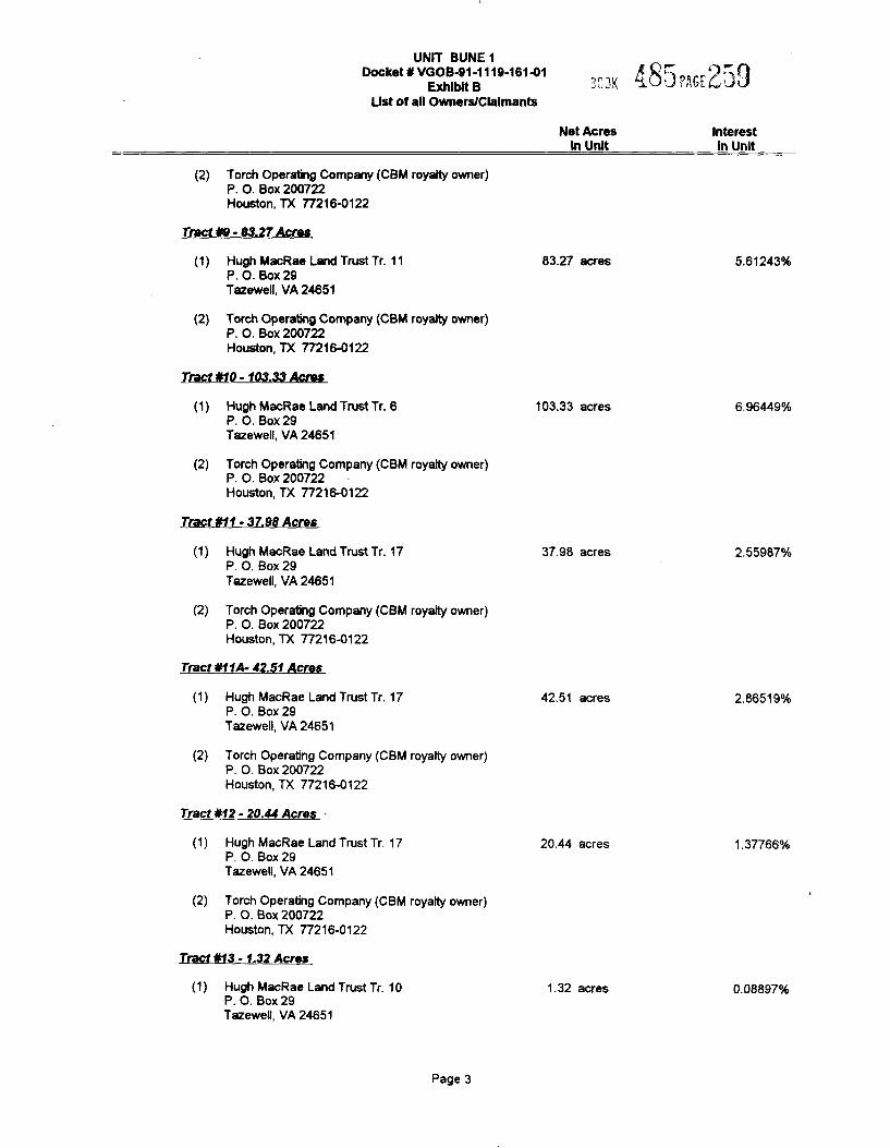
(2) Torch Operating Company (CBM royalty owner)P. O. Box 200722Houston, TX 77216-0122
Tract Nl - 83.27 Acres
Hugh MacRae Land Trust Tr. 11P. O. Box 29Tazewell, VA 24651
83.27 acres 5.61243%
(2) Torch Operating Company (CBM royalty owner)P. O. Box 200722Houston, TX 772184122
Tract ¹10-103.33Acres
Hugh MacRae Land Trust Tr. 6P. O. Box 29Tazewell, VA 24651
103.33 acres 6.964494%%d
(2) Torch Operating Company (CBM royally owner)P. O. Box 200722Houston, TX 77216-0122
Tract ¹11- 37.98 Acres
(2)
Hugh MacRae Land Trust Tr. 17P. O. Box 29Tazewell, VA 24651
Torch Operating Company (CBM royalty owner)P. O. Box 200722Houston, TX 77216-0122
37.98 acres 2.55987o%%d
Tract ¹11A- 42.51 Acres
(2)
Hugh MacRae Land Trust Tr. 17P. O. Box 2STazewell, VA 24651
Torch Operating Company (CBM royalty owner)P. O. Box 200722Houston, TX 77216-0122
42.51 acres 2.865190/o
Tract ¹12- 20.44 Acres
Hugh MacRae Land Trust Tr. 17P. O. Box 29Tazewell, VA 24651
20.44 acres 1.377660%%d
(2) Torch Operating Company (CBM royalty owner)P. O. Box 200722Houston, TX 77216-0122
Tract ¹13- 1.32 Acres
Hugh MacRae Land Trust Tr. 10P. O. Box 2STazewell, YA 24651
1.32 acres 0.08897'%%d
Page 3
UNIT BUNE 1Docket¹VGO¹41-1119-16141 g c ~ „„.gyes()
Exhibit BList of ail OwnerslClalmants
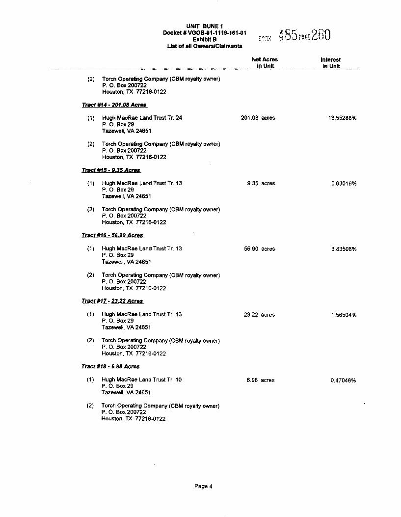
(2) Torch Operating Company (CBM royalty owner)P. O. Box 200722Houston, TX 77216-0122
Net AcresIn Unit
InterestIn Unit
Tract ¹f4- 201.08 Acres
(2)
Hugh MacRae Land Trust Tr. 24P. O. Box29Tazewell, VA 24651
Torch Operating Company (CBM royalty owner)P. O. Box 200722Houston, TX 77216-0122
201.08 acres 13 55288%
Tract ¹15 - 9.35 Acres
(2)
Hugh MacRae Land Trust Tr. 13P. O. Box 29Tazewell, VA 24651
Torch Operating Company (CBM royalty owner)P. O. Box 200722Houston, TX 77216-0122
9.35 acres 0 63019%
Tract ¹16 - 56.90 Acres
Hugh MacRae Land Trust Tr. 13P. O. Box 29Tazewell, VA 24651
56.90 acres 3.83508%
(2) Torch Operating Company (CBM royalty owner)P. O. Box 200?22Houston, TX 77216-0122
Tract ¹17 - 23.22 Acres
Hugh MacRae Land Trust Tr. 13P. O. Box 29Tazewell, VA 24651
23.22 acres 1.56504'/o
(2) Torch Operating Company (CBM royalty owner)P. O. Box 200722Houston, TX 77216-0122
Tract ¹f8 - 6.98 Acres
Hugh MacRae Land Trust Tr. 10P. O. Box 29Tazewell, VA 24651
6.98 acres 0.47046'/o
(2) Torch Operating Company (CBM royalty owner)P. O. Box 200722Houston, TX 77216-0122
Page 4
UNIT BUNE 1Docket ¹ VGOB4I1-1119-161%1 g g g
Exhibit B &- ~){ ~j, ,3.J P+"".4~~Ust of ail Owners/CLaimants
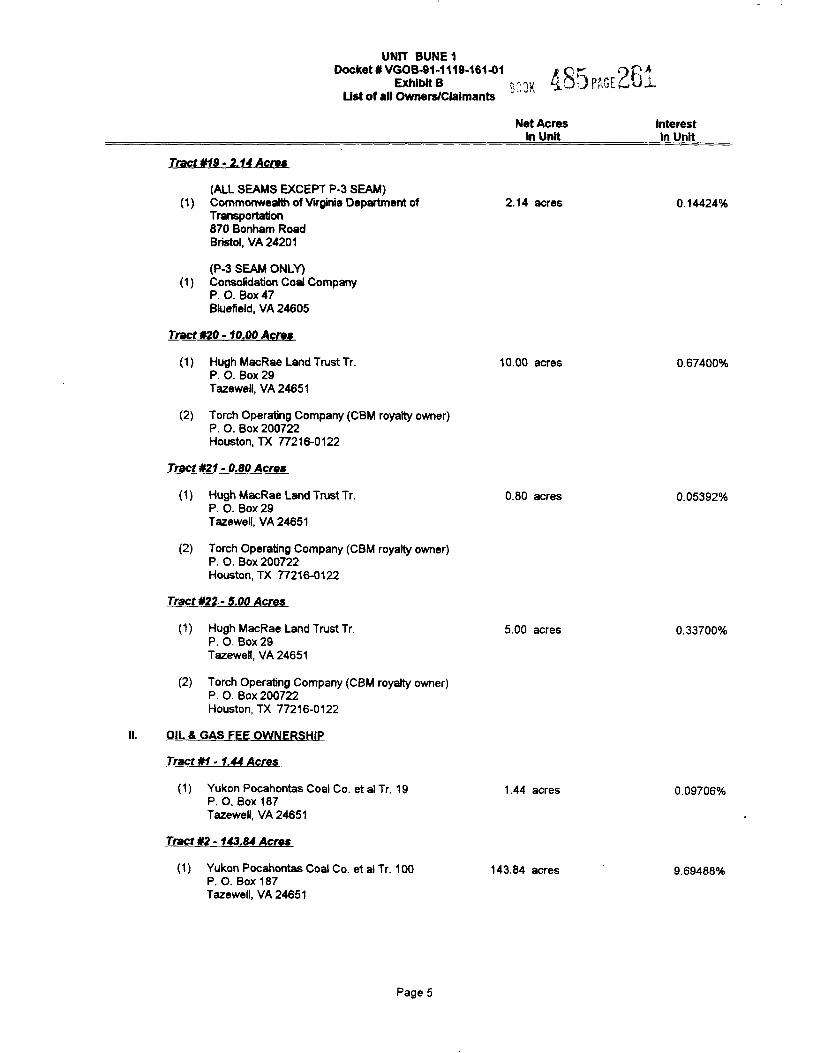
Tract ¹ff/- 2.14 Acres
Net Acresin Unit
Interestin Unit
(ALL SEAMS EXCEPT P-3 SEAM)(1) Commonweallh of Virginia Department of
Transportation870 Bonham RoadBristol, VA 24201
(P-3 SEAM ONLY)(1) Consolidation Coal Company
P. O. Box 47Bluefield, VA 24605
Tract ¹20- f0.00 Acres
2.14 acres 0.14424o%%d
(1) Hugh MacRae Land Trust Tr.P. O. Box 29Tazewell, VA 24651
(2) Torch Operating Company (CBM royalty owner)P. O. Box 200722Houston, TX 77216-0122
Tract ¹2f- 0.80 Acres
10.00 acres 0.67400o%%d
(1) Hugh MacRae Land Trust Tr.P. O. Box29Tazewell, VA 24651
(2) Torch Operating Company (CBM royalty owner)P. O. Box 200722Houston, TX 77216-0122
Tract ¹22-5.00 Acres
0.80 acres 0.05392'%%d
(1) Hugh MacRae Land Trust Tr.P. O. Box 29Tazewell, VA 24651
(2) Torch Operating Company (CBM royalty owner)P. O. Box 200722Houston, TX 77216-0122
OIL 8, GAS FEE OWNERSHIP
Tract ¹f- 1A4 Acres
(1) Yukon Pocahontas Coal Co. et al Tr. 19P, O. Box 187Tazewell, VA 24651
Tract ¹2- 143.84 Acres
(1) Yukon Pocahontas Coal Co. et al Tr. 100P. O. Box 187Tazewell, VA 24651
5.00 acres
1.44 acres
143.84 acres
0.33700'%%d
0.09706%
9.69488o%%d
Page 5
UNIT BUNE 1Docket' VGOB4I1-1119-16141 ".;;3i( &a3P~".Wu'
Exhibit BUst of aN Owners/Claimants
Net AcresIn Unit
Interestln Unit
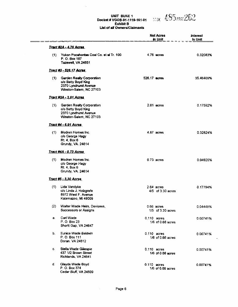
Tract t/2A - 4.76 Acres
Yukon Pocahontas Coal Co. et al Tr. 100P. O. Box 187Tazewell, VA 24651
Tract t/3- 526.1TAcres
Garden Realty Corporationclo Betty Boyd King2370 Lyndhurst AvenueWinston-Salem, NC 27103
Tract I/3A - 2.61 Acres
4.76 acres
526.17 acres
0 32083%
35.46409%
Garden Realty Corporabonclo Betty Boyd King2370 LyndhurstAvenueWinston-Saiem, NC 27103
Tract t/4- 6.91 Acres
Modren Homes Inc.clo George HagyRt. 4, Box 6Grundy, VA. 24614
Tract t/4A - 0.73 Acres
2.61 acres
4.87 acres
0.17592%
0 32824olo
Modren Homes Inc.c/o George HagyRt. 4, Box 6Grundy, VA. 24614
Tract 86 - 3.30 Acres
0.73 acres 0.04920%o
(2)
Lida Vandykeclo Linda J. Holzgrefe&972 West F. AvenueKalamazoo, Ml 4SOOS
Walter Wade Heirs, Devisees,Successors or Assigns
Carl WadeP. O. Box 23Shorlt Gap, VA 24647
Eunice Wade BaldwinP. O. Box 111Doran. VA 24612
Stella Wade Gillespie437 1/2 Brown StreetRichlands, VA 24641
Glayds Wade BoydP. O. Box 374Cedar Bluff, VA 24609
2.64 acres4/5 of 3.30 acres
0.66 acres1/5 of 3.30 acres
0.110 acres1/6 of 0.66 acres
0.110 acres1/6 of 0.66 acres
0.110 acres1/6 of 0.66 acres
0.110 acres1/6 of 0.66 acres
0.17794%
0.04448%
0.00741%
0.00741%
0 00741%
0.00741 olo
Page 6
UNIT BUNE 1 xQDocket 5 vGQB41-111$-161N1 ."'., 3l( 4U:.3 P"6[PB
Exhibit BList oS aN Owners/Claimants
Net AcresIn Unit
Interestln Unit
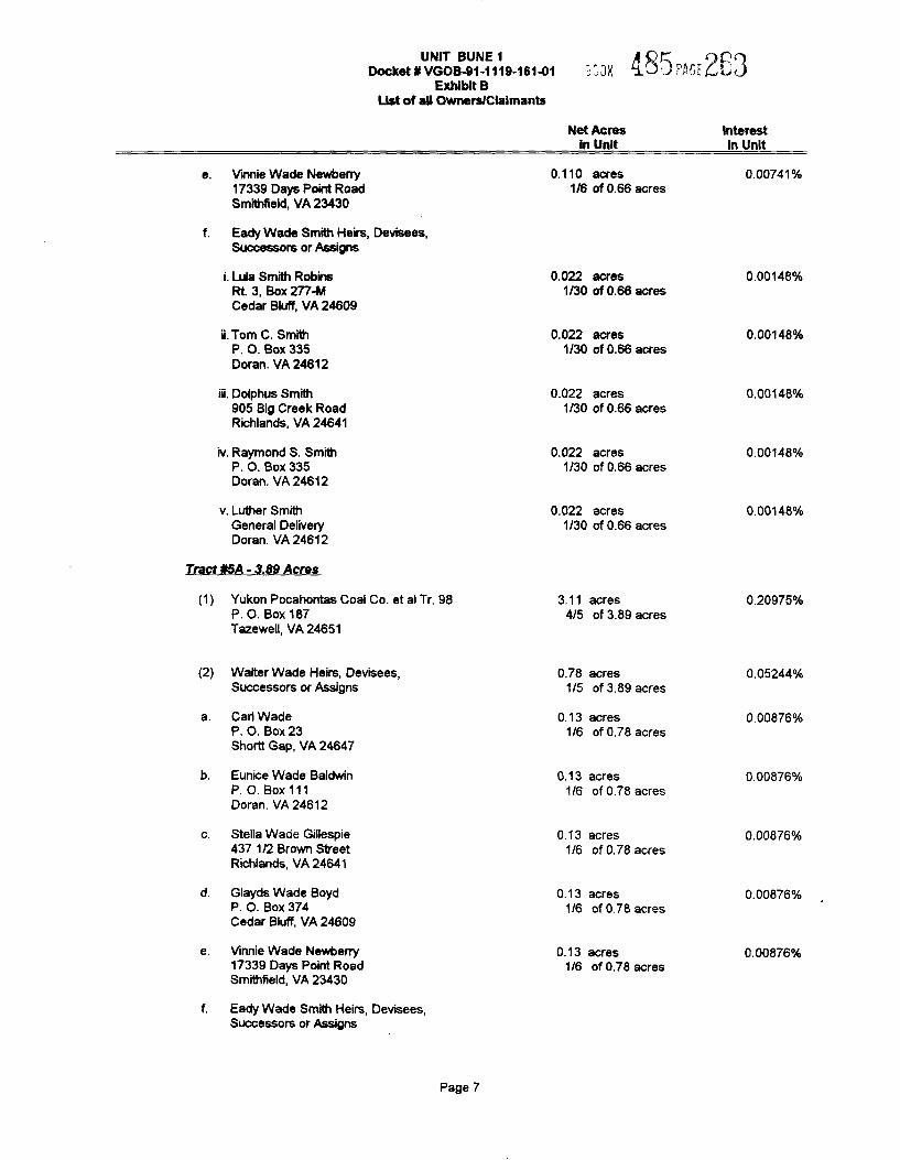
Vinnie Wade Newberry17339 Days Point RoadSmithfield, VA 23430
Eady Wade Smith Heirs, Devisees,Successors or Assigns
i. LWa Smith RobinsRt 3, Box 277-MCedar Bluff, VA 24609
ii. Tom C. SmithP. O. Box 335Doran. YA 24612
0.110 acres1/6 of 0.66 acres
0.022 acres1/30 of 0.66 acres
0.022 acres1/30 of 0.66 acres
0 00741%
0.00148%
0 00148%
iii. Dolphus Smith905 Big Creek RoadRichlands, VA 24641
iv. Raymond S. SmithP. O. Box 335Doran. VA 24612
0.022 acres1/30 of 0.66 acres
0.022 acres1/30 of 0.66 acres
0.00148%
0.00148%
v. Luther SmithGeneral DeliveryDoran. VA 24612
0.022 acres1/30 of 0.66 acres
0.00148%
Tract ftSA - 3.89 Acres
Yukon Pocahontas Coal Co. et al Tr. 98P. O. Box 187Tazewell, YA 24651
3.11 acres4/5 of 3.89 acres
0.20975%
(2) Walter Wade Heirs, Devisees,Successors or Assigns
Carl WadeP. O. Box 23Shoitt Gap, VA 24647
Eunice Wade BaldwinP. O. Box 111Doran. VA 24612
0.78 acres1/5 of 3.89 acres
0.13 acres1/6 of 0.78 acres
0.13 acres1/6 of 0.78 acres
0.05244%
0.00876%
0 00876%
Stella Wacie Gillespie437 1/2 Brown StreetRichlands, VA 24641
Glayds Wade BoydP. O. Box 374Cedar Bluff, VA 24609
Vinnie Wade Newberry17339 Days Point RoadSmithfield, VA 23430
Eady Wade Smith Heirs, Devisees,Successors or Assigns
0.13 acres1/6 of 0.78 acres
0.13 acres1/6 of 0.78 acres
0.13 acres1/6 of 0.78 acres
0.00876%
0 00876%
0.00876%
Page 7
UNIT BUNE 1 gpDockalBVGOB41-1'l19 16141 .„7k $Q J9,, „11Exhibit B
Ust of aN Owners/Claimants
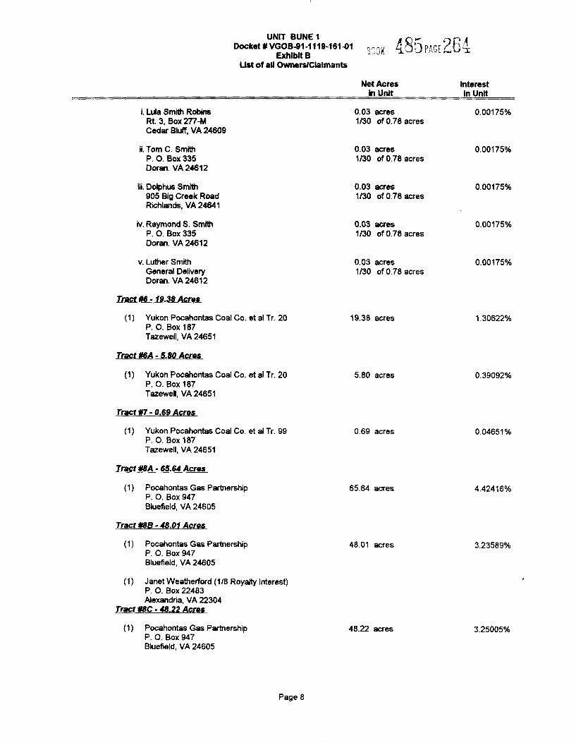
i. Lula Smith RobinsRt 3, Box 277-MCedar Blulf, VA 246Q9
ii. Tom C. SmithP. O. Box 335Doran. VA 24612
Net Acresin Unit
0.03 acres1/30 of 0.78 acres
0.03 acres1/30 of 0.78 acres
Interestin Unit
Q 00175%
0 00175ok
iii. Dolphus Smith905 Big Creek RoadRichlands, VA 24641
iv. Raymond S. SmithP. O. Box 335Doran. VA 24612
0.03 acres1/30 of 0.78 acres
0.03 acres1/30 of 0.78 acres
0 QQ175'k
P PP175ok
v. Luther SmithGeneral DeliveryDoran. VA 24612
0.03 acres1/30 of 0.78 acres
P 001756k
Tract ¹6- 19.38 Acres
(1) Yukon Pocahontas Coal Co. et al Tr. 20P. O. Box 187Tazewell, VA 24651
Tract ¹6A- 5.80 Acres
19.38 acres 1 30622%
(1) Yukon Pocahontas Coal Co. et al Tr. 20P. O. Box 187Tszewell, VA 24651
Tract ¹7- 0.69 Acres
(1) Yukon Pocahontas Coal Co. et al Tr. 99P. O. Box 187Tazewell, VA 24651
Tract ¹8A- 65.64 Acres
(1) Pocahontas Gas PartnershipP. O. Box 947Bluefield, VA 24605
Tract ¹8B- 48.01 Acres
(1) Pocahontas Gas PartnershipP. O. Box 947Bluefield, VA 24605
(1) Janet Weatherford (1/8 Royalty Interest)P. O. Box 22483Alexandria, VA 22304
Tract ¹8C- 48.22 Acres
(1) Pocahontas Gas PartnershipP. O. Box 94/Bluefield, VA 24605
5.80 acres
0.69 acres
65.64 acres
48.01 acres
48.22 acres
0.39092%
0 04651%
4.42416%
3 235899k
3.25005%
Page 8
UNIT BUNE 1Docket 0 VGOB-91-1119-161%1 3i 3I( X~3 0"(.4 MJ
Exhibit 8Ust of aN Owners/Claimants
Net AcresIn Unit
Interestln Unit
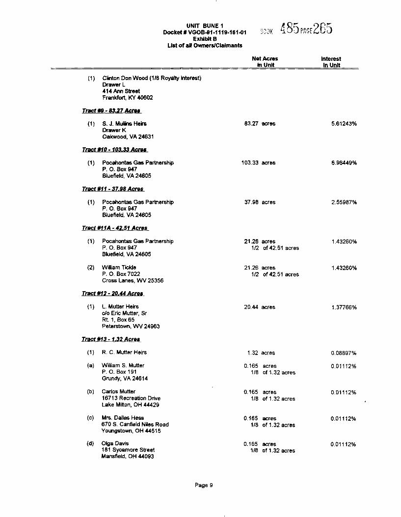
Cfinton Don Wood (1/8 Royalty interest)Drawer L414 Ann StreetFrankfort, KY 40602
Tract ttl - 03.27 Acres
S.J. MuNins HeirsDrawer KOakwood, VA 24631
Tract 010- 103.33Acres
83.27 acres 5.61243%
Pocahontas Gas PartnershipP. O. Box 947Bluefield, VA 24605
Tract 011- 37.98 Acres
103.33 acres 6.96449%
Pocahontas Gas PartnershipP. O. Box 947Bluefield, VA 24605
Tract kl 1A - 42.Sf Acres
37.98 acres 2.55987%
(2)
Pocahontas Gas PartnershipP. O. Box 947Bluefield, VA 24605
William TickleP. O. Box 7022Cross Lanes, WV 25356
21.26 acres1/2 of 42.51 acres
21.26 acres1/2 of 42.51 acres
1 43260%
1.43260ok
Tract 012- 20A4 Acres
L. Mutter Heirsc/o Eric Mutter, SrRt. 1, Box 65Peterstown, WV 24963
20.44 acres 1.37766%
Tract «13 - 1.32 Acres
(a)
(b)
(c)
(d)
R. C. Mutter Heirs
Wilfiam S. MutterP. O. Box 191Grundy, VA 24614
Carios Mutter16713 Recreation DriveLake Milton, OH 44429
Mrs. Dallas Hess670 S. Canfield Niles RoadYoungstown, OH 44515
Oiga Davis181 Sycamore StreetManslield, OH 44093
1.32 acres
0.165 acres1/8 of 1.32 acres
0.165 acres1/8 of 1.32 acres
0.165 acres1/8 of 1.32 acres
0.165 acres1/8 of 1.32 acres
0.08897'k
0.01112'k
0.01112'k
0.01112%
0.01112%
Page 9
UNIT BUNE 1Docket ¹ VGOB4I1-1119-161%1
Exhibit BUst of aN Owners/Claimants
Net AcresIn Unit
InterestIn Unit
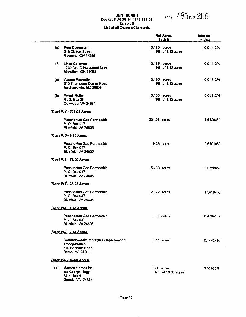
(e) Fem Duecaster518 Clinton StreetRavenna, OH 44266
(f) Linda Coleman1230 Apt D Hardwood DriveMansfield, OH 440S3
(g) Wanda Padgette315 Thompson Comer RoadMechanicvifie, MD 20659
(h) Farrell MutterRt 2, Box 36Oakwood, VA 24631
Tract ¹14- 201.08 Acres
0.165 acres1/8 of 1.32 acres
0.165 acres1/8 of 1.32 acres
0.165 acres1/8 of 1.32 acres
0.165 acres1/8 of 1.32 acres
0 01112o%%d
0 01112%
0.01112%
0.01112'%%d
Pocahontas Gas PartnershipP. O. Box 947Bluefield, YA 24605
Tract ¹15 - 9.35 Acres
201.08 acres 13.55288%
Pocahontas Gas PartnershipP. O. Box S47Bluefield, VA 24605
Tract ¹16- 56.90 Acres
9.35 acres 0 63019%
Pocahontas Gas PartnershipP. O. Box 947Bluefield, VA 24605
Tract ¹17-23.22 Acres
56.SO acres 3.83508'%%d
Pocahontas Gas PartnershipP. O. Box 947Biuefield, VA 24605
Tract ¹18- 6.98 Acres
Pocahontas Gas PartnershipP. O. Box 947Bluefieid, VA 24605
Tract ¹19- 2.14 Acres
23.22 acres
6.98 acres
1.56504'%%d
0.47046'/0
Commonwealth of Virginia Department ofTransportation870 Bonham RoadBristol, VA 24201
Tract ¹20- 10.00 Acres
2.14 acres 0.14424o%%d
(1) Modren Homes Inc.c/o George HagyRt. 4, Box 6Grundy, VA. 24614
8.00 acres4/5 of 10.00 acres
0.53920%
Page 10
UNlT BUNE1 P Q~ „„PiI-.7Docket ¹ VGOB-91-1119-16141 ":.".'3l(
Exhibit BList of all Owners/Claimants
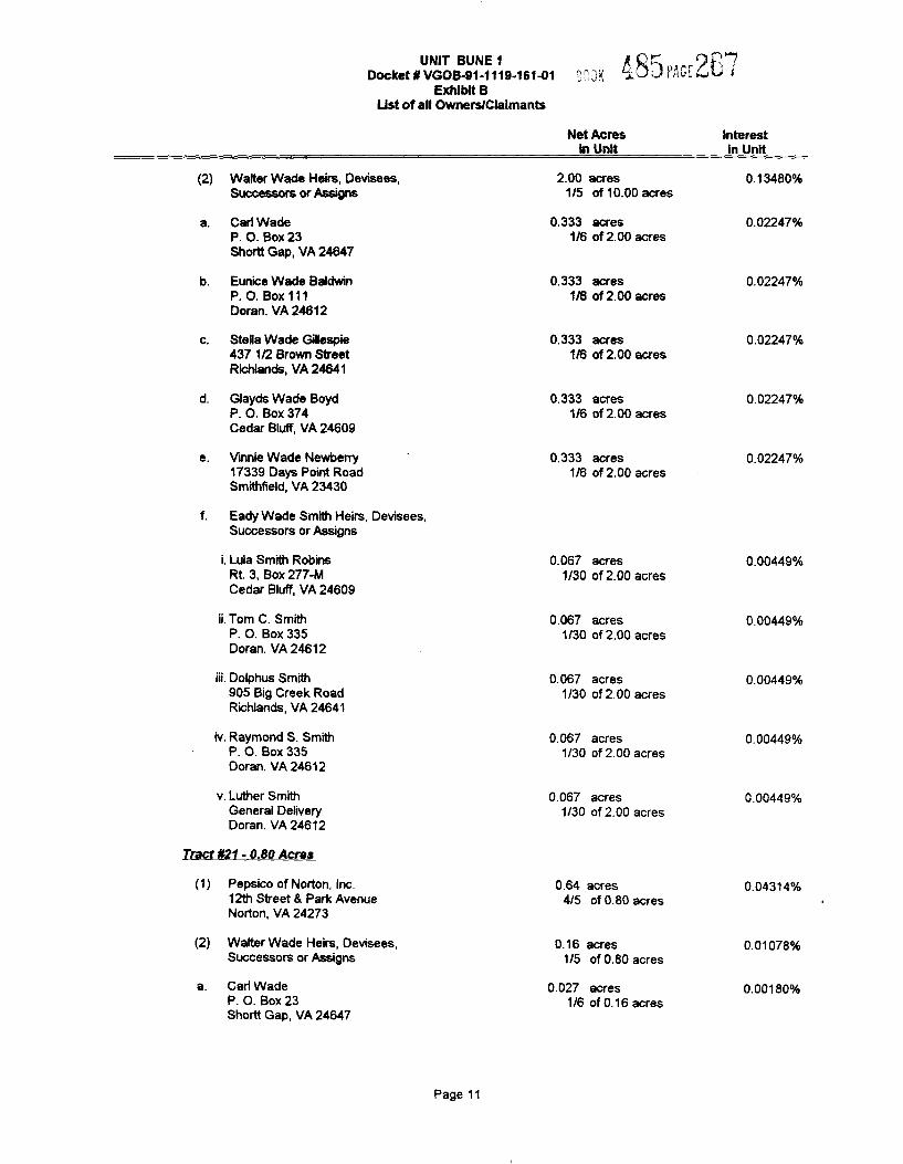
(2) Walter Wade Heirs, Devisees,Successors or Assigns
Cari WadeP. O. Box 23Shortt Gap, VA 24647
Eunice Wade BaldwinP. O. Box 111Doran. VA 24612
Stella Wade Gilespe437 1/2 Brown StreetRichlands, VA 24641
Glayds Wade BoydP. O. Box 374Cedar Bluff, VA 24609
Vinnie Wade Newberry17339 Days Point RoadSmithfield, VA 23430
Eady Wade Smith Heirs, Devisees,Successors or Assigns
i. Lula Smith RobinsRt. 3, Box 277-MCedar Bluff, VA 24609
ii. Tom C. SmithP. O. Box 335Doran. VA 24612
iii. Dolphus Smith905 Big Creek RoadRichlands, VA 24641
iv. Raymond S. SmithP. O. Box 335Doran. VA 24612
v. Luther SmithGeneral DeliveryDoran. VA 24612
Net Acresin Unit
2.00 acres1/5 of 10.00 acres
0.333 acres1/6 of 2.00 acres
0.333 acl'es1/6 of 2.00 acres
0.333 acres1/6 of 2.QO acres
0.333 acres1/6 of 2.00 acres
0.333 acres1/6 of 2.00 acres
0.067 acres1/30 of 2.00 acres
O.Q67 acres1/30 of 2.00 acres
0.067 acres1/30 of 2.00 acres
0.067 acres1/30 of 2.00 acres
0.067 acres1/30 of 2.00 acres
Interestln Unit
0.13480%
0.02247%
0.02247%
0 02247%
0.02247'k
0.02247%
Q.QQ449%
P 00449
0.00449%
0.00449%
0.00449'k
Tract ¹21- 0.80 Acres
Pepsico of Norton, Inc.12th Street & Park AvenueNorton, VA 24273
0.64 acres4/5 of 0.80 acres
0.04314ok
(2) Walter Wade Heirs, Devisees,Successors or Assigns
Carl WadeP. O. Box 23Shortt Gap, VA 24647
0.16 acres1/5 of 0.80 acres
0.027 acres1/6 of 0.16 acres
0.01078%
0.00180%
Page 11
UNIT BUNE 1 sGoeeket¹vooo4I1-111¹-16141 ". .'1k /e83 I',",
.C[4LSExhibit B
List of aN Owners/Claimants
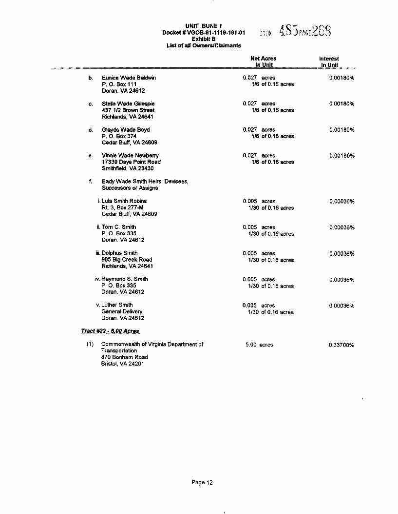
b. Eunice Wade BaldwinP. O. Box 111Doran. VA 24612
c. Stella Wade G@espie437 1/2 Brown StreetRichlands, VA 24641
d. Glayds Wade BoydP. O. Box 374Cedar Bluff, VA 24609
e. Vinnie Wade Newberry1?339Days Point RoadSmithfield, VA 23430
f. Eady Wade Smith Heirs, Devisees,Successors or Assigns
i. Lula Smith RobinsRt 3, Box 277-MCedar Bluff, YA 24609
ii. Tom C. SmithP. O. Box 335Doran. VA 24612
Net AcresIn Unit
0.027 acres1/6 of 0.16 acres
0.027 acres1/6 of 0.16 acres
0.027 acres1/6 of 0.16 acres
0.027 acres1/6 of 0.16 acres
0.005 acres1/30 of 0.16 acres
0.005 acres1/3Q of 0.16 acres
InterestIn Unit
0 00180ok
0.00180%
0 00180ok
0.00180%
0 00036ok
0 00036ok
iii. Dolphus Smith905 Big Creek RoadRichlands, VA 24641
iv. Raymond S. SmithP. O. Box 335Doran. YA 24612
0.005 acres1/30 of 0.16 acres
0.005 acres1/30 of 0.16 acres
0 QQQ36'k
0.00036%
v. Luther SmithGeneral DeliveryDoran. VA 24612
Q.Q05 acres1/30 of 0.16 acres
0.00036%
Tract $22 - 5.00 Acres
(1) Commonwealth of Virginia Department ofTransportation8?0 Bonham RoadBristol, YA 242Q1
5.00 acres 0.33700%
Page 12
UNIT BUNE \ ~",gy QQ ('Ij;[4r~lgDocket ¹ VGOB-91-1119-18141
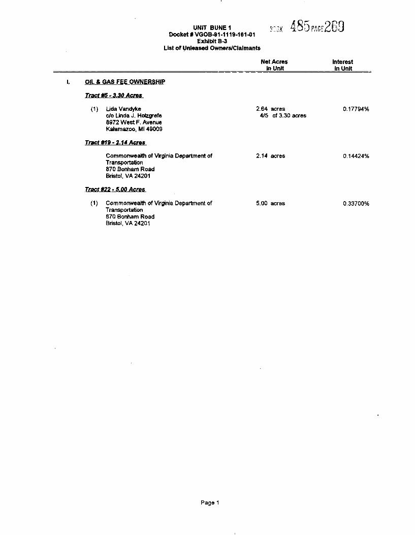
Exhibit B4List of Unleased Owners/Claimants
Net AcresIn Unit
Interestin Unit
OIL Ei GAS FEE OWNERSHIP
Tract ¹5- 3.30 Acres
(1) Lida Vandykec/o Linda J. Holzgrefe8S72 West F. AvenueKalamazoo, Ml 4900S
Tract ¹t9- 2.14 Acres
Commonwealth of Virginia Department ofTransportation870 Bonham RoadBristol, VA 24201
Tract ¹22-5.00 Acres
(1) Commonwealth of Virginia Department ofTransportation870 Bonharn RoadBristol, VA 24201
2.64 acres4/5 of 3.30 acres
2.14 acres
5.00 acres
0.17794%
0 14424%
0.33700%
Page 1
UNIT BUNE 1Docket ¹ VGOB4I1-1119-181%1
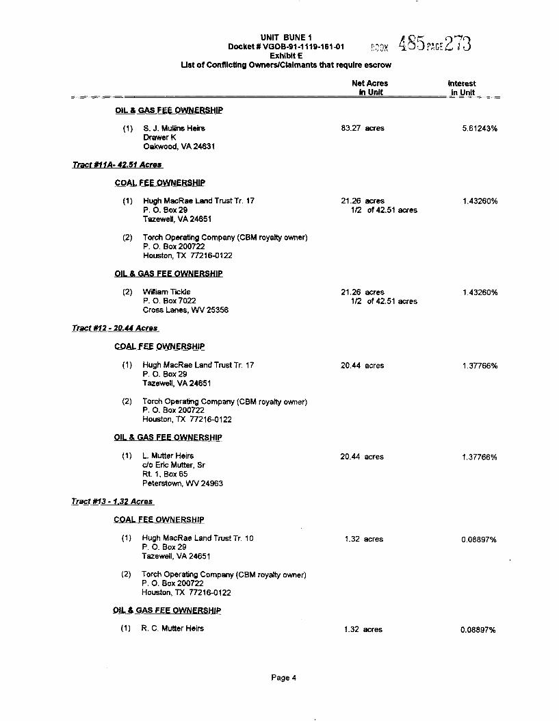
p Q ~Exhibit E XV3r,",6rQ N'J
Ust of Conflicting Owners/Claimants that require escrow
Net AcresIn Unit
InterestIn Unit
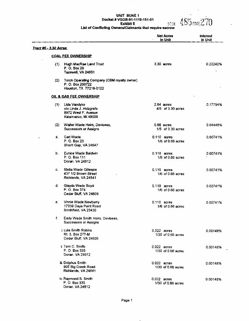
Tract ¹5- 3.30 Acres
COAL FEE OWNERSHIP
(2)
Hugh MacRae Land TrustP. O. Box 29Tazewell, YA 24651
Torch Operating Company (CBM royalty owner)P. O. Box 200722Houston, TX 77216-0122
3.30 acres 0.22242%
OIL 8 GAS FEE OWNERSHIP
(2)
a.
Lida Vandykec/o Linda J. Holzgrefe8972 West F. AvenueKalamazoo, Ml 49009
Walter Wade Heirs, Devisees,Successors or Assigns
Carl WadeP. O. Box 23Shortt Gap, YA 24647
Eunice Wade BaldwinP. O. Box 111Doran. VA 24612
2.64 acres4/5 of 3.30 acres
0.66 acres1/5 of 3.30 acres
0.110 acres1/6 of 0.66 acres
0.110 acres1/6 of 0.66 acres
Q 17794%
0.044480/0
0.00741%
0 00741%
Stella Wade Gillespie437 1/2 Brown StreetRichlands, VA 24641
Giayds Wade BoydP. O. Box 374Cedar Bluff, VA 24609
Vinnie Wade Newberry17339 Days Point RoadSmithfield, VA 23430
Eady Wade Smith Heirs, Devisees,Successors or Assigns
i. Lula Smith RobinsRt. 3, Box 277-MCedar Bluff, VA 24609
ii. Tom C. SmithP. O. Box 335Doran. VA 24612
iii. Dolphus Smith905 Big Creek RoadRichlands, VA 24641
iv. Raymond S. SmithP. O. Box 335Doran. VA 24612
0.110 acres1/6 of 0.66 acres
0.110 acres1/6 of 0.66 acres
0.110 acres1/6 of 0.66 acres
0.022 acres1/30 of 0.66 acres
0.022 acres1/30 of 0.66 acres
0.022 acres1/30 of 0.66 acres
0.022 acres1/30 of 0.66 acres
0.007410/0
0.00741%
0.00741%
0 00148%
0.00148%
Q QQ148%
0.00148%
Page 1
UNIT BUNE 1Deeket BVGDB611.1116-16141,-. 16 /|Qj r66rg 1 j
Exhibit EList of Conflicting Owners/Claimants that require escrow
Net Acresln Unit
Interestin Unit
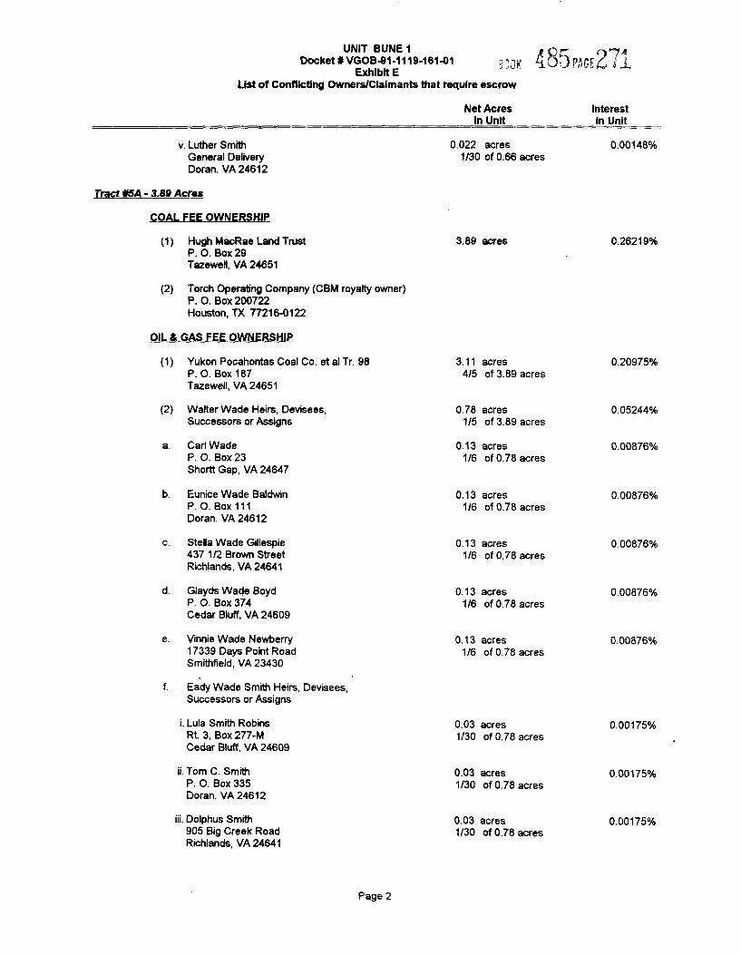
v. Luther SmithGeneral DeliveryDoran. VA 24612
0.022 acres1/30 of 0.66 acres
0.00148ok
7'rect f/6A - 3.89 Acres
COAL FEE OWNERSHIP
(2)
Hugh MacRae Land TrustP. O. Box 29Tazewell, VA 24651
Torch Operating Company (CBM royalty owner)P. O. Box 200722Houston, TX 77216-0122
3.89 acres 0.26219ok
OIL 4 GAS FEE OWNERSHIP
(2)
Yukon Pocahontas Coal Co. et al Tr. 98P. O. Box 187Tazewell, VA 24651
Walter Wade Heirs, Devisees,Successors or Assigns
Carl WadeP. O. Box 23Shortt Gap, VA 24647
Eunice Wade BaldwinP. O. Box 111Doran. VA 24612
3.11 acres4/5 of 3.89 acres
0.78 acres1/5 of 3.89 acres
0.13 acres1/6 of 0.78 acres
0.13 acres1/6 of 0.78 acres
0.20975'k
0.05244%
0.00876'/o
0.00876%
Stella Wade Gillespie437 1/2 Brown StreetRichlands, VA 24641
Glayds Wade BoydP. O. Box 374Cedar Biuff, VA 24609
Vinnie Wade Newberry17339 Days Point RoadSmithfield, VA 23430
Eady Wade Smith Heirs, Devisees,Successors or Assigns
i. Lula Smith RobinsRt. 3, Box 277-MCedar Bluff, VA 24609
ii. Tom C. SmithP. O. Box 335Doran. VA 24612
0.13 acres1/6 of 0.78 acres
0.13 acres1/6 of 0.78 acres
0.13 acres1/6 of 0.78 acres
0.03 acres1/30 of 0.78 acres
0.03 acres1/30 of 0.78 acres
0.00876%
Q.QQ876%
0.00876'k
0.00175%
0.00175ok
iii. Dolphus Smith905 Big Creek RoadRichlands, VA 24641
0.03 acres1/30 of 0.78 acres
0.00175%
Page 2
UNIT BUNE 1Docket ¹ VGOB-91-1119-161O1 ".'.3)( Xu 4 I.I6& 6 ~ ~
Exhibit EUst of Conflicting Owners/Claimants that require escrow
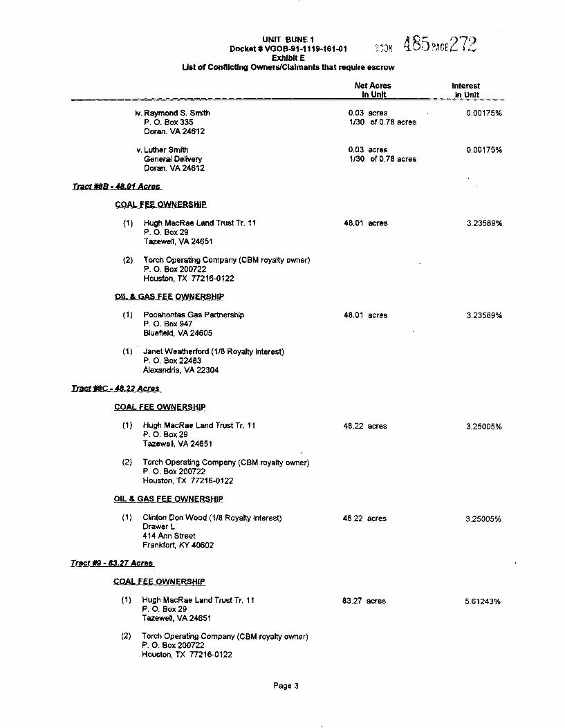
iv. Raymond S. SmithP. O. Box 335Doran. VA 24612
v. Luther SmithGeneral DeliveryDoran. VA 24612
Tract ¹8B- 48.01 Acres
COAL FEE OWNERSHIP
Net AcresIn Unit
0.03 acres1/30 of 0.78 acres
0.03 acres1/30 of 0.78 acres
InterestIn Unit
0.00175%
0.00175%
(1) Hugh MacRae Land Trust Tr. 11P. O. Box 29Tazewell, VA 24651
(2) Torch Operating Company (CBM royalty owner)P. O. Box 200722Houston, TX 77216-0122
OIL 8 GAS FEE OWNERSHIP
(1) Pocahontas Gas PartnershipP. O. Box 947Bluefield, VA 24605
(1) Janet Weatherford (1/8 Royalty Interest)P. O. Box 22483Alexandria, VA 22304
Tract ¹8C- 48.22 Acres
48.01 acres
48.01 acres
3.23589%
3.23589%
COAL FEE OWNERSHIP
(1) Hugh MacRae Land Trust Tr. 11P. O. Box 29Tazewell, VA 24651
(2) Torch Operating Company (CBM royalty owner)P. O. Box 200722Houston, TX 77216-0122
OIL & GAS FEE OWNERSHIP
48.22 acres 3.25005%
(1) Clinton Don Wood (1/8 Royalty interest)Drawer L414 Ann StreetFrankfort, KY 40602
Tract ¹9- 83.27 Acres
COAL FEE OWNERSHIP
48.22 acres 3 25005%
(1) Hugh MacRae Land Trust Tr. 11P. O. Box 29Tazewell, VA 24651
(2) Torch Operating Company (CBM royalty owner)P. O. Box 200722Houston, TX 77216-0122
83.27 acres 5.61243%
Page 3
UNIT BUNE 1Oocket¹VGOB-91-1119-16141 ".' .ll( ~3;3 f'~P. 5 I 3
Exhibit EUst of Conttictlng Owners/Claimants that require escrow
Net AcresIn Unit
interestin Unit
OIL 8 GAS FEE OWNERSHIP
(1) S. J. Mu4ins HeirsOrawer KOakwood, VA 24631
Tract ¹11A- 42.S1 Acres
83.27 acres 5.61243%
COAL FEE OWNERSHIP
(1) Hugh MacRae Land Trust Tr. 17P. O. Box 29Tazewe4, VA 24651
(2) Torch Operating Company (CBM royalty owner)P. O. Box 200722Houston, TX 77216-0122
OIL 4 GAS FEE OWNERSHIP
(2) Wi4iam TickleP. O. Box 7022Cross Lanes, WV 25356
Tract ¹12- 20.44 Acres
21.26 acres1/2 of 42.51 acres
21.26 acres1/2 of 42.51 acres
1.43260%
1.43260%
COAL FEE OWNERSHIP
(1) Hugh MacRae Land Trust Tr. 17P. O. Box 29Tazewe4, VA 24651
(2) Torch Operating Company (CBM royalty owner)P. O. Box 200722Houston, TX 77216-0122
OIL 8 GAS FEE OWNERSHIP
(1) L. Mutter Heirsc/o Eric Mutter, SrRt. 1, Box 65Peterstown, WV 24963
Tract ¹13- 1.32 Acres
20.44 acres
20.44 acres
1.37766%
1.37766%
COAL FEE OWNERSHIP
(1) Hugh MacRae Land Trust Tr. 10P. O. Box 2STazewe4, VA 24651
(2) Torch Operating Company (CBM royalty owner)P. O. Box 200722Houston, TX 77216-0122
OIL 8 GAS FEE OWNERSHIP
(1) R. C. Mutter Heirs
1.32 acres
1.32 acres
0.088S7%
0.08897%
Page 4
UNIT BUNE 1Docket ¹ VGD¹.91.1 1 1¹.to 1 ett
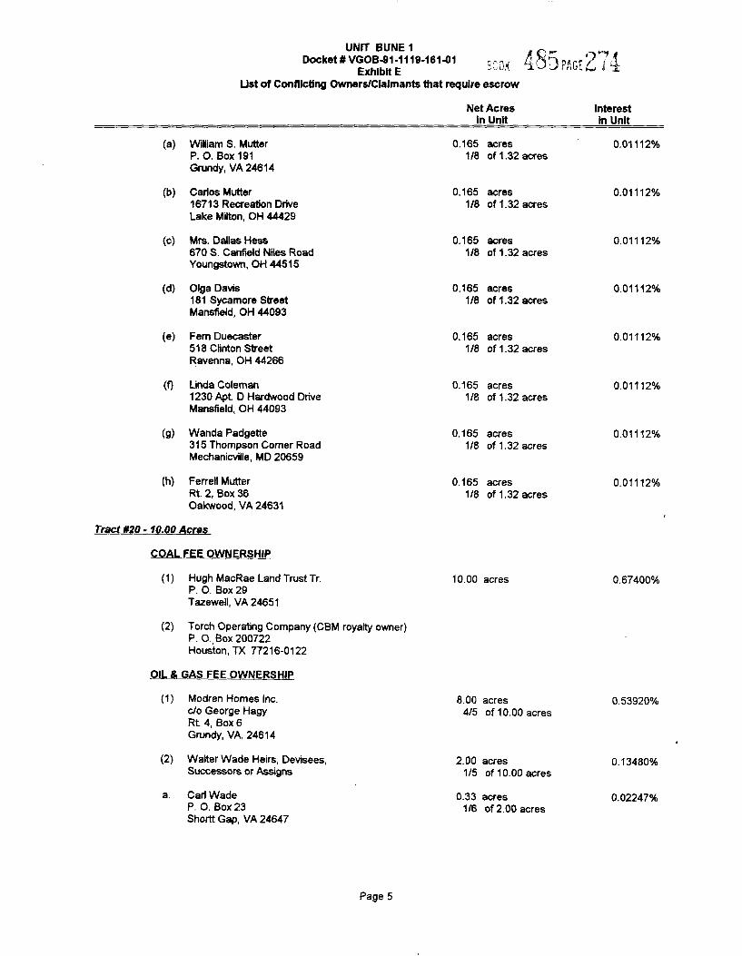
Exhibit EUst ot Conflicting Owners/Claimants that require escrow
Net AcresIn Unit
Interestln Unit
(a)
(b)
(c)
(d)
(e)
(g)
(h)
William S. MutterP. O. Box 191Grundy, VA 24614
Carlos Mutter16713Recreation DriveLake Milton, OH 44429
Mrs. Dallas Hess670 S. Canfield Niles RoadYoungstown, OH 44515
Olga Davis1S1 Sycamore StreetMansfieid, OH 44093
Fem Duecaster518 Clinton StreetRavenna, OH 44266
Linda Coleman1230 Apt Q Hardwood DriveMansfield, OH 44093
Wanda Padgette315 Thompson Comer RoadMechanicville, MD 20659
Ferrell MutterRt. 2, Box 36Oakwood, VA 24631
0.165 acres1/8 of 1.32 acres
0.165 acres1/8 of 1.32 acres
0.165 acres1/8 of 1.32 acres
0.165 acres1/8 of 1.32 acres
0.165 acres1/8 of 1.32 acres
0.165 acres1/S of 1.32 acres
0.165 acres1/8 of 1.32 acres
0.165 acres1/8 of 1.32 acres
0.01112¹k
0.01112'k
0.01112'k
0 01112%
0.01112'k
0.01112¹k
0.01112%
0.01112%
Tract 820- 10.00 Acres
COAL FEE OWNERSHIP
(2)
Hugh MacRae Land Trust Tr.P. O. Box 29Tazewell, VA 24651
Torch Operabng Company (CBM royalty owner)P. O. Box 200722Houston, TX 77216-0122
10.00 acres 0.6?400%
OIL S GAS FEE OWNERSHIP
Modren Homes Inc.c/o George HagyRt 4, Box 6Grundy, VA. 24614
8.00 acres4/5 of 10.00 acres
0.53920%
(2) Walter Wade Heirs, Devisees,Successors or Assigns
Carl WadeP. O. Box 23Shortt Gap, VA 24647
2.00 acres1/5 of 10.00 acres
0.33 acres1/6 of 2.00 acres
0 13480%
0.0224?%
Page 5
UNIT BUNE1oeeketoVGOB41-111S161O1,,&~ (gggI~p; J
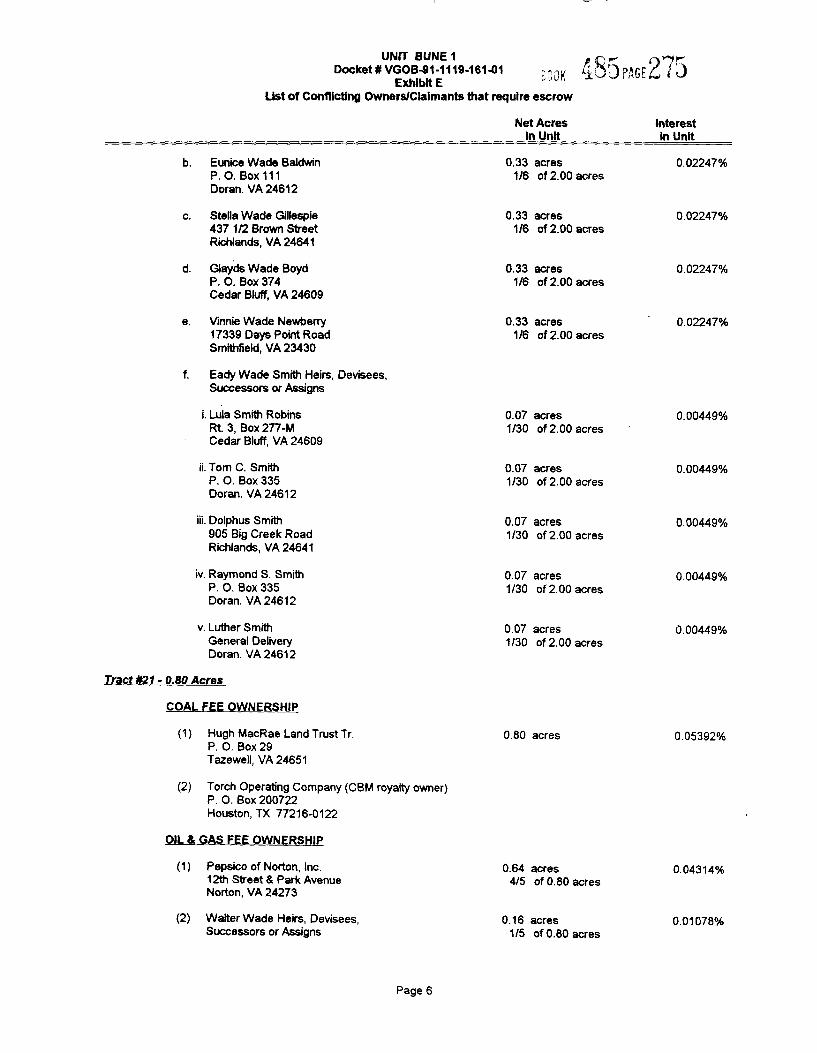
Exhibit EUst of Conflicting Owners/Claimants that require escrow
Net AcresIn Unit
Interestin Unit
Eunice Wade BaldwinP. O. Box 111Doran. VA 24612
0.33 acres1/6 of 2.00 acres
0.02247%
Stella Wade Gillespie437 1/2 Brown StreetRichlands, VA 24641
Glayds Wade BoydP. O. Box 374Cedar Bluff, VA 24609
Yinnie Wade Newberry1?339Days Point RoadSmithfield, VA 23430
0.33 acres1/6 of 2.00 acres
0.33 acres1/6 of 2.00 acres
0.33 acres1/6 of 2.00 acres
0.02247%
0.02247%
0.02247%o
Eady Wade Smith Heirs, Devisees,Successors or Assigns
i. Lula Smith RobinsRt. 3, Box 277-MCedar Bluff, VA 24609
ii. Tom C. SmithP. O. Box 335Doran. VA 24612
0.07 acres1/30 of 2.00 acres
0.07 acres1/30 of 2.00 acres
0.00449%o
0.00449%
iii. Dolphus Smith905 Big Creek RoadRichlands, YA 24641
iv. Raymond S. SmithP. O. Box 335Doran. VA 24612
v. Luther SmithGeneral DeliveryDoran. VA 24612
0.07 acres1/30 of 2.00 acres
0.07 acres1/30 of 2.00 acres
0.07 acres1/30 of 2.00 acres
0.00449%
0.00449%
0 PP449
Tract 821 - 0.80 Acres
COAL FEE OWNERSHIP
(2)
Hugh MacRae Land Trust Tr.P. O. Box 29Tazewell, VA 24651
Torch Operating Company (CBM royalty owner)P. O. Box 200'722Houston, TX 77216-0122
0.80 acres 0 05392%
OIL 8 GAS FEE OWNERSHIP
(2)
Pepsico of Norton, inc.12th Street & Park AvenueNorton, VA 24273
Walter Wade Heirs, Devisees,Successors or Assigns
0.64 acres4/5 of 0.80 acres
0.16 acres1/5 of 0.80 acres
0.04314%
0.01078%
Page 6
UNIT BUNE 1 ~Or,Docket¹VGOB-91-1119-161%1 ".;",, ~i( "iUUI 5(Jff 1c)
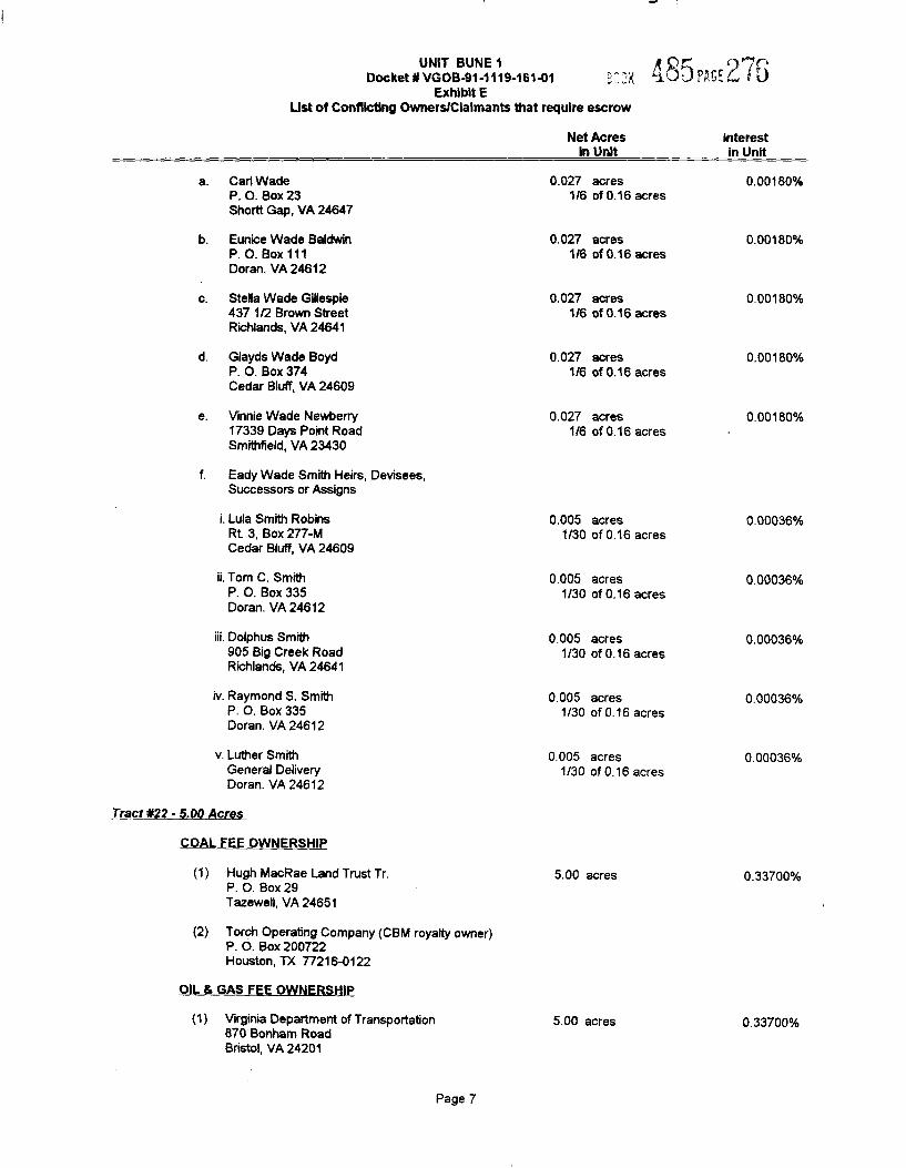
Exhibit EUst of Conflicting Owners/Claimants that require escrow
Carl WadeP. O. Box 23Shortt Gap, VA 24647
Eunice Wade BaldwinP. O. Box 111Doran. VA 24612
Stella Wade Gillespie437 1/2 Brown StreetRichlands, VA 24641
Glayds Wade BoydP. O. Box 374Cedar Bluff, VA 24609
Vinnie Wade Newberry17339 Days Point RoadSmithfield, VA 23430
Eady Wade Smith Heirs, Devisees,Successors or Assigns
i. Luis Smith RobinsRt. 3, Box 277-MCedar Bluff, VA 24609
ii. Tom C. SmithP. O. Box 335Doran. VA 24612
iii. Dol phus Smith905 Big Creek RoadRichlands, VA 24641
iv. Raymond S. SmithP. O. Box 335Doran. VA 24612
v. Luther SmithGeneral DeliveryDoran. VA 24612
Net Acresin Unit
0.027 acres1/6 of 0.16 acres
0.027 acres1/6 of 0.16 acres
0.027 acres1/6 of 0.16 acres
0.027 acres1/6 of 0.16 acres
0.027 acres1/6 of 0.16 acres
0.005 acres1/30 of 0.16 acres
0.005 acres1/30 of 0.16 acres
0.005 acres1/30 of 0.16 acres
0.005 acres1/30 of 0.16 acres
0,005 acres1/30 of 0.16 acres
Interestin Unit
0 00180%
0.00180%
0.00180%
0.00180%
0.00180%
0.00036%
0.00036%
0.00036o/o
0.00036%
0.00036%
Tract ¹22- 5.00 Acres
COAL FEE OWNERSHIP
«)
(2)
Hugh MacRae Land Trust Tr.P. O. Box 29Tazewell, VA 24651
Torch Operating Company (CBM royalty owner)P. O. Box 200722Houston, TX 77216-0122
5.00 acres 0.33700'/o
OIL & GAS FEE OWNERSHIP
«) Virginia Department of Transportation870 Bonham RoadBristol, VA 24201
5.00 acres 0.33700%
Page 7
1
I!7 t
1I
Itrerre I
/
I I I
:45
RES R?RA
e5A
P,. Itl
75
)eA 0W If tt i~ett-dI. JH-JI
II,! 'I Il I,' '
«I
e3b
J', '
I
I rr2
'I
II,
!
e2IJ I
e3tJ Ie . y . -I
~ - 22 NORTHEAST 22!IIIEE
lO
, I
rr Ii
' 'i J,
4115 fr! I
i I I,,'
I, ,'I
rI Ii
'it Jl
I'2-2
I -I , r I lr I, J Ii I, rl
' l1'i ' Il
. .II I
' ir'l l II
r' ' 1'LIT 3L Ura&.
VIRGINIA ..was this day padmitted to reDeed Book NoReturned this d
g instrument
gtpe exed,
s, Jr. , ClerkDeputy Clerk
ODOM VINIBtllh 'NOQBMI8V3AIHQ QOONHVHO OSV ~ 9I VI XO8 30lddO J.SOd
1IO '8 SVB 30 NOISIAIQ
ASAQMQ fRIS e/SlsM)g 'SQUID $0 )LISILQJSdSQ