Embed Size (px)
Citation preview
© 2007 Bentley Systems, Inc.
Integrating Oracle 10g Workflows via the Geospatial Enterprise Oracle Connector
Francois ValoisGeospatial Product Manager
Integrating Oracle 10g Workflows via the Geospatial Enterprise Oracle Connector
Francois ValoisGeospatial Product Manager
© 2007 Bentley Systems, Inc.
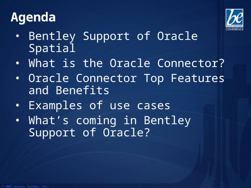
Agenda Agenda
• Bentley Support of Oracle Spatial• What is the Oracle Connector?• Oracle Connector Top Features and
Benefits • Examples of use cases• What’s coming in Bentley Support of
Oracle?
• Bentley Support of Oracle Spatial• What is the Oracle Connector?• Oracle Connector Top Features and
Benefits • Examples of use cases• What’s coming in Bentley Support of
Oracle?
© 2007 Bentley Systems, Inc.
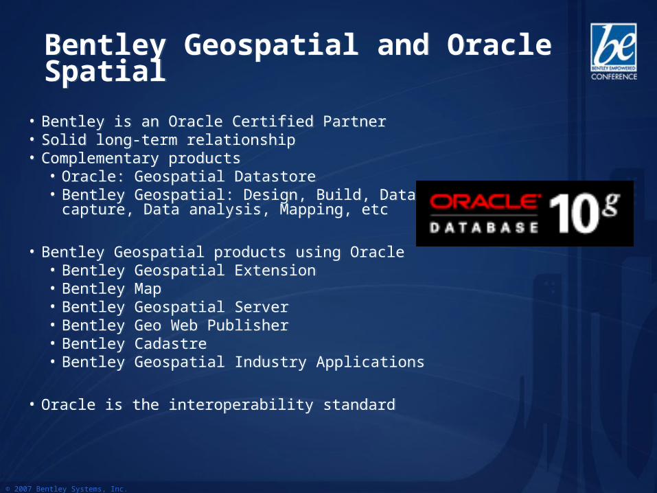
Bentley Geospatial and Oracle SpatialBentley Geospatial and Oracle Spatial
• Bentley is an Oracle Certified Partner• Solid long-term relationship• Complementary products
• Oracle: Geospatial Datastore• Bentley Geospatial: Design, Build, Data capture,
Data analysis, Mapping, etc
• Bentley Geospatial products using Oracle• Bentley Geospatial Extension• Bentley Map• Bentley Geospatial Server• Bentley Geo Web Publisher• Bentley Cadastre• Bentley Geospatial Industry Applications
• Oracle is the interoperability standard
© 2007 Bentley Systems, Inc.
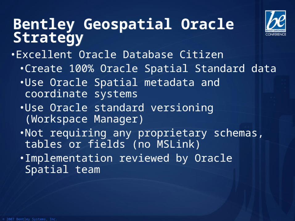
• Excellent Oracle Database Citizen• Create 100% Oracle Spatial Standard data• Use Oracle Spatial metadata and coordinate
systems• Use Oracle standard versioning (Workspace
Manager)• Not requiring any proprietary schemas, tables or
fields (no MSLink)• Implementation reviewed by Oracle Spatial team
• Excellent Oracle Database Citizen• Create 100% Oracle Spatial Standard data• Use Oracle Spatial metadata and coordinate
systems• Use Oracle standard versioning (Workspace
Manager)• Not requiring any proprietary schemas, tables or
fields (no MSLink)• Implementation reviewed by Oracle Spatial team
Bentley Geospatial Oracle StrategyBentley Geospatial Oracle Strategy
© 2007 Bentley Systems, Inc.
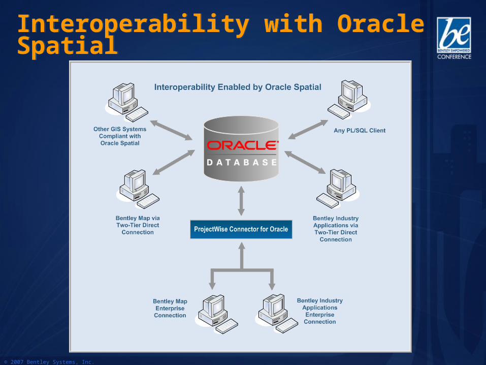
Interoperability with Oracle SpatialInteroperability with Oracle Spatial
© 2007 Bentley Systems, Inc.
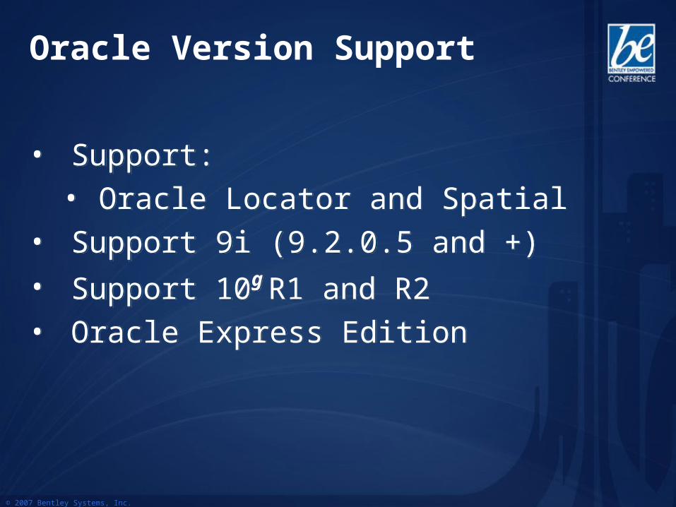
• Support:
• Oracle Locator and Spatial
• Support 9i (9.2.0.5 and +)
• Support 10g R1 and R2
• Oracle Express Edition
• Support:
• Oracle Locator and Spatial
• Support 9i (9.2.0.5 and +)
• Support 10g R1 and R2
• Oracle Express Edition
Oracle Version Support
© 2007 Bentley Systems, Inc.
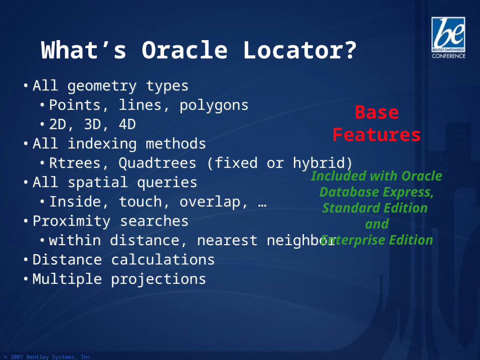
• All geometry types• Points, lines, polygons• 2D, 3D, 4D
• All indexing methods• Rtrees, Quadtrees (fixed or hybrid)
• All spatial queries• Inside, touch, overlap, …
• Proximity searches• within distance, nearest neighbor
• Distance calculations• Multiple projections
• All geometry types• Points, lines, polygons• 2D, 3D, 4D
• All indexing methods• Rtrees, Quadtrees (fixed or hybrid)
• All spatial queries• Inside, touch, overlap, …
• Proximity searches• within distance, nearest neighbor
• Distance calculations• Multiple projections
Base Features
Included with Oracle Database Express, Standard Edition
andEnterprise Edition
What’s Oracle Locator?
© 2007 Bentley Systems, Inc.
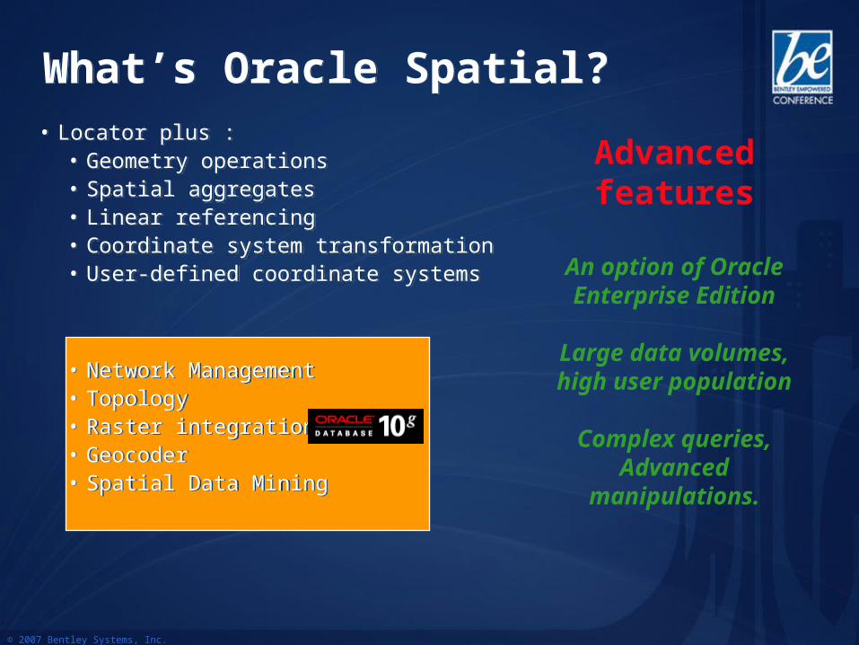
What’s Oracle Spatial?What’s Oracle Spatial?• Locator plus :
• Geometry operations• Spatial aggregates• Linear referencing• Coordinate system transformation• User-defined coordinate systems
• Network Management• Topology• Raster integration• Geocoder• Spatial Data Mining
• Locator plus :• Geometry operations• Spatial aggregates• Linear referencing• Coordinate system transformation• User-defined coordinate systems
• Network Management• Topology• Raster integration• Geocoder• Spatial Data Mining
Advanced features
An option of Oracle Enterprise Edition
Large data volumes, high user population
Complex queries, Advanced
manipulations.
© 2007 Bentley Systems, Inc.
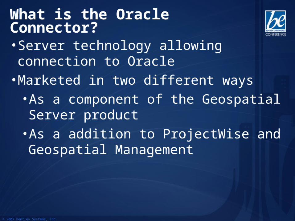
What is the Oracle Connector?What is the Oracle Connector?
• Server technology allowing connection to Oracle
• Marketed in two different ways
• As a component of the Geospatial Server product
• As a addition to ProjectWise and Geospatial Management
• Server technology allowing connection to Oracle
• Marketed in two different ways
• As a component of the Geospatial Server product
• As a addition to ProjectWise and Geospatial Management
© 2007 Bentley Systems, Inc.
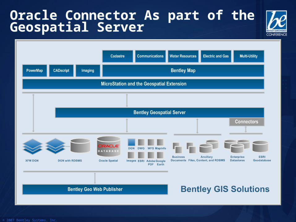
Oracle Connector As part of the Geospatial ServerOracle Connector As part of the Geospatial Server

© 2007 Bentley Systems, Inc.
Product FrameworkProduct Framework
Bentley Geospatial Desktop
Bentley Geospatial Industry Applications
Bentley Geospatial Server
Bentley Geospatial Web Publishing
Bentley Geospatial Mobile Applications
Enterprise Integration
© 2007 Bentley Systems, Inc.
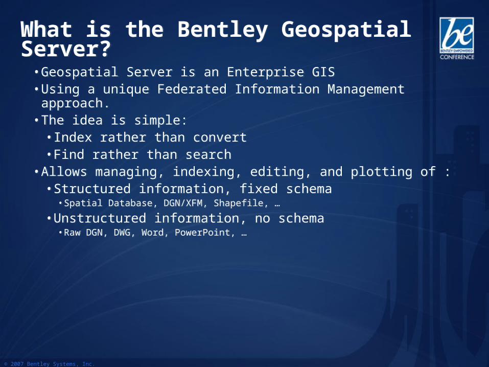
What is the Bentley Geospatial Server?What is the Bentley Geospatial Server?
• Geospatial Server is an Enterprise GIS• Using a unique Federated Information Management approach.• The idea is simple:
• Index rather than convert• Find rather than search
• Allows managing, indexing, editing, and plotting of :• Structured information, fixed schema
• Spatial Database, DGN/XFM, Shapefile, …
• Unstructured information, no schema• Raw DGN, DWG, Word, PowerPoint, …
© 2007 Bentley Systems, Inc.
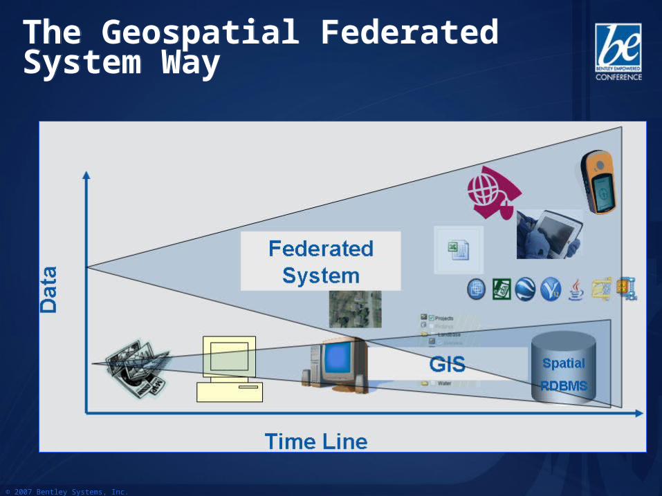
The Geospatial Federated System WayThe Geospatial Federated System Way
• Federated System allows dealing with a wider range of information help considering all aspects of a project
• Federated System allows dealing with a wider range of information help considering all aspects of a project
© 2007 Bentley Systems, Inc.
Bentley Geospatial Server
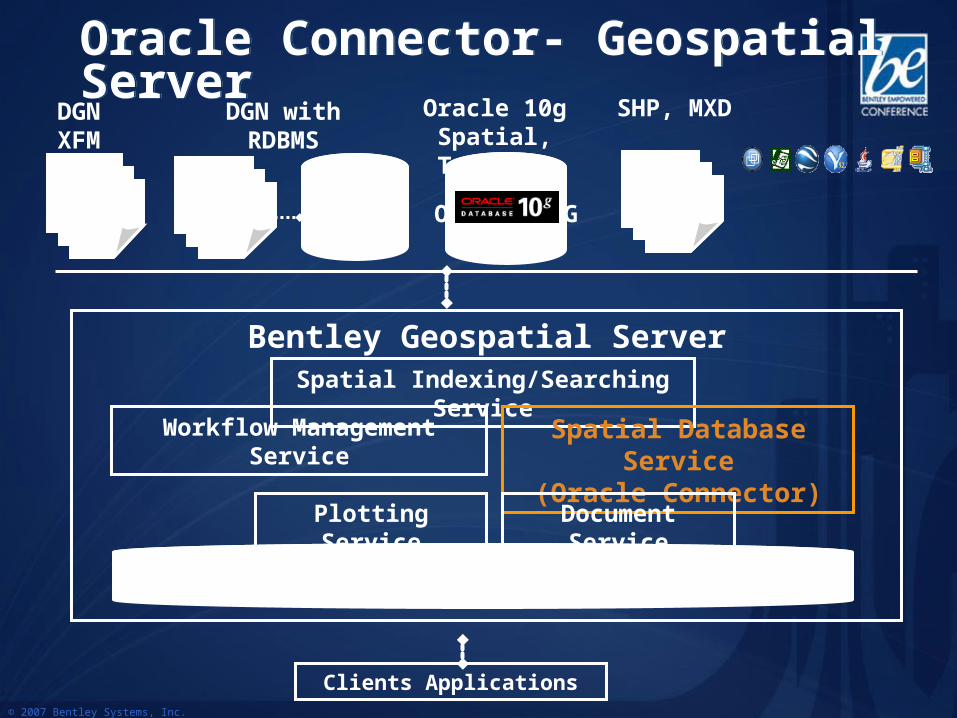
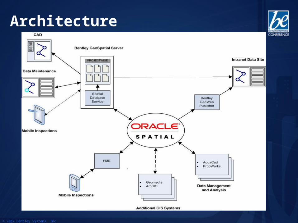
Oracle Connector- Geospatial ServerOracle Connector- Geospatial Server
Clients Applications
Spatial Indexing/Searching Service
Plotting Service
Spatial Database Service(Oracle Connector)
Workflow Management Service
Indexes, Metadata, Settings
Document Service
DGNXFM
DGN with RDBMS
Oracle 10G
Oracle 10gSpatial, Topology
SHP, MXD
© 2007 Bentley Systems, Inc.
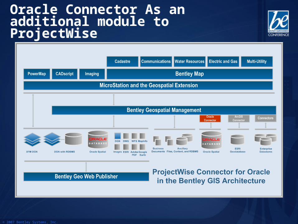
Oracle Connector As an additional module to ProjectWiseOracle Connector As an additional module to ProjectWise
© 2007 Bentley Systems, Inc.
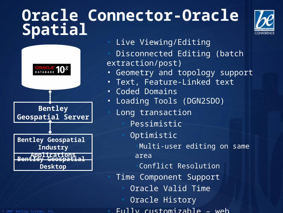
Oracle Connector-Oracle SpatialOracle Connector-Oracle Spatial• Live Viewing/Editing• Disconnected Editing (batch extraction/post)• Geometry and topology support• Text, Feature-Linked text• Coded Domains• Loading Tools (DGN2SDO)• Long transaction
• Pessimistic• Optimistic
•Multi-user editing on same area •Conflict Resolution
• Time Component Support• Oracle Valid Time• Oracle History
• Fully customizable – web services
Bentley Geospatial Desktop
Bentley Geospatial Industry Applications
Bentley Geospatial Server
© 2007 Bentley Systems, Inc.
Oracle Connector - FunctionalityOracle Connector - Functionality
• Oracle Spatial Geometry• Point, Linestring, Polygon, Polygon w/ Holes,
Arcs, Circles, Multipoint, Multilinestring, Multipolygon
• Tabular Attributes• Oracle field types supported
• Coordinate systems support (On-the-fly Transformation)
• All Oracle coordinate systems supported and more (5000+)
• Oracle workspace manager• Leveraged Oracle Standard versioning system
© 2007 Bentley Systems, Inc.
Oracle Connector - FunctionalityOracle Connector - Functionality• Oracle views
• Support of database view• Ex: To hide Social Security Number information from data editor
• Simple Text• Simple text support based on point• Feature-Linked Text
• Coded Domains• Restrict possible input values when editing
• Reconciliation Extension to MicroStation/GeoGraphics• Allow version (Oracle Workspace) merging• Conflict resolution• Version content visualization
• Oracle views• Support of database view• Ex: To hide Social Security Number information from data editor
• Simple Text• Simple text support based on point• Feature-Linked Text
• Coded Domains• Restrict possible input values when editing
• Reconciliation Extension to MicroStation/GeoGraphics• Allow version (Oracle Workspace) merging• Conflict resolution• Version content visualization
© 2007 Bentley Systems, Inc.
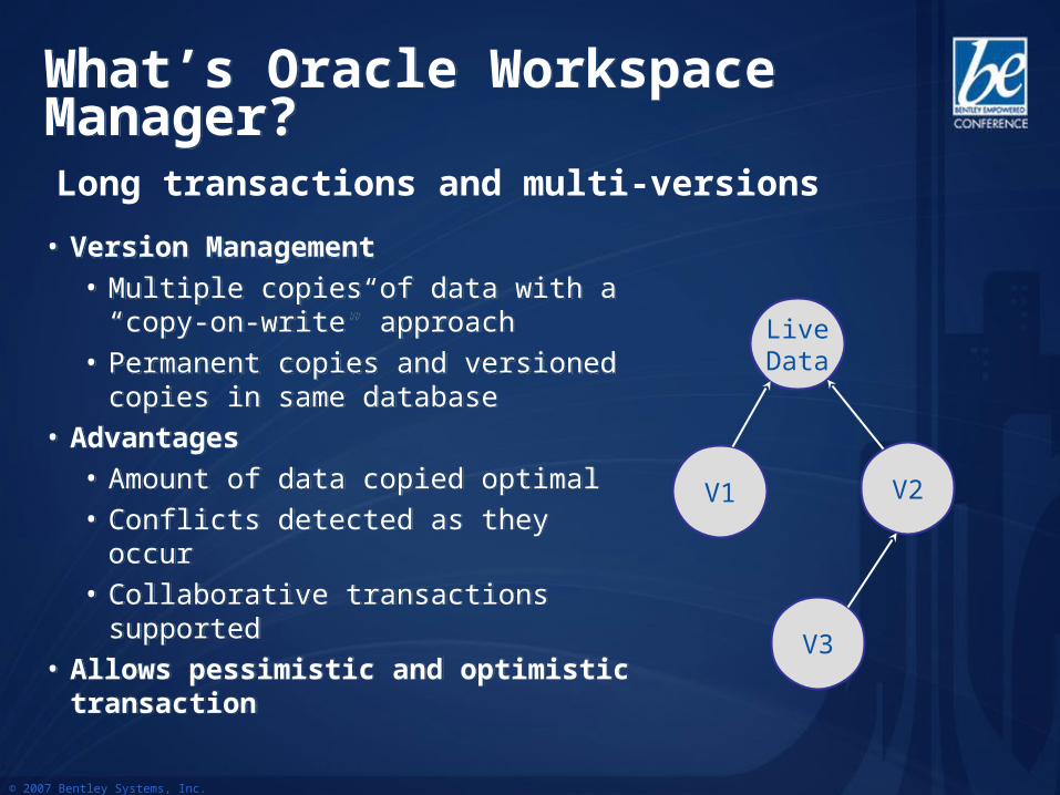
What’s Oracle Workspace Manager?What’s Oracle Workspace Manager?
• Version Management • Multiple copies of data with a “copy-on-
write” approach• Permanent copies and versioned copies
in same database• Advantages
• Amount of data copied optimal• Conflicts detected as they occur• Collaborative transactions supported
• Allows pessimistic and optimistic transaction
• Version Management • Multiple copies of data with a “copy-on-
write” approach• Permanent copies and versioned copies
in same database• Advantages
• Amount of data copied optimal• Conflicts detected as they occur• Collaborative transactions supported
• Allows pessimistic and optimistic transaction
LiveData
V1 V2
V3
Long transactions and multi-versions
© 2007 Bentley Systems, Inc.
Transaction TypeTransaction Type
• Short Transaction
• Database Editing Session lasting for a short time, i.e.: within one MicroStation Session• E.g.: split a parcel or open a valve
• Locking: Only pessimistic
• Pros: less overhead database side
• Cons: single user editing in same area, cannot work on same project for long time
• Short Transaction
• Database Editing Session lasting for a short time, i.e.: within one MicroStation Session• E.g.: split a parcel or open a valve
• Locking: Only pessimistic
• Pros: less overhead database side
• Cons: single user editing in same area, cannot work on same project for long time
© 2007 Bentley Systems, Inc.
Transaction TypeTransaction Type
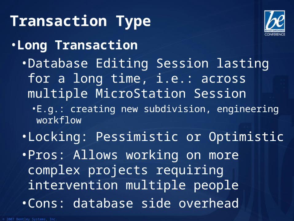
• Long Transaction
• Database Editing Session lasting for a long time, i.e.: across multiple MicroStation Session• E.g.: creating new subdivision, engineering workflow
• Locking: Pessimistic or Optimistic
• Pros: Allows working on more complex projects requiring intervention multiple people
• Cons: database side overhead
© 2007 Bentley Systems, Inc.
Locking TypeLocking Type
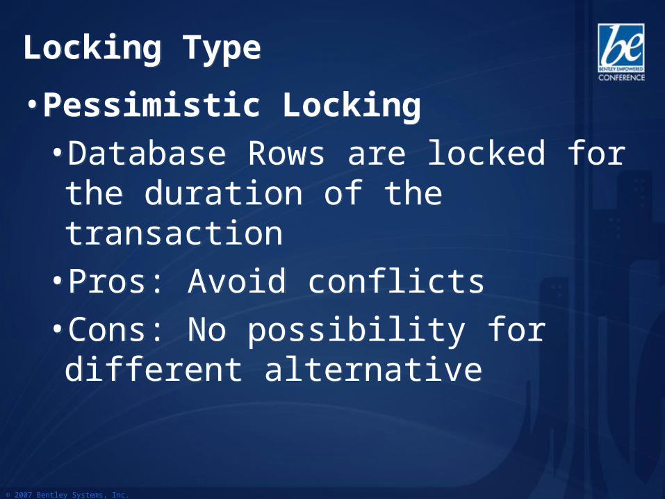
• Pessimistic Locking
• Database Rows are locked for the duration of the transaction
• Pros: Avoid conflicts
• Cons: No possibility for different alternative
• Pessimistic Locking
• Database Rows are locked for the duration of the transaction
• Pros: Avoid conflicts
• Cons: No possibility for different alternative
© 2007 Bentley Systems, Inc.
Locking TypeLocking Type
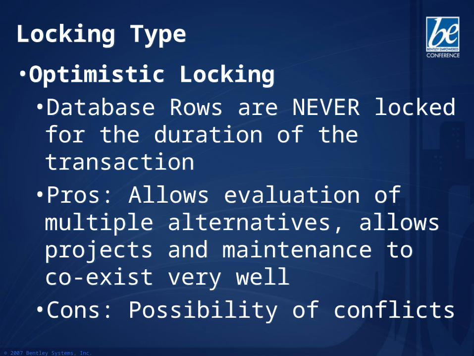
• Optimistic Locking
• Database Rows are NEVER locked for the duration of the transaction
• Pros: Allows evaluation of multiple alternatives, allows projects and maintenance to co-exist very well
• Cons: Possibility of conflicts
• Optimistic Locking
• Database Rows are NEVER locked for the duration of the transaction
• Pros: Allows evaluation of multiple alternatives, allows projects and maintenance to co-exist very well
• Cons: Possibility of conflicts
© 2007 Bentley Systems, Inc.
Live Database DocumentLive Database Document
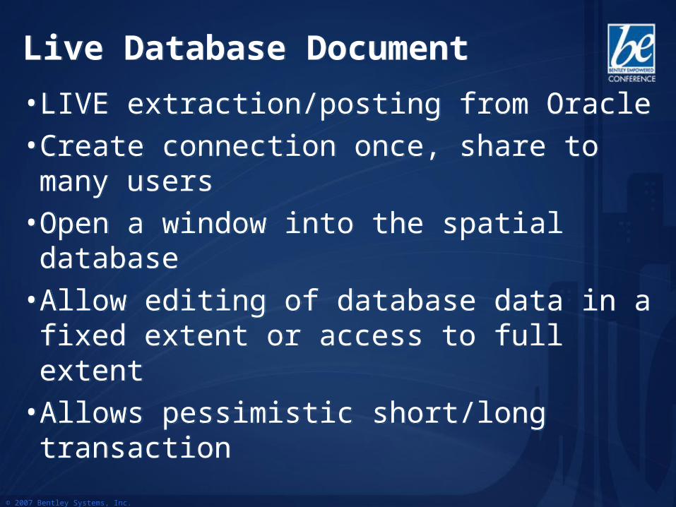
• LIVE extraction/posting from Oracle
• Create connection once, share to many users
• Open a window into the spatial database
• Allow editing of database data in a fixed extent or access to full extent
• Allows pessimistic short/long transaction
• LIVE extraction/posting from Oracle
• Create connection once, share to many users
• Open a window into the spatial database
• Allow editing of database data in a fixed extent or access to full extent
• Allows pessimistic short/long transaction
© 2007 Bentley Systems, Inc.
Live Database DocumentLive Database Document
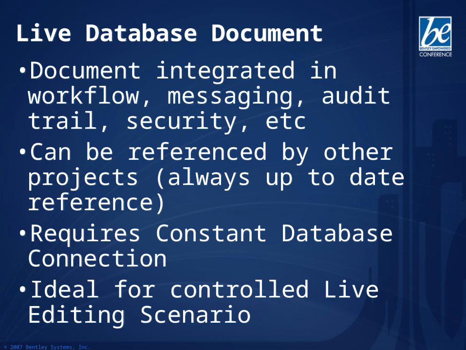
• Document integrated in workflow, messaging, audit trail, security, etc
• Can be referenced by other projects (always up to date reference)
• Requires Constant Database Connection• Ideal for controlled Live Editing Scenario
• Document integrated in workflow, messaging, audit trail, security, etc
• Can be referenced by other projects (always up to date reference)
• Requires Constant Database Connection• Ideal for controlled Live Editing Scenario
© 2007 Bentley Systems, Inc.
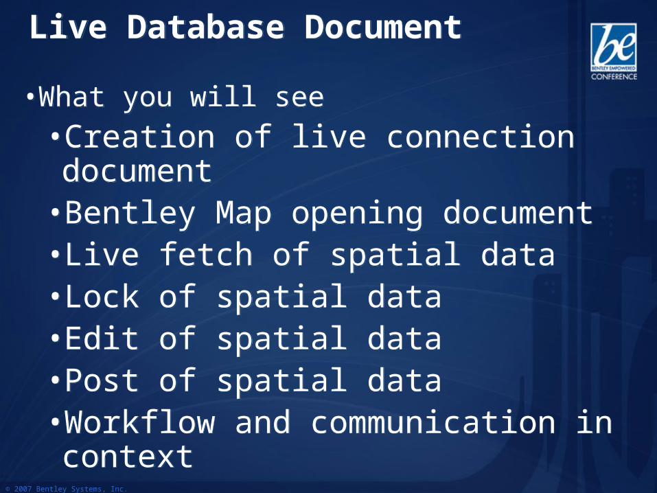
• What you will see
• Creation of live connection document• Bentley Map opening document• Live fetch of spatial data• Lock of spatial data• Edit of spatial data• Post of spatial data• Workflow and communication in context
• What you will see
• Creation of live connection document• Bentley Map opening document• Live fetch of spatial data• Lock of spatial data• Edit of spatial data• Post of spatial data• Workflow and communication in context
Live Database DocumentLive Database Document
© 2007 Bentley Systems, Inc.
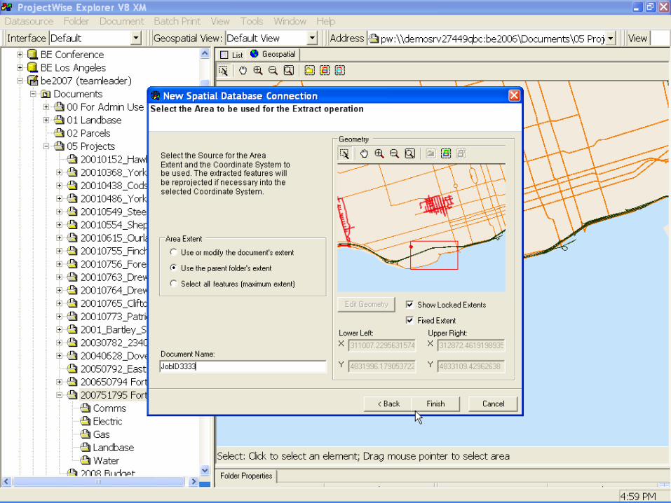
Demo: Creating InformationDemo: Creating Information
© 2007 Bentley Systems, Inc.
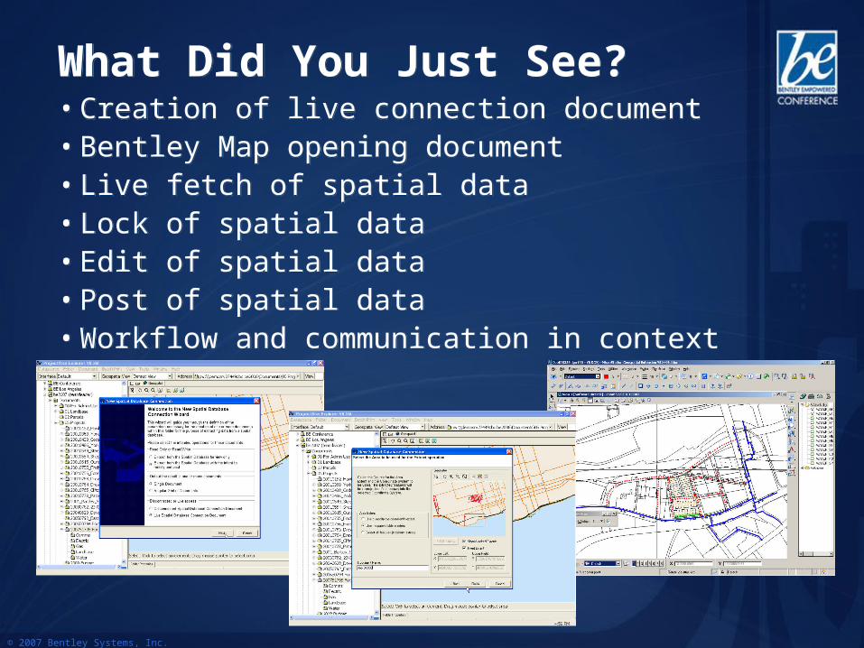
What Did You Just See?What Did You Just See?• Creation of live connection document• Bentley Map opening document• Live fetch of spatial data• Lock of spatial data• Edit of spatial data• Post of spatial data• Workflow and communication in context
• Creation of live connection document• Bentley Map opening document• Live fetch of spatial data• Lock of spatial data• Edit of spatial data• Post of spatial data• Workflow and communication in context
© 2007 Bentley Systems, Inc.
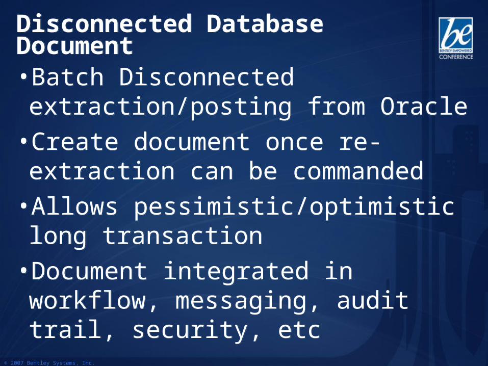
Disconnected Database DocumentDisconnected Database Document
• Batch Disconnected extraction/posting from Oracle
• Create document once re-extraction can be commanded
• Allows pessimistic/optimistic long transaction
• Document integrated in workflow, messaging, audit trail, security, etc
• Batch Disconnected extraction/posting from Oracle
• Create document once re-extraction can be commanded
• Allows pessimistic/optimistic long transaction
• Document integrated in workflow, messaging, audit trail, security, etc
© 2007 Bentley Systems, Inc.
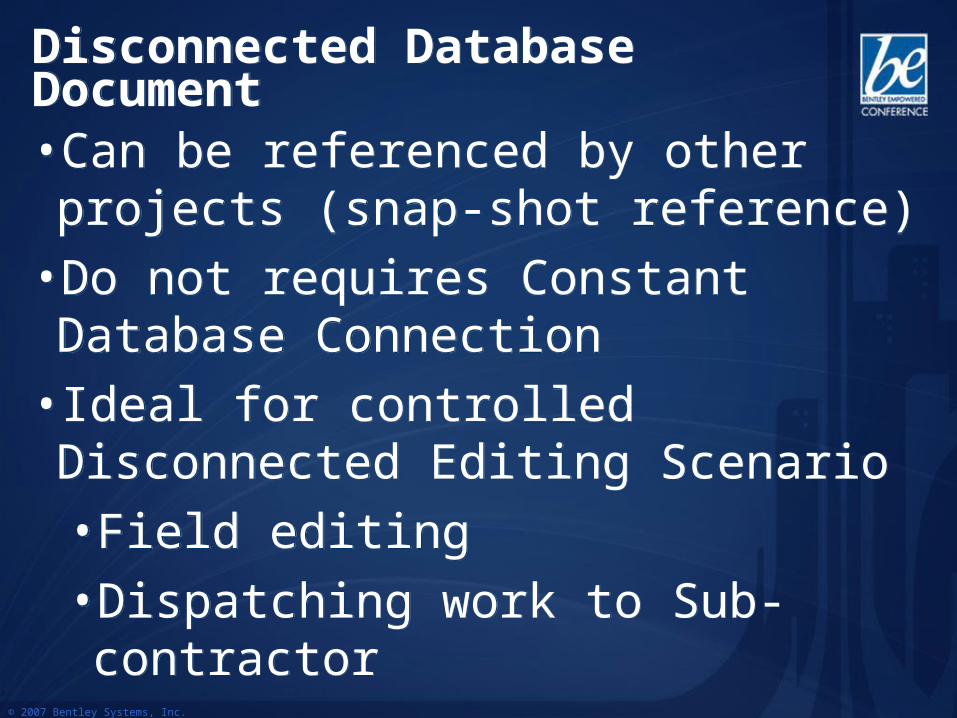
Disconnected Database DocumentDisconnected Database Document
• Can be referenced by other projects (snap-shot reference)
• Do not requires Constant Database Connection
• Ideal for controlled Disconnected Editing Scenario
• Field editing
• Dispatching work to Sub-contractor
• Can be referenced by other projects (snap-shot reference)
• Do not requires Constant Database Connection
• Ideal for controlled Disconnected Editing Scenario
• Field editing
• Dispatching work to Sub-contractor
© 2007 Bentley Systems, Inc.
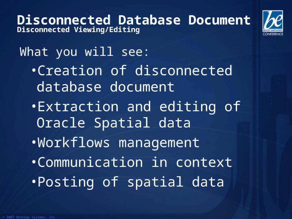
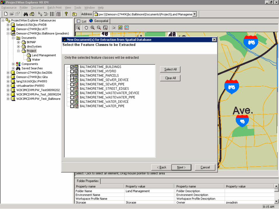
Disconnected Database DocumentDisconnected Viewing/EditingDisconnected Database DocumentDisconnected Viewing/Editing
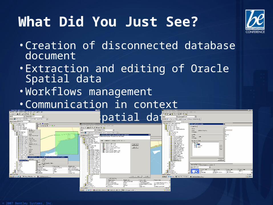
What you will see:
• Creation of disconnected database document
• Extraction and editing of Oracle Spatial data
• Workflows management• Communication in context• Posting of spatial data
What you will see:
• Creation of disconnected database document
• Extraction and editing of Oracle Spatial data
• Workflows management• Communication in context• Posting of spatial data
© 2007 Bentley Systems, Inc.
© 2007 Bentley Systems, Inc.
What Did You Just See?What Did You Just See?
• Creation of disconnected database document• Extraction and editing of Oracle Spatial data • Workflows management• Communication in context• Posting of spatial data
• Creation of disconnected database document• Extraction and editing of Oracle Spatial data • Workflows management• Communication in context• Posting of spatial data
© 2007 Bentley Systems, Inc.
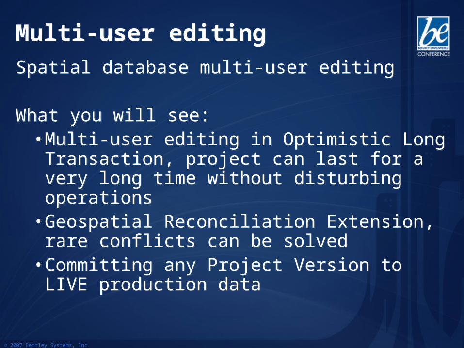
Multi-user editingMulti-user editing
Spatial database multi-user editing
What you will see:• Multi-user editing in Optimistic Long Transaction,
project can last for a very long time without disturbing operations
• Geospatial Reconciliation Extension, rare conflicts can be solved
• Committing any Project Version to LIVE production data
Spatial database multi-user editing
What you will see:• Multi-user editing in Optimistic Long Transaction,
project can last for a very long time without disturbing operations
• Geospatial Reconciliation Extension, rare conflicts can be solved
• Committing any Project Version to LIVE production data
© 2007 Bentley Systems, Inc.
DemoDemo
© 2007 Bentley Systems, Inc.
What Did You Just See?What Did You Just See?
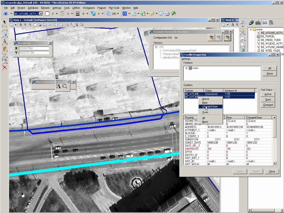
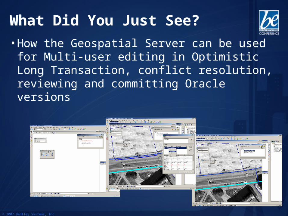
• How the Geospatial Server can be used for Multi-user editing in Optimistic Long Transaction, conflict resolution, reviewing and committing Oracle versions
• How the Geospatial Server can be used for Multi-user editing in Optimistic Long Transaction, conflict resolution, reviewing and committing Oracle versions
© 2007 Bentley Systems, Inc.
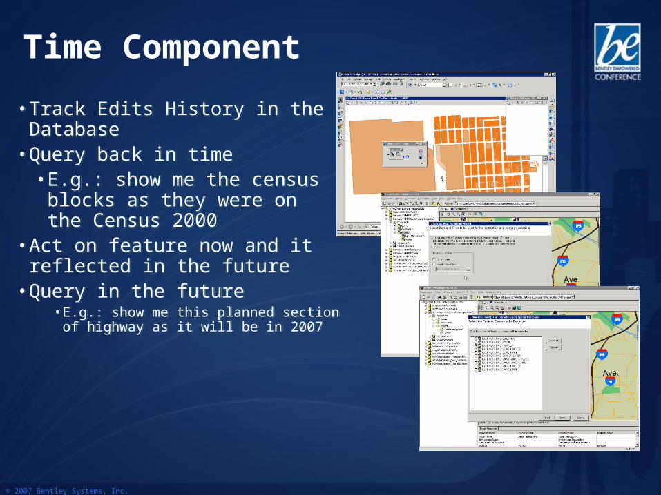
• Track Edits History in the Database
• Query back in time• E.g.: show me the census
blocks as they were on the Census 2000
• Act on feature now and it reflected in the future
• Query in the future• E.g.: show me this planned section of
highway as it will be in 2007
• Track Edits History in the Database
• Query back in time• E.g.: show me the census
blocks as they were on the Census 2000
• Act on feature now and it reflected in the future
• Query in the future• E.g.: show me this planned section of
highway as it will be in 2007
Time Component
© 2007 Bentley Systems, Inc.
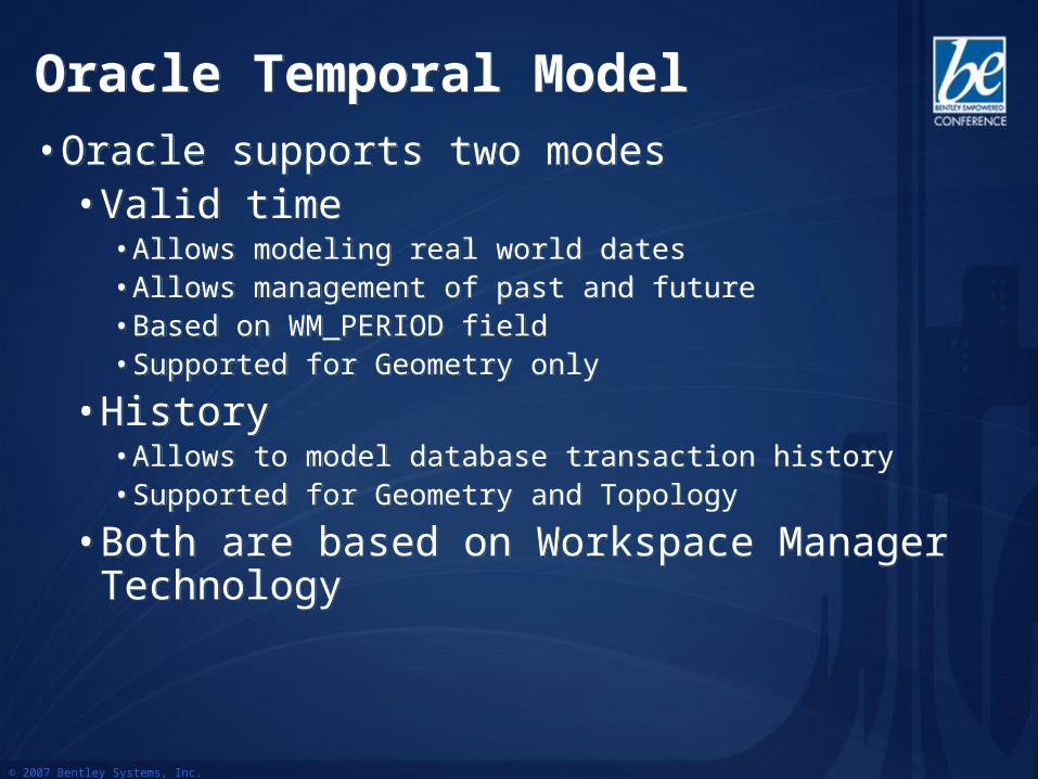
Oracle Temporal ModelOracle Temporal Model• Oracle supports two modes
• Valid time• Allows modeling real world dates• Allows management of past and future• Based on WM_PERIOD field• Supported for Geometry only
• History• Allows to model database transaction history• Supported for Geometry and Topology
• Both are based on Workspace Manager Technology
• Oracle supports two modes• Valid time
• Allows modeling real world dates• Allows management of past and future• Based on WM_PERIOD field• Supported for Geometry only
• History• Allows to model database transaction history• Supported for Geometry and Topology
• Both are based on Workspace Manager Technology
© 2007 Bentley Systems, Inc.
Valid TimeValid Time
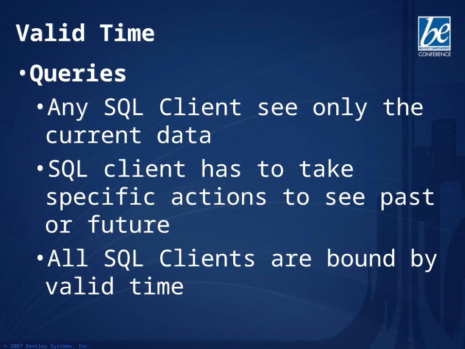
• Queries
• Any SQL Client see only the current data
• SQL client has to take specific actions to see past or future
• All SQL Clients are bound by valid time
• Queries
• Any SQL Client see only the current data
• SQL client has to take specific actions to see past or future
• All SQL Clients are bound by valid time
© 2007 Bentley Systems, Inc.
HistoryHistory
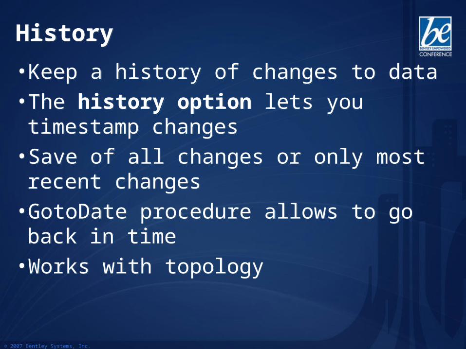
• Keep a history of changes to data
• The history option lets you timestamp changes
• Save of all changes or only most recent changes
• GotoDate procedure allows to go back in time
• Works with topology
• Keep a history of changes to data
• The history option lets you timestamp changes
• Save of all changes or only most recent changes
• GotoDate procedure allows to go back in time
• Works with topology
© 2007 Bentley Systems, Inc.
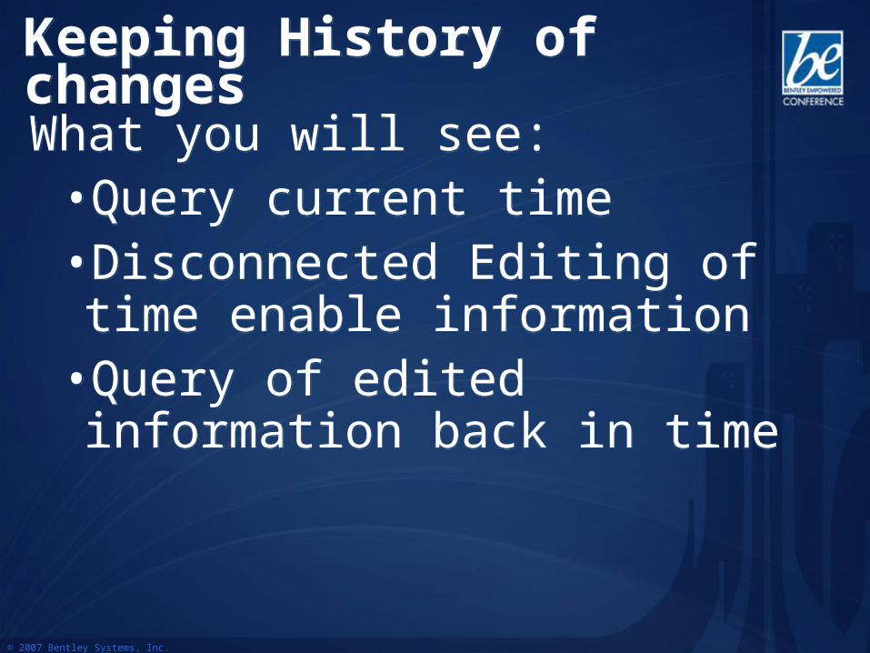
Keeping History of changesKeeping History of changesWhat you will see:
•Query current time•Disconnected Editing of time enable information
•Query of edited information back in time
What you will see:•Query current time•Disconnected Editing of time enable information
•Query of edited information back in time
© 2007 Bentley Systems, Inc.
DemoDemo
© 2007 Bentley Systems, Inc.
What Did You Just See?What Did You Just See?
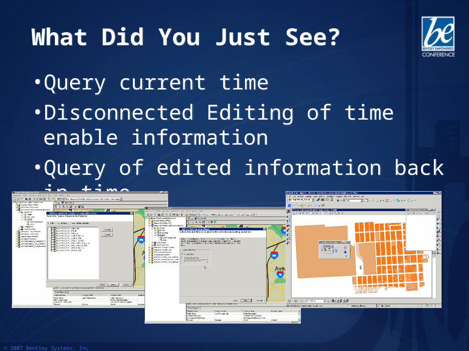
• Query current time
• Disconnected Editing of time enable information
• Query of edited information back in time
• Query current time
• Disconnected Editing of time enable information
• Query of edited information back in time
© 2007 Bentley Systems, Inc.
Oracle Spatial Topology ModelOracle Spatial Topology Model• Persistent topology model in a standard RDBMS• Explicit spatial relationship existing among features• Based on topological primitives:
• Nodes, Edges, Faces• Each topological primitive is stored once in the database
• Each topological primitive can be associated with one or more features. For example:• An edge may be associated with two adjacent county
boundaries• An edge may be associated with a land parcel and a river
• Shared Editing is easier• Analysis is done using topological algorithms, using
persistent relationships
• Persistent topology model in a standard RDBMS• Explicit spatial relationship existing among features• Based on topological primitives:
• Nodes, Edges, Faces• Each topological primitive is stored once in the database
• Each topological primitive can be associated with one or more features. For example:• An edge may be associated with two adjacent county
boundaries• An edge may be associated with a land parcel and a river
• Shared Editing is easier• Analysis is done using topological algorithms, using
persistent relationships

© 2007 Bentley Systems, Inc.
Features/Topology PrimitivesFeatures/Topology Primitives
Topology FeaturesTopology primitives
Relationships Between Primitives and Feature
Relationships Between Nodes/Edges/Faces
Allow finding relationships between
features->Spatial Query
© 2007 Bentley Systems, Inc.
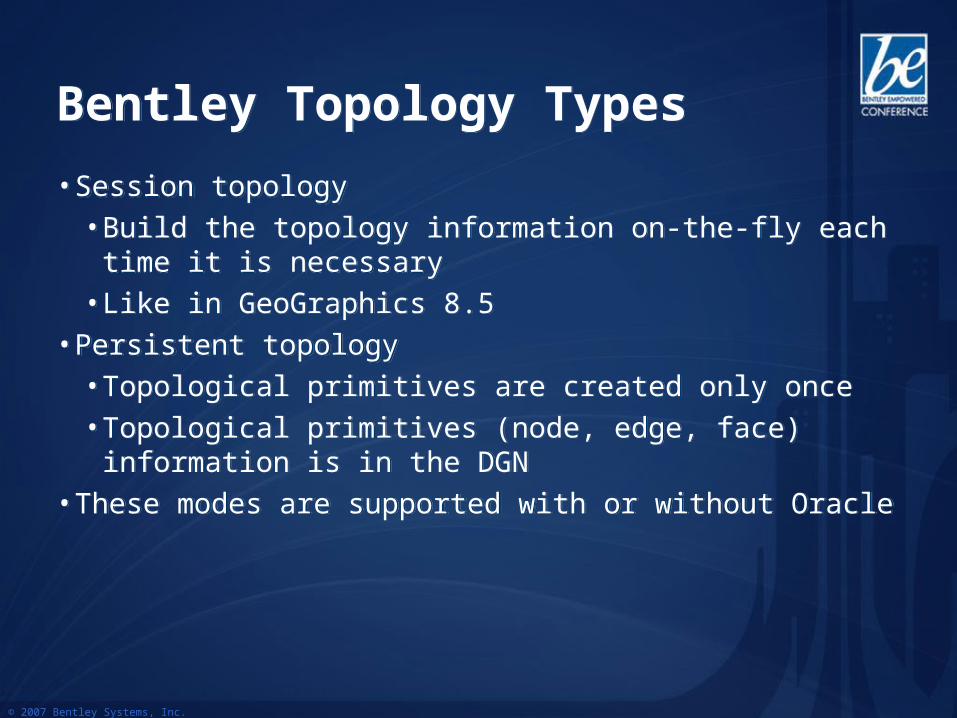
Bentley Topology TypesBentley Topology Types
• Session topology• Build the topology information on-the-fly each time it is
necessary • Like in GeoGraphics 8.5
• Persistent topology• Topological primitives are created only once• Topological primitives (node, edge, face) information is in
the DGN• These modes are supported with or without Oracle
© 2007 Bentley Systems, Inc.
Bentley Persistent Topology ModelBentley Persistent Topology Model
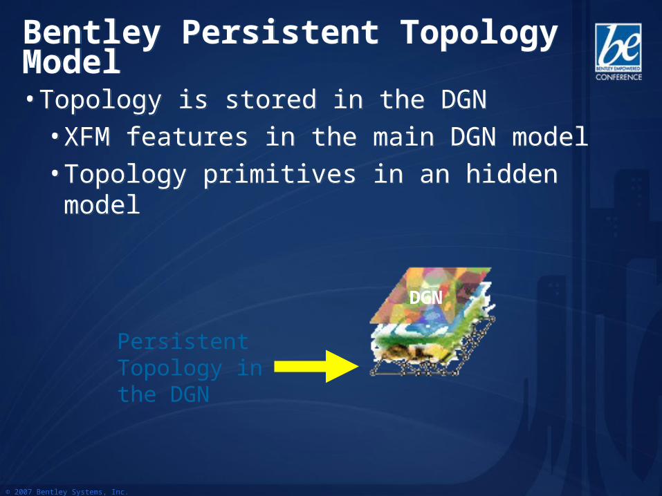
• Topology is stored in the DGN• XFM features in the main DGN model• Topology primitives in an hidden model
• Topology is stored in the DGN• XFM features in the main DGN model• Topology primitives in an hidden model
DGN
Persistent Topology in the DGN

© 2007 Bentley Systems, Inc.
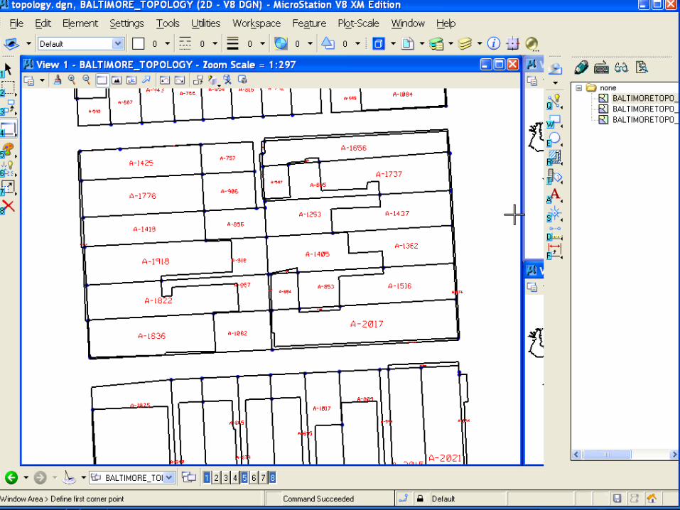
Open from Oracle Spatial TopologyOpen from Oracle Spatial Topology
What you will see:• Open Oracle Spatial Topology features in
current DGN•View the topological features•Show the hidden topology model
• Nodes, Edges, Faces
What you will see:• Open Oracle Spatial Topology features in
current DGN•View the topological features•Show the hidden topology model
• Nodes, Edges, Faces
© 2007 Bentley Systems, Inc.
DemoDemo
© 2007 Bentley Systems, Inc.
What Did You Just See?What Did You Just See?
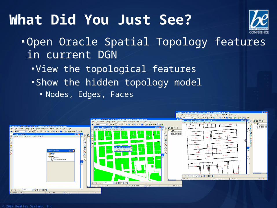
• Open Oracle Spatial Topology features in current DGN• View the topological features• Show the hidden topology model
• Nodes, Edges, Faces
• Open Oracle Spatial Topology features in current DGN• View the topological features• Show the hidden topology model
• Nodes, Edges, Faces
© 2007 Bentley Systems, Inc.
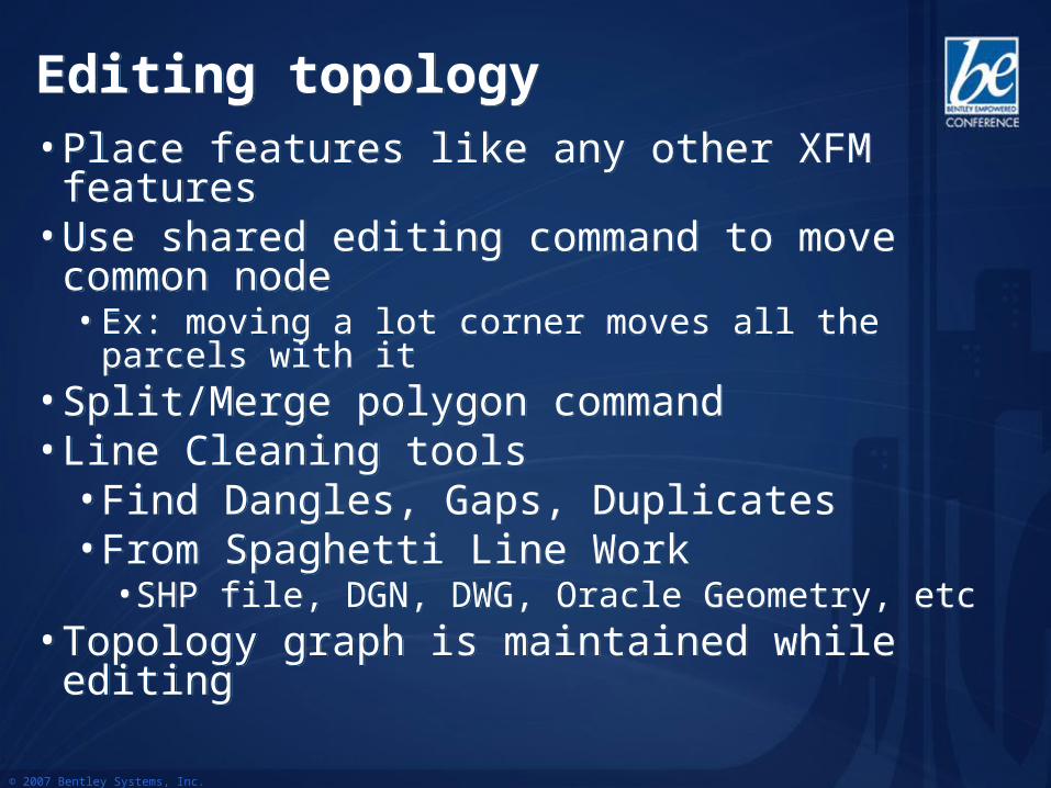
Editing topologyEditing topology• Place features like any other XFM features• Use shared editing command to move common
node• Ex: moving a lot corner moves all the parcels with it
• Split/Merge polygon command• Line Cleaning tools
• Find Dangles, Gaps, Duplicates• From Spaghetti Line Work
• SHP file, DGN, DWG, Oracle Geometry, etc• Topology graph is maintained while editing
• Place features like any other XFM features• Use shared editing command to move common
node• Ex: moving a lot corner moves all the parcels with it
• Split/Merge polygon command• Line Cleaning tools
• Find Dangles, Gaps, Duplicates• From Spaghetti Line Work
• SHP file, DGN, DWG, Oracle Geometry, etc• Topology graph is maintained while editing
© 2007 Bentley Systems, Inc.
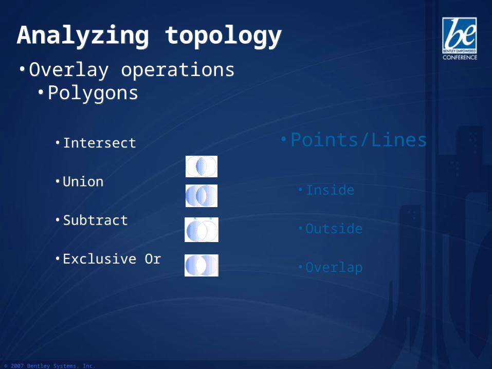
Analyzing topologyAnalyzing topology• Overlay operations
• Polygons
• Intersect
• Union
• Subtract
• Exclusive Or
• Overlay operations• Polygons
• Intersect
• Union
• Subtract
• Exclusive Or
• Points/Lines
• Inside
• Outside
• Overlap
© 2007 Bentley Systems, Inc.
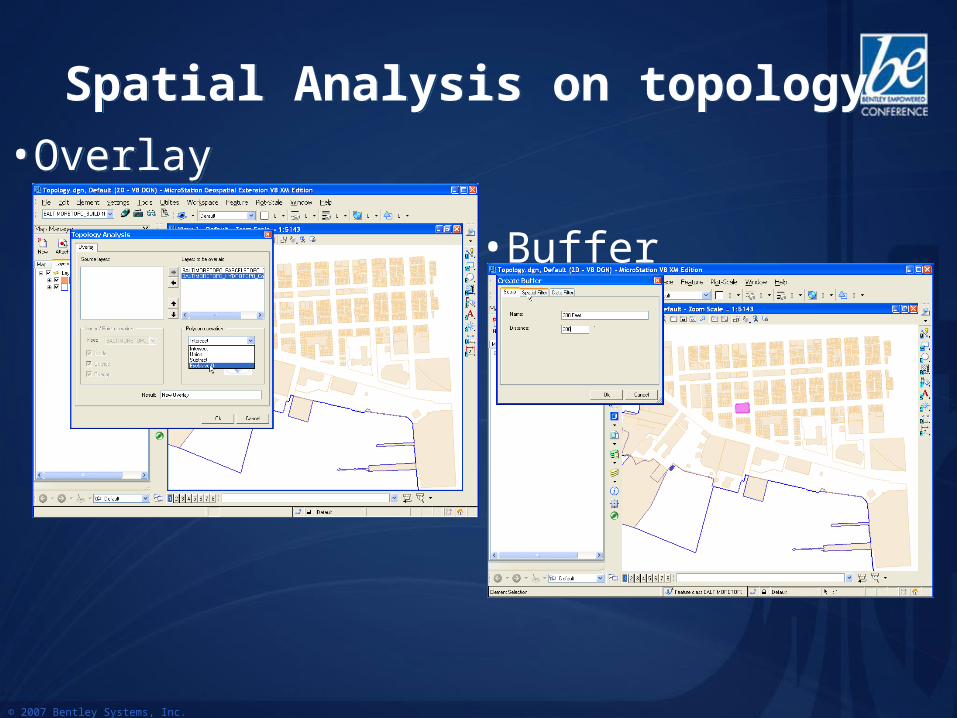
Spatial Analysis on topologySpatial Analysis on topology
• Overlay Operations• Overlay Operations
• Buffer
© 2007 Bentley Systems, Inc.
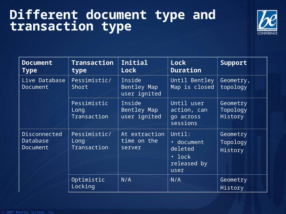
Different document type and transaction typeDifferent document type and transaction type
Document Type
Transaction type
Initial Lock Lock Duration Support
Live Database Document
Pessimistic/Short Inside Bentley Map user ignited
Until Bentley Map is closed
Geometry, topology
Pessimistic Long Transaction
Inside Bentley Map user ignited
Until user action, can go across sessions
Geometry Topology History
Disconnected Database Document
Pessimistic/Long Transaction
At extraction time on the server
Until: • document deleted• lock released by user
Geometry
Topology
History
Optimistic Locking
N/A N/A Geometry
History
© 2007 Bentley Systems, Inc.
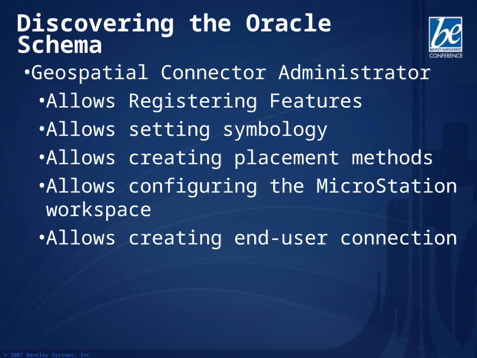
• Geospatial Connector Administrator
• Allows Registering Features
• Allows setting symbology
• Allows creating placement methods
• Allows configuring the MicroStation workspace
• Allows creating end-user connection
• Geospatial Connector Administrator
• Allows Registering Features
• Allows setting symbology
• Allows creating placement methods
• Allows configuring the MicroStation workspace
• Allows creating end-user connection
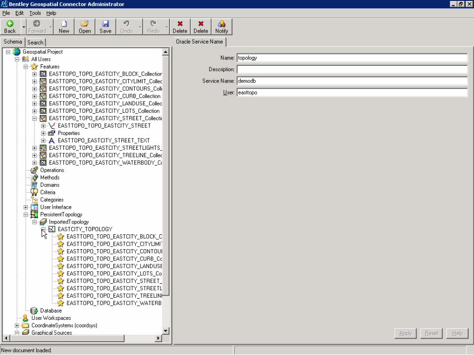
Discovering the Oracle Schema
© 2007 Bentley Systems, Inc.
Discovering the Oracle SchemaDiscovering the Oracle Schema
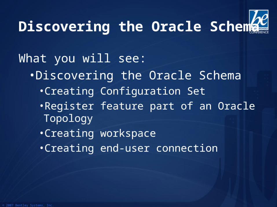
What you will see:
• Discovering the Oracle Schema•Creating Configuration Set•Register feature part of an Oracle Topology•Creating workspace•Creating end-user connection
What you will see:
• Discovering the Oracle Schema•Creating Configuration Set•Register feature part of an Oracle Topology•Creating workspace•Creating end-user connection
© 2007 Bentley Systems, Inc.
© 2007 Bentley Systems, Inc.
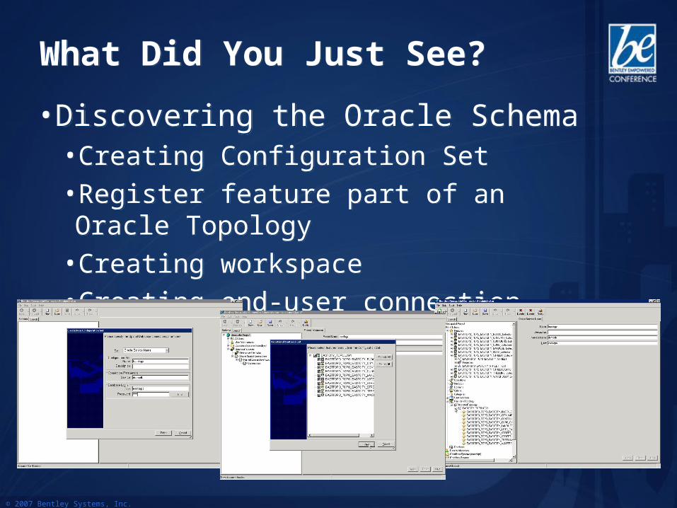
What Did You Just See?What Did You Just See?
• Discovering the Oracle Schema•Creating Configuration Set•Register feature part of an Oracle Topology•Creating workspace•Creating end-user connection
• Discovering the Oracle Schema•Creating Configuration Set•Register feature part of an Oracle Topology•Creating workspace•Creating end-user connection
© 2007 Bentley Systems, Inc.
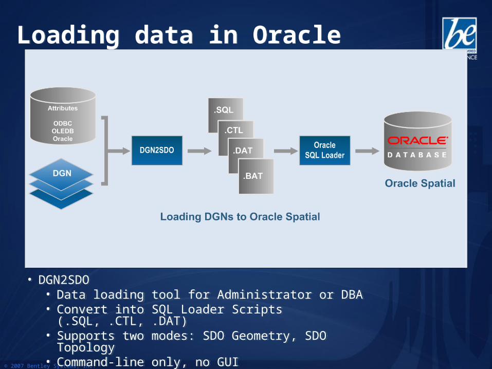
Loading data in OracleLoading data in Oracle
• DGN2SDO• Data loading tool for Administrator or DBA• Convert into SQL Loader Scripts (.SQL, .CTL, .DAT)• Supports two modes: SDO Geometry, SDO Topology• Command-line only, no GUI
• DGN2SDO• Data loading tool for Administrator or DBA• Convert into SQL Loader Scripts (.SQL, .CTL, .DAT)• Supports two modes: SDO Geometry, SDO Topology• Command-line only, no GUI
© 2007 Bentley Systems, Inc.
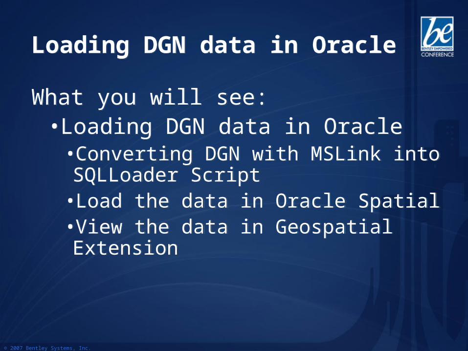
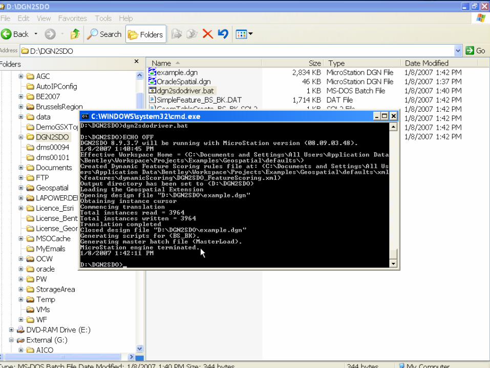
Loading DGN data in OracleLoading DGN data in Oracle
What you will see:• Loading DGN data in Oracle
•Converting DGN with MSLink into SQLLoader Script
•Load the data in Oracle Spatial•View the data in Geospatial Extension
What you will see:• Loading DGN data in Oracle
•Converting DGN with MSLink into SQLLoader Script
•Load the data in Oracle Spatial•View the data in Geospatial Extension
© 2007 Bentley Systems, Inc.
DemoDemo
© 2007 Bentley Systems, Inc.
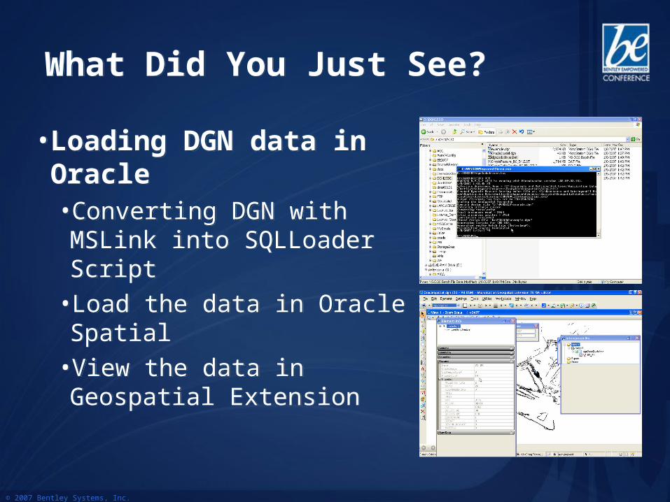
What Did You Just See?What Did You Just See?
• Loading DGN data in Oracle•Converting DGN with MSLink into SQLLoader Script
•Load the data in Oracle Spatial
•View the data in Geospatial Extension
• Loading DGN data in Oracle•Converting DGN with MSLink into SQLLoader Script
•Load the data in Oracle Spatial
•View the data in Geospatial Extension
© 2007 Bentley Systems, Inc.
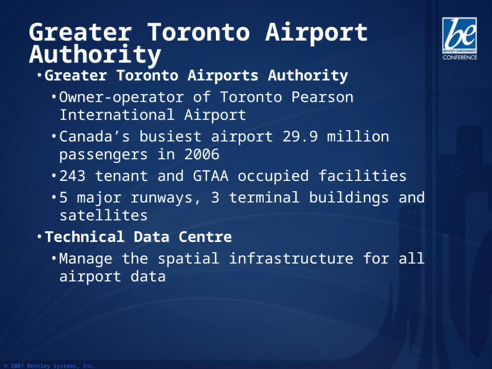
Greater Toronto Airport AuthorityGreater Toronto Airport Authority• Greater Toronto Airports Authority
• Owner-operator of Toronto Pearson International Airport
• Canada’s busiest airport 29.9 million passengers in 2006
• 243 tenant and GTAA occupied facilities• 5 major runways, 3 terminal buildings and satellites
• Technical Data Centre• Manage the spatial infrastructure for all airport data
• Greater Toronto Airports Authority• Owner-operator of Toronto Pearson International
Airport• Canada’s busiest airport 29.9 million passengers in
2006 • 243 tenant and GTAA occupied facilities• 5 major runways, 3 terminal buildings and satellites
• Technical Data Centre• Manage the spatial infrastructure for all airport data
© 2007 Bentley Systems, Inc.
Architecture
© 2007 Bentley Systems, Inc.
© 2007 Bentley Systems, Inc.
AES Torino-ItalyAES Torino-Italy
• Large Italian utility company specializes in gas distribution and district heating• Web based application is being developed for accessing the Geospatial
Connector back end for extraction/modification (in MicroStation)/posting • This custom application is defined such that:
• Oracle Spatial stores the final information on the network and other company assets.
• The Geospatial Server is used as the back end for extraction and posting in long transaction mode.
• Geo Web Publisher is interface to the data editor that views the spatial database using a web based front-end (i.e.: direct connection to the database via GWP server). The data editor decides what extents to work in and performs an extraction.
• MicroStation is used for editing of the extracted data. The editing session can last from hours to days depending on the work order.
© 2007 Bentley Systems, Inc.
• Nice example of integration of several Bentley products
• Geo Web publisher, Geospatial Server, MicroStation
• Long disconnected transaction• Web Service
• Nice example of integration of several Bentley products
• Geo Web publisher, Geospatial Server, MicroStation
• Long disconnected transaction• Web Service
AES Torino-Italy
© 2007 Bentley Systems, Inc.
AEM TorinoAEM Torino• Large Italian electric utility company• Web based application is being developed for accessing the Geospatial
Connector back end for extraction/modification (in MicroStation)/posting • This custom application is defined such that:
• Oracle Spatial stores the final information on the network and other company assets.
• The Geospatial Server is used as the back end for extraction and posting in long transaction mode.
• Geo Web Publisher is interface to the data editor that views the spatial database using a web based front-end (i.e.: direct connection to the database via GWP server). The data editor decides what extents to work in and performs an extraction.
• MicroStation is used for editing of the extracted data. The editing session can last from hours to days depending on the work order.
• Client and database side network analysis are performed using the Oracle 10G Network Data Model
• Large Italian electric utility company• Web based application is being developed for accessing the Geospatial
Connector back end for extraction/modification (in MicroStation)/posting • This custom application is defined such that:
• Oracle Spatial stores the final information on the network and other company assets.
• The Geospatial Server is used as the back end for extraction and posting in long transaction mode.
• Geo Web Publisher is interface to the data editor that views the spatial database using a web based front-end (i.e.: direct connection to the database via GWP server). The data editor decides what extents to work in and performs an extraction.
• MicroStation is used for editing of the extracted data. The editing session can last from hours to days depending on the work order.
• Client and database side network analysis are performed using the Oracle 10G Network Data Model
© 2007 Bentley Systems, Inc.
• Nice example of integration of several Bentley products
• Geo Web publisher, Geospatial Server, MicroStation
• Long disconnected transaction• Database Side Network Analysis• Web Service (SOA Architecture)
• Nice example of integration of several Bentley products
• Geo Web publisher, Geospatial Server, MicroStation
• Long disconnected transaction• Database Side Network Analysis• Web Service (SOA Architecture)
AEM Torino-Italy
© 2007 Bentley Systems, Inc.
Geospatial Server Benefits for Oracle usersGeospatial Server Benefits for Oracle users
• Integrate document management , workflows management and spatial database management
• Spatial management of all data types, including non GIS files types
• Find Information using intuitive spatial criteria• View and edit your Oracle Spatial database directly-
>Spatial Database Document• Perform fully reliable disconnected field editing
© 2007 Bentley Systems, Inc.
Geospatial Server Benefits for Oracle usersGeospatial Server Benefits for Oracle users
• Avoid conflict->Pessimistic Locking• Study Different What-If Scenario->Optimistic Locking• Keep data consistent at all time and interact easily with
Oracle 10G Topology• Produce historical maps and reports-> historical data
management• Bringing Geospatial Engineering information into mainstream
IT world -> Oracle Standard• Excellent Database Citizen->Oracle reviewed
• Print only what you need and save time with batch plotting capability
© 2007 Bentley Systems, Inc.
What’s coming in Bentley Products?What’s coming in Bentley Products?
• GeoRaster• Viewing of GeoRaster• Loading of GeoRaster• Editing of GeoRaster• Integration in Geospatial Administrator
• Network Data Model • Network viewing• Network editing• Network tracing• Integration with industry application
• GeoRaster• Viewing of GeoRaster• Loading of GeoRaster• Editing of GeoRaster• Integration in Geospatial Administrator
• Network Data Model • Network viewing• Network editing• Network tracing• Integration with industry application
© 2007 Bentley Systems, Inc.
What’s coming in Bentley Products?What’s coming in Bentley Products?• Cartographic Text Support
• Cartographic text support will allow storing natively the following:• Text with leader line• Text with different text size and rotation
• Database Side Spatial Analysis• 3D Objects support
• Viewing of 3D objects• Editing of 3D objects
• TIN support• Viewing of TIN• Storing Bentley TIN in Oracle• Editing TIN
• Cartographic Text Support• Cartographic text support will allow storing natively the
following:• Text with leader line• Text with different text size and rotation
• Database Side Spatial Analysis• 3D Objects support
• Viewing of 3D objects• Editing of 3D objects
• TIN support• Viewing of TIN• Storing Bentley TIN in Oracle• Editing TIN
© 2007 Bentley Systems, Inc.
THANK YOU. THANK YOU. • Questions ?• Questions ?