Embed Size (px)
Citation preview
www.arcis.com
ILLE LAKE 3D
Arcis Corporation is pleased to announce that the Ille Lake 3D survey, located in Townships 42
to 43, Ranges 2 to 4 W5, is currently available for immediate subscription.
This survey is designed to evaluate multiple zones from the Cretaceous to Devonian, including
producing formations such as Belly River, Glauconitic and Rock Creek.
In addition to this survey’s optimal acquisition parameters, Arcis provides proprietary tools
that will enhance imaging and azimuthal fold distribution for even greater assistance with the
placement of horizontal wells upon both deep and shallow targets. A TGS COMPANY
2100, 250 - 5TH Street SW Calgary, Alberta, Canada T2P 0R4 Printed in Canada
AVO compliant processing adds value
SALES INQUIRIES
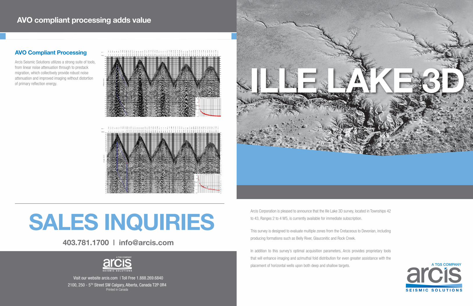
AVO Compliant Processing
Arcis Seismic Solutions utilizes a strong suite of tools, from linear noise attenuation through to prestack migration, which collectively provide robust noise attenuation and improved imaging without distortion of primary reflection energy.
403.781.1700 | [email protected]
Visit our website arcis.com | Toll Free 1.888.269.6840
www.arcis.comwww.arcis.com
PAGE ONE
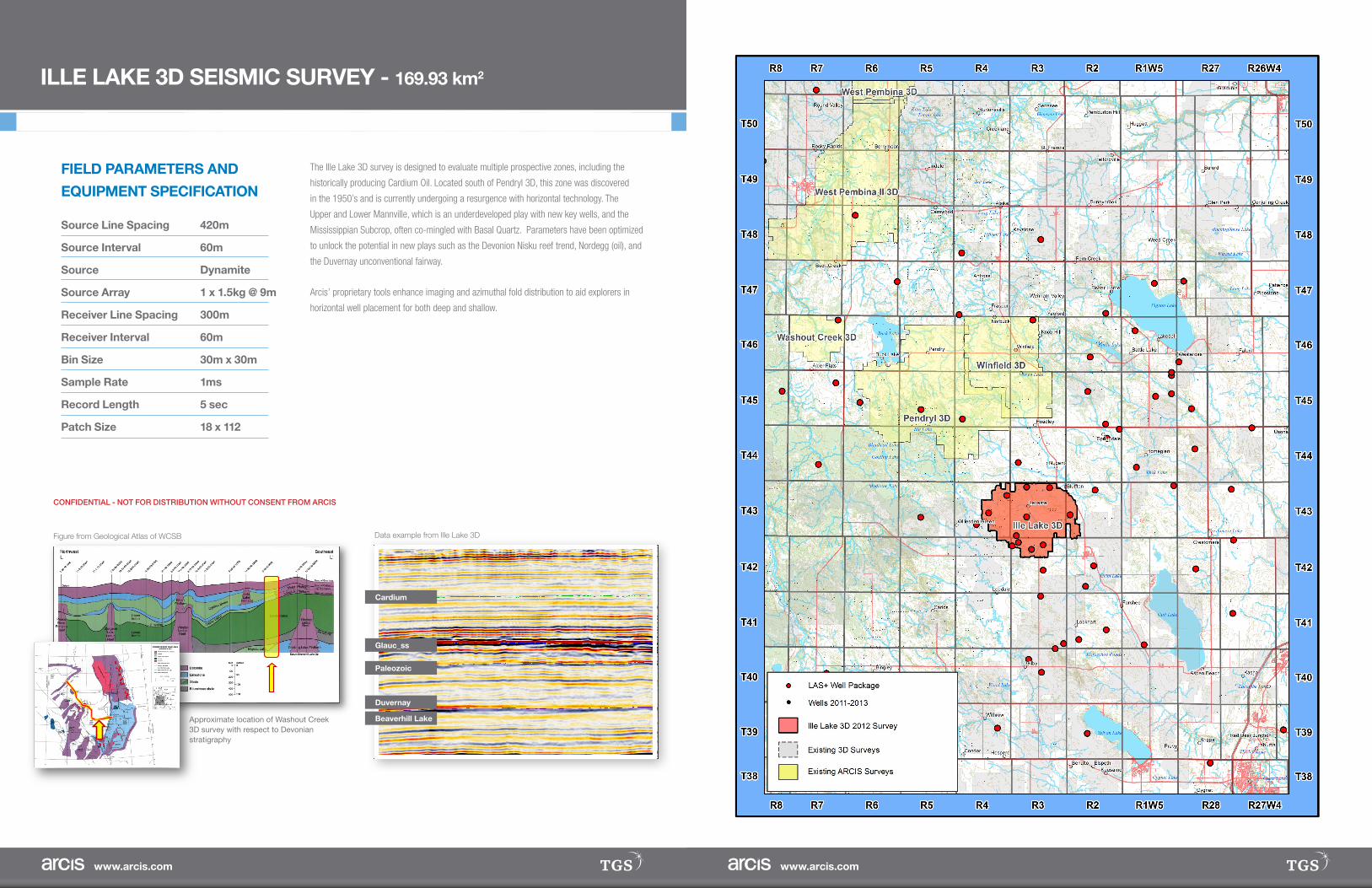
ILLE LAKE 3D SEISMIC SURVEY - 169.93 km2
FIELD PARAMETERS AND
EQUIPMENT SPECIFICATION
Source Line Spacing 420m
Source Interval 60m
Source Dynamite
Source Array 1 x 1.5kg @ 9m
Receiver Line Spacing 300m
Receiver Interval 60m
Bin Size 30m x 30m
Sample Rate 1ms
Record Length 5 sec
Patch Size 18 x 112
CONFIDENTIAL - NOT FOR DISTRIBUTION WITHOUT CONSENT FROM ARCIS
Cardium
Figure from Geological Atlas of WCSB Data example from Ille Lake 3D
Approximate location of Washout Creek 3D survey with respect to Devonian stratigraphy
Glauc_ss
Beaverhill Lake
The Ille Lake 3D survey is designed to evaluate multiple prospective zones, including the
historically producing Cardium Oil. Located south of Pendryl 3D, this zone was discovered
in the 1950’s and is currently undergoing a resurgence with horizontal technology. The
Upper and Lower Mannville, which is an underdeveloped play with new key wells, and the
Mississippian Subcrop, often co-mingled with Basal Quartz. Parameters have been optimized
to unlock the potential in new plays such as the Devonion Nisku reef trend, Nordegg (oil), and
the Duvernay unconventional fairway.
Arcis’ proprietary tools enhance imaging and azimuthal fold distribution to aid explorers in
horizontal well placement for both deep and shallow.
Paleozoic
Duvernay