Embed Size (px)
Citation preview
RCAHMW National Monuments RecordDIGITAL ARCHIVE GUIDELINES: A SUSTAINABLE APPROACH TO DIGITAL PRESERVATION
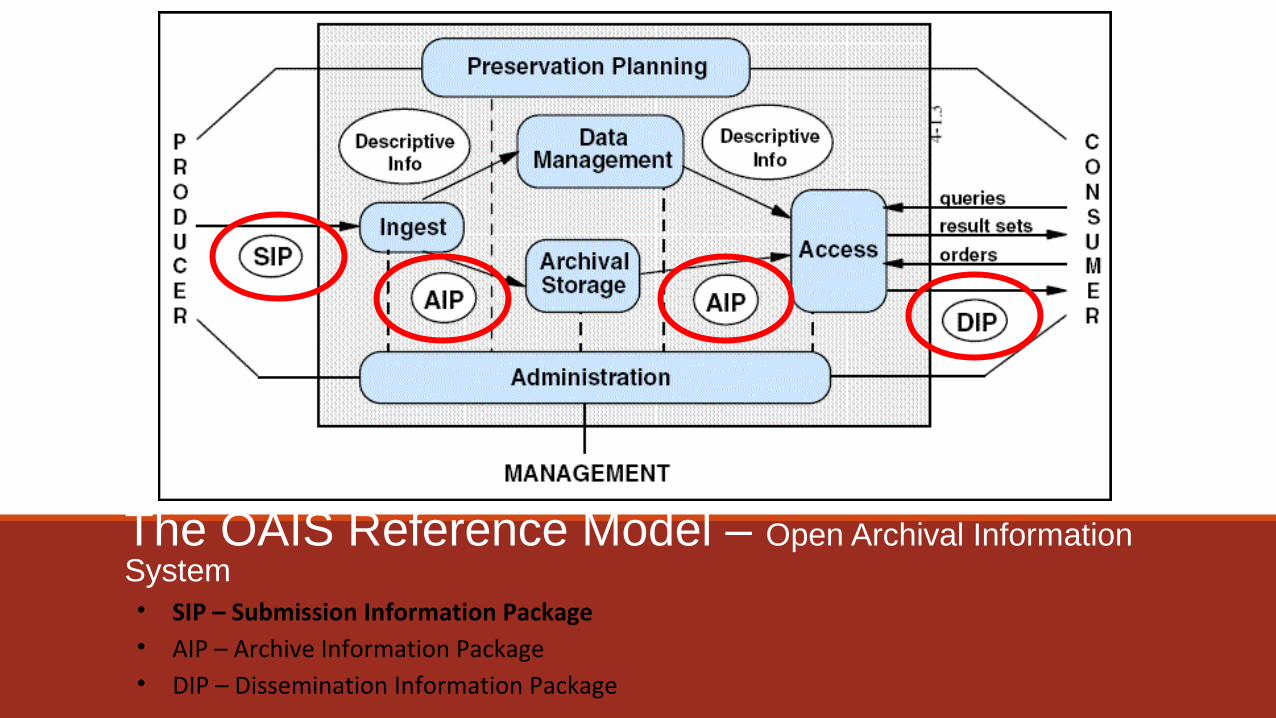
The OAIS Reference Model – Open Archival Information System• SIP – Submission Information Package• AIP – Archive Information Package• DIP – Dissemination Information Package
Digital Archiving Package
Technical Metadata
Preservation Planning
Active Preservation
Automated Preservation Actions
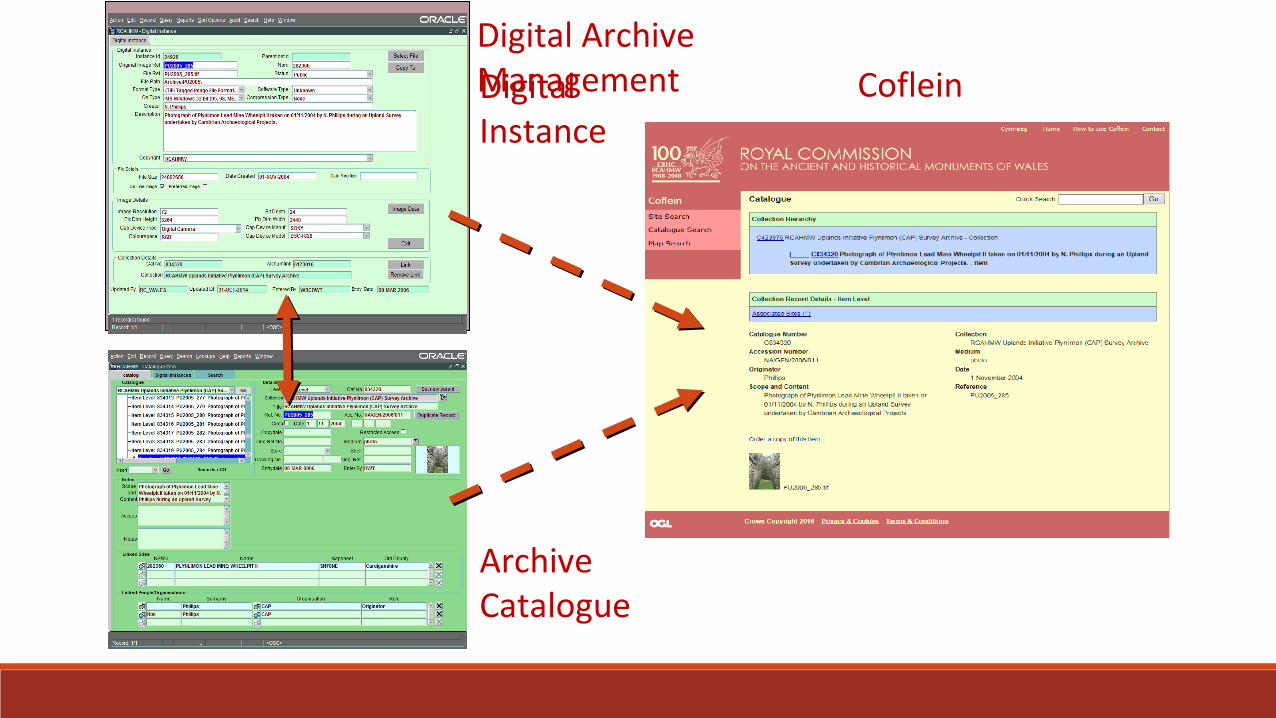
Digital Instance
Archive Catalogue
CofleinDigital Archive Management
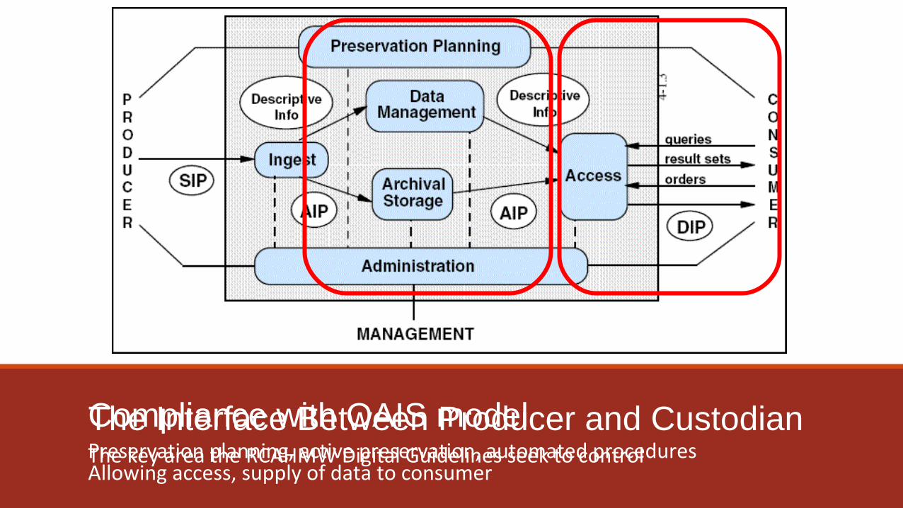
The Interface Between Producer and Custodian The key area the RCAHMW Digital Guidelines seek to control
Compliance with OAIS model
Allowing access, supply of data to consumerPreservation planning, active preservation, automated procedures
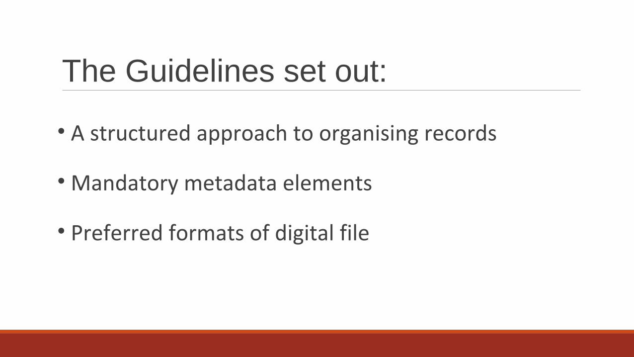
The Guidelines set out:
• A structured approach to organising records
• Mandatory metadata elements
• Preferred formats of digital file
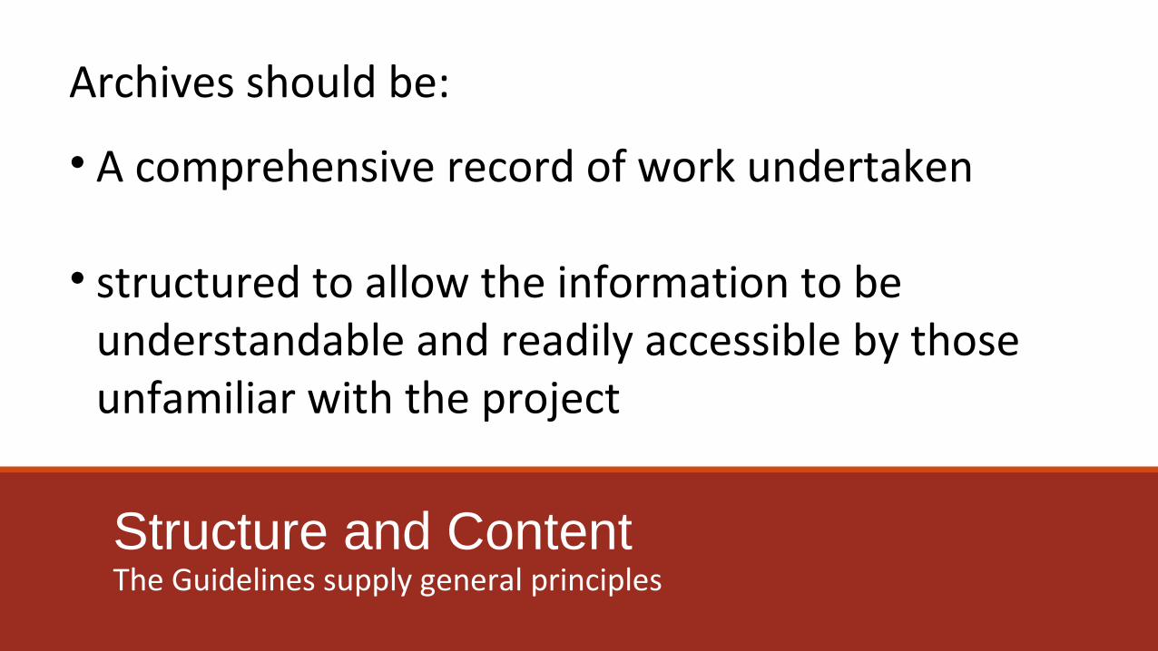
Structure and ContentThe Guidelines supply general principles
• A comprehensive record of work undertaken
• structured to allow the information to be understandable and readily accessible by those unfamiliar with the project
Archives should be:
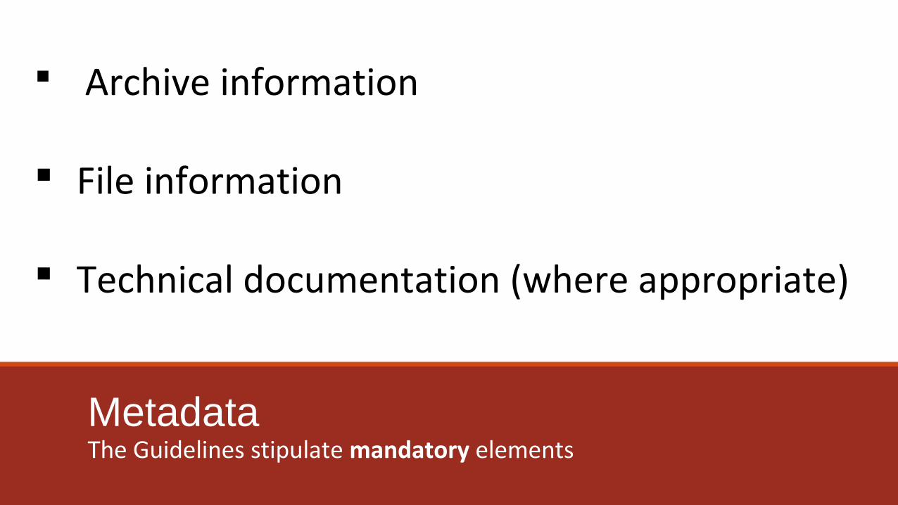
MetadataThe Guidelines stipulate mandatory elements
Archive information
File information
Technical documentation (where appropriate)
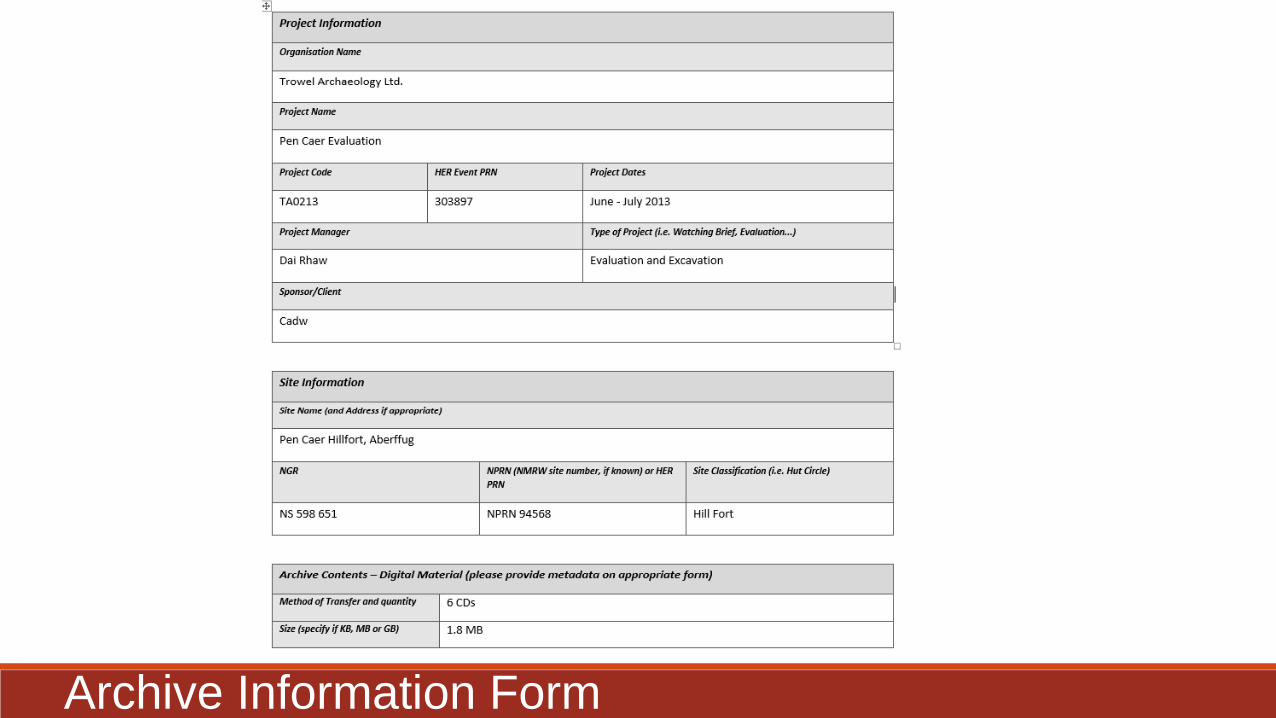
Archive Information Form
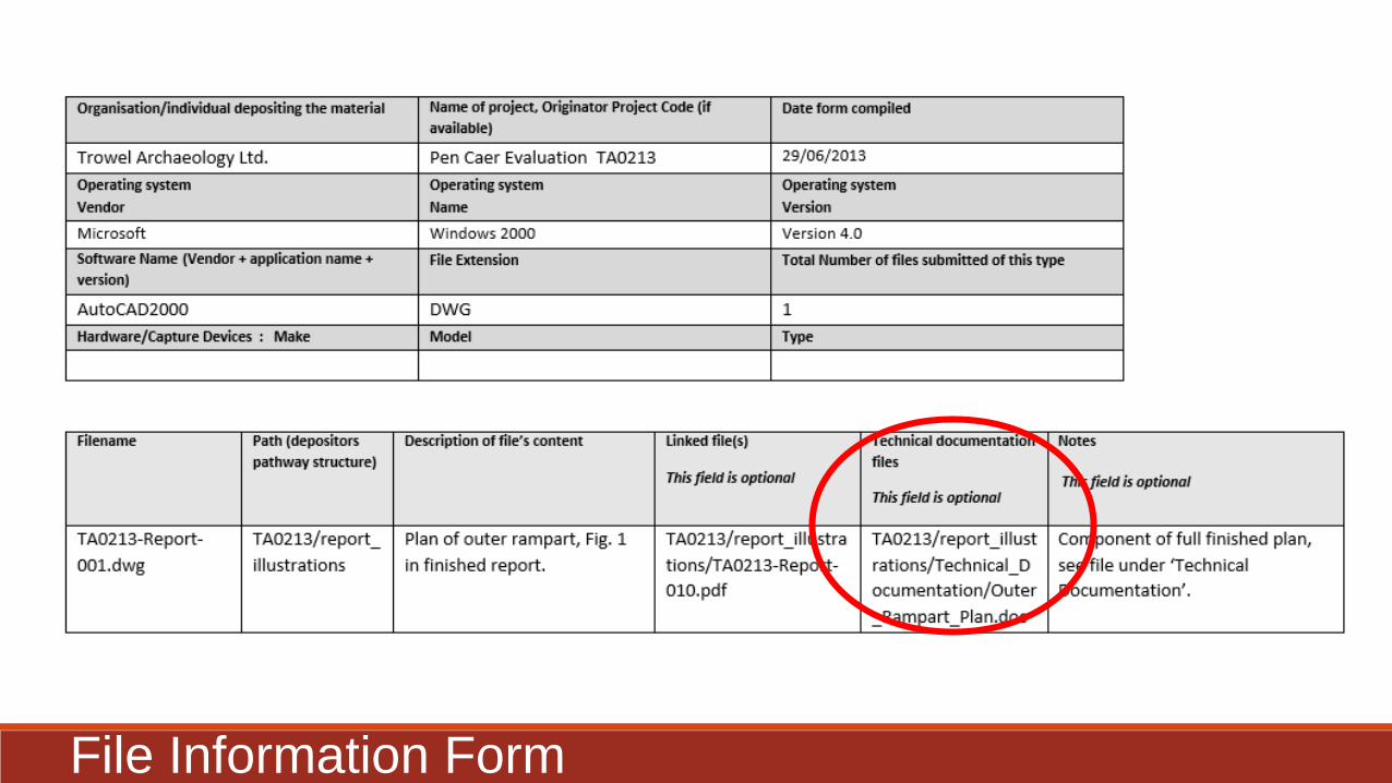
File Information Form
Technical Documentation – no formal data elements
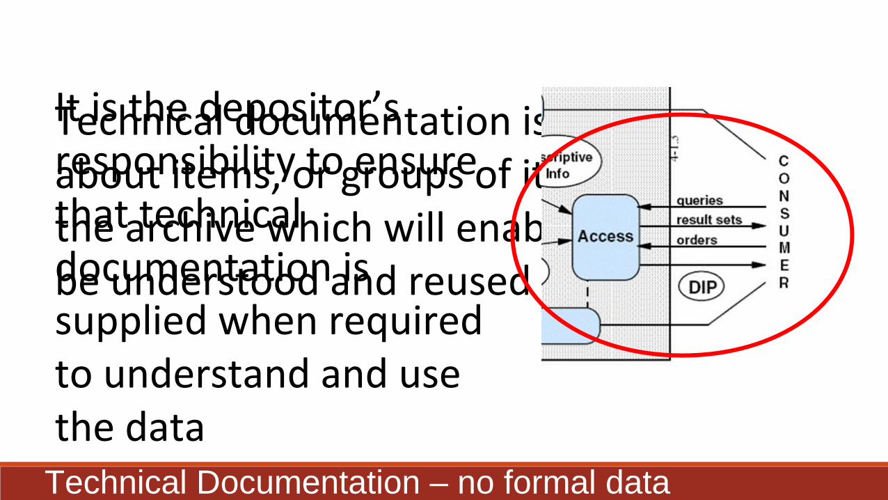
Technical documentation is information about items, or groups of items, within the archive which will enable the data to be understood and reused by others.
It is the depositor’s responsibility to ensure that technical documentation is supplied when required to understand and use the data
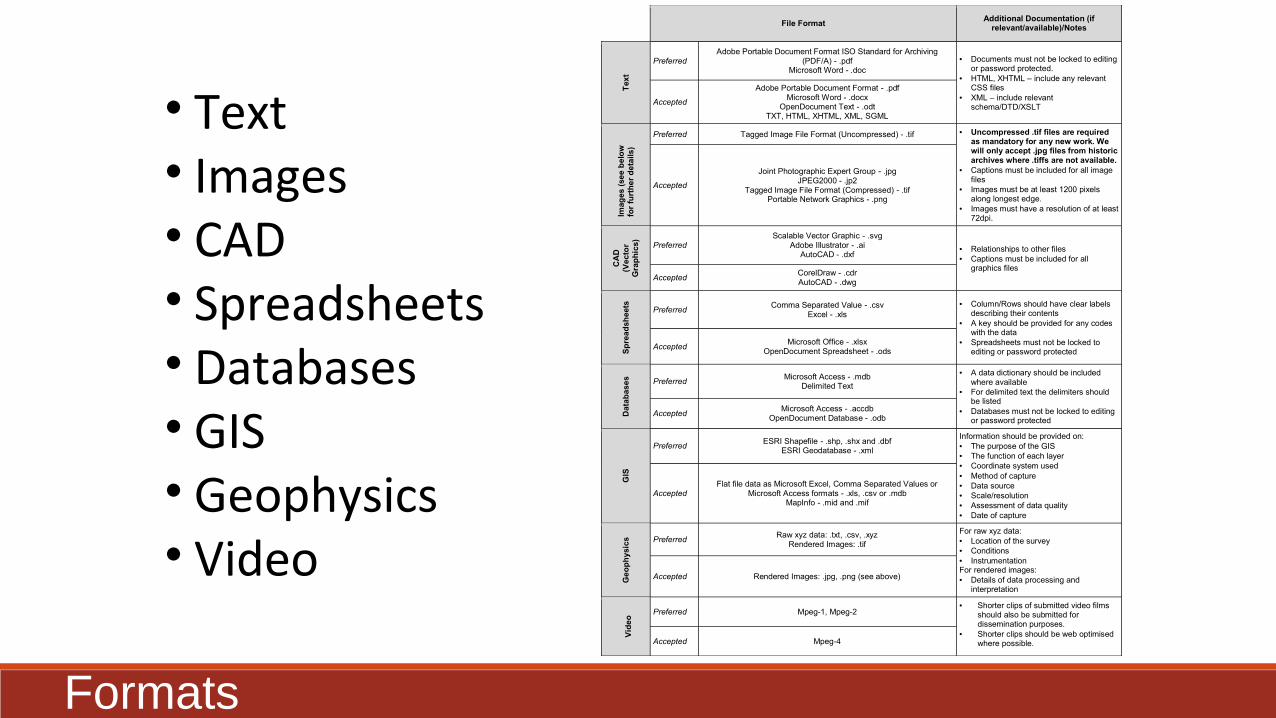
• Text• Images• CAD• Spreadsheets• Databases• GIS• Geophysics• Video
File Format Additional Documentation (if
relevant/available)/Notes
Tex
t
Preferred Adobe Portable Document Format ISO Standard for Archiving
(PDF/A) - .pdf Microsoft Word - .doc
• Documents must not be locked to editing or password protected.
• HTML, XHTML – include any relevant CSS files
• XML – include relevant schema/DTD/XSLT
Accepted
Adobe Portable Document Format - .pdf Microsoft Word - .docx
OpenDocument Text - .odt TXT, HTML, XHTML, XML, SGML
Imag
es (
see
bel
ow
fo
r fu
rth
er d
etai
ls)
Preferred Tagged Image File Format (Uncompressed) - .tif • Uncompressed .tif files are required as mandatory for any new work. We will only accept .jpg files from historic archives where .tiffs are not available.
• Captions must be included for all image files
• Images must be at least 1200 pixels along longest edge.
• Images must have a resolution of at least 72dpi.
Accepted
Joint Photographic Expert Group - .jpg JPEG2000 - .jp2
Tagged Image File Format (Compressed) - .tif Portable Network Graphics - .png
CA
D
(Vec
tor
Gra
ph
ics)
Preferred Scalable Vector Graphic - .svg
Adobe Illustrator - .ai AutoCAD - .dxf
• Relationships to other files • Captions must be included for all
graphics files Accepted
CorelDraw - .cdr AutoCAD - .dwg
Sp
read
shee
ts
Preferred Comma Separated Value - .csv
Excel - .xls • Column/Rows should have clear labels
describing their contents • A key should be provided for any codes
with the data • Spreadsheets must not be locked to
editing or password protected Accepted
Microsoft Office - .xlsx OpenDocument Spreadsheet - .ods
Dat
abas
es
Preferred Microsoft Access - .mdb
Delimited Text
• A data dictionary should be included where available
• For delimited text the delimiters should be listed
• Databases must not be locked to editing or password protected
Accepted Microsoft Access - .accdb
OpenDocument Database - .odb
GIS
Preferred ESRI Shapefile - .shp, .shx and .dbf
ESRI Geodatabase - .xml
Information should be provided on: • The purpose of the GIS • The function of each layer • Coordinate system used • Method of capture • Data source • Scale/resolution • Assessment of data quality • Date of capture
Accepted Flat file data as Microsoft Excel, Comma Separated Values or
Microsoft Access formats - .xls, .csv or .mdb MapInfo - .mid and .mif
Geo
ph
ysic
s Preferred Raw xyz data: .txt, .csv, .xyz
Rendered Images: .tif
For raw xyz data: • Location of the survey • Conditions • Instrumentation For rendered images: • Details of data processing and
interpretation
Accepted Rendered Images: .jpg, .png (see above)
V
ideo
Preferred Mpeg-1, Mpeg-2 • Shorter clips of submitted video films
should also be submitted for dissemination purposes.
• Shorter clips should be web optimised where possible. Accepted Mpeg-4
Formats

•Implement at start of project
•Contact us with any queries
•See our website for most up-to-date version
Principles to Keep in Mind

Promulgating the Guidelines
• Mandatory part of planning and development control regime
• Through the National Standards for Wales for Collecting and Depositing Archaeological Archives
• Through training events and promotion
CiFA Wales Group/RCAHMW Training 17th March at RCAHMW, Aberystwyth