Embed Size (px)
Citation preview

Theories of Architecture and Urbanism
(ARC61303/ARC2224)
Project Part 2:
Comparative Essay
Tutor: Nicholas Ng
Chong Yee Ching
0316102
Table of Content
1.0 Introuction
1.1 Philadelphia
1.2 Kuala Lumpur
2.0 Comparative Analysis
3.0 References
1.0 Introduction
1.1 Philadelphia
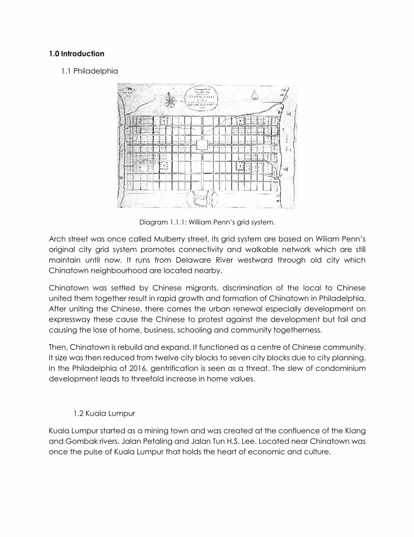
Diagram 1.1.1: William Penn’s grid system.
Arch street was once called Mulberry street, its grid system are based on Wiliam Penn’s original city grid system promotes connectivity and walkable network which are still maintain until now. It runs from Delaware River westward through old city which Chinatown neighbourhood are located nearby.
Chinatown was settled by Chinese migrants, discrimination of the local to Chinese united them together result in rapid growth and formation of Chinatown in Philadelphia. After uniting the Chinese, there comes the urban renewal especially development on expressway these cause the Chinese to protest against the development but fail and causing the lose of home, business, schooling and community togetherness.
Then, Chinatown is rebuild and expand. It functioned as a centre of Chinese community. It size was then reduced from twelve city blocks to seven city blocks due to city planning. In the Philadelphia of 2016, gentrification is seen as a threat. The slew of condominium development leads to threefold increase in home values.
1.2 Kuala Lumpur
Kuala Lumpur started as a mining town and was created at the confluence of the Klang and Gombak rivers. Jalan Petaling and Jalan Tun H.S. Lee. Located near Chinatown was once the pulse of Kuala Lumpur that holds the heart of economic and culture.
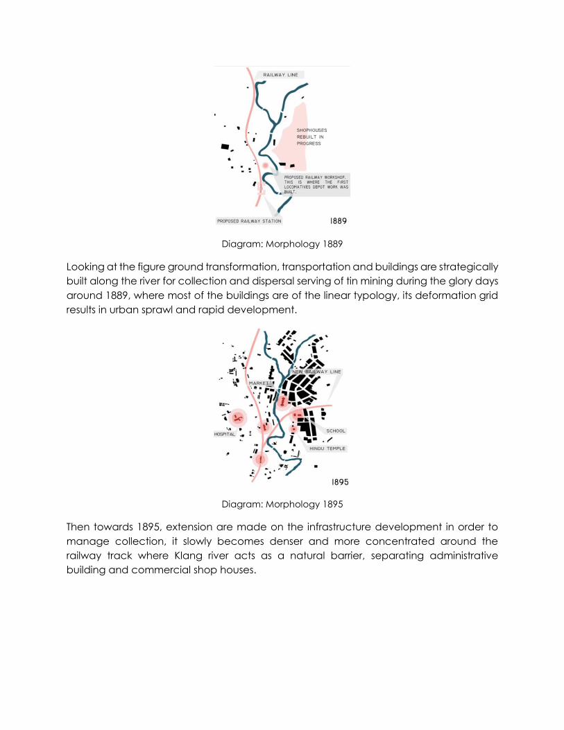
Diagram: Morphology 1889
Looking at the figure ground transformation, transportation and buildings are strategically built along the river for collection and dispersal serving of tin mining during the glory days around 1889, where most of the buildings are of the linear typology, its deformation grid results in urban sprawl and rapid development.
Diagram: Morphology 1895
Then towards 1895, extension are made on the infrastructure development in order to manage collection, it slowly becomes denser and more concentrated around the railway track where Klang river acts as a natural barrier, separating administrative building and commercial shop houses.
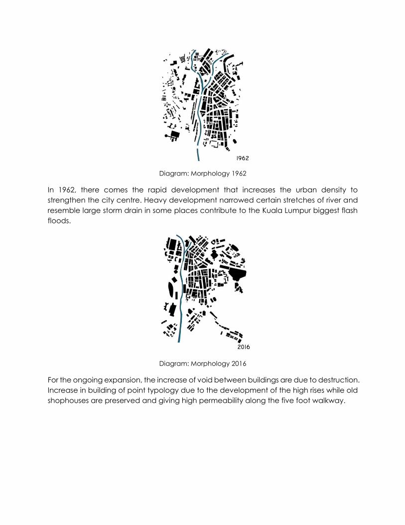
Diagram: Morphology 1962
In 1962, there comes the rapid development that increases the urban density to strengthen the city centre. Heavy development narrowed certain stretches of river and resemble large storm drain in some places contribute to the Kuala Lumpur biggest flash floods.
Diagram: Morphology 2016
For the ongoing expansion, the increase of void between buildings are due to destruction. Increase in building of point typology due to the development of the high rises while old shophouses are preserved and giving high permeability along the five foot walkway.
2.0 Comparative analysis:
Streets are our most fundamental shared public spaces, but they are also one of the most contested and overlooked. In urban design, public open space act as an important element for the street, its role can be seen through its function as a communication that channel social and activity spaces, this results to the place of assembly where there will be social intercourse of meeting, known as contact points. Like the existence of the street, contact points are normally taken for granted as it is an outdoor spaces where activities carried out, act as an added feature to the city.
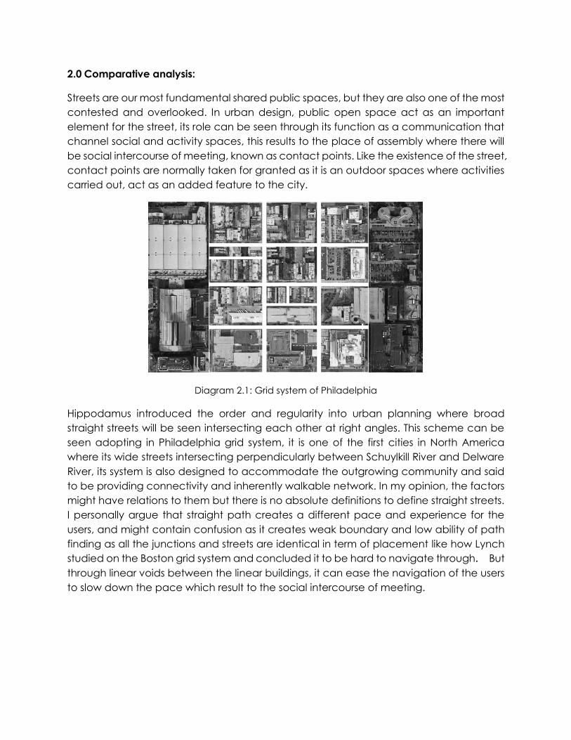
Diagram 2.1: Grid system of Philadelphia
Hippodamus introduced the order and regularity into urban planning where broad straight streets will be seen intersecting each other at right angles. This scheme can be seen adopting in Philadelphia grid system, it is one of the first cities in North America where its wide streets intersecting perpendicularly between Schuylkill River and Delware River, its system is also designed to accommodate the outgrowing community and said to be providing connectivity and inherently walkable network. In my opinion, the factors might have relations to them but there is no absolute definitions to define straight streets. I personally argue that straight path creates a different pace and experience for the users, and might contain confusion as it creates weak boundary and low ability of path finding as all the junctions and streets are identical in term of placement like how Lynch studied on the Boston grid system and concluded it to be hard to navigate through. But through linear voids between the linear buildings, it can ease the navigation of the users to slow down the pace which result to the social intercourse of meeting.
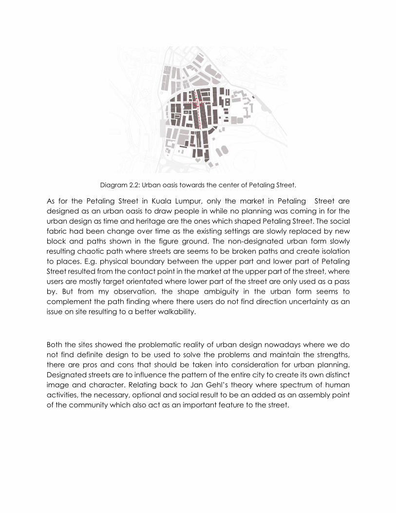
Diagram 2.2: Urban oasis towards the center of Petaling Street.
As for the Petaling Street in Kuala Lumpur, only the market in Petaling Street are designed as an urban oasis to draw people in while no planning was coming in for the urban design as time and heritage are the ones which shaped Petaling Street. The social fabric had been change over time as the existing settings are slowly replaced by new block and paths shown in the figure ground. The non-designated urban form slowly resulting chaotic path where streets are seems to be broken paths and create isolation to places. E.g. physical boundary between the upper part and lower part of Petaling Street resulted from the contact point in the market at the upper part of the street, where users are mostly target orientated where lower part of the street are only used as a pass by. But from my observation, the shape ambiguity in the urban form seems to complement the path finding where there users do not find direction uncertainty as an issue on site resulting to a better walkability.
Both the sites showed the problematic reality of urban design nowadays where we do not find definite design to be used to solve the problems and maintain the strengths, there are pros and cons that should be taken into consideration for urban planning. Designated streets are to influence the pattern of the entire city to create its own distinct image and character. Relating back to Jan Gehl’s theory where spectrum of human activities, the necessary, optional and social result to be an added as an assembly point of the community which also act as an important feature to the street.
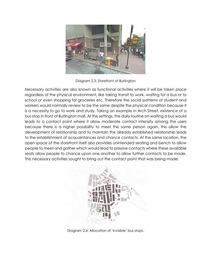
Diagram 2.3: Storefront of Burlington
Necessary activities are also known as functional activities where it will be taken place regardless of the physical environment, like taking transit to work, waiting for a bus or to school or even shopping for groceries etc. Therefore the social patterns of student and workers would normally review to be the same despite the physical condition because it is a necessity to go to work and study. Taking an example in Arch Street, existence of a bus stop in front of Burlington mall. At this settings, the daily routine on waiting a bus would leads to a contact point where it allow moderate contact intensity among the users because there is a higher possibility to meet the same person again, this allow the development of relationship and to maintain the already established relationship leads to the establishment of acquaintances and chance contacts. At the same location, the open space of the storefront itself also provides unintended seating and bench to allow people to meet and gather which would lead to passive contacts where these available seats allow people to chance upon one another to allow further contacts to be made. This necessary activities sought to bring out the contact point that was being made.
Diagram 2.4: Allocation of ‘invisible’ bus stops.
In Petaling Street, bus stops that are being indicate as a contact point establish contacts that are pretty much similar as the ones in Philadelphia but through observation, Malaysia’s bus do stops at places without a bus stand to pick up and drop off users and for visitors around the area, this leads to social activities where people attracts people, the users who waited the bus on daily basis would know the exact location where buses drops and pick up the users, it is normal to see a bunch of people standing at the pavements waiting for the bus to arrive, this would leads to people acknowledging the culture of the ‘invisible’ bus stops therefore following the users, chance acquaintances contacts where visitors would ask about the schedule then making further contacts, in comparison, this culture in Petaling Street allow the higher possibility of contacts and referring back to Jan Gehl’s definition in contact point intensity, bus stops in Petaling Street establish a higher intensity where acquaintances contacts can be achieved through converse than passive contacts in Arch Street.
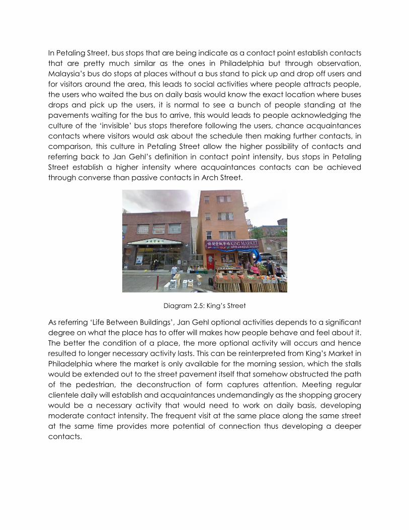
Diagram 2.5: King’s Street
As referring ‘Life Between Buildings’, Jan Gehl optional activities depends to a significant degree on what the place has to offer will makes how people behave and feel about it. The better the condition of a place, the more optional activity will occurs and hence resulted to longer necessary activity lasts. This can be reinterpreted from King’s Market in Philadelphia where the market is only available for the morning session, which the stalls would be extended out to the street pavement itself that somehow obstructed the path of the pedestrian, the deconstruction of form captures attention. Meeting regular clientele daily will establish and acquaintances undemandingly as the shopping grocery would be a necessary activity that would need to work on daily basis, developing moderate contact intensity. The frequent visit at the same place along the same street at the same time provides more potential of connection thus developing a deeper contacts.
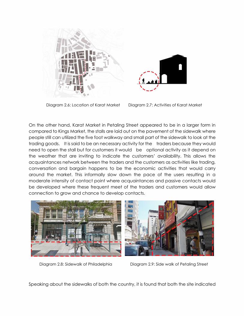
Diagram 2.6: Location of Karat Market Diagram 2.7: Activities of Karat Market
On the other hand, Karat Market in Petaling Street appeared to be in a larger form in compared to Kings Market, the stalls are laid out on the pavement of the sidewalk where people still can utilized the five foot walkway and small part of the sidewalk to look at the trading goods. It is said to be an necessary activity for the traders because they would need to open the stall but for customers it would be optional activity as it depend on the weather that are inviting to indicate the customers’ availability. This allows the acquaintances network between the traders and the customers as activities like trading, conversation and bargain happens to be the economic activities that would carry around the market. This informally slow down the pace of the users resulting in a moderate intensity of contact point where acquaintances and passive contacts would be developed where these frequent meet of the traders and customers would allow connection to grow and chance to develop contacts.
Diagram 2.8: Sidewalk of Philadelphia Diagram 2.9: Side walk of Petaling Street
Speaking about the sidewalks of both the country, it is found that both the site indicated
have a large wide sidewalk where we can see the prioritizing of pedestrian instead of roads that accommodate automobiles. Philadelphia was identified to be one of the most walkable cities as of the designated sidewalks and also the adoption of the grid system, and for Petaling Street itself, the five foot walkway that was old and full of historical value are preserve. The wide street was constructed instead of road as of during the old days, people do not depends on automobile but carriage instead. Till the modern era with all the technologies, the five foot walkway are never a must. To compare both the countries’ sidewalks, I personally would prefer the one with shade which is the five foot walkway as the shaded space that allow continuity of visual network would leads to activities where chance passive and acquaintances contacts.
Going back to activites, Gehl addressed that there is three types of outdoor activities that leads to contacts take place where necessary activities and optional activities were address, left social activities. Social activity depends on the presence of others in the public spaces (Gehl, 1986) it is the fruit of the quality and length of the other types of activities, these activities occurs spontaneously where social interaction can occurs anywhere. This involves simple greetings and conversations, communal activities of various kinds, and simply seeing and hearing other people. (Gehl, 1987) And because of all these spontaneous activities, resulted to meaningful outdoor spaces and attractive in terms of activities complementing each other.
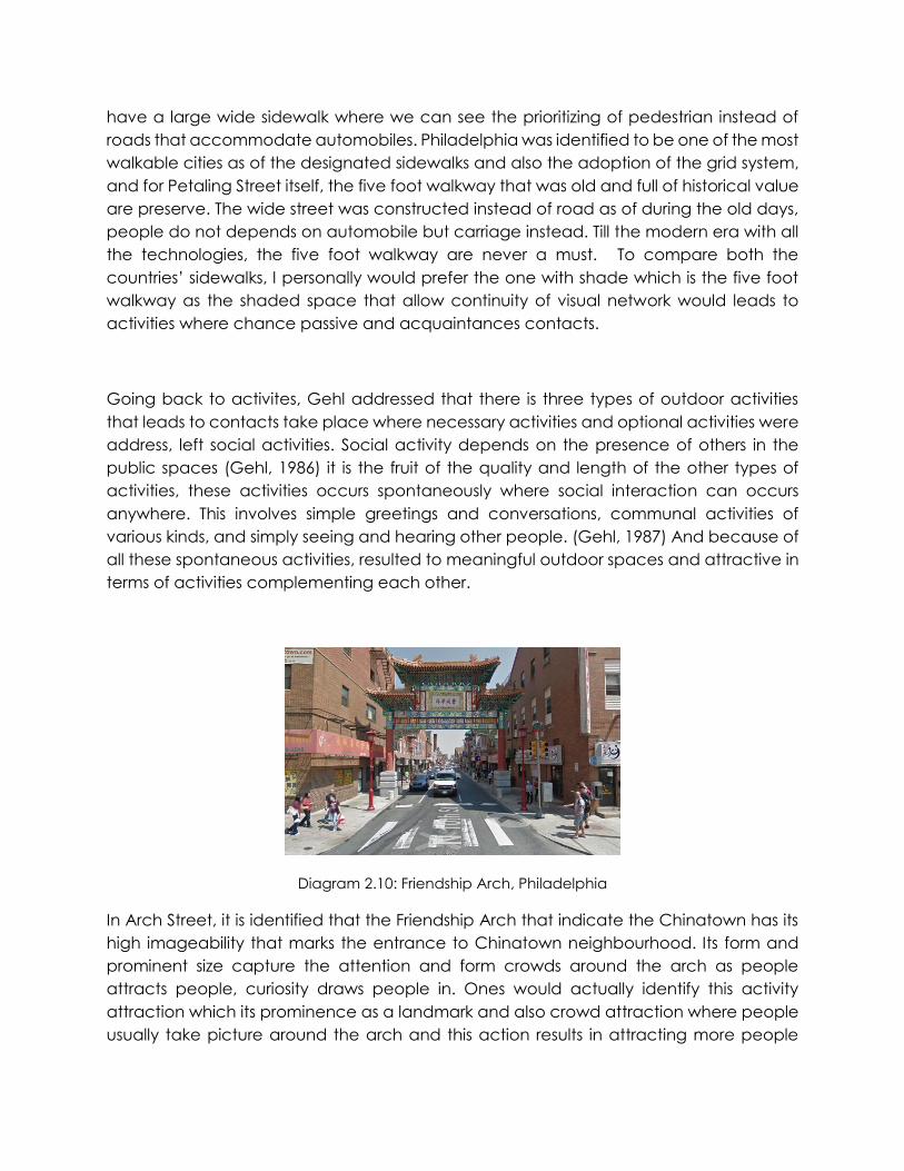
Diagram 2.10: Friendship Arch, Philadelphia
In Arch Street, it is identified that the Friendship Arch that indicate the Chinatown has its high imageability that marks the entrance to Chinatown neighbourhood. Its form and prominent size capture the attention and form crowds around the arch as people attracts people, curiosity draws people in. Ones would actually identify this activity attraction which its prominence as a landmark and also crowd attraction where people usually take picture around the arch and this action results in attracting more people
around to stop by and allow possible contacts with one another. It is identified to be a low intensity contact point where people ‘stop’ and ‘go’, therefore chance passive contacts. Whereas in Petaling Street, the most prominent landmark are said to be the Chinatown arch that located at the front and back of the Petaling Street Market addressing the sense of arrival to the people where it has the similarities as the friendship arch in Philadelphia that was located at the junction of the street, this also results in passive contacts where at junction, people waiting to cross the road, crossing the road, walking pass one another allows the lowest levels of passive contacts where it happens when people gets to see and hear about one another without making further contacts. Both of the contact point are categorized under low contact intensity where there is only occurrence of passive contacts, where people contribute to social activities.
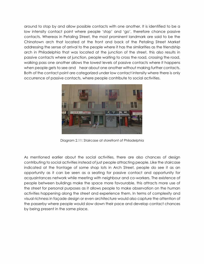
Diagram 2.11: Staircase at storefront of Philadelphia
As mentioned earlier about the social activities, there are also chances of design contributing to social activities instead of just people attracting people. Like the staircase indicated at the frontage of some shop lots in Arch Street, people do see it as an opportunity as it can be seen as a seating for passive contact and opportunity for acquaintances network while meeting with neighbour and co-workers. The existence of people between buildings make the space more favourable, this attracts more use of the street for personal purposes as it allows people to make observation on the human activities happening along the street and experience them. In terms of complexity and visual richness in façade design or even architecture would also capture the attention of the passerby where people would slow down their pace and develop contact chances by being present in the same place.
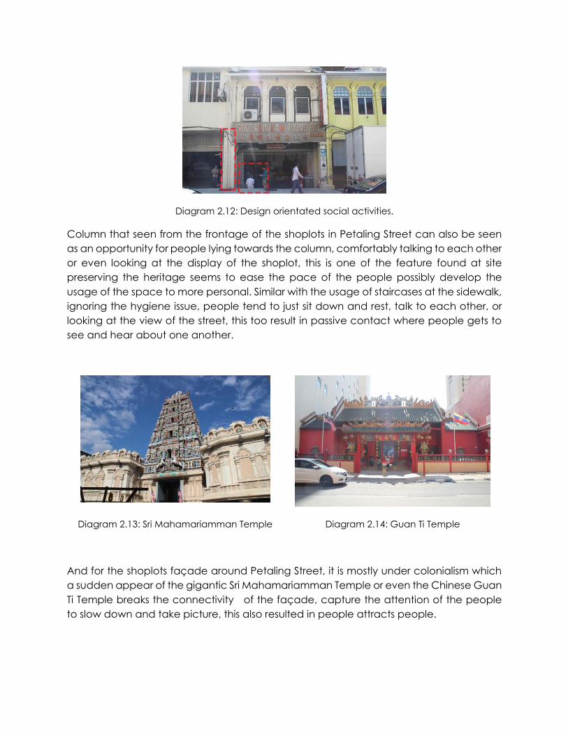
Diagram 2.12: Design orientated social activities.
Column that seen from the frontage of the shoplots in Petaling Street can also be seen as an opportunity for people lying towards the column, comfortably talking to each other or even looking at the display of the shoplot, this is one of the feature found at site preserving the heritage seems to ease the pace of the people possibly develop the usage of the space to more personal. Similar with the usage of staircases at the sidewalk, ignoring the hygiene issue, people tend to just sit down and rest, talk to each other, or looking at the view of the street, this too result in passive contact where people gets to see and hear about one another.
Diagram 2.13: Sri Mahamariamman Temple Diagram 2.14: Guan Ti Temple
And for the shoplots façade around Petaling Street, it is mostly under colonialism which a sudden appear of the gigantic Sri Mahamariamman Temple or even the Chinese Guan Ti Temple breaks the connectivity of the façade, capture the attention of the people to slow down and take picture, this also resulted in people attracts people.
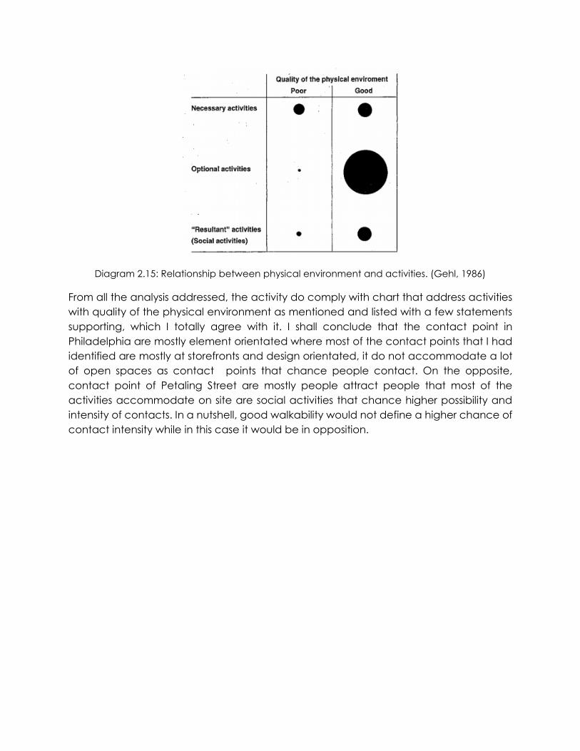
Diagram 2.15: Relationship between physical environment and activities. (Gehl, 1986)
From all the analysis addressed, the activity do comply with chart that address activities with quality of the physical environment as mentioned and listed with a few statements supporting, which I totally agree with it. I shall conclude that the contact point in Philadelphia are mostly element orientated where most of the contact points that I had identified are mostly at storefronts and design orientated, it do not accommodate a lot of open spaces as contact points that chance people contact. On the opposite, contact point of Petaling Street are mostly people attract people that most of the activities accommodate on site are social activities that chance higher possibility and intensity of contacts. In a nutshell, good walkability would not define a higher chance of contact intensity while in this case it would be in opposition.
3.0 References
1. Castagnoli, F. (1971). Orthogonal town planning in antiquity (1st ed.). Cambridge, Mass.: MIT Press.
2. Gehl, J. (2011). Life between buildings (1st ed.). Washington, DC: Island Press.
3. Gehl, J. & Svarre, B. How to study public life (1st ed.).
4. Planning Philadelphia. (2016). Xroads.virginia.edu. Retrieved 28 November 2016, from http://xroads.virginia.edu/~cap/penn/pnplan.html
5. Spaces, P. (2016). Jan Gehl - Project for Public Spaces. Project for Public Spaces. Retrieved 28 November 2016, from http://www.pps.org/reference/jgehl/


![Excursions in Group Theory - arXiv.org e-Print archive · 2012-10-31 · arXiv:1210.7958v1 [math.GR] 30 Oct 2012 Excursions in Group Theory Pramod K Sharma1 School of Mathematics](https://img.pdfslide.us/doc/110x75/5f3c7409e907866304433c3c/excursions-in-group-theory-arxivorg-e-print-archive-2012-10-31-arxiv12107958v1.jpg)


![Game Theory Non-cooperative games - Heidelberg University · An introduction to game theory. New York: Oxford University Press, 2004. Print. •[2] Tadelis, Steve. Game theory : an](https://img.pdfslide.us/doc/110x75/5fdb17d89c1a5304b77890a0/game-theory-non-cooperative-games-heidelberg-university-an-introduction-to-game.jpg)