Embed Size (px)
Citation preview
1
Look what I can do!Harnessing drone enthusiasm for Citizen Science initiatives
Britta Ricker, PhD
University of Washington Tacoma
CUGOS Spring Fling 2015 UW Seattle
5/13/15 @bricker #CUGOS2015 #dronie
2
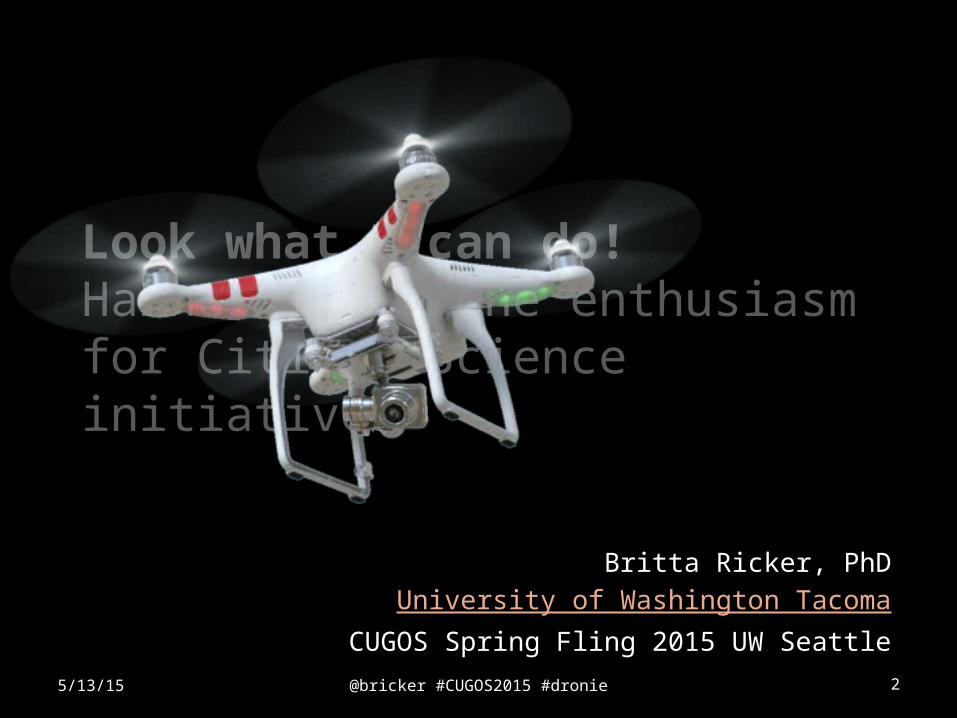
Look what I can do!Harnessing drone enthusiasm for Citizen Science initiatives
Britta Ricker, PhD
University of Washington Tacoma
CUGOS Spring Fling 2015 UW Seattle
5/13/15 @bricker #CUGOS2015 #dronie
@bricker #CUGOS2015 #dronie 35/13/15
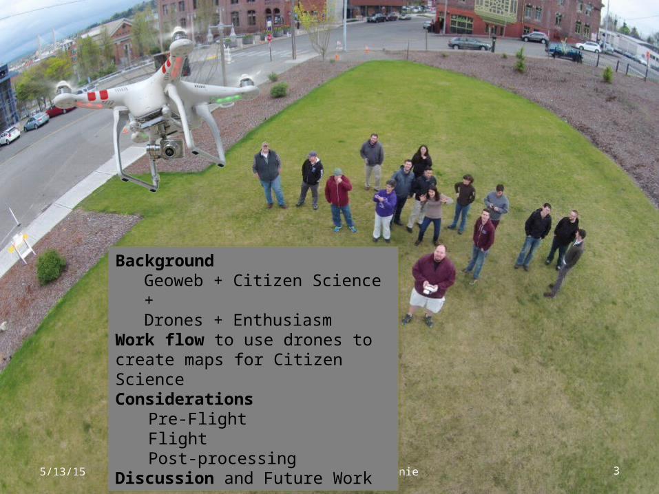
BackgroundGeoweb + Citizen Science +Drones + Enthusiasm
Work flow to use drones to create maps for Citizen Science Considerations
Pre-FlightFlightPost-processing
Discussion and Future Work
@bricker #CUGOS2015 #dronie 4
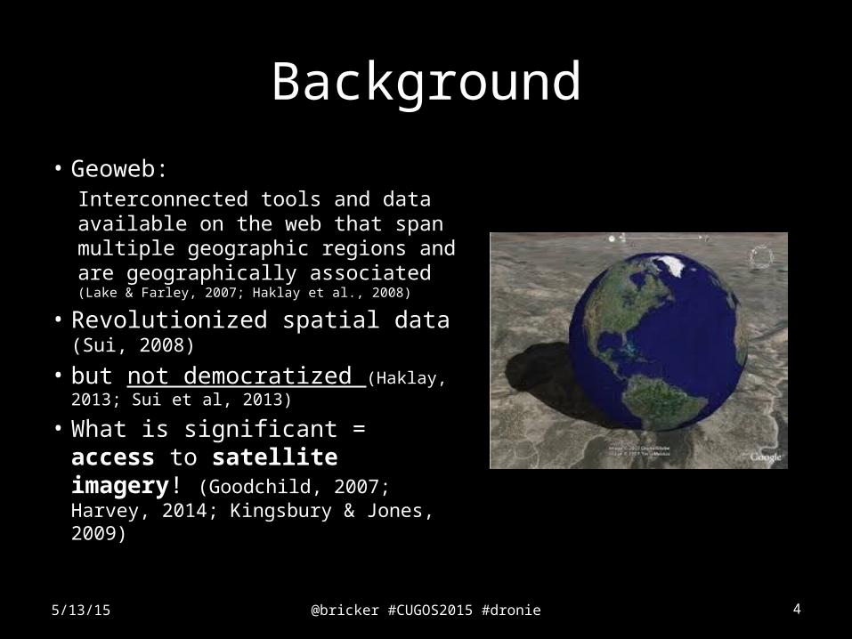
Background
• Geoweb: Interconnected tools and data available on the web that span multiple geographic regions and are geographically associated (Lake & Farley, 2007; Haklay et al., 2008)
• Revolutionized spatial data (Sui, 2008)
• but not democratized (Haklay, 2013; Sui et al, 2013)
• What is significant = access to satellite imagery! (Goodchild, 2007; Harvey, 2014; Kingsbury & Jones, 2009)
5/13/15
@bricker #CUGOS2015 #dronie 5
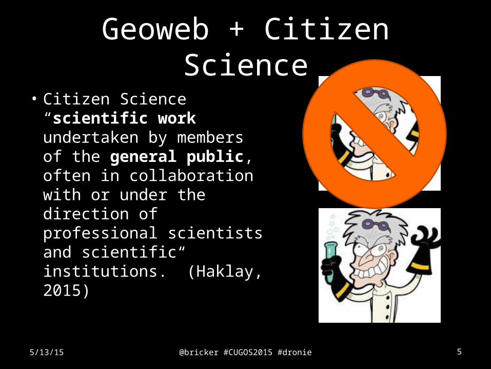
Geoweb + Citizen Science
• Citizen Science “scientific work undertaken by members of the general public, often in collaboration with or under the direction of professional scientists and scientific institutions.” (Haklay, 2015)
5/13/15
@bricker #CUGOS2015 #dronie 6
Tell me, I forget.
Show me, I remember.
Involve me, I understand.
-Chinese Proverb
(Paulos et al., 2009)
5/13/15
@bricker #CUGOS2015 #dronie 7
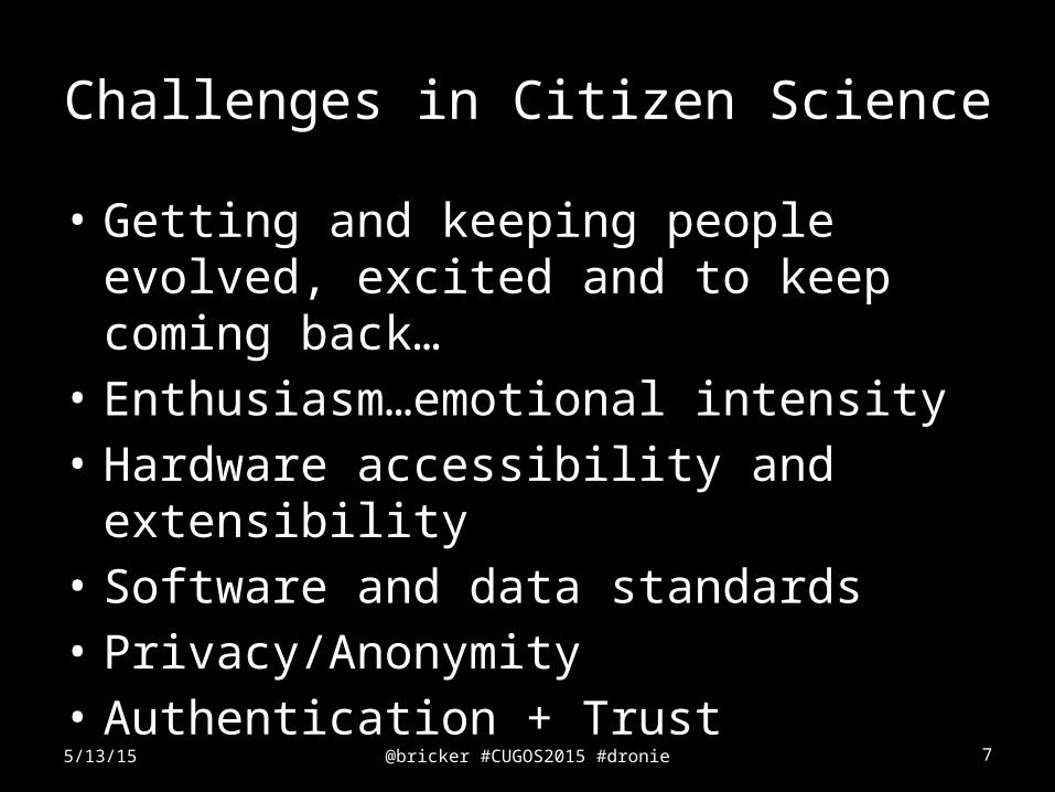
Challenges in Citizen Science
• Getting and keeping people evolved, excited and to keep coming back…
• Enthusiasm…emotional intensity • Hardware accessibility and extensibility• Software and data standards • Privacy/Anonymity• Authentication + Trust
5/13/15
@bricker #CUGOS2015 #dronie 8
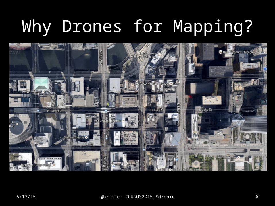
Why Drones for Mapping?
5/13/15

@bricker #CUGOS2015 #dronie 9
Drones!
• Evoke negative connotation (Sandvik & Lohne, 2014) – Militarization– Surveillance
(Crampton et al., 2013)
5/13/15
@bricker #CUGOS2015 #dronie 10
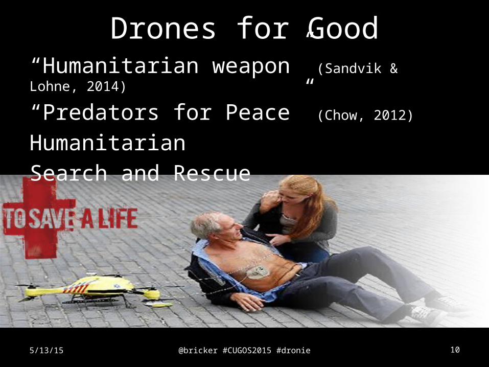
Drones for Good
5/13/15
“Humanitarian weapon” (Sandvik & Lohne, 2014)
“Predators for Peace” (Chow, 2012)
Humanitarian
Search and Rescue
@bricker #CUGOS2015 #dronie 115/13/15
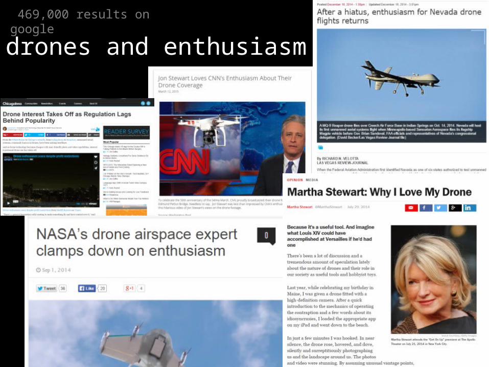
469,000 results on google
drones and enthusiasm
@bricker #CUGOS2015 #dronie 12
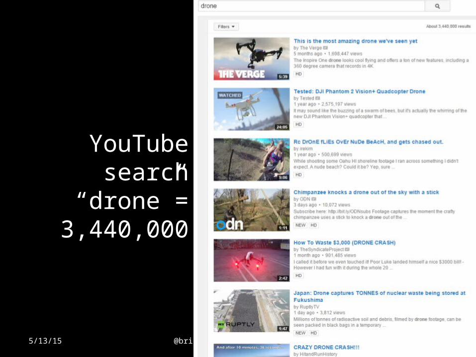
YouTube search “drone”=
3,440,000
5/13/15
@bricker #CUGOS2015 #dronie 13
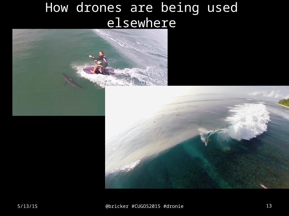
How drones are being used elsewhere
5/13/15
@bricker #CUGOS2015 #dronie 14
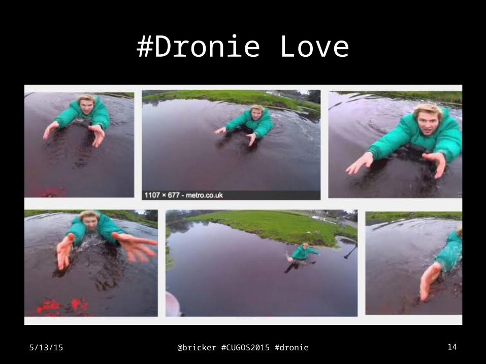
#Dronie Love
5/13/15
@bricker #CUGOS2015 #dronie 15
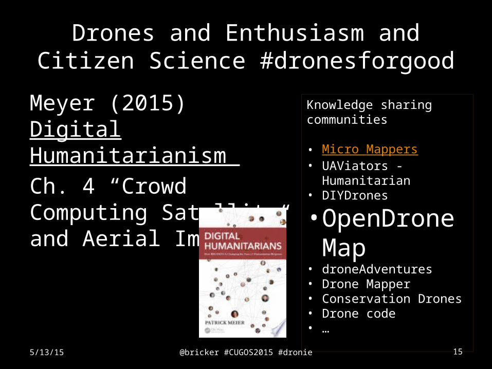
Drones and Enthusiasm and Citizen Science #dronesforgood
Meyer (2015) Digital Humanitarianism
Ch. 4 “Crowd Computing Satellite and Aerial Imagery”
5/13/15
Knowledge sharing communities
• Micro Mappers• UAViators - Humanitarian• DIYDrones
• OpenDroneMap
• droneAdventures• Drone Mapper• Conservation Drones• Drone code• …
@bricker #CUGOS2015 #dronie 16
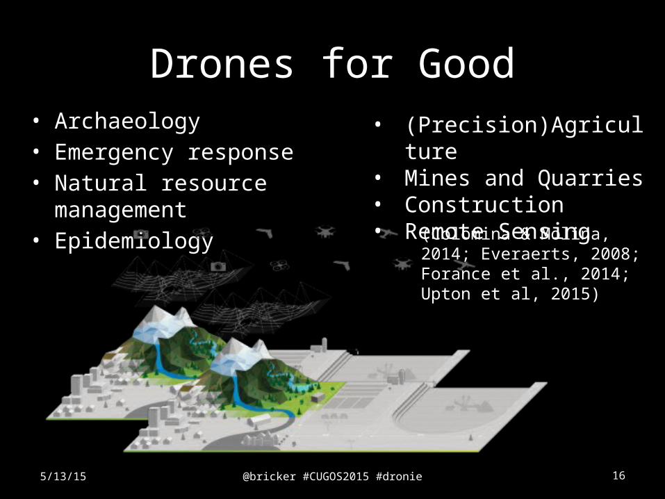
Drones for Good• Archaeology• Emergency response• Natural resource management• Epidemiology
5/13/15
• (Precision)Agriculture• Mines and Quarries• Construction• Remote Sensing
(Colomina & Molina, 2014; Everaerts, 2008; Forance et al., 2014; Upton et al, 2015)
@bricker #CUGOS2015 #dronie 17
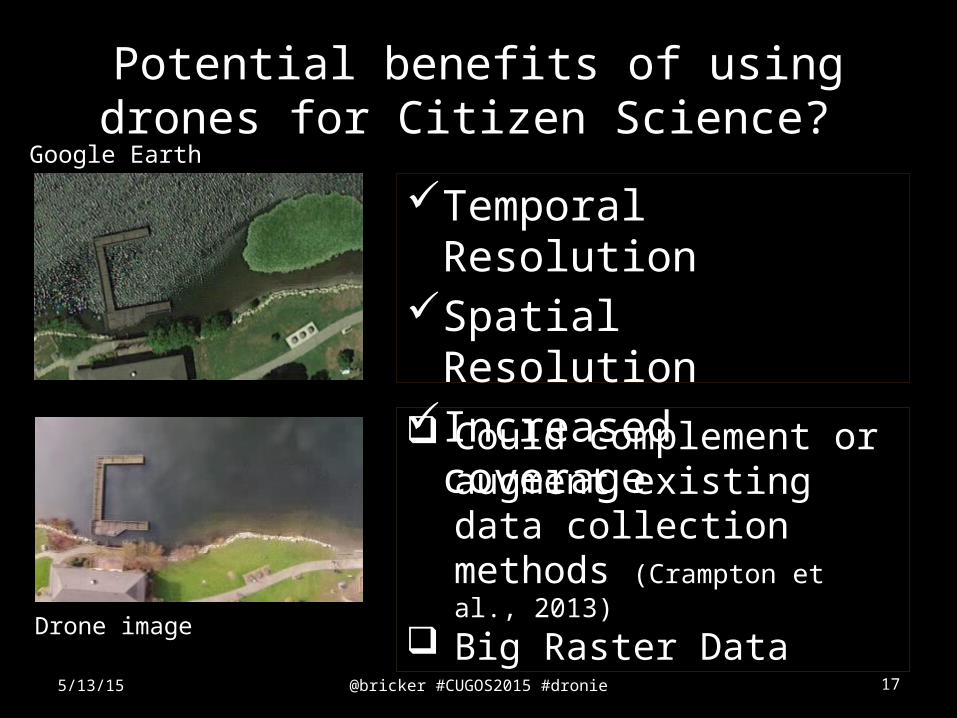
Potential benefits of using drones for Citizen Science?
Temporal ResolutionSpatial ResolutionIncreased coverage
5/13/15
Could complement or augment existing data collection methods (Crampton et al., 2013)
Big Raster DataDrone image
Google Earth
@bricker #CUGOS2015 #dronie 18
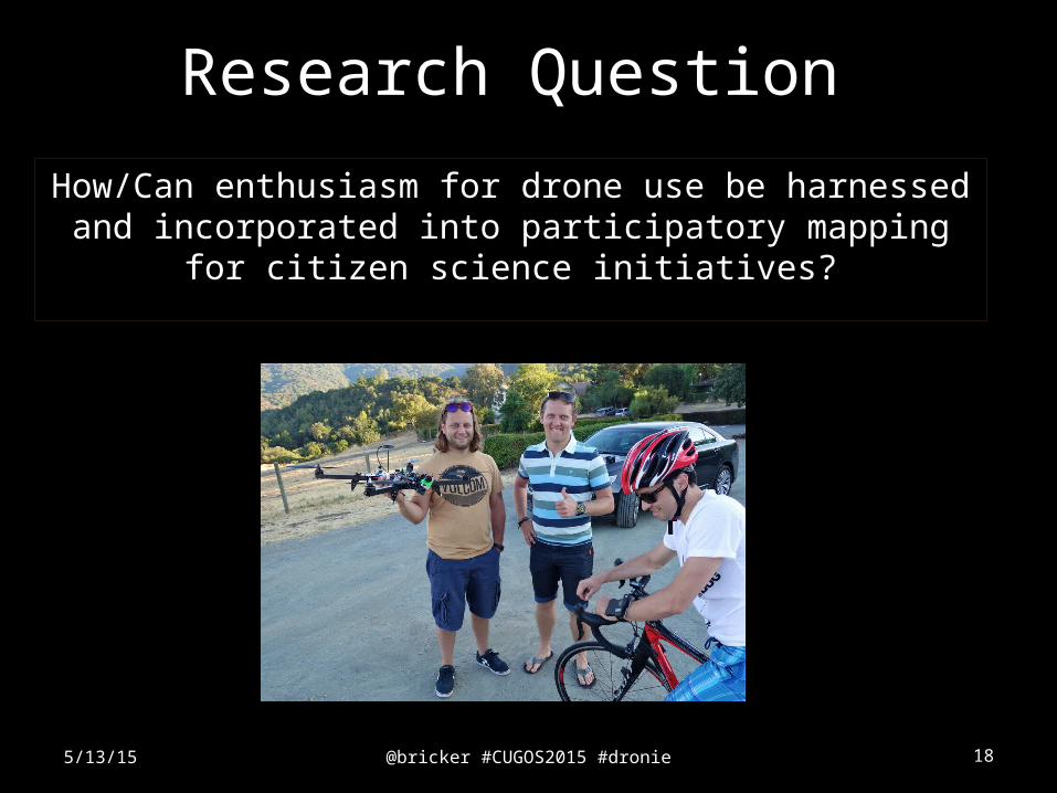
How/Can enthusiasm for drone use be harnessed and incorporated into participatory mapping for
citizen science initiatives?
5/13/15
Research Question
@bricker #CUGOS2015 #dronie 19
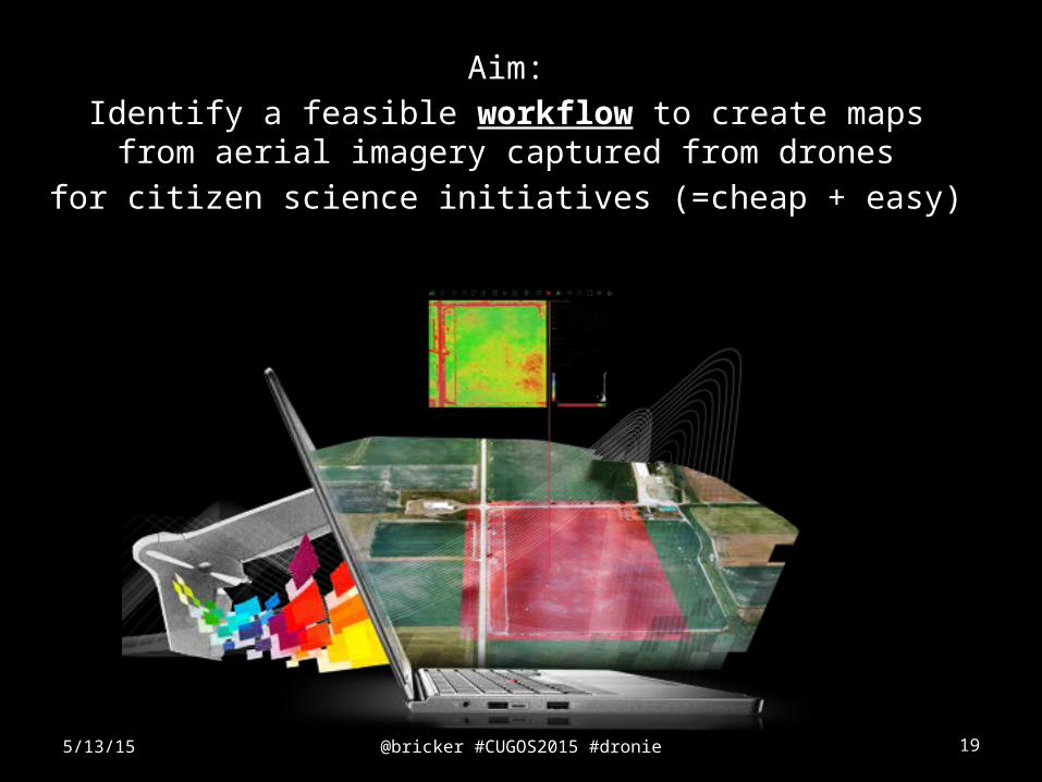
Aim:
Identify a feasible workflow to create maps from aerial imagery captured from drones
for citizen science initiatives (=cheap + easy)
5/13/15
@bricker #CUGOS2015 #dronie 20
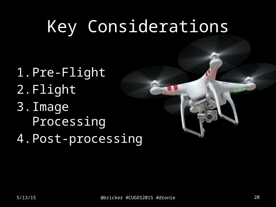
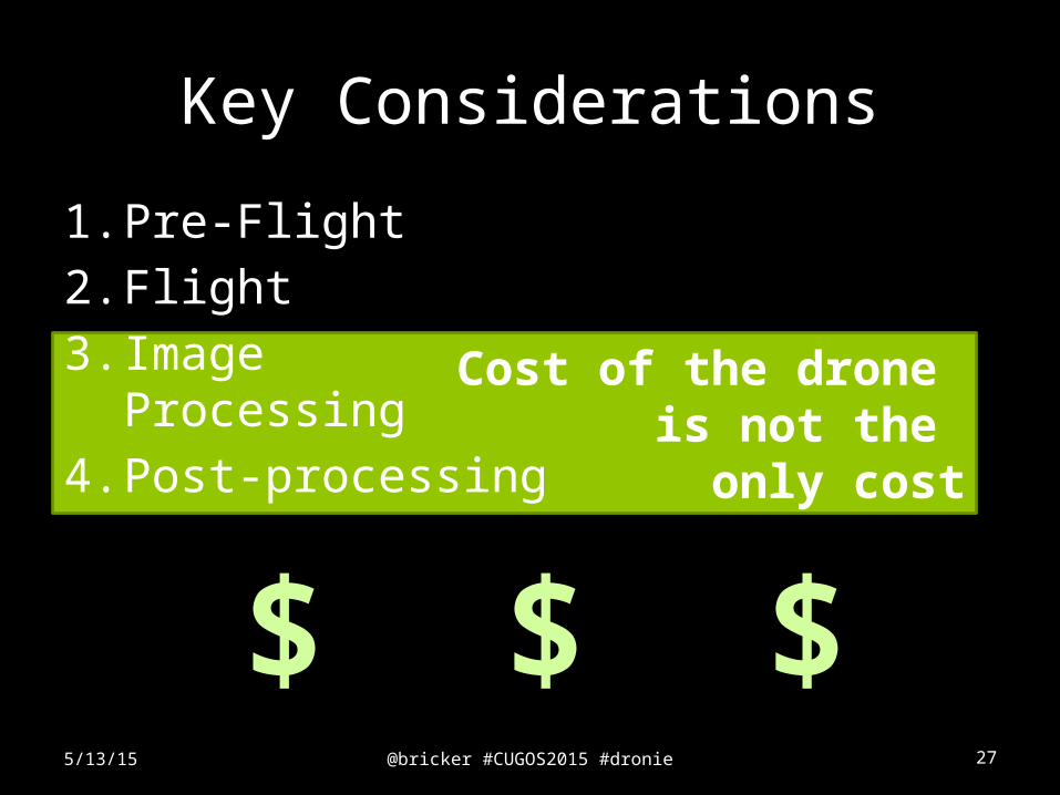
Key Considerations
1. Pre-Flight
2. Flight
3. Image Processing
4. Post-processing
5/13/15
@bricker #CUGOS2015 #dronie 21
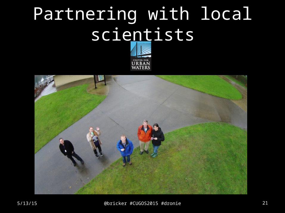
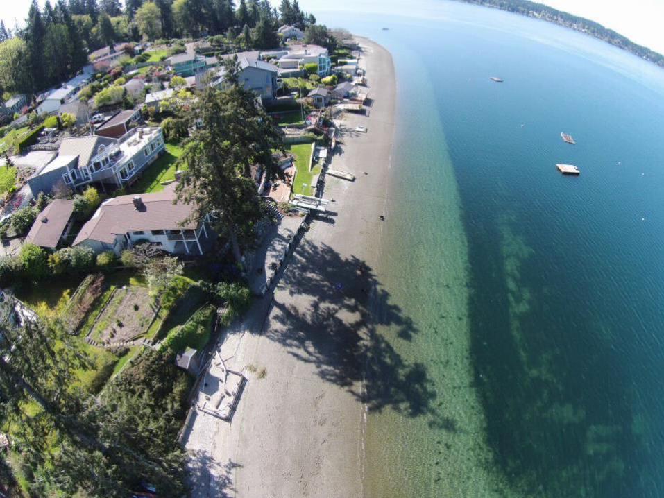
Partnering with local scientists
5/13/15
@bricker #CUGOS2015 #dronie 225/13/15
@bricker #CUGOS2015 #dronie 23
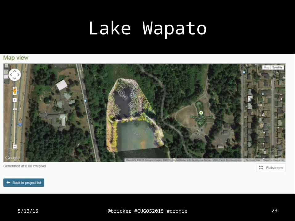
Lake Wapato
5/13/15
@bricker #CUGOS2015 #dronie 24
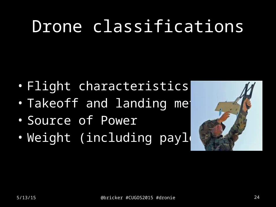
Drone classifications
• Flight characteristics• Takeoff and landing methods• Source of Power• Weight (including payload)
5/13/15
@bricker #CUGOS2015 #dronie 25
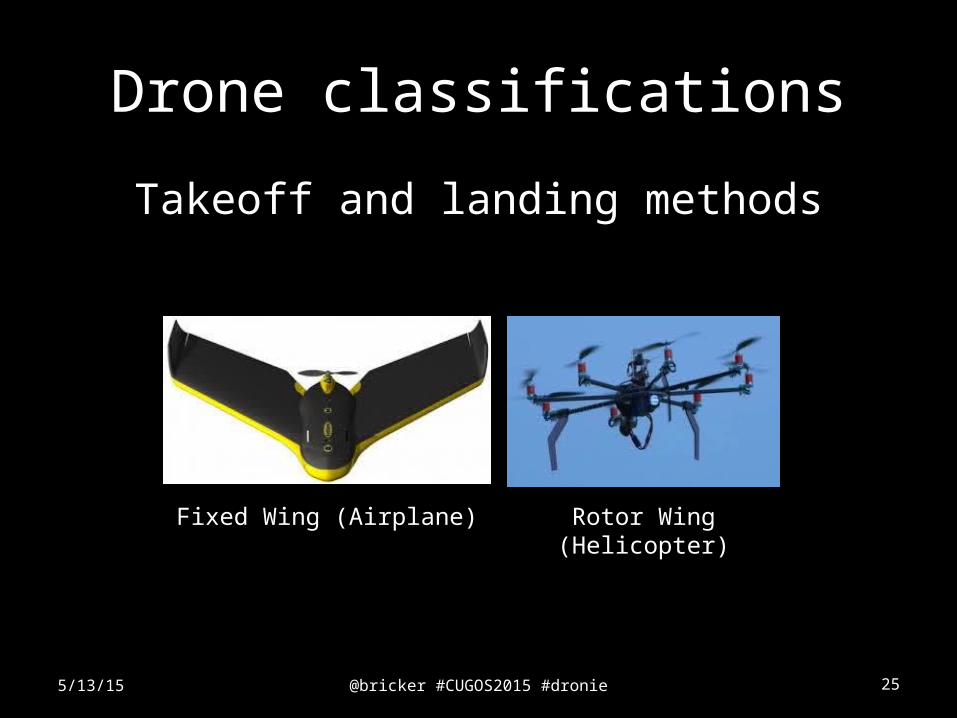
Drone classifications
Takeoff and landing methods
5/13/15
Fixed Wing (Airplane) Rotor Wing (Helicopter)
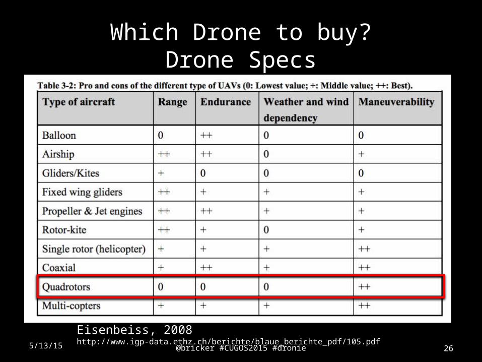
Which Drone to buy?Drone Specs
5/13/15 @bricker #CUGOS2015 #dronie 26
Eisenbeiss, 2008 http://www.igp-data.ethz.ch/berichte/blaue_berichte_pdf/105.pdf
@bricker #CUGOS2015 #dronie 27
Cost of the drone is not the only cost
Key Considerations
1. Pre-Flight
2. Flight
3. Image Processing
4. Post-processing
5/13/15
$ $$
@bricker #CUGOS2015 #dronie 28
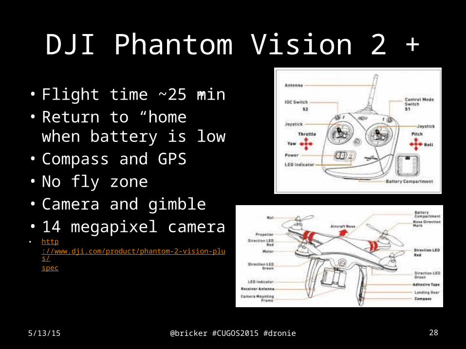
DJI Phantom Vision 2 +
• Flight time ~25 min• Return to “home”
when battery is low• Compass and GPS• No fly zone• Camera and gimble• 14 megapixel camera• http
://www.dji.com/product/phantom-2-vision-plus/spec
5/13/15
@bricker #CUGOS2015 #dronie 29
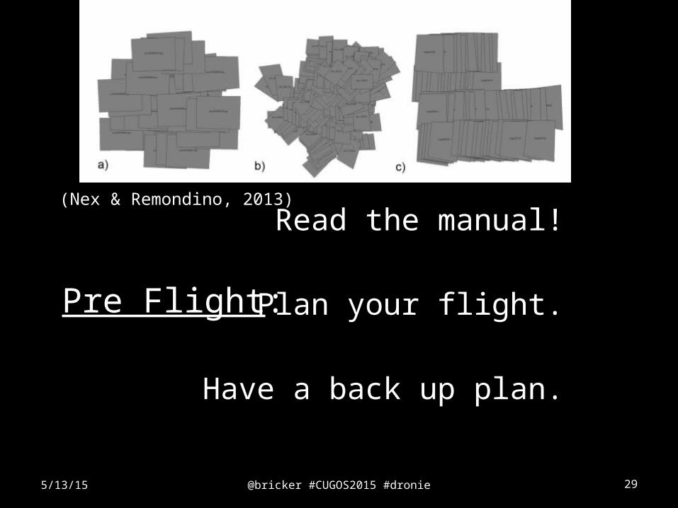
Pre Flight:
Read the manual!
Plan your flight.
Have a back up plan.
5/13/15
(Nex & Remondino, 2013)
@bricker #CUGOS2015 #dronie 305/13/15
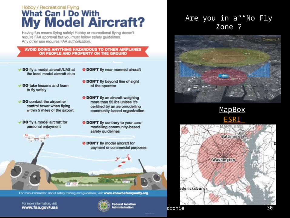
MapBox ESRI
Are you in a “No Fly Zone”?
@bricker #CUGOS2015 #dronie 315/13/15
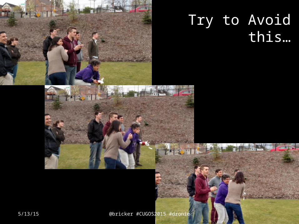
Try to Avoid this…
@bricker #CUGOS2015 #dronie 325/13/15
@bricker #CUGOS2015 #dronie 33
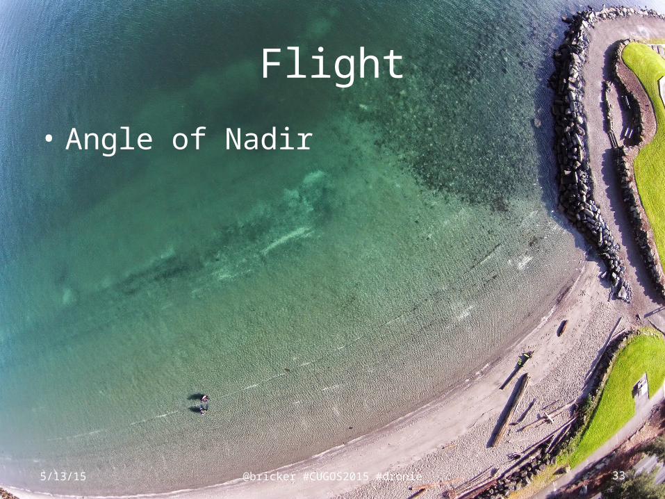
Flight
• Angle of Nadir
5/13/15
@bricker #CUGOS2015 #dronie 34
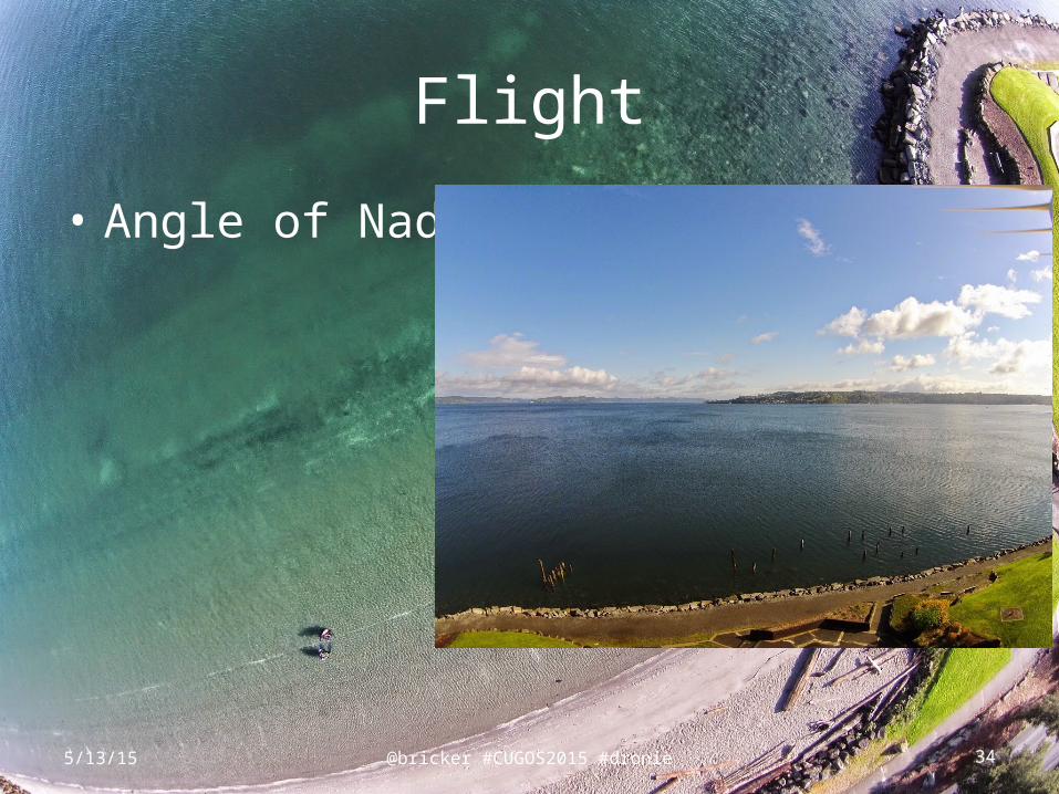
Flight
• Angle of Nadir
5/13/15
@bricker #CUGOS2015 #dronie 35
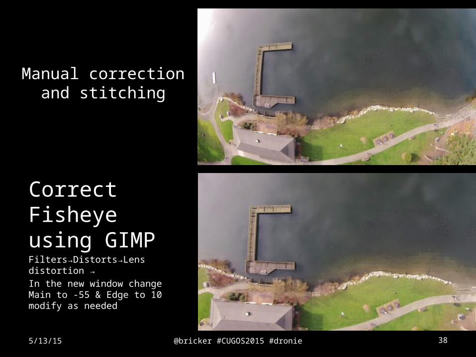
Manual Processing Strategies
1. Correct Fisheye
2. Process (Stitch) imagery – orthophoto
3. Post -Process imagery
5/13/15
@bricker #CUGOS2015 #dronie 36
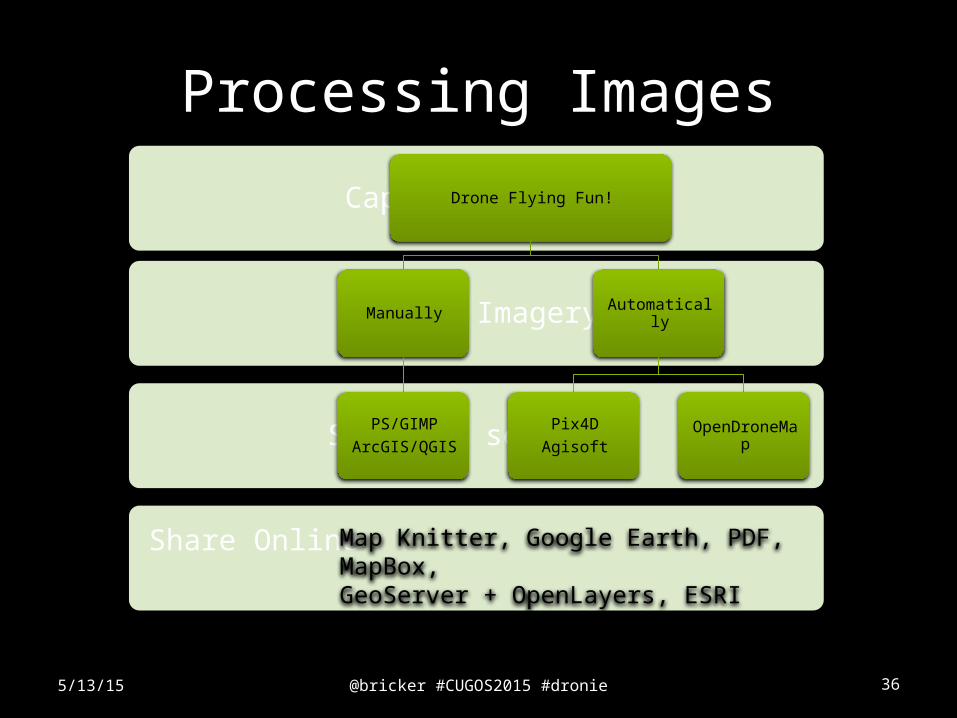
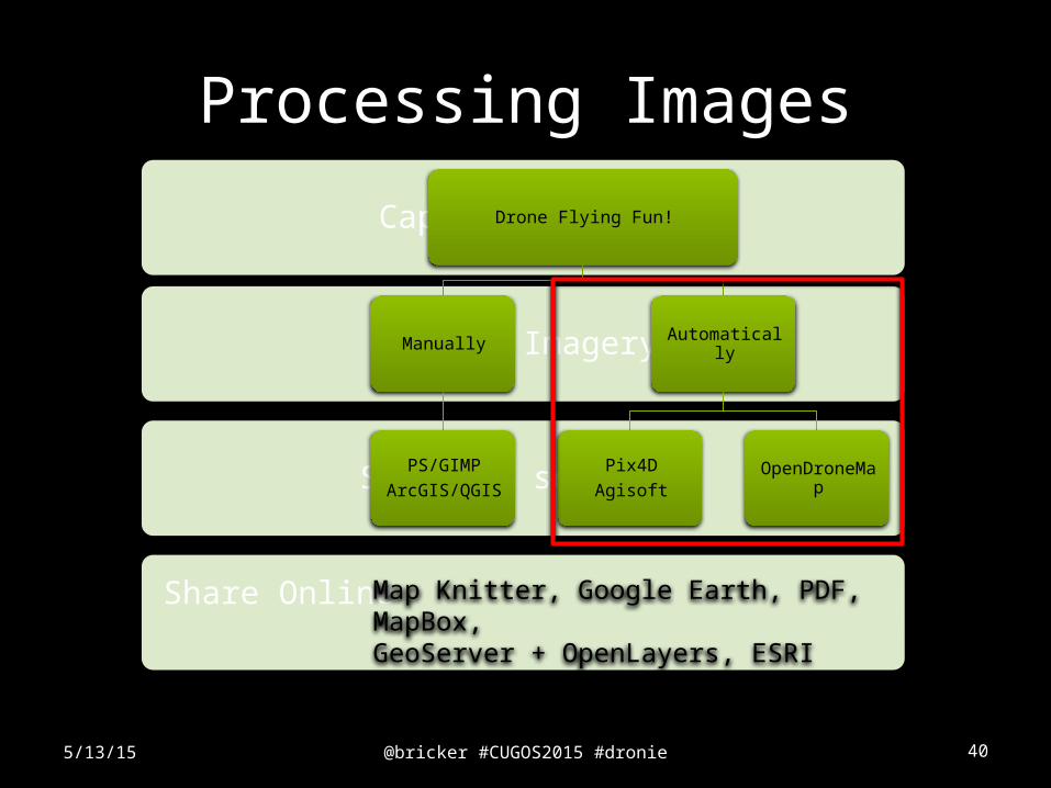
Processing Images
5/13/15
Share Online
Software selction
Stitch Imagery
Capture imagery
Drone Flying Fun!
Manually
PS/GIMP
ArcGIS/QGIS
Automatically
Pix4D
AgisoftOpenDroneMap
Map Knitter, Google Earth, PDF, MapBox, GeoServer + OpenLayers, ESRI Online…
@bricker #CUGOS2015 #dronie 37
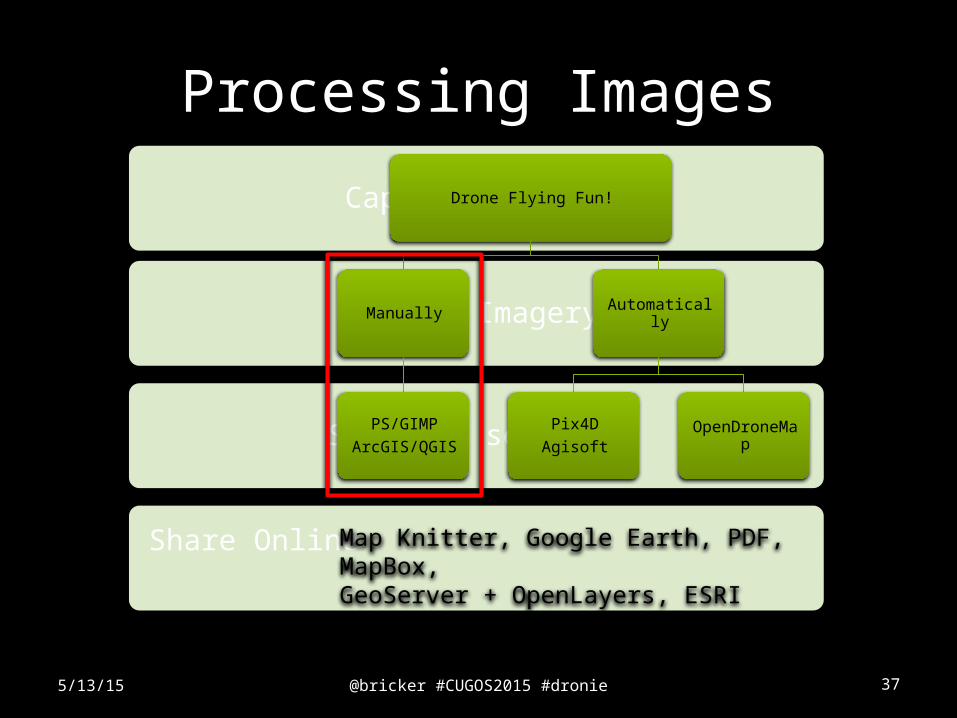
Processing Images
5/13/15
Share Online
Software selction
Stitch Imagery
Capture imagery
Drone Flying Fun!
Manually
PS/GIMP
ArcGIS/QGIS
Automatically
Pix4D
AgisoftOpenDroneMap
Map Knitter, Google Earth, PDF, MapBox, GeoServer + OpenLayers, ESRI Online…
@bricker #CUGOS2015 #dronie 38
Manual correction and stitching
Correct Fisheye using GIMP Filters→Distorts→Lens distortion →
In the new window change Main to -55 & Edge to 10 modify as needed
5/13/15
@bricker #CUGOS2015 #dronie 39
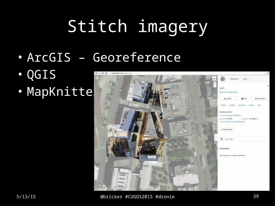
Stitch imagery
• ArcGIS – Georeference• QGIS• MapKnitter
5/13/15
@bricker #CUGOS2015 #dronie 40
Processing Images
5/13/15
Share Online
Software selction
Stitch Imagery
Capture imagery
Drone Flying Fun!
Manually
PS/GIMP
ArcGIS/QGIS
Automatically
Pix4D
AgisoftOpenDroneMap
Map Knitter, Google Earth, PDF, MapBox, GeoServer + OpenLayers, ESRI Online…
@bricker #CUGOS2015 #dronie 41
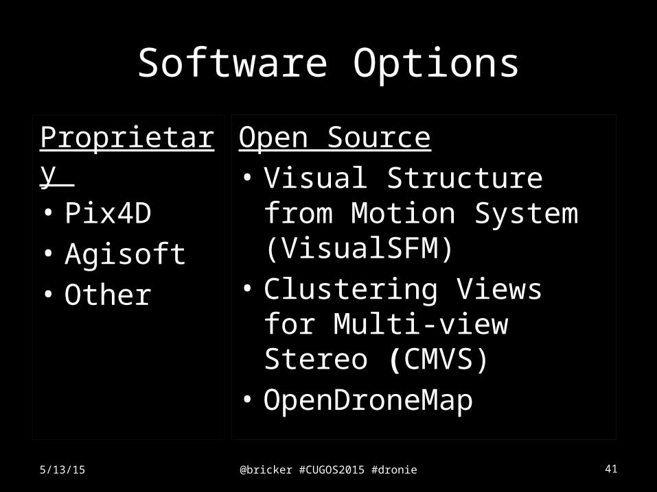
Software Options
Proprietary • Pix4D• Agisoft• Other
5/13/15
Open Source• Visual Structure from
Motion System (VisualSFM)
• Clustering Views for Multi-view Stereo (CMVS)
• OpenDroneMap
@bricker #CUGOS2015 #dronie 42
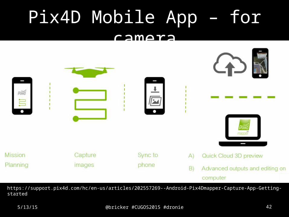
Pix4D Mobile App – for camera
5/13/15
Flight PathAuto PilotFree flight
https://support.pix4d.com/hc/en-us/articles/202557269--Android-Pix4Dmapper-Capture-App-Getting-started
@bricker #CUGOS2015 #dronie 43
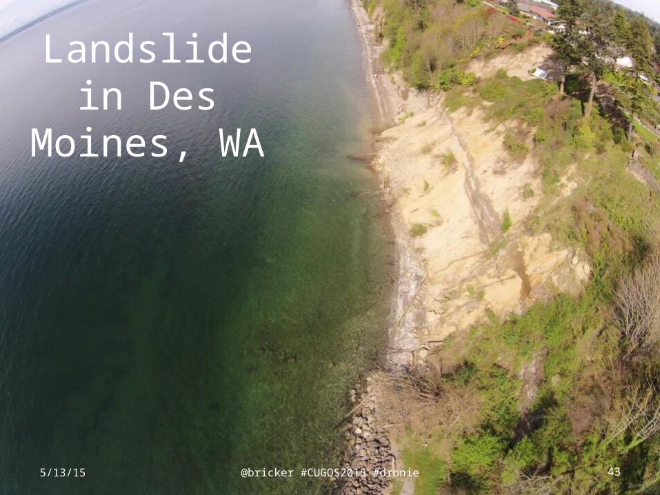
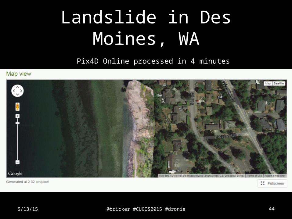
Landslide in Des Moines,
WA
5/13/15
@bricker #CUGOS2015 #dronie 44
Landslide in Des Moines, WA
5/13/15
Pix4D Online processed in 4 minutes
@bricker #CUGOS2015 #dronie 455/13/15
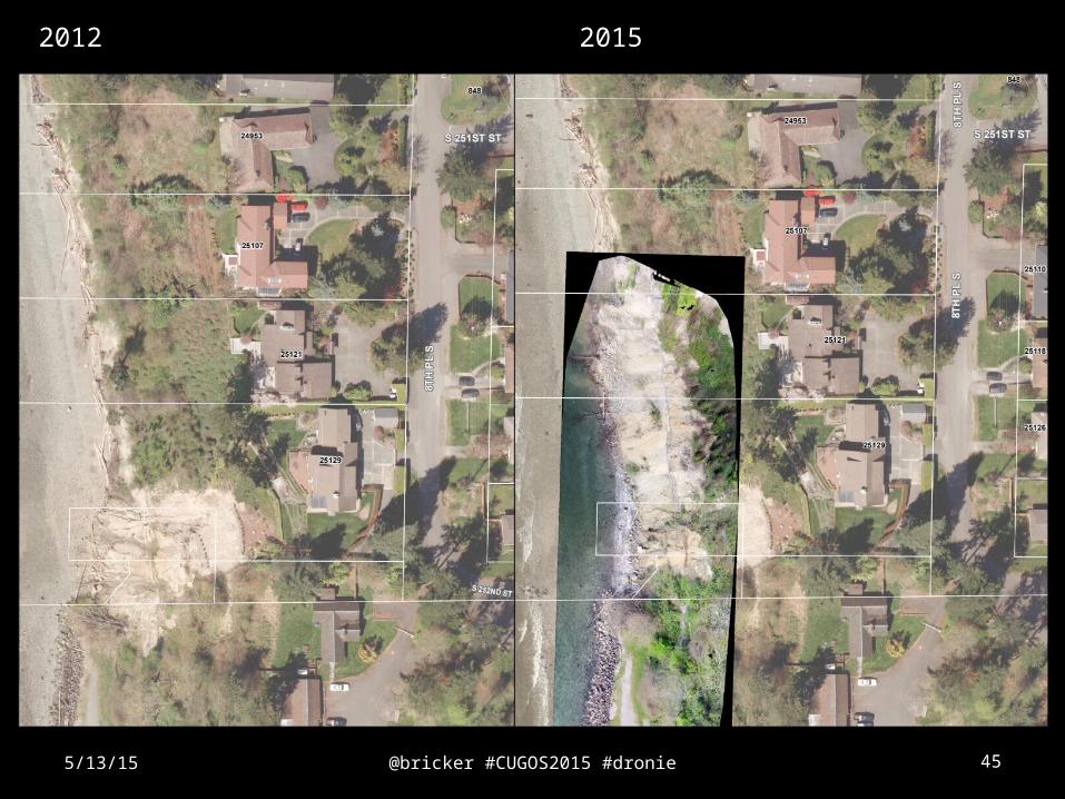
2012 2015
@bricker #CUGOS2015 #dronie 465/13/15
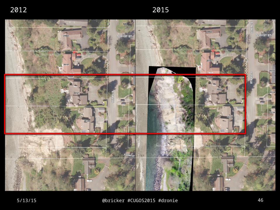
2012 2015
@bricker #CUGOS2015 #dronie 47
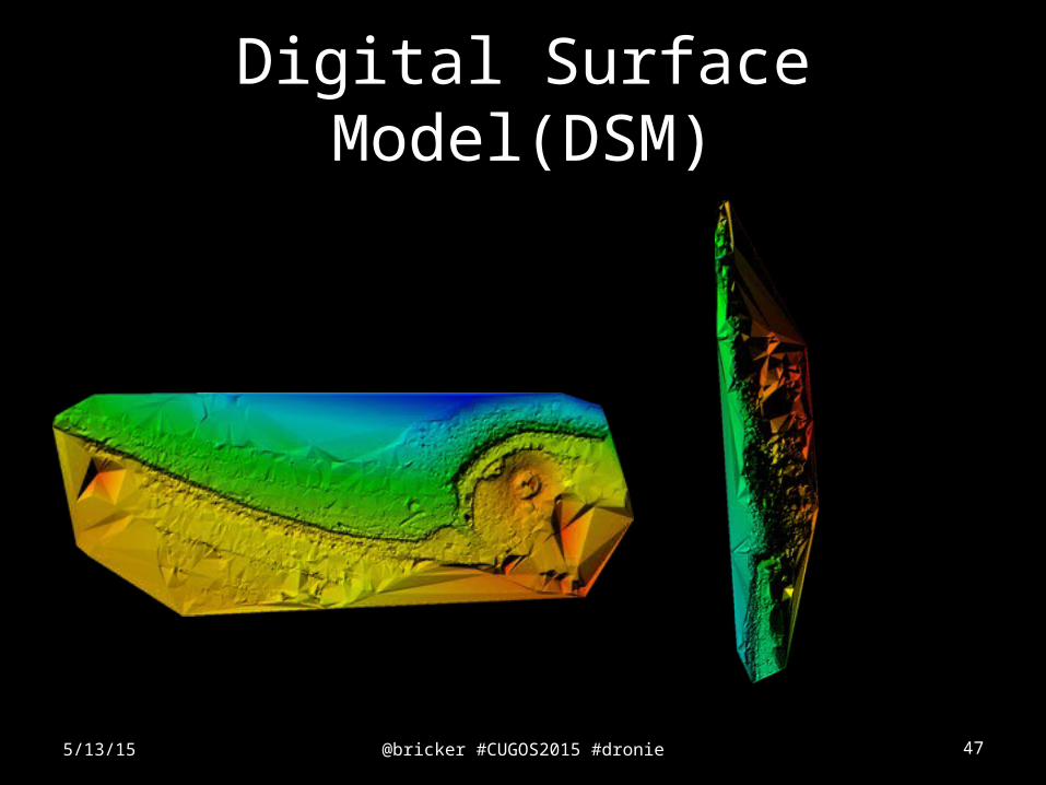
Digital Surface Model(DSM)
5/13/15
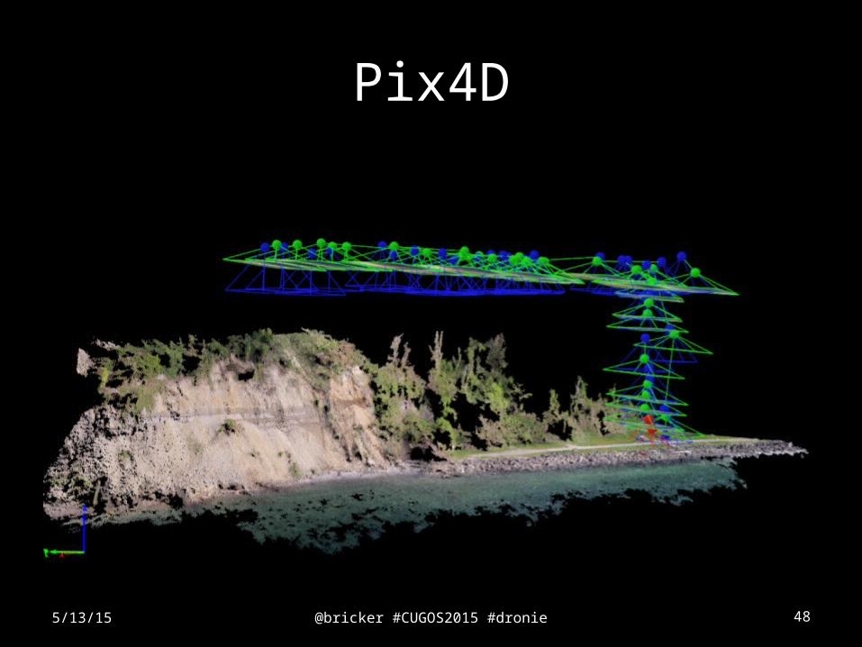
@bricker #CUGOS2015 #dronie 48
Pix4D
5/13/15
@bricker #CUGOS2015 #dronie 49
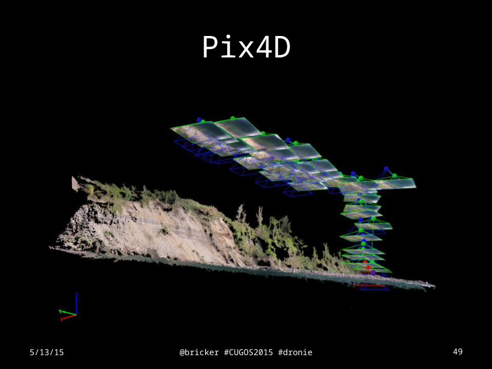
Pix4D
5/13/15
@bricker #CUGOS2015 #dronie 50
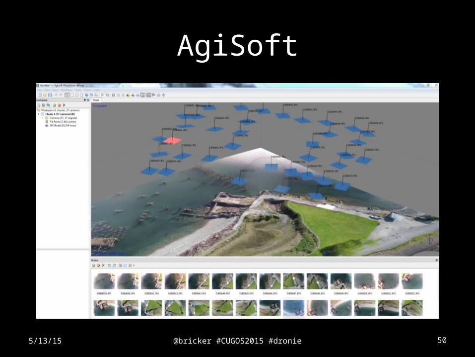
AgiSoft
5/13/15
@bricker #CUGOS2015 #dronie 515/13/15
@bricker #CUGOS2015 #dronie 52
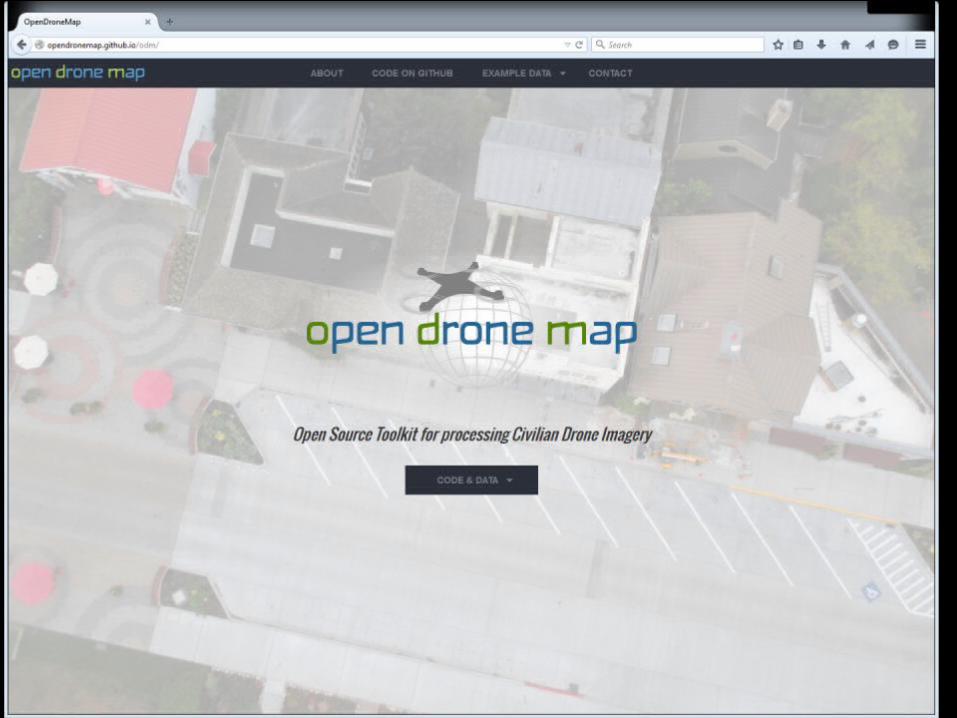
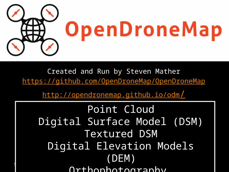
Open Drone Map
Created and Run by Steven Mather
https://github.com/OpenDroneMap/OpenDroneMap
http://opendronemap.github.io/odm/
5/13/15
Point CloudDigital Surface Model (DSM)
Textured DSMDigital Elevation Models (DEM)
Orthophotography
@bricker #CUGOS2015 #dronie 53
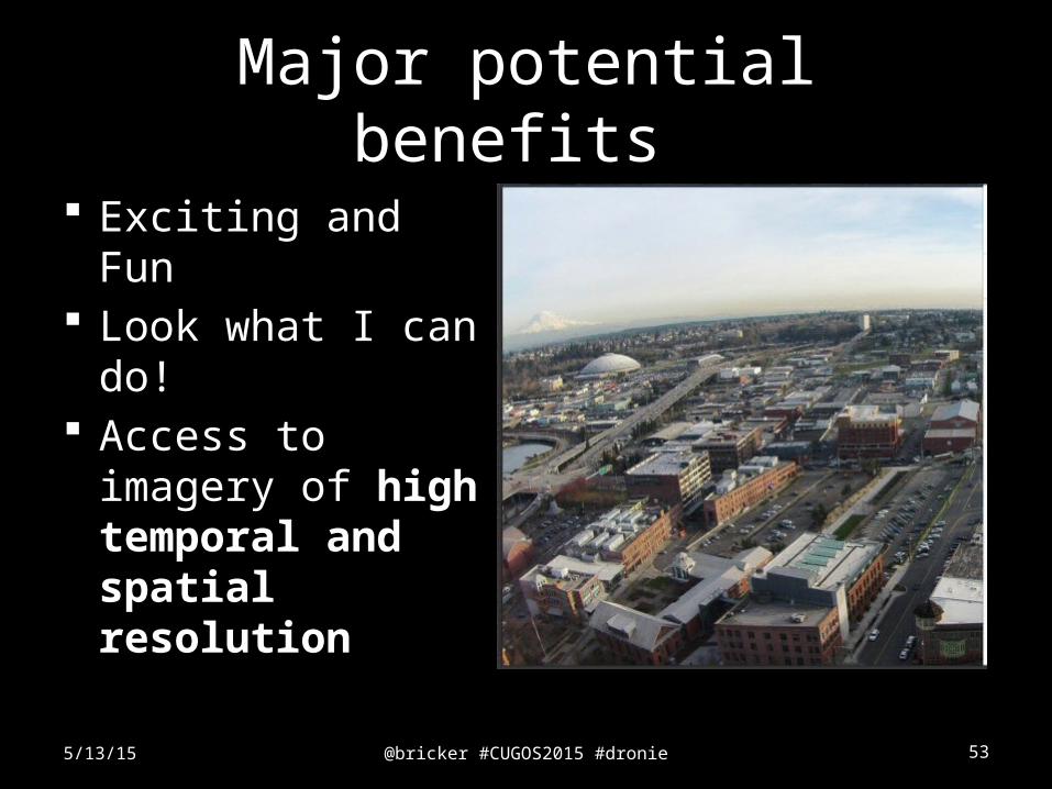
Major potential benefits
Exciting and Fun Look what I can
do! Access to imagery
of high temporal and spatial resolution
5/13/15
@bricker #CUGOS2015 #dronie 545/13/15
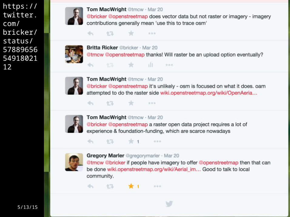
https://twitter.com/bricker/status/578896565491802112
@bricker #CUGOS2015 #dronie 55
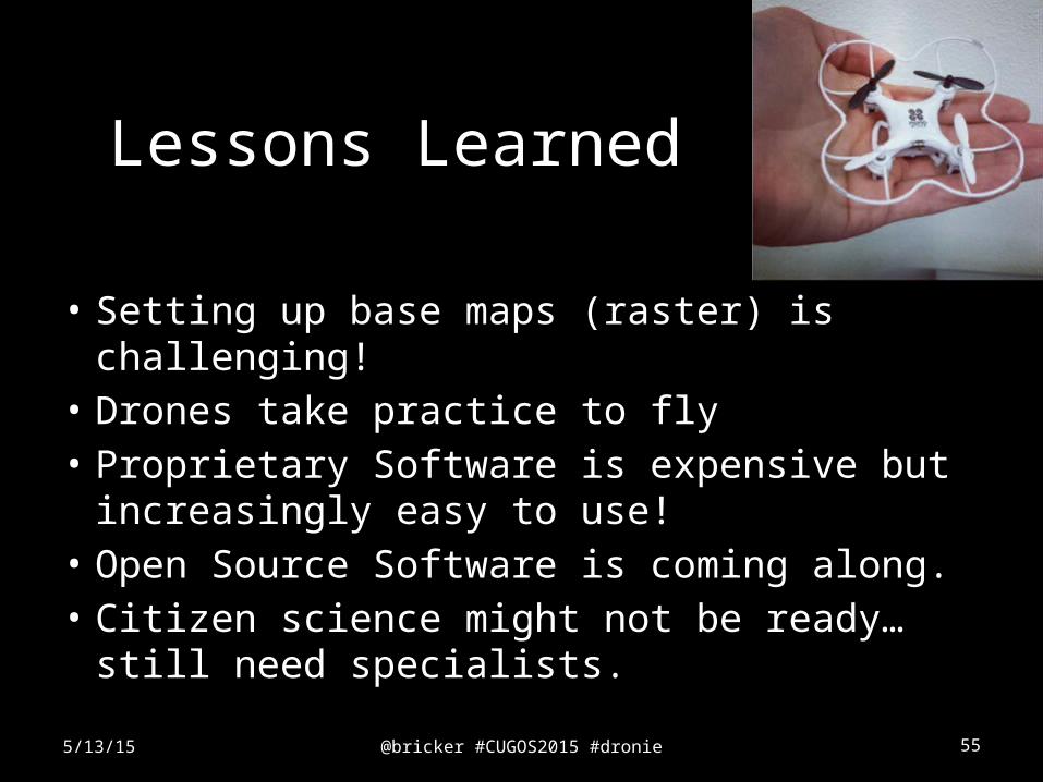
Lessons Learned
• Setting up base maps (raster) is challenging!• Drones take practice to fly• Proprietary Software is expensive but
increasingly easy to use!• Open Source Software is coming along.• Citizen science might not be ready…still
need specialists.
5/13/15
@bricker #CUGOS2015 #dronie 56
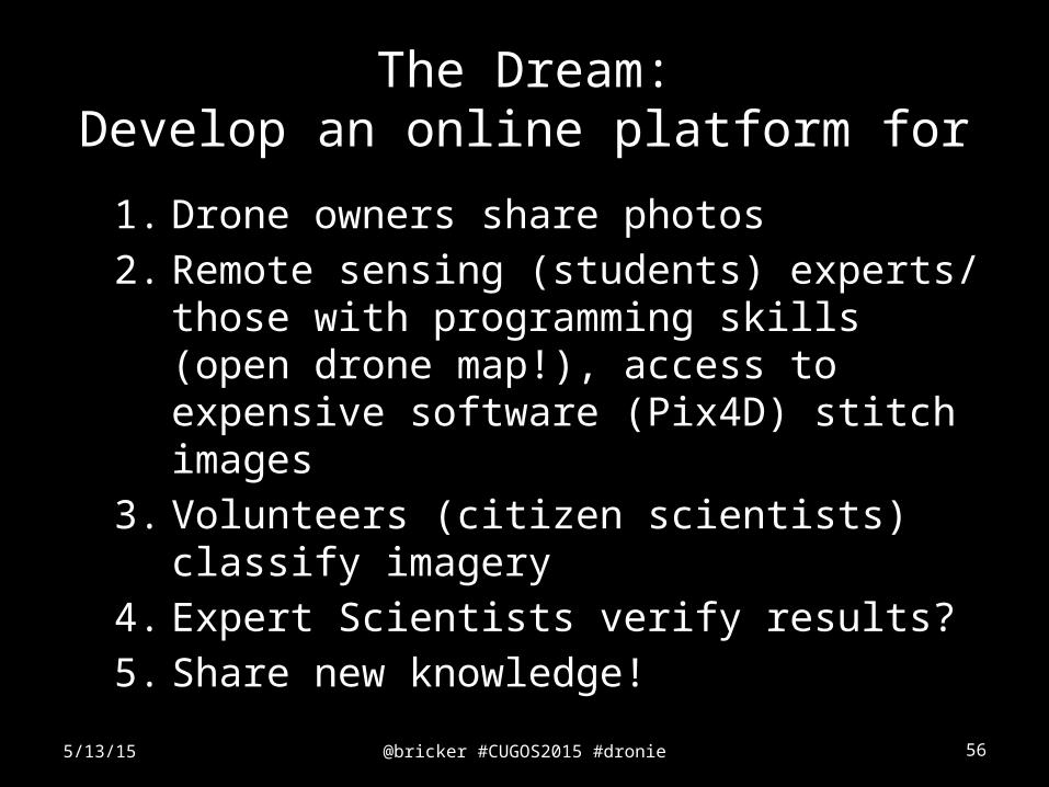
1. Drone owners share photos
2. Remote sensing (students) experts/ those with programming skills (open drone map!), access to expensive software (Pix4D) stitch images
3. Volunteers (citizen scientists) classify imagery
4. Expert Scientists verify results?
5. Share new knowledge!
5/13/15
The Dream:Develop an online platform for
@bricker #CUGOS2015 #dronie 57
Thank you!
CUGOS!, Andy James, Ali Modarres
5/13/15
Masters of Science in Geospatial Technologieshttp://
www.tacoma.uw.edu/urban-studies/master-science-geospatial-technologies
@bricker #CUGOS2015 #dronie 58
ReferencesBalletti, C., Guerra, F., Tsioukas, V., & Vernier, P. (2014). Calibration of action cameras for photogrammetric purposes. Sensors (Basel, Switzerland), 14(9), 17471–90. doi:10.3390/s140917471Chow, J. (2012, April). Predators for Peace. Foreign Policy. Retrieved from http://foreignpolicy.com/2012/04/27/predators-for-peace/Crampton, J. W., Graham, M., Poorthuis, A., Shelton, T., Stephens, M., Wilson, M. W., & Zook, M. (2013). Beyond the geotag: situating “big data” and leveraging the potential of the geoweb. Cartography and Geographic Information Science, 40(2), 130–139. Retrieved from http://dx.doi.org/10.1080/15230406.2013.777137Eisenbeiss, H., & Grün, A. (2009). UAV Photogrammetry. Institute of Photogrammetry and Remote Sensing (Vol. Doctor of). doi:doi:10.3929/ethz-a-005939264Everaerts, J. (2008). The use of unmanned aerial vehicles (uavs) for remote sensing and mapping. The International Archives of the Photogrammetry, Remote Sensing and Spatial Information Sciences, XXXVII, 1187–1192. Retrieved from http://www.isprs.org/proceedings/XXXVII/congress/1_pdf/203.pdfFornace, K. M., Drakeley, C. J., William, T., Espino, F., & Cox, J. (2014). Mapping infectious disease landscapes: unmanned aerial vehicles and epidemiology. Trends in Parasitology, 30(11), 514–519. doi:10.1016/j.pt.2014.09.001Haklay, M. (2013). Neogeography and the delusion of democratisation. Environment and Planning A, 45(1), 55–69. Retrieved from http://www.envplan.com/abstract.cgi?id=a45184Haklay, M. (2015). Citizen Science and Policy: A European Perspective.Kingsbury, P., & Jones, J. (2009). Walter Benjamins Dionysian Adventures on Google Earth. Geoforum, 40(4), 502–513.Lake, R., & Farley, J. (2007). Infrastructure for the Geospatial Web. In A. Scharl & K. Tochterman (Eds.), The geospatial web: How geobrowsers, social software, and Web 2.0 are shaping the network society (pp. 15–26). London: Springer.Meier, P. (2015). Digital Humanitarians: How Big Data is changing the face of humanitarian response. Boca Raton, FL: CRC Press Taylor & Francis Group.Nex, F., & Remondino, F. (2013). UAV for 3D mapping applications: a review. Applied Geomatics, 6(1), 1–15. doi:10.1007/s12518-013-0120-xPaulos, E., Foth, M., Satchell, C., Kim, Y., Dourish, P., & Choi, J. (2008). Ubiquitous Sustainability: Citizen Science and Activism. In Workshop at the 10th International Conference on Ubiquitous Computing (UbiComp 2008).Sandvik, K. B., & Lohne, K. (2014). The Rise of the Humanitarian Drone: Giving Content to an Emerging Concept. Millennium - Journal of International Studies, 43(1), 145–164. doi:10.1177/0305829814529470Sui, D., Goodchild, M., & Elwood, S. (2013). Volunteered Geographic Information, and the Growing Digital Divide. In D. Sui., S. Elwood, & M. Goodchild (Eds.), (pp. 1–12). Dordrecht: Springer.Sui, D. Z. (2008). The wikification of GIS and its consequences: Or Angelina Jolie’s new tattoo and the future of GIS. Computers, Environment and Urban Systems, 32(1), 1–5.Upton, V., Ryan, M., O’Donoghue, C., & Dhubhain, A. N. (2015). Combining conventional and volunteered geographic information to identify and model forest recreational resources. Applied Geography, 60, 69–76. doi:10.1016/j.apgeog.2015.03.007
5/13/15


![Participatory [Citizen] Science](https://img.pdfslide.us/doc/110x75/586f8b9a1a28ab54768b6703/participatory-citizen-science.jpg)