Embed Size (px)
Citation preview
February 25, 2010 WCB Board MeetingFebruary 25, 2010 WCB Board Meeting10:00 a.m., State Capitol, Room 11210:00 a.m., State Capitol, Room 112Sacramento, California 95814Sacramento, California 95814
Sierra Crest Conservation Easement, Nevada and Sierra Counties
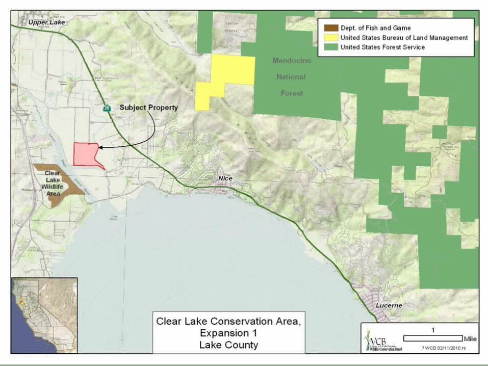
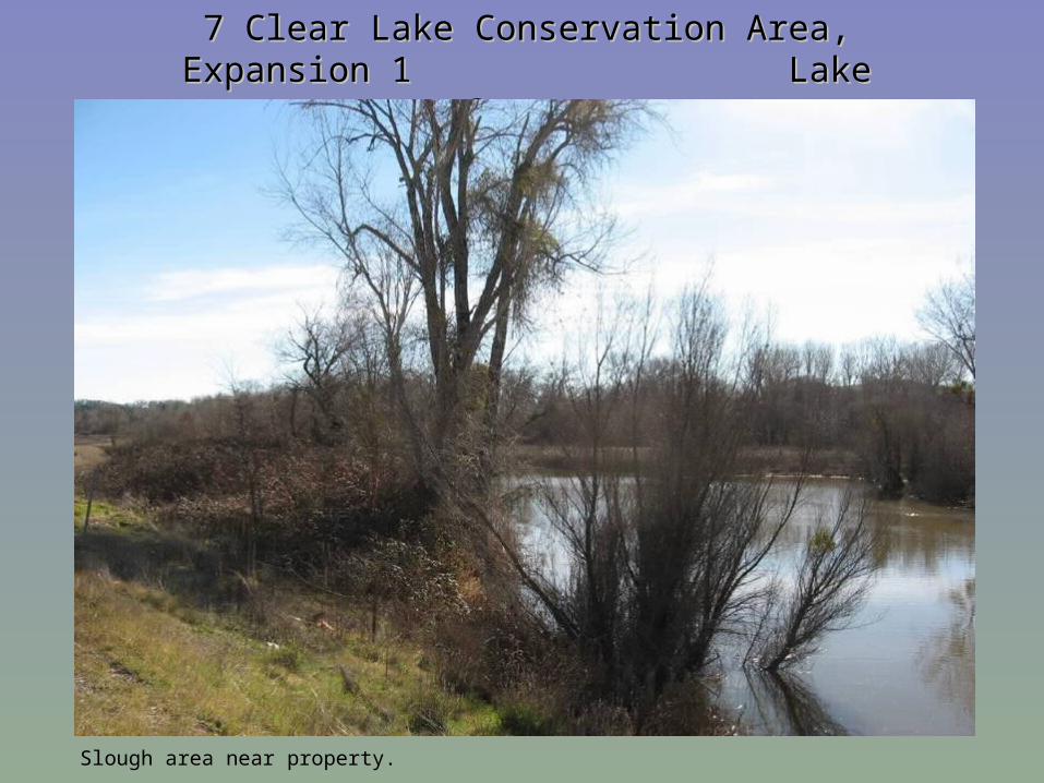
7 Clear Lake Conservation Area, Expansion 1 7 Clear Lake Conservation Area, Expansion 1 Lake County Lake County
Slough area near property.
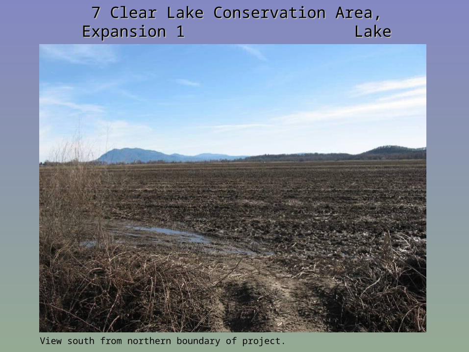
7 Clear Lake Conservation Area, Expansion 1 7 Clear Lake Conservation Area, Expansion 1 Lake County Lake County
View south from northern boundary of project.

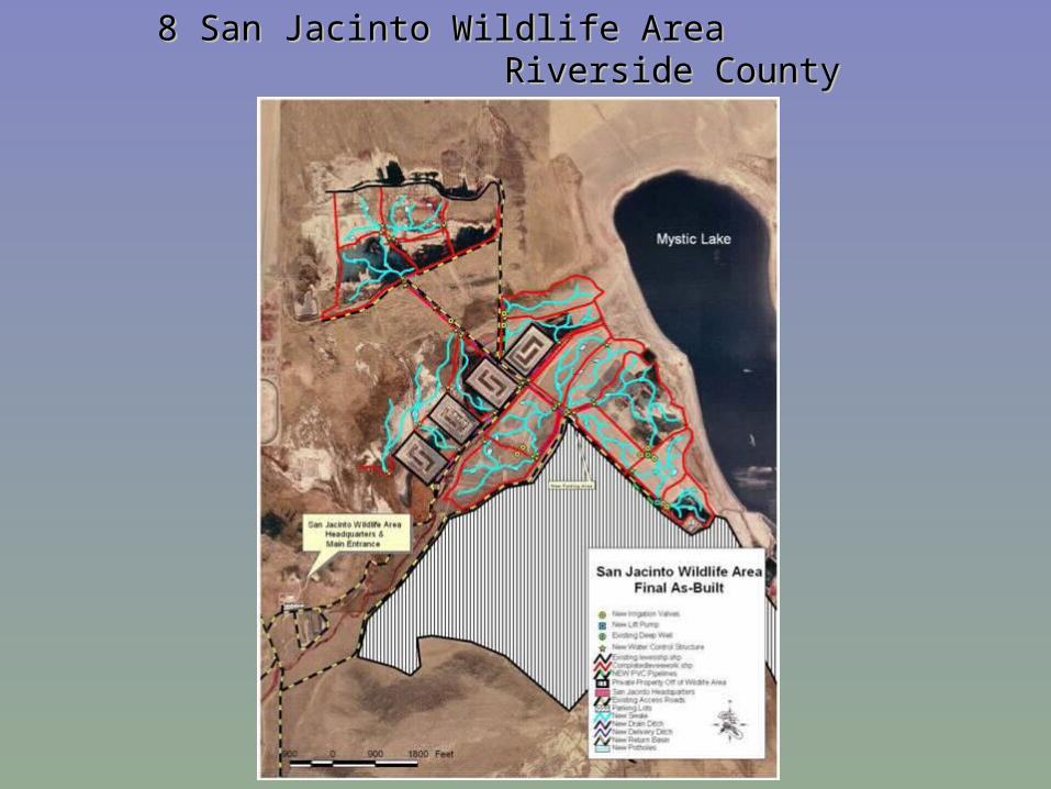
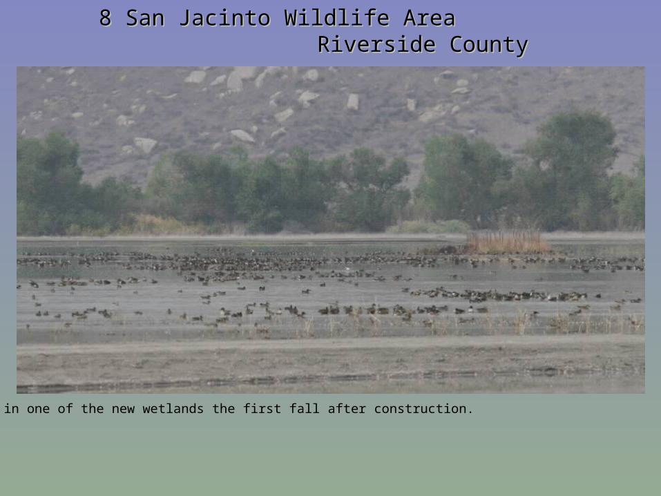
8 San Jacinto Wildlife Area 8 San Jacinto Wildlife Area Riverside CountyRiverside County
8 San Jacinto Wildlife Area 8 San Jacinto Wildlife Area Riverside CountyRiverside County
Bird use in one of the new wetlands the first fall after construction.
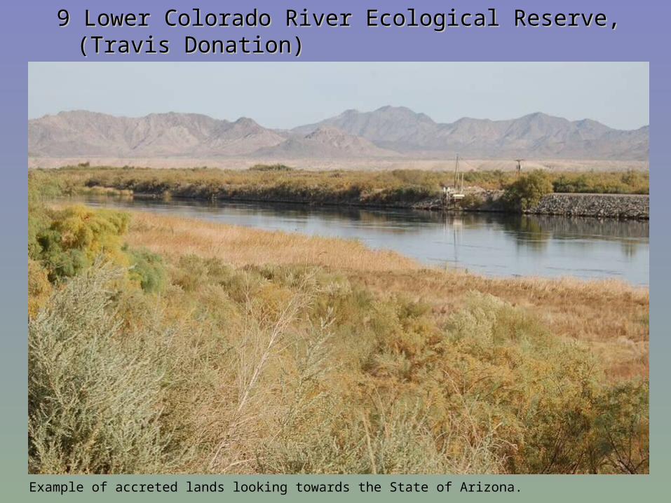
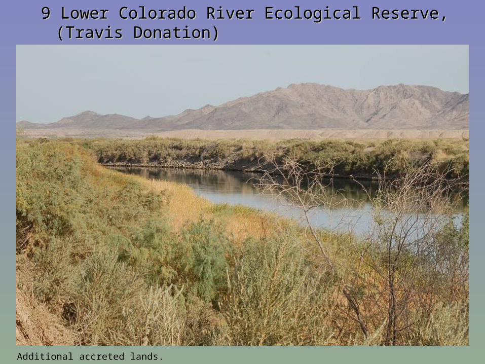
9 Lower Colorado River Ecological Reserve, (Travis Donation) 9 Lower Colorado River Ecological Reserve, (Travis Donation) Riverside County Riverside County
Example of accreted lands looking towards the State of Arizona.
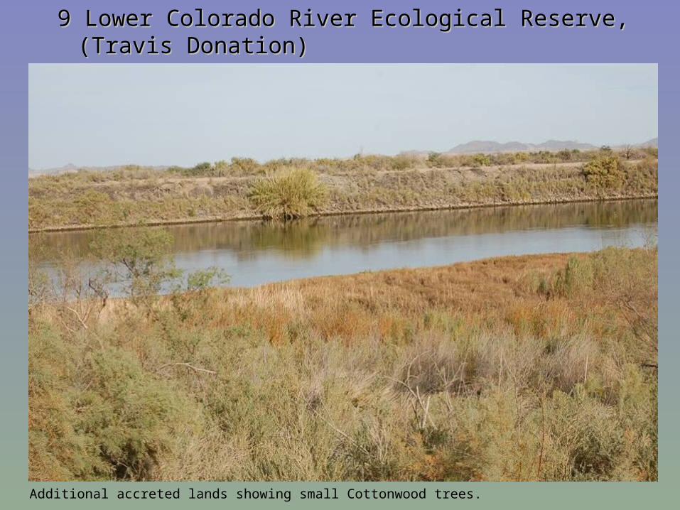
9 Lower Colorado River Ecological Reserve, (Travis Donation) 9 Lower Colorado River Ecological Reserve, (Travis Donation) Riverside County Riverside County
Additional accreted lands showing small Cottonwood trees.
9 Lower Colorado River Ecological Reserve, (Travis Donation) 9 Lower Colorado River Ecological Reserve, (Travis Donation) Riverside County Riverside County
Additional accreted lands.
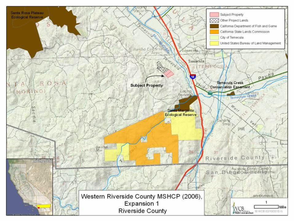
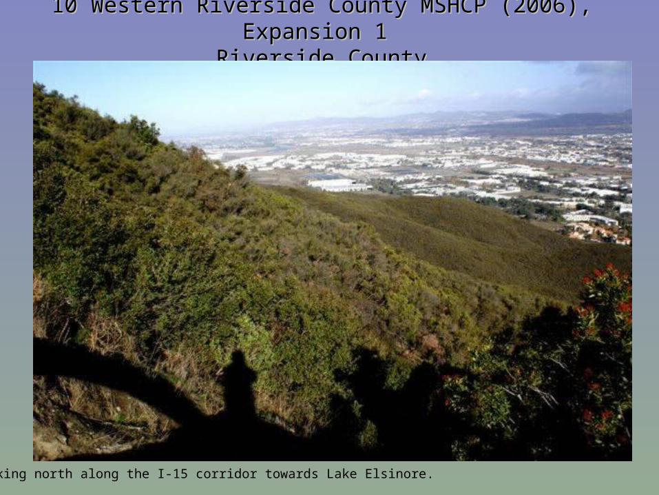
10 Western Riverside County MSHCP (2006), Expansion 1 10 Western Riverside County MSHCP (2006), Expansion 1 Riverside CountyRiverside County
Looking north along the I-15 corridor towards Lake Elsinore.
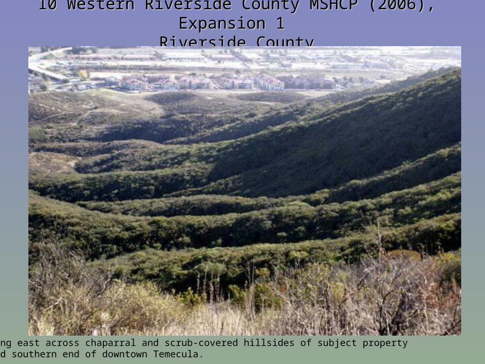
10 Western Riverside County MSHCP (2006), Expansion 1 10 Western Riverside County MSHCP (2006), Expansion 1 Riverside CountyRiverside County
Looking east across chaparral and scrub-covered hillsides of subject property toward southern end of downtown Temecula.
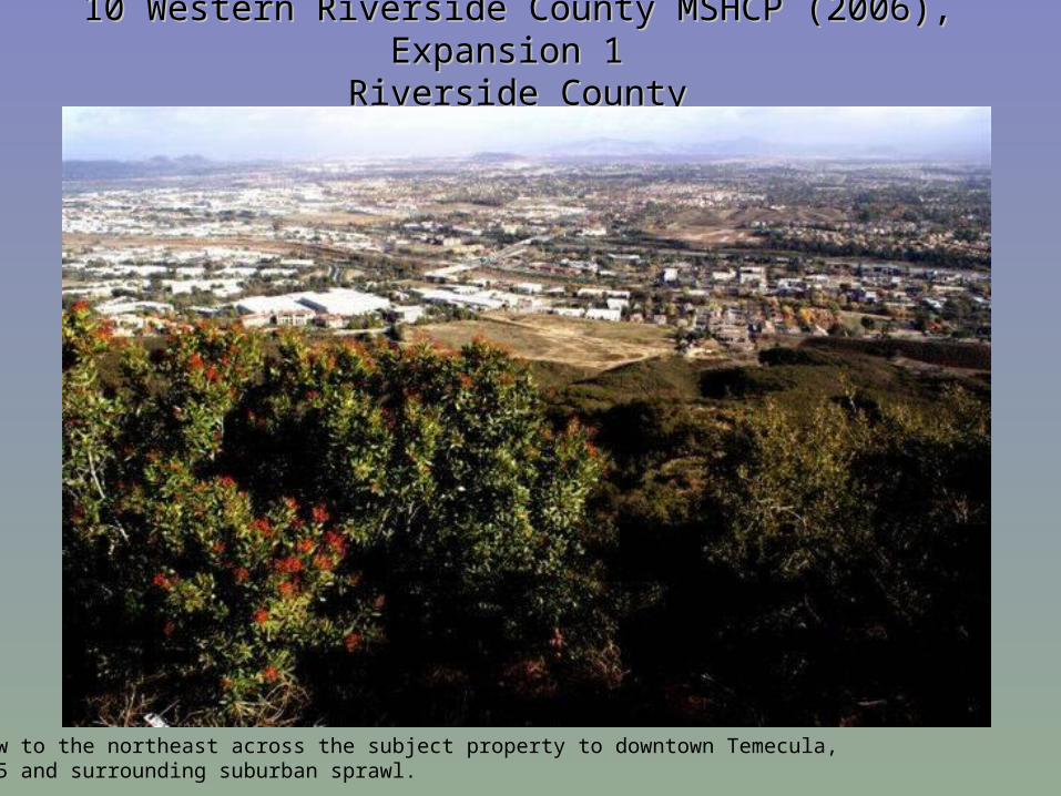
10 Western Riverside County MSHCP (2006), Expansion 1 10 Western Riverside County MSHCP (2006), Expansion 1 Riverside CountyRiverside County
View to the northeast across the subject property to downtown Temecula,I-15 and surrounding suburban sprawl.
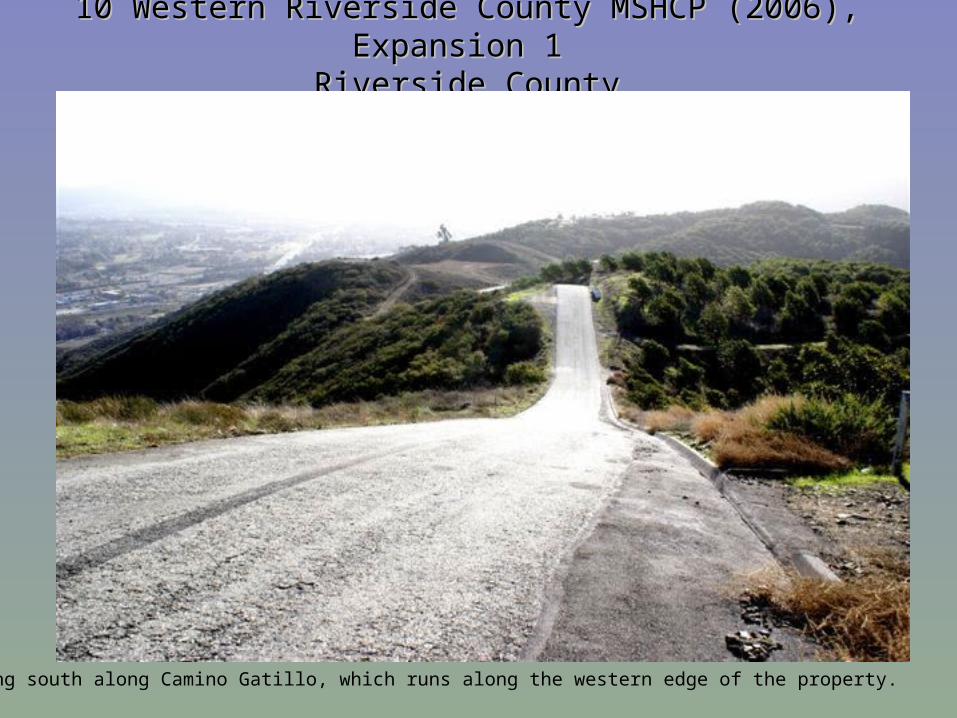
10 Western Riverside County MSHCP (2006), Expansion 1 10 Western Riverside County MSHCP (2006), Expansion 1 Riverside CountyRiverside County
Looking south along Camino Gatillo, which runs along the western edge of the property.
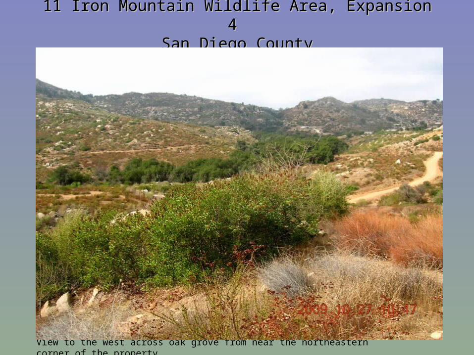
11 Iron Mountain Wildlife Area, Expansion 4 11 Iron Mountain Wildlife Area, Expansion 4 San Diego CountySan Diego County
View to the west across oak grove from near the northeastern corner of the property.
11 Iron Mountain Wildlife Area, Expansion 4 11 Iron Mountain Wildlife Area, Expansion 4 San Diego CountySan Diego County
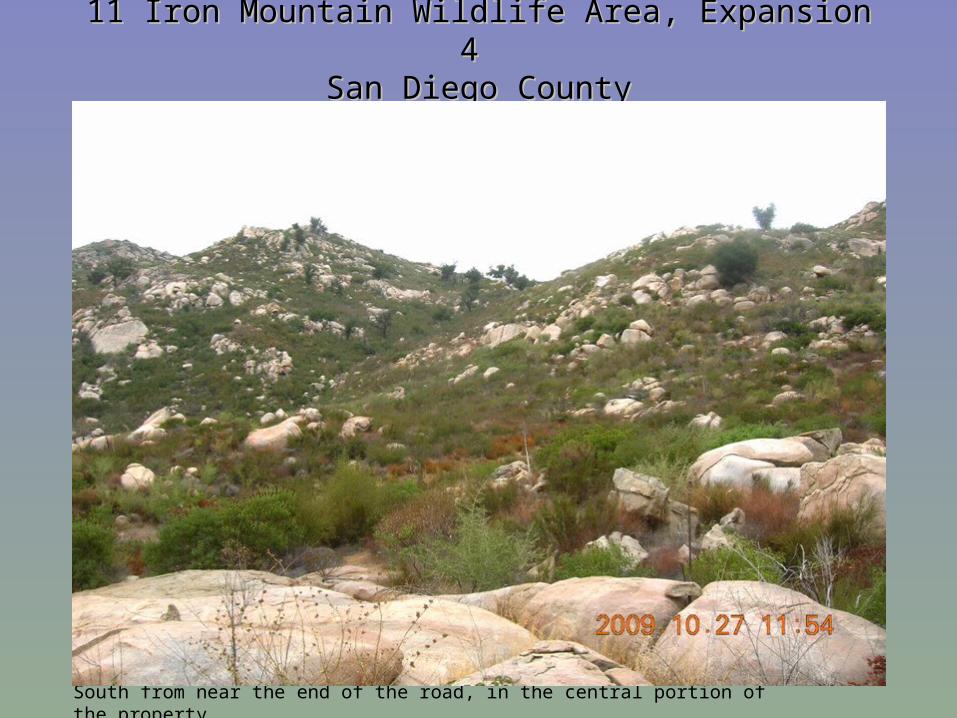
South from near the end of the road, in the central portion of the property.
11 Iron Mountain Wildlife Area, Expansion 4 11 Iron Mountain Wildlife Area, Expansion 4 San Diego CountySan Diego County
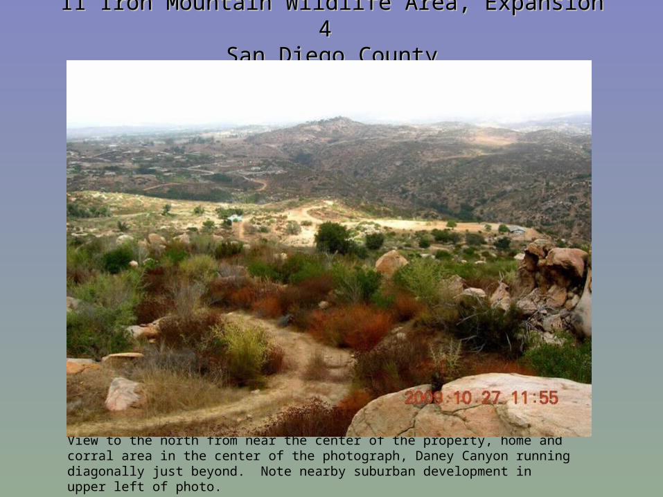
View to the north from near the center of the property, home and corral area in the center of the photograph, Daney Canyon running diagonally just beyond. Note nearby suburban development in upper left of photo.
11 Iron Mountain Wildlife Area, Expansion 4 11 Iron Mountain Wildlife Area, Expansion 4 San Diego CountySan Diego County
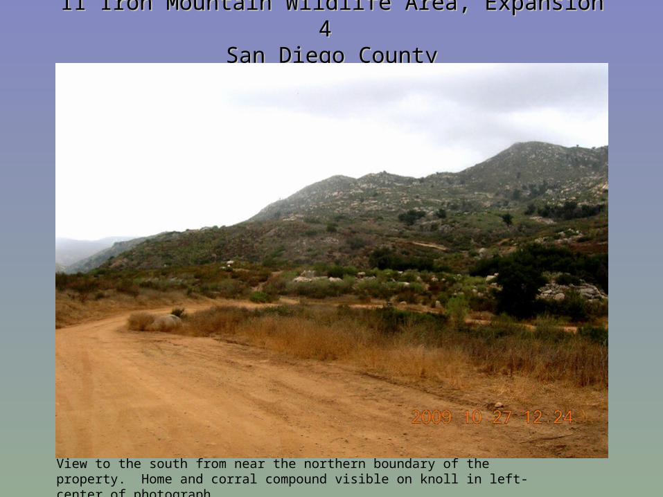
View to the south from near the northern boundary of the property. Home and corral compound visible on knoll in left-center of photograph.
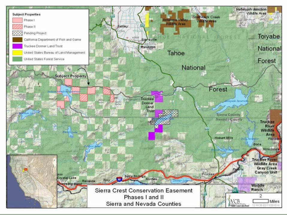
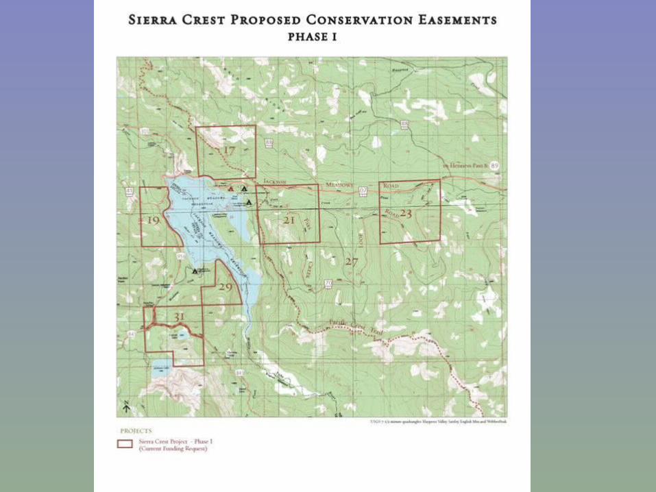
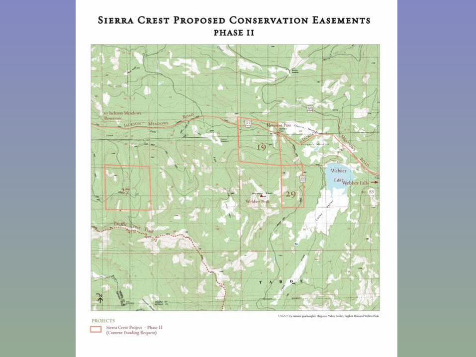
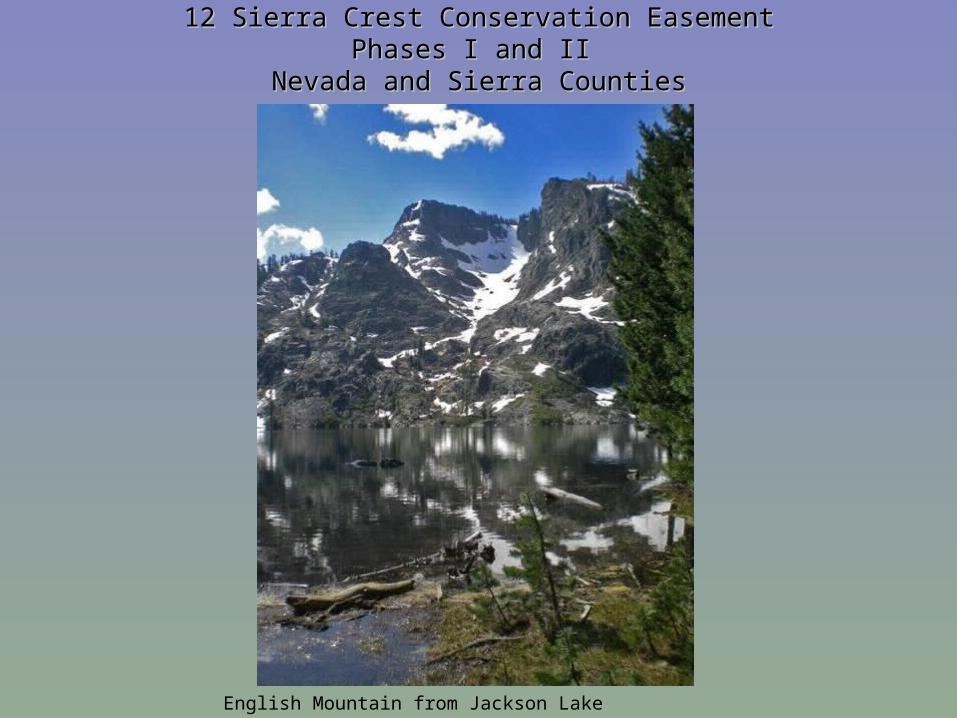
12 Sierra Crest Conservation Easement12 Sierra Crest Conservation EasementPhases I and II Phases I and II
Nevada and Sierra CountiesNevada and Sierra Counties
English Mountain from Jackson Lake
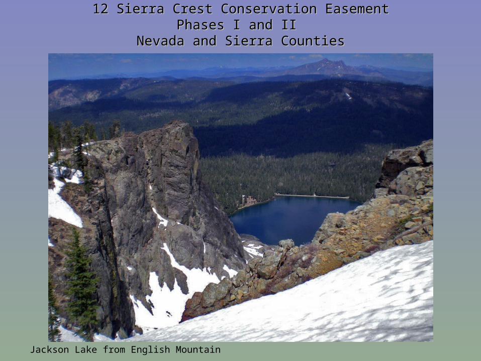
12 Sierra Crest Conservation Easement12 Sierra Crest Conservation EasementPhases I and II Phases I and II
Nevada and Sierra CountiesNevada and Sierra Counties
Jackson Lake from English Mountain
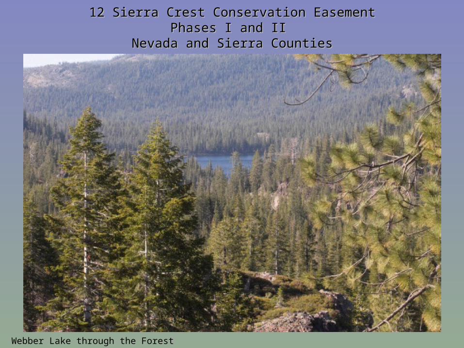
12 Sierra Crest Conservation Easement12 Sierra Crest Conservation EasementPhases I and II Phases I and II
Nevada and Sierra CountiesNevada and Sierra Counties
Webber Lake through the Forest
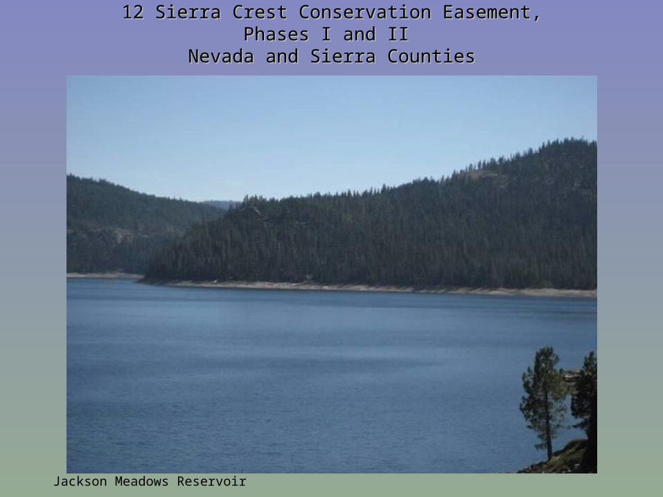
12 Sierra Crest Conservation Easement,12 Sierra Crest Conservation Easement,Phases I and II Phases I and II
Nevada and Sierra CountiesNevada and Sierra Counties
Jackson Meadows Reservoir
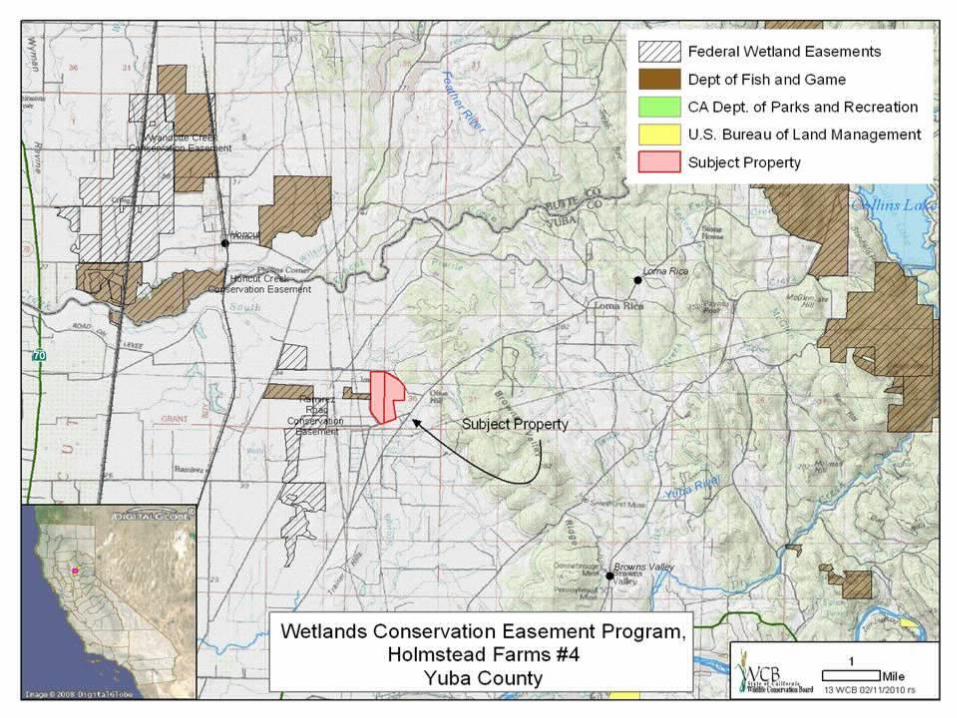
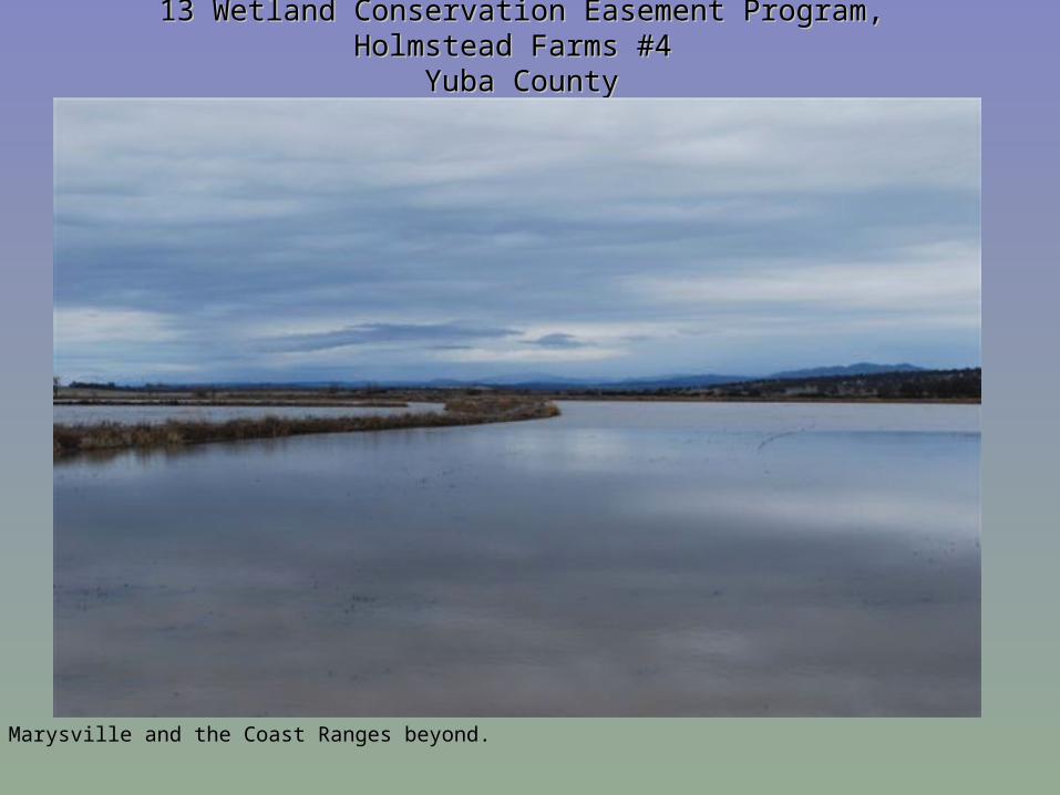
13 Wetland Conservation Easement Program, Holmstead Farms #4 13 Wetland Conservation Easement Program, Holmstead Farms #4 Yuba CountyYuba County
Marysville and the Coast Ranges beyond.
13 Wetland Conservation Easement Program, Holmstead Farms #4 13 Wetland Conservation Easement Program, Holmstead Farms #4 Yuba CountyYuba County
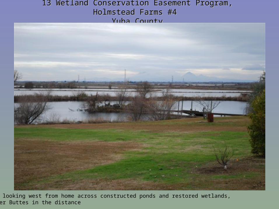
View looking west from home across constructed ponds and restored wetlands, Sutter Buttes in the distance
13 Wetland Conservation Easement Program, Holmstead Farms #4 13 Wetland Conservation Easement Program, Holmstead Farms #4 Yuba CountyYuba County
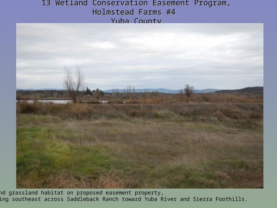
Upland grassland habitat on proposed easement property, looking southeast across Saddleback Ranch toward Yuba River and Sierra Foothills.
13 Wetland Conservation Easement Program, Holmstead Farms #4 13 Wetland Conservation Easement Program, Holmstead Farms #4 Yuba CountyYuba County
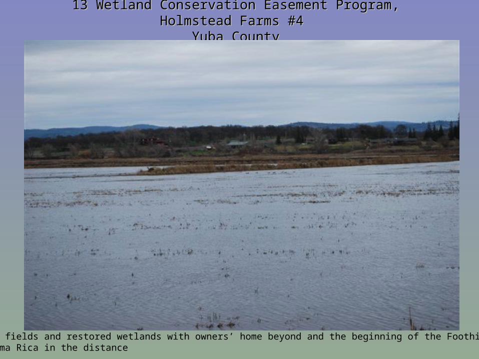
Flooded fields and restored wetlands with owners’ home beyond and the beginning of the Foothillsnear Loma Rica in the distance
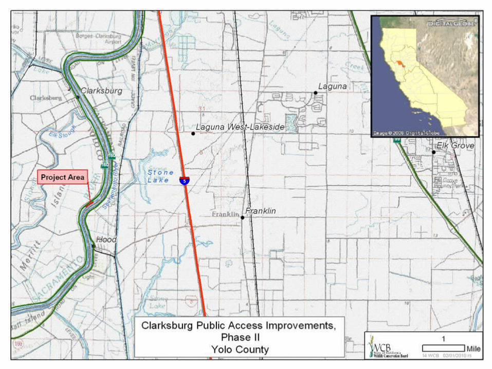
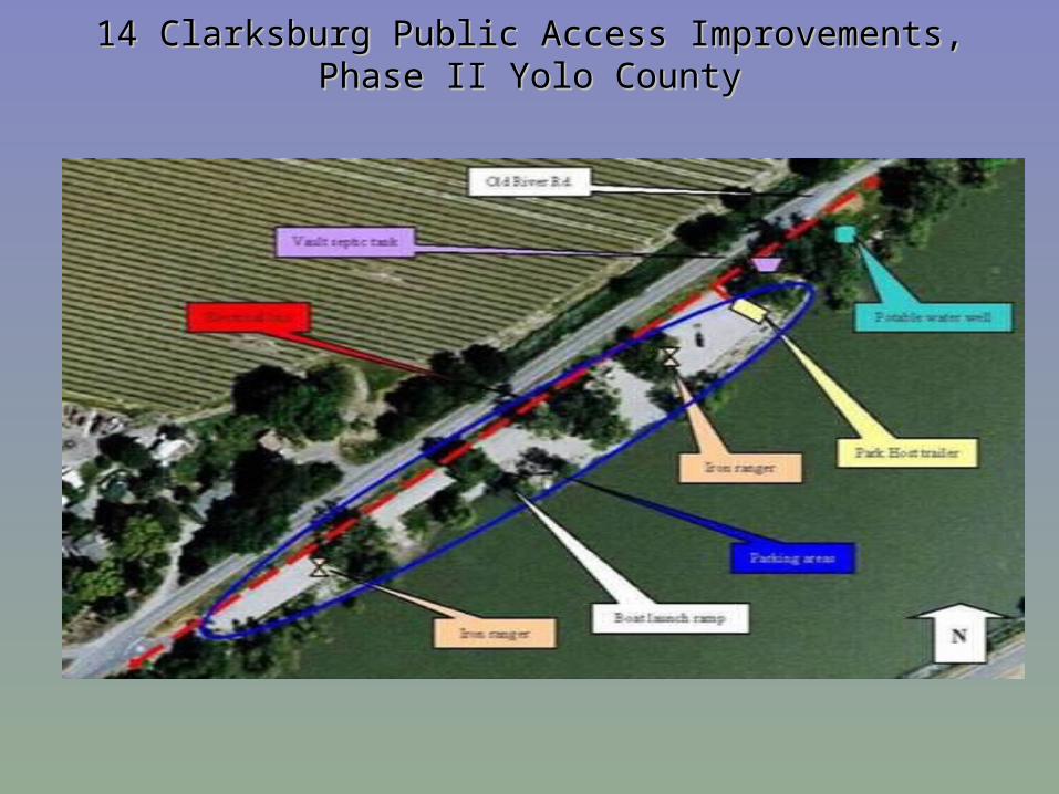
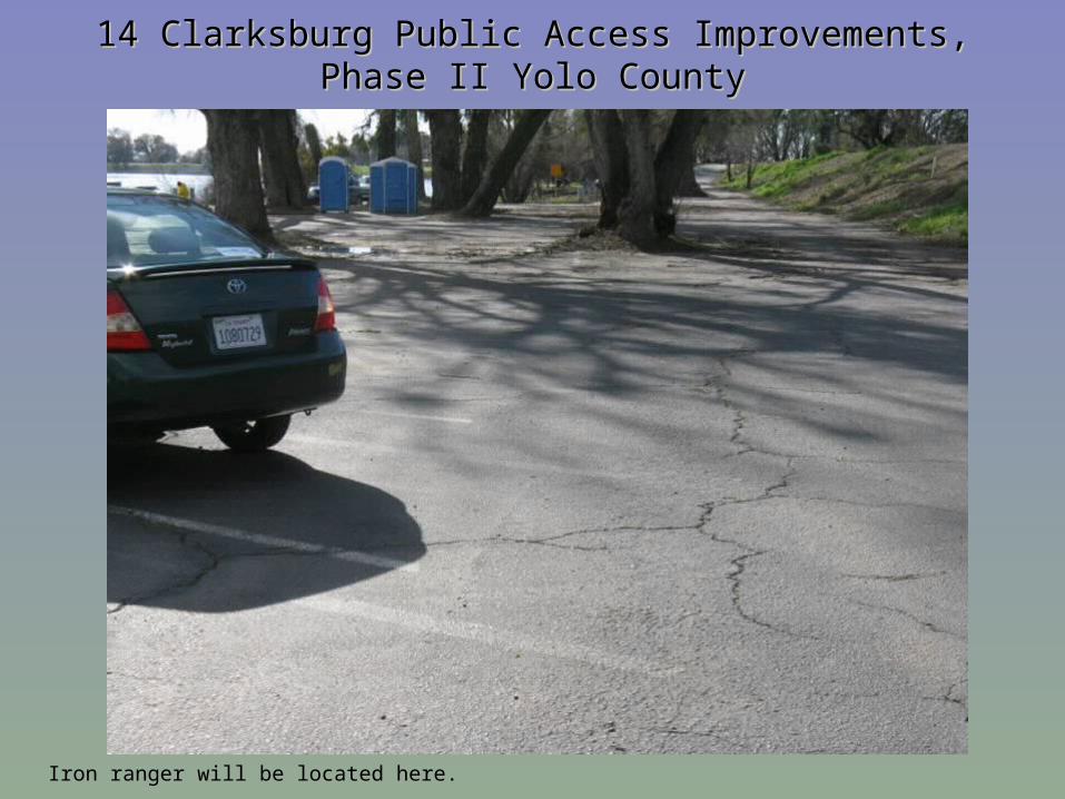
14 Clarksburg Public Access Improvements, Phase II 14 Clarksburg Public Access Improvements, Phase II Yolo CountyYolo County
14 Clarksburg Public Access Improvements, Phase II 14 Clarksburg Public Access Improvements, Phase II Yolo CountyYolo County
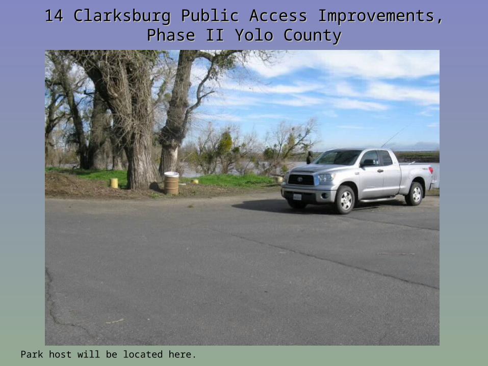
Park host will be located here.
14 Clarksburg Public Access Improvements, Phase II 14 Clarksburg Public Access Improvements, Phase II Yolo CountyYolo County
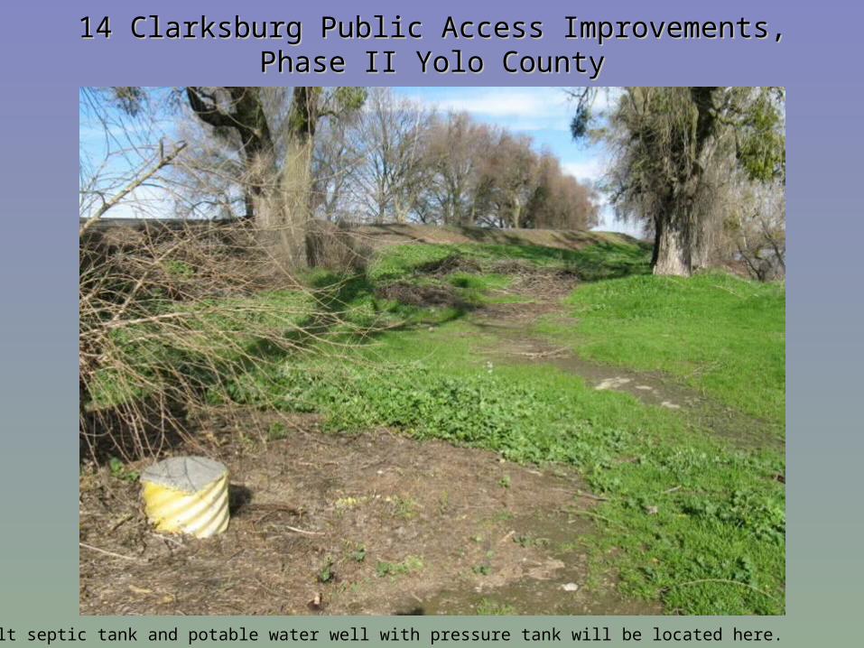
Vault septic tank and potable water well with pressure tank will be located here.
14 Clarksburg Public Access Improvements, Phase II 14 Clarksburg Public Access Improvements, Phase II Yolo CountyYolo County
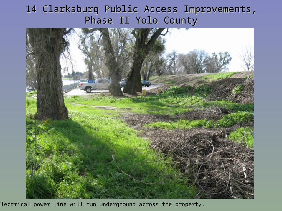
Electrical power line will run underground across the property.
14 Clarksburg Public Access Improvements, Phase II 14 Clarksburg Public Access Improvements, Phase II Yolo CountyYolo County
Iron ranger will be located here.
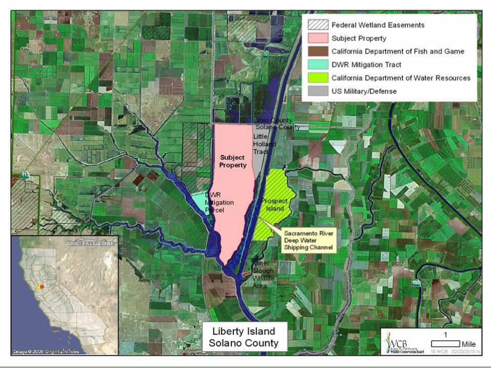
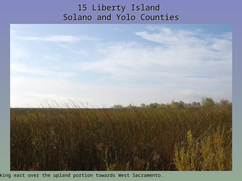
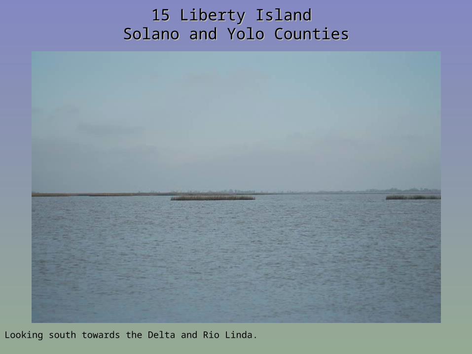
15 Liberty Island 15 Liberty Island Solano and Yolo CountiesSolano and Yolo Counties
Looking east over the upland portion towards West Sacramento.
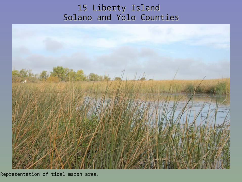
15 Liberty Island 15 Liberty Island Solano and Yolo CountiesSolano and Yolo Counties
Representation of tidal marsh area.
15 Liberty Island 15 Liberty Island Solano and Yolo CountiesSolano and Yolo Counties
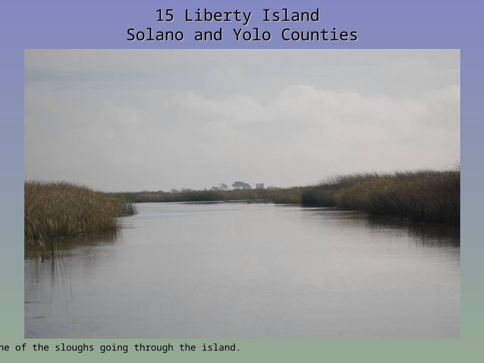
One of the sloughs going through the island.
15 Liberty Island 15 Liberty Island Solano and Yolo CountiesSolano and Yolo Counties
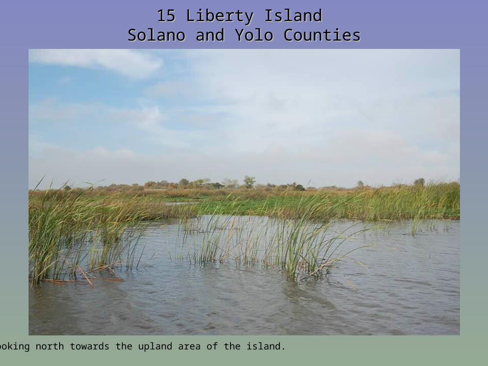
Looking north towards the upland area of the island.
15 Liberty Island 15 Liberty Island Solano and Yolo CountiesSolano and Yolo Counties
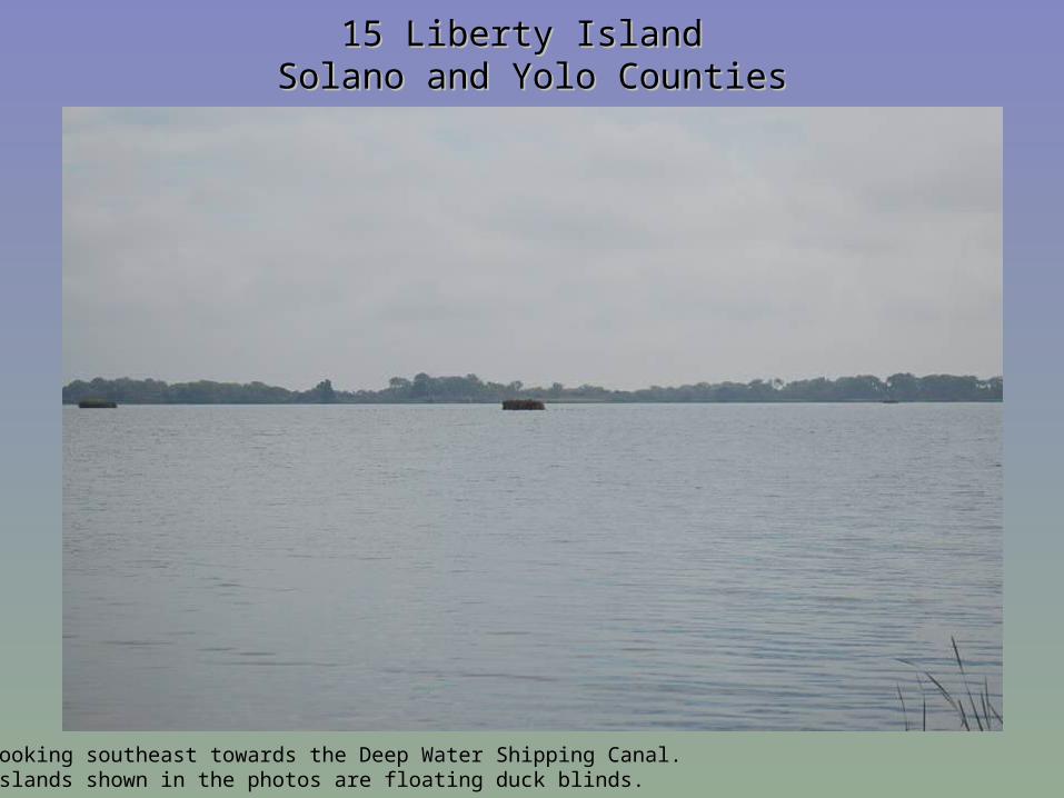
Looking southeast towards the Deep Water Shipping Canal. Islands shown in the photos are floating duck blinds.
15 Liberty Island 15 Liberty Island Solano and Yolo CountiesSolano and Yolo Counties
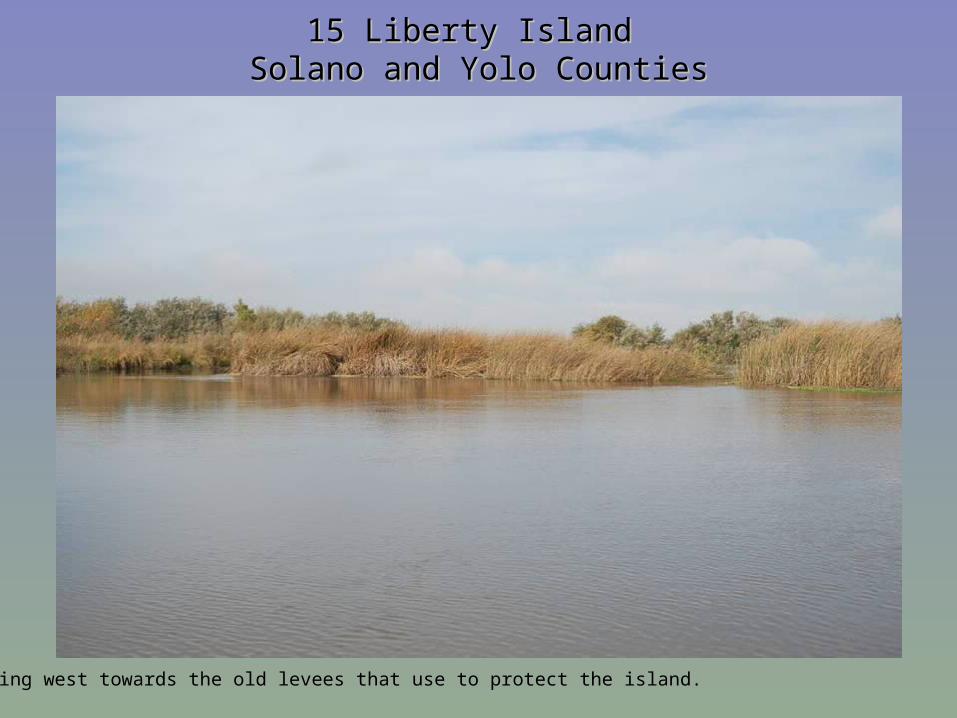
Looking west towards the old levees that use to protect the island.
15 Liberty Island 15 Liberty Island Solano and Yolo CountiesSolano and Yolo Counties
Looking south towards the Delta and Rio Linda.
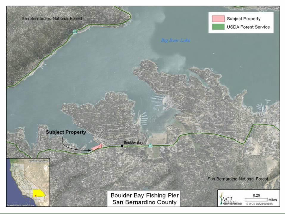
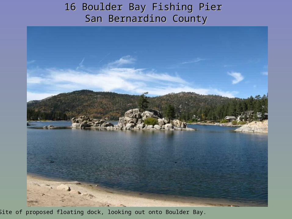
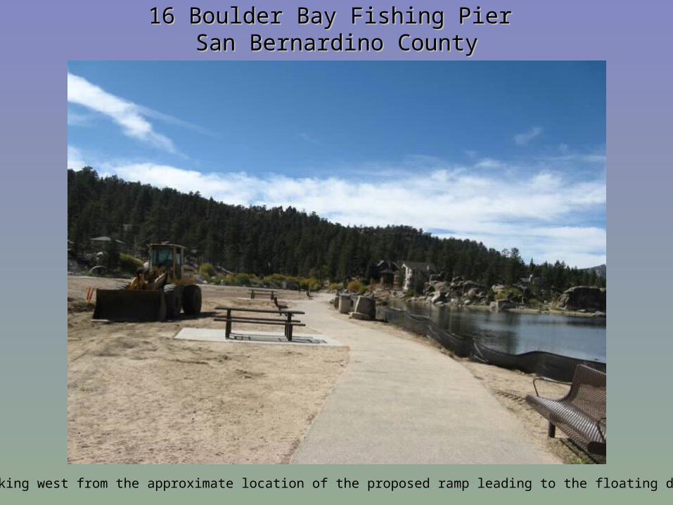
16 Boulder Bay Fishing Pier 16 Boulder Bay Fishing Pier San Bernardino CountySan Bernardino County
Site of proposed floating dock, looking out onto Boulder Bay.
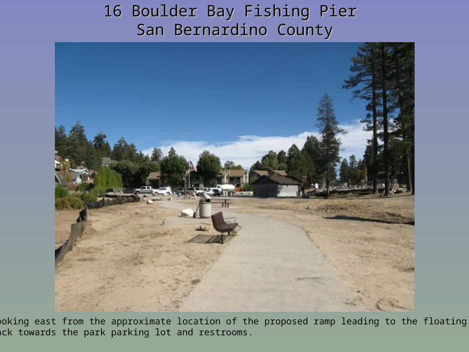
16 Boulder Bay Fishing Pier 16 Boulder Bay Fishing Pier San Bernardino CountySan Bernardino County
Looking east from the approximate location of the proposed ramp leading to the floating dock,back towards the park parking lot and restrooms.
16 Boulder Bay Fishing Pier 16 Boulder Bay Fishing Pier San Bernardino CountySan Bernardino County
Looking west from the approximate location of the proposed ramp leading to the floating dock.
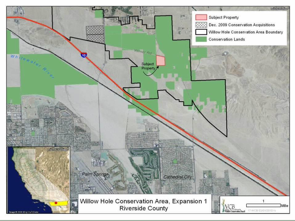
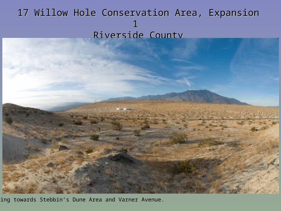
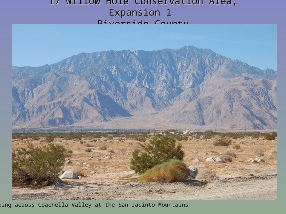
17 Willow Hole Conservation Area, Expansion 1 17 Willow Hole Conservation Area, Expansion 1 Riverside CountyRiverside County
Looking towards Stebbin’s Dune Area and Varner Avenue.
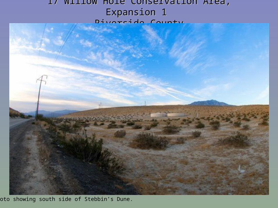
17 Willow Hole Conservation Area, Expansion 1 17 Willow Hole Conservation Area, Expansion 1 Riverside CountyRiverside County
Photo showing south side of Stebbin’s Dune.
17 Willow Hole Conservation Area, Expansion 1 17 Willow Hole Conservation Area, Expansion 1 Riverside CountyRiverside County
Looking across Coachella Valley at the San Jacinto Mountains.
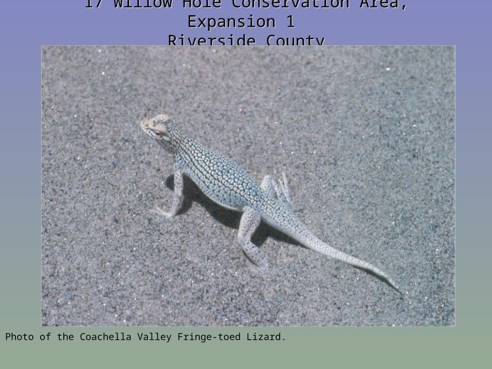
17 Willow Hole Conservation Area, Expansion 1 17 Willow Hole Conservation Area, Expansion 1 Riverside CountyRiverside County
Photo of the Coachella Valley Fringe-toed Lizard.
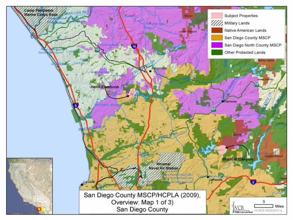
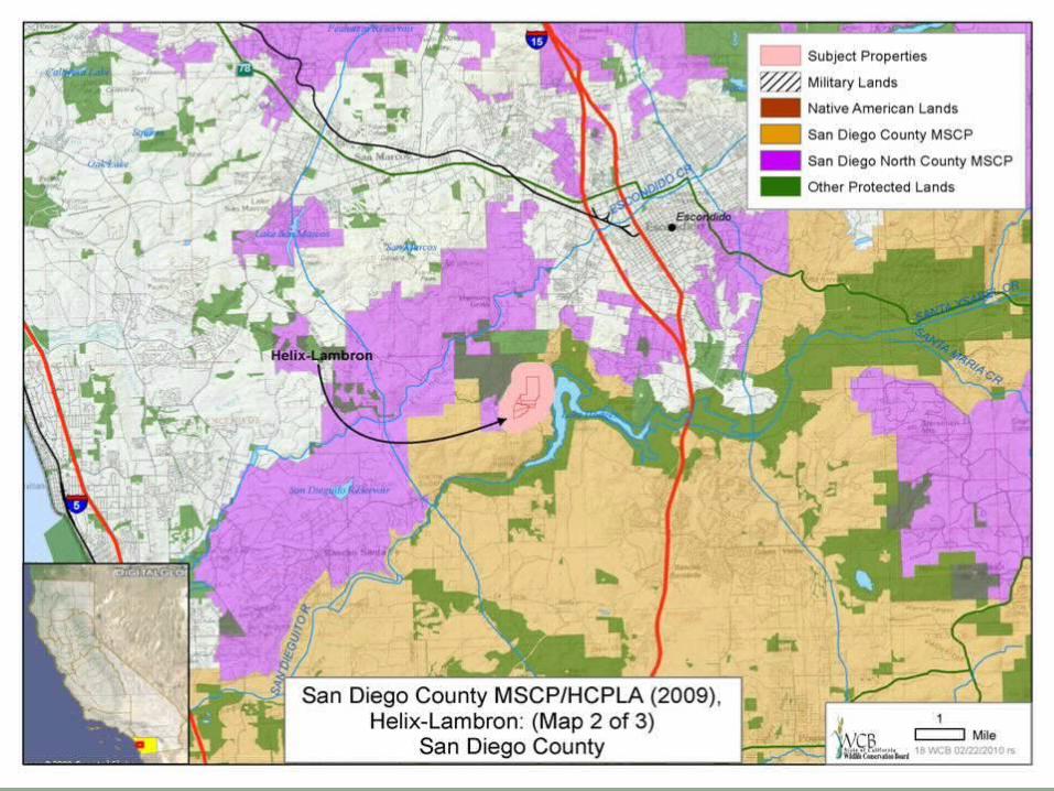
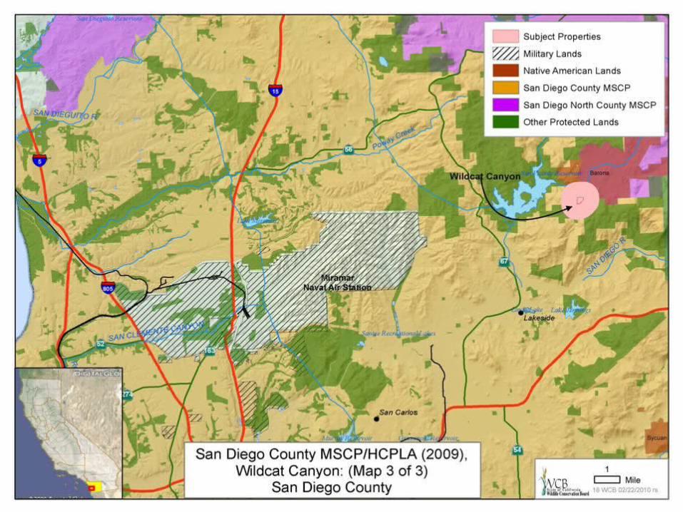
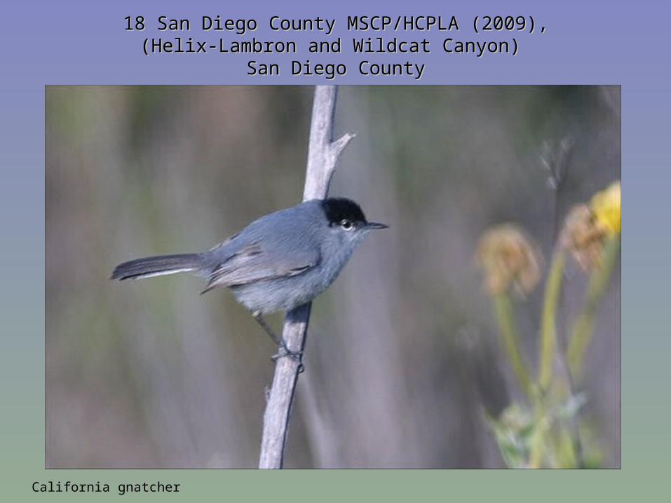
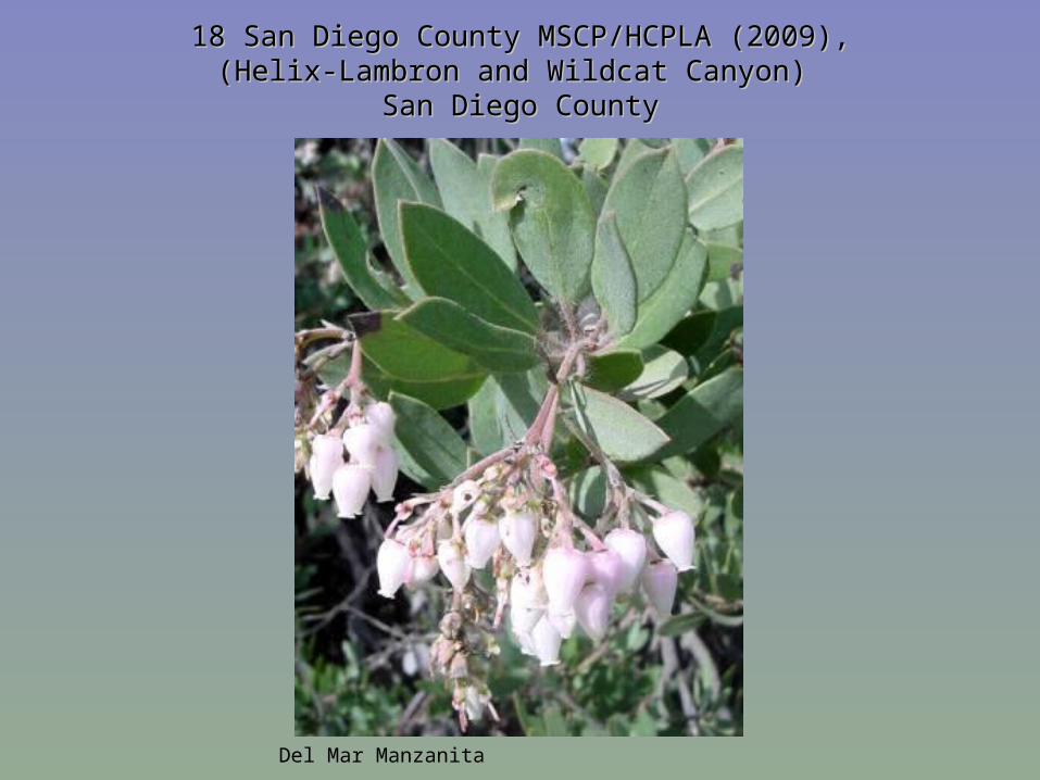
18 San Diego County MSCP/HCPLA (2009),18 San Diego County MSCP/HCPLA (2009),(Helix-Lambron and Wildcat Canyon) (Helix-Lambron and Wildcat Canyon)
San Diego CountySan Diego County
California gnatcher
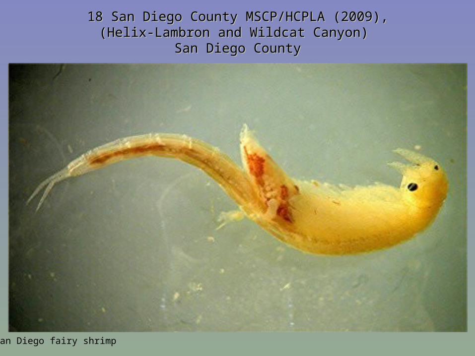
18 San Diego County MSCP/HCPLA (2009),18 San Diego County MSCP/HCPLA (2009),(Helix-Lambron and Wildcat Canyon) (Helix-Lambron and Wildcat Canyon)
San Diego CountySan Diego County
San Diego fairy shrimp
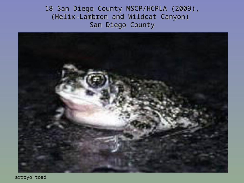
18 San Diego County MSCP/HCPLA (2009),18 San Diego County MSCP/HCPLA (2009),(Helix-Lambron and Wildcat Canyon) (Helix-Lambron and Wildcat Canyon)
San Diego CountySan Diego County
arroyo toad
18 San Diego County MSCP/HCPLA (2009),18 San Diego County MSCP/HCPLA (2009),(Helix-Lambron and Wildcat Canyon) (Helix-Lambron and Wildcat Canyon)
San Diego CountySan Diego County
Del Mar Manzanita


![MAHARASHTRA STATE BOARD OF TECHNICAL EDUCATION … ANSWER... · 17310 [Type text] Page 2/16 iv) Define: WCB and Quadrantal Bearing system. Ans.: 1)WCB:-In this system the bearing](https://img.pdfslide.us/doc/110x75/5eb7139d7df56530c4231f73/maharashtra-state-board-of-technical-education-answer-17310-type-text-page.jpg)